Park Service releases Environmental Assessment to use fireworks at Mount Rushmore

The EA downplays the amount of perchlorate found in the water caused by previous fireworks at the Memorial

Mount Rushmore
Mount Rushmore

The National Park Service has released an Environmental Assessment (EA) as part of their plan to explode fireworks at Mount Rushmore National Memorial in the Black Hills of South Dakota. The next step is a relatively short period during which the public may submit comments about the EA.

You have 30 days, until March 30, 2020 to express your opinion.

After March 30 the NPS is supposed to evaluate the public comments and then make a decision about whether to proceed with the fireworks or not.

Download the EA and submit a comment. Express your opinion on the use of fireworks at Mount Rushmore. (A backup copy of the EA can be found here.)

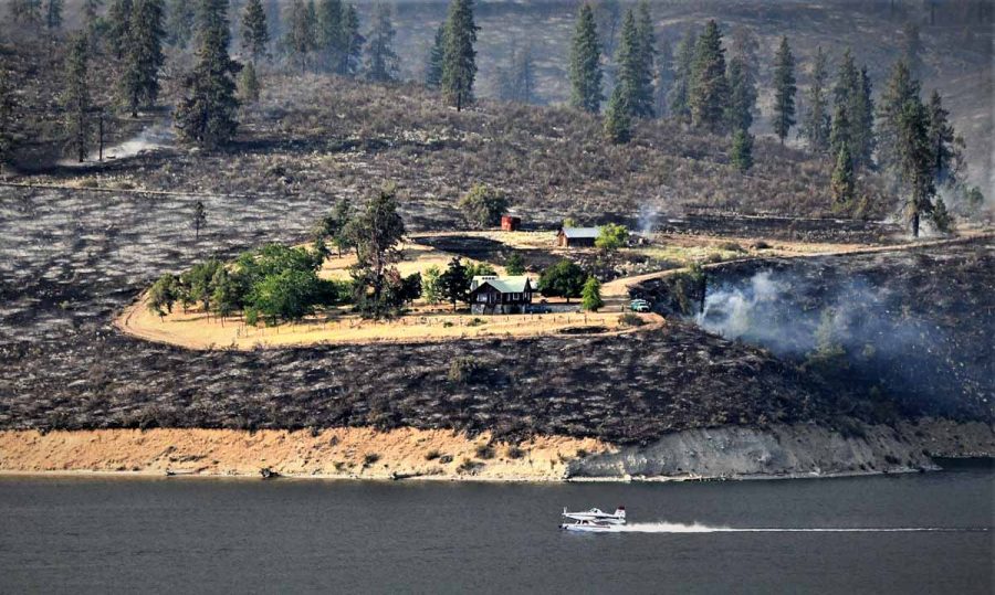
Fireworks were used at Mount Rushmore on July 3 or 4 from 1998 to 2009, except for 2002 when it was canceled due to the danger of the pyrotechnic display starting wildfires. During those 11 events 20 documented wildfires were ignited by the fireworks during the middle of the fire season. They were all suppressed by the 60 to 80 firefighters staged around the sculpture before they could grow large. The park is not just the stone carving; it has over 1,000 acres of timber within the boundary, and beyond that is the Black Hills National Forest.

Concerning the threat of adding to the 20 wildfires started in previous fireworks displays, the EA states that in a dry year a wildfire “would be more likely to result in a high-consequence fire burning outside the boundaries of the Memorial and toward the town of Keystone, South Dakota, up the northeast aspect of Black Elk Peak, or into the basin near Horsethief Lake.”

I was the Fire Management Officer for Mount Rushmore and six other parks during the first four years that fireworks were used on Independence Day at the Memorial. I developed a plan that would require that the weather and fuel conditions be within certain parameters before the fireworks could be used. We continued to refine the plan each year, settling on Probably of Ignition as one of the primary factors on the go/no-go checklist, especially after the fireworks started about 10 fires one year. All of the fires were small and were suppressed by the scores of firefighters we had positioned in the forest around the sculpture.

Park Superintendents Dan Wenk and Gerard Butler promoted and encouraged the program that started numerous fires, rained down tons of debris, and as we found out in 2016, poisoned the water with chemicals. The U.S. Geological Survey discovered that the ground and surface water at Mount Rushmore are contaminated with perchlorate, a component of rocket fuels and explosives. They determined that the chemical came from the fireworks over that 12-year period.

The EA has several paragraphs devoted to the perchlorate and says the concentrations in the water inside the Memorial are “orders of magnitude higher” than reference samples outside the Memorial. But that is an understatement at best. Order of magnitude may sound vague, but it usually means ten times higher. Unmentioned in the EA is the fact that data from the USGS report showed that a maximum perchlorate concentration of 54 micrograms per liter measured in a stream sample between 2011 and 2015 was about 270 times higher than that in samples collected from sites outside the memorial, which were 0.2 micrograms per liter. The Centers for Disease Control says high levels of perchlorates can affect the thyroid gland, which in turn can alter the function of many organs in the body. The fetus and young children can be especially susceptible.

According to the EA the U.S. Environmental Protection Agency is planning to raise the health advisory for perchlorate from 15 to 56 micrograms per liter. Maybe it is just a coincidence that it would put the contaminated water at Mount Rushmore suddenly within acceptable guidelines. But a process like this is consistent with other environmental policy changes by the federal government in recent years.

Another issue with exploding pyrotechnics over the Memorial is the trash that can never be completely picked up. Left on the sculpture and in the forest are unexploded shells, wadding, plastic, ash, pieces of the devices, and paper; stuff that can never be totally removed in the very steep, rocky, rugged terrain.

Here is an excerpt from page 38 of the EA:

Although it would be the responsibility of the fireworks contractor to remove unexploded ordnance and fireworks debris from the minimum separation distance, the rugged topography of the area would preclude complete recovery of unexploded ordnance and debris. Unexploded ordnance fallout and fireworks malfunction have the potential to cause impacts on buildings, structures, and the cultural landscape from burn marks and scorching, which occurred during past shows. A fireworks malfunction within the Hall of Records area could cause adverse impacts on the walls and the entrance to the Hall of Records…Past fireworks events have left burn marks on top of the sculpture and embedded plastic debris. The preferred alternative would result in additional unexploded ordnance and debris on the landscape.

The language in the announcement of the EA makes it appear that the Park Service wants the state of South Dakota to be the focal point for the effort to explode pyrotechnics over the Memorial: “The National Park Service (NPS) is evaluating a proposal by the State of South Dakota to host a fireworks display at Mount Rushmore National Memorial on July 3, 2020.”

Shortly after the EA was  posted on the NPS website, Kelly Andersson left a comment on one of our earlier articles about the attempt to use fireworks at the Memorial. She wrote, “… All y’all feel free to revise mine or write your own.” You can see it here — scroll way down, it’s dated February 29, 2020.

Other articles on Wildfire Today about fireworks at Mount Rushmore:

Some prescribed fires are more challenging than others

Prescribed fire fuel break Angeles National Forest
Prescribed fire on the Clear Creek fuel break in the Angeles National Forest. ANF photo.

Firefighters on the Angeles National Forest are using prescribed fire on the Clear Creek fuel break north of Los Angeles that separates the Arroyo Seco from the Big Tujunga drainages.

“It helps to protect some of the largest communication sites anywhere, some of LA’s drinking water storage, and major communities,” said Robert Garcia, Fire Chief on the Angeles National Forest. “It is also on some of the toughest ground we have on the ANF making initial attack very difficult. The adjacent slopes are unfortunately known from such incidents as Woodwardia, Bryant and more recently the origins of the 2009 Station Fire.”

When I worked on the Laguna and El Cariso Hotshots nearby on the Cleveland NF, to us the ANF was infamous for its extremely steep slopes, which are evident in these photos.

Prescribed fire fuel break Angeles National Forest
Prescribed fire on the Clear Creek fuel break in the Angeles National Forest. ANF photo.
Prescribed fire fuel break Angeles National Forest
Prescribed fire on the Clear Creek fuel break in the Angeles National Forest. ANF photo.
Prescribed fire fuel break Angeles National Forest
Prescribed fire on the Clear Creek fuel break in the Angeles National Forest. ANF photo.
map Prescribed fire fuel break Angeles National Forest
Clear Creek fuel break in the Angeles National Forest. ANF.

In most other locations super-steep slopes are not a serious obstacle while conducting prescribed fires, as in the example below.

Prescribed fire at Chickasaw National Recreation Area
Prescribed fire at Chickasaw National Recreation Area in Oklahoma by M. Fidler, February, 2013.

Do not try this at home

pile burning back pump torch
Pile burning back in the day on the Challis National Forest. Photo by Rick Freimuth.

Rick Freimuth sent us this photo, and said, “This is late season pile burning on the Lost River RD of the, then, Challis NF. I had totally forgotten our sketchy setup of Indian pumps rigged for burning. I’m sure the fuel mix was heavy on the gas side, not to mention the even sketchier igniting wand out front. Where’s our Nomex? Things have definitely changed for the better.”

For those not familiar with the device on the person’s back, it is designed to hold five gallons of water which is used to suppress or mop up a fire.

He did not say if they ever got the back pumps mixed up and used the wrong one on a fire.

Thanks Rick!

Fire agencies say they have adequate plans to deal with coronavirus outbreaks among firefighters

How could the disease affect wildland firefighting?

Medical Unit
An example of a Medical Unit at a wildfire. Community members toured the Incident Command Post at the Springs Fire in Idaho in 2012. Inciweb photo.

When I learned that thousands of passengers were quarantined on a cruise ship due to an outbreak of the Coronavirus, or COVID-19, I thought about what would happen if a wildland firefighter tested positive for the virus. If it occurs at a fire station, judging from the procedures being implemented around the world now it seems likely that the person and others that worked around them would be quarantined, possibly for two weeks. That would make the engine or hand crew unavailable.

If the firefighter who tested positive was at a fire, or had been in recent days, then you’re possibly looking at a much larger group to quarantine. We could be talking about dozens of firefighters. Or, perhaps much greater numbers. Some of the largest fires have 1,000 to 5,000 people assigned. That would take us to a place we have not been before.

I contacted individuals in the U.S. Forest Service, National Park Service, and Bureau of Land Management, asking what they would do if a firefighter tested positive, and what steps would be taken if a significant percentage of the firefighter workforce becomes unavailable due to the disease. I will not disclose their names because today the White House directed that any statements from federal government officials about this virus situation must first be cleared by Vice President Pence, who was appointed yesterday to manage all federal activities related to the Coronavirus.

The responses that came back from individuals in the Department of the Interior (DOI) and the Forest Service were nearly word-for-word identical. Basically they said the plans and standard operating procedures that have been on the shelf for years will be fine.

Both organizations referenced the National Wildfire Coordinating Group’s document prepared in 2010, “Infectious Diseases Guidelines For Wildland Fire Incident Management Teams.” The DOI provided a link to the Department’s “Pandemic Influenza Plan“. The latter was written in 2007 and the .pdf version was updated February 19, 2020 “to be 508 compliant”, which may refer to a Health and Human Services requirement that all website content be accessible to people with disabilities.

The NWCG guidelines address the steps to take at an incident when an outbreak of an illness, for example Norovirus, is detected, such as who to notify and how to reduce the chances of it spreading. The document recommended, in 2010, that incidents have access to two types of contagious disease barrier kits for individuals and multiple persons, NFES numbers 1660 and 1675.

The DOI pandemic plan written 13 years ago, probably in response to the H5N1 “bird flu” or “avian influenza” outbreak, has excellent generic information about the characteristics of an influenza pandemic — how it is spread, attack rate, employee absenteeism, length of epidemics, and how to manage a workforce in order to minimize exposure to the virus. However, there is a great deal of variability in strains of influenza, so the assumptions listed may not apply to coronavirus. For example, it assumes that children will play a major role in the transmission of infection because their illness rates are likely to be higher. But so far the reverse seems to be the case with this latest outbreak, with older people especially those with preexisting conditions being more frequently affected.

Both of these documents have valuable information, but most of it is available from the Centers f0r Disease Control (CDC).

To get more information about how the agencies would react to a significant reduction in the number firefighters available, I asked for more specifics. They said if there is a shortage of resources, Multi-Agency Coordinating Groups at the National and Geographic Area level would consider guidance in Chapter 10 of the 132-page National Interagency Mobilization Guide, a publication that was mentioned by both sources. They pointed out pages 1 & 2,  as well as the preparedness levels on pages 15-17.

Page 1 of Chapter 10 in the “Mob Guide” covers the ability of the Multi-Agency Coordinating Groups to move and position resources to meet needs “regardless of geographic location or agency affiliation.” If there is competition for resources they will establish national priorities and confirm drawdown levels.

Page 2 in Chapter 10 is about a concept that I had not noticed previously in the Mob Guide —  the National Ready Reserve (NRR). This concept involves identifying suppression resources “[I]n order to maintain overall national readiness during periods of actual or predicted national suppression resource scarcity.” If established by the National Multi-Agency Coordinating Group (NMAC), the individual Geographic Area Coordinating Centers would place specific categories, types, and quantities of resources on NRR that would meet the following requirements:

  • May be currently assigned to ongoing incidents;
  • Must be able to demobilize and be en route to the new assignment in less than 2 hours;
  • Resources must have a minimum of 7 days left in 14 day rotation (extensions will not be factored in this calculation);
  • May be assigned to incidents after being designated ready reserve, in coordination with NICC; and
  • Designated ready reserve resources may be adjusted on a daily basis.

There is a lot that we don’t know about the Coronavirus, but what officials have said this week indicates that some infected persons have very mild symptoms, or even none. But they may still pass the disease to others. Wildland firefighters are tactical athletes with a  can-do attitude. After breathing smoke during a long fire season they may battle through respiratory issues with a chronic hacking cough — which is also one of the symptoms of the Coronavirus. As they cough this year they may be thinking about the reported two percent fatality rate of the Coronavirus. “Is this camp crud, or am I going to die?”

It was revealed yesterday that a person from the Bay Area of California is in a hospital outside of Sacramento suffering from the virus. Days ago doctors who thought it could be THE VIRUS wanted to test the patient but the characteristics presented did not meet the threshold established by the Centers for Disease Control that would allow the test. Eventually it was administered, but days were wasted in not only treating the person correctly, but in investigating who they earlier came in contact with. The patient had not been overseas and it is now thought to be the first case of ‘community transmission’ in the country.

Hopefully  wildland fire incidents will not have to order strike teams of these vehicles–

Medical ambulance bus

UPDATE Feb. 29, 2020: I just listened to the first episode of a new podcast that is solely about the coronavirus. The name is “Epidemic” with Dr. Celine Gounder and Ronald Klain. Five minutes in I realized that the epidemic could be managed in ways that are similar to the Incident Command System. On a large fire you don’t select the local Fire Management Officer or Forest Supervisor to run it, because their suddenly expanded duties will on their own be overwhelming. So you bring in an incident management team that can concentrate full time, 100 percent on the emergency. Vice President Mike Pence has been chosen to be the Coronavirus “czar”.

Mr. Klain explains in the podcast that he was the U.S. Ebola czar from 2014 to 2015. He makes the case that managing a large and growing program is the primary skill needed to oversee the response to the Coronavirus.

Brush fire has burned about 20% of Kahoʻolawe

The island is southwest of Maui in Hawaii

Kaho‘olawe Island fire satellite photo map
Satellite photo showing the vegetation fire on Kaho‘olawe Island February 25, 2020. Sentinel 2, processed by Wildfire Today.

The fire that started over the weekend has burned about 6,400 acres on Kahoʻolawe island southwest of Maui in Hawaii. The Maui Fire Department sized up the blaze Wednesday and confirmed that due to unexploded ordnances left over from 49 years of the military using the island as a bombing range it is unsafe for firefighters on the ground or the air to attempt to suppress the fire.

Kaho‘olawe Island fire
Storage facilities for the Kaho‘olawe Island Reserve Commission burned in the fire. Photo Feb., 25, 2020 by Kaho‘olawe Island Reserve Commission

The Kaho‘olawe Island Reserve Commission’s main storage facilities have burned.

“Losing the KIRC storage facility, more commonly known as ‘Squid’, to the fire yesterday was a huge setback,” the Commission reported February 26 in a news release. “Squid was home to the majority of our restoration and irrigation supplies and equipment, along with five 2500 gallon water catchment tanks, a fleet of all-terrain vehicles used to transport volunteers and gear to work sites, and water craft used for ocean management projects and activities. All of these things are vital to the restoration efforts undertaken by KIRC staff and their volunteer force.”

The fire has blackened an area on the west side of the island that is about three miles by three miles, covering about 20 percent of the 10-mile long island.

Kaho‘olawe Island fire
Kaho‘olawe Island fire. Photo by Maui Fire Department.
Kaho‘olawe Island fire map 3-D
Map, 3-D, showing the location of the fire on Kaho‘olawe Island February 25, 2020. Google/Wildfire Today.

Wildfire activity in 2019 was heavier than usual in Alaska, but slower than average in rest of U.S.

The number of acres burned in the lower 48-states was the least since 2004

Williams Flats Fire Washington
The Incident Management Team titled this photo at the Williams Flats Fire, “Success at the goat ranch”. It was uploaded to InciWeb August 4, 2019 and shows a single engine air tanker scooping water to refill its tank.

The statistics collected by the National Interagency Coordination Center (NICC) for last year’s fire activity confirm what wildland firefighters in the United States already knew — the fire season in the lower 48 states was much slower than average. Outside of Alaska 2,210,266 acres burned, about 40 percent of the 10-year average of 5,608,376 acres. The 2019 lower 48 total was the least since 2004 when 1,451,902 acres were blackened.

However, the number of acres burned in Alaska, 2,454,098, was almost double the 10-year average for the state and was more than the other 49 states combined. That and the fact that fires in Alaska are managed far differently than those in the rest of the U.S. is why at Wildfire Today we keep the statistics separate.

Wildfire acres burned -- US except Alaska, 1971-2019
2019 US acres burned, except Alaska. Stats by NICC. Numbers prior to 1983 may not be reliable. Processed by Wildfire Today. (this image corrects one posted earlier)
Number of fires, US except Alaska, 1970-2019 wildfires
Number of fires, U.S. except Alaska, 1970-2019. Data prior to 1983 may not be reliable.

All other Geographic Areas saw below average acres burned: Southwest (78%), Northern California (48%), Great Basin (42%), Eastern (38%), Southern Area (38%), Northwest (28%), Rocky Mountain (24%), Southern California (20%), and Northern Rockies (15%). Only 27 fires and complexes exceeded 40,000 acres in 2019, which is 21 fewer than 2018.

Map showing the occurrence of large wildfires in 2019
Map showing the occurrence of large wildfires in 2019. NICC.

The eight largest fires in Lower 48 states in 2019

NameStateStart DateSizeCauseEstimated Suppression Cost
WoodburyAZJune 8123,875Unknown$20,000,000
SheepIDJune 22112,106Lightning$710,000
KincadeCAOct. 2377,758Unknown$77,144,000
PotholeIDAug. 669,704Human$600,000
WalkerCAAug. 1654,608Unknown$35,600,000
Williams FlattWAAug. 244,446Lightning$19,432,000
SawgrassFLJune 2342,000Lightningnot reported
Cold CreekWAJuly 1841,920Unknown$900,000

One reason for the slowdown in wildfire activity was the weather — it was not as hot, dry, and windy across the Western United States as we have been accustomed to in a typical summer. This affected the Preparedness Level (PL), which is the planning and organizational readiness dictated by burning conditions, fire activity, and resource availability. In 2019 the PL never rose above three, with five being the highest possible level of preparedness. On August 6 it was raised to PL 3 where it remained for only nine days. This is the first time PL 4 has a not been reached since 2010. In 2017 and 2018 we were at PL 4 or 5 for a total of 122 days.

Incident Management Team mobilizations 2009-2019
Incident Management Team mobilizations 2009-2019. NICC.

The number of mobilizations of Type 1 Incident Management  Teams was about a third of the 10-year average — 12 fires compared to the average of 33. There were no T-1 IMTs deployed during 2019 in the Great Basin, Northern Rockies, or Northwest Geographic Areas.

Between June 5th and July 10th the United States provided 20 crews and 24 individual wildland fire personnel to Alberta, Canada. Between November 14th and December 31st, through the NIFC-Australia Agreement, 85 wildland fire personnel were assigned to support large fires in New South Wales and Victoria, Australia. Support to Australia has continued into 2020.

The number of crews mobilized, 614, was 71 percent of the 10-year average. Nationally the unable to fill rate on crews was 15 percent, but was much higher in Northern California where it was 42 percent.

2019 Engine mobilizations wildfires
2019 Engine mobilizations. NICC.

NICC received 949 engine requests in 2019, which was 61 percent of the 10-year average. Of these requests, 789 were filled, 64 were canceled and 96 (10 percent) were unable to be filled (UTF). There were 13 requests placed to NICC for tactical water tenders, of which 11 were filled, two canceled, and zero UTF.

The number of overhead mobilizations was two-thirds of the 10-year average, with 9 percent UTF.

Large air tankers exclusive use contracts 2000-2019
Large air tankers on exclusive use contracts, 2000-2019. NICC data processed by FireAviation.

A total of 438 Very Large Air Tanker, Type 1, and Type 2 large airtanker requests were received by NICC in 2019. Of that total, 308 requests were filled, 41 were canceled and 89 (20 percent) were UTF. The NICC received no requests for MAFFS in 2019.

NICC received 78 requests in 2019 for Single Engine Air Tankers and Type 3 Air Tankers, of which 64 were filled, 6 were canceled, and 8 were UTF.

Eurocopter AS-350 AStar, N357TA
Eurocopter AS-350 AStar, N357TA, owned by Roberts Aircraft Co. Working the Prairie Dog Fire in Wind Cave National Park July 7, 2017. Photo by Bill Gabbert.

A total of 351 Type 1, 2 and 3 helicopter requests were received by NICC in 2019, 274 were filled, 38 were canceled, and 39 (11 percent) were UTF. Of the 151 Type 1 helicopter requests placed to NICC, 130 were filled, 14 were canceled and 7 (5 percent) were UTF. Of the 100 requests placed to NICC for Type 2 helicopters, 66 were filled, 12 canceled and 22 (33 percent) were UTF. Of the 100 requests placed to NICC for Type 3 helicopters, 78 were filled, 12 canceled and 10 (12 percent) were UTF.

There were no activations of military C-130 aircraft with Modular Airborne FireFighting Systems, MAFFS, for the first time since 2010.

NICC arranged for 5,197 passengers to be transported on large aircraft, mostly on a B737 that was on fire season contract. There were also two additional large aircraft charter flights that were arranged by NICC.

A total of 49 requests for mobile food services were received at NICC in 2019. Of these 47 were filled, two were canceled and zero were UTF. A total of 62 shower units were requested, and all of these were filled (none were canceled or UTF).

The number of shower and food service mobilizations were both 44 percent of the 10-year average.

acres wildfires human caused
Acres burned, broken down by geographic area, of fires caused by humans (rather than lightning). NICC.

Here is a list of the abbreviations for the Geographic Areas as shown in the reports: AK Alaska, EA Eastern, GB Great Basin, NO Northern California (North Operations), NR Northern Rockies, NW Northwest, RM Rocky Mountains, SA Southern, SO Southern California (South Operations), SW Southwest, ST/OT States/other, and CN Canada.

number of prescribed fire accomplishments in 2019, by federal agencies
Prescribed fire accomplishments in 2019. NICC.
number of prescribed fires in 2019, by federal agency
The number of prescribed fires in 2019 by agency. NICC.