Ferguson Fire slowed Tuesday by inversion

The fire has burned over 37,000 acres

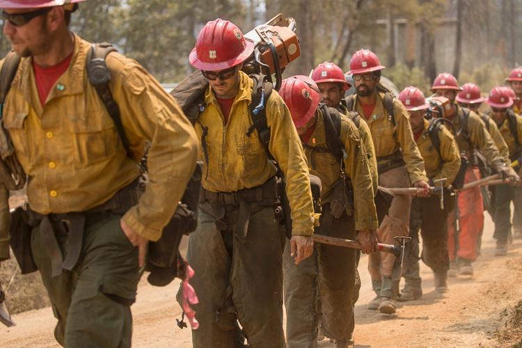
Hot shot crew Ferguson Fire firefighters
Bear Divide Hot Shots on the Ferguson Fire. Kari Greer photo taken around July 23, 2018.

One of the primary factors affecting the spread of the Ferguson Fire west of Yosemite National Park in California is the weather — specifically, the inversions that have been trapping the smoke and partially blocking the sun. Since the fire started July 13 these inversions have been a frequent occurrence. They usually break up in the afternoon, allowing the intensity and rate of spread of the fire to increase. On Tuesday this weather phenomenon again kept the fire from making any big runs, allowing only another 1,693 acres to burn, bringing the total up to 37,795 acres.
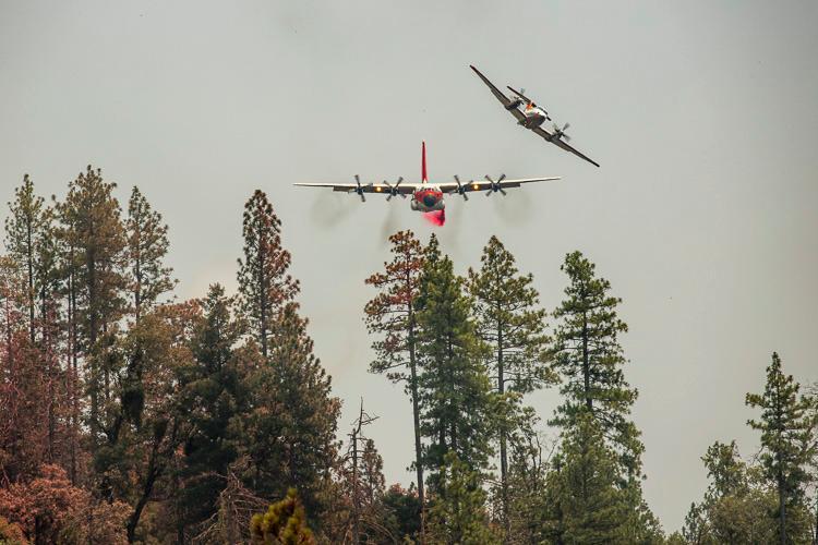
Air Tanker 118 HC_130H Ferguson Fire
While following a lead plane, Tanker 118, an HC-130H, begins a retardant drop on the Ferguson Fire. Kari Greer photo taken around July 23, 2018.

Information from the Incident Management Team Tuesday night:

“North of the Merced River on the Stanislaus National Forest, firefighters constructed indirect containment lines up Soapstone Ridge, opening old roads near the burn scar of the 2013 Rim Fire. Crews strengthened and improved containment lines east toward Eagle Peak and down to El Portal.

“Along the eastern edge of the fire, crews were successful initiating strategic firing operations to remove unburned vegetation between containment lines and the fire. Crews also evaluated structures for defensible space.

“South of the Merced River on the Sierra National Forest, containment lines were secured from Jerseydale across to Wawona Campground. Crews will continue planning strategic firing operations to help build a wider buffer to stop the fire’s spread.

“Yosemite National Park closure: Yosemite National Park officials announced closures to the Yosemite Valley and Wawona areas, as well as the Mariposa Grove of Giant Sequoias, effective noon on Wednesday, July 25. ”
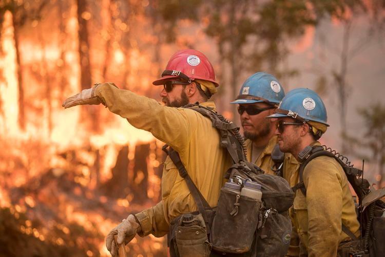
Hot shot crew Ferguson Fire firefighters
Sierra Hot Shots on the Ferguson Fire. Kari Greer photo taken around July 23, 2018.

Drought and high temperatures result in numerous wildfires in Sweden

Posted on Categories UncategorizedTags

Eight European countries are sending firefighters to assist

Above: A convoy of dozens of pieces of fire apparatus from Poland en route to assist Sweden in battling wildfires. Screen grab from the Bella B video below.

(Originally published at 11:37 a.m. MDT July 24, 2018)

The most severe drought in 74 years accompanied by higher than normal temperatures have set the stage for a rash of large wildfires in Sweden. Temperatures are expected to reach 30C (86F) all week which is significantly higher than the more typical 23C (73F). The heat is unprecedented and the country is not prepared for such temperatures.

At least 27 fires are burning across the country, covering 25,000 hectares (61,000 acres).

The government has issued a call for help to deal with the blazes. Many countries in the EU have responded, including Italy, France, Germany, Lithuania, Denmark, Portugal, Poland, and Austria. In a press release the EU’s Emergency Response Coordination Center said 7 fixed wing aircraft, 7 helicopters, 60 vehicles, and 340 firefighting personnel had been offered to Sweden.

Poland sent 45 fire engines which were greeted by cheering Swedes waving Polish flags as the firefighters traveled to Sveg in the central part of the country.

At least 50 people killed in wildfires near Athens, Greece

This is the deadliest fire season in Greece since 2007

Above: The red dots on the map represent fires in Greece detected by a satellite July 23, 2018.

(Originally published at 8:25 a.m. MDT July 24, 2018)

Authorities in Greece are saying that at least 50 people have been killed in two large wildfires near Athens. As 50 mph winds pushed the fires, residents and tourists took refuge on ocean beaches. Boats plucked some out of the water while others were picked up on the shore and taken to safety. The Greek Coast Guard and other vessels picked up more than 700 who were fleeing from the fire.

Rescuers reported finding the bodies of more than 20 people huddled together near a beach. Other were found in or near groups of vehicles that became trapped, much like the situation in Portugal last year when 62 people died.

There are at least two large fires in Greece. One is about 10 miles northeast of Athens near the coastal city of Nea Makri and the other is about 25 miles west of Athens at another city on the coast, Kineta. Both fires spread toward the ocean, generally west to east.

The Associated Press reported that 10 people were killed when a boat capsized while it was evacuating vacationers from a hotel in Mati, east of Athens.

This is the deadliest fire season in Greece since 2007 when more than 60 people were killed in the Peloponnese region.

Showers near Athens Monday missed both fires, but heavy rain is in the forecast for Wednesday.

Several European countries have offered to send water-scooping air tankers to assist firefighters, including Spain, Italy, Turkey, and Croatia. Greece also has their own fleet of scoopers.

Fires in Southwest Oregon were very active Sunday

Above: The map of Southwest Oregon shows heat on wildfires detected within the last week. The red dots are the most current.

(Originally published at 10 a.m. PDT July 23, 2018)

Firefighters in Southwest Oregon are still battling wildfires ignited by the lighting storms that passed across the state a week ago. The good news is they got a reprieve Sunday when additional lightning that was predicted didn’t show up.

Here is a brief summary of the fire situation in Oregon prepared by the Northwest Coordination Center Monday morning:

The warming and drying trend in Oregon will continue [Monday]. This trend is moving north into Washington. Smoke covered the Southwest Oregon fires through the morning [Sunday] and cleared out by early afternoon. As the smoke cleared, large fires in Southwest Oregon exhibited more active growth through the afternoon and into the evening.

Four Incident Management Teams are prepositioned in the Geographic Area and ready for assignments if needed: NW Team 7 (Knerr), NW Team 8 (Johnson), NW Team 10 (Lawson), and PNW Team 2 (Schulte).

The Garner Complex consists of six fires east of Cave Junction. Together they have burned over 11,000 acres. Sunday 50 Oregon National Guard personnel arrived to staff ten road blocks around the clock.

The 1,200-acre Timber Crater 6 Fire in Crater Lake National Park is one of several fires ignited by lightning in and around the Park July 15. On Monday the Incident Management Team described their situation:

With the number of new fires in the Northwest this week, firefighting resources are strained. However, the Timber Crater 6 Fire is being aggressively managed for full suppression, commensurate with values at risk and the overriding objective of public and firefighter safety.

Some western states hit hard by lightning Sunday

lighting strike map
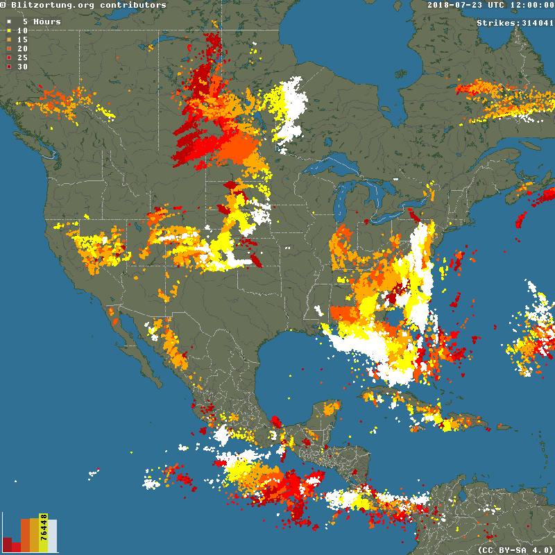
Lightning that occurred during the 30-hour period that ended at 6 a.m. MDT July 23, 2018. The lighter colors are the most recent. The map shows all strikes. Approximately 20% are usually cloud to ground. Click to enlarge.

In spite of the weather forecast, the lightning predicted for Southwest Oregon on Sunday didn’t really pan out, but portions of other western states received thousands of strikes. Firefighters may have some followup to do in Northeast Montana, Southwest Wyoming, Utah, Colorado, Nevada, the Sierras in California, and states in the Great Plains.

During the rest of this week Southern California will likely experience temperatures much higher than normal, possibly setting a few daily records. Weak hot and dry sundowner winds could occur near Santa Barbara bringing compressional heating and high fire danger.

Here’s more weather information from the National Interagency Fire Center, issued July 23:

A critical fire weather scenario will begin to set up as shards of monsoonal moisture begin to filter further into the Pacific Northwest and the Northern Rockies. These storms, while still isolated, will be dry and should trigger new starts as the stage begins to set for the next few days after [Monday], which should be pretty convective.