The result of aerial ignition on the Moose Fire August 2, 2022 in Idaho. By Mike McMillan for the USFS.
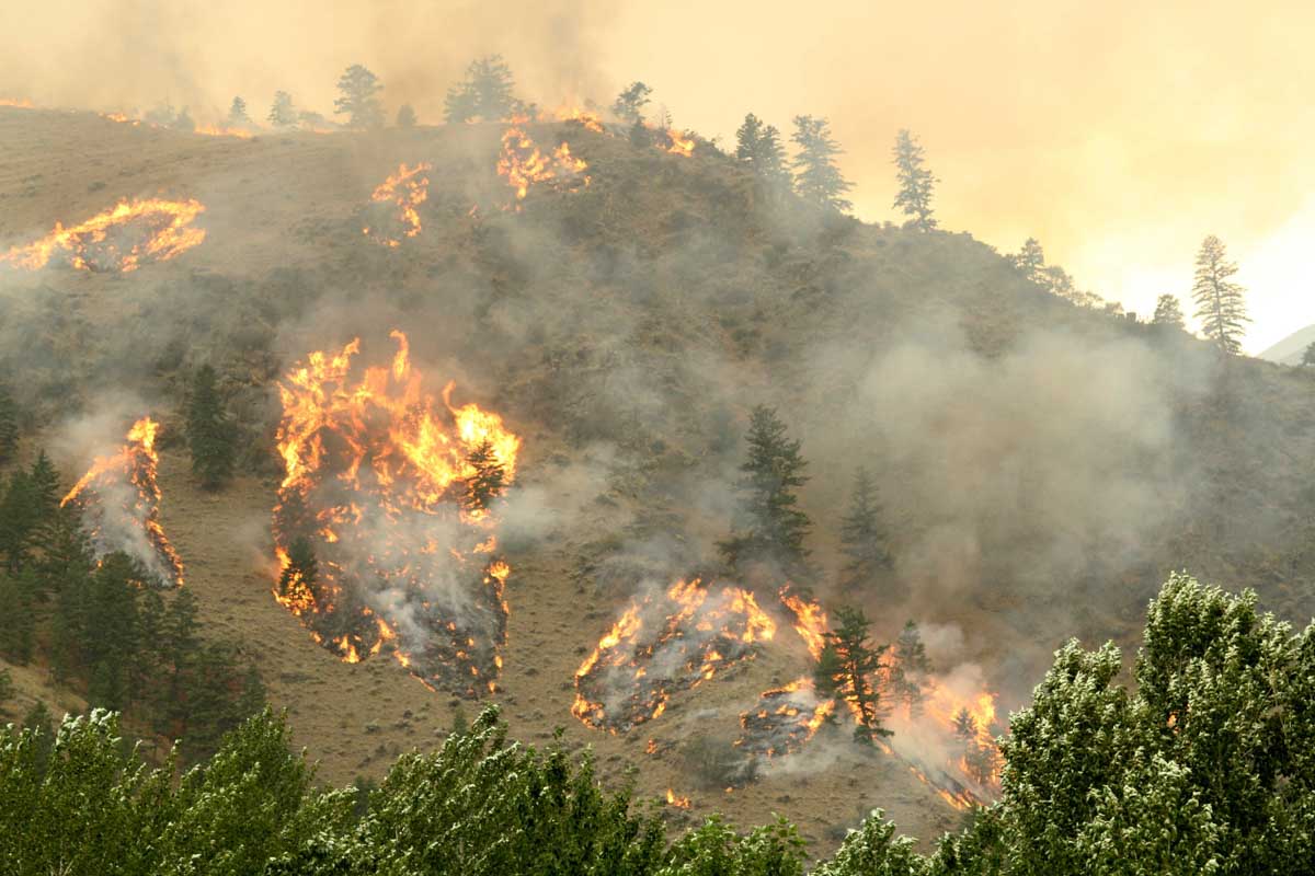
Bloomberg Law has an interesting article by Bobby Magill about efforts to reduce the wildfire threat to homes. It discusses and compares forest thinning vs. hardening structures. Here are excerpts, but read the entire article.
Congress is spending billions to save communities from Western megafires by thinning large swaths of forests even as scientists say climate change-driven drought and heat are too extreme for it to work.
The money would be better spent thinning woods closest to homes and shoring up houses against embers raining down from firestorms, according to academics, former agency officials, and others who study wildfires.
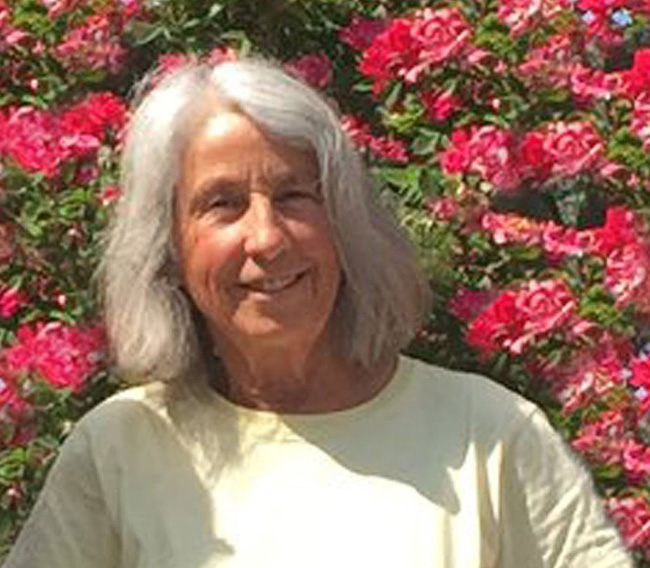
“If our goal is to keep homes and communities from burning, the experts are telling us to focus from the home outwards. First, harden the home so it is less likely to ignite,” said Beverly Law, an emeritus professor of forestry at Oregon State University.
Megafires are sustained by drought and heat, and “no amount of thinning treatment will prevent such fires from occurring,” she said.
[…]
No Scientific Consensus
As the federal government focuses on forest thinning, no scientific consensus exists that removing vegetation, especially at a landscape-scale, will save communities in the paths of firestorms amid the West’s historic 23-year drought.
The science is clear that “there isn’t a great connection between home loss and these fuel treatments,” though they sometimes help firefighters gain a foothold on some fires, Cheng said.
Randy Moore, the Forest Service chief, said the agency is confident that as homes are built deeper and deeper into the woods, its research shows that removing “overstocked” trees is the best way to protect them.
“We know where we do nothing, or where we do a little, we’re seeing the evidence out on the landscape,” Moore said, referring to recent megafires. “We feel compelled to do something.”
The US Forest Service has announced that one of the four people killed in the McKinney Fire in Northern California was Kathy Shoopman, a long-time FS employee. The agency said she died in her home in the community of Klamath River as a result of the fire on July 29, the day the fire erupted.
Ms. Shoopman started her career as a lookout at Baldy Mountain Lookout, west of Happy Camp, in 1974. Since then, she has staffed Lake Mountain Lookout, and most recently Buckhorn Lookout, a post she has held since 1993. She lived in the community of Klamath River for nearly five decades and was a talented artist, gardener, and a devout animal lover.
All four victims lived in Klamath River, which was ordered to evacuate on July 29 as the fire spread rapidly. It has now burned more than 60,000 acres. Ms. Shoopman was the first victim to have been positively identified.
Our sincere condolences go out to Ms. Shoopman’s family, friends, and co-workers.
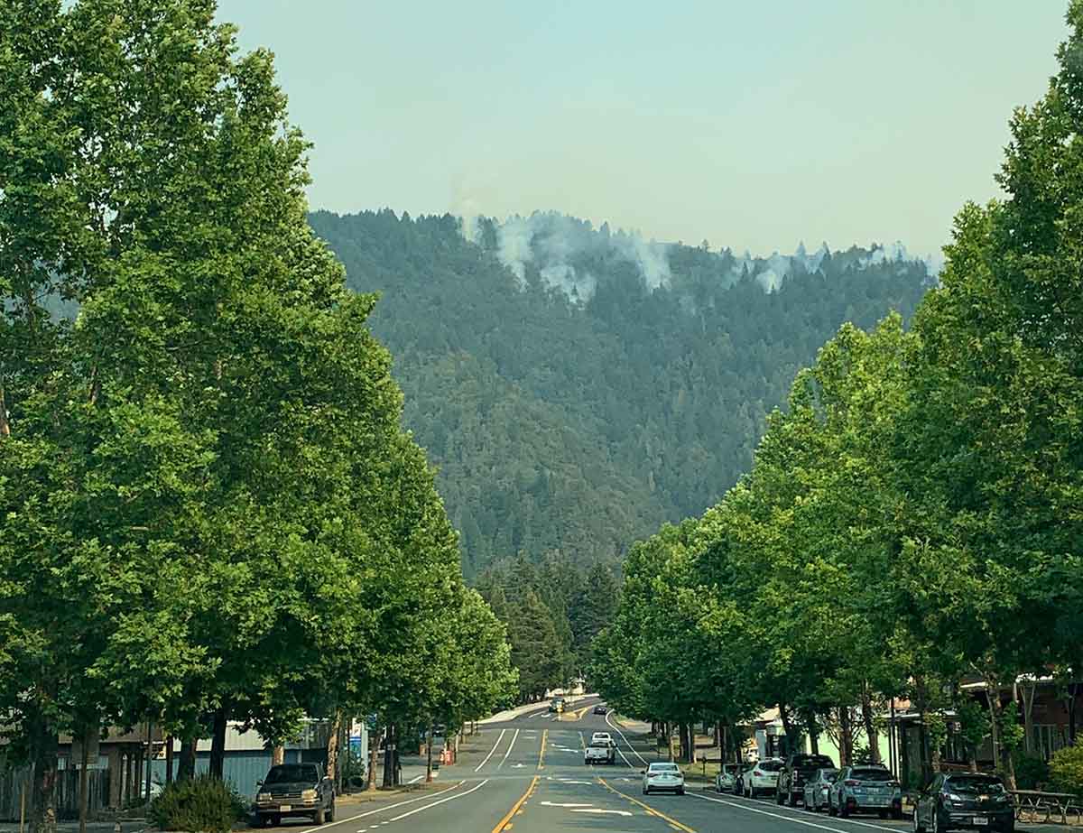
Willow Creek downtown during the Six Rivers Lightning Complex of fires, Aug. 7, 2022. InciWeb.
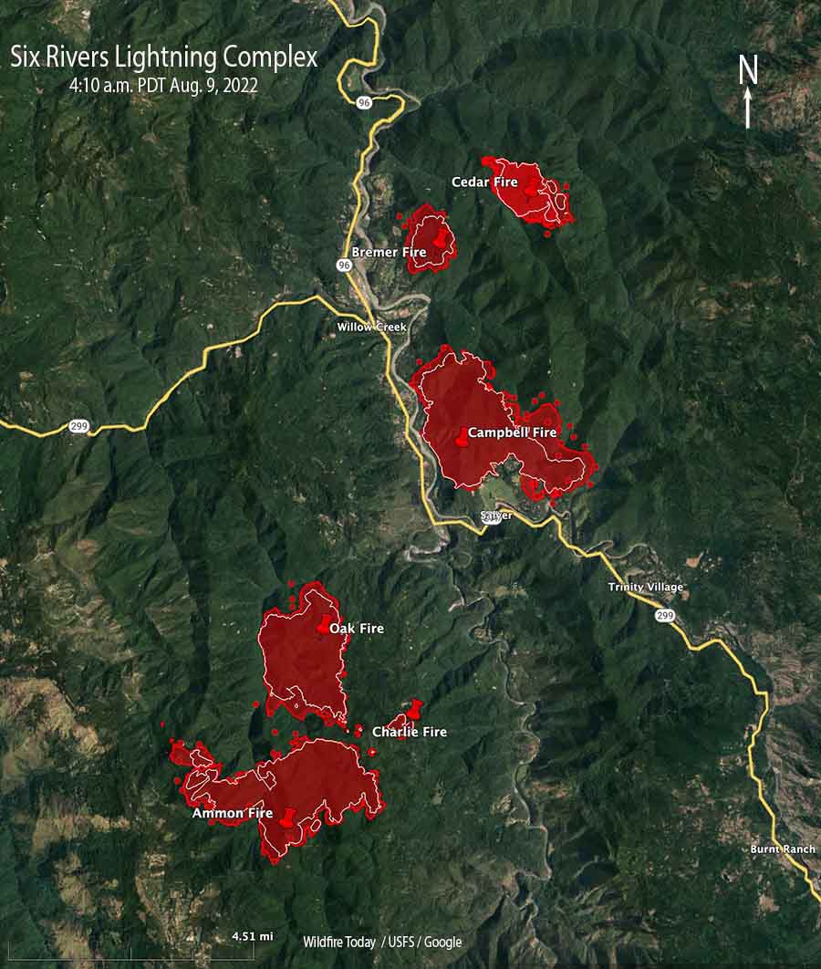
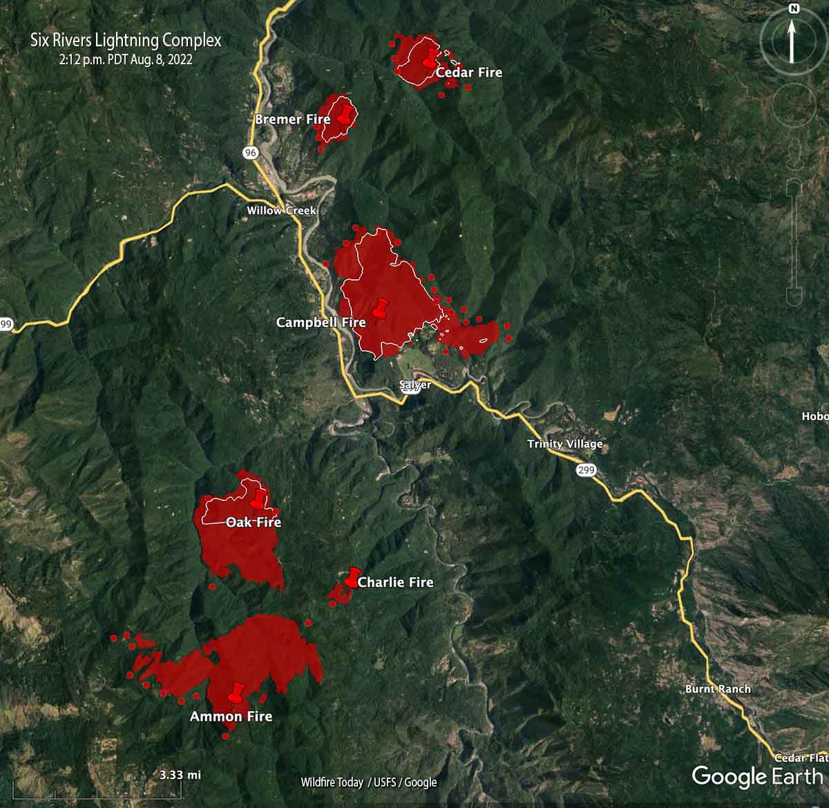
The wildfires in the Six Rivers Lightning Complex grew incrementally Monday, bringing the total acres burned up to about 8,900 acres when it was mapped at 9:00 Monday night. (See map below)
“Given the full-suppression tactics on this fire, crews will continue to fight fire aggressively in order to keep fire as small as possible,” the incident management team wrote in a Monday evening update. “Personnel are working to find areas to fight fire directly while continuing to provide community defense for Willow Creek, Seely Mcintosh, Salyer Heights, and other areas along the Trinity River.”
Map of the Six Rivers Lightning Complex. The red shaded areas were the perimeters at 9 p.m. August 8, 2022. The white lines were the perimeters about 24 hours previously. The red dots represent heat detected by a satellite at 4:10 a.m. Aug. 9, 2022.
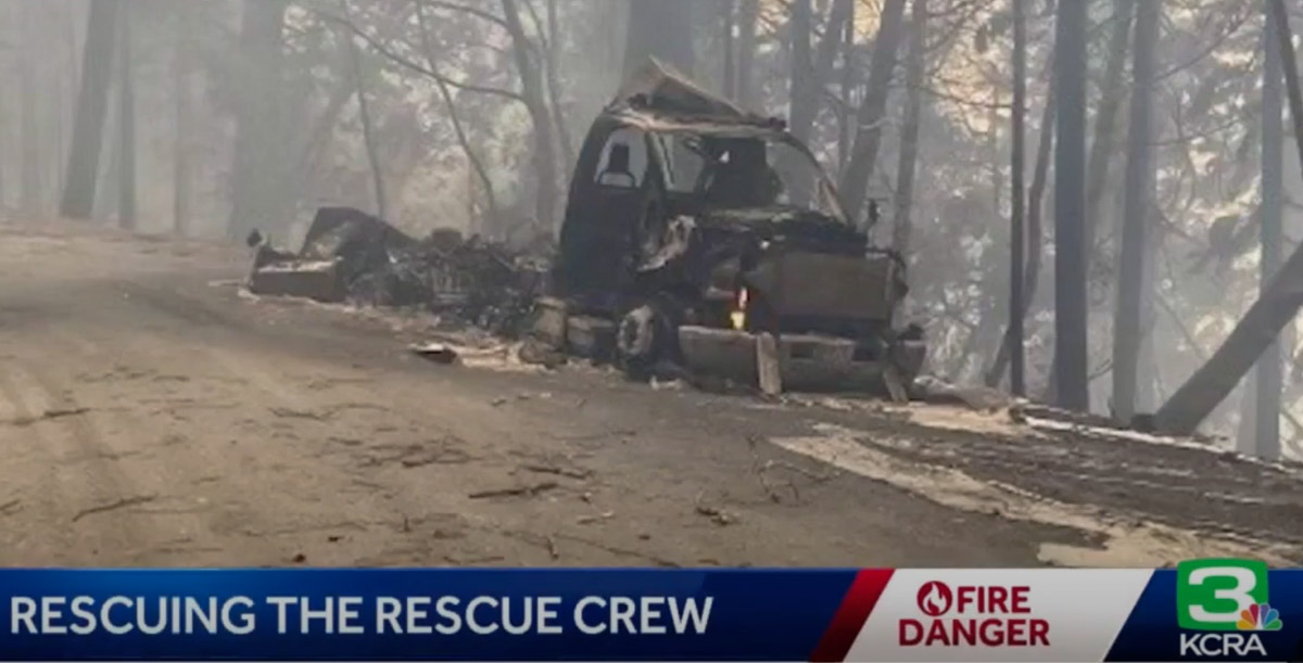
KCRA News reports that two firefighter crew carrier vehicles were destroyed by the fire. Dave Whitt, Chief of the Shingle Springs Band of Miwok Indians Tribal Fire, said “We had almost a million dollars worth of fire apparatus lost but nobody’s hurt, everybody’s safe.”
Two crew carriers burned in the Six Rivers Lightning Complex Fire, Aug. 8, 2022
With the destruction of the vehicles, 15 of the firefighters lost all of the personal gear they brought to the fire except what they were carrying at the time. Gone were sleeping bags, tents, extra tools, clothing, and personal items. Without their gear they were unable to set up tents and camp overnight like the other firefighters, so the Red Cross helped out by treating them like evacuees, providing a place to sleep when they were off duty.
Chief Whitt told Wildfire Today that he expects the US Forest Service compensation/claims process to replace the fire trucks and firefighting equipment. The tribe may assist the firefighters to replace their personal belongings, he said, but was not sure.
Resources assigned to the fire include 14 Type 1 Crews, 8 Type 2 Crews, 11 ST (strike teams) Type 3 Crews, 12 Dozers, 4 Chippers, 11 ST Type 6 Engines, 4 ST Dozers, 11 Type 3 Engines, 7 Water Tender Support, and 2 Feller Bunchers for a total of 525 personnel.
The weather forecast continues to predict moderate and normal conditions.
Map looking north from the south end of the Six Rivers Lightning Complex. The red shaded areas were the perimeters at 8:26 p.m. Aug. 7. The white lines were the perimeters about 24 hours before. The red dots represent heat detected by a satellite at 2:12 p.m. Aug. 8, 2022.
The incident management team that assumed command of the Six Rivers Lightning Complex at 6 a.m. Sunday August 7 said on Monday, “This is a full suppression fire. Firefighters will aggressively fight fire whenever it is safe to do so.”
Among their objectives, they intend to keep the fire west of Lone Pine, south of Horse Linto Creek, east of Brannan Ridge, and north of Ammon Ridge.
Humboldt County has issued additional evacuation orders. The current information is at the county’s website.
The fire is in a remote area of northwest California in the Six Rivers National Forest between Redding and Eureka.
The team reported that last year’s snow event left a lot of trees dead and down on the ground. If ignited, it can result in fire behavior that is more substantial than what would usually be anticipated this time of year.
Map of the Six Rivers Lightning Complex. The red shaded areas were the perimeters at 8:26 p.m. Aug. 7. The white lines were the perimeters about 24 hours before. The red dots represent heat detected by a satellite at 2:12 p.m. Aug. 8, 2022.
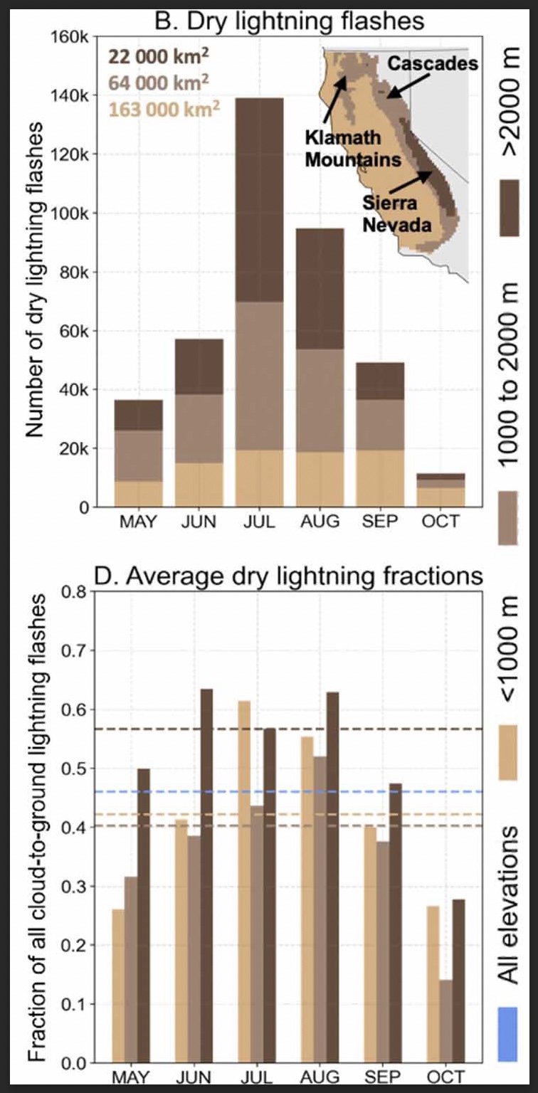
Researchers studied the climatology of dry lightning in California
(B) Total number of dry lightning flashes across three elevation zones (<1000 m, 1000–2000 m, >2000 m) within the domain for each month between 1987–2020. Text indicates the area of each elevation zone, and inset map shows the geographic distribution of the elevation zones and major mountain ranges. (D) The three elevation zones for each month (bars). Dashed lines in (D) indicate the dry lightning fraction averaged across all months for each zone. Blue dashes in (D) represent the dry lightning fraction computed from all months and elevation zones. (From the paper)
A group of six researchers who studied the occurrence and characteristics of cloud to ground lightning in Central and Northern California found that nearly half, 46 percent, was dry, accompanied by less than 0.1 inch of precipitation.
Of course dry lightning is the bane of land managers and is much more likely to ignite a wildfire than a wet thunderstorm. And on the occasions when there are thousands of down strikes, it can overwhelm the capacity to suppress what can be hundreds of fires.
The six scientists used daily gridded lightning and precipitation observations (1987–2020) in combination with atmospheric reanalyses, to characterize the climatology of dry lightning and the associated meteorological conditions during the warm season (May–October) when wildfire risk is highest.
The paper the group produced is available as open source: “Meteorological and geographical factors associated with dry lightning in central and northern California.”
Daniel Swain, a prolific user of Twitter, used the platform today to highlight some of the group’s findings. In the tweet below, click on “read reply” to see more discussion and illustrations.
We assess regional-scale atmospheric conditions favorable for dry lightning in central & northern California (N&C CA), as well as seasonality. We find that nearly half of all lightning strikes in N&C CA are “dry” (accompanied by <0.10 in. of rain). (2/n) https://t.co/DkooDBG0ggpic.twitter.com/1eZpRIG9cX
The six researchers who participated in the project were Dmitri A. Kalashnikov, John T. Abatzoglou, Nicholas J. Nauslar, Daniel L. Swain, Danielle Touma, and Deepti Singh.
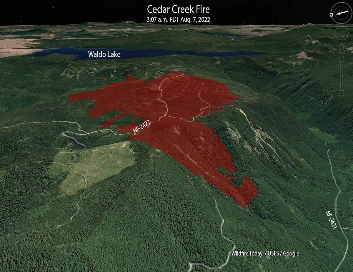
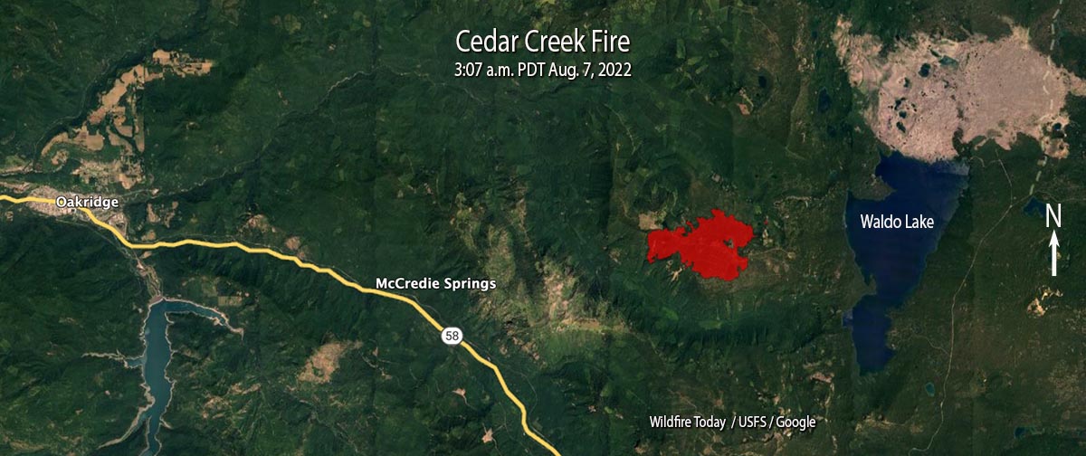
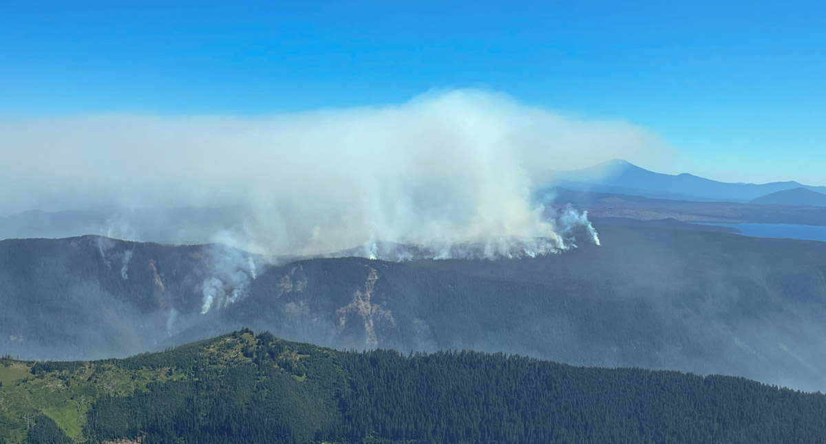
Cedar Creek Fire, looking east at 3:07 a.m. PDT Aug. 7, 2022
The Cedar Creek Fire on the Willamette National Forest in Western Oregon was very active when it was mapped by a fixed wing aircraft at about 10 p.m. Saturday, and also during a satellite overflight at 3 a.m. Sunday. Spot fires were observed 800 feet ahead of the main fire.
It has burned 1,822 acres since it started from a lightning strike August 1, one of 20 to 30 fires ignited by lightning that night. Most of it is burning on a plateau with a steep slope on the south side. The blaze is north of Highway 58, 14 air miles east of Oakridge, and 2 miles west of Waldo Lake.
Cedar Creek Fire, mapped at 3:07 a.m. PDT Aug. 7, 2022.
A Type 1 incident management team assumed command on August 5. Since then the team has been scouting for opportunities to safely engage the fire.
Currently there are no evacuations in effect.
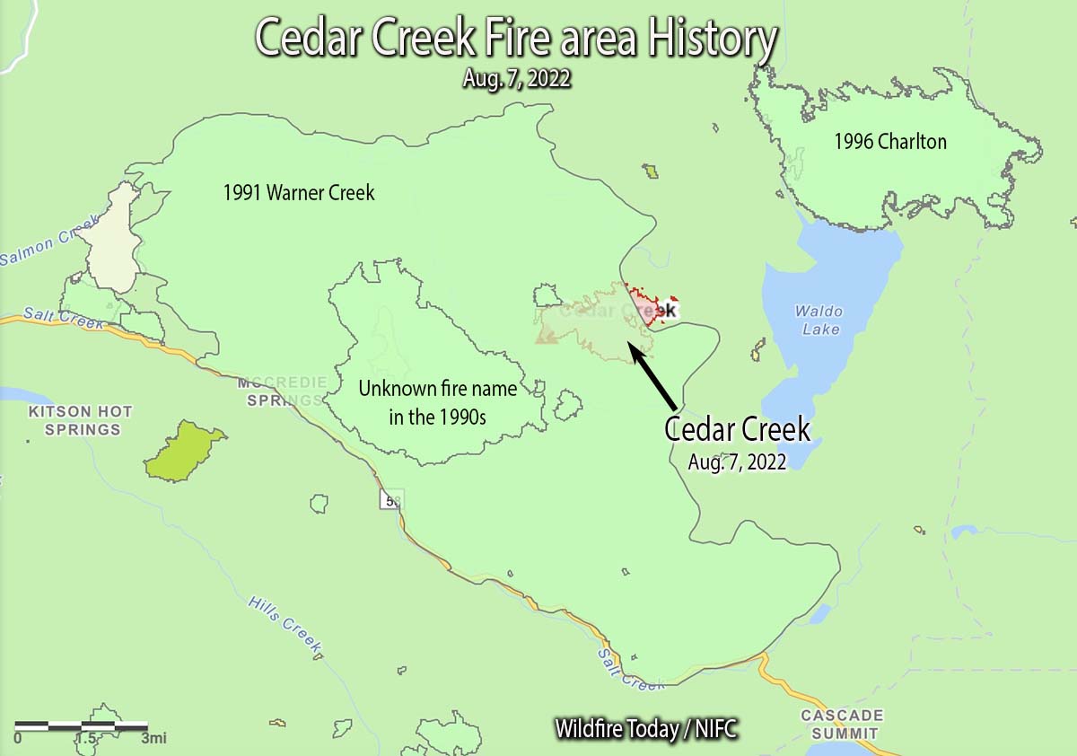
Update at 11:57 a.m. PDT August 9 2022. It turns out that there is a major error in the National Interagency Fire Center fire history database. In the map below we created using their data, the polygon shown as the 68,000-acre 1991 Warner Creek Fire is completely in error and does not exist at that scale or at that location. The polygon that was not identified in the NIFC database that we labeled as “Unknown fire name in the 1990s”, is actually the 8,900-acre Warner Creek Fire of 1991. We regret the error. This is not the first time we have seen gross errors in the NIFC fire history database, especially for Oregon, and causes us to question ever using it again.
The 1996 Charlton Fire which burned 9,000 acres is 3 miles to the northeast on the north side of Waldo Lake.
Cedar Creek Fire looking north at 11 a.m. August 6, 2022. InciWeb photo.
In the video below recorded Sunday morning, Operations Section Chief Kyle Cannon describes the current situation.
Firefighter Shawna Lynn Jones was airlifted after being injured in Malibu on Feb. 25, 2016. (Credit: KTLA)
The third California state inmate to die since 1943 while incarcerated and fighting a wildland fire was a woman. In the early hours of the morning on February 25, 2016 while fighting the Mulhollan Fire near Malibu as part of a hand crew, Shawna Lynn Jones, 22, was struck by a boulder that rolled down a hill. She was airlifted to UCLA Medical Center where she was treated for major head injuries. Ms. Jones was removed from life support after her organs were donated, in keeping with her family’s wishes.
This tragedy is one of the stories covered in a book by Jaime Lowe about California’s female inmate firefighters, “Breathing Fire: Female Inmate Firefighters on the Front Lines of California’s Wildfires.”
Here is an excerpt from a review by Erin Berger in Outside Magazine.
But Lowe makes a clear distinction between professional firefighting in the free world and the carceral system’s employment of inmates as firefighters. “All the women I spoke with could see the benefits of the firefighting program, but most bristled at the idea that they had volunteered,” Lowe writes, citing the litany of reasons an inmate would consider such a dangerous job more desirable than the conditions in prison, which include sexual assault, neglect for the sick or mentally ill, and poor nutrition. “‘Volunteer’ is a relative term for the incarcerated.”