NASA satellite photos of the huge Anderson Creek Fire in OK and KS

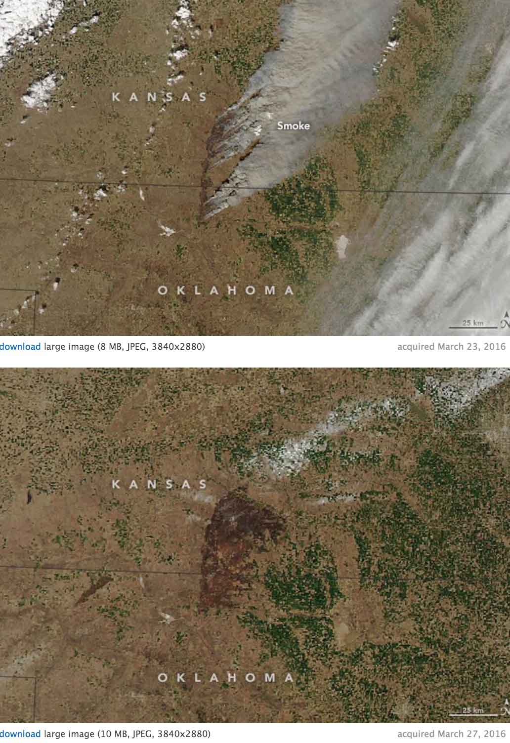
Here is the description from NASA of the images below of the Anderson Creek Fire that burned almost 400,000 acres in Oklahoma and Kansas last month:

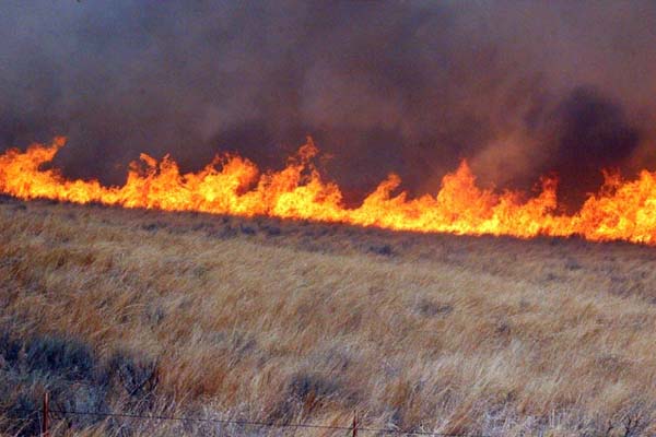
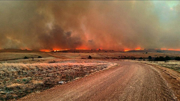
“In late March 2016, wildfire raged across rural areas of Kansas and Oklahoma. Local authorities and media outlets are calling it the largest grass fire in Kansas history. The Anderson Creek fire started in northern Oklahoma on March 22 and proceeded to burn more than 620 square miles (1600 square kilometers) of prairie and cattle grazing land. No human deaths have been reported, though 600 cattle were killed by the fires. At least 16 homes and 25 structures were lost, as were countless miles of fencing.

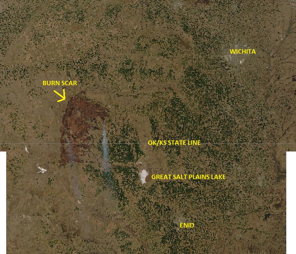
The Moderate Resolution Imaging Spectroradiometer (MODIS) on NASA’s Aqua satellite acquired these two natural-color images of the fire. The first shows the extensive smoke plumes as winds whipped the fires on March 23, 2016. The second image shows the scarred land as it appeared on March 27. Turn on the image comparison tool to see the change.

The wildfire spread quickly due to dry conditions in the region; rainfall has been below normal this spring. By March 31, the fire was close to 90 percent contained, thanks to work by fire crews, the National Guard, and a few inches of snow. Click here to view drone footage of the fire at its peak.”

Anderson Creek Fire satellite photo

Anderson Creek Fire 90 percent contained

The fire has burned 397,420 acres in Kansas and Oklahoma. It is the largest fire in the recorded history in Kansas.

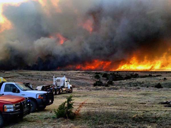
The teams managing the huge Anderson Creek wildfire that burned from Oklahoma into Kansas were calling it 90 percent contained Sunday night. The organization running the fire is described by the Kansas Forest Service as a Unified Command comprised of the Kansas Forest Service Type 3 Incident Management Team, Kansas Type 3 All Hazard Incident Management Team, and Barber County.

Kansas Oklahoma wildfire

The Blackhawk helicopters from the Kansas National Guard that were assisting by dropping water were released Sunday afternoon. The Temporary Flight Restriction was then terminated.

The Kansas Forest Service and the Kansas Incident Management Teams will both be transitioning their management responsibilities back to Barber County this week. Monday, crews will be in patrol status with four mutual aid fire departments and the Barber County resources. Warmer and dryer conditions will return to the fire area Monday and Tuesday.

The 38 Hutchinson Community College Fire Science students who were enrolled in Mitigation Project Training last week over spring break got more than they bargained for in hands-on training. They began the project with mechanical mitigation work at Sand Hills State Park, Dillon Nature Center, and the Prairie Dunes Country Club, but on March 23 the group was diverted to Medicine Lodge, Kansas along with their mentors and trainers to help fight the fire.

All photos were provided by the Kansas Forest Service.

Kansas Oklahoma wildfire

Kansas Oklahoma wildfire

Kansas Oklahoma wildfire

Continue reading “Anderson Creek Fire 90 percent contained”

Drone footage of the huge Anderson Creek fire in Kansas

The Kiowa County Media Center, a non-profit organization, shot this very impressive footage of the Anderson Creek Fire that has burned close to 400,000 acres in Kansas and Oklahoma. They uploaded it to YouTube on March 25, 2016.

Anderson Creek fire in Oklahoma and Kansas

(UPDATED at 11:30 a.m. March 25, 2016)

KS-OK fire from space
The Anderson Creek Fire in Oklahoma and Kansas as seen from space. Photo via Damon Lane
@KOCOdamonlane

****

(UPDATED at 12:15 a.m. CDT, March 25, 2016)

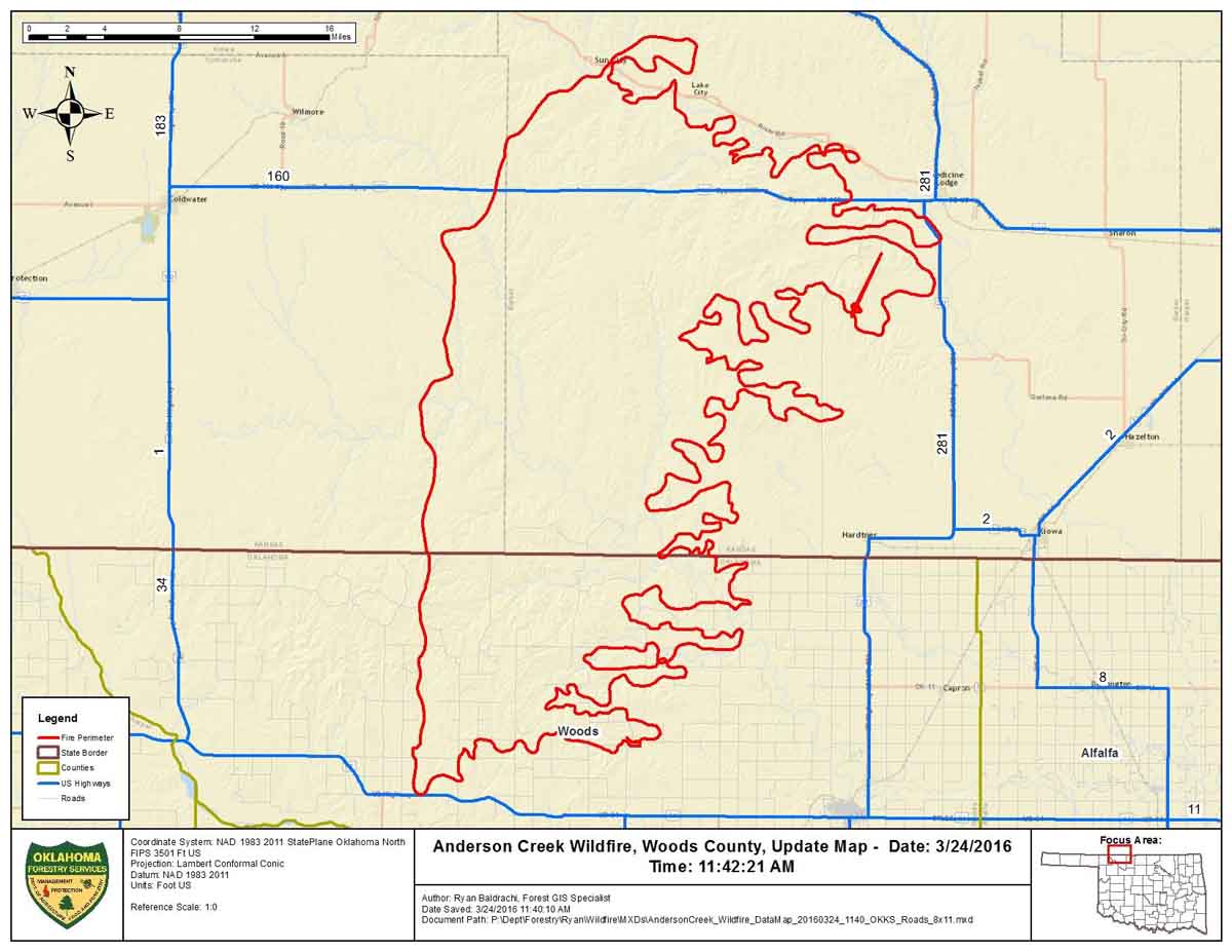
This map was provided by Oklahoma Forestry Services, along with the information that the fire had burned an estimated 397,420 acres and was 0% contained Thursday morning.

Map Anderson Ck Fire 3-24-2016

****

(UPDATED at 6:12 p.m. CDT March 24, 2016)

The video below is a recording of the briefing by public officials of Barber County Kansas the morning of March 24, 2016 about the very large fire insouthern Kansas and northern Oklahoma. It was originally broadcast on Periscope by Amy Bickel, but since recordings there are automatically deleted after 24 hours, we preserved it here. It was recorded off a computer monitor, so we apologize for the low quality.

In the briefing referenced above, the County Attorney said “397,420 acres have burned over the last couple of days”. He did not indicate if that was the size of the very large fire in our maps, or if the acreage includes multiple fires. He also said two homes were destroyed.

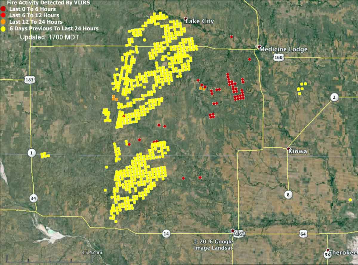
The map below shows heat detected by a satellite at 2:25 p.m. on March 24. The light vegetation in the area may sometimes ignite, burn up completely, and then cool before the next satellite overpass, which can be about 12 hours apart. In this case the mapped data may under-report the true extent of the fire.

map fire wildfire kansas oklahoma medicine lodge
Kansas-Oklahoma fire map at 2:25 p.m. CDT March 24, 2016.

Here is an excerpt from an article at WIBW, dated March 24 at 2:10 p.m.

Strong winds have thwarted efforts to contain a wildfire that has burned 620 square miles of rural land in Oklahoma and Kansas, and it’s now approaching populated areas.

Oklahoma Forestry Services spokesman Mark Goeller said Thursday that strong winds shifted the direction of the fire late Wednesday and overwhelmed existing containment lines.

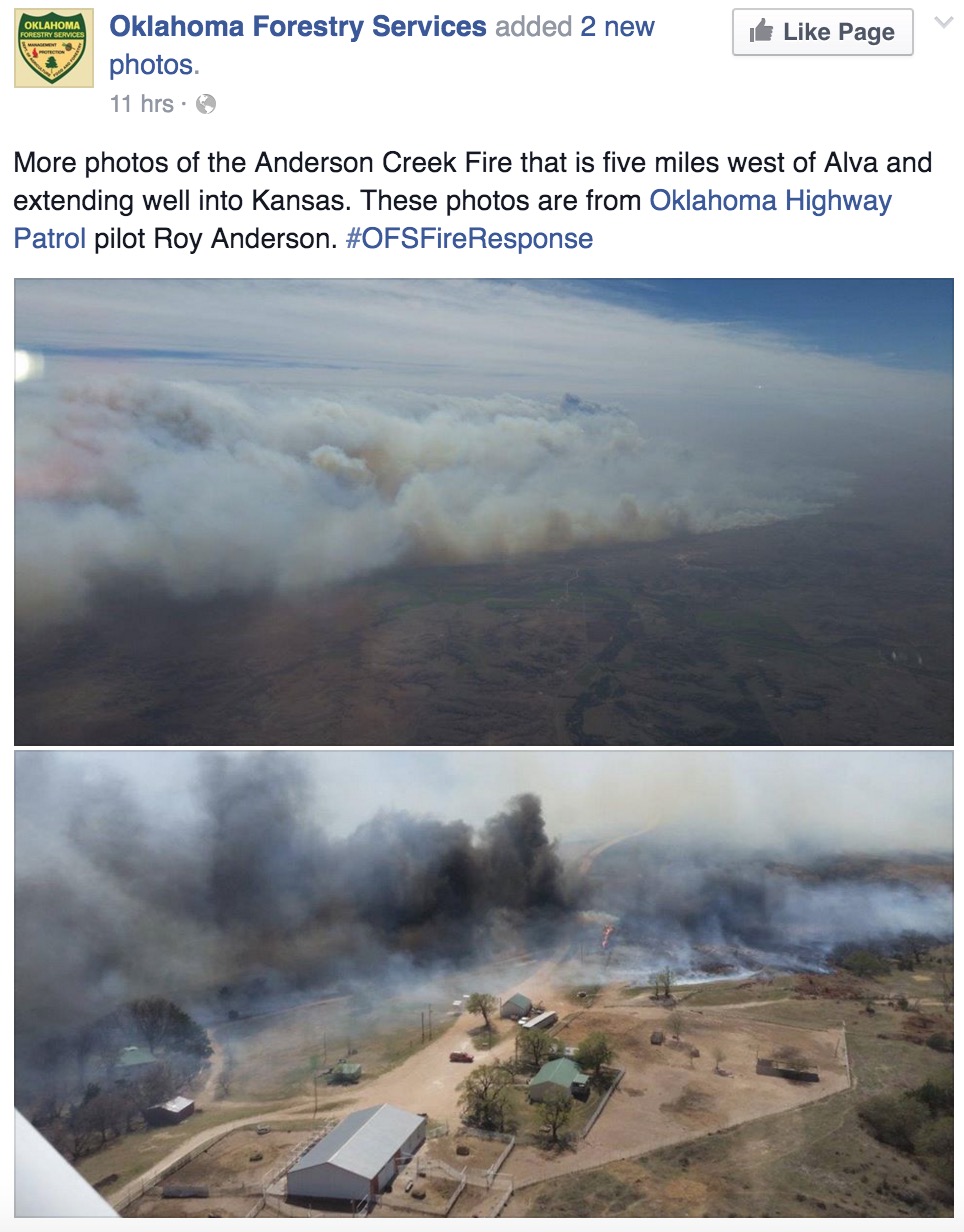
Officials are now monitoring a part of the blaze 5 miles away from Alva, Oklahoma, where about 5,000 people live. No mandatory evacuations have been issued in Oklahoma, though Goeller says officials are forming contingency evacuation plans as crews work to slow the fire’s spread.

Goeller says wind conditions and humidity are expected to improve throughout the day, making progress on containment more likely…

Anderson Creek Fire 3-24-2016

Continue reading “Anderson Creek fire in Oklahoma and Kansas”