Central Fire breaks out north of Phoenix

(UPDATED at 9:37 a.m. MDT July 21, 2019)
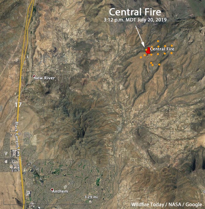
Map Arizona location Central Fire
The brown dots represent heat on the Central Fire east of New River, Arizona, detected by a satellite at 3:21 p.m. MDT July 20, 2019.

Officials said Saturday evening that the Central Fire just east of New River, Arizona had burned 503 acres (see the map below). The National Situation Report issued Sunday morning has it listed at 800 acres. Since Saturday evening very little additional information has been released.

Most of the fire is on land managed by the Tonto National Forest.
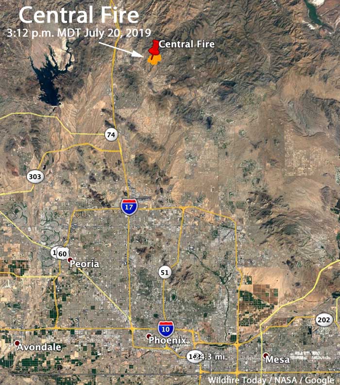
Map Arizona location Central Fire
Map showing the location of the Central Fire 35 miles north of Phoenix at 3:21 p.m. MDT July 20, 2019.

During the first few hours after the fire started Saturday afternoon firefighting resources mobilized included two Very Large Air Tankers (DC-10s), four Large Air Tankers, and three hand crews.

The fire is burning about 35 miles north of Phoenix, 4 miles east of Interstate 17, which remains open.

A satellite overflight at approximately 3 a.m. MDT on Sunday did not detect any large heat sources on the fire. This could mean the fire was not very active at that time, or clouds obscured the view. It does not mean the fire is out. It is likely that the fire is burning in light fuels such as grass and brush that burns quickly without leaving residual heat, making it very difficult for an orbiting satellite 200 miles over the fire to detect heat.

We will update this article after the Tonto National Forest releases information.


(Originally published at 5:46 p.m. MDT July 20, 2019)

map Central Fire New River, AZ
3-D map showing the location of the Central Fire near New River, AZ at 2:32 p.m. MDT July 20, 2019. Looking east.

(Originally published at 5:47 p.m. MDT July 20, 2019)

Saturday afternoon a wildfire broke out near New River, Arizona north of Phoenix. Late Saturday afternoon Arizona State Forestry said it had burned 250 acres. (see the map above)

The blaze is 48 miles northwest of the Phoenix-Mesa Gateway airport, which is a fairly quick turnaround for the air tankers working out the airport’s retardant reload base. Other air tankers are coming from Prescott. At 5 p.m. MDT FlightAware showed the following air tankers working on the fire; Tankers 01, 16, 15, 164, and 911 (a very large air tanker, a DC-10), plus an assortment of air attack and lead planes.
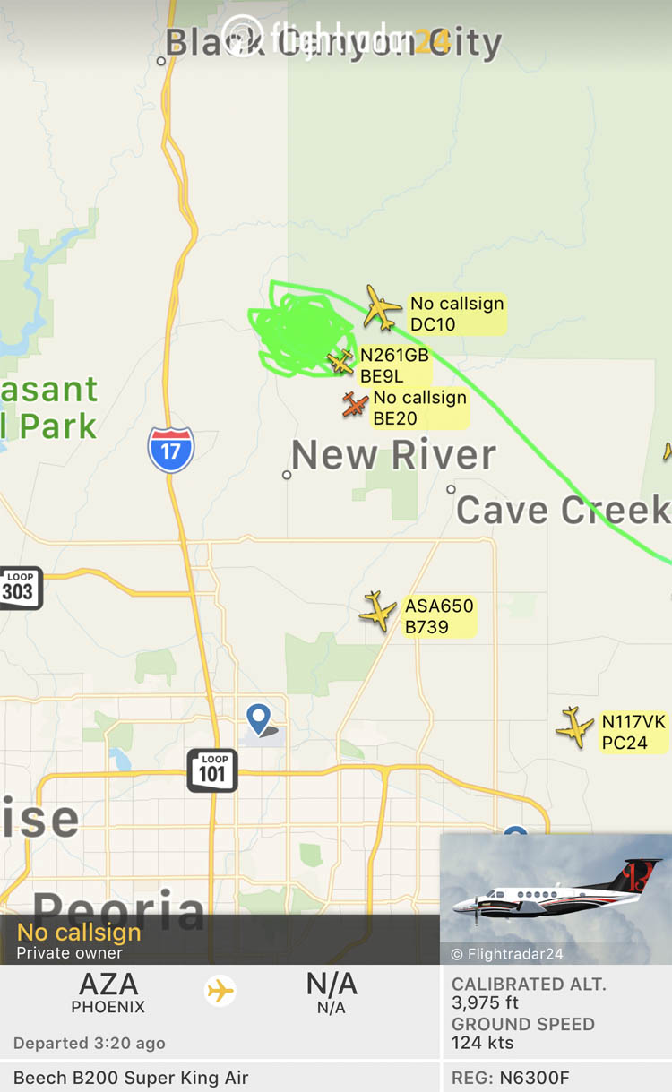
aircraft map Central Fire
FlightAware map showing aircraft near the Central Fire in Arizona at 4:53 MDT July 20, 2019.
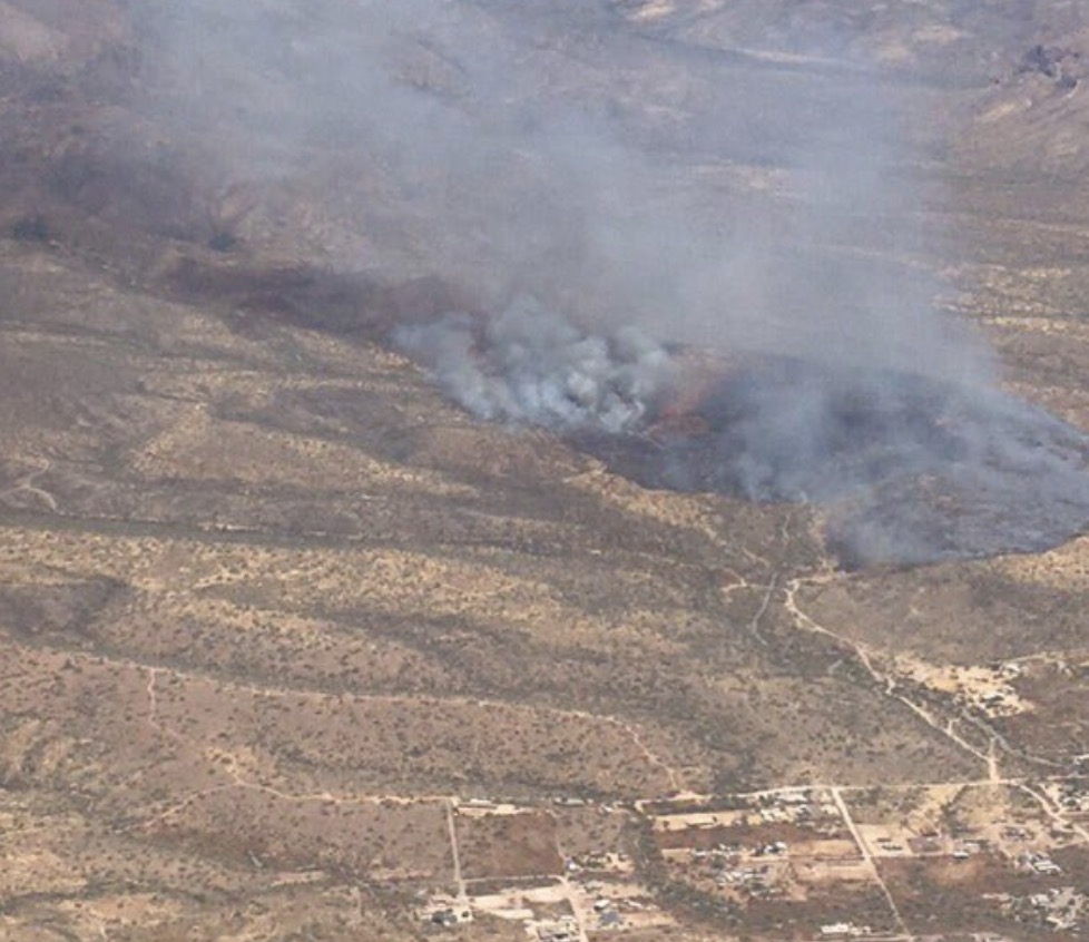
Central Fire Arizona
Aerial photo of the Central Fire. Arizona State Forestry.

14 aircraft and 367 firefighters are battling the Cellar Fire 14 miles east of Yarnell, Arizona

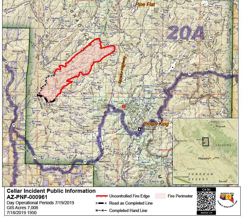
Map of the Cellar Fire
Map of the Cellar Fire, at 7:50 p.m. July 18, 2019 by the Incident Management Team.

The 7,000-acre Cellar Fire 15 miles south of Prescott, Arizona was active Thursday afternoon primarily on the northeast side as 7 air tankers, 7 helicopters, and 13 hand crews worked to limit the spread (see the map above). A total of 367 personnel are assigned to the fire.

The overall strategy of the Type 1 Incident Management Team led by Alan Sinclair is full 100 percent suppression. Structure protection is in place on the 52 Road (the Senator Highway). The highway may be used as a holding feature if the fire continues to move east.

The Incident Management Team reported that a DC-10 Very Large Air Tanker was effective in slowing the fire’s spread on the east side. Additional air tankers continued to support hotshot crews working on the northwest flank of the fire.

The Yavapai County Sheriff’s Office issued a Code Red ‘GO’ mandatory evacuation for the residents in Pine Flat affecting 41 residences and 21 outbuildings. A total of 690 structures are threatened. A shelter has been established at the Prescott High School.

The weather at Crown King, 6 miles southeast of the fire, is predicted to be about the same Friday and Saturday as it was on Thursday — temperature in the high 80s and relative humidity in the teens. The wind will be a little stronger, generally out of the west or southwest at 10 to 15 mph with gusts to 20. This translates to no relief for the firefighters, however there are some fire scars out ahead of the Cellar Fire that could decrease the intensity and resistance to control.

Map of the Cellar Fire
Map of the Cellar Fire — from a mapping flight at 10 p.m. MDT July 18, 2019.


Forest Service is managing a 7,000-acre wildfire south of Prescott, Arizona

The Cellar Fire is 16 miles south of Prescott

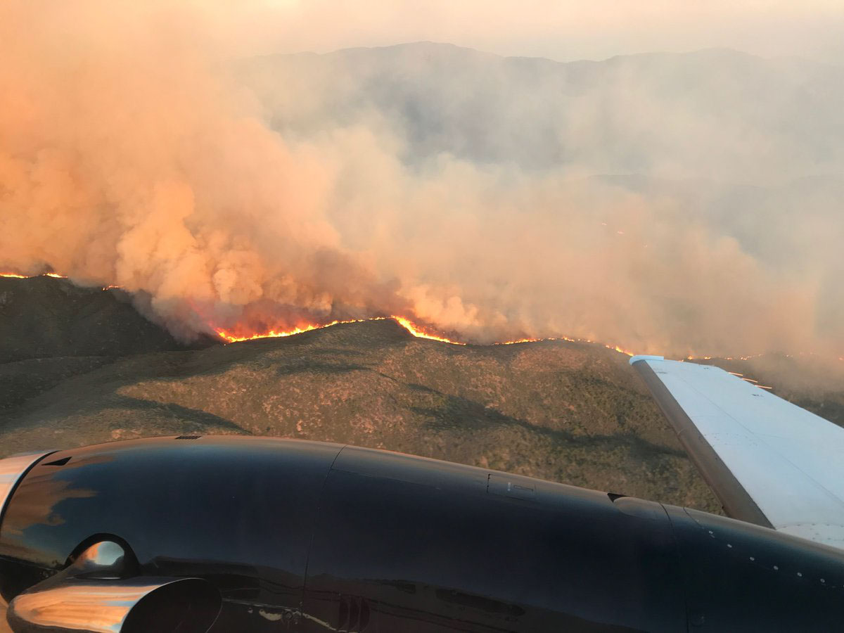
Cellar Fire Arizona
The Cellar Fire in Arizona. July 16, 2019. USFS photo.

A wildfire 10 miles southwest of Mayer, Arizona (see the map below) has burned about 7,000 acres in the Prescott National Forest. According to the National Situation Report the agency is not intending to fully suppress the fire, but instead is managing it to enhance the natural resources. They will take action as needed to herd it around or protect values at risk.

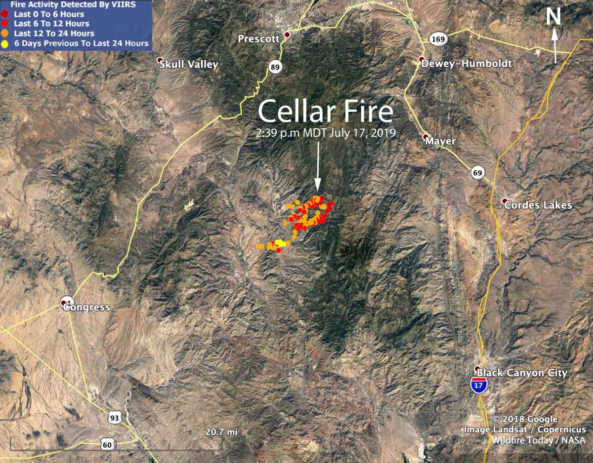
Map showing location Cellar Fire Arizona
Map showing the location of the Cellar Fire 16 miles south of Prescott, Arizona. The red dot represent heat detected by a satellite at 2:39 p.m. MDT July 17, 2019.

Believed to have been started by lightning, it was reported on July 14 burning in grass and brush but is spreading northeast into ponderosa pine west of the Senator Highway (FR 52).

A Type 1 Incident Management Team is expected to assume command of the fire Thursday, July 18 at 6:00 am.

As a precaution the Yavapai County Sheriff’s Office issued a Code Red for the community of Pine Flat. The ‘SET’ alert was issued last night by the Sheriff’s Department. There are NO evacuations currently in effect. For information on the Code Red issued call (928) 771-3321.

The US Forest Service and the Air Tanker Base at Prescott Regional Airport expects heavy aircraft activity out of airport over the next couple of days as they continue to assist with the fire.

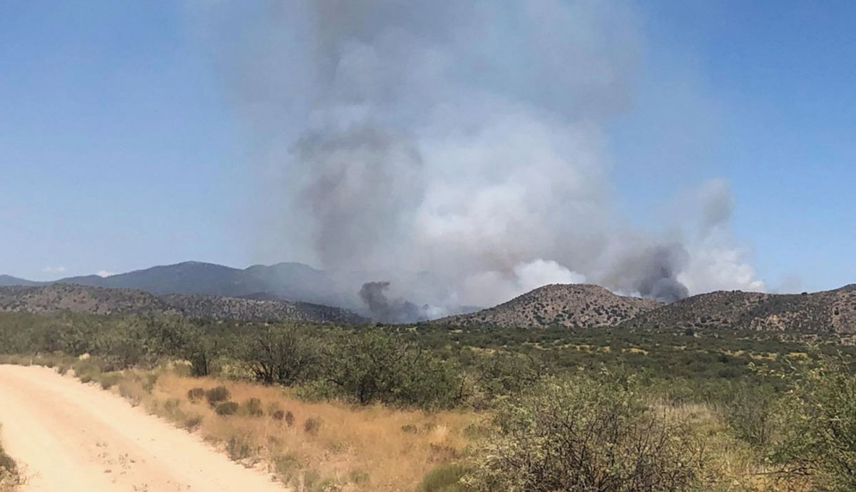
Cellar Fire Arizona
Cellar Fire in Arizona. July 16, 2019. USFS photo.

Demob begins on the Woodbury Fire

Woodbury Fire Phoenix Roosevelt
The Woodbury Fire visited the Superstition Wilderness, June 22, 2019. InciWeb.

The spread of the Woodbury Fire east of the Phoenix suburbs has slowed considerably, allowing fire managers to begin “right-sizing” the fire, according to information released by the Incident Management Team (IMT). Some firefighting resources are being demobilized.

The Southwest Area Type 1 IMT 2 is starting an initial transition of duties to the Arizona Central West Zone Type 3 IMT. The Type 3 team will assume command of the fire at 6:00 a.m. tomorrow, June 28th.

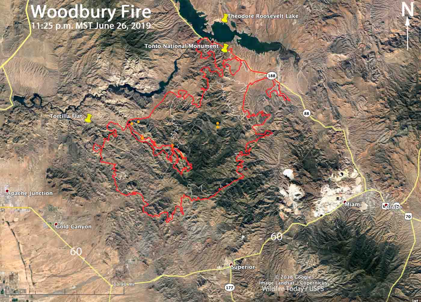
Below is a map of the Woodbury Fire.

Map of the Woodbury Fire P
Map of the Woodbury Fire. The red line was the perimeter at 11:25 p.m. MDT June 26. The white line was the perimeter June 22, 2019. Click to enlarge.

The work remaining on the fire includes patrolling, securing, and monitoring firelines. Fish Creek, Pinyon Mountain and Two Bar Ridge have interior pockets of vegetation burning within the fire perimeter. These areas pose no threats to the fireline, however southwest winds will push smoke towards the Roosevelt area on Thursday.

An Unmanned Aerial System, or drone, was used Tuesday to fly over the eastern border of the fire to scout for hotspots. The aircraft detected heat within the fire perimeter and helicopters then dropped water and firefighters constructed line on the ground. The IMT used the drone again on Wednesday.

Woodbury Fire Phoenix Roosevelt
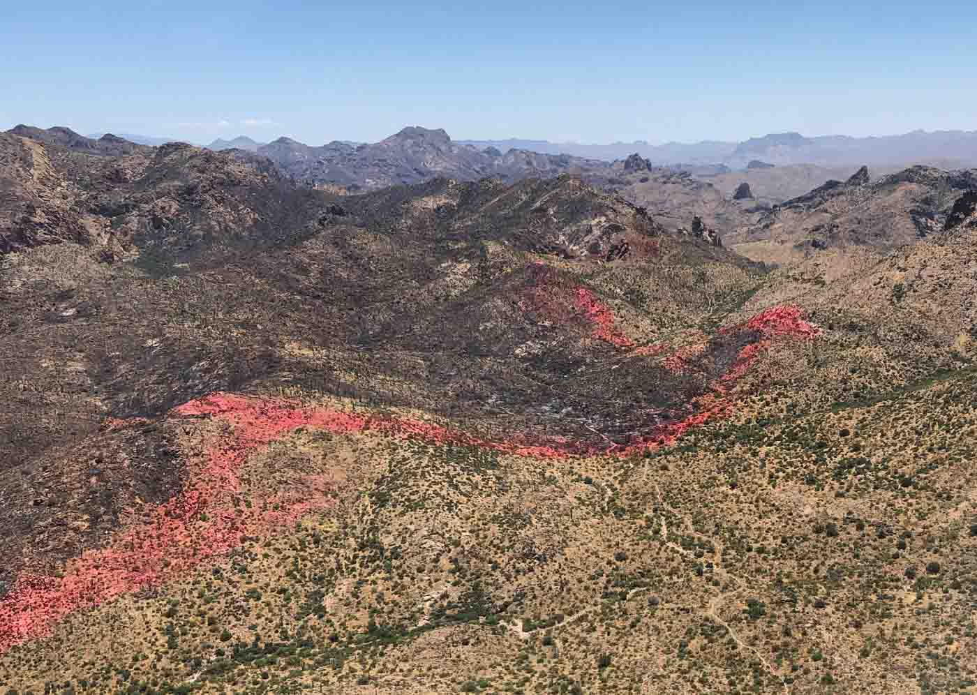
A line of fire retardant dropped by aircraft helped hold a section of the perimeter of the Woodbury Fire near Coffee Flat. Date unknown. InciWeb.

Firefighters concentrating on the east side of the Woodbury Fire in Arizona

The fire has burned over 96,000 acres east of Phoenix

3-D map Woodbury Fire Phoenix Arizona Lake Roosevelt
This 3-D map, looking south, shows the mapped perimeter (in Red) of the Woodbury Fire as of 11:12 p.m. MST June 22. The white line was the perimeter about 48 hours before.

(Above, map of the Woodbury Fire, Saturday night) 

(Originally published at 11:11 a.m. MDT June 23, 2019)

The Woodbury Fire was less active Saturday than it had been in previous days, which allowed the construction of direct fireline by hotshot crews, but it still produces large amounts of smoke. The southeast side of the fire where retardant was dropped along Sawtooth Ridge continues to hold. Crews are performing structure protection around the community of Top of the World, Pinto Valley Mine, Carlota Mine, and other infrastructure.

(To see all articles on Wildfire Today about the Woodbury Fire, including the most recent, click HERE.)

The fire has burned 96,307 acres east of Phoenix and south of Theodore Roosevelt Lake.

Firing operations have been underway along the Highway 188 corridor from Roosevelt to Spring Creek to limit fire spread should it progress further northeast. That line is holding well.

Additional firing occurred at Tonto National Monument ahead of the advancing wildfire as a precautionary measure. The Monument is two air miles southeast of Roosevelt. There has been no apparent damage to the cliff dwellings and other structures.

Resources assigned to the fire include 16 hand crews, 49 fire engines, and 8 helicopters, for a total of 905 personnel. This is a slight reduction in personnel over the last 24 hours, probably due to the eastern one-third of the fire having been relatively quiet for several days.

State Highway 88 is closed from milepost 213 at Tortilla Flat to State Highway 188 at Theodore Roosevelt Dam. Also, State Highway 188 is closed from its junction with State Highway 88, east to the junction of State Highway 288 (the Young Road). Highway 288 remains open.