Bushfire in Western Australia closes highway, stranding hundreds of travelers

Above: Wind in Western Australia produces an interesting trajectory of smoke from a bushfire near Madura. NASA image, December 7, 2016 U.S. time.

A large bushfire in Western Australia forced authorities to close a major highway resulting in hundreds of long-haul truckers and tourists being stuck on the road for hours. Some of them were stranded between roadblocks that were 170 kilometers (105 miles) apart.

Wednesday morning the Eyre Highway across the Nullarbor was closed between Caiguna Roadhouse and Madura. By evening it was open again.

There were two large fires south of the highway that were being pushed by the wind toward the road.

The fire started from lightning four days ago 20 kilometres (12 miles) south of Cocklebiddy.

Below is a time-lapse video of satellite photos of smoke from fires in the area.

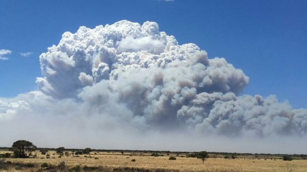
Bushfire Madura, Western Australia
Bushfire near Madura, Western Australia. Photo by DFES.

Thunderstorm initiated by a wildfire

This time-lapse video of the pyrocumulus cloud over the Sedgerly Fire in Queensland, Australia is fascinating. According to the description by the Bushfire Convective Plume Experiment it shows a thunderstorm initiated by the fire. If you look closely you will see rain and lightning.

Firefighters busy in New South Wales

Above: Photo of the Lone Pine fire at Port Stephens. The fire crossed the Pacific Highway near Tarean Road and was moving east toward Scotts Road. New South Wales Rural Fire Service.

Numerous wildfires have been keeping firefighters in New South Wales busy for the last several days.

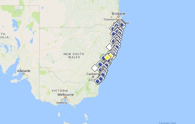
fire map NSW
November 5, 2016 U.S. time. 52 bush and grass fires burning across NSW, with 17 yet to be contained. The Lone Pine Fire (Port Stephens) closed the Pacific Highway again, mainly due to smoke.

This video has some great shots of some of the activity:

North American air tankers under contract during the Australian summer, Coulson’s Tanker 132, an L-382G, and 10 Tanker’s T-910, a DC-10, have been used extensively over the last three days.

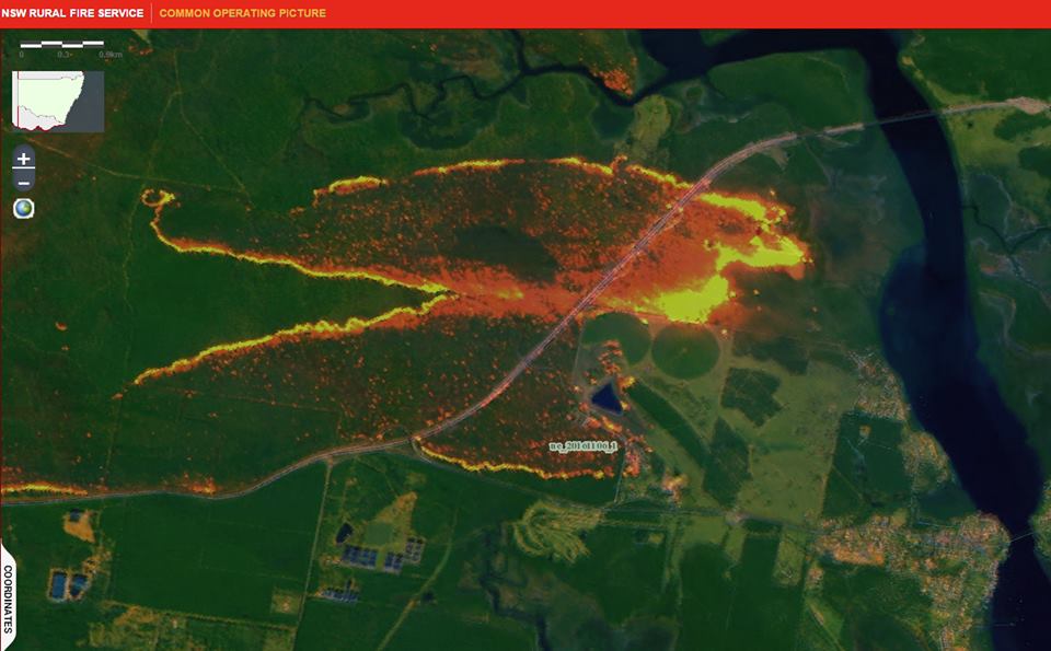
As you can see below, the infrared mapping system the Aussies use provides an excellent image showing the location and intensity of a fire.

infrared fire NSW
This is a infrared linescan image of the Lone Pine fire that is currently burning north of Karuah. New South Wales Rural Fire Service.

Bushfire in Western Australia burns millions of acres


A huge bushfire in the Kimberley region of Western Australia has burned approximately 2.4 million acres (1 million hectares). Since it started from lightning two weeks ago it has been spreading across cattle stations on both sides of Gibb River Road and recently began approaching Aboriginal communities. Not all fires in sparsely populated areas of Western Australia are aggressively suppressed but firefighters have been working around the clock this week to put in a fireline on the north side near Gibb River Road station.

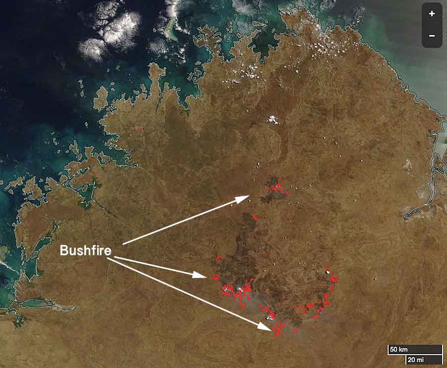
Kimberly region bushfire map
The Kimberley region of the north part of Western Australia. The red dots represent heat detected by a satellite October 10, 2016. The black areas near the dots are most likely recently burned. Note the graphic scale at bottom-right.  MODIS/Wildfire Today.

Below is an excerpt from an article at ABC.NET in Australia:

Indigenous ranger groups from across the region have converged on the area to help, some travelling hundreds of kilometres. There is concern about the impact the bushfire will have on the landscape, which covers both prime grazing country and biodiversity hotspots.

The fire is now heading towards properties managed by the Australian Wildlife Conservancy. The group’s national operations manager Tim Allard said it would have a harsh impact on native species.

“It’s a significant fire and a significant chunk of land has been burnt in one event,” he said.

“It’s decimated the habitat for so many animals … [and] the other issue is it destroys all of the refuge for native animals to hide from feral cats.”