Fire agencies respond to earthquake near Napa

(UPDATED at 5:32 p.m. PDT, August 24, 2014)

As we noted below, the U.S. Forest Service Regional Office in Vallejo, approximately 5 miles south of the epicenter, was affected by this morning’s 6.0 earthquake. Further assessments revealed a water line break on the fourth floor that caused extensive damage. Additional problems were also found, however the USFS is saying the building is structurally sound. An Incident Management Team is working on the cleanup and the office will be closed through Tuesday while a contract crew deals with the water and further assessments are completed. All employees are authorized administrative leave for August 25th and 26.

****

(UPDATED at 12:55 p.m. PDT, August 24, 2014)

At a news conference that just finished, Napa Fire Chief Mike Randolph said resources in the city include four strike teams of Type 1 (structure) engines, one strike team of water tenders, and two urban search and rescue task forces.

The fire department has received 100 calls reported natural gas odors. They have also been assessing damaged structures to determine if anyone needs to be rescued, but have found none.

Approximately 50 water main breaks have been reported.

California Office of Emergency Services is live-streaming video from the state Operations Center.

****

(Originally published at 9:39 a.m. PDT August 24, 2014; updated at 9:27 a.m. PDT, August 24, 2014)

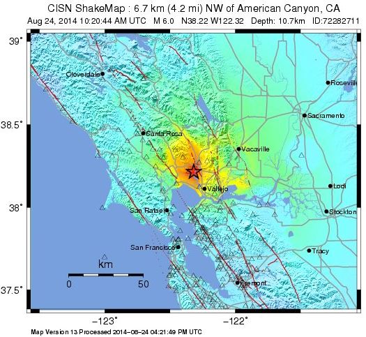
Earthquake map

The 6.0 magnitude earthquake that struck the Napa area north of San Francisco at 3:20 a.m. PDT today not only caused damage to structures, roads, and water mains, but several mobile homes caught fire when they were shaken off their foundations, rupturing natural gas lines. The broken water main made it difficult for firefighters to suppress the fires, using only the booster tanks in the engines until water tenders arrived.

Battalion Chief Scott McLean, a spokesperson for the California Department of Forestry and Fire Protection (CAL FIRE), said the agency has not had any reports of vegetation fires related to the earthquake, but 10 CAL FIRE engines, plus 2 Napa County engines and 2 Napa County water tenders are assisting the city of Napa. There are a total of 4 strike teams on order — 3 Type 1 strike teams (structure engines) and 1 Type 3 (brush engine) strike team. Each strike team has 5 engines plus a strike team leader. Two Type 1 urban search and rescue teams have been ordered, Chief McLean said.

There are no CAL FIRE aviation assets are working the incident, but Chief McLean said Helicopter 104 is available if needed.

U.S. Forest Service spokesperson Stanton Florea said their Region 5 headquarters in Vallejo, approximately 5 miles south of the epicenter, sustained damage that is being evaluated.

Girl, 13, to stand trial for starting Cocos Fire in San Marcos, California

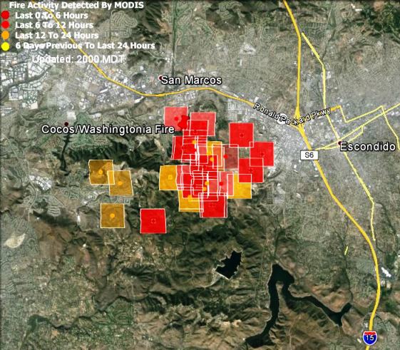
A judge has ruled that a 13-year old girl is competent to stand trial after being accused of starting the Cocos Fire. In May the blaze burned about 1,995 acres and destroyed 36 homes in San Marcos, California, north of San Diego. The judge announced his decision in a hearing where the girl pleaded not guilty to four arson-related felony charges.

The Cocos Fire was one of at least 10 fires that burned in San Diego County during the same time period in mid-May.

During the proceeding the Deputy District Attorney told San Diego Superior Court Judge Rod Shelton that the girl’s parents, who were present in the courtroom, could be ordered to pay restitution in the case. County fire officials have estimated the costs of property damage and fire suppression to be about $12 million.

map Cocos Fire
Map showing the Cocos Fire. The dark red squares represent heat detected by a satellite at 2:27 p.m. PDT, May 15, 2014. The location of the icons can be as much as a mile in error.

California: Tecolote Fire

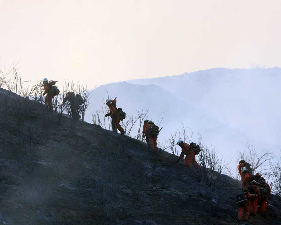
Tecolote Fire. Photo by Jeff Zimmerman.
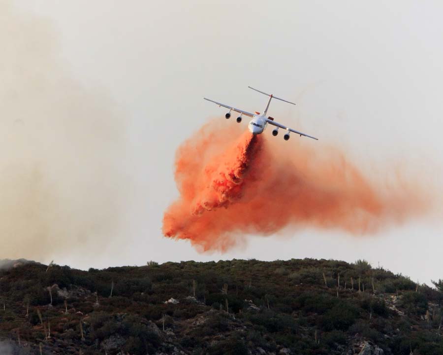
A BAe-146 drops on the Tecolote Fire. Photo by Jeff Zimmerman.

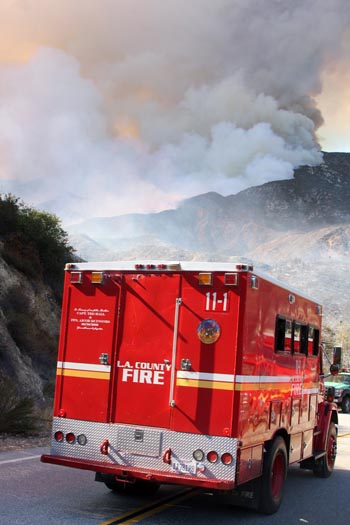
The Tecolote Fire burned about 275 acres in the Angeles National Forest on August 17 near Highway 39 about 18 miles north of Azusa, California. Hundreds of people were forced to evacuate their homes and campsites but the marine layer moved in that night and slowed the spread.

The agencies responding included the U.S. Forest Service and Los Angeles County. In addition to very steep terrain, firefighters had to deal with temperatures around 100 degrees.

These photos were contributed by Jeff Zimmerman, of Zimmerman Media. Thanks Jeff.

Tecolote Fire. Photo by Jeff Zimmerman.

Helicopter hoist extraction at night on the French Fire

A night time helicopter hoist operation was used to extract a firefighter who was injured during a night shift on the French Fire, about 36 miles northeast of Fresno, California. The Lessons Learned report does not give the date of the incident, but the fire started on July 28, 2014.

At approximately 12:53 a.m., a large snag within the burned area fell, hit adjacent trees, and caused a shrapnel effect of flying woody debris. A sawyer cutting brush ahead of the line construction effort for the Tahoe IHC was struck by an 8” diameter piece of this woody debris. As crewmembers rushed to the downed firefighters aid, he was found to be semi-conscious with a visible laceration to the head (caused by broken hardhat suspension).

The firefighter was stabilized and packaged by fellow hotshots, paramedics from a nearby Ventura County crew, and line medics. Within 1 hour and 10 minutes after the first report, the victim had been hoisted from the remote area by a helicopter and delivered to a hospital in Fresno.

The Dutch Creek protocols were used during the incident.

The Lessons Learned included:

  • Choose extraction site away from fireline or black edge.
  • When pilots use night vision goggles, all colors look the same — use glow sticks in a circular or spinning motion to call attention to the location.
  • Having qualified medical personnel and equipment close at hand facilitates prompt patient care.

The report did not provide the outcome of the victim’s injury other than being conscious and stable upon arrival at the hospital, but aside from that, the management of the incident sounds like a success story — good planning and execution of the plan.

More details are in the report: Night_Hoist_Extraction_final

California: Way Fire near Kernville

(UPDATED at 8:41 a.m. PDT, August 21, 2014)

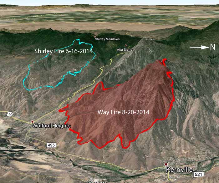
Map of Way Fire at 10 pm 8-20-2014
3-D map of the Way Fire at 10 p.m. 8-20-2014. The Shirley Fire that occurred across the highway in June is also shown. (click to enlarge)

Firefighters are beginning to get a handle on the Way Fire near Wofford Heights, California, but there is still some fireline that has not yet been constructed in very steep terrain. The remaining fire activity is on the east and northwest sides, but those areas are being kept mostly in check with aircraft.

At the public meeting Wednesday night the Operations Section Chief said that for safety reasons, they may not commit firefighters to those rugged areas; they will continue to treat them with water and retardant drops from helicopters and hope that does the trick. The team is bringing in a portable fire retardant plant that will supply the helicopters. Long Term Retardant is more effective than water when dropped from a helicopter or an air tanker. Fire Aviation has photos of a retardant plant being used on the Beaver Fire in northern California on August 13.

The latest size estimate is 4,031 acres. The incident management team is calling it 48 percent contained as of 8:41 a.m. PDT, August 21, 2014.

****

(UPDATED at 8:25 p.m. PDT, August 20, 2014)

At 8 p.m. today the incident management team issued an update on the Way Fire near Wofford Heights and Kernville, reporting that the fire had burned 3,858 acres and they are calling it 48 percent contained. There is still some active fire on the north side.

All evacuation orders and road closures have been lifted.

A public meeting was held at 6 p.m. which was live-streamed on YouTube. The meeting was very well organized and informative for the locals who attended and the others who watched it on the internet. It was recorded and is available on YouTube.

****

(UPDATED at 9 a.m. PDT, August 20, 2014)

The Way Fire near Wofford Heights and Kernville in southern California grew very little on Tuesday under more moderate weather conditions. Very little information is being distributed by the Type 1 Incident Management Team that assumed command at 6 p.m. Tuesday, but the latest reported size is 3,367 acres and they are calling it 15 percent contained.

According to the Situation Report eight homes have burned. KBAK television reported that at the peak of fire activity 14 air tankers and 8 helicopters were working to assist firefighters on the ground. Approximately 900 personnel are assigned, along with 26 hand crews and 56 engines. The fire is burning in Bureau of Land Management jurisdiction, and is organized under a unified command with Kern County Fire Department and the U.S. Forest Service.

BakersfieldNow has an impressive slide show with more than 50 photos of the fire.

****

(UPDATED at 6:05 p.m. PDT August 19, 2014)

The map of the Way Fire near Kernville shows data collected at 2:26 p.m. PDT, August 19, 2014.
Continue reading “California: Way Fire near Kernville”

72-hour report on Beaver Fire shelter deployment

Beaver Fire deployment
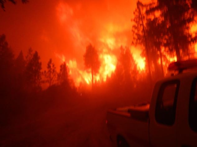
The Division Supervisor’s truck is seen in the foreground just before the fire shelters were deployed. The photo is from the report.

A 72-Hour Report has been released for the incident on the Beaver Fire in which three people took refuge from a wildfire inside their fire shelters. The near miss occurred August 11 at 5:30 p.m. on the Klamath National Forest in northern California, approximately 15 miles northwest of Yreka. We first wrote about it on August 12. Below is the Incident Summary from the report:

****

“At approximately 1730 on August, 11, a Division Supervisor, contract dozer and a Heavy Equipment Boss deployed their fire shelters on the Beaver Fire on the Klamath National Forest in northern California (U.S. Forest Service Incident CA-KNF-005497). The individuals involved were improving line on the far western edge of the fire, approximately 2 miles from the fire front. Fuels in the area consisted of a pine overstory and manzanita surface fuels. Extreme to exceptional drought, at the highest levels on the Drought Monitor system, existed over nearly all of northern California.

As indirect dozer line construction progressed downslope, outflow from a thunderstorm which had already tracked through the area, caused a dramatic and large scale pulse in fire behavior. As fire activity increased, the Division Supervisor drove down to the Heavy Equipment Boss and Dozer Operator to check their status. The dozer operator was in the process of constructing a predetermined safety zone. The fire quickly traveled a significant distance through heavy timber, impacting the indirect dozer line, requiring the three firefighters to deploy fire shelters to survive the heat blast and ember shower. The contract dozer operator received non-life threatening burn injuries, but was referred to a burn center for further evaluation.

PROPERTY DAMAGE: The DIVS pickup truck parked at the deployment site received heat damage and the bed and back seat caught fire. The Division Supervisor and Heavy Equipment Boss were able to put the fire out with two fire extinguishers. The Dozer received minor damage from a small fire which started behind the seat in the open cab.

Based on the nature of this incident, the Pacific Southwest Region will be utilizing the Facilitated Learning Analysis (FLA) process to maximize learning opportunities and better manage future incidents.”