Another report released for Colorado Springs’ Waldo Canyon Fire

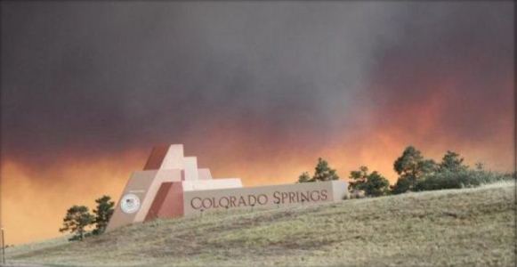
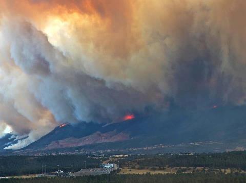
Waldo Canyon Fire, June 26, 2012
Waldo Canyon Fire, June 26, 2012, the day most of the homes burned in Colorado Springs. Credit: Keystoneridin

(Originally published at 2:07 p.m. MT, April 5, 2013; updated at 4:30 p.m. MT, April 5, 2013)

The City of Colorado Springs has released a second report about the disastrous Waldo Canyon fire that in June, 2012 killed two people, destroyed 347 homes, and burned 18,247 acres. The first report can be found HERE, and was called an “Initial After Action Report” considered preliminary. Wildfire Today covered that report on October 23, 2012. This new report on the City’s web site is described as the “Final After Action Report”. Unlike the first version, this one provides more information about what went well and what didn’t, and includes many recommendations along with the reasons for each one.

As a firefighter who worked on the 1975 Pacoima Fire where the Incident Command System was used for the first time, it is difficult to understand why 37 years later a large city with an extensive wildland/urban interface in a wildfire-prone area had not fully adopted the ICS by 2012. In reviewing these two reports, and an excellent exposé written for the Colorado Independent by Pam Zubeck, which in my mind deserves a Pulitzer Prize, roughly 75 percent of the problems identified could have been avoided if Colorado Springs had fully implemented the ICS.

The City’s reports claim ICS training has been conducted for some of their employees, but it is clear from the problems encountered during the Waldo Canyon Fire that it was poorly, if at all, implemented.

Even if extensive ICS training is given within the City, that is not enough. The system needs to be used daily. No one can receive the training and then instantly be qualified as a Logistics Section Chief, for example. Under the best of circumstances, it takes years, sometimes decades of experience and training to advance from an entry level ICS position to the highest ranks, so Colorado Springs needs to develop an aggressive mentoring program. Trainees need to be assigned on large incidents outside the City to shadow someone who can show them the ropes. Their freshly trained employees may not qualify for a Trainee position at the Unit Leader or Section Chief level, but I doubt if the City will worry much about qualifications for ICS positions, or how to move up the chain of command from position to position. The 310-1 Wildland Fire Qualification System Guide might only be a pipe dream for Colorado Springs.

This in no way should be considered as criticism of the Colorado Springs firefighters. Many of them are highly trained and some have had multiple assignments with Type 1 incident management teams on large wildfires. The organizational and policy problems rest with the city administrators and the leaders within the fire department.

The Colorado Springs Gazette published an article about the report on April 3, pulling no punches. Here is an excerpt:

“Obviously, going forward we need to learn from this. If this fire had started on Cheyenne Mountain we would have lost thousands of homes and probably many more people,” [Mayor Steve Bach] said Wednesday. “This is going to happen again.”

The report focused largely on the afternoon and night of June 26, when the fire destroyed 347 homes and killed two residents.

Colorado Springs firefighters raced into Mountain Shadows without plans to ensure they had food, water or rest breaks, the report said.

Capt. Steve Riker, the department’s incident commander on June 26, said he initially had his firefighters “well under control.” However, he said that control began to slip as units from neighboring fire departments rushed to help.

Supervisors operated under organizational charts that weren’t fully developed, the report said, and emergency plans were “underutilized.”

Communication lagged between city officials and first responders in the field — leading firefighters and police officers to work without full situational awareness.

The Colorado Springs city administration has been sensitive to criticism about they way they managed the fire. In a video that was shot at a press conference, Chief Rich Brown said:

The hypercritical view by some at times just gets a little old. Because of the fact that they weren’t there. They didn’t see what the decision maker at the time saw. Any public safety professional worth anything is always going to come back and say I would have done this differently if I had the same thing to do over again.


Thanks go out to Dick

Lessons learned about survival of structures during Waldo Canyon Fire

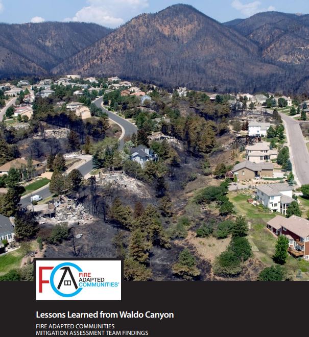
Lessons Learned from Waldo Canyon Fire
Lessons Learned from Waldo Canyon Fire, cover. Click to enlarge

The Fire Adapted Communities Coalition has prepared an excellent report titled “Lessons Learned from Waldo Canyon”. Written by representatives from the Insurance Institute for Business and Home Safety, U.S. Forest Service, International Association of Fire Chiefs, and the NFPA, it documents factors that affected the destruction or survival of structures during the Waldo Canyon Fire, a fire that destroyed 346 Colorado Springs homes in June of 2012. This document, along with the Texas report, “Common Denominators of Home Destruction”, could be very useful resources for communities and home owners that desire to mitigate potential damage before wildfires threaten their wildland-urban interface.

Often you will see media reports using words like “random” or “miracle” to describe how some homes are burned while others survive a wildfire that burns into a community. It is neither — it is science — and fuel reduction, building materials, screening off vents, plugging holes between roof tiles, a lack of combustible decks, the actions your neighbor takes or does not take, and many other factors. And did I mention fuel reduction?

While the city of Colorado Springs and their fire department has received criticism for their lack of operational preparedness and training for wildfires, as well as their actions during the Waldo Canyon Fire, this report indicates the city had a program that resulted in some positive outcomes related to fuel mitigation and home owner education about how to reduce the chances of structures burning during a wildfire event.

Here is a sample of some of the conclusions identified in the report:

Observations on building design and materials improvements and maintenance could have reduced losses:

  • Ember ignition via ignition of combustible materials on, in or near the home was confirmed by the surveys. This reaffirms the serious risk posed by ember ignitions to properties during wildfires. This reinforces the importance of maintaining an effective defensible space and regularly removing debris from areas on and near the home.
  • Home-to-home fire spread was again a major issue, as with prior post-fire field investigations. When it occurred, it was dependent on at least one wildland fire-to-home ignition and then home spacing and slope / terrain. Home-to-home fire spread was attributed to a relatively large number of home losses in this survey.
  • Wildland fire-to-home ignition was influenced by location of home on slope and fuels treatment(s) or lack of on the slope leading to the home.
  • A building can be hardened with noncombustible materials, for example, but it is also necessary to incorporate appropriate construction details, which will help ensure that the protections offered by those materials is not by-passed.
  • Individual homeowners must take responsibility for fortifying their property against wildfire damage by taking appropriate measures to incorporate noncombustible building materials and construction details.

Observations on the role of fuels management and landscape vegetation and features:

  • Past fuel treatments by mastication in heavy, continuous, mature Gambel oak retained multi-season effectiveness for reducing wildfire spread. Two- and three-year-old oak treatments did not carry fire. Oak leaves were scorched, but did not typically burn.
  • Hardened landscape barriers such as noncombustible retaining walls, paths and gravel borders were effective in stopping fire in lighter fuel types.
  • Pruning and thinning of ladder fuels in Gambel oak clumps, as a Firewise practice by homeowners, appeared to be effective in keeping fire on the ground and reducing crown fire potential.
  • Firewise landscape plants, primarily deciduous trees and shrubs, were scorched but did not burn when exposed to heat from adjacent crowning fuels.
  • Landscaping fencing contributed to fire spread from adjacent native areas to structures. Split rail and cedar privacy fencing both led fire to structures.

The video below is very well done.

More information on Wildfire Today about the Waldo Canyon Fire.

Report released on Colorado Springs’ Waldo Canyon Fire

Waldo Canyon After Action ReportAn After Action Report (AAR) was released today about the Waldo Canyon Fire that burned into Colorado Springs June 26, destroying 345 homes and ultimately blackening over 18,000 acres. This AAR is not the final, comprehensive report on the fire, but is considered preliminary. An in-depth analysis will occur over the next several months to fully explore Colorado Spring’s management of the fire.

The organization of the report is a little unusual, listing strengths and recommendations, but omitting many of the issues that caused the recommendations. Therefore, it is not always clear WHY the recommendations were made, forcing an observer to read between the lines. This limits the opportunities for lessons learned and may not in all cases have the desired result of preventing mistakes. Maybe the final report will fill in these gaps.

The report listed several areas identified as “major strengths”, including interagency cooperation, dedicated personnel, pre-incident training and exercises, planning, and the fact that they saved 82 percent of the homes in the direct impact area.

Some of the recommendations:

  • A system needs to be designed to provide immediate notification to first responders and key agency representatives as decisions are made.
  • Real-time documentation. Use “scribes” to track real-time information for record keeping and serve as a communication link between locations when primary staff is busy with their duties.
  • Train staff and volunteers who can serve in the Emergency Operations Center to staff a more robust Logistics Section.
  • Provide additional training on the use of the Incident Command System (ICS).
  • A Communications Unit Leader should be assigned to ensure that an incident-wide Communications Plan is developed.
  • Exercise the numerous emergency management plans. The report listed seven of them.
  • For the Emergency Operations Center, develop an organization chart early in the incident, and train the personnel on their roles and how to interface with the Incident Command Post.
  • Develop a plan on how to provide adequate food to incident personnel.
  • Establish procedures for handling large quantities of donated food and water. Provide incident management training for non-profits and agency personnel to improve management of volunteers and donations.
  • Develop a plan to ensure incident personnel work consistent shifts and receive adequate rest, breaks, and rehabilitation (food and supplies).
  • Evaluate the need for post-incident critical stress debriefings.
  • Develop an ICS organization chart to ensure that a Safety Officer and Accountability Officer are assigned.
  • Ensure that span of control policies are followed.
  • Utilize Staging Areas to assist in accountability of personnel and resources.
  • Use street names rather than neighborhood names to define evacuation boundaries.
  • Provide maps of areas that are being evacuated to first responders.

In reviewing the recommendations in the ARR, it appears that many of them would be mitigated with adequate training and experience in the Incident Command System, NIMS, or NIIMS. A Type 1 Incident Management Team assumed command of the fire at the end of Day 2, June 24; most of the homes were destroyed on June 26. The team was no doubt very fluent in the use of ICS, but if they were interfacing with multiple agencies who had limited knowledge in the management system, there could have been some inefficiencies and a lack of adherence to ICS protocols.

You can download the entire 1.7 MB After Action Report.

HERE is a link to articles on Wildfire Today that mention both “Waldo Canyon” and “Colorado Springs”.

$100,000 reward offered for information about Waldo Canyon Fire

An anonymous donor has offered a $100,000 reward to anyone who can provide information leading to an arrest of the person who started the Waldo Canyon Fire in Colorado Springs, Colorado. The fire started June 23, killed two people and destroyed about 346 homes.

Investigators have not released information about how the fire started, except to say it was not ignited by lightning, which means it was human-caused.

In a presentation about economic warfare within the United States, William Scott introduced the hypothesis that the Waldo Canyon Fire may have been started by al Qaeda terrorists. You can see his talk HERE; he begins speaking about this fire at about 3:30.

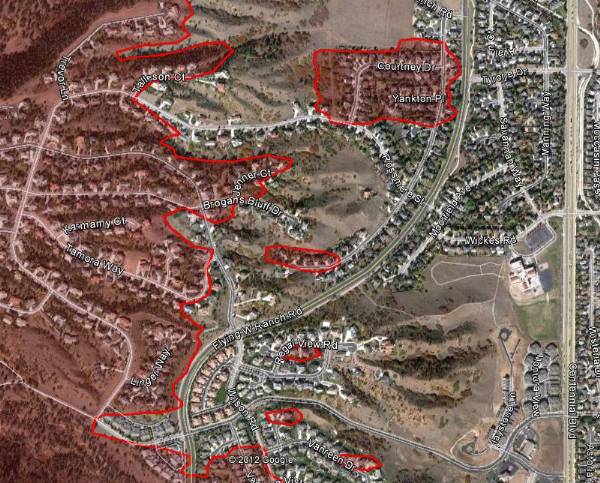
Map of Waldo Canyon fire, east side June 29, 2012

The map above is an example of how the the Waldo Canyon fire spread into the Flying W Ranch area of Colorado Springs on Tuesday, June 26.


One fatality in Colorado Springs Waldo Canyon fire

Map of Waldo Canyon fire, east side June 29, 2012(The map above is an example of how the the Waldo Canyon fire spread into the Flying W Ranch area of Colorado Springs on Tuesday, June 26. HERE is a link to a map that can zoom in to see more details. MODIS/Google)

Authorities searching through the rubble of the 348 homes that burned in the Waldo Canyon fire at Colorado Springs, Colorado found the remains of one person. A second person at that home and another nine are still unaccounted for that live in the areas that burned in the fire.

Firefighters wanted to do some burning out Thursday night to remove some of the fuels adjacent to the firelines but the humidity was too high. That same humidity also prohibited any additional spread of the fire, which has burned 16,750 acres and officially is 15 percent contained at a cost to date of $5.2 million.

President Obama will tour the fire area on Friday to inspect the destruction. Officials said this would not interfere with fire operations and the number of closed roads will be less than you would typically encounter during a Presidential visit. He will most likely fly in to Peterson Air Force Base at Colorado Springs and we are thinking that he may have a photo op with the military MAFFS C-130 air tankers working out of the base.

If the president makes any public comments during his visit it will be interesting to see if he mentions wildland fire preparedness, such as the reductions over the last few years in funding, and the reduced number of firefighters, equipment, and air tankers.

The City of Colorado Springs announced that they will release a list of the damaged homes by mid-morning on Friday. It will be posted on the city’s web site at http://springsgov.com/

A slide show with aerial photos of the destruction in the urban area is jaw-dropping.

Colorado: Flagstaff and Waldo Canyon fires force evacuations

UPDATED at 8:52, a.m. MT, June 27, 2012:

Due to a large number of people seeking information about the Waldo Fire in Colorado Springs, our site hosting provider is having some issues. We have posted updated maps and more information about the fire at our sister site, Examiner.com.

=============================================================

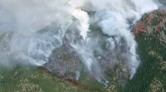
Waldo Canyon fire near Colorado Springs

The Waldo Canyon fire has burned over 6,000 acres northwest of Colorado Springs since Saturday, but it found new life on Tuesday and exhibited extreme fire behavior as a record high temperature of 101 and strong winds pushed it into a populated area, burning an undetermined number of homes while forcing 32,000 people from their homes.

Around 7 p.m. the southbound lanes of Interstate 25 were closed at Interquest Parkway. The northbound lanes remained open at that time. All lanes were later opened.

An evacuation order was issued after 9 p.m. by the City of Colorado Springs for areas that are north of Garden of the Gods Rd. between I-25 to the east all the way to the western City limits and north to the Air Force Academy. The evacuated areas in the Air Force Academy include Academy Dr. to the USAFA’s southern and western boundaries.

The Academy’s glider port is being used as a helibase for the helicopters dropping water on the fire.Their Class of 2016, consisting of 1,045 freshmen cadets, are scheduled to arrive Thursday.

A Type 1 Incident Management Team, Great Basin Team 2, Incident Commander Rich Harvey, assumed command Monday morning, June 25.

Information about evacuations can be found at InciWeb. Public Information Center Phones: 719-520-7058, 720-402-7935, 720-202-4510, 720-237-9947, 720-237-3417

The City of Colorado Springs also has some fire information, including a map of areas that are under evacuation orders.

Flagstaff fire near Boulder

Flagstaff fire, June 26, 2012
Flagstaff fire, June 26, 2012 (KWGN)

The Flagstaff fire started mid-afternoon on Tuesday about three miles southwest of Boulder, Colorado and by 4:45 p.m. had spread so rapidly that a Type 1 Incident Management Team from California staged in the Denver area, Rocky Opliger Incident Commander, was dispatched to manage the fire. First called the Bison fire, it became the Flagstaff fire, named after a nearby road.

The first evacuations were ordered before 3:28 p.m. and the size at that time was estimated at 200 to 300 acres.

Below is information as of 9:00 p.m. from the City of Boulder Office of Emergency Management:

  • Only 26 homes have been evacuated. Those were near Bison Drive and Kossler Lake.
  • A total of 2,416 reverse notifications have been sent to people in and around the affected area [to remain on standby in case of a change in fire direction and behavior overnight]
  • Three helicopters and two tanker planes were working the fire until sunset.
  • About 100 firefighters are on the ground doing structure protection through the night.
  • The fire is burning in upper Skunk Canyon. just west of the NIST/NOAA campus, and expected to produce smoke in Boulder through the night.
  • A Federal Type 1 team is expected to take over management of the fire on Wednesday.
  • All Pets Animal Hospital, 5290 Manhattan Circle, 303-499-5335, is open 24 hours and is accepting small animals. In the case of an evacuation, small animals can be dropped off at All Pets if their owners are unable to take them with them in the case of an evacuation.
  • No structures are threatened at this time.
  • There are no reported injuries and there is zero percent containment of the approximately 300 acre fire.