
The data for the drought monitor was valid April 17, 2018 and the map was issued April 19. Author: Brad Rippey, U.S. Department of Agriculture.

The data for the drought monitor was valid April 17, 2018 and the map was issued April 19. Author: Brad Rippey, U.S. Department of Agriculture.

Above: Areas of the United States where the average temperature for April-June 2018 is favored to be in the upper (reddish colors) or lower (blue colors) third of the 1981-2010 seasonal temperature record. Within a given area, the intensity of the colors indicates higher or lower chances for a warm or a cool outcome, not bigger or smaller anomalies. For example, both Texas and Tennessee face better than even chances of experiencing well above average spring temperatures, but the chances are higher in Texas (60-70%) than in Tennessee (40-50%). NOAA Climate.gov map, based on data from NOAA CPC. Photo credit: NOAA
Spring is likely to be warmer than the historical normal this year in much of the country with a worsening drought situation across swaths of the West, according to the latest report from the National Oceanic and Atmospheric Administration.
The report, issued Thursday, encompasses April-June.
The Northern Rockies is the only region leaning toward below-average temperatures this spring, forecasters said.
In addition to increased probabilities of warmer temperatures across much of the U.S. — and especially the Southwest — the outlook suggests drought is likely to develop or worsen in Southern California, Arizona, New Mexico and part of Utah, Colorado and Kansas.
“It appears La Nina is on its last legs,” said Mike Halpert, with the Climate Prediction Center. “As sea surface temperature anomalies weaken, their influence on springtime temperature and precipitation should also weaken.”
 Drought is likely to worsen or develop across much of the Southwest quadrant of the contiguous United States this spring. Pockets of drought are predicted to continue in the Southeast and Oregon. Map by NOAA Climate.gov, based on data from the Climate Prediction Center.
The outlook also noted a moderate risk of flooding in the Ohio River Valley basin and lower Mississippi River where streamflows and soil moisture are above normal after recent heavy rain.
Research results were published January 17, 2018
Continue reading
Above: the status of the large reservoirs in California as of February 16, 2016, showing the current water levels and the historic average for the date. California Department of Water Resources.
In spite of significant rain over parts of California over the last six months all but one of 12 large reservoirs in the state are still storing water at levels below the historic average for the date. Folsom Lake has 117 percent of average while the other 11 have from 30 to 80 percent.
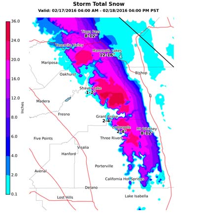
Precipitation predicted for Thursday in the Sierra Nevada Mountains should help a little, with some areas above 7,000 feet receiving a foot or more of snow.
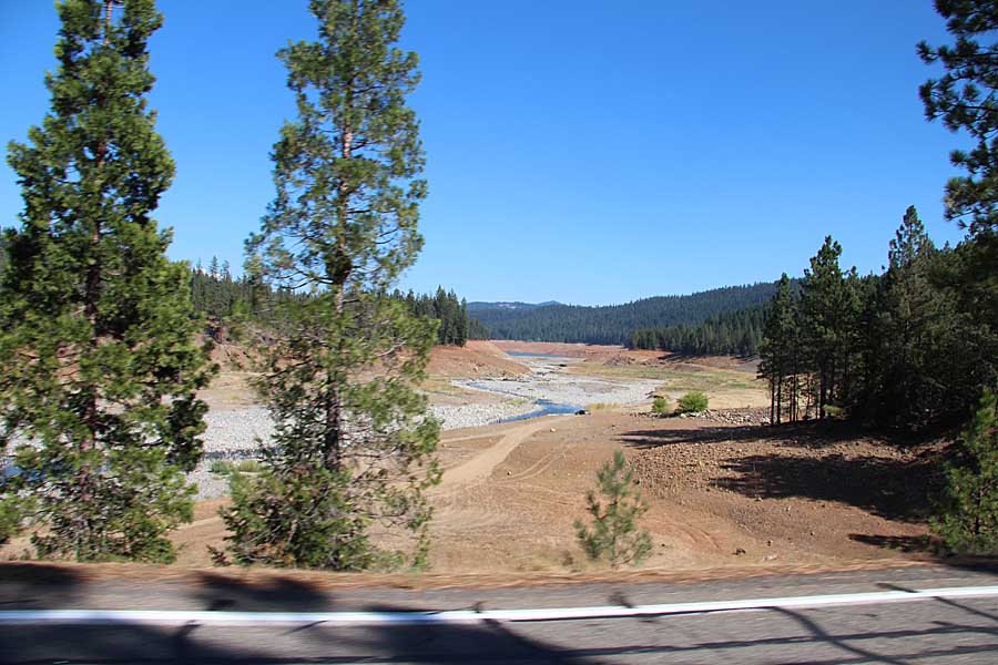
The photo below shows the extreme northern end of Trinity Lake on August 9, 2014 when it held about 40 percent of average. On February 16 of this year it was at 43 percent.
It remains to be seen how the winter weather will affect the 2016 wildfire season. It is a factor of course, but more significant is the weather DURING the fire season. If it is hot, dry, and windy, there will be major fires.
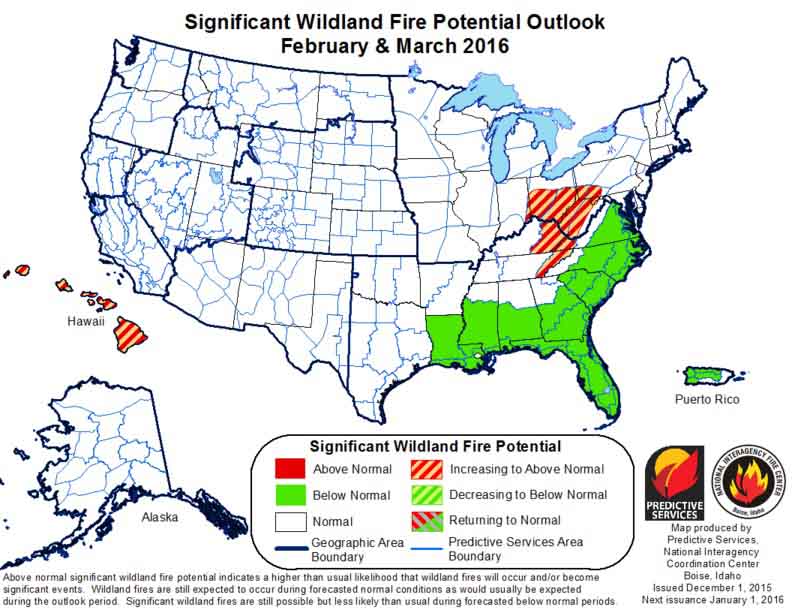
On December 1 the Predictive Services section at the National Interagency Fire Center issued their Wildland Fire Potential Outlook for December, 2015 through March, 2016. The data represents the cumulative forecasts of the ten Geographic Area Predictive Services Units and the National Predictive Services Unit.
If their forecasts are accurate, it looks like a continuation of pretty benign conditions across the United States this winter.
Here are the highlights from their outlook.
December

January

February-March
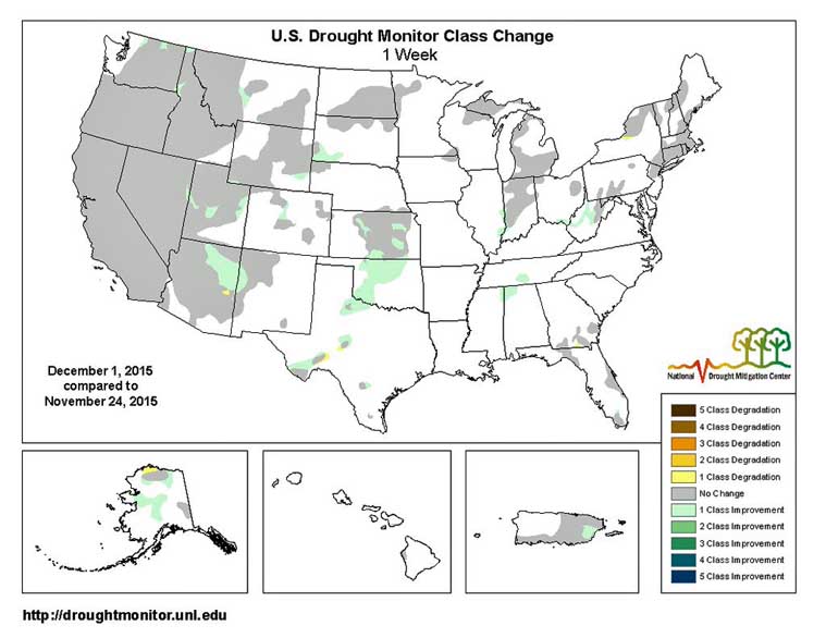
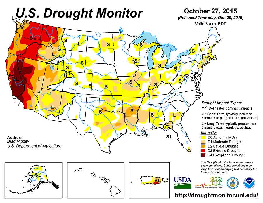
And as a bonus — the Drought Monitor:

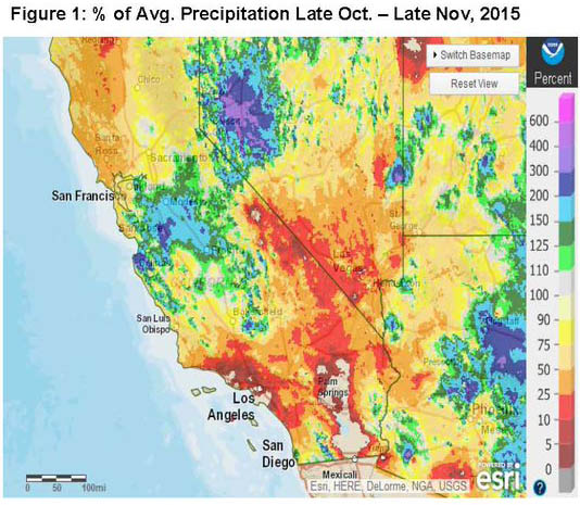
Bonus #2, Percent of Normal Precipitation:

The three-year drought in the western United States and especially in California became more obvious this year as wildfires were influenced by low moisture in live vegetation, and in some areas once-healthy trees began to show drought-induced stress.
The current El Niño is expected to influence weather patterns during the coming winter and forecasters predict higher than normal precipitation across the southern portions of the United States, including southern California.
The map above illustrates how much precipitation is needed over a three-month period to end or ameliorate the current drought. Most of northern California will need from 6 to 12 inches according to NOAA.
NOAA’s disclaimer about the map at the top of the article:
This [map] only tells you how much precipitation a location needs to get the Palmer Hydrological Drought Index (PHDI) to a certain value based on the model’s equations. It does not tell you how much precipitation is needed to refill a reservoir, restore groundwater to normal, or bring an ecosystem back to normality. It also does not incorporate snowpack into its calculations, and mountain snowpack is a crucial part of hydrology in the U.S. West.

The New York Times has a visually stunning article about the drought in California and its effect on wildfires. It was published about four days before record-setting rain in the south part of the state caused flooding and a bridge washout on a heavily-travelled Interstate Highway. This one rain event, however, will not turn around the drought, or have any lasting effect on the trees and brush that have already died due to lack of water.
The article was written by Haeyoun Park, Damien Cave, and Wilson Andrews. The photos are by Zackary Canepari. If you enjoy seeing awesome photos, especially of wildfires, check it out — preferably on a computer with a large monitor.
Below is an excerpt from an article at Capital Public Radio:
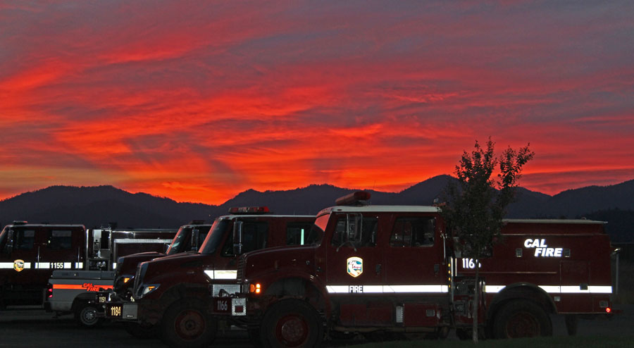
…CAL FIRE says the timing of this year’s rains and four years of drought will combine to make fire conditions in 2015 the worst on record.
“We measure the fuel moisture content of all of the vegetation -the brush and the trees and we track that over the course of time and compare it month to month each year,” says Ken Pimlott, Director of CAL FIRE. “And we put it through formulas and determine how much energy and how much heat it will put out when it’s burning. And we have seen -we saw it last year and we will see it again this year- we’ll be reaching records for potential heat output for times of the year that would normally not be burning in those conditions.
CAL FIRE Director Ken Pimlott urged homeowners to clear space and conserve water.
“We don’t have water to water lawns and unnecessary landscaping. So, what that means is, is you need to remove that vegetation as it dries. We don’t want your dry lawn and your dry brush to contribute to more of the fire hazard. So, stop watering your lawn and remove it.”

On May 28 the amount of water in the snowpack in California’s Sierra Mountains was zero percent of normal for that date.
Click the Drought Monitor image below to see a larger version.


Moderate to exceptional drought covers 31.5% of the contiguous United States.
Roughly 95 percent of California is in Severe to Exceptional Drought.
