Cold Brook prescribed fire escapes in South Dakota (updated with post-fire photos)

(UPDATED at 4 p.m. April 19, 2015)

Cold Brook Fire
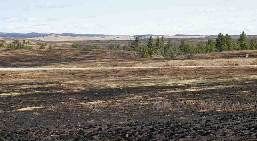
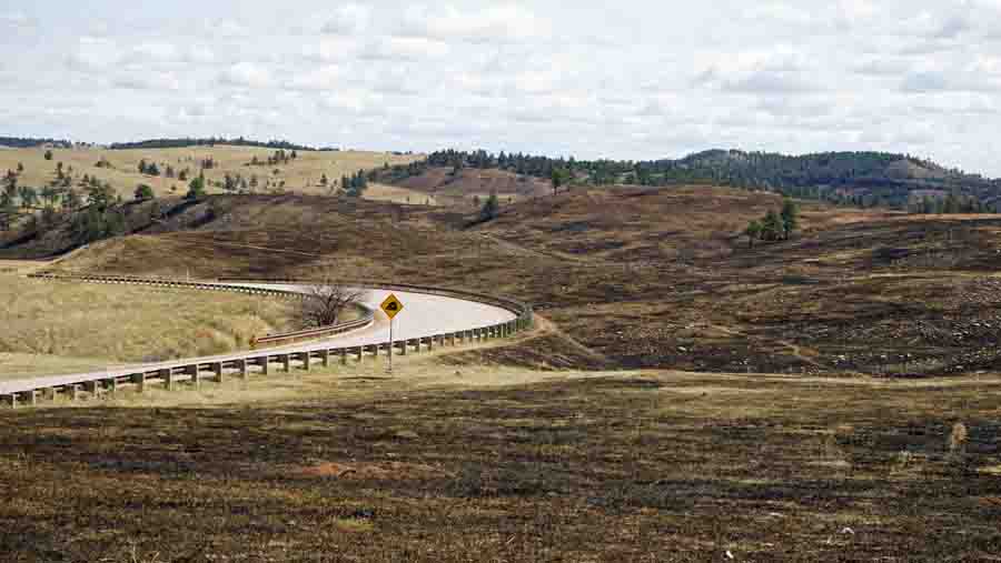
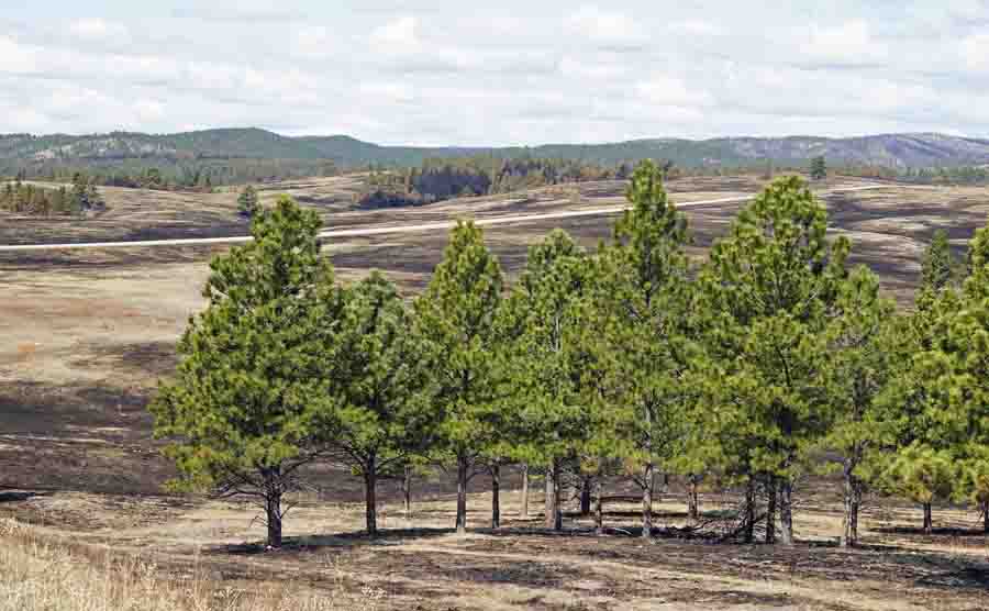
Highway 385, which can be seen in the distance, was supposed to be the boundary of the prescribed fire. Only the land on the far side of the highway was planned to burn.

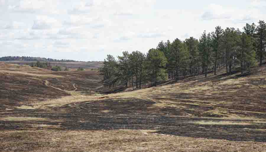
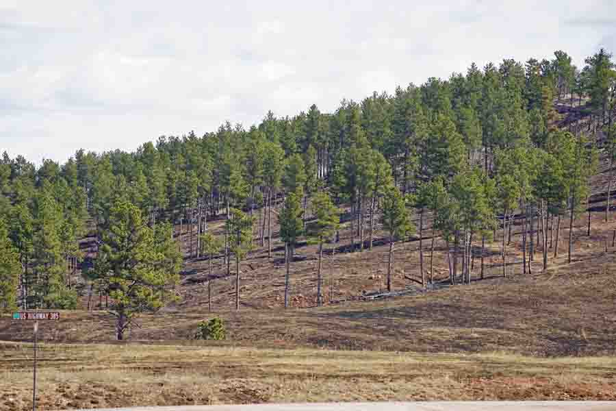
After being out of town for a while, today we saw the Cold Brook escaped prescribed fire in Wind Cave National Park in South Dakota for the first time. Our initial impression was that a very small percentage of the Ponderosa Pine trees lost their canopies to the fire; the mortality was very low. This is largely due to a series of prescribed fires that were conducted in the area about 13 to 16 years ago. Those burns eliminated some trees and “raised the canopy” on many; that is, some of the lower limbs were burned off reducing the ladder fuels that could later carry a fire into the crowns.

Approximately 5,420 acres burned outside the prescribed fire unit, all within the National Park.

The fire would have burned private land outside the park if the Casey Ranch south of the park had not been added a few years ago. The fire burned quite a few acres east of Highway 385 and south of the former park boundary.

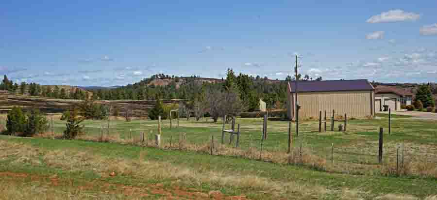
In that area, a residence that remains on private land had the fire burn right up to their back yard, as you can see in the photo below.

Cold Brook Fire
The fire burned up to the back yard of a private residence near Highway 385. A blackened area can be seen on the left side of the photo.

When the fire escaped, it ran to the east for about four to five miles.

Cold Brook Fire
Looking east from the planned burn area to Highway 385 which did not serve as an adequate fire line under the conditions that day.

All of these photos in today’s update were taken by Bill Gabbert. Click on them to see larger versions.

Cold Brook Fire

Cold Brook Fire
The north end of the fire, east of Highway 385.

Cold Brook Fire

****

Continue reading “Cold Brook prescribed fire escapes in South Dakota (updated with post-fire photos)”

Court rules in favor of the Forest Service over escaped prescribed fire

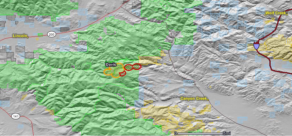
map of davis fire August 27 2010
The map of the Davis fire, an escaped prescribed fire in Montana, shows heat detected by satellites during the early morning on Aug. 27, 2010. Click to see a larger version of the map.

The U.S. Forest Service dodged a bullet recently when the agency received a very favorable ruling from a Federal court judge over a 2010 escaped prescribed fire in Montana. Senior U.S. District Judge Charles Lovell decided on March 22, 2015 that the U.S. is immune from the suit writing in his decision:

The Court concludes that Plaintiff has failed to demonstrate that the Forest Service was negligent either in conducting the Davis 5 Unit prescribed burn or in fighting the escaped fire once it occurred or that the Forest Service violated any mandatory policy or prescription. In addition, and more significantly, strict liability does not apply and the discretionary function exception applies to bar Plaintiff’s tort claims.

The Plaintiff in the case was Kent Taylor, the landowner of a 146-acre parcel of which 142 acres burned, including some lodgepole pine.

Firefighters ignited the Davis 5 prescribed fire at 1 p.m on Wednesday, August 26, 2010 on the Helena National Forest 11 miles southeast of Lincoln and 28 miles northwest of Helena in Montana. By 2:00 p.m. strong winds became a problem and the fire moved into the tree canopy. All ignition ceased, but soon there was a spot fire which burned 20 acres in heavy mixed conifers. When all personnel left the fire at 10:00 p.m. to avoid the hazard of falling trees, the spot fire had been partially lined.

The next day, Thursday, additional personnel were on scene. They were completing the fireline and gridding for other spot fires when an undetected one took off at 1:00 p.m. which quickly transitioned to a crown fire. The prescribed fire was declared an escape at 1:15 p.m. and a Type 2 Incident Management Team was requested at 2:27 p.m. By nightfall the fire was estimated at over 1,600 acres on federal land and 450 acres on private lands involving multiple landowners. Approximately 22 structures were evacuated on Thursday afternoon and evening.

Both the court decision and the official USFS report on the escaped prescribed fire failed to consider the significance of the differences between a spot weather forecast issued the day before the prescribed fire and the spot weather forecast that was issued at 10:43 a.m. Wednesday, August 25 on the day of the burn, about 2 hours before the firefighters ignited the final test burn. In fact, the Judge’s decision does not mention the 10:43 a.m. forecast that predicted stronger winds than in the forecast that was issued the previous day which was for “winds upslope 3 to 6 mph, ridge top winds southwest 5 to 10 mph with gusts to 15 mph”. Here is what Wednesday morning’s forecast predicted for the day of ignition (the all-caps are from the weather forecast, a bad habit the NWS needs to break):

WIND (20 FT)……..SOUTHWEST WINDS 10 TO 15 MPH WITH AFTERNOON GUSTS 20 TO 25 MPH.
RIDGE TOP WIND……WEST AT 15 TO 20 MPH.

The report says:

The prescribed fire personnel stated they did not note any differences between the two forecasts.

That forecast also stated that on the following day, Thursday, the winds in the afternoon would be 30 to 35 mph.  The maximum wind speed allowed in the prescription for the project was 15 mph.

Again, the judge’s written opinion does not mention the last spot weather forecast, which was issued the morning of the ignition.

Even though ignition on the prescribed fire did not begin until 1 p.m. the USFS Burn Boss planned to have the 100-acre project essentially mopped up by the end of the day, anticipating for the following day the winds predicted in the now obsolete forecast: “winds upslope 3 to 6 mph, ridge top winds southwest 5 to 10 mph with gusts to 15 mph”.

In light of this very favorable court ruling, Jamie Kralman, a USFS Regional Fuels Specialist for the California region, distributed the good news, saying in part:

…I could really see the mindfulness of the agency personnel involved demonstrating High Reliability Organization (HRO) principles in their planning and implementation.  All key personnel met or exceeded minimum qualifications, planning and implementation was by appropriate certified personnel, appropriate line officer involvement and approvals occurred, and The Interagency Prescribed Fire Planning and Implementation Procedures Guide was followed in development of the Burn Plan.  The Court opinion also demonstrates support for use of The Interagency Prescribed Fire Planning and Implementation Procedures Guide.

This legal outcome is clearly consistent with what we have been teaching  in Prescribed Fire courses, Burn Boss Refresher training, and in other venues in this region regarding lack of personal liability in our prescribed fire operations and that  “…strict liability does not apply and the discretionary function exception applies…” because the action involved ‘an element of choice’ and the action was taken ‘based on consideration of public policy’.
 

Escaped prescribed fire in California required evacuations

A prescribed fire near Victorville, California escaped on March 31 causing mandatory evacuations in the southern California desert community. Two helicopters assisted firefighters in stopping the 185-acre blaze as it burned through heavy vegetation that had not burned in years.

The project in Mojave Narrows Regional Park was designed to remove cattails, but firefighters said shifting winds caused it to grow out of control Tuesday afternoon.

A car and an outbuilding burned in the fire. The evacuations were lifted after several hours.

Stephens Fire, east of Weed, California

Stephens Fire
Stephens Fire, February 24, 2014. USFS photo.

(Updated at 4:35 p.m. PT, February 26, 2015)

The U.S. Forest Service Wednesday night on Twitter said the Stephens Fire had grown by 50 acres, to 250 acres. The fire is 17 miles east of Weed, California. The Incident Commander has estimated that the 100 personnel on scene will have a fireline around it, meaning the fire is contained, by February 28, which is a revision from Wednesday’s estimate of March 2.

****

(Originally published at 3:41 p.m. PT, February 25, 2015)

The Stephens Fire has burned about 200 acres in northern California, 17 miles east of Weed. It spread onto the Shasta-Trinity National Forest after escaping from a prescribed fire in Siskiyou County on private land.

According to the USFS Wednesday afternoon:

While the burned area has expanded outside the original planned prescribed area, positive effects to natural resources are being met and suppression forces are in place to limit additional spread.

Tuesday night strong winds were driving the fire, producing short-range spotting. On Wednesday the fire activity is expected to be moderate, according to  the USFS, with possible spread south toward Stephens Pass Road and north toward FS Road 43N04.

The Incident Commander estimates the 100 personnel on scene will have a fireline around it by March 2.

map Stephens Fire
Map showing the approximate location of the Stephens Fire at 11:14 p.m. PT February 24, 2015. Click to enlarge.
Stephens Fire
Stephens Fire, February 24, 2014. USFS photo.

Further to the south, on Thursday the National Park Service is planning to burn 60 acres of a 533-acre burn unit in the Wawona area of Yosemite National Park near the South Entrance.

Five fires started from escaped burn piles near Eldorado National Forest

Eldorado National Forest fireOn Saturday, January 24, five fires were ignited by burn piles that escaped on private timber lands near the Eldorado National Forest in northeast California. Two of the fires burned 33 acres each. The piles were originally ignited in December. Judging from the photos and reports from firefighters, the fire behavior was impressive for January.

In 2014 the El Dorado NF only had one fire that required a Type 3 Incident Commander. That was the King Fire fire east of Placerville, California where 12 firefighters deployed their fire shelters in front of advancing flames and were directed to safety by a helicopter pilot.

These excellent photos were taken by Michael Loeffler, an Engine Captain on the Eldorado NF.

Eldorado National Forest fire Eldorado National Forest fire

Eldorado National Forest map

Slash burns rekindle in Oregon

Hug Point Fire Oregon
From the Oregon Department of Forestry: “Mop-up continues on the Hug Point Fire (erstwhile Hug Point Complex). Rain is expected to close out these rekindled slash burns by the end of the week. (Photo by Dan Goody, ODF)”

Multiple logging slash burns rekindled Tuesday in Oregon east of Highway 101 between Cannon Beach and Arch Cape on lands owned by the Stimson Lumber Company. Tuesday night east winds in excess of 40 mph with gusts over 70 mph fanned the fire, consuming slash piles in four post-harvest units.

Personnel from the lumber company and the Oregon Department of Forestry (ODF) were on scene and were joined Wednesday by more firefighters from the Tillamook and Forest Grove ODF district offices. By evening there were about 70 personnel, including five hand crews, working on the 100 acres of fire that became the Hug Point Complex.

Rain began falling Thursday morning which is aiding control and mop up, but by the weekend the weather is expected to change to cold, dry, windy conditions.