Firefighters make progress on Bluewater and Dienier Canyon Fires in New Mexico

Above: Operations Section Chief Rocky Gilbert. Screenshot from Incident Management Team video.

On Monday firefighters were able to hold some of the perimeter on two fires in western New Mexico, the Bluewater and Diener Canyon Fires, which have burned 2,532 and 6,682 acres respectively.

Soon after it started April 12 there were reports that the Diener Canyon Fire started from an escaped prescribed fire on the Cibola National Forest. Then on April 15 the Forest Service issued a statement saying “the exact cause of the Diener Canyon Fire is currently being investigated.” Today, April 16, the Forest Service is reporting that “fire investigators have determined that multiple spot fires from the Redondo Prescribed Burn started the Diener Canyon Fire”.

The Diener Canyon Fire is burning on Mount Sedgwick within an old fire scar from 2004. The Bluewater fire is approximately 4 miles north of the Diener Canyon Fire on Salitre Mesa.

Sunday firefighters continued the burnout operation on the east flank of the Diener Canyon Fire, along Forest Road (FR) 425. The burnout resulted in a wide containment line, as six to ten inch flames slowly consumed light to moderate forest vegetation. This line is designed to prevent any fire from moving to the east toward Bluewater Village and La Jara subdivision.

Fire crews completed confinement lines on the northwest corner of the Bluewater Fire, stopping movement of fire toward Bluewater Acres, but fire remained active in windrows of uprooted juniper trees on the north side of the fire. A heavy helicopter dropped water on burning vegetation, assisting firefighters as they suppressed the flames.

Monday crews planned to continue the burnout along FR 425 east of the Diener Canyon Fire, bringing the containment line south to tie in to FR 480. Firefighters will patrol and mop up along FR 178, and may use aerial ignition to clean up unburned areas if necessary, weather permitting. Structure Protection crews will continue assessing prevention needs. Fire is still active on the northeast corner, and helicopters will be used to keep the fire in check, weather permitting.

Below is a video update for both fires by Operations Section Chief Rocky Gilbert. It was posted on Monday, April 16.

Five wildfires in New Mexico burn total of 19 structures

Initially reported to be an escaped prescribed fire, officials now say the Diener Fire is under investigation

Above: Map showing the location of the Diener Canyon Fire between Grants and Gallup, New Mexico at 3:48 a.m. MDT April 15, 2018.

Five large fires in New Mexico have burned 19 structures and over 57,000 acres.

Now that the wildfire activity in Arizona and New Mexico is increasing, firefighting resources from across the country are arriving to assist the local agencies and departments.

The fire responsible for 16 of the destroyed structures, the “246 Fire“, is five miles north of Capitan and is  being managed by New Mexico State Forestry. It started April 12 but the spread has slowed to creeping. Crews are working on mopup and rehab.

Soon after it made the news the reported cause of the Diener Canyon Fire on the Cibola National Forest was an escaped prescribed fire, but now officials are saying “the exact cause of the Diener Canyon fire is currently being investigated.” John Pierson’s Type 1 Incident Management Team is managing the 6,106-acre Diener Canyon Fire and the nearby Blue Water Fire which has blackened 1,000 acres also on the Cibola National Forest. The cause of the Blue Water Fire is an abandoned campfire. Both of these fires started April 12, 2018.

The spread of the 2,644-acre Rattlesnake Fire five miles north of Capitan has also slowed.

The “206 Fire” burning in both New Mexico and Texas has destroyed three structures, including at least one residence.

Stateline Fire burns more than 20,000 acres in New Mexico and Colorado

The fire is burning in the area where Colorado, New Mexico, and Oklahoma converge

Above: satellite image showing the Stateline Fire. Red indicates heat, and the burned area appears black.

(UPDATED at 9:15 p.m. MDT March 12, 2018)

Here is an update from fire officials at 9 p.m. MDT March 12:

“The Stateline Fire burning in Union County, north of Clayton, New Mexico is now 50% contained. An estimated 27,658 acres has burned, of which 16,898 acres is on state and private land in New Mexico, 10,750 in Colorado and 10 acres in Oklahoma.”

****

(Originally published at 7:20 p.m. MST March 10, 2018)

The Stateline Fire burning in Union County, north of Clayton, New Mexico, is currently estimated at 21,253 acres, of which 7,160 acres has crossed over into Colorado.  The fire started Thursday morning March 8 on private property in New Mexico.  There is no immediate threat to structures at this time. Fuels include piñon, juniper, oak, and grass. Currently there are more than 80 personnel from multiple agencies fighting the fire. The cause is under investigation.

The has also crossed from New Mexico into Cimarron County in Oklahoma, making it one of the few fires that have burned in three states.

Stateline Fire
Stateline Fire. Photo credit: Albuquerque Fire Department.

Thanks and a tip of the hat go out to L M.
Typos or errors, report them HERE.

New Mexico firefighter dies after suffering burn injuries

A volunteer firefighter from the eastern New Mexico town of Nara Vista died Thursday after suffering severe burns on a large wildfire in Quay County (map). A second firefighter was injured but has been released from the hospital.

Below is an excerpt from an article at the Eastern New Mexico News:

John Cammack, 74, of Nara Visa, was severely burned after falling from a fire engine during a “burn over” Wednesday night, said Nara Visa Fire Chief Gary Girard.

Girard said a second firefighter, Kyle Perez, was also injured during the incident.

He said the firefighters were attempting to refill a fire engine with a water tanker when the winds shifted abruptly.

“We were no longer fighting the fire, we were running from the fire,” Girard said.

Girard said the flames were as high as the fire engine as they fled the area. He said Cammack was transported to Lubbock for treatment and Perez was admitted to a hospital in Amarillo.

Perez’ condition was not released, but a family member posted on social media that he’d been released from the hospital.

Thanks and a tip of the hat go out to Willard.
Typos or errors, report them HERE.

Satellite photo of wildfires in the Southwest

The image above from the Goes-16 satellite shows smoke from the large fires in Arizona and New Mexico on June 17, 2017.

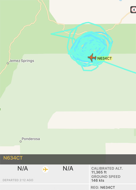
Below: in the two hours since it left the Santa Fe Municipal Airport, an Aero Commander air attack aircraft owned by “N9FX” has orbited the Cajete Fire west of Los Alamos, NM many, many times.Cajete Fire Air Attack Ship

Cajete Fire west of Los Alamos doubles in size

Above: A 3-D map of the Cajete Fire in northern New Mexico. The red line was the perimeter at 10 p.m. MDT June 16, 2017. The white line was from about 20 hours earlier. 

(UPDATED at 11:54 a.m. MDT June 17, 2017)

The Cajete Fire in the Santa Fe National Forest doubled in size on Friday, increasing to 1,325 acres. The fire has burned on both sides of Highway 4 in the Santa Fe National Forest 7 miles northeast of Jemez Springs and 12 miles west of Los Alamos in northern New Mexico.

The fire is spreading mostly through timber. Yesterday the southeast portion moved into the footprint of the Las Conchas Fire that burned 63 structures and 156,000 acres in 2011. It is likely that in the six-year old fire scar there will be less resistance to control.

Officials believe the fire started approximately one mile northeast of Vallecitos de los Indios but have not yet released a cause. The burned area runs along the East Fork of the Jemez River.

Approximately 70 structures are threatened, many of which have been evacuated, including a lookout tower.

On Friday the fire ran up a slope south of Highway 4, from 8,300 feet above sea level to about 9,300 feet.

On Friday the firefighting resources assigned included about 150 personnel, multiple engines, one bulldozer, four helicopters (including a rappel ship), five air tankers, and two air attack platforms.

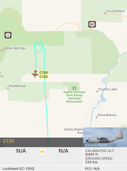
As this was written at 11:50 a.m. MDT on June 17, a C-130Q air tanker had just departed the fire after presumably dropping a load of fire retardant. See the map below.

C-130Q air tanker Cajete Fire
A C-130Q air tanker departs the Cajete Fire at 11:50 a.m. MDT June 17, 2017.

Mark von Tillow’s Type 1 Incident Management Team from California assumed command at 7 a.m. on Saturday, taking over from a Type 3 Team. The official strategy of the team is to fully suppress the fire.

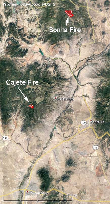
Map Bonita and Cajete Fires
Map showing the location of the Bonita and Cajete Fires north of Albuquerque, New Mexico.