And the next day, July 4, we see the Operations Section Chief on the Corner Creek fire briefing firefighters:

More information about the Corner Creek Fire, 9 air miles south of Dayville, Oregon.
News and opinion about wildland fire

And the next day, July 4, we see the Operations Section Chief on the Corner Creek fire briefing firefighters:

More information about the Corner Creek Fire, 9 air miles south of Dayville, Oregon.
(UPDATE at 8:40 a.m. PT, July 5, 2015)
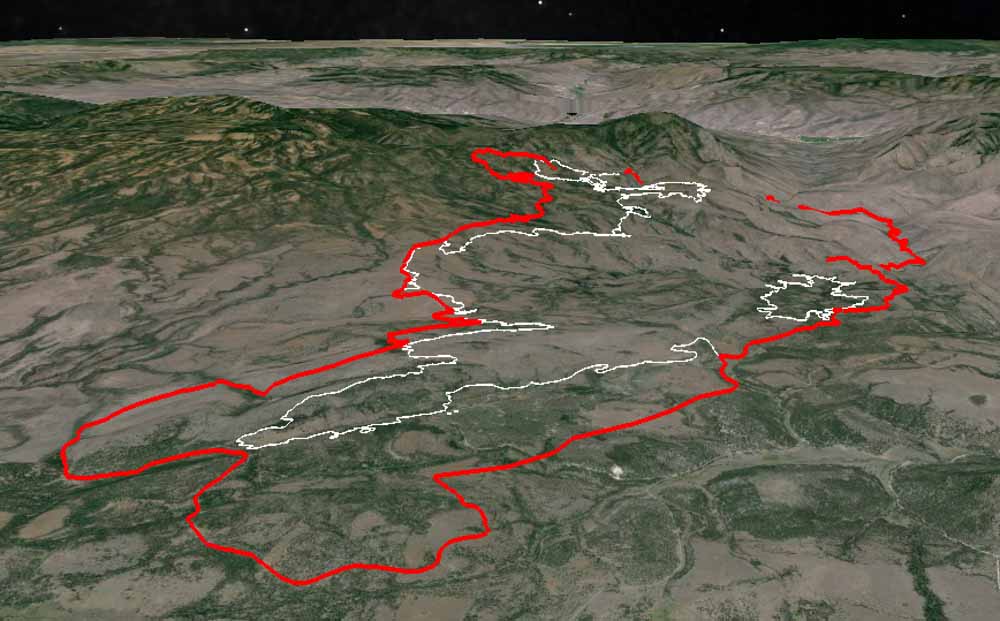
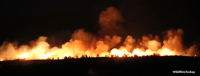
Over the last two days the Corner Creek Fire in central Oregon has continued to spread on the south and west sides and has blackened approximately 27,000 acres.
Here is an excerpt from the incident management team’s description of the activity on Saturday:
On Saturday, winds on the Corner Creek Fire pushed the blaze against firelines being built along its south and west flanks, prompting swift action from helicopters and air tankers. Cooling water and retardant dropped from the aircraft helped firefighters to keep fire growth to a minimum.
**** (UPDATE at 9 a.m. PT, July 4, 2015)

The Corner Creek Fire 9 air miles miles south of Dayville, Oregon continued to grow Friday to the south and northwest. Extremely hot and dry weather conditions are causing the fire to run, spot, and torch into timber and rangeland. Firefighters continue to work to protect structures near the fire and prevent it from crossing onto the east side of the South Fork John Day River. The area is under a Red Flag Warning on Saturday for gusty winds and low relative humidities. A weather forecast for the fire area on Saturday calls for a high temperature in the high 90s, relative humidity around 10 percent, and 5 to 10 mph winds out of the northwest. The weather on Sunday should be about the same. **** (UPDATE at 9:45 a.m. PT, July 3, 2015)
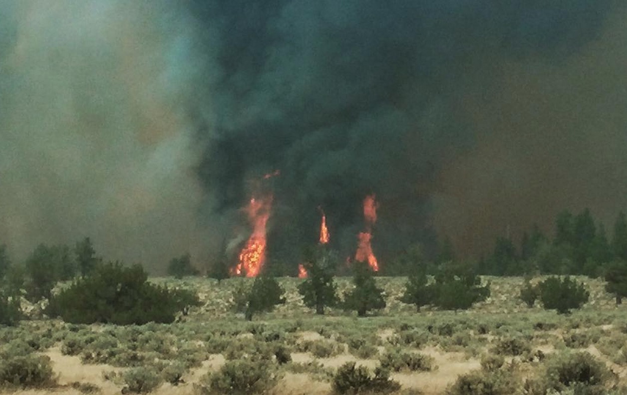
The Corner Creek Fire in Central Oregon grew by more than 6,000 acres on Thursday to 19,232 acres. It was most active on the south
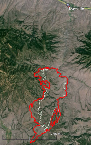
and west sides and progressed an additional three miles to the southwest. On the west side it is near the Turnpike and Upper Bronco Reservoirs. The fire still has not crossed the South Fork John Day River on the east side. Firefighters are protecting structures and looking for opportunities to control the fire spread, including clearing fuels near forest roads to the south and west which may be used as fire lines for burnout operations. The area will be under a Red Flag Warning from noon Saturday until 8 p.m. Saturday. The Corner Creek Fire is 9 air miles miles south of Dayville, 29 miles southwest of John Day, and 85 miles northeast of Bend. **** (UPDATED at 11:05 a.m. PT, July 2, 2015)
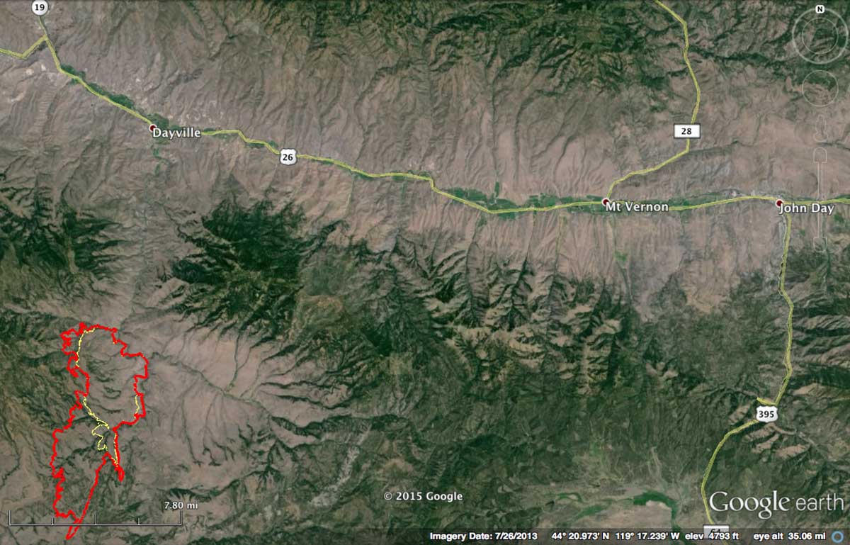
The Corner Creek Fire in central Oregon more than doubled in size in 24 hours. Late Wednesday night it was mapped at about 12,700 acres. The fire moved east to the South Fork of the John Day River but did not cross it, yet, and it spread about five miles to the southwest. Very little information about the fire has been made public by Buckman’s Oregon Department of Forestry Team 1. But, the term “extreme fire behavior” was used in a very brief description released by the Northwest Coordination Center.
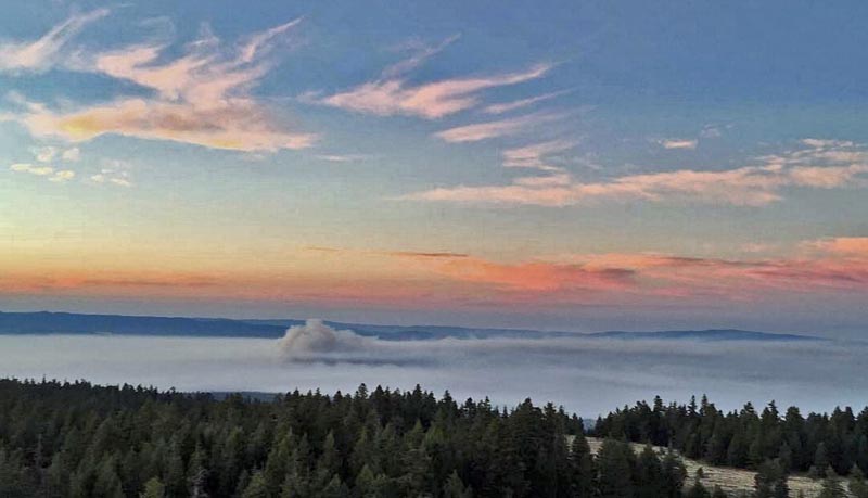
High temps, wind and low humidity means fire behavior is picking up on Corner Creek (photo by Wolf Mountain Lookout). pic.twitter.com/bSCoHnbW1A
— Central OR Fire Info (@CentralORFire) July 2, 2015
Crew wading the South Fork of the John Day River on Corner Creek Fire. Black Canyon Wilderness. pic.twitter.com/iGikkPmk34 — Prineville IHC (@PrinevilleIHC) July 2, 2015
****
(Originally published at 7:23 a.m. PT, July 1, 2015)
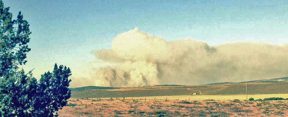
Firefighters have been busy in central Oregon for the last week after the area got hammered by lightning.
The spread of the Sugarloaf Fire, 7 miles north of Dayville, is slowing and some of the resources are being sent to the Corner Creek Fire 16 miles to the south. A satellite still detected some heat on the northeast side of the fire late Tuesday night on the 5,016-acre blaze. The Oregon Department of Forestry’s Incident Management Team 1 is managing this fire plus the 300-acre Blue Basin Fire just to the west along Highway 19.
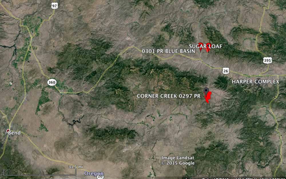
Another fire, the 6,300-acre Corner Creek Fire, was added to the Team’s workload Wednesday morning. Located on the west side of the South Fork John Day River, it was reported on June 29, a lightning-caused fire that held over from last week’s storms. High temperatures and low relative humidity yesterday contributed to the growth of the fire. Numerous aviation resources were used Tuesday for structure protection of cabins and outbuildings along Wind Creek, including three large tankers, one very large air tanker (DC-10), four single engine air tankers, and three helicopters.
The Corner Creek Fire is 9 air miles miles south of Dayville, 29 miles southwest of John Day, and 85 miles northeast of Bend.

Forecasts for high temperatures and lightning with little or no rain on Saturday have resulted in Red Flag Warnings for areas in Oregon, Washington, California, and Nevada.
As shown in the map below, central Oregon received numerous lightning strikes during the 24-hour period ending at 6 a.m. MT, today June 27, 2015.

As of about 9 a.m. on Saturday, Central Oregon Fire reported 17 lightning fires had been discovered. The largest two were near Brothers, OR in grass or shrub; one was 200 acres and the other was 50 acres. The rest are small.
(UPDATE at 7:04 a.m. PT, June 15, 2015)
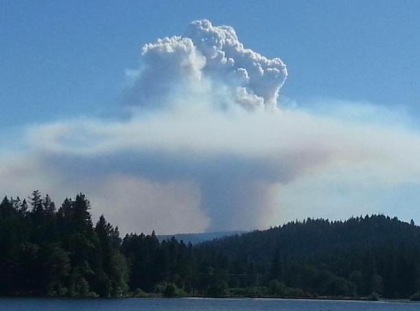
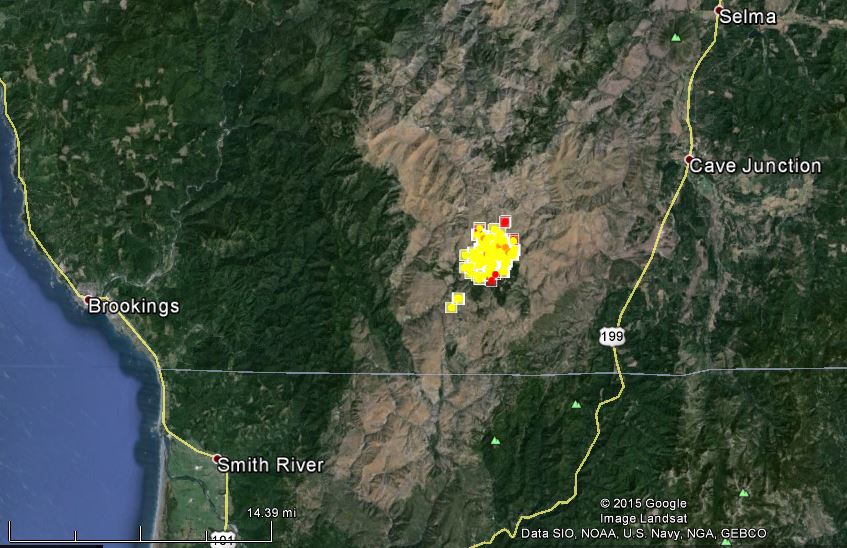
The Buckskin Fire 10 miles southwest of Cave Junction, Oregon spread east Sunday across Baldface Creek and grew to 1,400 acres. Firefighters are improving existing trails on the west side of the fire for a potential contingency containment line. Ten helitack and four rappellers were flown to the spot fires southwest of the main fire and constructed direct fireline, assisted by water drops from helicopters.
Firefighters are staying in remote spike camps close to the fire in order to reduce travel time and increase productivity.
The Buckskin Fire is burning in an area scorched by the Biscuit Fire that burned half a million acres in 2002.
****
(UPDATE at 9:31 p.m. PT, June 13, 2015)
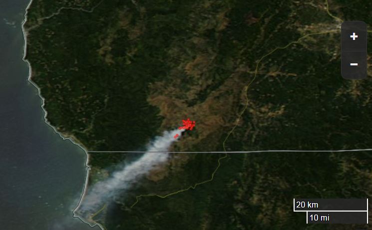
The Buckskin Fire southwest of Cave Junction, Oregon was pushed by winds Saturday that varied from the northwest to the northeast causing the fire to spread on the southeast and southwest sides. As you can see in the satellite image above, the transport wind was consistently from the northeast.
The Crazy Peak weather station 13 miles southeast of the fire recorded winds Saturday afternoon of 2 to 3 mph with the highest gust being 9. The RH was in the 20s and the temperature was in the 70s. This is not, at least at that weather station, extreme fire weather, but apparently the Buckskin Fire spread easily through the footprint of the 2002 Biscuit Fire.
The Quail Prairie weather station 14 miles northeast of the fire recorded stronger winds on Saturday, 8 to 12 mph gusting up to 18 mph, with a low RH of 18% and temperatures in the mid-80s. It showed consistent north-northeast winds Saturday afternoon which jives with the satellite image above showing the smoke plume drifting to the southwest.
****
(Originally published at 12:59 p.m. PT, June 13, 2015)
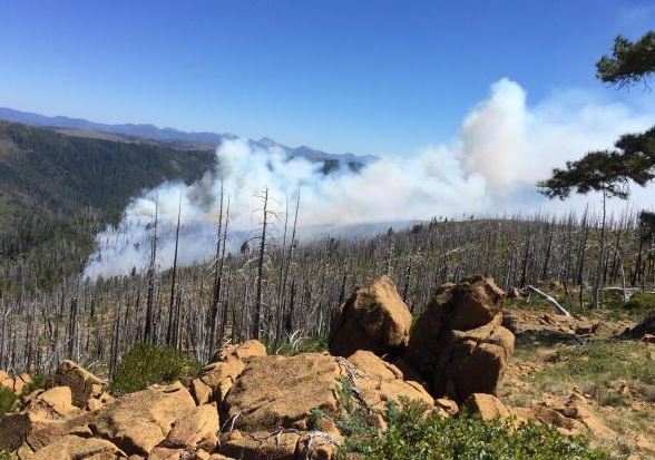
A wildfire in southwest Oregon is bringing back memories of a huge fire that burned the same area 13 years ago. The Biscuit Fire burned half a million acres in 2002 leaving a forest of snags — dead trees that are now burning in a new fire, the Buckskin Fire.
Firefighters are loath to fight fire in a snag forest because the tree skeletons burn through readily and frequently — crashing to the ground creating a very hazardous situation for anyone in the wrong place at the wrong time. Snags kill firefighters.

The fire has burned about 1,200 acres 10 miles southwest of Cave Junction, Oregon, and five miles north of the California border. From the satellite photo above, it appears to be in the center of the old Biscuit Fire.
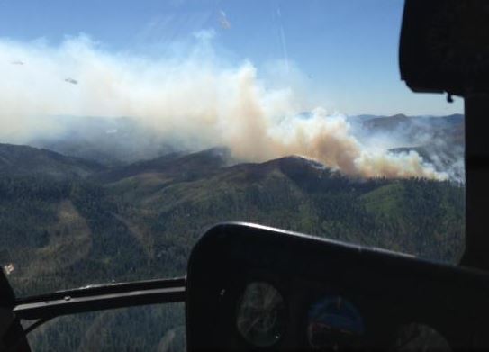
Firefighters are assessing the situation, contemplating strategies for the fire on steep slopes with an abundance of snags. Conventional direct tactics, constructing firelines on the edge of the burning area, may not be feasible because of the hazards of falling trees. Adding to the already complex situation is the weather — a Red Flag Warning for the area is in effect for Saturday and Sunday. A local 10-person fire crew is monitoring the fire growth and scouting options for placement of containment lines. The plan is for full suppression of the fire.
Doug Johnson’s Type 2 Incident Management Team assumed command Saturday morning.
(UPDATED April 20, 2015)
The state of Oregon decided to buy the wildfire insurance from Lloyd’s of London. The policy was purchased through the Oregon Department of Forestry, and provides $25 million in coverage. The coverage will kick in when firefighting costs exceed $50 million, with the policy providing as much as $25 million to cover these costs. Premiums for this coverage are being split between state and private timberland owners, whom have agreed to pay $3.75 million into the policy.
****
(Originally published April 4, 2015)
For decades the state of Oregon has purchased insurance from Lloyd’s of London to help defray the costs of suppressing wildfires, the only state that does so according to OregonLive. This year the company has almost doubled the annual premium from $2 million to $3.75 million while increasing the deductible from $20 million to $50 million.
If the state decides to accept Lloyd’s offer, up to $25 million of their costs of suppressing wildfires will be reimbursed.
The last two consecutive bad fire seasons had state officials rightfully worried that they would have to pay more for the policy this year, especially after spending $75 million on managing wildfires in 2014.
(UPDATED at 5:37 p.m. MDT, March 25)
The U.S. Forest Service is offering a $5,000 reward for help in finding the thieves who stole an engine, two ATV’s, 10 chainsaws and other equipment late Thursday night from a USFS facility in Cave Junction, Oregon. The engine, damaged, was found, but the value of the stolen and damaged machinery is more than $122,000.
****
(Originally published at 12:05 a.m., March 25, 2015)
A U.S. Forest Service engine and two ATVs were stolen recently from a USFS facility in Cave Junction, Oregon. The engine was found Friday morning, stuck, and missing much of its compliment of firefighting and medical equipment.
The ATVs are still missing.