Station Fire burns homes and at least 7,000 acres near Casper, Wyoming

Cole Creek Fire
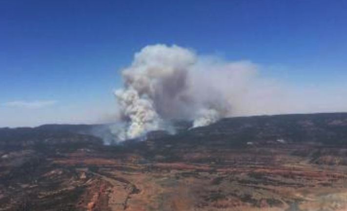
Station Fire near Evansville, WY, Oct. 11, 2015. Photo by MyWyomingAdventure

The Station Fire has burned approximately 16 homes and 9,000 acres just east of Casper, Wyoming in the community of Evansville. It started in a landfill on the north edge of town Saturday afternoon during a strong wind event, laid down overnight, but took off again Sunday afternoon. At 3:15 p.m. Monday, Wyoming State Forester Bill Crapster said the fire had been mapped at 7,000 Monday morning, but strong winds later in the day caused it to continue spreading and he estimated it had grown to about 9,000 acres.

Mr. Crapster said 536 homes are under evacuation orders affecting 1,350 residents. Two large air tankers assisted the ground-based firefighters. The MD-87 and BAe-146 were reloading at Rocky Mountain Metropolitan Airport (JeffCo) 219 miles southeast of the fire.

He confirmed the name of the fire is Station, in spite of media reports calling it the Cole Creek Fire.

Map Cole Creek Fire
Map showing heat detected by a satellite over the Station Fire up through 11:36 a.m., October 12, 2015. The dots represent heat, but most of the vegetation is grass which can burn and then cool off before the next satellite overflight.

Two helicopters are working the fire, a Type 1 and a Type 3, in addition to 50 to 60 engines, Mr. Crapster said.

While returning from a motorcycle trip to the national parks in northwest Wyoming Saturday evening, we happened to stop overnight in Evansville at a hotel 1.8 miles southeast of the burning landfill. As the sun was setting we watched the fire which was burning vigorously in the landfill and had spread a bit beyond it. Sunday morning as we left at 8 a.m. we did not notice any smoke there at all.

But the wind in the area Saturday night and Sunday morning was very, very strong, steady at 30 mph at least, with much stronger gusts. I was worried about the wind Saturday night blowing over my 600-pound bike in the hotel parking lot. When I checked in, the desk clerk noticed my attire, asked if I was on a motorcycle, and said that because of the wind I could park it near the front door … which I did. Thankfully it was still upright Sunday morning. As I departed the area on Interstate 25 heading east and then south there was an electronic sign over the Interstate warning of winds gusting to 55 mph, and said light trailers should not attempt travel. It was a battle on the motorcycle trying to stay in only one lane as I was rudely pushed around by the very, very strong wind.

The RAWS weather station at Fales Rock west of Casper recorded a wind gust Sunday morning of 61 mph with sustained winds above 30 mph between 8 a.m. and 2 p.m. By afternoon the relative humidity dropped to 10 percent.

At 3:10 p.m. on Monday the Fales Rock station showed 69 degrees, RH of 13 percent, and a southwest wind of 16 mph gusting to 27.

The weather forecast for the fire area calls for southwest winds decreasing Monday night to 17 mph with gusts to 24, an overnight RH of 42 percent and a low temperature of 44 degrees. Tuesday should bring 73 degrees, winds out of the southwest at 13 gusting around 20, and an RH of 14 percent.

UPDATE  December 22, 2015: The Star Tribune has more information about how the fire started and how the initial attempts by landfill personnel to suppress the fire were not successful. The correct name of the fire is Station, not Cole Creek.

A fire that destroyed 14 homes in rural Evansville began after smoldering debris from a grinder at the Casper landfill ignited a woodchip pile at the facility, a state report concluded.

High winds the following day spread the embers to the surrounding prairie, sparking the Cole Creek Fire, which burned over 10,000 acres and temporarily displaced more than 1,000 people in October.

Landfill workers tried twice to extinguish the smoldering debris from the grinder, first with water extinguishers and later by stomping on them, according to the report, which was produced by the Wyoming Department of Fire Prevention and Electrical Safety.

The debris was pushed back into the woodchip pile after the second attempt by employees who believed the debris was no longer burning. However, the debris was still smoldering and ignited wood in the brush pile. Firefighters responded and kept watch overnight but lost control of the fire the following afternoon.

The report, which the Star-Tribune obtained Monday using a public records request, concludes the fire was an accident. The document does not address whether any workers at the landfill acted negligently….

$2.9 million settlement reached for 2012 fire near Jackson, Wyoming

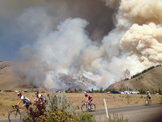
Horsethief Canyon Fire and bike race
Bicycle racers ride past the Horsethief Canyon fire. The fire started September 8, 2012. Photo by David Cernicek

An insurance company and the man who started the Horsethief Canyon Fire south of Jackson, Wyoming have agreed to pay a total of $2.9 million in restitution. The fire started when James G. Anderson Jr., 79, was burning debris in a rusted barrel. Embers that fell through holes in the barrel on September 8, 2012 ignited the fire that burned 3,373 acres.

In November 2013, the U.S. Forest Service sent a bill to Mr. Anderson for $6.3 million to repay costs incurred by the USFS, Bureau of Land Management, U.S. Fish and Wildlife Service, National Park Service, the state of Wyoming, and Teton County. The USFS said the suppression costs totaled about $9 million.

The settlement stipulates that Mr. Anderson will be responsible for $425,000. Insurance companies State Farm and Mountain West Farm Bureau will pick up the rest, according to the U.S. attorney’s office for Wyoming.

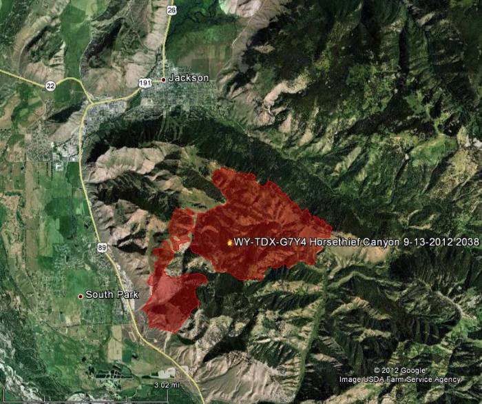
Map of Horsethief Fire
Map of Horsethief Canyon Fire, 8:38 p.m. MT, September 13, 2012. Google/MODIS. (Click to enlarge)

Colorado National Guard being sued for starting fire in Wyoming

Sawmill Canyon Fire
Firefighters conduct a burnout on the Sawmill Canyon Fire in 2012. USFS photo.

A private landowner is suing the Colorado National Guard for starting a fire at a training site in Wyoming that burned more than 2,000 acres of their Bulls Bend Ranch near the town of Glendo. The $6.8 million suit claims the use of ammunition and explosives while training during dry conditions started the fire at the Wyoming National Guard’s Camp Guernsey.

The Sawmill Canyon Fire began July 14, 2012 seven miles southeast of Glendo, Wyoming and burned 14,185 acres before it was contained. About 1,000 acres of grazing land and another 1,000 acres of timberland that burned was on the ranch owned by Kevin and Susan Rothschild.

“The defendants collectively knew of the risk and danger in using live ammunition and explosives in an area that was prone to be dry, yet they proceeded to use explosives and other fire-causing materials that ignited a substantial fire, which caused damage to the property,” the complaint states. “The defendants were further negligent, irresponsible, reckless and acted without regard for plaintiff’s property by not having any fire extinguishing equipment or other controls in place to control and minimize the risk of fire from their activities.”

The Rothschilds say the fires resulted in dead cattle carcasses rotting on their property, dead fish in streams and rivers, destruction of wildlife habitat, burned standing timber and erosion, with silt and ash flowing into streams.

It wasn’t the first time. In 2006, the Tracer Fire, caused by the Army’s firing live rounds into dry grass, burned more than 13,000 acres of grazing land and timber, killing thousands of healthy trees, according to the complaint.

“The only conclusion that can be reached is that the training procedures with the National Guard and the Department of the Army have been shoddy, neglectful and poorly supervised,” the ranchers say.

Thanks and a tip of the hat go out to Dick.

Ten Sleep FD fire hall destroyed by fire

Ten Sleep FD fire
Ten Sleep FD. Photo by Talon Wayne Loveless.

The fire hall and all five pieces of apparatus of the Ten Sleep Rural Fire District were destroyed by a fire Saturday night, The 300-person community is on Highway 16 in north-central Wyoming between Worland and Buffalo.

Ten Sleep FD truck destroyed by the fire. Photo by Talon Wayne Loveless.
Ten Sleep Rural Fire District truck destroyed by the fire. Photo by Talon Wayne Loveless.

The cause of the fire was a propane leak. Below is an excerpt from County 10:

Working with the State Fire Marshall’s Office the cause of the fire was determined to be from the weight of heavy snow on the roof of the fire hall. The snow fell through the roof and landed on a propane line, fracturing it and filling the fire hall with propane, according to [Washakie County Fire Chief Chris] Kocher.

“After the fire hall built up with a sufficient amount of propane, it was ignited with one of the appliances in the fire hall. This led to the explosion and the fire hall was then engulfed in flames, ” reported Kocher.

Ten Sleep Fire Department Fire Hall,
Ten Sleep Rural Fire District Fire Hall, before the fire. Photo from Google Maps.

Ten Sleep FD map

A Gofundme account has been established that hopes to raise $100,000 in donations to assist the department in recovering from their loss.

West Range Fire near Buffalo, Wyoming

West Range Fire
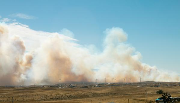
West Range Fire along Highway 16 west of Buffalo, Wyoming, November 9, 2014. Photo by Jessica Reicks.

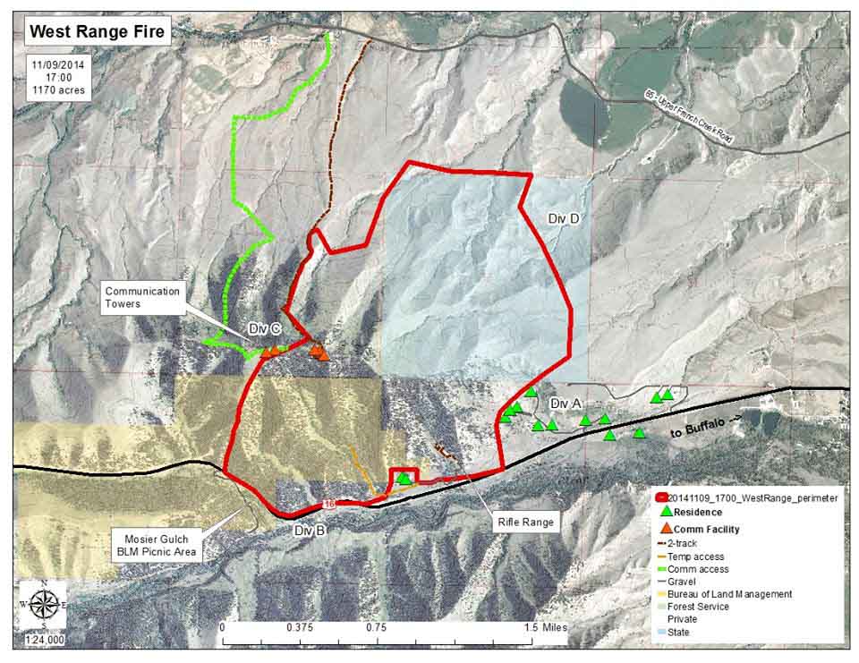
On Saturday November 8 the West Range Fire started five miles west of Buffalo, Wyoming, and eventually burned 1,170 acres near Highway 16 west of town, occasionally closing down the highway.

The occurrence of the fire late in the season made finding aerial resources very difficult. A helicopter was brought in from Fort Collins, Colorado, (271 air miles away) and dropped 65 loads of water on the blaze before strong winds grounded the ship. There is a report that fire crews constructed 12 miles of fireline on Saturday and Sunday.

Resources were brought in from seven counties, two Johnson County fire districts, and four state and federal agencies. Firefighters used sprinkler systems to protect two structures in the area as the fire came within about 50 feet of the houses.

Map West Range Fire

Snow moved in virtually putting out the fire and by Monday morning most of the firefighters had been demobilized.

Below is an excerpt from an article in the Buffalo Bulletin.

…This was one fire everyone in town could watch from their front porch. People were digging around the closet to find those old binoculars so they could keep an eye on what was happening.

The fire started Saturday morning, and during the night those of us who wake up at odd hours to visit the commode could look out the window and see the flames burning down the sides of the mountain toward town. You “sound sleepers” missed quite a show.

Only in Wyoming can wildfire crews work in short sleeves one day and then learn they are snowed in and can’t go home the next morning.

Monday morning, they declared the fire was 95 percent contained. The Bench Sitters wondered who they sent out in that blizzard to find the 5 percent that was still burning.

One-liners, June 18, 2014

Assayii Fire June 15
Assayii Fire June 15, 2014. InciWeb photo.

*The Assayii Fire in northwest New Mexico, reported on Friday the 13th, has burned 12,107 acres on the Navajo Nation in the Bowl Canyon area.

*Missoula smokejumpers got checked out on a new Eurocopter (now Airbus Helicopters) EC135 helicopter on Tuesday.

*On Tuesday five fires were intentionally set in vegetation in Oakland, California about two miles from where the Tunnel Fire began, which in 1991 killed 25 people (23 civilians, 1 police officer, and 1 firefighter), injured 150, and destroyed 2,449 single-family dwellings and 437 apartment and condominium units.

*An off duty firefighter employed by the city of Arcadia, California is missing in the Los Padres National Forest in southern California.

*California will give $10 million of the $48 million of the “fire fees” they have collected to counties and organizations who intend to use the funds for fire prevention and mitigation projects.

*Evaluations of how agencies in San Diego County handled the rash of wildfires in mid-May determined that communications was major issue; that and the need for a third helicopter, but the $5 million request for the helicopter was not approved.

*Three cities in the Austin, Texas area plan to install a network of wildfire detection cameras to add to the one purchased last year by West Lake Hills.

*Squirrels may be to blame for some patchy reproduction of lodgepole pines following the 1988 wildfires in Yellowstone National Park.

*An unfortunate raven started a wildfire 25 kilometers northeast of Yellowknife in the Northwest Territories of Canada when it contacted electrical wires; we will add this to our Animal Arson series, although it may have been a case of suicide arson.

*Dan Glickman and Harris Sherman, two former very high-ranking appointees in the Department of Agriculture, wrote an opinion piece for the New York Times supporting the bill that would allow the Forest Service to draw money from federal disaster funds when firefighting costs reach 70 percent of the 10-year average.
Thanks and a hat tip go out to Doug