Members announced for Wildland Fire Commission

47 are part of the group

Fall Creek Area of San Miguel County, NM, Hermits Peak - Calf Canyon Fire
Fall Creek Area of San Miguel County, NM, Hermits Peak – Calf Canyon Fire, May 8, 2022.

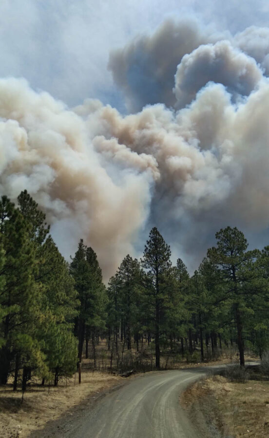
The members of a new Wildland Fire Mitigation and Management Commission were announced today. The group is tasked with recommending federal policies and strategies to more effectively prevent, mitigate, suppress, and manage wildland fires, including the rehabilitation of land affected by wildland fires.

The establishment of the commission was required by the Bipartisan Infrastructure Law, H.R.3684, signed by the President on November 15, 2021, which became Public Law Number 117-58.

More than 500 applications were received, and 36 non-federal members — 18 primary and 18 alternates — were selected. Along with 11 federal members, the commission will be co-chaired by Departments of Agriculture, the Interior, and FEMA leadership. Commission members represent federal agencies, Tribes, state and local municipalities, and private entities, as directed by the Bipartisan Infrastructure Law.

*The selections of the members were made by the co-chairs of the Commission.

A government official who is not authorized to speak publicly on the issue said the makeup of the commission “Has been close hold between fire leadership and intergovernmental affairs. Need to know basis; tighter than budget issues or executive orders.”

The members have their work cut out for them, already up to seven months late on mileposts. Their appointments were to be made no more than 60 days after the date the legislation became law, which works out to January 14, 2022. Their initial meeting was to be held within 30 days after all members have been appointed — no later than February 13, 2022. They are to meet at least once every 30 days, in person or remotely and will serve “without compensation” but can be reimbursed for travel expenses and per diem.

Deliverables

Their assignments, according to the law, fall into two broad categories; here are some of the highlights:

1. Develop recommendations to mitigate and manage wildland fires

By February 13, 2023 develop a report describing recommendations to prevent, mitigate, suppress, and manage wildland fires; consider protection of human life, short- and long-term forest management; wildland-urban interface; utility corridors; rehab after fires; streamlining environmental reviews; and, recommendations for modernizing and expanding the use of technology, including satellite technology, remote sensing, unmanned aircraft systems, and any other type of emerging technology to prevent, mitigate, suppress, and manage wildland fires.

2. Report on aerial wildland firefighting equipment, strategy, and inventory

By March 30, 2022 prepare an inventory of surplus cargo and passenger aircraft that may be used for wildland firefighting purposes.

By June 28, 2022 develop an assessment of the number of aircraft needed to fight wildland fires through 2030. The report will include an assessment of the federal government’s authorities to provide or sell surplus aircraft to Federal, State, or local organizations to be used for wildland firefighting, and, identify any additional authorities that are needed. The Commission is directed to consider all private and public sector options for accessing necessary aircraft and aircraft parts, including procurement, contracting, retrofitting, and public-private partnerships.

Membership (as announced July 7, 2022). The categories of membership and types of expertise were specified by the legislation. For example, “not fewer than one representative from wildland firefighters” was required. That was fulfilled by the selection of Kelly Martin, former Chief of Fire and Aviation at Yosemite National Park, currently president of Grassroots Wildland Firefighters. One of 47. However, other members of the committee presumably have on-the-ground fire experience in the past.

Listed below are the members:

Continue reading “Members announced for Wildland Fire Commission”

Study confirms extreme wildfires of 2020 in Western Oregon were not unprecedented

satellite photo fires smoke Washington, Oregon, and California
GOES-17 photo of smoke from wildfires in Washington, Oregon, and California at 5:56 p.m. PDT Sept. 8, 2020. The photo was taken during a very strong wind event.

By U.S. Forest Service

When the 2020 Labor Day Fires torched more than 300,000 hectares over the span of two weeks in parts of western Oregon and Washington, they devastated communities and put the threat of west-side fires squarely into focus. A new study led by the USDA Forest Service’s Pacific Northwest Research Station examines the context surrounding the fires and offers insight into the historical role of large, high-severity fires—and the future of wildfires—west of the Cascades.

“Without a doubt, the 2020 Labor Day Fires were a significant fire event on many levels, and one that was a wake-up call for the region,” said Matthew Reilly, research forester and lead author of the study, which is published in the journal Ecosphere. “The goal of our study was to help understand how this event compared to past west-side fires so that we can help inform adaptation strategies aimed at preventing or mitigating similar events in the future.”

Drawing from a literature review, extensive historical data, and new analysis, Reilly and his co-authors explored five questions surrounding the 2020 Labor Day Fires: how the 2020 fires compared with historical fires in the region, the role of weather and climate, the effects of forest management and pre-fire forest structure on burn severity, the impacts of these fires on west-side landscapes, and what can be done to adapt to similar fires in the future. Ultimately, they found that the 2020 fires were remarkably consistent with historical fires on the west side, both in terms of their timing and size and the cause of their rapid spread—dry conditions combined with strong east winds.

“Our findings suggest that these severe fires are normal for west-side landscapes when you look at historical fire regimes at longer time scales,” Reilly said. In fact, the researchers identified similarly large historical fires in the early 20th century under similar weather conditions—some even burning right around Labor Day—in some of the same locations that burned in 2020.

Because of the abundant and productive forests characteristic of the west side and the driving role of extreme winds, conventional fire management tools used in dry forests, like prescribed burning and fuels management, will likely be less effective in west-side forests than they are on the east side. This is particularly the case, their study found, when fire weather conditions are as extreme as those witnessed during the 2020 fires.

“Our study indicates we need very different approaches and adaptation strategies in west-side forests compared to those we use in dry forests,” Reilly said.

The study was conducted as part of the Pacific Northwest Research Station’s ongoing West-side Fire Research Initiative, which was launched in 2019 to develop science-based tools to help resource managers respond to wildfire risk in west-side forests. The study’s coauthors are from the Washington State Department of Natural Resources, University of Washington, Oregon State University, and USDA Forest Service’s Pacific Northwest Region.

Highlights

  • The 2020 Labor Day Fires were much larger and more severe than others in the recent record, but they were remarkably consistent with many historical fires. Strong east winds and dry conditions are the common denominators in both large historical fires of the past and the 2020 fires.
  • Forest management and fuel treatments are unlikely to influence fire severity in the most extreme wind-driven fires, like the 2020 Labor Day Fires. Pre-fire forest structure, largely the result of previous forest management activities, had little effect on burn severity when east winds were strong during the 2020 fires.
  • Fuel treatments around homes and infrastructure may still be beneficial under low and moderate fire-weather conditions.
  • Adaptation strategies for similar fires in the future in west-side communities might, instead, focus on ignition prevention, fire suppression, and community preparedness.

More information:

Matthew J. Reilly et al, Cascadia Burning: The historic, but not historically unprecedented, 2020 wildfires in the Pacific Northwest, USA, Ecosphere (2022). DOI: 10.1002/ecs2.4070

Wildfire Today, articles posted in September, 2020 tagged Oregon, or Washington.

Firefighters gain more containment on Electra Fire

Four miles southeast of Jackson, California

Updated 9:59 a.m. PDT July 7, 2022

Electra Fire map 11:15 p.m. July 6, 2022
The red line on the map was the perimeter of the Electra Fire at 11:15 p.m. July 6, 2022. The green line was the perimeter about 24 hours before. Most of the fire is within the footprint of the 2015 Butte Fire (white line).

Most of the 372-acre growth of the Electra Fire Wednesday was on the northeast side east of Clinton Bar Road, where crews conducted a firing operation. There was also growth on the southeast side in the Rich Gulch area near Highway 26.

Fire behavior moderated Wednesday night due to increased humidity. Several small spot fires were detected and mitigated with the support of intel platforms and one of the first uses of a CAL FIRE helicopter (C-101) conducting night-flying operations dropping water, using one of the new Firehawk ships.

The wind has been moderate since the Electra Fire started July 4. The prediction for Thursday is 6 to 10 mph winds out of the southwest in the afternoon, 86 degrees, and about 30 percent relative humidity.


Updated at 3:01 p.m. PDT July 6, 2022

Electra Fire map, northeast side, 1:39 p.m. MDT July 6, 2022
Electra Fire map, northeast side. The red squares represent heat detected by satellites at 1:39 p.m. PDT July 6, 2022. The red line was the perimeter at 11:50 p.m. MDT July 5, 2022.

The Electra fire 4 miles southeast of Jackson, California was not as active in the early portion of Wednesday afternoon as it was the previous two days. A satellite overflight at 1:39 p.m. only detected large heat sources on the northeast side southeast of Clinton Bar Road. There is no doubt there were many small heat sources scattered around the fire which could not be seen by the sensors on the satellite, but if it was vigorously spreading those areas would have shown up in the data.

Electra Fire, northeast side
Electra Fire, northeast side, looking southeast from Mt. Zion at 2:31 p.m. MDT July 6, 2022.

Wednesday afternoon at 2 p.m. CAL FIRE announced changes regarding road closures and evacuation status.

AMADOR COUNTY

Evacuation Order Update: The Amador County Sheriff’s Office is removing the road closure at the intersection of Lower Clinton Road and Butte Mountain Road. The new road closure will be moved to the Upper Clinton Road and Butte Mountain intersection. All residents along Clinton Road and Butte Mountain Road within this area are clear to return home. The evacuation order for this area has been reduced to a warning. Visit www.bit.ly/AmadorCountyEvacMap for more information.

Evacuation Warning Update: The warning zone running east from Jackson, along Hwy 88 to Previtali Road has been removed. All existing Evacuation Orders and Warnings not listed above remain in effect.

Road Closures: Tabeaud Road southbound at Highway 88, Mount Zion Road southbound at Highway 88, Upper Clinton Road at Butte Mountain Road, Clinton Road at West Clinton Road, and Electra Road at Highway 49

CALAVERAS COUNTY

All evacuation orders, evacuation warnings, and road closures remain unchanged.


9:37 a.m. PDT July 6, 2022

Electra Fire 3-D map 1150 p.m. MDT July 5, 2022
3-D map of the Electra Fire map at 11:50 p.m. MDT July 5, 2022. Looking northeast.

On Tuesday the Electra Fire four miles southeast of Jackson, California was not as active as it was on Monday, which allowed firefighters to make progress aided by numerous drops by air tankers and helicopters. Crews have been constructing direct fireline and burning out where possible, gaining containment, even though the official containment percentages are very low.

As of Tuesday night the 3,900-acre fire was almost entirely still within the footprint of the Butte Fire that burned more than 70,000 acres in September of 2015. It has burned both sides of the drainage along the Mokelumne River and reached but not crossed Highway 26 on the south side near Rich Gulch.

To see all articles on Wildfire Today about the Electra Fire, including the most recent, click HERE.

Electra Fire map 1150 p.m. MDT July 5, 2022
Map of the Electra Fire at 11:50 p.m. MDT July 5, 2022; and, the 2015 Butte Fire.

The most recent growth of the Electra Fire has been on the north and northeast sides, where firefighters are working to protect homes near Quail Drive and Clinton Bar Road. Where possible they are taking advantage of firelines used during the Butte Fire, firing out or backfiring from those areas.

The Amador County Sheriff’s office has created an online map showing the areas under evacuation orders.

Resources on the fire Tuesday included 200 fire engines, 26 water tenders, 7 helicopters and 41 dozers for a total of 1,334 personnel.

The weather forecast for Wednesday calls for skies clearing in the afternoon, 84 degrees, 40 percent relative humidity, and 5-10 mph afternoon winds out of the southwest and west gusting to 15.

Two CAL FIRE firefighters, Emily Eymann and Jessica Moser, rescued a pair of dogs, loading them into a US Forest Service truck for evacuation as the Electra Fire approached.

28 years ago eight firefighters survived the South Canyon Fire in their shelters

South Canyon memorial
South Canyon Fire memorial in Two Rivers Park, Glenwood Springs, Colorado.

Today marks the 28th anniversary of the entrapment and death of 14 firefighters on the South Canyon Fire who were overrun by the fire on Storm King Mountain near Glenwood Springs, Colorado. Those firefighters were Kathi Beck, Tamera Bickett, Scott Blecha, Levi Brinkley, Robert Browning, Doug Dunbar, Terri Hagen, Bonnie Holtby, Rob Johnson, Jon Kelso, Don Mackey, Roger Roth, Jim Thrash, and Richard Tyler.

Barry Stevenson of Outside Adventure Media produced the short video below that looks at an often overlooked part of the event — the eight smokejumpers further uphill who took refuge in their fire shelters for two hours as the fire burned around them.

If you have not seen it already, be sure and watch the excellent lessons learned video about the South Canyon Fire titled Everyone Goes HomeIt includes numerous interviews of wildland firefighters who were involved with, or were on scene during the entrapment and deaths of the 14 firefighters.

For more information about the South Canyon Fire visit southcanyonfire.com.

Electra Fire prompts evacuations southeast of Jackson, CA

Approximately 5 miles southeast of Jackson

Updated 1:39 p.m. MDT July 5, 2022

Electra Fire history July 4, 2022
Map showing the current Electra Fire, as of Monday night, and the 2015 Butte Fire.

The activity on the Electra fire southeast of Jackson, California has been increasing since noon Tuesday. Several air tankers are dropping retardant, including a DC-10, MD-87, C-130, and S-2T.

The Amador County Sheriff’s office has created an online map showing the areas under evacuation orders.

To see all articles on Wildfire Today about the Electra Fire, including the most recent, click HERE.

As of the Monday night mapping data, the Electra Fire has been burning entirely within the footprint of the huge Butte Fire that blackened more than 70,000 acres in 2015 while leading to two deaths and 135 destroyed homes.

Electra Fire 12:33 p.m. July 5, 2022
Electra Fire, looking south from Mt. Zion at 12:33 p.m. July 5, 2022.
Map Butte Fire
CAL FIRE’s map of the Butte Fire obtained Sept. 12, 2015. No information was provided about the date of the perimeter.

Resources working the fire include 128 engines, 22 water tenders, 33 dozers, 39 hand crews, and multiple aircraft.

On Monday approximately 100 recreational visitors and PG&E employees had to shelter in the Electra Powerhouse, but were safely evacuated from the area by 9:30 p.m.

The control objectives are to keep the fire east of Hwy. 49, south of Hwy. 88, north of Jesus Maria Road, and west of Hwy. 26 and Railroad Flat Road.

About 450 structures are threatened.

The weather at the Golden Chain Highway weather station south of Jackson at 1:20 p.m. Tuesday was 80 degrees, 49 percent relative humidity, and 6 mph winds out of south gusting to 12 mph. The forecast is for the RH to drop to about 40 percent by late afternoon.  Monday afternoon while the large convection column was raging, the nearby weather stations recorded a minimum RH of around 60 percent — remarkably high for such vigorous fire behavior.

Electra Fire
Electra Fire at the Mokelumne River. July 4 or 5, 2022.

Updated 5:25 a.m. PDT July 5, 2022

Electra Fire map, Monday night July 4, 2022
Electra Fire map, Monday night July 4, 2022. Data from FIRIS.

The Electra Fire 5 miles south of Jackson, California grew substantially Monday evening and into the night, but the activity slowed in the very early hours of Tuesday. Most of the growth was on the north and east sides after it crossed the Mokelumne River and reached highway 26 near Rich Gulch.

The FIRIS mapping crew estimated the size at 3,034 acres at about 1 a.m. Tuesday.

Electra Fire 8:07 p.m. July 4, 2022
Electra Fire, looking north from the Buena Vista camera at 8:07 p.m. July 4, 2022.

6:00 p.m. MDT July 4, 2022

Electra Fire, location
Map showing the location of the Electra Fire.

The Electra Fire that started Monday afternoon near Electra Road approximately 5 miles southeast of Jackson, California has prompted evacuations. At 5:06 p.m. a mapping aircraft estimated the size at nearly 390 acres. It is on both sides of the Mokelumne River.

perimeter map of the Electra Fire
Approximate perimeter of the Electra Fire at about 5:20 p.m. July 4, 2022. FIRIS aircraft.

At 5:36 the Amador County Sheriff Office said a mandatory evacuation order has been issued for all residents in the Butte Mountain Road area. Butte Mountain Road will be closed except for egress purposes.

An evacuation warning is in effect for all residents in a two mile radius around Lake Tabeau.

Electra Fire 5:28 p.m. July 4, 2022
Electra Fire, looking northeast from the Buena Vista camera at 5:28 p.m. July 4, 2022.

Soon after it started the fire was putting up a very large plume of smoke topped by condensation and a pyrocumulus cloud, indicating extreme fire behavior.

Aircraft near the Electra Fire in Northern California
Aircraft near the Electra Fire in Northern California at 5:23 p.m. July 4, 2022. FlightRadar24.

Wildfire at Centerville, Utah prompts evacuations

The police reported that fireworks is the most likely cause, but it is under investigation

Updated at 5:03 p.m. MDT July 4, 2022

Deuel Creek Fire
Helicopter drops water on the Deuel Creek Fire Monday afternoon, July 4, 2022. Image from Division A.

The Deuel Creek Fire in the foothills east of Centerville, Utah was  mapped Monday at 128 acres. Firefighting resources assigned include multiple helicopters and 7 engines for a total of 80 personnel; an additional 3 hand crews are en route.

Monday afternoon the fire was less active than it was during the night, but still has potential for growth with the strong winds and low humidity. The fire is between Deuel Creek and Parrish Creek.


12:51 p.m. MDT July 4, 2022

Deuel Creek Fire map, 3:54 a.m. MDT July 4, 2022
The red dots on the map represent heat on the Deuel Creek Fire detected by satellites as late as 3:54 a.m. MDT July 4, 2022. Looking east.

A fire that was reported around midnight Sunday night resulted in the evacuation of about 89 homes on the east side of Centerville, Utah. It started near Center Street and Firebreak Road north of Bountiful. The evacuations were later lifted.

Fire authorities estimate it has burned approximately 100 acres, mostly on a steep slope 10 miles north of Salt Lake City.

“All indications are that this fire was human caused, the most likely source being fireworks,” wrote the Centerville Police Department on Twitter at 5:50 a.m. Monday. “We will be working with fire investigators to determine the cause.”

Much of Western Utah, including the greater Salt Lake City Area, has been under a Red Flag Warning Sunday and Monday for single-digit humidity and strong winds.

A Type 3 Incident Management Team will assume command of the fire Monday morning.

Regarding the tweet below, Spencer J. Cox is the governor of Utah.