Map of the Calf Canyon / Hermits Peak Fire. The bright red dots represent heat detected by a satellite at 3:49 a.m. MDT May 20, 2022.
The four largest active wildfires in New Mexico all continued to grow Thursday and have burned a total of more than 476,000 acres. Red Flag Warnings are in effect Friday for winds gusting from 30 to 40 mph with single digit humidity.
The 303,701-acre Calf Canyon / Hermits Peak Fire northwest of Las Vegas was subject to single digit humidity and strong winds Thursday afternoon, 10 to 20 mph with 30 to 40 mph gusts out of the west. Since the east side is somewhat secure most of the additional spread was limited to the west side, which experienced in some areas fire behavior described as “extreme, crowning, group torching, and spotting.”
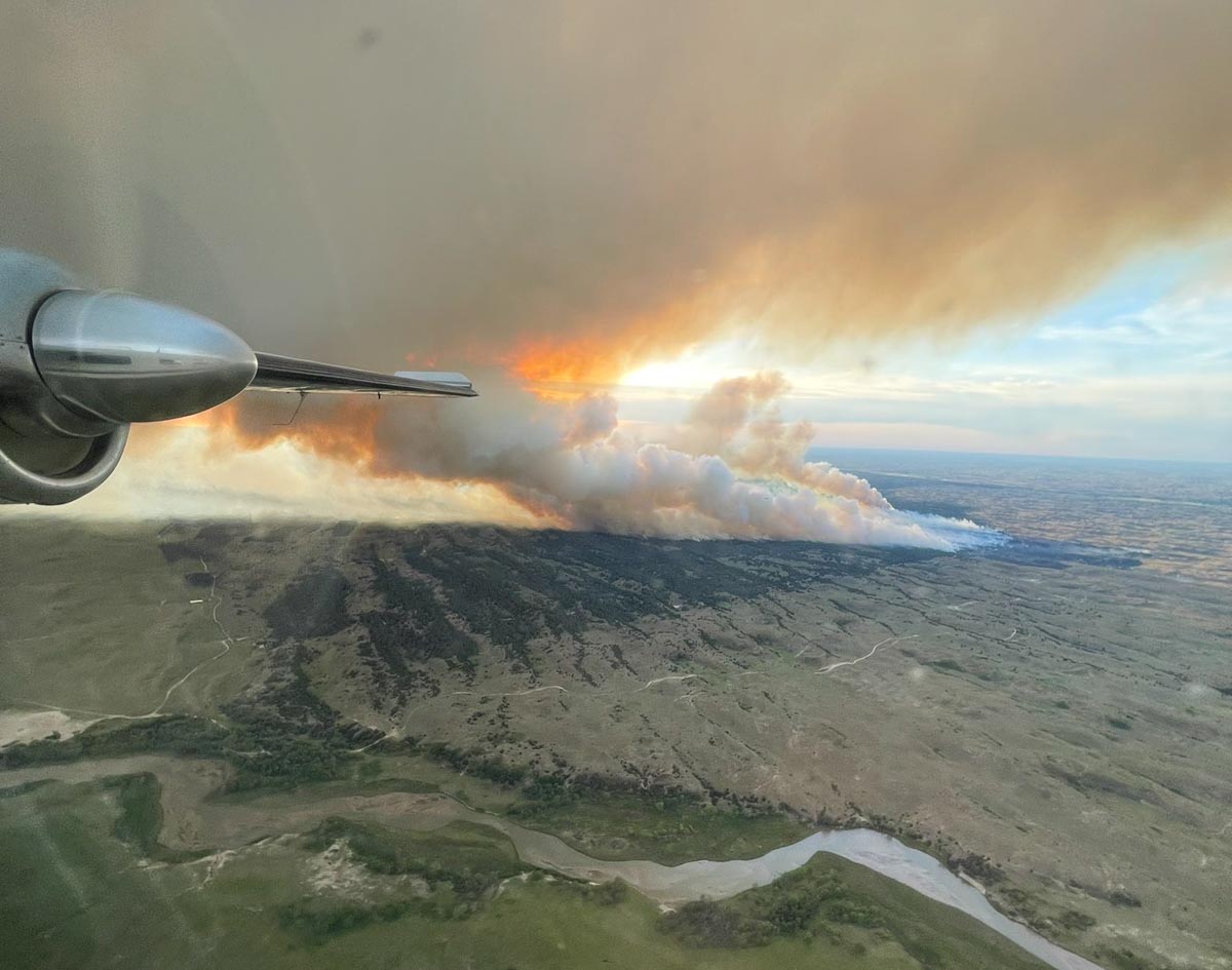
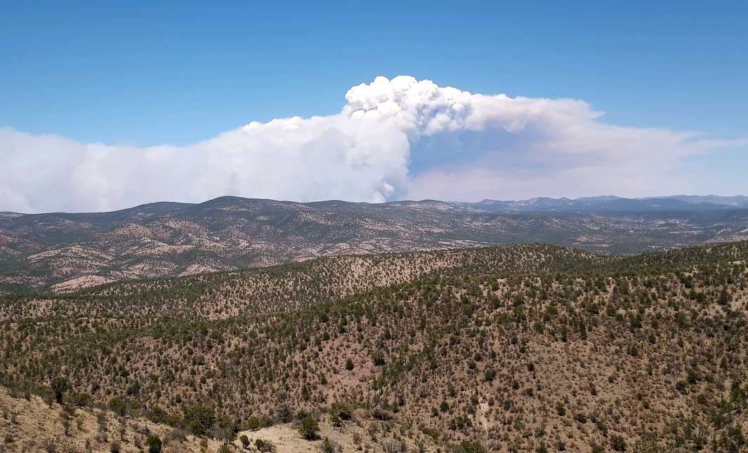
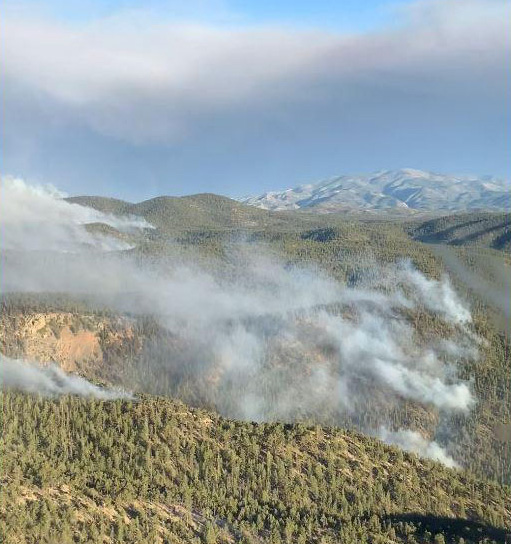
Smoke over the Calf Canyon – Hermits Peak Fire May 18, 2022 by pilot Travis Graham.
The Black Fire 28 miles west-northwest of Truth or Consequences consumed more vegetation on the northwest, northeast, east, and southeast sides. Fire officials said in some places it spread for three miles, growing on the southeast side to within one or two miles of Hermosa. It has burned 104,969 acres.
Map of the Black Fire. The bright red dots represent heat detected by a satellite at 3:49 a.m. MDT May 20, 2022.
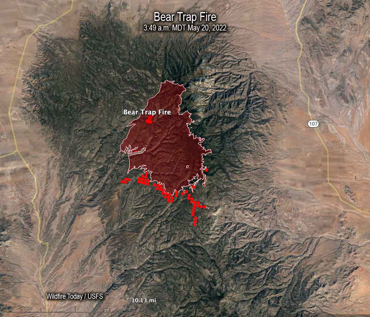
Most of the spread of the 21,687-acre Bear Trap Fire 34 miles southwest of Socorro was on the south side Thursday. Hand crews are prepping and conducting tactical burning operations, some of which may be conducted by aerial ignition. Limited movement to the east off the San Mateo crest is expected due to non-continuous fuels in several recent fire scars.
Map of the Bear Trap Fire. The bright red dots represent heat detected by a satellite at 3:49 a.m. MDT May 20, 2022.
The 45,605-acre Cerro Pelado Fire six miles southwest of Los Alamos has been relatively quiet for several days.
A smokejumper was seriously injured Sunday May 15 during a training parachute jump. Ben Elkind sustained a dislocated hip and pelvic fracture during a hard landing. During surgery at the hospital they found six fractures and placed three plates and 10 screws to repair the damage.
Ben has been a Smokejumper for the US Forest Service based in Redmond, OR for nine years and worked in fire as a member of the Zig-Zag Hotshots before jumping. He rookied as a smokejumper in Redding, CA, in 2014 then transferred to Redmond in 2015 to be closer to home and his family.
If his name seems familiar it is because on Wildfire Today we reprinted an opinion article he wrote that was published in The Oregonian, titled, “A USFS firefighter in Oregon can be paid more at McDonald’s.” Ben was also a member of a group that traveled to Washington, D.C. in March where they met with White House officials about pay issues and passing the Tim Hart Wildland Firefighter Classification and Pay Parity Act (H.R. 5631). They also talked with Marty Walsh, the Secretary of Labor, who oversees the Office of Worker’s Compensation Programs (OWCP), an agency that has been criticized for slow-walking or failing to appropriately process the claims and pay the medical bills of firefighters injured on the job.
In an ironic twist, a GoFundMe page has been set up for Ben’s family by the Redmond Smokejumpers Welfare Organization, an often necessary step taken by many federal firefighters who are injured on the job. Here is an excerpt from their description on GoFundMe:
Ben has a long road to recovery and will be unable to work for a significant length of time and will be missing out on the overtime that so many wildland firefighters depend on to make a living. We are starting this GoFundMe in order to help Ben and his family through this tough time. Please consider donating to help a firefighter and his family while they support each other on the road to recovery.
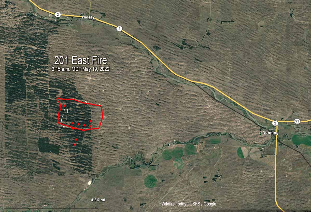
Map of the 201 East Fire, Friday morning, May 20, 2022.
In a Friday morning briefing Caleb, Operations Section Chief, said the 201 East Fire in Central Nebraska is still 4,100 acres and is not expected to grow larger.
Updated 9:09 p.m. MDT May 19, 2022
201 East Fire in central Nebraska, May 19, 2022. By@littleemilee6.
The 201 East Fire in Central Nebraska was very active again Thursday afternoon, as the convection column topped out with a hint of pyrocumulus. Thursday evening fire officials estimated it had grown to 4,100 acres, an increase of about 2,600 acres since Wednesday evening. Much of the growth was on the east side where it ran for about two miles, but when the wind shifted from coming from the west and then north gusting to 30 to 35 mph, it spread to the south where it merged with the Whitetail Fire, which also started from Tuesday’s lightning; it had been stopped at 8 acres, but flared up again Thursday. As of Thursday evening, the additional southward spread had not crossed the Dismal River.
Firefighters were battling 90 degree temperatures and strong, shifting winds.
Additional firefighting resources are arriving, including hand crews, helicopters, and engines. They hoping to directly suppress the flanks as it moves into the grass to the east.
The forecast for Friday is cooler temperatures, 55 degrees, 40 percent relative humidity, and 18 mph winds gusting out of the northwest at 28 mph, but there is a 26 percent chance of rain Friday night.
201 East Fire in central Nebraska, May 19, 2022. By@littleemilee6.
9:48 a.m. MDT May 19, 2022
Map of the 201 East Fire in Nebraska. The red line was the approximate perimeter early in the morning May 19, 2022. The white line was the perimeter about 24 hours before. The red dots represent heat detected by a satellite at 3:15 a.m. MDT May 19, 2022.
A fire in central Nebraska has burned about 1,500 acres of timber in the Nebraska National Forest. The 201 East Fire is one of six in the area ignited by lightning on Tuesday May 17. Firefighters were able to stop the spread of the others at less than 9 acres.
It started in a 21,000-acre patch of timber three miles south of Halsey. By Wednesday morning a dozer line had it mostly encircled, but in the afternoon the fire crossed the line on the east side and ran for about 1.5 miles, leaving the timber and getting into grass. District Ranger Julie Bain said greenup has started but there is enough dead grass mixed with this year’s growth to still carry a fire, but they feel they can more easily stop it in the grass.
201 East Fire in Nebraska, May 18, 2022. Photo by Air Attack pilot @littleemilee6.
Aircraft used on the fire Wednesday included two single engine air tankers, two large air tankers, and an air attack ship. A Type 3 incident management team has been assigned.
The weather recorded at Thedford Wednesday afternoon as the fire made the run to the east was 6 to 13 mph winds occasionally gusting to 17 mph, 84 degrees, and 26 percent relative humidity.
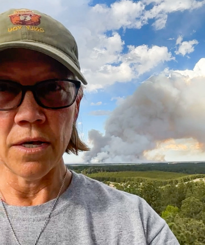
USFS District Ranger Julie Bain at a lookout tower during a briefing about the 201 East Fire, Wednesday afternoon May 18, 2022.
Numerous large wildfires are burning in New Mexico
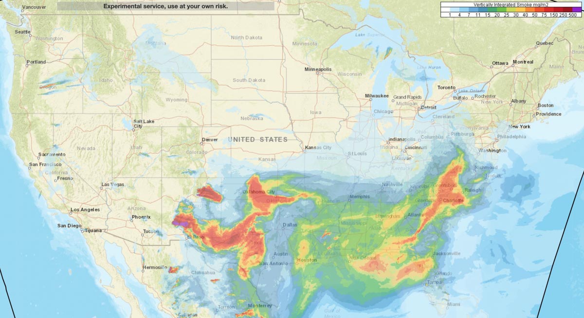
Smoke forecast for 5 p.m. MDT May 18. NOAA.
Smoke from wildfires in New Mexico is drifting into the Southeast United States. While much of the smoke is not at ground level except in East New Mexico and West Texas, the impact should at a minimum produce red sunsets for a couple of days across the Southern states.
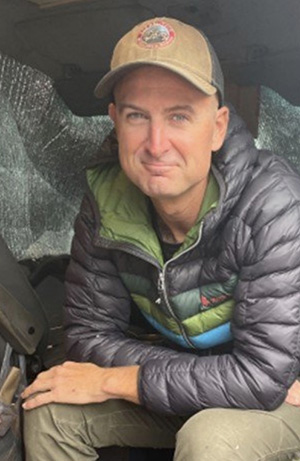
Patrick Gladics was working as a Helicopter Manager in Sierra Vista
Patrick Gladics. BLM photo.
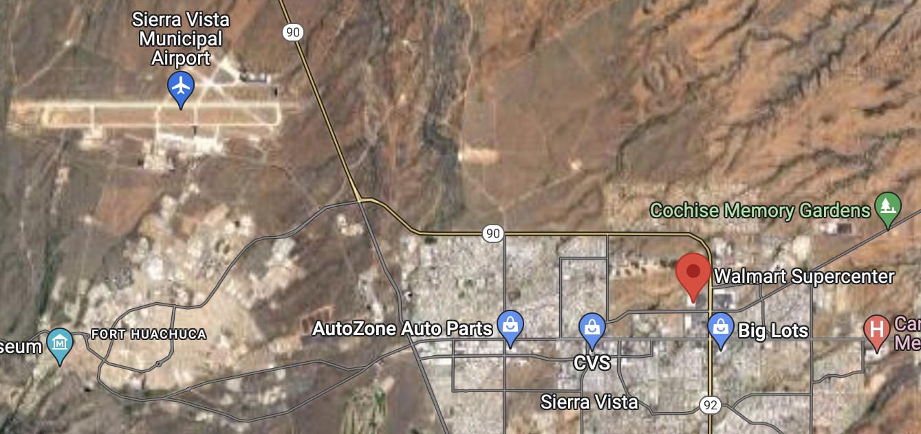
A Bureau of Land Management firefighter who was reported missing on May 14 was found deceased May 16 in Sierra Vista, Arizona.
Patrick Gladics was staying at a hotel while working out of the Sierra Vista Municipal Airport in southern Arizona as a helicopter manager, but failed to report to duty on May 14.
The Coronado National Forest reported that the Sierra Vista Police Department with the assistance of Arizona Department of Public Safety Air Rescue, found the body of the 38-year-old firefighter shortly before 12:30 p.m. May 16.
Mr. Gladics was found deceased in the desert area west of Walmart in Sierra Vista. SVPD Special Operations detectives responded to investigate the scene. The case is being referred to the Pima County Medical Examiner’s Office for further investigation.
His BLM vehicle had been located at the Walmart in Sierra Vista on Monday. Video surveillance showed him on foot heading north toward the open desert from the parking lot at about 5 a.m. on Saturday May 14.
The 11,620-acre San Rafael Fire is near the US/Mexico border 20 miles southwest of Sierra Vista. The latest entry on Inciweb was on May 15, reporting that the fire was 100 percent contained and was staffed by five people. Another fire in the area, the 112-acre Locklin Fire 20 miles southeast of Sierra Vista, was listed as contained April 30.
We send out our sincere condolences to the family, friends, and coworkers of Mr. Gladics.
Red Flag Warning for the Calf Canyon / Hermits Peak Fire, May 19-20, 2022. NWS.
The National Weather Service has taken the unusual step of issuing a Red Flag Warning one and two days in advance for the Calf Canyon / Hermits Peak Fire 21 miles east of Santa Fe, New Mexico. The prediction is for winds gusting from the west and southwest at more than 30 mph with single digit relative humidity. Similar conditions will exist at least on Thursday for the area of the Black and Bear Trap Fires in southwest New Mexico.
Updated 12:10 p.m. MDT May 18, 2022
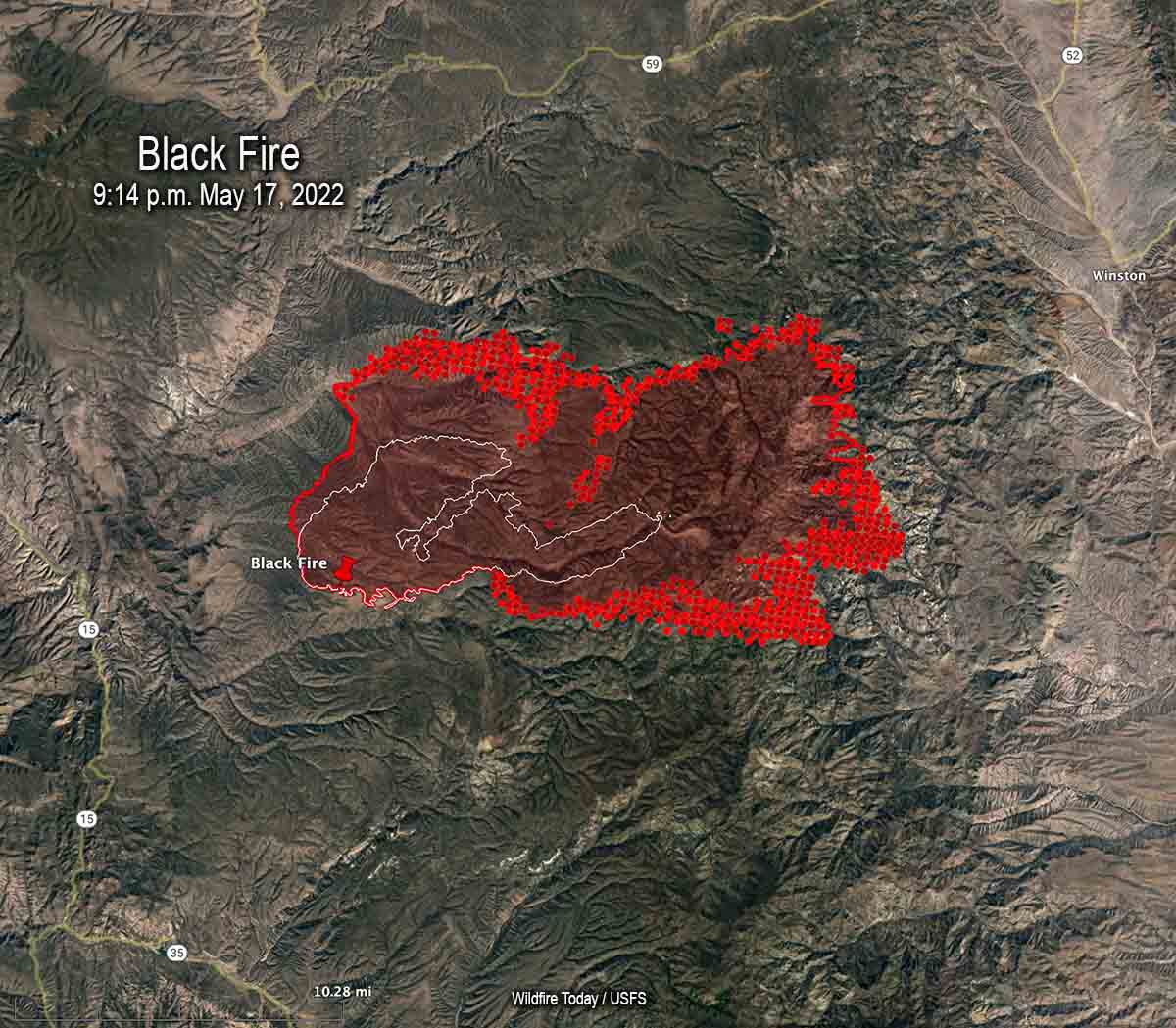
Map of the Black Fire. The bright red dots represent heat detected by a satellite at 2:48 a.m. May 18. The red line is the perimeter at 9:14 p.m. May 17. The white line is the perimeter about 48 hours before.
On Wednesday the northern half of New Mexico is under a Red Flag Warning. Isolated dry thunderstorms are predicted for portions of New Mexico, Texas, and Colorado.
Red Flag Warnings Wednesday.
Chance for isolated dry thunderstorms in portions of NM, CO, & TX.
From the NWS:
“Thunderstorms are expected across portions of the central Rockies this afternoon. Storms should be dry with the potential for new lightning induced fire starts.” pic.twitter.com/kT4KwlJC27
The Calf Canyon – Hermits Peak Fire 21 miles east of Santa Fe, NM was active on the west side Tuesday, but there was very little significant activity on the east side between Mora and Las Vegas.
The Cerro Pelado Fire 25 miles west of Santa Fe was relatively quiet Tuesday. There has been no major spread for several days and a satellite was only able to detect one large heat source early Wednesday morning.
Black Fire, May 16, 2022. IMT photo.
The Black Fire (see map above) 28 miles west-northwest of Truth or Consequences made another large run to the east Tuesday adding another 21,000 acres to bring the total up to 77,360. Fuel treatments and wildfires that have occurred over the last 20 years may slow any major spread to the north, west, and south, but the NIFC database shows no significant history of fire east of the incident.
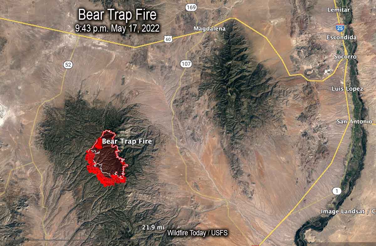
Map of the Bear Trap Fire. The bright red dots represent heat detected by a satellite at 2:48 a.m. May 18. The red line is the perimeter at 9:43 p.m. May 17. The white line is the perimeter about 24 hours before.
Another fire in southwest New Mexico, the Bear Trap Fire, is 34 miles southwest of Socorro. It spread southwest on Tuesday and was mapped Tuesday night at 15,215 acres. The fire is surrounded by fuel treatments and prescribed natural fires on all sides except for the southwest — which is where the most of the spread has occurred during the last couple of days.
South side of the Bear Trap Fire, May 16. IMT photo.
5:10 p.m. MDT May 17, 2022
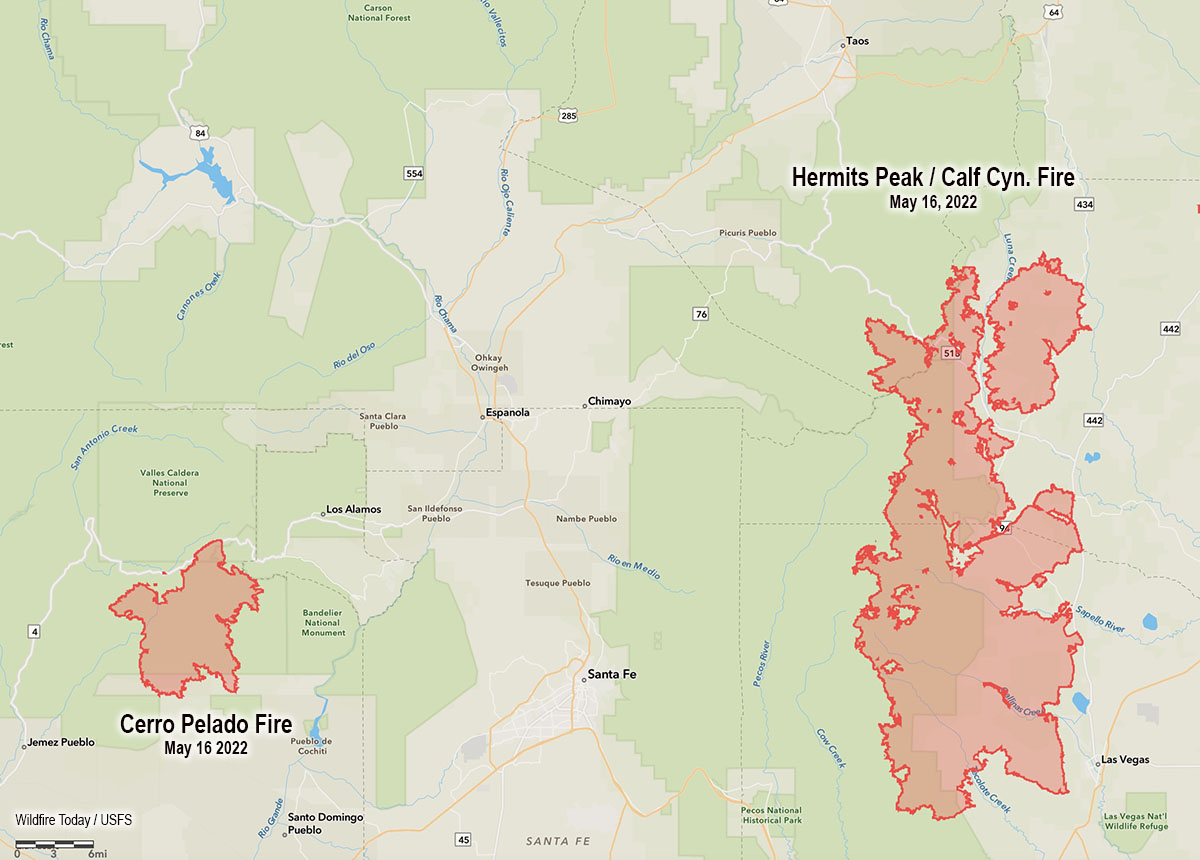
Map showing the location of the Cerro Pelado and Calf Canyon – Hermits Peak Fires, the evening of May 16, 2022.
High temperatures and very low humidity on Tuesday kept most of the large wildfires in New Mexico very active.
Calf Canyon – Hermits Peak Fire
The Calf Canyon – Hermits Peak Fire 21 miles east of Santa Fe has become the largest fire in the recorded history of New Mexico. At 299,565 acres it has eclipsed the previous record set by the 297,845-acre Whitewater and Baldy Fires when they burned together in May of 2012 in Southwest New Mexico. On Tuesday it was again putting up a large smoke column while a 5 to 20 mph wind gusted out of of the northwest, west, and southwest at 25 mph. The humidity dropped to 10 percent in the afternoon.
Cerro Pelado Fire
On Monday most of the fire activity on the 45,605-acre Cerro Pelado Fire was on the northwest and southeast sides. On Tuesday the fire 25 miles west of Santa Fe was putting up much less smoke than the Calf Canyon – Hermits Peak Fire, judging from the Satellite photo below taken at 3:56 p.m.