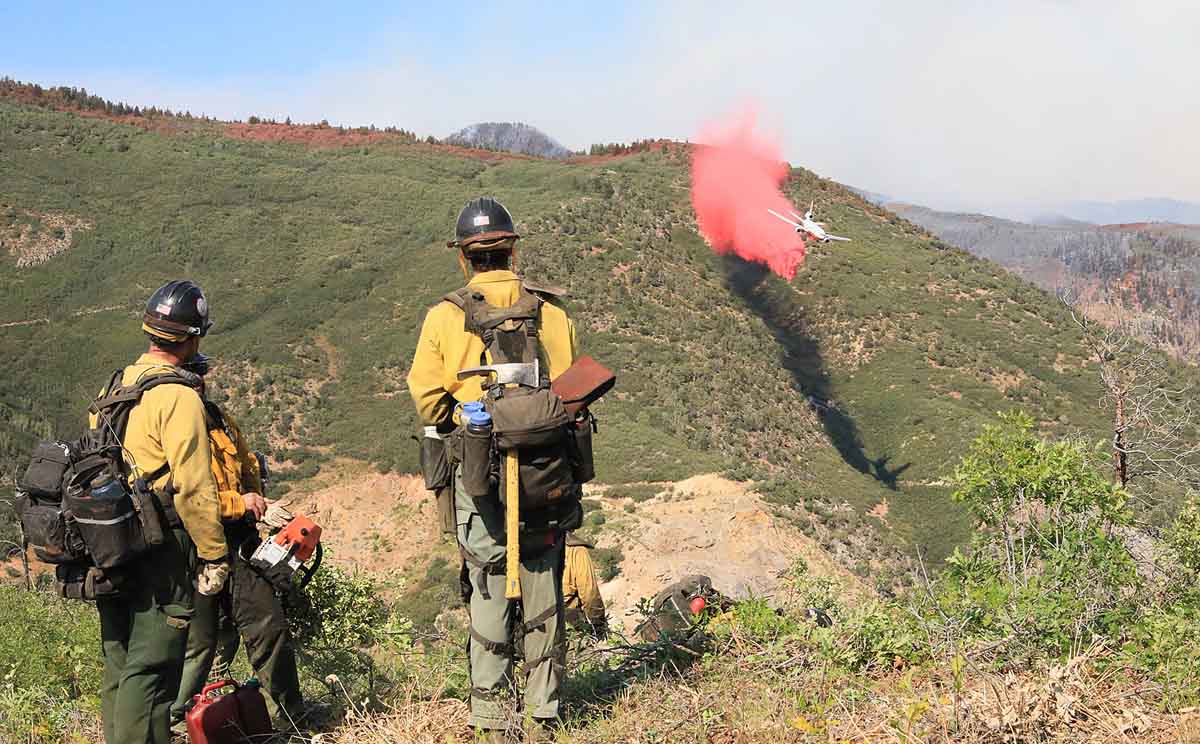
NWS issued fire tornado warning for Loyalton Fire northwest of Reno Saturday

At least five tornado-strength/scale vortices are likely to have occurred in the fire Saturday

August 16, 2020 | 5:04 p.m. PDT
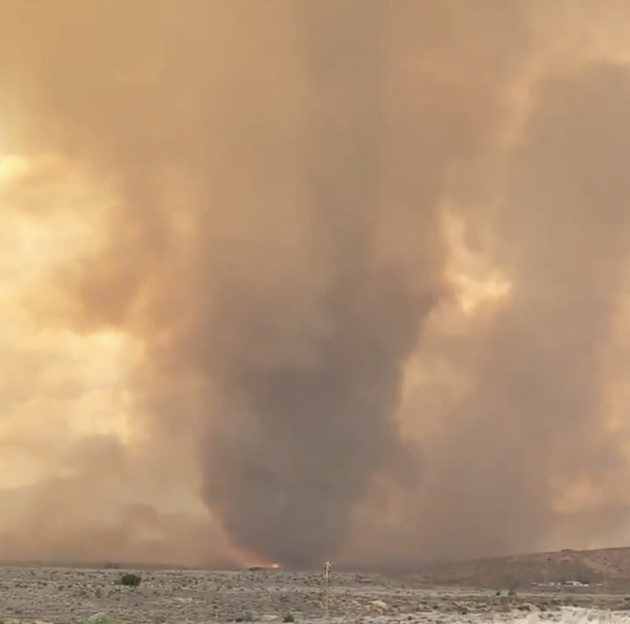
Fire tornado Loyalton Fire
Fire tornado on the Loyalton Fire, by @DVRockJockey August 15, 2020.

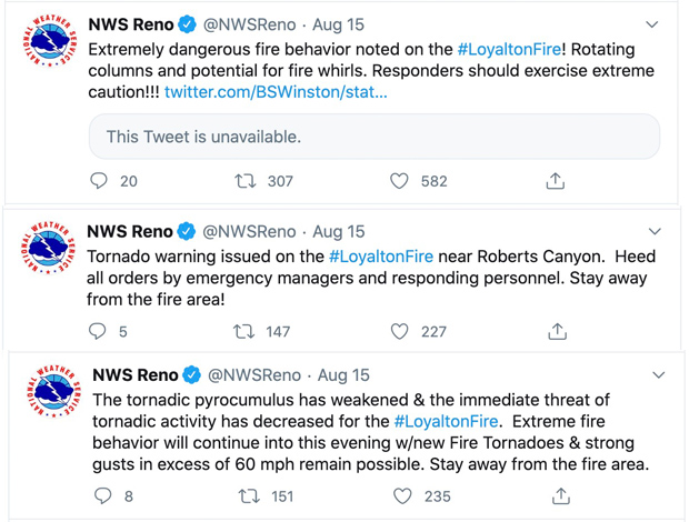
On August 15 meteorologists with the National Weather Service in Reno observed on radar a very rare fire tornado in real time at the Loyalton Fire about 12 miles northwest of the city. They used emergency warning systems to get the word out as quickly as possible to firefighters and the general public. It is believed that this is the first time a real time warning for this type of event has ever happened, at least in the United States.

They also sent out tweets, of course:
NWS tweets fire tornado

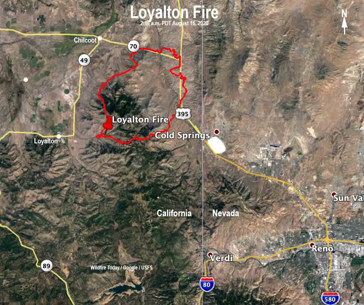
Loyalton Fire map
Map of the Loyalton Fire the morning of August 16, 2020, time uncertain, but possibly about 2 a.m.
The Loyalton Fire started at about 4:30 p.m. August 14 east of the town of Loyalton and southwest of Mount Ina Coolbrith. It burned north and east adjacent to the areas of Beckwourth Pass and Hallelujah Junction. Early Sunday morning it was estimated at 29,829 acres. More information about the Loyalton fire on Wildfire Today.

A fire tornado is just like it sounds — a large column of rotating air over a vegetation fire. Inside it and around it are extremely strong winds, very high temperatures, and flying debris.

On July 26, 2018 a firefighter was killed as a fire tornado burned and scoured a mile-long path as the Carr Fire moved into Redding, California. A Redding Fire Department Inspector was burned over in his truck and died on Buenaventura Boulevard. Three dozer operators were entrapped and one of them was also killed.

According to a Green Sheet report by CAL FIRE the conditions that resulted in the entrapment of three dozers and the Redding Fire Department Fire Inspector that day were due to the fire tornado — a large rotating fire plume that was roughly 1,000 feet in diameter. The winds at the base were 136-165 mph (EF-3 tornado strength), as indicated by wind damage to large oak trees, scouring of the ground surface, damage to roofs of houses, and lofting of large steel power line support towers, vehicles, and a steel marine shipping container. Multiple fire vehicles had their windows blown out and their bodies damaged by flying debris.

The strong winds caused the fire to burn all live vegetation less than 1 inch in diameter. Peak temperatures likely exceeded 2,700 °F.

Here is an excerpt from an article in the Washington Post about the fire tornados yesterday:

Fire tornadoes in and of themselves are rare; being able to detect them in real time on radar is something new. Wendell Hohmann is the meteorologist at the Reno office who issued the precedent-setting warning. He described it as a “once-in-a-lifetime, career event.”

“We were just trying to get the message out of the extreme fire behavior from this fire given the rotation and the tornadic potential,” Hohmann said. “We figured we could do a severe [thunderstorm warning], but we decided to do a tornado warning to get [the emergency alert system] and [wireless emergency alerts] to activate.”

Matthew Cappucci believes at least five tornado-strength/vortices are likely to have occurred on the Loyalton Fire August 15.

The news media sometimes calls any little fire whirl a “fire tornado”, or even a “firenado”. These and related terms (except for “firenado”) were, if not founded, at least documented and defined in 1978 by a researcher for the National Weather Service in Missoula, David W. Goens. He grouped fire whirls into four classes:

  1. Fire Devils. They are a natural part of fire turbulence with little influence on fire behavior or spread. They are usually on the order of 3 to 33 feet in diameter and have rotational velocities less than 22 MPH.
  2. Fire Whirls. A meld of the fire, topograph, and meteorological factors. These play a significant role in fire spread and hazard to control personnel. The average size of this class is usually 33 to 100 feet, with rotational velocities of 22 to 67 MPH.
  3. Fire Tornadoes. These systems begin to dominate the large scale fire dynamics. They lead to extreme hazard and control problems. In size, they average 100 to 1,000 feet in diameter and have rotational velocities up to 90 MPH.
  4. Fire Storm. Fire behavior is extremely violent. Diameters have been observed to be from 1,000 to 10,000 feet and winds estimated in excess of 110 MPH. This is a rare phenomenon and hopefully one that is so unlikely in the forest environment that it can be disregarded.”

It was just two days ago that I wrote extreme fire behavior and massive pyrocumulus are becoming much more frequent. If we are going to see more fire tornados, that is a scary thought. The west coast is expected to have very high temperatures this week.

Loyalton Fire
Loyalton Fire at 1:39 p.m. PDT August 15, 2020, looking north.

Thanks and a tip of the hat go out to Chris and SST.

Helicopters help suppress fire that burned into Oregon junkyard

August 16, 2020 | 3:34 p.m. PDT

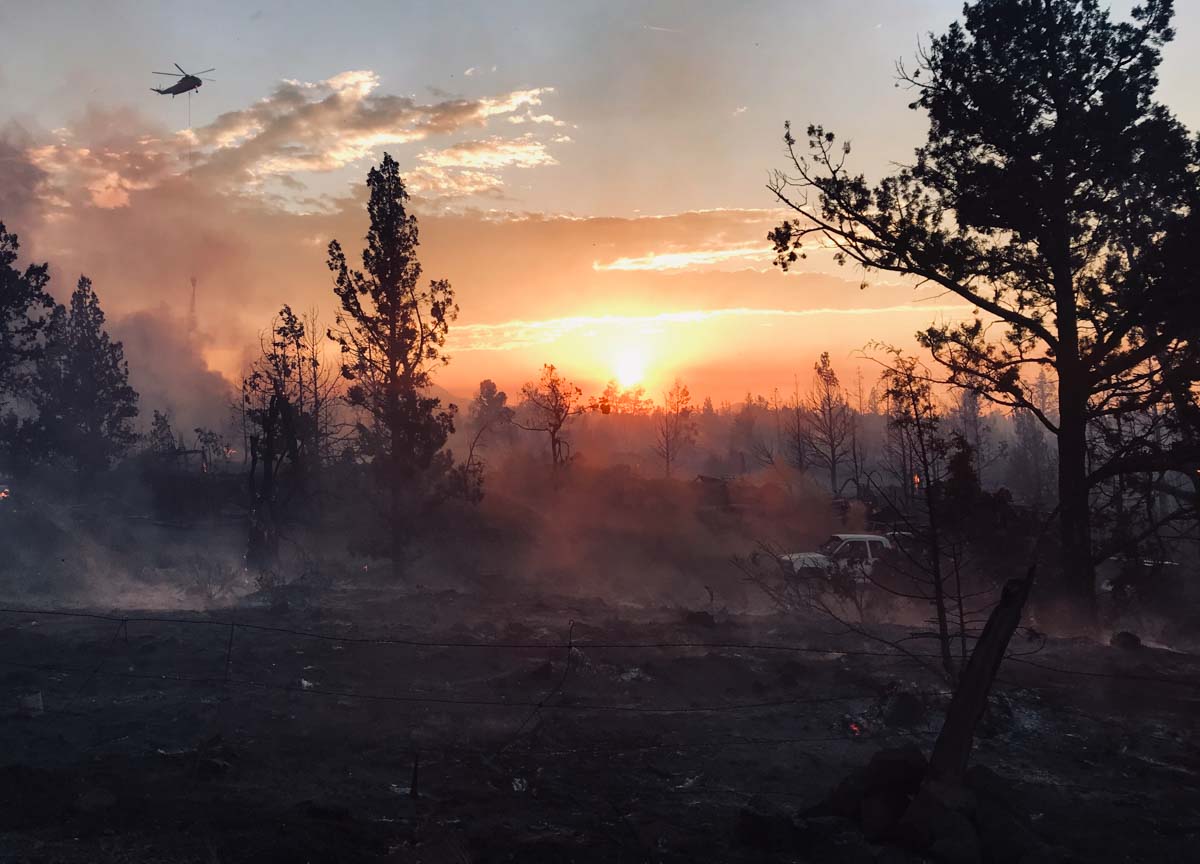
Juniper Fire Bend Oregon junkyard
An S-61 helicopter drops water on the Juniper Ridge Fire, August 15, 2020. Photo by Brendan O’Reilly.

(This article first appeared on Fire Aviation)

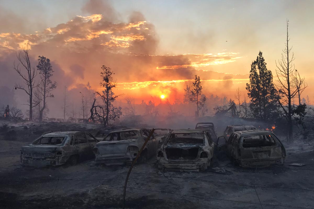
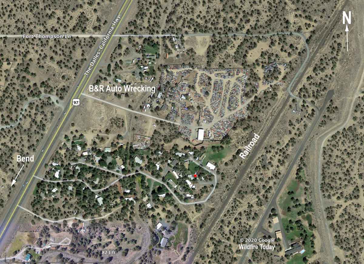
 A vegetation fire that spread into an auto wrecking yard Saturday was attacked by firefighters on the assisted by at least five aircraft. Hundreds of homes were threatened including a mobile home park next door.

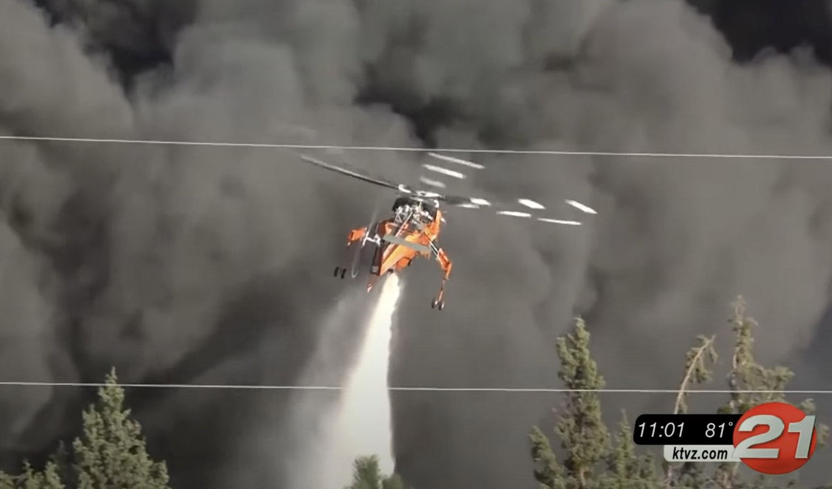
Footage from KTVZ showed numerous water drops by an Air-Crane, Helicopter 3AC. At least two Single Engine Air Tankers also worked the fire, as well as two other helicopters, an S61 and a third that may have been a Bell 205, said Brendan O’Reilly, Superintendent of the Prineville Hotshots who was on scene.

Helicopter 3AC drops on the Juniper Fire
Helicopter 3AC drops on the Juniper Fire August 15, 2020. Note the shadow of the helicopter on the thick smoke. Screenshot from KTVZ video.

Numerous vehicles were on fire in the wrecking yard producing a thick column of black smoke.

“Maybe 25 acres [were burning] in the wildland around several structures, and then about 10 acres in the junkyard although due to the thick toxic smoke and exploding airbags and tires, we couldn’t accurately map the whole perimeter on the ground,” Superintendent O’Reilly said. “I’d never personally seen helicopters used on a junkyard fire. The helicopters were much more effective than SEATs due to the thick black smoke column, but still couldn’t do much except limit spread to adjacent structures. It took structure engines with SCBAs to make any headway in the junkyard itself, but that was after hours of tires and airbags exploding. It was a very interesting evening.”

Juniper Ridge Fire, August 15, 2020 by Brendan O’Reilly.

“Due to the air attack resources we were able to make an aggressive stop on the fire,” said Trish Connolly, Battalion Chief for Bend County Fire Department. “Today we know that we lost two outbuildings and [and there was] damage to a commercial building.”

Evacuations were in effect while the fire was spreading but were lifted late in the day.

Early reports say the fire started east of the railroad that is just east of the wrecking yard.

Juniper Fire junkyard bend oregon
File photo of the Juniper Fire area, July 27, 2018. Google Earth.

The video below shows several drops by the Air-Crane helicopter, 3AC.

Thanks and a tip of the hat go out to Brendan.

Wildfire smoke forecast for 9 a.m. MDT August 16

August 15, 2020  |  6:46 p.m. MDT

wildfire fire smoke forecast for 9 a.m. MDT August 16, 2020
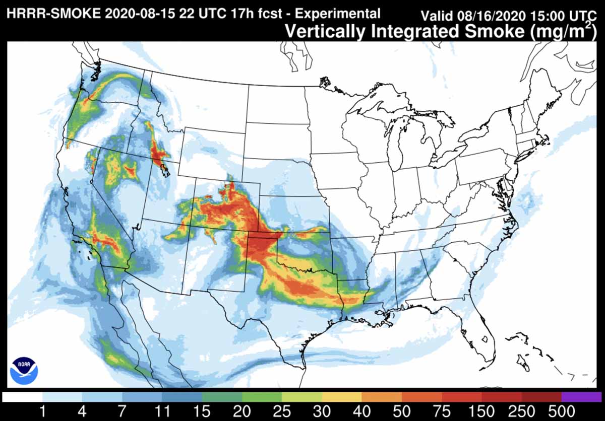
Smoke forecast for 9 a.m. MDT August 16, 2020. NOAA.

The map above is the forecast for the distribution of smoke from wildfires at 9 a.m. MDT August 16, 2020. Locations where it will be most noticeable include areas in Oregon, Washington, Idaho, Nevada, Arizona, New Mexico, Utah, Colorado, Nebraska, Oklahoma, Texas, Louisiana, and southern California.

Four large wildfires keep firefighters in Colorado busy

August 15, 2020 | 10 a.m.

Pine Gulch Fire
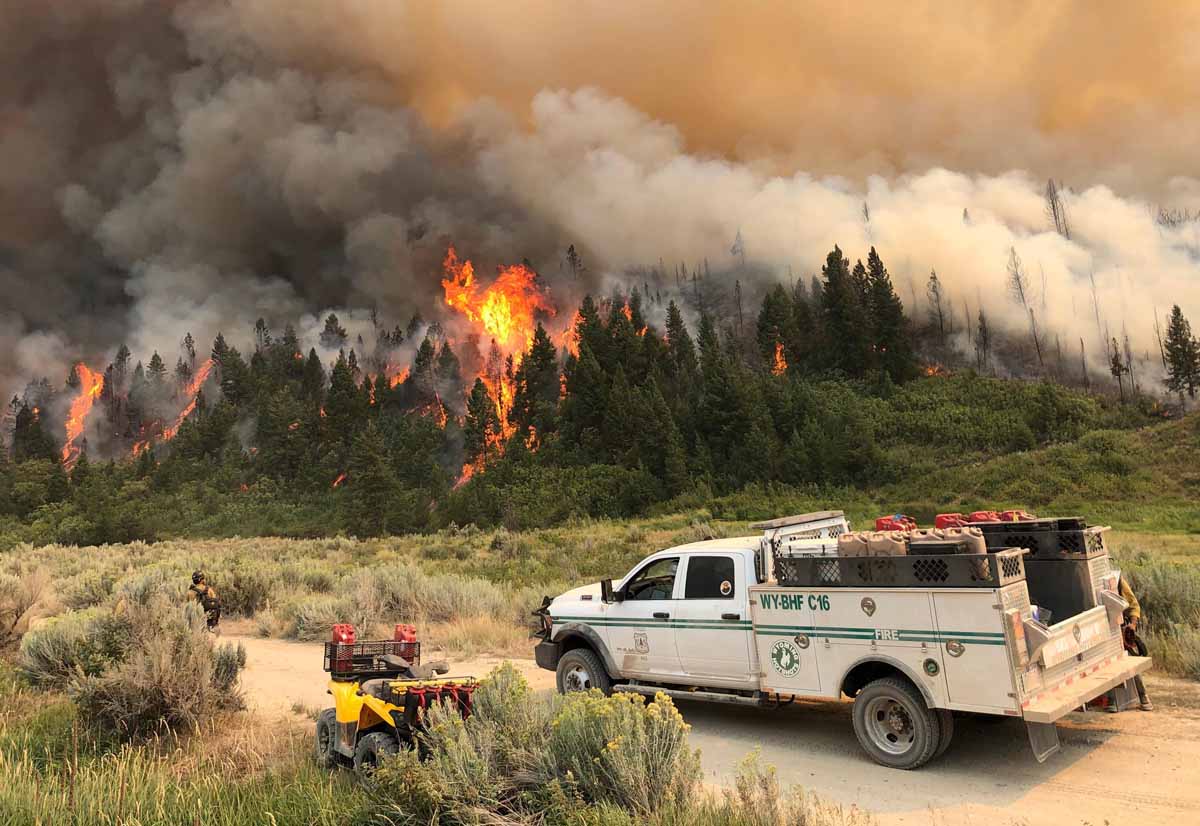
The Wyoming Hotshots on the Pine Gulch Fire August 7, 2020. InciWeb.

A week ago when I was talking with a colleague about the national wildfire situation we agreed there was a “lull” in the action. With new fires in California and Colorado since then, that has changed.

In southern California on August 12 the Lake Fire west of Lancaster grew large enough 29 minutes after it was reported to create pyrocumulus clouds above the smoke column. Three hours later it was 10,000 acres and Friday had blackened at least 17,000 acres.

But much of the focus has turned Colorado where four large fires are out of control.

Map four large wildfires Colorado
Map showing four large wildfires in Colorado, August 15, 2020.

The Pine Gulch Fire 15 miles north of Grand Junction, Colorado at 73,381 acres Saturday became the fourth largest fire in the recorded history of the state. The Rocky Mountain Type 1 Incident Management Team with Dan Dallas as Incident Commander assumed command of the Friday morning after transitioning with the type 2 team.

Pine Gulch Fire fourth largest Colorado

The Grizzly Creek Fire just east of Glenwood Springs has been adding thousands of acres every day since it started August 10. Interstate 70 has been closed since then due to the fire.

More information about the Grizzly Creek Fire on Wildfire Today.

Grizzly Creek Fire
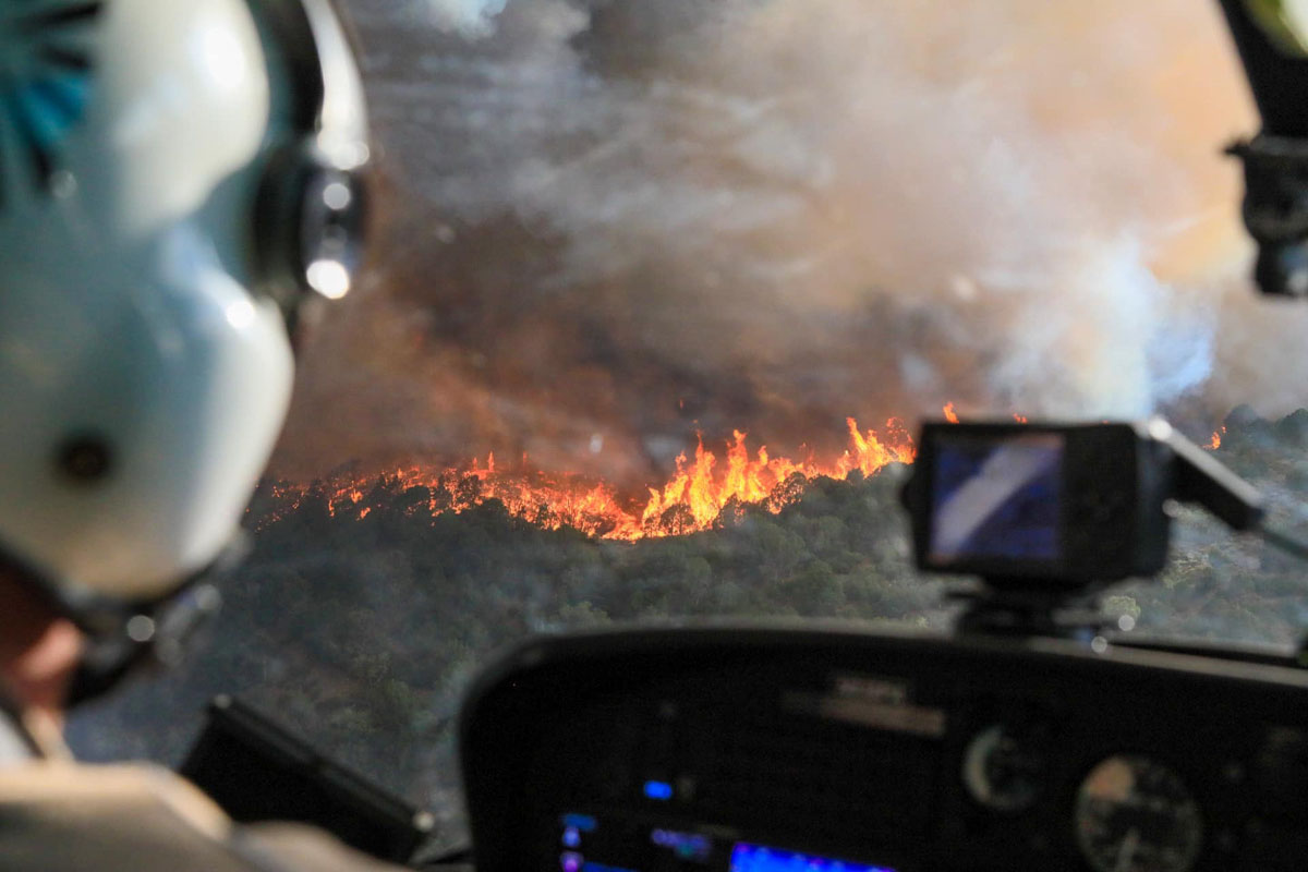
View of the Grizzly Creek Fire from a helicopter August 14, 2020. InciWeb.

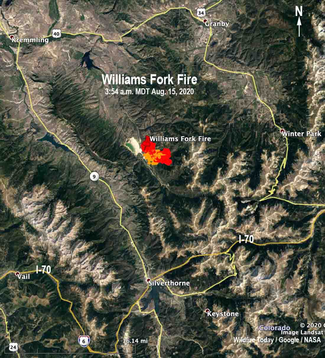
The newest of the four large fires in Colorado is the Williams Fork Fire 10 air miles southeast of Williams Fork Reservoir and 19 miles southeast of Kremmling reported just before noon Friday August 14. Firefighters estimated Friday night it was 1,300 acres and said it is exhibiting extreme fire behavior as it moves east and northeast toward Church Park. The fire is currently holding east of CR 30 and south of Keyser Creek in an area with intensive beetle kill from the early 2000s. Henderson Mill and its infrastructure along with multiple other utilities are in the immediate area.

map Williams Fork Fire
Map showing heat on the Williams Fork Fire detected by a satellite at 3:54 a.m. MDT August 15.

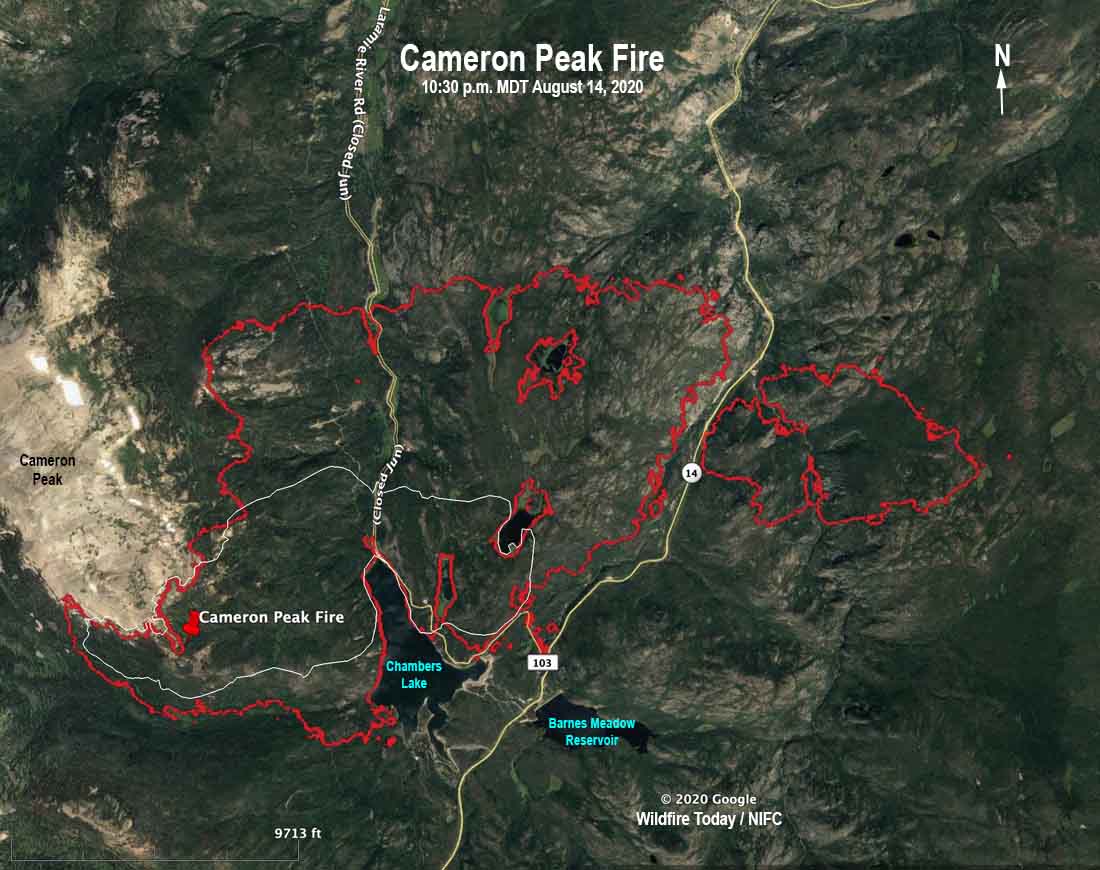
The Cameron Peak Fire has been burning since August 13 in the Rawah Wilderness on the Arapaho & Roosevelt National Forests near Highway 14 and Chambers Lake. It is 36 air miles west of Fort Collins, Colorado and as of Friday night had burned about 5,424 acres. Mike Haydon’s Type 2 Rocky Mountain Incident Management Team Blue will assume command today, August 15. The Cameron Peak Fire started west of Chambers Lake and has crossed Highway 14 to the east, burning nearly 800 acres on the south side of the highway.

To see all articles on Wildfire Today about the Cameron Peak Fire including the most recent, click here.

Cameron Peak Fire map
The red line was the perimeter of the Cameron Peak Fire at 10:30 p.m. MDT August 14, 2020. The white line was the perimeter about 24 hours before.

Grizzly Fire near Glenwood Springs continues to spread along Interstate 70

It has grown to over 25,000 acres

August 16, 2020  |  10:35 a.m. MDT

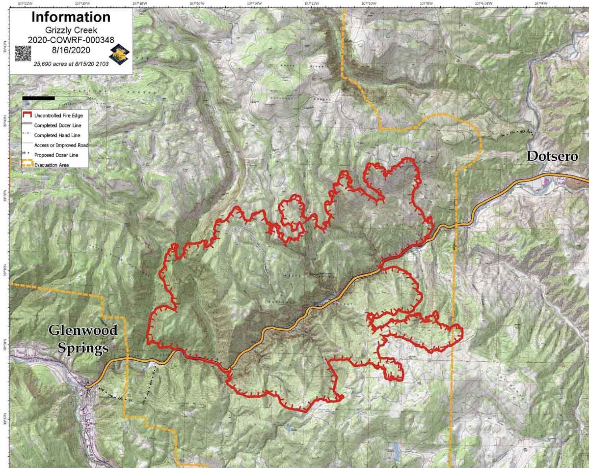
Grizzly Creek Fire Map, 9:02 p.m. MDT August 15, 2020
Map of the Grizzly Creek Fire, current at 9:02 p.m. MDT August 15, 2020. Incident Management Team.

The Grizzly Creek Fire burning on both sides of Interstate 70 east of Glenwood Springs grew by more than 6,000 acres Saturday to bring the total size up to 25,690 acres.

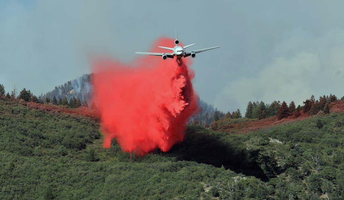
DC-10 air tanker dropping Grizzly Creek Fire Colorado Glenwood Springs
DC-10 dropping on the northwest side of the Grizzly Creek Fire August 14, 2020. InciWeb.

Resources that were assigned to the fire Saturday evening included 13 hand crews, 32 engines, and 13 helicopters for a total of 625 personnel. That was an increase of 72 people over the day before.

For a 25,690-acre fire that started six days ago and has closed a major Interstate highway for that entire time, this is not a huge commitment of hardware and firefighters on a full-suppression fire threatening 1,162 structures. It is difficult to compare fires without worrying about apples vs. oranges, but Saturday an 11,000-acre wilderness fire in remote northern California, the Red Salmon Complex, had 24 hand crews, 36 engines, and 14 helicopters for a total of 1,281 personnel. That was a decrease of 209 people over the day before. The Red Salmon Complex was reported on July 27 and has had more time to develop the organization.

“We have not had problems getting the resources that we need,” said Mary Cernicek, an information officer for the fire’s Incident Management Team.”

Three structures have been destroyed. At least two of those were outbuildings and the third was described as a “small structure”.

The plan developed by the Incident Management Team is for hotshot and engine crews to continue to establish structure protection measures and plans for additional subdivisions and dispersed holdings that may be impacted. Hand crews will establish indirect lines for future control operations in accessible terrain where exposure risks have been mitigated. Heavy equipment will establish indirect lines on the north and south sides of the fire.

The typical COVID-19 precautions and procedures for a fire are in place on the Grizzly Creek Fire, including those for operational period briefings. “The morning briefings are virtual, so we only have the presenters attend those and the rest attend virtually or over the radio,” said Ms. Cernicek.

The estimated cost to date is $6.3 million.


August 15, 2020 | 7 a.m. MDT

Grizzly Creek Fire air tanker
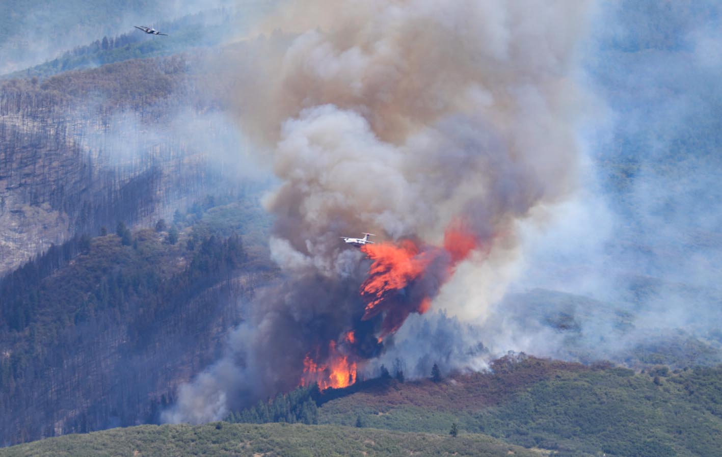
A lead plane exits the drop area as an RJ85 air tanker applies retardant on the southeast side of the Grizzly Creek Fire August 13, 2020. InciWeb.

The Grizzly Fire east of Glenwood Springs, Colorado spread to the north, east, and south Friday, adding another 6,000 acres to bring the total up to 19,440.

Firefighters were able to confirm that the immediate area around Hanging Lake which was overrun by the fire Thursday did not burn, but there was still fire in nearby. For locals, the lake is a very beautiful and special landmark.

To see all articles on Wildfire Today about the Grizzly Creek Fire, including the most recent, click here.

The fire has forced the closure of a 57-mile section of Interstate 70 for five days; there is no estimate for reopening.

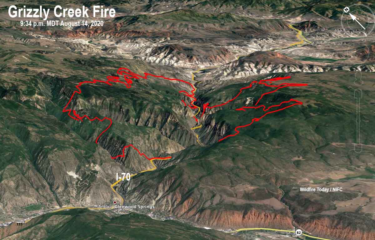
Map Grizzly Creek Fire August 14, 2020 3-D
3-D Map of the Grizzly Creek Fire looking northeast. The red line was the perimeter at 9:34 p.m. MDT August 14, 2020.
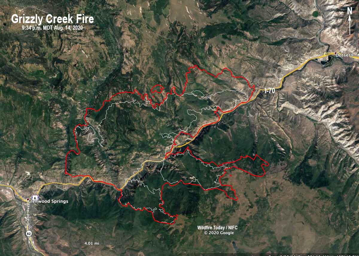
Map Grizzly Creek Fire August 14, 2020
Map of the Grizzly Creek Fire. The red line was the perimeter at 9:34 p.m. MDT August 14, 2020. The white line was the perimeter about 24 hours before.
Grizzly Creek Fire
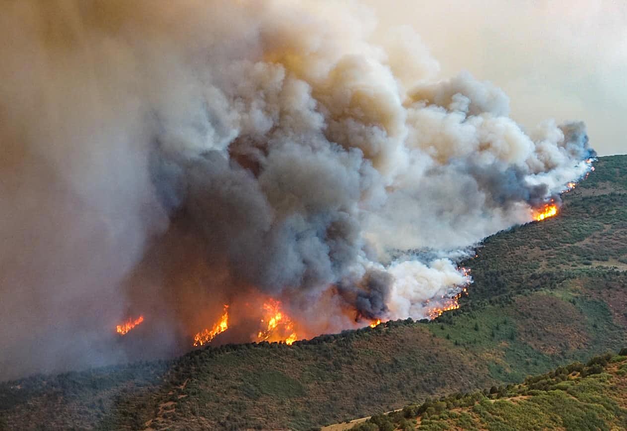
Grizzly Creek Fire August 13, 2020. InciWeb.
Grizzly Creek Fire air tanker
A lead plane exits the drop area as an RJ85 air tanker applies retardant on the southeast side of the Grizzly Creek Fire August 13, 2020. InciWeb.
Grizzly Creek Fire air tanker
A DC-10 air tanker makes a downhill retardant drop on the northwest side of the Grizzly Creek Fire, August 13, 2020. InciWeb.