Two large fires north of Grand Canyon allowed to spread within predetermined boundaries

The Ikes and Castle Fires have burned a total of almost 23,000 acres

Ikes Fire Arizona
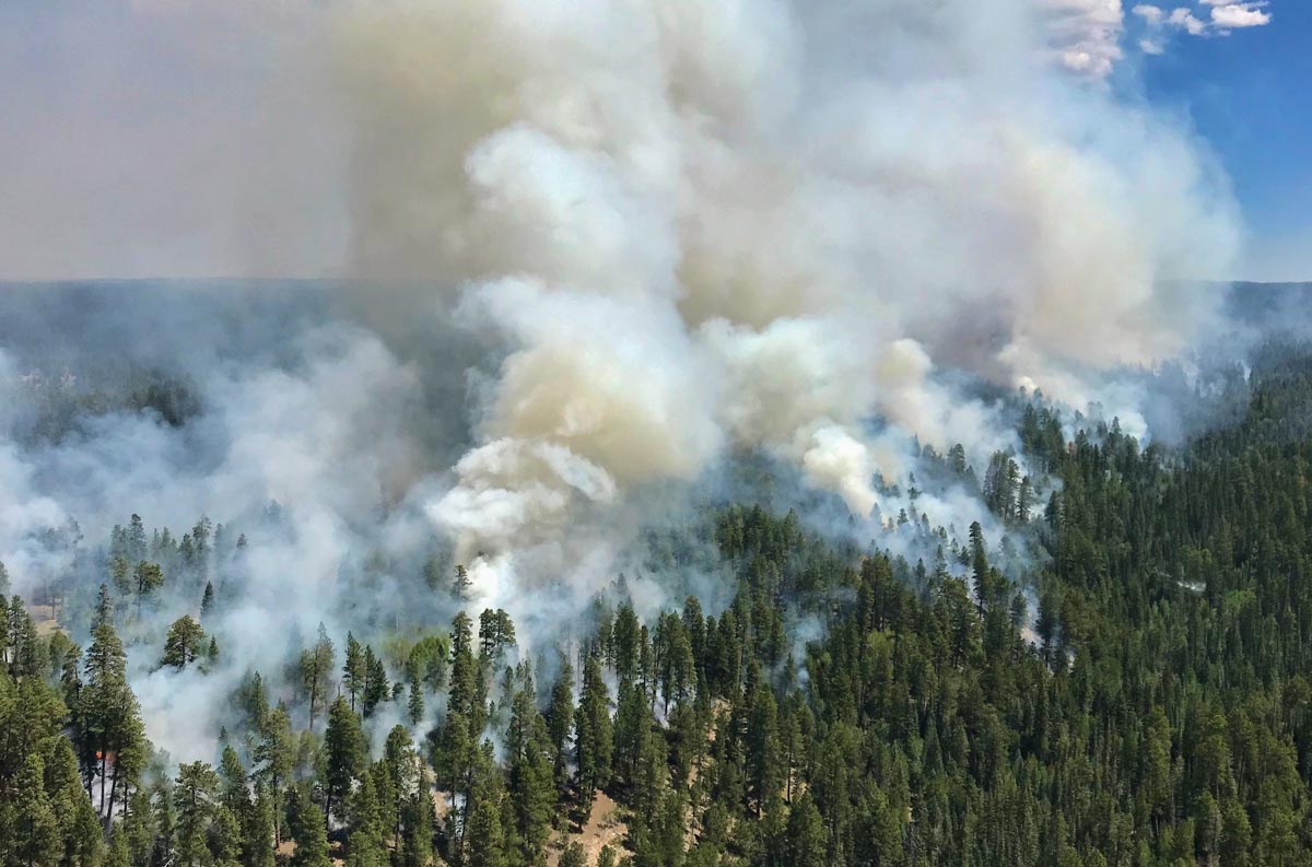
Aerial view of the Ikes Fire, August 15, 2019. Paul Lemmon photo.

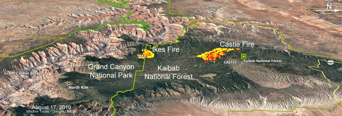
Two wildland fires on lands managed by federal agencies north of the Grand Canyon have burned a total of almost 23,000 acres. Both fires, burning at about 8,000 feet above sea level, are being allowed to spread within predetermined boundaries in order to benefit the natural resources. (see map below)

The largest blaze, the Castle Fire on the Kaibab National Forest, has burned through 96 percent of the 19,368-acre planning area, consuming a significant amount of dead and down trees and some mixed conifer species. As expected with strong gusty winds on Friday, it became more active moving into pockets of unburned piñon-juniper and mixed conifer. The fire slowed once reaching confinement lines. A total of 32 personnel are assigned, which includes 4 fire engine crews. The estimated cost to date is $4.6 million.
map Castle and Ikes Fires Arizona
3-D map (looking west) showing the locations of the Castle and Ikes Fires north of the Grand Canyon in Arizona. Data from August 17, 2019 at 3:30 a.m.

The 3,500-acre Ikes Fire is burning in Grand Canyon National Park and the Kaibab National Forest. It has spread across 42 percent of the 7,785-acre planning area, with low to moderate fire behavior being observed. Firefighting resources assigned include 1 hand crew, 7 fire engines, and 1 helicopter for a total of 88 personnel. On Friday gusty winds prevented firefighters from carrying out firing operations. Crews patrolled the perimeter on the northeast and eastern portions of the fire while other personnel continued to prep the west side of Forest Service Road 223. Observed fire behavior was active, with backing fire along ridge tops and single tree torching. The estimated cost to date is $1 million.

The predicted weather for the weekend is warm, very dry conditions with temperatures about 5 degrees above average. Gusty west to southwest breezes are predicted for Saturday afternoon with light drainage winds overnight.
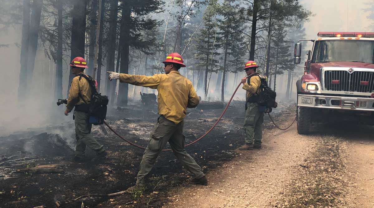
Firefighters Arizona Castle Fire
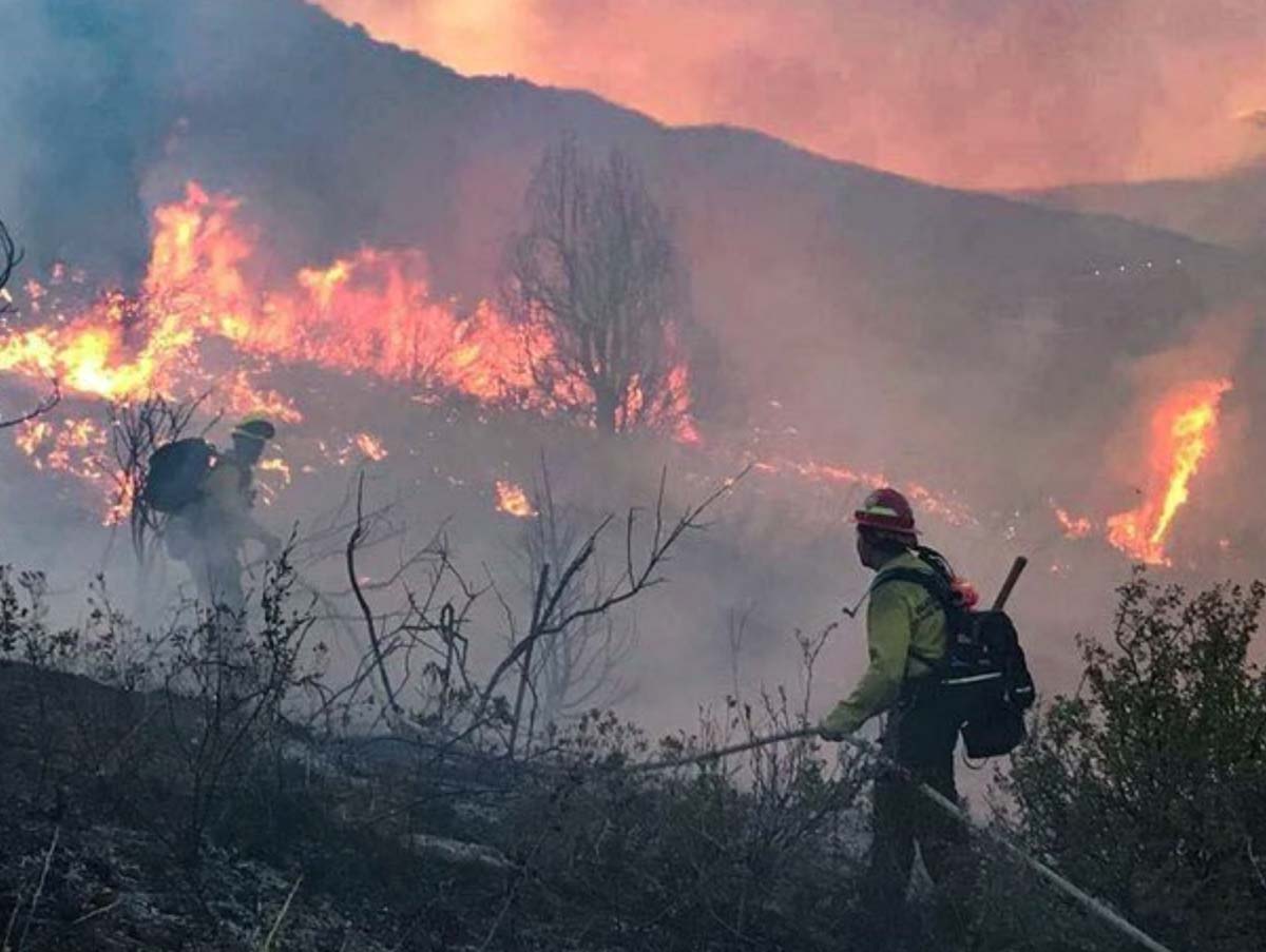
Firefighters on the Castle Fire. Photo by Jackie Banks for the Kaibab National Forest July 19, 2019.

Defense Department to use artificial intelligence to help map wildfires

Posted on Categories Uncategorized
Cold Fire
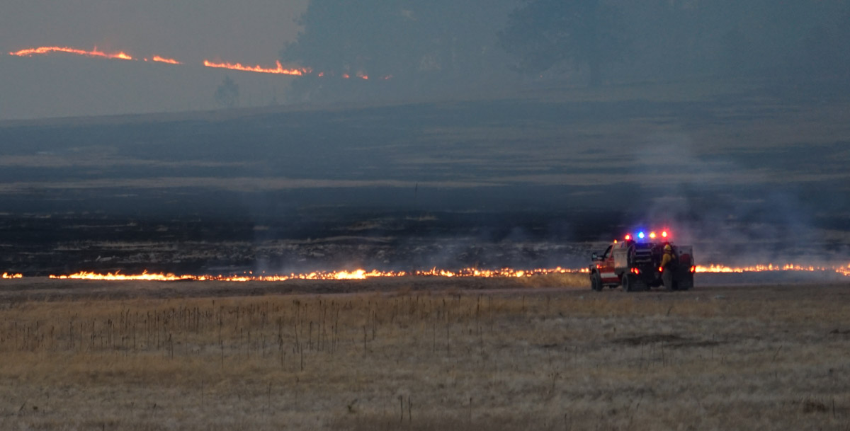
An engine holds the Cold Fire at a road, April 2, 2016. South Dakota. Photo by Bill Gabbert.

The Defense Department’s Joint Artificial Intelligence Center plans to use their sensor and automation capabilities to help provide intelligence about ongoing wildfires.

Below is an excerpt from an article at Nextgov.com:

…Defense has troves of sensor data, digital video data, digital infrared data and sonar data—all of which are attractive environments for machine-learning algorithms. Through this disaster-relief initiative, the agency plans to fly airborne sensors over wildfires in California and collect full-motion video data of the activity. At the same time, they are going to be automatically using a computer vision algorithm to detect which frames of the video have active wildfire.

Typically, the Federal Emergency Management Agency and other disaster-relief entities try to disseminate maps of the fire to all relevant organizations involved in the efforts once per day.

“We believe we will be able to cut that to about once per hour distributed over an app,” Allen said. “By switching to this airborne sensor, applying an AI computer vision algorithm and converting that to geolocation data that is useful for a map application we are also developing, we’ll really be able to make an impact for our users in a short time frame.”

The agency expect to begin testing this capability within the next few months with the National Guard.

The article did not specify how the intelligence would be collected, such as by satellites, fixed wing aircraft, or Unmanned Aerial Systems.

California sends firefighters into Mexico to battle wildfire near border

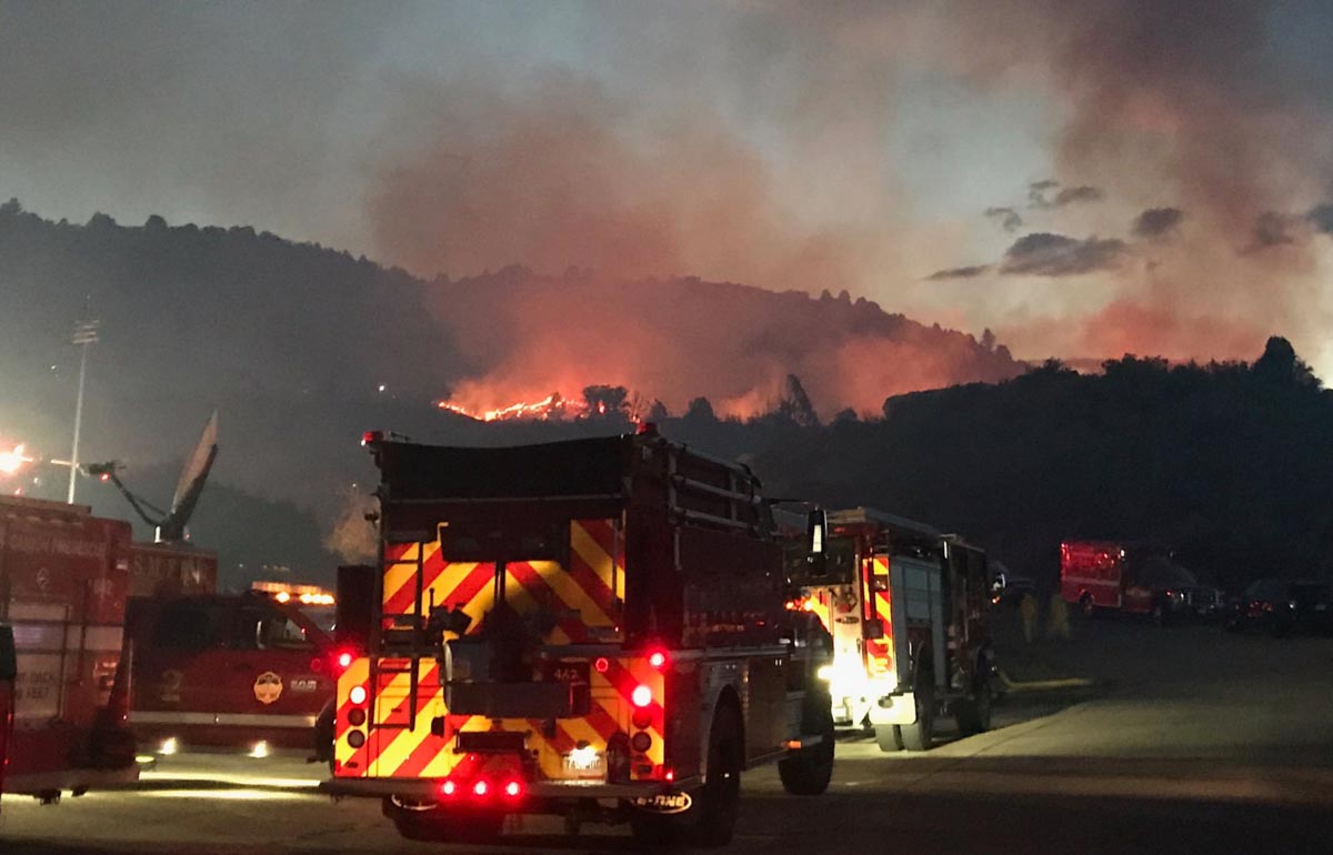
CAL FIRE engines cross border into Mexico
CAL FIRE engines cross the border into Mexico to assist firefighters in the suppression of a wildfire west of Tecate, Mexico. CAL FIRE photo.

The California Department of Forestry and Fire Protection (CAL FIRE) has mobilized a strike team of fire engines to cross the international border in order to help firefighters in Mexico. They will be assisting in the suppression of the Border 8 Fire that has burned 1,500 acres very close to the border just west of Tecate, Mexico 23 miles southeast of San Diego.

The fire is a threat to cross the border in an area of the United States with steep topography and limited access. Keeping it from crossing the border would be the preferred option, rather than having to suppress a much larger fire in difficult terrain on the U.S. side.

The fire has been spreading to the east, generally toward the city of Tecate which has a population of 102,000 in its metropolitan area.

Air tankers have been dropping retardant in a few selected locations north of the border off and on since the fire started August 14, including S2T and C-130 aircraft from bases at Ramona and Hemet, California.

Border Fire Mexico United States California
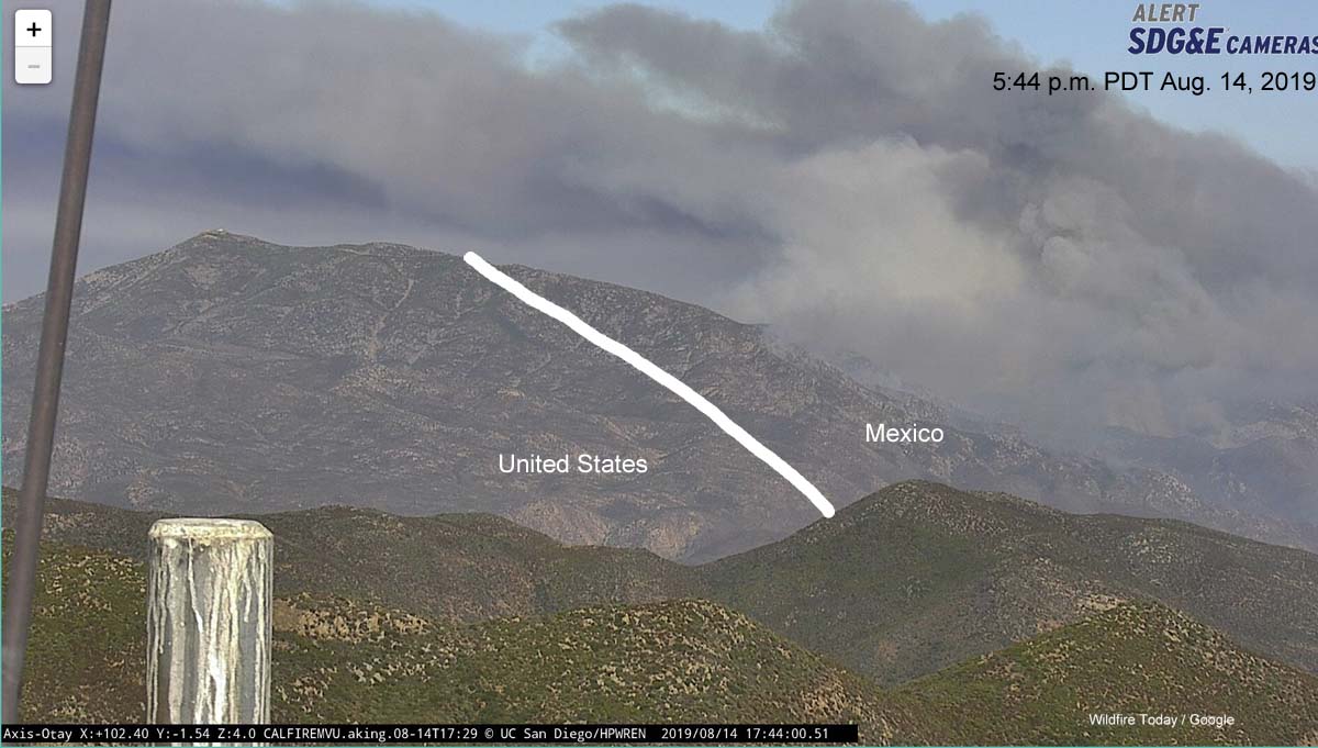
Photo from Otay Mountain showing the Border Fire at 5:44 p.m. PDT August 14, 2019, and the approximate location of the international border (white line).

CAL FIRE may decide to activate the unstaffed air tanker base at Brown Field Municipal Airport which is 1.6 miles north of the border and about 16 miles west of this fire. It is 31 miles south of the Ramona air tanker base and has a 7,972-foot runway which according to information from the USFS “provides ample length to meet safe takeoff requirements for the size and weight of a Next Generation Air Tanker with a full payload”. The runway at Ramona is too short to handle many of the large air tankers. The tanker base at Hemet, which also has a relatively short runway, is 80 miles north of the fire.

The fire can be seen via cameras here and here.

Fire southwest of Denver causes evacuations

Deer Creek Canyon Park Fire Colorado
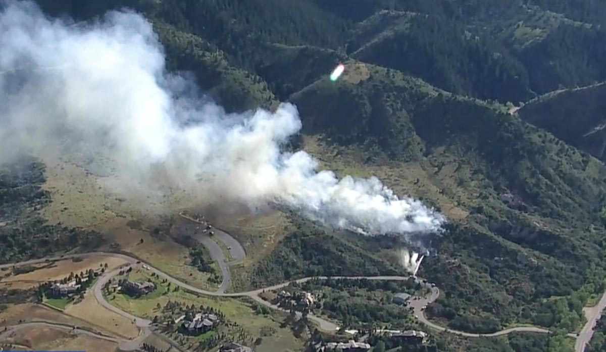
Screenshot from the ABC7 video below of the Deer Creek Canyon Park Fire southwest of Denver.

A wildfire that broke out Thursday at 4:30 p.m MDT caused evacuations to be ordered southwest of Denver. It was named “Deer Creek Canyon Park Fire” after the park by the same name. The fire appeared to have ignited about 250 feet south of a fire station for the Inter-Canyon Fire Protection District along Grizzly Drive south of 124. (see map below)

The video below shows the fire burning with a slow rate of spread through heavy brush, but it slowed even more when reaching grassy areas that still had a green component.

The closest structures that were affected by the evacuation are very large homes, most but not all with defensible space. Stacy Martin, Public Information Officer for the fire, said Friday at 9 a.m. that no residents took advantage of the designated evacuation shelters. The evacuation was still in effect Friday at 9 a.m. but she said fire officials hope to rescind the order “soon”.

Overnight the relative humidity rose to over 80 percent which along with a wind shift dampened the spread of the fire.

map Deer Creek Canyon Park Fire Colorado
Map showing the location of the Deer Creek Canyon Park Fire.

Ms. Martin said the fire burned an estimated 20 to 25 acres and is surrounded by a hose lay. The 33-minute Denver 7 video below did not record any aircraft working the fire. A helicopter will be available today that flew in from Montrose, Colorado Thursday night. Approximately 130 firefighters have been assigned.

A spokesperson for the Jefferson County Sheriff’s Department said the fire was human-caused, but that just means it was not started by lightning or a volcano. He said an explosion was heard around the time it started and juveniles were seen running in the area.

Deer Creek Canyon Park Fire Colorado
Deer Creek Canyon Park Fire. Photo by Jefferson County Sheriff Office.
Deer Creek Canyon Park Fire Colorado
. Photo by Jefferson County Sheriff Office.

Thanks and a tip of the hat go out to Bean. Typos or errors, report them HERE.

Border Fire threatens to burn from Mexico into U.S.

Border Fire Mexico United States California
Photo from Otay Mountain showing the Border Fire at 5:44 p.m. PDT August 14, 2019, and the approximate location of the international border (white line).

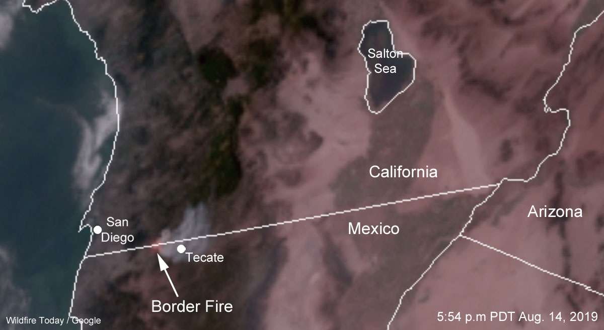
A large wildfire in Mexico west of Tecate is very close to the U.S. border and threatens to burn into California about 23 miles southeast of San Diego. It is spreading to the east, generally toward the city of Tecate which has a population of 102,000 in its metropolitan area.

The California Department of Forestry and Fire Protection, CAL FIRE, is monitoring the situation and has already started moving firefighting resources into the area, including aircraft.

Video from Channel 8 in San Diego showed air tankers, an S2 and a C-130 (T-134), making drops north of the border.

CAL FIRE may decide to activate the unstaffed air tanker base at Brown Field Municipal Airport which is 1.6 miles north of the border and about 16 miles west of this new fire. It is 31 miles south of the Ramona air tanker base and has a 7,972-foot runway which according to information from the USFS “provides ample length to meet safe takeoff requirements for the size and weight of a Next Generation Air Tanker with a full payload”. The runway at Ramona is too short to handle many of the large air tankers.

The fire can be seen via cameras here and here.

Border Fire Mexico United States California
A 3-D map view of the area, looking east from Otay Mountain. The yellow line is the international Border. The area is similar to that seen in the photo from Otay Mountain, at the top of the article.
Border Fire Mexico United States California
Satellite photo showing smoke from the Border Fire at 5:44 p.m. PDT August 14, 2019.

It has been a much slower wildfire season in the continental U.S. so far