A screengrab from a video below illustrating how the number of trees per acre can increase if fires are excluded from an area.
In the first two in a series of 12 videos produced by the Santa Fe National Forest in Northern New Mexico, Fuels Program Manager Dennis Carril discusses the inevitability of vegetation fires and how fuel, standing trees and deep layers of litter, can build up as a result of fire exclusion. Each video is less than three minutes long.
The videos are “unlisted” on YouTube, however they have been promoted on Twitter by @SantafeNF and @DOIWildlandFire.
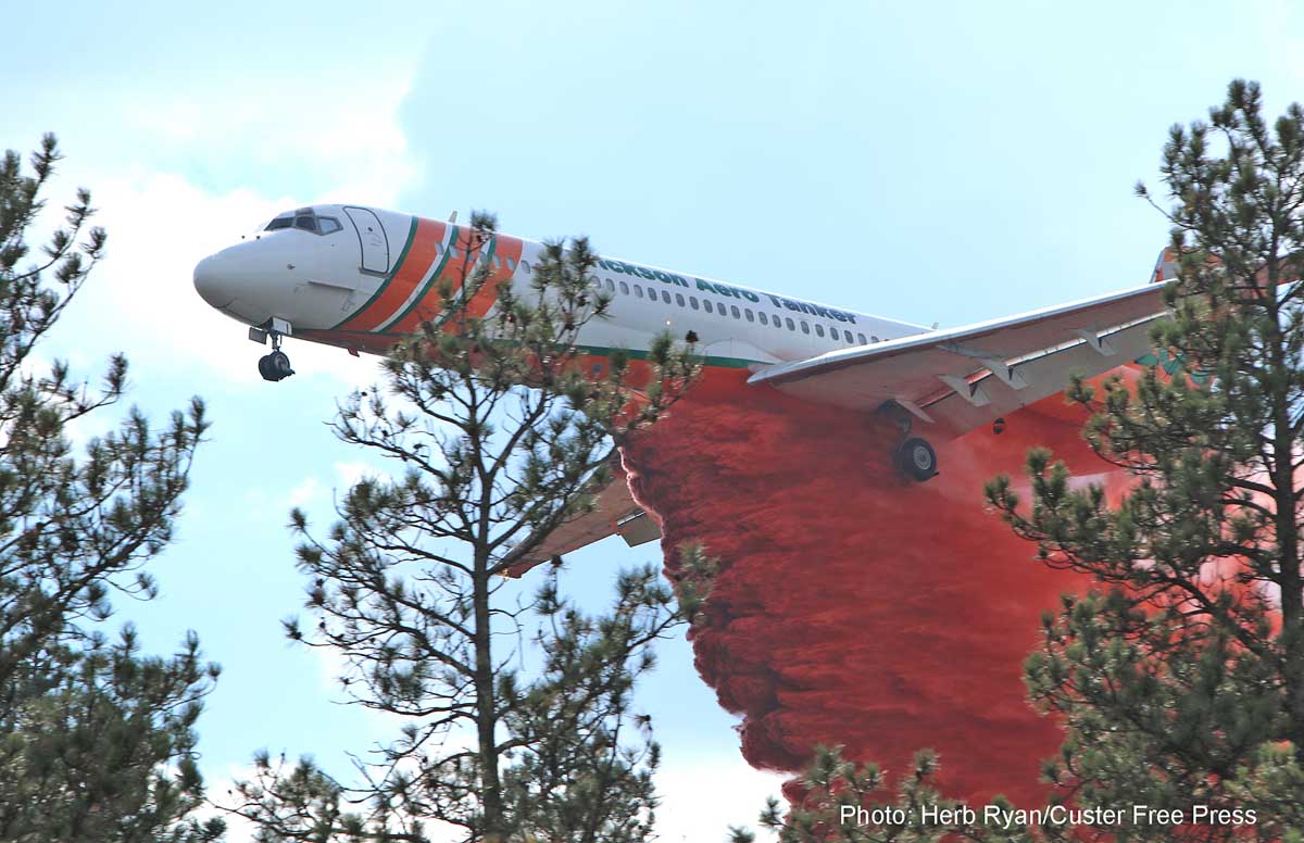
An MD-87, probably Tanker 103, drops on the Beaver Fire west of Wind Cave National Park September 13, 2017. Photo by Herb Ryan used with permission.
The American Chemical Society produced this video that provides some information about how fire retardant, such as the slurry dropped by air tankers, works to slow the spread of a wildfire.
The fire burned 38,008 acres in California and Oregon
Map of the Klamathon Fire, July 7, 2018.
From KTVL:
The man accused of starting the fatal Klamathon Fire in July of 2018 pleaded guilty to all counts Thursday morning in a Siskiyou County courtroom.
John Colin Eagle Skoda, 32, was arrested on August 20, 2018, after a joint investigation between CAL FIRE and the Siskiyou County District Attorney’s Office.
According to Siskiyou County District Attorney Kirk Andrus Skoda was camping when the fire began.
“He lit a fire in a fire ring and the wind took it. He tried to stomp it out and when that didn’t work he called authorities,” Andrus said.
The Klamathon Fire started July 5, 2018, and burned on both sides of Interstate 5 in Northern California and spread across the border into Oregon eventually blackening 38,008 acres . One man was killed, Hornbrook resident John Bermel, 72, who died in his home as the fire swept over the structure.
Firefighter Brandon Feller suffered severe burns when his engine was burned over.
Lightning strikes during the 24-hour period ending at 4:29 a.m. MDT August 2, 2019.
Lightning strikes, above, and accumulated precipitation, below.
Accumulated precipitation during the 72-hour period ending at 4 a.m. MDT August 2, 2019.Dry lightning strikes shown with the degree of dryness, August 1, 2019.
On Friday the Red Flag Warning areas in Washington, Idaho, and southwestern Montana could experience additional lightning with little or no rain.
On August 1 the Predictive Services section at the National Interagency Fire Center issued their Wildland Fire Potential Outlook for August through November. The data represents the cumulative forecasts of the ten Geographic Area Predictive Services Units and the National Predictive Services Unit.
If NIFC’s analysis is correct, areas in Washington, Oregon, Nevada, and California will have elevated potential for wildfires in August and September. With the monsoons moving into the Southwest there are no areas east of those four states that NIFC identified as having high wildfire potential between August and November.
Below:
An excerpt from the NIFC narrative report for the next several months;
More of NIFC’s monthly graphical outlooks;
NOAA’s three-month temperature and precipitation forecasts;
Drought Monitor;
Vegetation greenness map.From NIFC:
“Moderate to severe drought conditions exist across portions of northern Oregon, Washington, northern Idaho and western Montana. However, a recent extended period of cool and periodically moist conditions has lessened the drought stress in the vegetation. Moderate drought has emerged across the northeastern Interior of Alaska and on the Kenai Peninsula. Puerto Rico is also showing developing drought across the southern portion of the island.
“Looking forward, an active but compressed season is expected across the West as the southwestern monsoon becomes more active in August. While this will effectively end the season across the Southwest, lightning-induced fire activity is expected to increase elsewhere. Wind events, which have been largely absent thus far, will increase in frequency by mid to late month as dry frontal passages become a more common occurrence. The occurrence of both wind events and low humidities will influence an increase in fire behavior and growth. Activity in Alaska will continue to diminish as the frequency of frontal passages increases and as temperatures begin to cool. By mid-September the seasonal transition out of the core fire season will be underway as the seasonal transition begins to bring wetting systems to most regions.
“By October and November, however, California will reenter the fire season as Foehn Wind events begin to develop. Concerns this year are higher than average due to the presence of an abundant crop of fine fuels in the lower to middle elevations.”
President Trump offered assistance to Russia with their wildfires in the Siberian arctic
Map showing the location of the Inuvik Fire in Northwest Canada, according to satellite data collected at 10:49 a.m. MDT August 1, 2019.
A wildfire in Canada’s Northwest Territories arctic has burned about 45,000 hectares (112,000 acres) according to the last size estimate by the Northwest Territories Environment and Natural Resources agency. Our very unofficial estimate based on satellite data collected Thursday morning showed that it has increased to approximately 60,000 hectares (150,000 acres).
The fire is burning along the Mackenzie River about 47 miles (77 kilometers) east of Tsiigehtchiceast. Presently there is no threat to that community, officials said. (see map above)
This is happening north of the Arctic Circle, at 67.3 north latitude. The Arctic Circle, which defines the southern boundary of the Arctic, is at 66.5 north latitude. Alaska has also had fires this summer in the Arctic and Russia has had many in the extreme northern latitudes.
President Trump spoke with President Vladimir Putin on Wednesday and offered U.S. help in fighting widespread forest fires raging in parts of Siberia, according to a Kremlin account of the call.
Putin, in response, expressed his “sincere gratitude” to Trump and said that if necessary, he will accept the offer, the Kremlin said on its website.