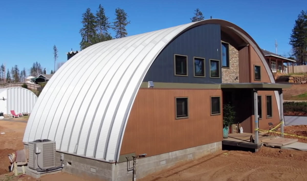
Based on the quonset hut design used extensively by the US military in World War II
A quonset hut style home, via CBS News.
A few of the 13,861 homes destroyed in the Camp Fire are being rebuilt using a particular design that is much more fire resistant than a typical structure. In 2018 the northern California fire burned most of the houses in Paradise after a failure on a Pacific Gas and Electric powerline ignited the blaze that raced through the town, doing much of its damage in just a few hours.
During World War II the US military purchased and installed thousands of quonset huts, a lightweight prefabricated structure of corrugated galvanized steel with a semi-cylindrical cross-section.
Design for a quonset hut style structure, via CBS News.
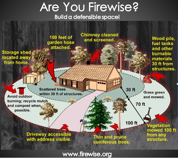
The steel itself is non-combustible of course, and if the rest of the exterior building materials are also, the structure should be very resistant to ignition during a wildfire. But it is important that everything within the home ignition zone is consistent with Firewise principles.
CBS News Sunday Morning produced the video story below of how this quonset hut concept is being used in Paradise.
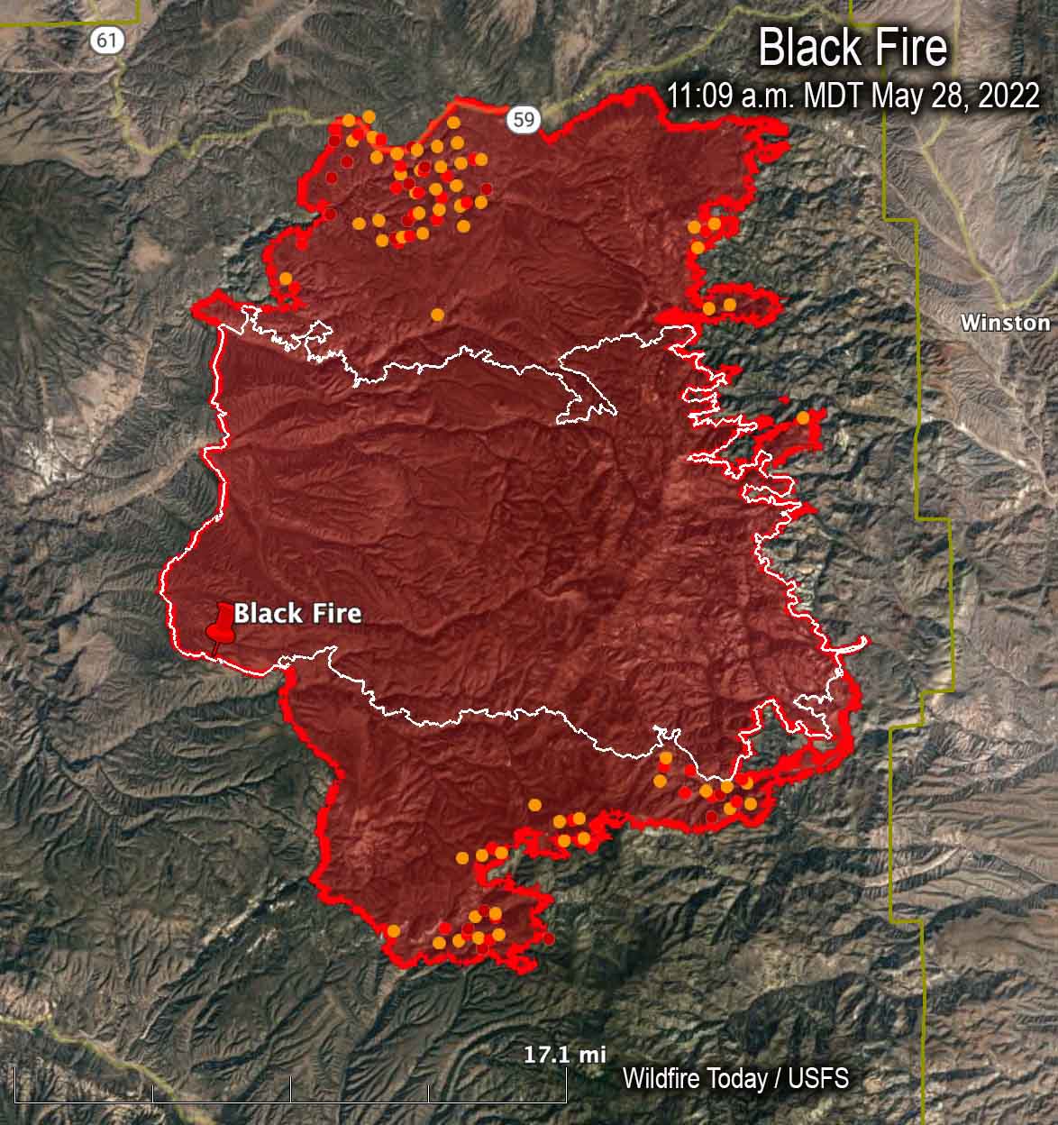
Map of the Black Fire. The red and yellow dots represent heat detected by a satellite as late as 11:09 a.m. MDT May 28, 2022. The red line was the perimeter at the end of the day on May 28. The white line was the perimeter on May 22.
The Black Fire in southwest New Mexico 25 miles west of Truth or Consequences has grown to 228,312 acres. The movement over the last week has mostly been to the north and south.
The fire was active Friday with extended downslope pushes through drainages on the east side of the Divide, additional spread to the south through heavy dead and down fuels, and uphill runs and spotting across containment lines on the northwest flank.
A Red Flag Warning is in effect Sunday for low humidity and winds gusting up to 40 mph.
The firefighters are being led by a Type 2 incident management team, Southwest Team 3. The estimated costs to date are $16,100,000.
Evacuations are still in effect (more information) and one residence has been destroyed.
Resources assigned to the fire Saturday evening included 21 hand crews, 26 engines, and 6 helicopters for a total of 756 personnel.
Map of the Black Fire, May 28, 2022. The black line is contained fire edge. The red line is not contained.
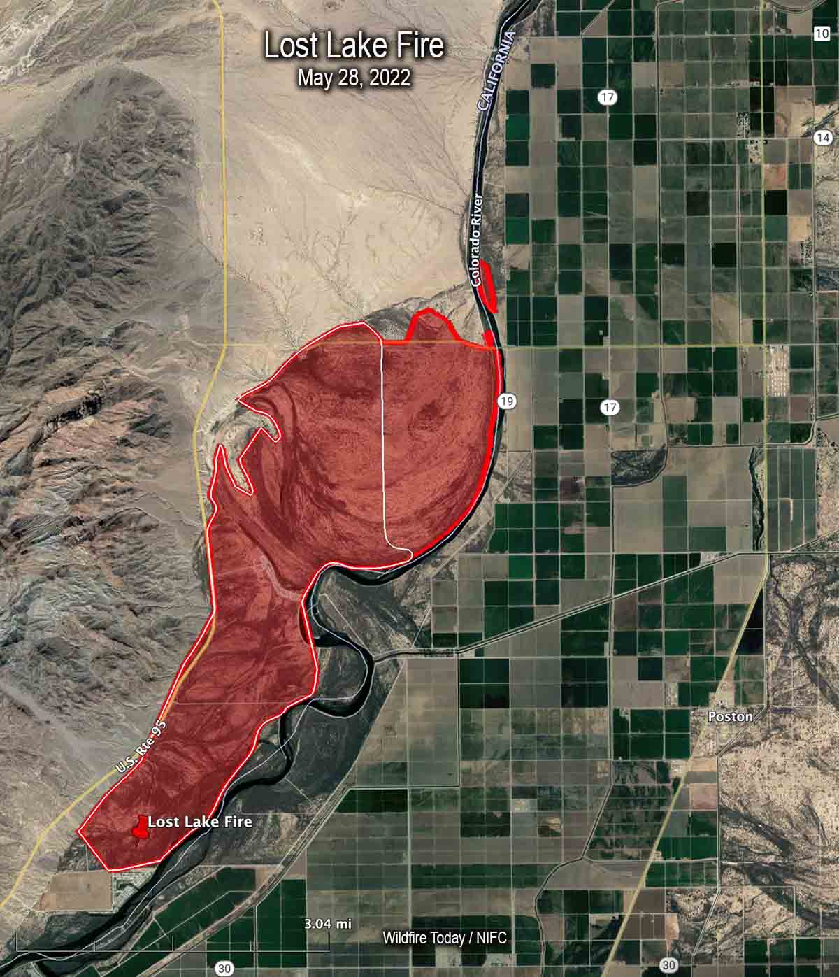
Map of the Lost Lake Fire. The red line was the perimeter late in the afternoon of May 28, 2022. The white line was the perimeter earlier in the day.
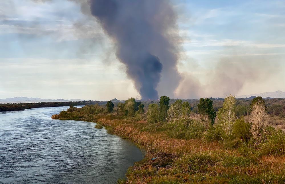
The Lost Lake Fire along the Colorado River on the California/Arizona border was mapped late in the afternoon on Saturday May 28 at about 5,300 acres. At that time about 30 acres had burned on the Arizona side, north of Agnes Wilson Road and west of 19.
Saturday evening resources assigned to the fire included two hand crews, eight fire engines, and one helicopter for a total of 150 personnel.
3:44 p.m. PDT May 28, 2022
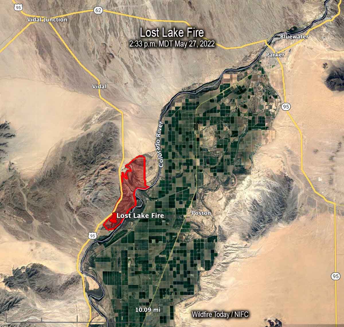
Map of the Lost Lake Fire at 2:33 p.m. PDT May 27, 2022.
The Lost Lake Fire which had been burning in California on the west side of the Colorado River, crossed the river Saturday prompting evacuations of about a dozen homes of the Colorado River Indian Tribes near Poston, Arizona.
It started Thursday morning but strong winds Saturday afternoon caused spot fires on the Arizona side of the river, which is the boundary between the two states.
The blaze is 11 air miles southwest of Parker, AZ and until it crossed the river it was 3 miles west of Poston. Saturday morning it had burned 5,900 acres but the afternoon growth is adding to that total.
Lost Lake Fire. Photo by Incident Management Team.Lost Lake Fire. Photo by Incident Management Team.This appears to be a briefing at the beginning of a shift on the Lost Lake Fire. In case any of the firefighters forget the name of the fire, they have a handy reference.
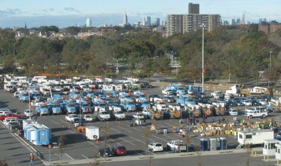
Logistical Staging Area in New York during the response to Hurricane Sandy, November, 2012. Photo by Bill Hahnenberg’s National Incident Management Organization (NIMO) team.
This weekend we are continuing something we started a few weeks ago. Borrowing an idea from The War Zone, this post can serve as the beginning of an open thread where our readers can talk about issues that we have, or have not, gotten into yet. This is literally an off-topic thread.
The usual rules about commenting apply. And remember, no personal attacks, please.
So let’s enjoy a wide-ranging debate!
(Oh, and send us pics of staging areas. Date, location, and photographer’s name would be nice.)
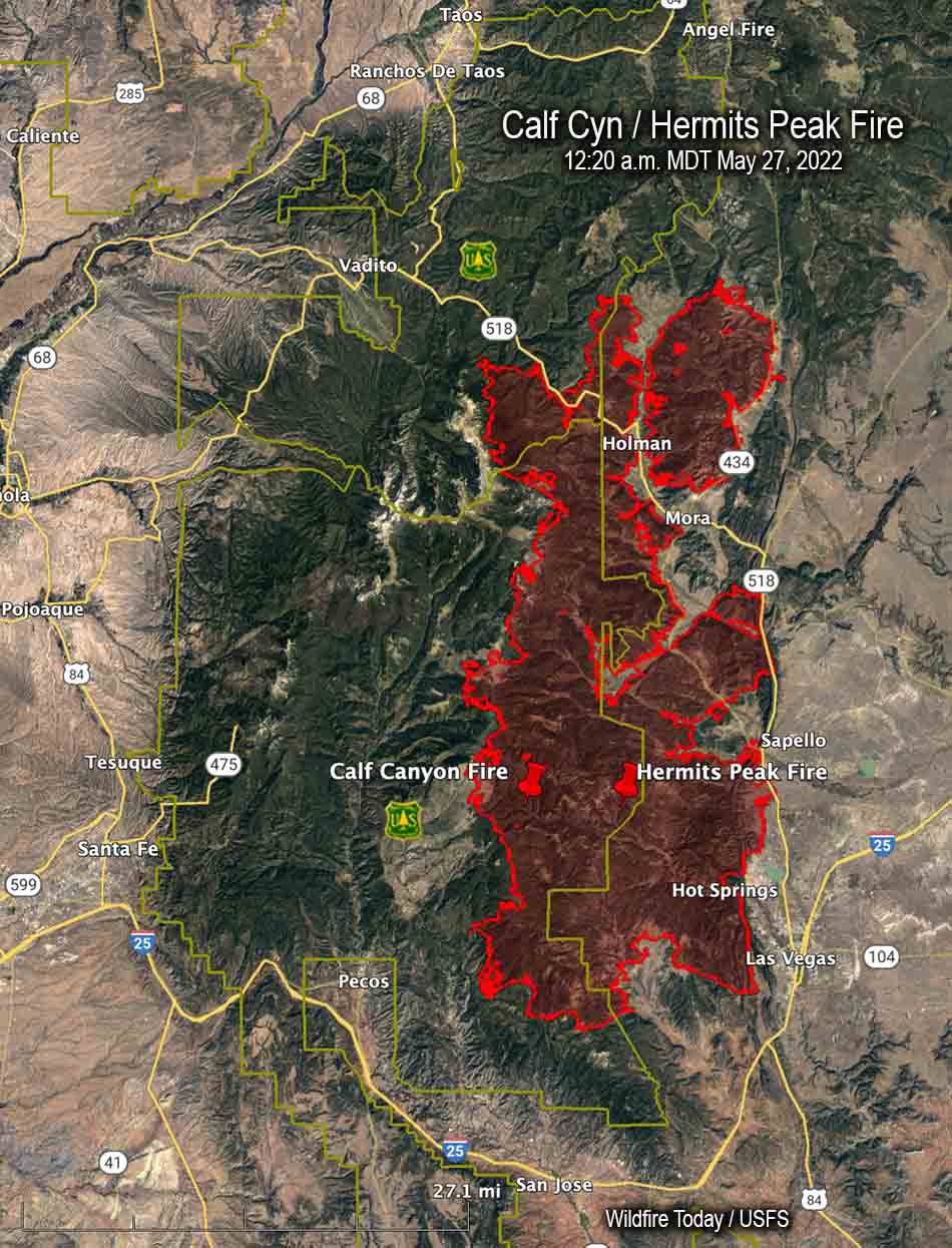
It later merged with the Hermits Peak Fire northwest of Las Vegas, New Mexico
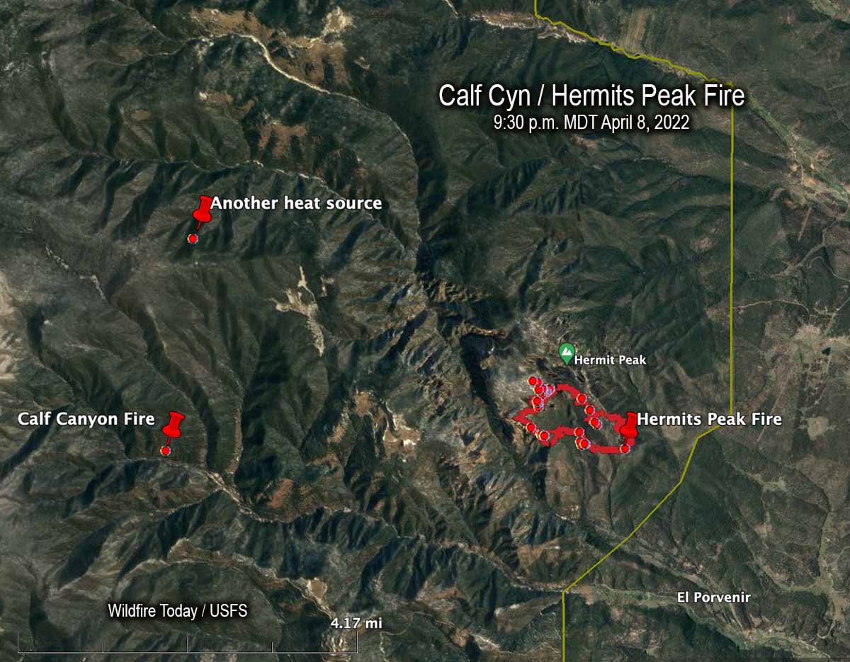
An April 8, 2022 map showing the Calf Canyon Fire before it grew large, another heat source nearby, and the Hermits Peak Fire.
The US Forest Service announced today that the Calf Canyon Fire northwest of Las Vegas, New Mexico was caused by piles that were still burning more than two months after they were ignited near the end of January, 2022. The heat remained after having been at times under snow when it was detected on April 9. The piles were comprised of vegetation and debris remaining after a fuel treatment project.
A statement released by the Santa Fe National Forest indicated that crews constructed a fireline around the 1.5-acre blaze on April 9 and “…continued to monitor the fire over the next couple of days to ensure there were no signs of heat or flames near the edge. Ten days later,” the statement continued, “on April 19 the Calf Canyon Fire reignited and escaped containment lines. A wind event on April 22 caused significant fire spread, and the Calf Canyon Fire merged with the Hermits Peak Fire, which was caused by an escaped prescribed burn.”
The term “reignited” is misleading. The burning piles were never completely put out. Wildfire Today found records showing that on April 8 fixed wing aircraft with thermal heat sensors began mapping the Hermits Peak Fire nearly every night the rest of the month. From imagery on April 8 at 9:30 p.m. MDT the Infrared Analyst noted two small heat sources both about 4 miles from the fire, one to the northwest and another almost due west which later became the Calf Canyon Fire. The heat to the northwest, 2.7 miles north of the Calf Canyon Fire, was not detected in subsequent mapping flights, indicating that it went out on its own or was successfully suppressed by firefighters.
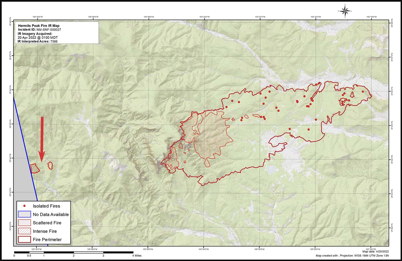
Map of the Calf Canyon and Hermits Peak Fires at 1 a.m. April 20, 2022 by the Incident Management Team. The red arrow, added by Wildfire Today, points to the Calf Canyon Fire which may have spotted, or there was an additional burn pile that spread.
Here are the results, related to what became the Calf Canyon Fire, of the Hermits Peak Fire aerial fire mapping from April 8 through April 21, 2022 (times are CDT):
8 @ 9:30 p.m.: heat noted at the pile burning site
9: (firefighters constructed line around a 1.5-acre fire spreading at the pile burning site)
10 @ 3 a.m.: heat noted
10 @ 10 p.m.: mapping mission unable to be filled (UTF)
11 @ 8:45: heat noted
13 @ 2 a.m.: not noted
13 @ 7:30 p.m.: not noted
14 @ 8:15 p.m.: not noted
15 @ 7:30 p.m.: not noted
16 @ 10 p.m.: UTF
18 @ 1:45 a.m.: not noted
18 @ 10 p.m.: UTF
20 @ 1 a.m.: intense heat noted at two locations at the pile burning site which were separately mapped by the Infrared Analyst. (See the map above. Either the fire spotted about 0.4 miles out ahead, or a second area in the pile burning project began spreading)
21 @ 1:30 a.m.: had grown to about 220 acres; was approximately half a mile wide and one mile long)
It is unknown if the mapping mission each night included the pile burning site four miles west of the Hermits Peak Fire, or if the Infrared Analyst was careful to examine the imagery for small detections of heat at the pile burning site.
After April 20 the Calf Canyon Fire was large and merged with the Hermits Peak Fire on the 22ndwhen both fires blew up. At that time the Hermits Peak fire was nearly contained and had been relatively quiet for several days, but pushed by very strong winds both fires ran 11 miles to the northwest in narrow parallel footprints until the wind speed decreased, allowing the flanks of both fires to spread laterally until they merged. The winds monitored at a weather station that day near Las Vegas, NM recorded sustained speeds of 40 to 50 mph with gusts up to 67 while the relative humidity dropped as low as 6 percent.
“We don’t have enough resources to do everything we want to do at one time so we have to prioritize the resources we have at the right location,” said Incident Commander Carl Schwope in a briefing on April 23.
The two merged fires, both the result of escaped prescribed fires and now called Calf Canyon / Hermits Peak Fire, are now 17 miles wide, 45 miles long, and have burned more than 312,000 acres, about 1/3 the size of Rhode Island. If you were driving from the south end of the fire at Las Vegas, NM on Highway 518 going north, it would take about an hour to reach the north edge of the fire near Angostura.
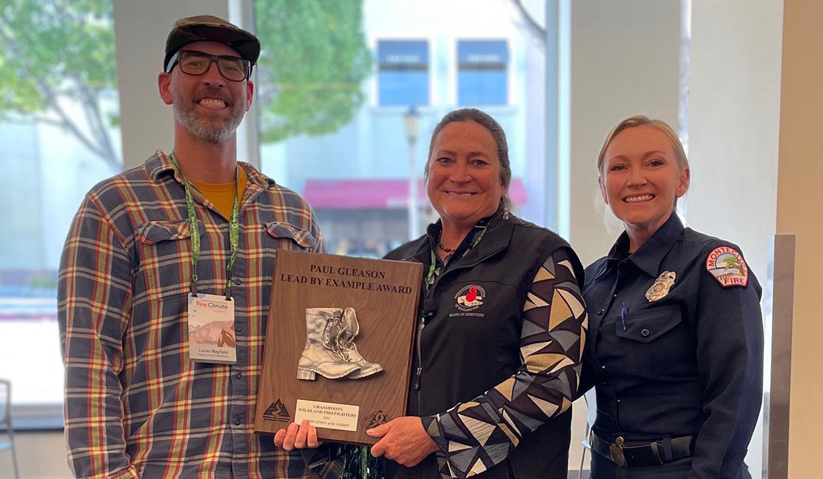
Paul Gleason Lead by Example award for Grassroots Wildland Firefighters. May, 2022. L to R: Lucas Mayfield, VP; Kelly Martin, President; Maeve Juarez, NWCG Leadership Committee.
(From Wildfire Leadership)
Congratulations to Grassroots Wildland Firefighters (GWF) for being selected as one of the recipients for the 2021 Paul Gleason Lead by Example award. Three individuals and one group from across the wildland fire service have been chosen to receive this national award.
The award was created by the NWCG Leadership Committee to remember Paul Gleason’s contributions to the wildland fire service. During a career spanning five decades, Paul was a dedicated student of fire, a teacher of fire, and a leader of firefighters. The intent of this award is to recognize individuals or groups who exhibit this same spirit and who exemplify the wildland fire leadership values and principles. GWF’s work in support of the Wildland Fire Leadership Development Program has been a demonstration of motivation and vision.
The GWF organization is recognized for tirelessly advocating and lobbying legislators and members of the executive branch to create a better system of support for our valued federal firefighting resources. Their advocacy efforts have given a voice and face to the wildland firefighter, highlighting the challenges we face. Through it all, they have remained professional, never seeking credit, relaying simple facts, and respecting federal agencies during briefings and through press releases.
GWF is commended for successful efforts to establish a federal fire series, implement pay improvements, and bring about OWCP reform. These efforts are a welcome relief to a weary federal wildland fire service. Their vision through the Tim Hart Act, if enacted, would dramatically impact the wildland fire service in terms of pay, recruitment/retention, and the health and mental well-being of the federal wildland firefighter.