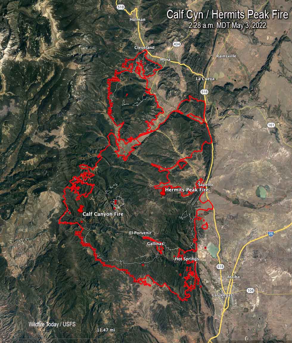
Map of the Calf Canyon / Hermits Peak Fire. The red line was the perimeter at 10:25 p.m. May 2. The white line was the perimeter about 24 hours before. The red dots represent heat detected by a satellite at 2:28 a.m. MDT May 3, 2022.
In spite of satellite photos showing massive amounts of smoke being generated by the Calf Canyon / Hermits Peak Fire, information released by the incident management team indicated that firefighters were able to make progress in several key areas of the fire on Monday. Large firing operations were conducted to widen fire lines and remove fuels ahead of a wind shift that could threaten communities.
The fire grew Monday to 145,854 acres, an increase of about 25,000 acres.
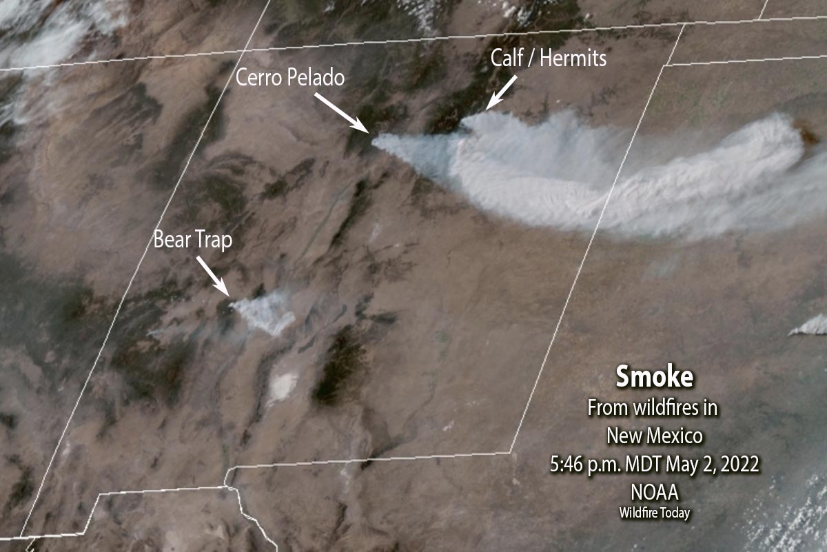
Satellite photo showing smoke created by wildfires in New Mexico, 5:46 p.m. MDT May 2, 2022. NOAA.
In addition to other aircraft, three DC-10 Very Large Air Tankers worked the fire Monday, dropping a total of nearly 28,000 gallons of retardant.
Structure protection crews have been removing fuels around buildings and securing lines around populated areas.
A Red Flag Warning is in effect Tuesday for nearly the entire state of New Mexico. The weather forecast is for 25 mph winds gusting out of the southwest at 37 mph with relative humidity of 12 percent. There is a slight chance of showers in the afternoon. On Wednesday the wind speeds will decrease to 20 mph from the west with the minimum humidity remaining at 12 percent.
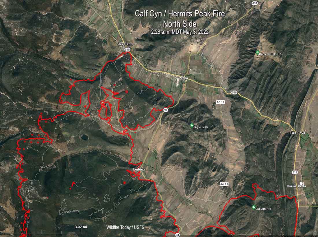
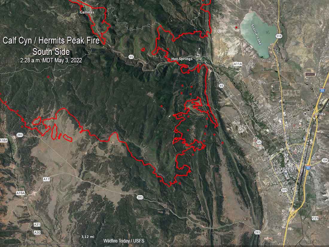
Below are maps of the north and south sides of the Calf Canyon / Hermits Peak Fire.
Map of the north side of the Calf Canyon / Hermits Peak Fire. The red line was the perimeter at 10:25 p.m. May 2. The white line was the perimeter about 24 hours before. The red dots represent heat detected by a satellite at 2:28 a.m. MDT May 3, 2022.Map of the south side of the Calf Canyon / Hermits Peak Fire. The red line was the perimeter at 10:25 p.m. May 2. The white line was the perimeter about 24 hours before. The red dots represent heat detected by a satellite at 2:28 a.m. MDT May 3, 2022.
Resources assigned Monday evening included 20 hand crews, 14 helicopters, and 89 fire engines for a total of 1,085 personnel.
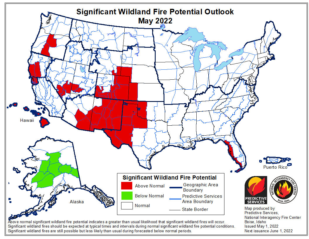
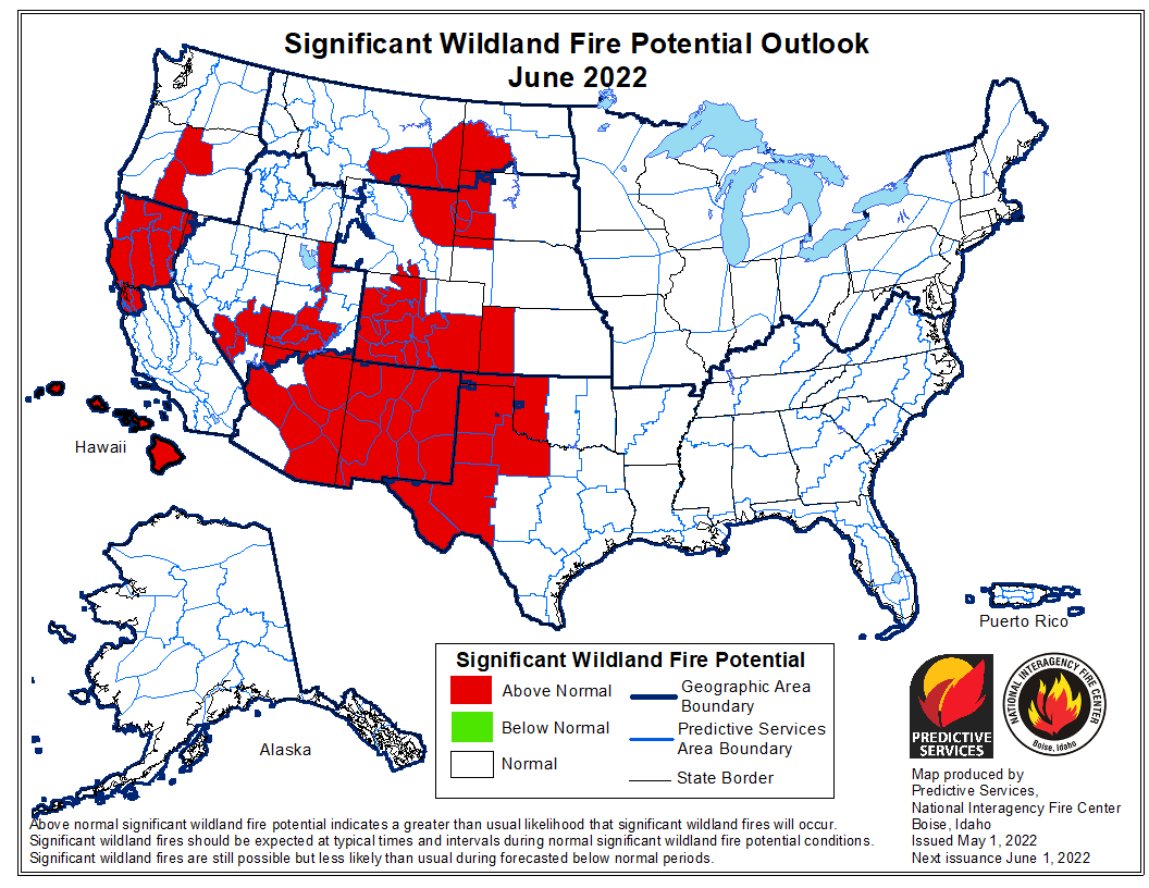
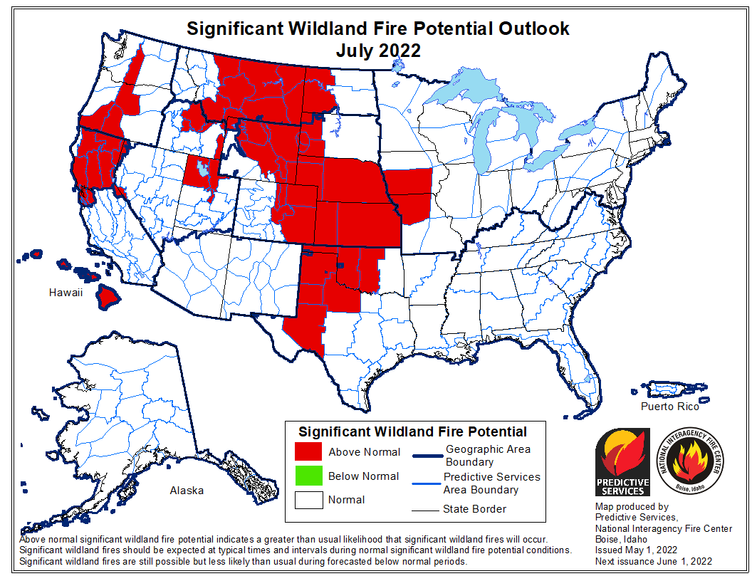
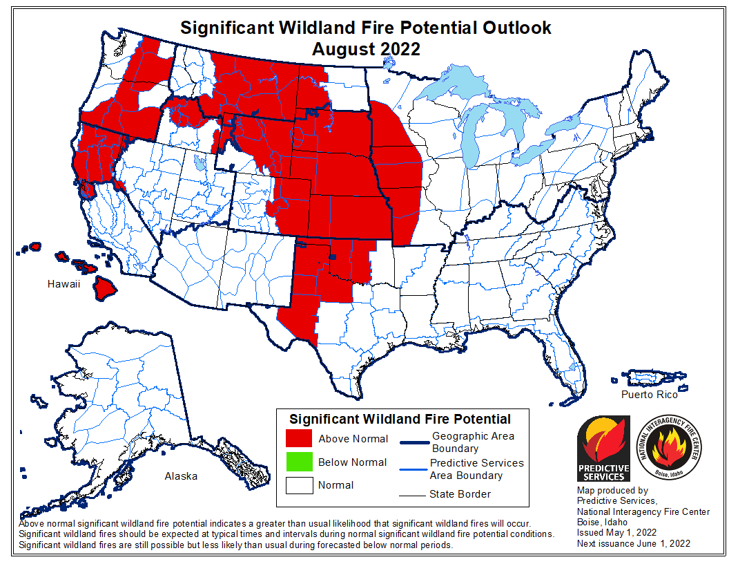
The forecast for wildland fire potential issued May 1 by the National Interagency Fire Center predicts that in July and August the wildland fire potential will be above normal in the Great Plains, Rocky Mountains, and the Northwest. Until then, in May and June it will be above average in the Southwest, Northern California, Central Oregon, and the Central and Southern Plains. Hawaii will be above normal for the entire May through August period, and Alaska will be in the normal range except in May when the central part of the state will be below normal. Most of the eastern half of the country is expected to be in the normal range through August.
The fire potential text and maps from NIFC shown here represents the cumulative forecasts of the ten Geographic Area Predictive Services Units and the National Predictive Services Unit. Additional graphics are included from other sources.
Below:
Excerpts from the NIFC narrative report for the next four months;
Additional NIFC monthly graphical outlooks;
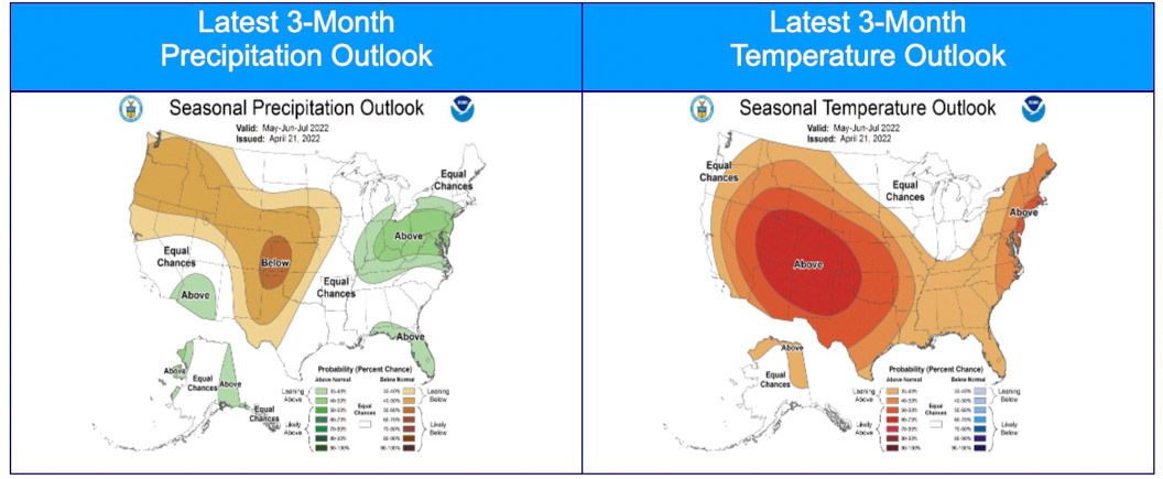
NOAA’s three-month temperature and precipitation forecasts;
Drought Monitor;
Keetch-Byram Drought Index;
Soil moisture.
“Most of the West, Plains, and Texas remain in drought, with areas of drought also along the Gulf Coast and South Florida. Temperatures were above normal across the Southwest into Texas with below normal temperatures across much of the northern US. Below normal precipitation continued in the Southwest into the central and southern Plains. Snowpack continued to rapidly melt in the Southwest, with the below normal snowpack in the Northwest and Rockies melting off at a slow rate.
“Climate outlooks indicate below normal precipitation is likely across much of the Plains west through the central Rockies to the Northwest, with above normal temperatures likely across much of the contiguous US (CONUS) through spring into summer. Critically windy and dry periods are likely to continue through June for the Southwest and central and southern High Plains with an active severe weather pattern to the east over the eastern Plains and Ohio Valley. The North American Monsoon is likely to arrive on time and be robust this summer, but potential early moisture surges during June could result in periods of lightning across the Southwest, Colorado, and the southern Great Basin.
“Above normal significant fire potential is forecast across the western Florida peninsula in May. The southern High Plains will retain above normal significant fire potential through August, with much of the Plains forecast to have above normal potential by July and spread into the western Mid-Mississippi Valley in August after green-up and subsequent curing occurs due to anticipated warmer and drier than normal conditions.
“Most of the Southwest is forecast to have above normal significant fire potential in May and June, with potential increasing across southern and western Colorado and southern portions of the Great Basin before returning to normal in July. Above normal potential will likely expand from central Oregon to southwest Oregon and central Washington by July and much of the Northwest in August. Above normal significant fire potential is also forecast to increase across northern California from May into July, with rising potential likely along portions of the Sierra Front. Alaska is forecast to have below normal potential across the Interior in May, returning to normal in June. Leeward locations of Hawaii are forecast to have above normal potential during June and July.”
Three-month precipitation and temperature outlook, May through July, 2022. Created April 21, 2022.
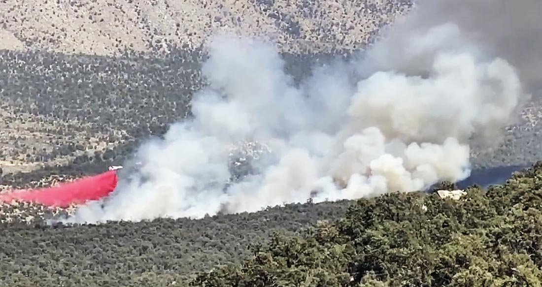
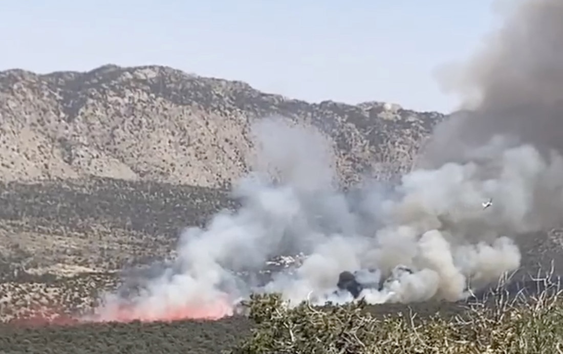
S-2T air tanker drops on the Cactus Fire, April 30, 2022. @BrookesLori.
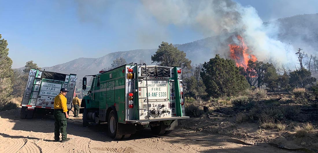
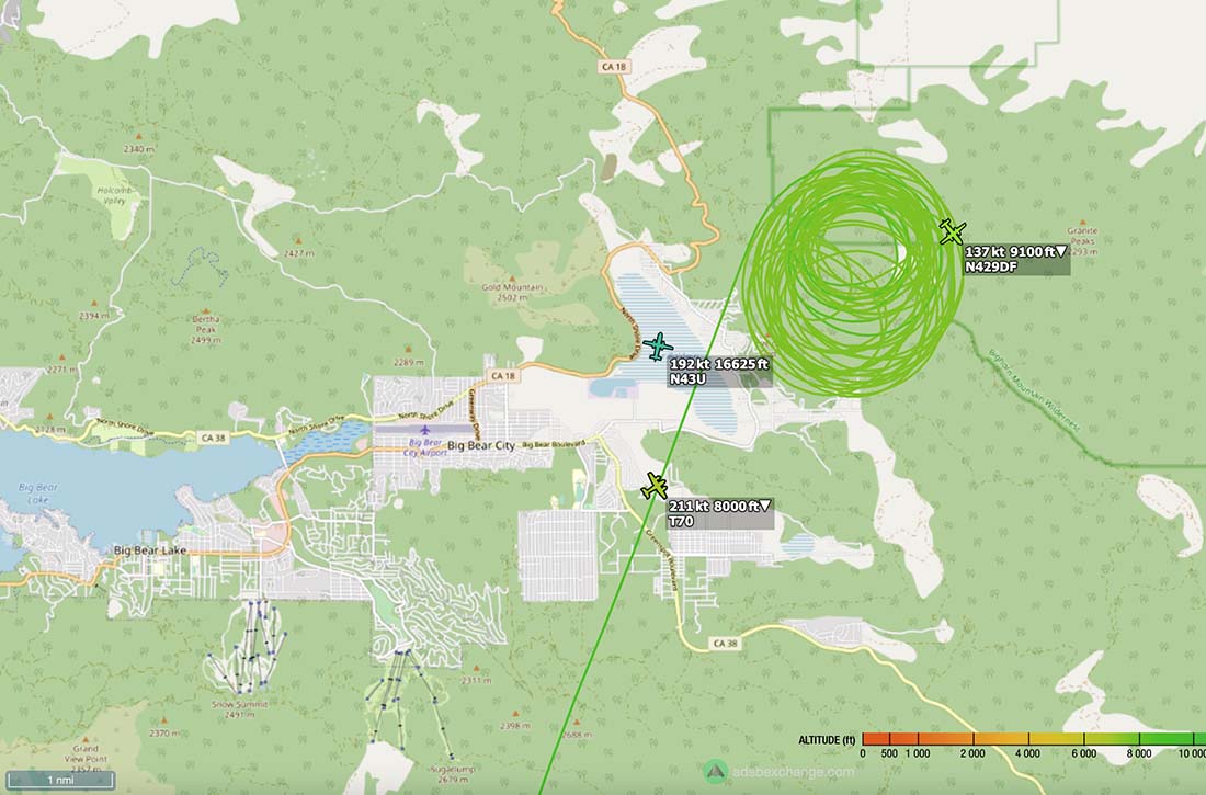
Yesterday firefighters stopped the spread of a wildfire in Southern California in the San Bernardino National Forest after it burned about 35 acres in Cactus Flats east of Big Bear Lake. Soon after it started it was putting up a smoke plume with occasional puffs of dense black smoke. The incident commander ordered a total of six fixed wing air tankers which assisted firefighters as they installed a hose lay around the perimeter.
Cactus Fire, April 30, 2022. @jojacalienteCactus Fire, April 30, 2022. San Bernardino NF photo.Map showing the location of aircraft over the Cactus Fire at 3:17 p.m. PDT April 30, 2022. ADS-B Exchange.
The video below was shot by the FIRIS aircraft at 2:22 p.m. PDT April 30, 2022.
The staging area at the South Fork prescribed fire in Custer State Park, April, 2014.
We’re trying something new this weekend. Borrowing an idea from The War Zone, this post can serve as the beginning of an open thread where our readers can talk about what happened this week that we have or have not gotten into yet. This is literally an off-topic thread.
The usual rules about commenting apply. And in light of some recent topics, remember, no personal attacks.
So let’s enjoy a wide-ranging debate! (Oh, and send us pics of staging areas. Date, location, and photographer’s name would be nice , but not required.)
Linnea Gebauer, prize winner in CSPAN documentary competition.
C-SPAN announced that earlier this month that Linnea Gebauer, a 12th grade student at Klamath Union High School in Klamath Falls, Oregon, is a second prize winner in C-SPAN’s national 2022 StudentCam competition. Ms. Gebauer will receive $1,500 for the documentary, “Fire Season,” about the National Cohesive Wildland Fire Management Strategy. The competition, now in its 18th year, invited all middle and high school students to enter by producing a short documentary. C-SPAN, in cooperation with its cable television partners, asked students to explore a federal policy or program and address the theme: “How does the federal government impact your life?”
In response, more than 3,000 students across the country participated in the contest. C-SPAN received over 1,400 entries from 41 states, Washington, D.C., Morocco and South Korea.
In February we reported that Ms. Gebauer had entered the competition and included her video in the article. We wrote, “It is obvious that Linnea put a great deal of time and effort into research, planning, interviewing subject matter experts, and editing the dozens of clips into the finished product. Excellent job, Linnea!”
Here again is her video:
Several government officials recorded congratulatory videos for Ms. Gebauer, including National Park Service Division Chief for Fire and Aviation Management Bill Kaage and Oregon Governor Kate Brown.
3-D Map of the Crooks Fire, looking north. The red line was the perimeter at 3 a.m. MDT April 28, 2022. The white line was the perimeter two days before.
The northwest side of the Crooks Fire 8 miles south of Prescott, Arizona was very active Wednesday. In the last two days the section of the fire near Golden Eagle Road/Forest Road 97B has spread one mile to the west. Strong winds out of the south with 10 percent relative humidity contributed to the rapid spread. Wind gusts of 30 mph drove the fire west of Lookout Mountain toward Dosoris Canyon, pushing smoke into Prescott and surrounding communities. Crews were successful in holding the 52 Spur Road to keep the fire west of the affected communities. Most of the east side saw little or no movement Wednesday.
According to the Incident Management Team the fire has burned 9,014 acres.
Map of the Crooks Fire. The red line was the perimeter at 3 a.m. MDT April 28, 2022. The white line was the perimeter two days before.
On Thursday dozers and hand crews will work to strengthen the containment lines along Forest Service Road (FSR) 82. Favorable terrain may allow firefighters to access the fire’s edge west of Lookout Mountain, with the assistance of aircraft. Structure protection remains a key tactical objective and crews continue to perform defensive operations throughout the area.
Resources assigned as of Wednesday evening included 20 hand crews, 41 fire engines, and 14 helicopters for a total of 855 personnel.
The weather forecast for Thursday at 7,200 feet elevation calls for 21 mph gusting out of the south and southwest at 30 mph with relative humidity in the mid-teens. The elevation at the fire ranges from 5,000 to 7,000 feet. Friday the winds will decrease to 15 mph with 22 mph gusts from the west with 10 percent relative humidity.
Firefighters set up sprinklers to protect structures in the Mt. Tritle area. USFS photo, April 27, 2022.