The San Bernardino County Sheriff’s Department has signed an agreement to purchase a SUBARU BELL 412EPX helicopter.
In additional to general law enforcement support, the San Bernardino County Sheriff’s Aviation Unit also aids in personnel and cargo transport, airborne photography, search and rescue operations, wildland fire suppression, and emergency medical transport services.
Other organizations in Southern California that have recently agreed to purchase a 412EPX include San Diego County Sheriff’s Office, Ventura County Sheriff’s Office, and San Diego Gas and Electric.
Certified in 2018, the 412EPX possesses an increased maximum internal weight of 12,200 lbs., external weight of 13,000 pounds, and ability to carry up to 5,000 lbs. of goods with the cargo hook. It is a joint venture between Bell and Subaru.
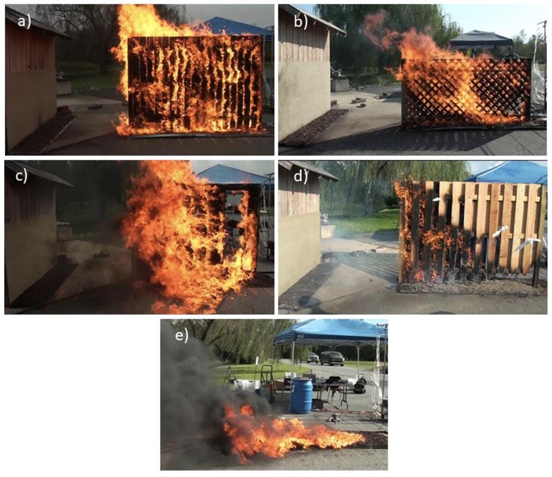
Examples of very high hazard fences and mulch: A) parallel privacy fences, B) double lattice fences, C) wood-plastic composite #1 fence, D) good neighbor fence, E) rubber mulch. (From the NIST research)
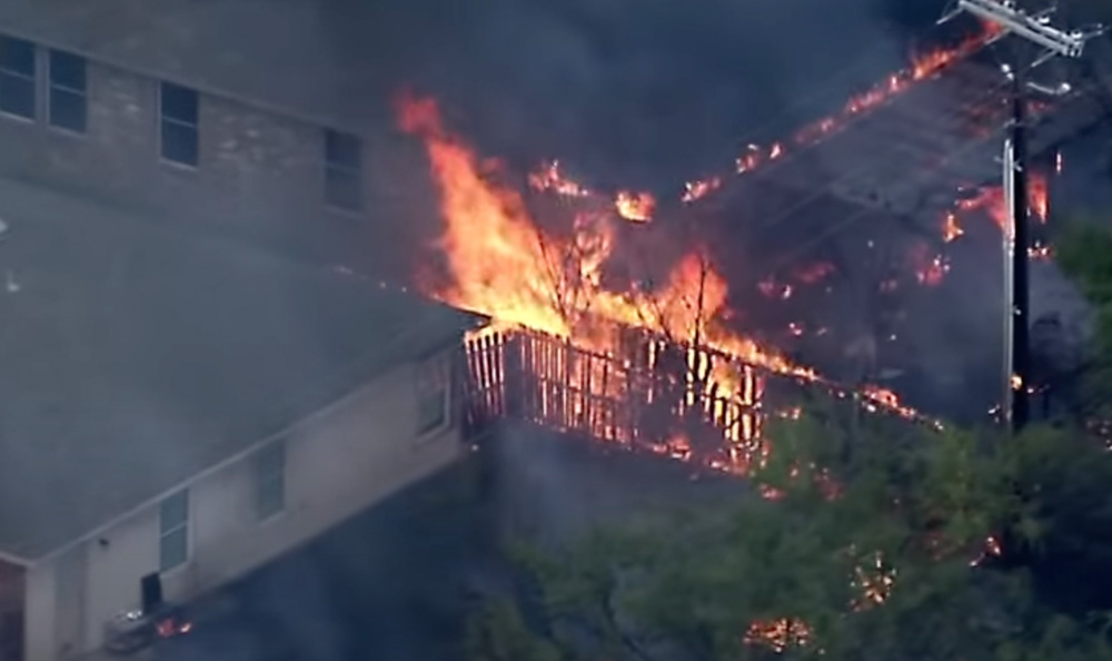
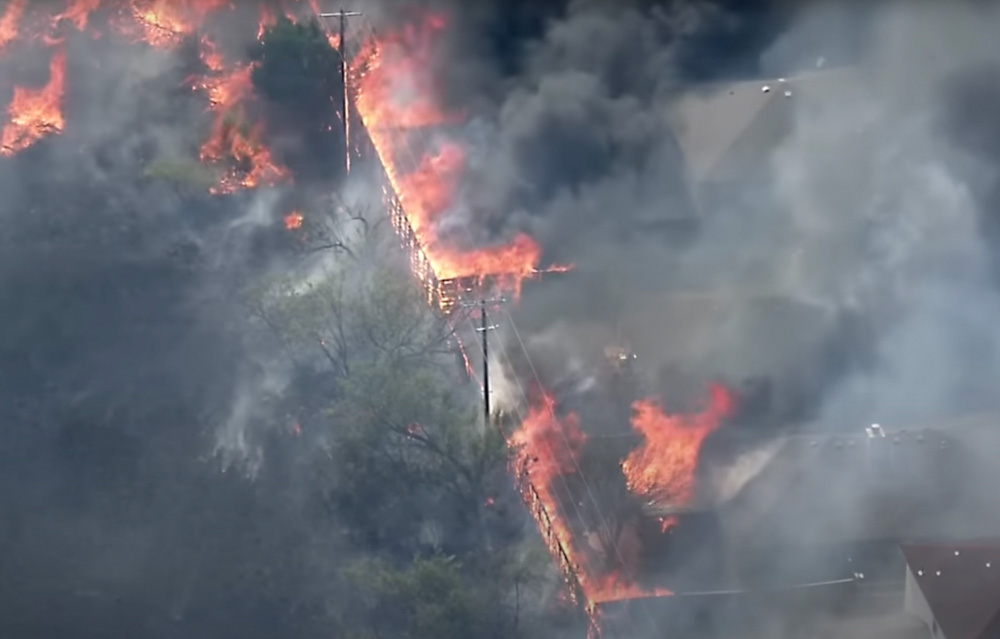
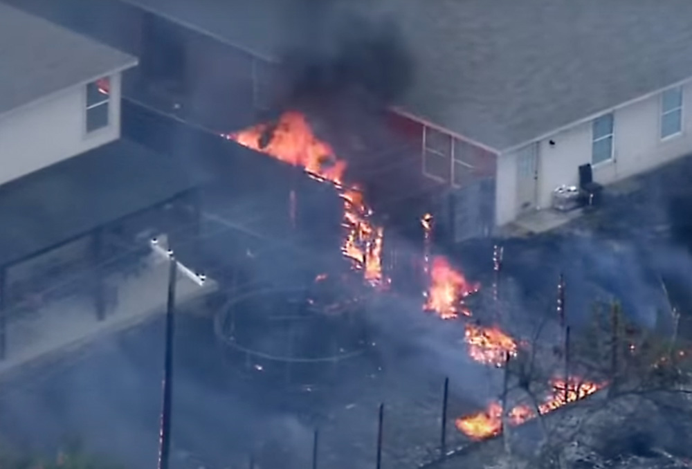
Three weeks ago a television station in Dallas, FOX 4, streamed live video as a grass fire spread across a field and reached densely-packed houses, eventually destroying 9 and damaging another 17. There were several reasons why the structures were so vulnerable, including medium-heavy vegetation in the field adjacent to the property lines, very little impact from efforts of the fire department to stop the spread, no air support, and wood fences that connected all of the properties on the rear and sides of the homes.
Parallel fences burn as grass fire spreads into neighborhood in Balch Springs, Texas, July 25, 2022. Image from video by FOX 4 Dallas-Fort Worth.
On August 10 the National Institute of Standards and Technology (NIST) published results of 187 experiments that examined how fire spread toward a structure is affected by combustible fences and mulch under conditions that may be encountered in a wildland-urban interface (WUI) fire. They looked at mulch only, fence only, fence plus mulch, parallel fences, and long range firebrands. The materials studied were western red cedar, California redwood, pine, vinyl, and wood-plastic composites. Fence styles included privacy, lattice, and good neighbor (board on board).
A small structure was located between zero and up to six feet downwind of the fence or mulch bed as a target for flames and firebrands. A target mulch bed at the base of the structure tested the ability of firebrands produced by the burning fence and mulch bed to ignite spot fires that threatened the structure.
While not many homeowners place store-bought mulch below their fences, it can be common for debris to build up along the base on one or both sides. The amount and flammability can be extremely variable, but the researchers’ use of mulch gave them control over the flammable material which could be consistently duplicated in their experiments.
The study found that firebrands capable of igniting spot fires downwind were generated by nearly all combinations of fence and mulch tested in this study. All wood fences with mulch at the base caused spot fires in the target mulch bed. Spot fires were often ignited within a few minutes of mulch and fence ignition. Shredded hardwood mulch and pine bark mulch burned and emitted firebrands for longer than an hour. Ignition of spot fires was also demonstrated from firebrands transported by the wind over distances as far as 156 feet from the burning item under high wind conditions and over a paved surface.
The research generated a number of recommendations:
Avoid parallel fences, to reduce exposure to large flames. Parallel fences can result in highly hazardous fuel accumulation corridors that are difficult to access and maintain. Spacing of 3 feet between fences is not sufficient.
Avoid proximity to other combustible fuels, to reduce fire intensity and limit fire spread. This includes fuels above the fence and fuels across parcel boundaries. Avoid mulch at base of fence.
Avoid proximity of combustible fences to residence, including neighboring residence, to prevent direct ignition.
Fire spread is more likely with wood and wood-plastic composite fences than with fences made of vinyl or noncombustible materials such as stone, brick, or steel.
Keep fence and yard clear of debris, to reduce the amount of fuel and potential pathways for fire.
Harden structures against firebrands to prevent structure ignition from embers produced by fences or other combustible sources.
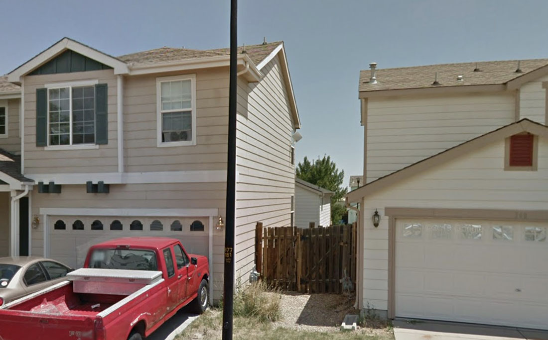
The video from the July 25 fire in Texas does not clearly show the fences between the residences, but it is likely that they directly connected to the structures. An example is seen in the photo below of two homes in Superior, Colorado, one of the communities devastated by the Marshall Fire that destroyed 991 structures south of Boulder December 30, 2021.
File photo of fence connecting houses in Superior, Colorado. July, 2012 Google image.
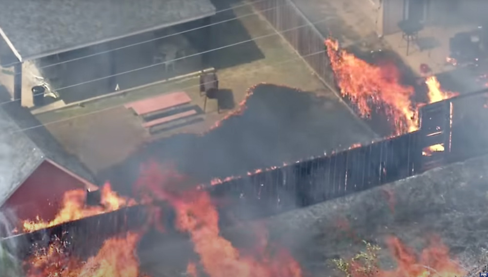
The images below are from the FOX 4 Dallas-Fort Worth video shot July 25, 2022.
Fences burn as grass fire spreads into neighborhood in Balch Springs, Texas, July 25, 2022. Image from video by FOX 4 Dallas-Fort Worth. Fences burn as grass fire spreads into neighborhood in Balch Springs, Texas, July 25, 2022. Image from video by FOX 4 Dallas-Fort Worth. Fences burn as grass fire spreads into neighborhood in Balch Springs, Texas, July 25, 2022. Image from video by FOX 4 Dallas-Fort Worth.
Most structures that burn in a wildfire are not ignited by direct flame impingement, but by burning embers that are lofted and carried downwind ahead of the fire. At Wildfire Today we first covered the role of embers in igniting structures in 2010, a concept brought into the public consciousness by Jack Cohen, a researcher at the Missoula Fire Science Lab. To reduce the chances of a home burning in a wildfire, the most bang for the buck is to concentrate on the Home Ignition Zone. The flammable material near the structure needs to be modified, reduced, or eliminated to the point where multiple burning embers landing in the zone will not propagate the fire and spread to the structure.
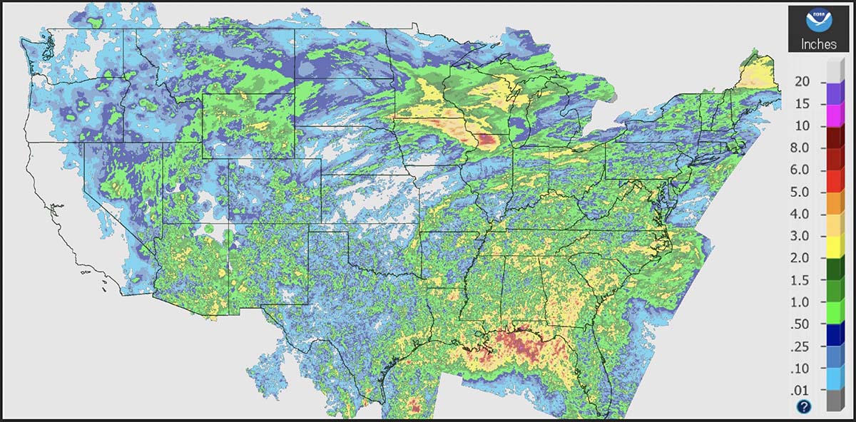
Precipitation, during the seven days ending at 11 a.m. MDT August 13, 2022.
It seemed to me that over the last few weeks the wildfire activity has been slower than typical for this time of the year, so I did a little digging. Using historical data from the National Interagency Fire Center and acres burned to date from the August 13 national Situation Report, it turns out that Alaska has burned nearly three times their 10-year to-date average while the other 49 states combined are running 12 percent below the to-date average.
Over the last 10 years Alaska’s average acres burned in a full year is 1.1 million. This year they are at 3.1 million, more than the other 49 states combined. There has been a major increase in Alaska acres burned after mid-August in only 2 of the last 18 years. And it has been fairly quiet there, fire wise, for the last four weeks.
So far this year, fires in the other 49 states have blackened about 2.8 million acres, 12 percent below the to-date 10-year average of 3.2 million. The 49 states typically burn 6.2 million in a full year, so if this year turns out like the average of the last 10, we’re about half done.
The Situation Report does not break out data for Alaska and the other 49 states, so just looking at their 50-state numbers a person would see that the 5.9 million acres burned to date is 27 percent higher than the average of 4.3 million, when actually the +27 percent figure is very wrong for both Alaska and the lower 49 states.
We usually separate Alaska stats because fires in that huge state are managed far differently from the other 49. Most of them are not fully suppressed since they are less likely to endanger people or private property than in the lower 49 states. The second reason is that the fire occurrence is extremely variable, with the acres burned since 1990 ranging, for example, from 43,965 acres in 1995 to 6,645,978 in 2004. Including the Alaska numbers in the total would skew the data for the other 49 states making it more difficult to spot trends.
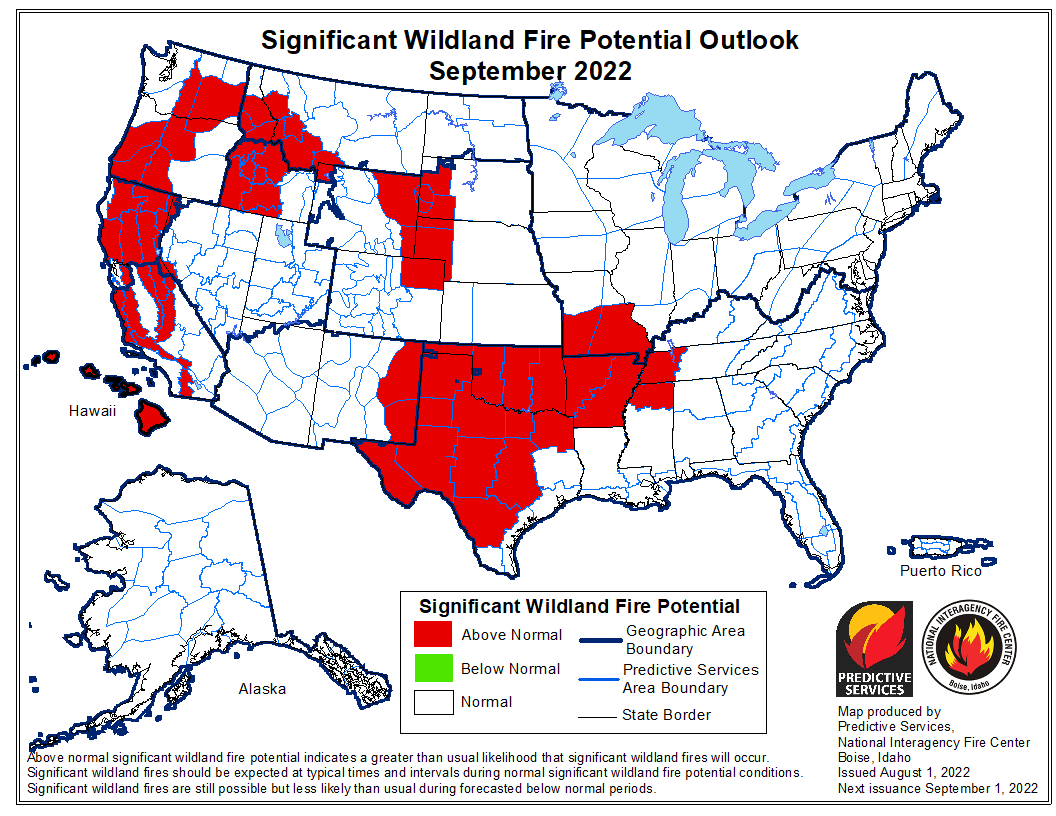
Wildland fire potential for September, 2022. NIFC. Wildland fire potential for August, 2022. NIFC.
CAL FIRE Air Tanker 120, formerly Coast Guard 1709, arriving at McClellan, August 12, 2022. By Mike McKeig.
Another of the seven C-130 aircraft that the Coast Guard will eventually transfer to the California Department of Forestry and Fire Protection flew into Sacramento McClellan Airport today. In the Coast Guard it was known as #1709 but will become Air Tanker 120 when the conversion is complete and it is operated by CAL FIRE.
Like some of the other Coast Guard C-130s that have come to McClellan after having work done it appears to have 98 percent new livery, the exception being the rudder. It will eventually receive the other half of the zero to complete the T-120 designation. The delay may have something to do with balancing the rudder after the conversion is largely complete.
We were told there are no obvious external indications of retardant drop doors or a tank having been installed.
Below is what it looked like five years before the transfer and tanker conversion effort for the seven C-130s began in 2013.
A Coast Guard No. 1709, October, 2008. This is one of the seven HC-130Hs being transferred to the CAL FIRE. Photo by Bob Garrard.
More photos of T-120 arriving at McClellan today:
CAL FIRE Air Tanker 120, formerly Coast Guard 1709, arriving at McClellan, August 12, 2022. By Mike McKeig. CAL FIRE Air Tanker 120, formerly Coast Guard 1709, arriving at McClellan, August 12, 2022. By Mike McKeig.
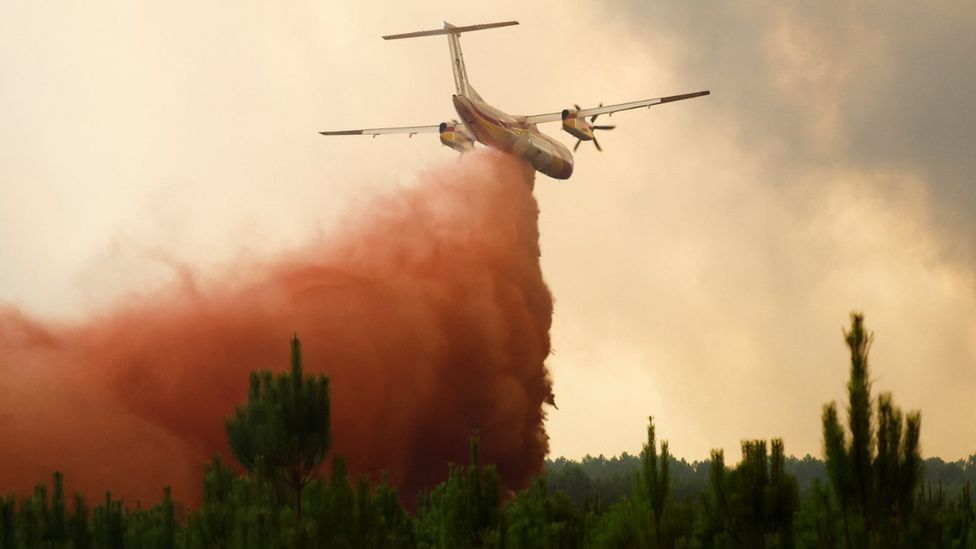
A Q400 drops retardant on a fire in France. Reuters.
The number of acres burned this year in France through mid-August, 148,000, is six times the full-year annual average over the last 15 years. Currently there are eight large fires in the country.
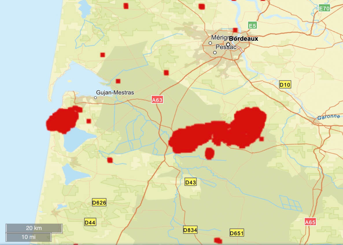
In the southwest, the Gironde region south of Bordeaux has been especially hard hit. One of the fires started a month ago and burned 14,000 acres. It was thought to be controlled, but officials said it either “reignited” on Tuesday or arson may have played a role. Since then it has blackened an additional 18,000 acres, destroyed or damaged 17 homes, and prompted about 10,000 residents to evacuate.
It has forced the closure of the A63 motorway, a major route to Spain between Bordeaux and Bayonne.
The difficulty in suppressing the fires is being attributed to record-breaking drought, strong winds, and high temperatures occasionally hitting 104 Fahrenheit in the southwest.
The red areas represent heat detected at wildfires in France in the Gironde region south of Bordeaux during the 31-day period ending August 12, 2022. FIRMS.
International assistance is coming in the form of 65 firefighters from Germany, others from Romania, Austria, and Poland, and water scooping air tankers from Greece and Sweden.
Dozens of firefighters from Romania are assisting France
France has a fleet of nine S-2 air tankers and has purchased six Q400 MR air tankers, with at least four having been delivered.
There is also large fire in the mountainous Serra de Estrela park in central Portugal, where 24,000 acres have burned. It is being fought by about 1,500 firefighters.
The red areas represent heat detected by satellites in Portugal’s Serra de Estrela Natural Park during the 7-day period ending August 12, 2022.
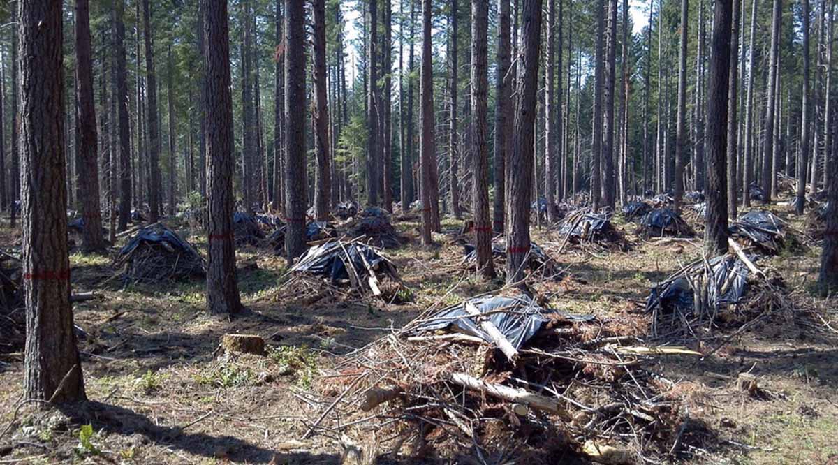
Forest thinning project in the Umpqua National Forest. Credit, Oregon State University.
NBC News conducted an investigation into some of the claims and statistics about vegetation management projects that are designed to improve forest health and/or and reduce the threat of wildfires. The emphasis of the very lengthy article about their findings was not so much to question the need or effectiveness of the hazardous fuel reduction projects, but to examine their claims of accomplishments, which are sometimes misleading.
Many fuel management projects on National Forests include multiple treatments of a single area. There can be some combination of thinning, pruning, piling, chipping, or prescribed burning, all considered independently and occurring at different times. In an extreme scenario, if the project was 100 acres and five different treatments occurred, each might be reported as accomplishing 100 acres of fuel treatment. They then tell Congress they treated 500 acres.
The NBC article gave an actual example of a project on the San Bernardino National Forest in Southern California near Big Bear Lake. The 173-acre project had multiple treatments. From the article:
They first [step] appeared in 2016, when the Forest Service assigned workers to cut trees to reduce the area’s density. The agency came back two years later, pruning the remaining trees and piling the cut wood across the full 173 acres, then chipping 52 acres of it. A few months later, workers burned 18 acres of the piles.
The pruning, piling, chipping and burning were entered as separate items in the database and the agency reported them as 416 acres of treated land in its 2019 fiscal year totals to Congress. In summer 2021, it burned the remaining 155 acres of piles, reporting them in that year’s totals.
The Forest Service’s efforts ultimately reduced fire risk on 173 acres of land, but they were reported to Congress as 744 acres over four fiscal years.
“These acres are reported six times because we must request funding to accomplish the full suite of activities on the same 173 acres,” said [Wade] Muehlhof, the service’s spokesperson. “Each of these activities needs to be planned and budgeted for annually.”
The Forest Service tells Congress that it reduces wildfire risk on more than 2.5 million acres of its land every year. But this process of recounting the same acres any time more than one type of work is completed means that far less land is protected from damaging fire than is being reported.
NBC estimates that nationwide the FS has overstated accomplishments by 2.5 million acres, or 17 percent. In California the numbers are higher, 27 percent in the past five years, and by roughly 35 percent in the places near the most people, the state’s wildland urban interface areas.
The NBC article was written by Adiel Kaplan, with assistance from Monica Hersher and Joe Murphy.
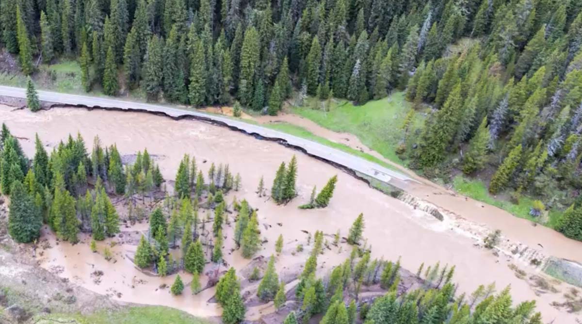
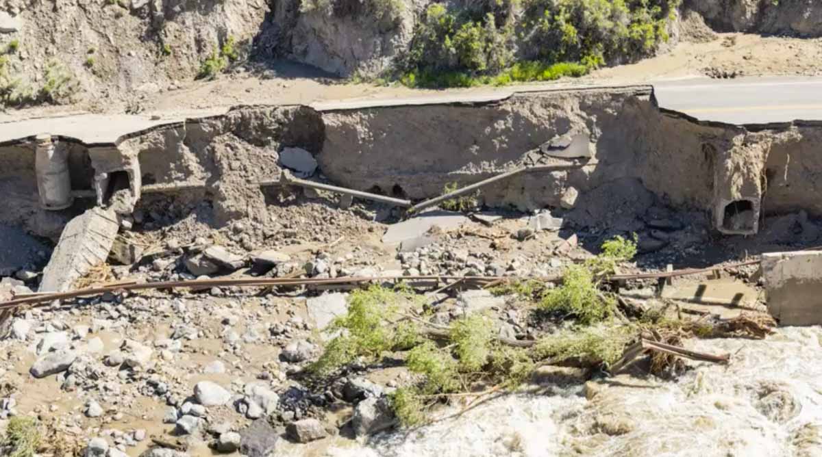
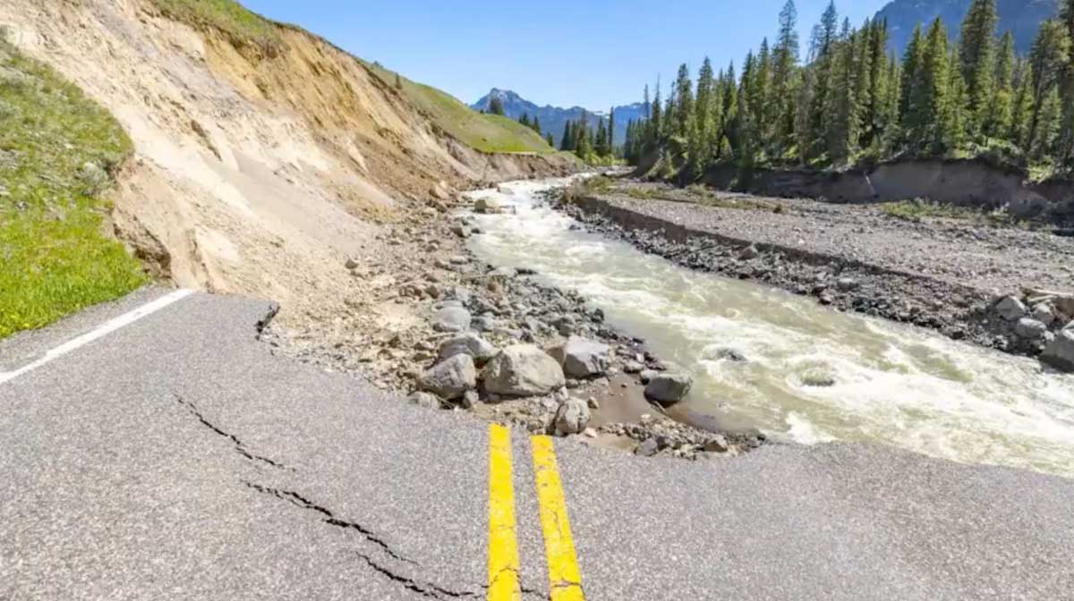
June 13, 2022 flood in Yellowstone National Park. YNP image.
Yellowstone National Park released a video yesterday describing the massive damage to the park’s infrastructure that occurred June 13 when unseasonably warm weather, melting snow, and very heavy rain produced widespread flooding across the north end of the park. Yellowstone Digital Communications Specialist, Jake Frank, gives his first-hand account of the 500-year flood event.
These photos are still images from the video below.
June 13, 2022 flood in Yellowstone National Park. YNP image. June 13, 2022 flood in Yellowstone National Park. YNP image. June 13, 2022 flood in Yellowstone National Park. YNP image.