Fire whirl, or waterspout, or fire tornado?

Spectacular video at a fire near Blythe, California

Above: screenshot from the video below.

Chris Mackie posted this video on July 15, 2018 of spectacular fire behavior at a wildfire on the Arizona side of the Colorado River near Blythe, California. It is not uncommon to see dust devils and fire whirls during unstable weather conditions on a fire, but as you can see beginning at about 1:10 the rotating vortex over this fire intensifies into what some might call a fire tornado (or “firenado”) as trees are uprooted and debris is thrown into the water as it moves over the river (and transforms into a waterspout?).

We have written about similar phenomenons several times on Wildfire Today. Here is an excerpt from a 2016 article, “Defining fire whirls and fire tornados”:


“The news media sometimes calls any little fire whirl a “fire tornado, or even a “firenado”. We found out today that these and related terms (except for “firenado”) were, if not founded, at least documented and defined in 1978 by a researcher for the National Weather Service in Missoula, David W. Goens. He grouped fire whirls into four classes:

  1. Fire Devils. They are a natural part of fire turbulence with little influence on fire behavior or spread. They are usually on the order of 3 to 33 feet in diameter and have rotational velocities less than 22 MPH.
  2. Fire Whirls. A meld of the fire, topograph, and meteorological factors. These play a significant role in fire spread and hazard to control personnel. The average size of this class is usually 33 to 100 feet, with rotational velocities of 22 to 67 MPH.
  3. Fire Tornadoes. These systems begin to dominate the large scale fire dynamics. They lead to extreme hazard and control problems. In size, they average 100 to 1,000 feet in diameter and have rotational velocities up to 90 MPH.
  4. Fire Storm. Fire behavior is extremely violent. Diameters have been observed to be from 1,000 to 10,000 feet and winds estimated in excess of 110 MPH. This is a rare phenomenon and hopefully one that is so unlikely in the forest environment that it can be disregarded.”

Report released for entrapments on Horse Park Fire

Above: photo from the report.

Additional information has been released about the entrapments that occurred on the Horse Park Fire May 27 in a remote area of Southwest Colorado. Earlier we posted two videos that were shot when firefighters hurriedly retreated as the fire advanced, plus information from a “72-hour report”.

Now a 56-page Facilitated Learning Analysis and a 12-minute video are available that break down the incident in even more detail.

To very briefly summarize what happened, while scouting a road for a potential burnout operation, a hotshot crew superintendent and foreman encounter a wall of flames and attempt to retreat. Their truck becomes stuck, forcing them to flee on foot, narrowly escaping the rapidly advancing fire front. Just as they reach safety, they learn that their crew lookout is missing. After nearly 40 agonizing minutes, the lead plane pilot locates her after she ignited an escape fire. It is a compelling story, which is pretty well summed up in this video.

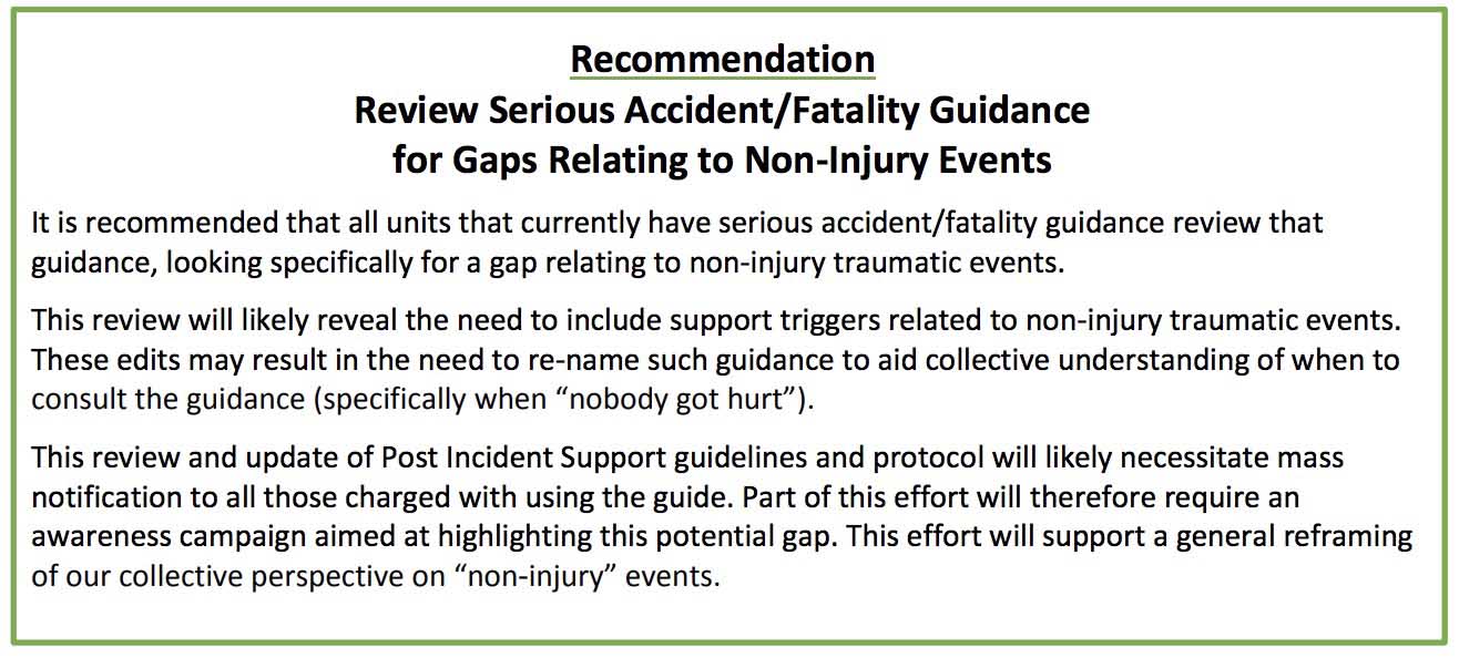
The 56-page report only has one recommendation:Recommendation horse park fire

Abundant lightning predicted for Southern Oregon Sunday

The National Weather Service is describing the lightning that is in the forecast for south-central Oregon and extreme northern California as “abundant”. It should begin by early Sunday afternoon and continue into the evening.

Lightning is also predicted for southwest Idaho and northern Nevada. There could be wetting rain with the thunderstorms except in Nevada, where dry strikes could occur. All of these areas are under a Red Flag Warning Sunday.

Some land managers in Oregon have brought in additional firefighting resources to assist in initial attack of any new lightning-caused fires.

Ferguson Fire forces evacuations in Jerseydale area

The fire has burned over 9,000 acres west of Yosemite National Park in California

(UPDATED at 7:50 a.m. PDT July 16, 2018)

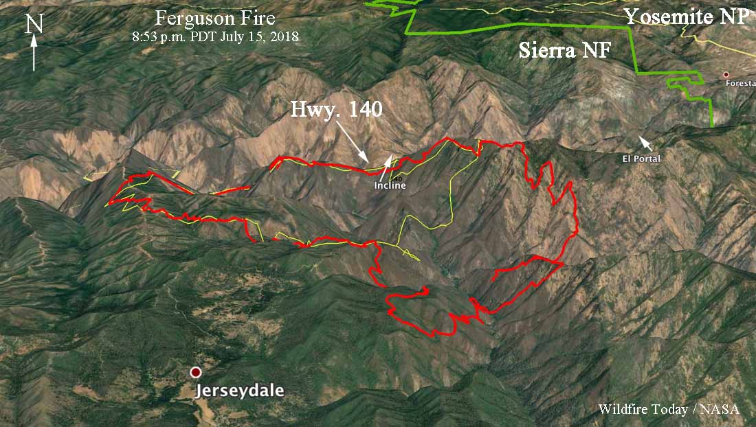
3-D map Ferguson Fire
3-D map of the Ferguson Fire at 8:53 p.m. PDT July 15, 2018. Click to enlarge.

After 3 p.m. Sunday the intensity of the Ferguson Fire increased dramatically as it spread 1.5 to 2 miles to the south and southeast, coming closer to the structures in the Jerseydale area.

Mandatory evacuation orders are still in effect. Sunday morning a fire advisement was issued for the Yosemite West area, which is on Wawona Road southeast of El Portal. It is an advisement of a potential Evacuation Order should conditions change.

CLICK HERE to see all of the articles on Wildfire Today about the Ferguson Fire, including the most recent.

Based on an 8:53 p.m. mapping flight Sunday night the Incident Management Team reported that the fire at that time had burned 9,266 acres.

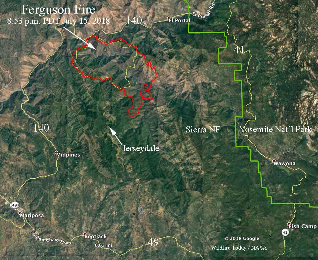
map ferguson fire
Map of the Ferguson Fire at 8:53 p.m. PDT July 15, 2018. The yellow line was the approximate perimeter at 2 p.m. July 15. Click to enlarge.

The weather at the Ferguson Fire is expected to remain hot and dry for the next seven days, with isolated thunderstorms possible.

The 20-second video below is a time-lapse of still images of the fire captured between 1:30 p.m. and 4 p.m. July 15. Toward the end you will see a smoke column break through the inversion as the fire intensity increases. Sierra Fire Watch posted it, saying it was shot from a point near Mt. Raymond.


(UPDATED at 7:41 p.m. PDT July 15, 2018)

Ferguson Fire
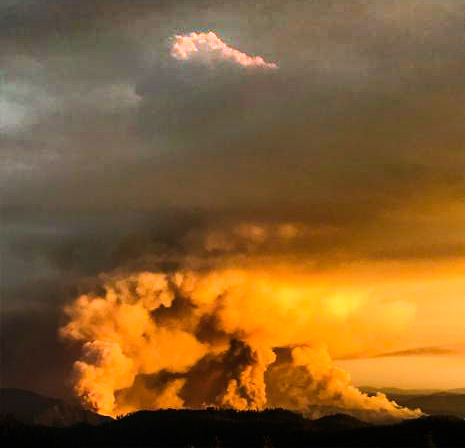
Ferguson Fire. Photo uploaded to InciWeb Sunday afternoon.

Continue reading “Ferguson Fire forces evacuations in Jerseydale area”

Firefighter fatality on the Ferguson Fire west of Yosemite National Park in California

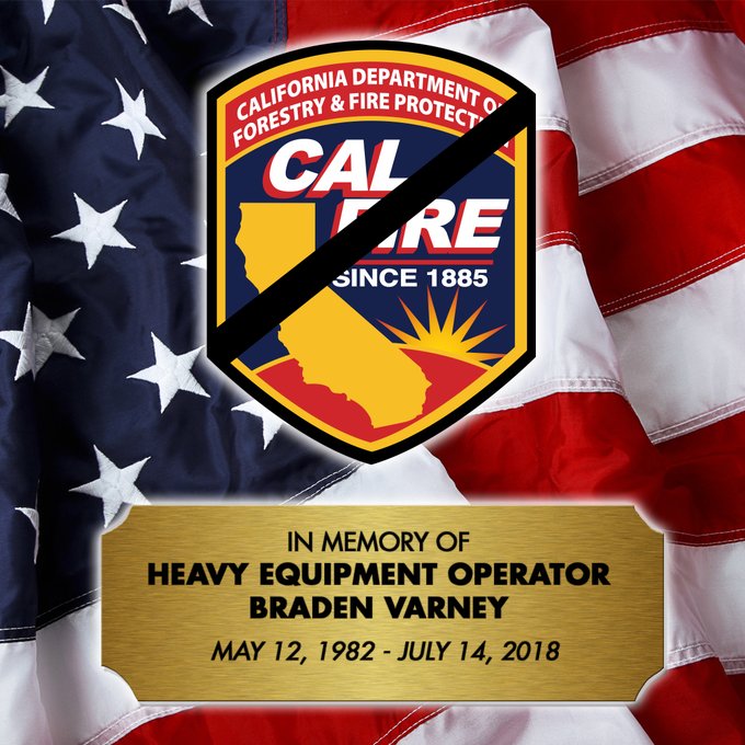
We regret to have to report that a firefighter died this morning, July 14, on the Ferguson Fire west of Yosemite National Park. CAL FIRE announced this afternoon that Heavy Fire Equipment Operator Braden Varney was tragically killed while battling the fire. Mr Varney leaves behind a wife and two small children.

One of the firefighters on the fire reported this morning that he thought there was a dozer rollover, and just in case, he wanted to get medical help started to the scene. It turned out that the dozer had rolled several times and ended up in a location that was very difficult to access by foot or see from an aircraft.

(To see all of the articles on Wildfire Today about the Ferguson Fire, including the most recent, click here.)

Just after 1 p.m. local time CAL FIRE made the official announcement about the fatality.

We send out our sincere condolences to Mr. Varney’s family, coworkers, and friends.Varney fatality

Ferguson Fire burning west of Yosemite National Park

Above: map showing heat on the Ferguson Fire detected by a satellite at 3 a.m. PDT July 14, 2018.

(UPDATED at 3:15 p.m. PDT July 14, 2018)

For a while late Saturday morning, smoke and impaired visibility grounded all air tankers on the Ferguson Fire, but by early afternoon the smoke had cleared enough to bring them back to drop retardant.

(To see all of the articles on Wildfire Today about the Ferguson Fire, including the most recent, click here.)

Now we are hearing that the fire has spotted across the South Fork of the Merced River on the west side of the fire. There is an effort to have the air tankers pretreat a ridge in an attempt to slow down the fire in that area.


(UPDATED at 2:02 p.m. PDT July 14, 2018)

We regret to have to report that a firefighter died this morning on the Ferguson Fire west of Yosemite National Park. CAL FIRE announced this afternoon that Heavy Fire Equipment Operator Braden Varney was tragically killed while battling the fire. Mr Varney leaves behind a wife and two small children.

One of the firefighters on the fire reported this morning that he thought there was a dozer rollover, and just in case, he wanted to get medical help started to the scene. It turned out that the dozer had rolled several times and ended up in a location that was very difficult to access by foot or see from an aircraft.

Just after 1 p.m. local time CAL FIRE made the official announcement about the fatality.

We send out our sincere condolences to Mr. Varney’s family, coworkers, and friends.


(UPDATED at 9:26 a.m. PDT July 14, 2018)

At 9:26 a.m. PDT Air Attack said the Ferguson Fire was holding at about 150 acres. The terrain, smoke, and power lines are challenges for the air tankers working the fire.

aircraft ferguson fire
At 9 a.m. PDT flight tracking showed two S2T air tankers and an Air Attack aircraft over the Ferguson Fire. The green line was the approximate track of the Air Attack ship.

(Originally published at 7:44 a.m. PDT July 14, 2018)

Highway 140, one of the three highways that lead into Yosemite Valley in California, is closed due to a new wildfire. The Ferguson Fire was reported at 10:35 p.m. Friday and at last report had burned about 75 acres. The fire is just off Highway 140 near Hite Cove and has high potential to grow. Since firefighters were working under electrical lines the power in the area has been shut off, which may affect Yosemite National Park. The area around Savages Trading Post has been evacuated.

The fire is spreading in steep terrain in the Sierra National Forest 7 miles west of El Portal. The incident commander has requested four fixed wing air tankers, of any type, to attack the fire early Saturday morning if possible. They also requested dozers, helicopters, water tenders, and hand crews.