Forecasters predict enhanced wildfire conditions in the southwest through June

Posted on Categories UncategorizedTags ,

Normal conditions expected for the West Coast and the Northern Rockies during the same time frame

wildland fire potential outlook forecast

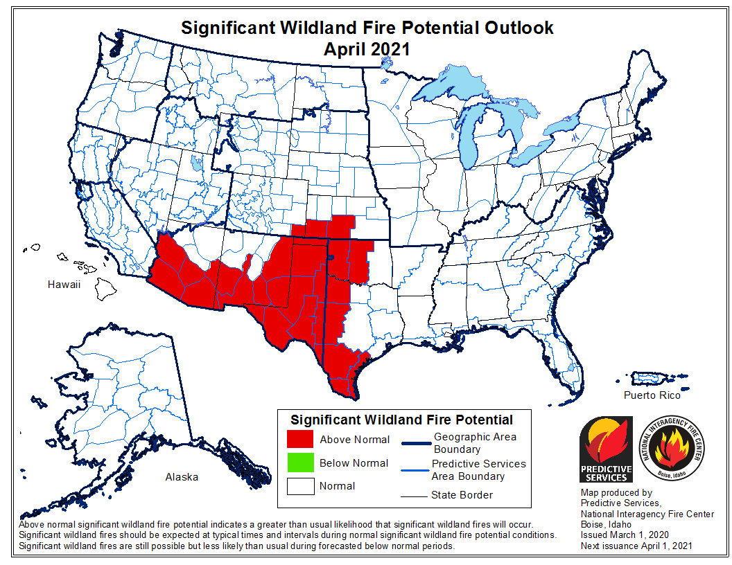
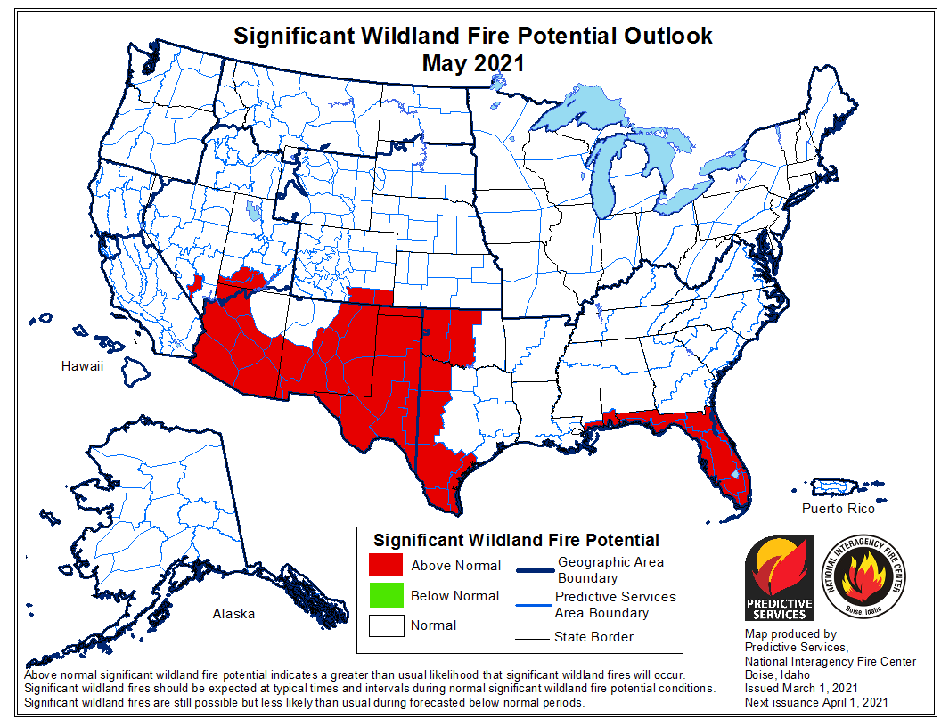
The maps in the March 1 National Significant Wildland Fire Potential Outlook issued by the Predictive Services section at the National Interagency Fire Center (NIFC) are nearly the same as the maps for the same months distributed on February 1. It took me a long time to see a couple of minor differences in the ones produced 28 days ago. The outlook predicts wildfire potential will be higher than normal in the Southern Plains through June, 2021. This will include portions of Texas, New Mexico, Oklahoma, and Kansas. Arizona and New Mexico will have enhanced fire activity April through June, according to the forecast.

The entire southwest one-quarter of the United States is currently experiencing either abnormally dry, severe, extreme, or exceptional drought.

The data from NIFC shown here represents the cumulative forecasts of the ten Geographic Area Predictive Services Units and the National Predictive Services Unit.

Below:

  • An excerpt from the NIFC narrative report for the next several months;
  • More of NIFC’s monthly graphical outlooks;
  • NOAA’s three-month temperature and precipitation forecasts;
  • Drought Monitor;
  • Keetch-Byram Drought Index.

“Below normal precipitation was observed across much of US with the driest areas in the southern California, the southern Great Basin, and western and southern Arizona. Additionally, parts of the Plains had well below average precipitation with wide expanses of snow-free areas. Much of the western snowpack is near to above normal, but notable below normal locations include the Sierra and Southwest. Record setting cold temperatures developed across the central US during the first half of February leading widespread snow cover. Due to these cold temperatures, much of the US experienced well below normal temperatures for February except the Great Basin, California, the Southwest, and Florida.

“A weather pattern consistent with La Niña will likely continue through spring across the US. Drought conditions are expected to continue for much of California, the Great Basin, and the Southwest into summer with drying expected to increase across portions of the Plains and Florida. Drought conditions across the southern half of the Intermountain West and southern High Plains are likely to intensify.

“Climate outlooks show normal to below normal significant fire potential is likely for large portions of the Southeast, Ohio Valley, Appalachians, and into the Mid-Atlantic through March. However, significant fire potential will increase across Florida and parts of the central Gulf Coast in April with above normal significant fire potential anticipated in May and June.

“Above normal significant fire potential is expected during spring across the Southwest and southern Plains due to background drought and forecast drier and warmer than normal conditions. Lower to mid elevations in the Southwest are favored to have above normal significant fire potential beginning in March and April. Most of the southern Plains are forecast to have an active spring fire season before green-up. By May, much of the Southwest and portions of the southern Great Basin are likely to have above normal significant fire potential with all the Southwest geographic area and most of southern Colorado forecast to have above normal significant fire potential in June.”


wildland fire potential outlook forecast

wildland fire potential outlook forecast

wildland fire potential outlook forecast
Continue reading “Forecasters predict enhanced wildfire conditions in the southwest through June”

Update — Wildfire southeast of Winslow, Arizona mapped at 461 acres

Updated at 6:28 p.m. MST March 2, 2021

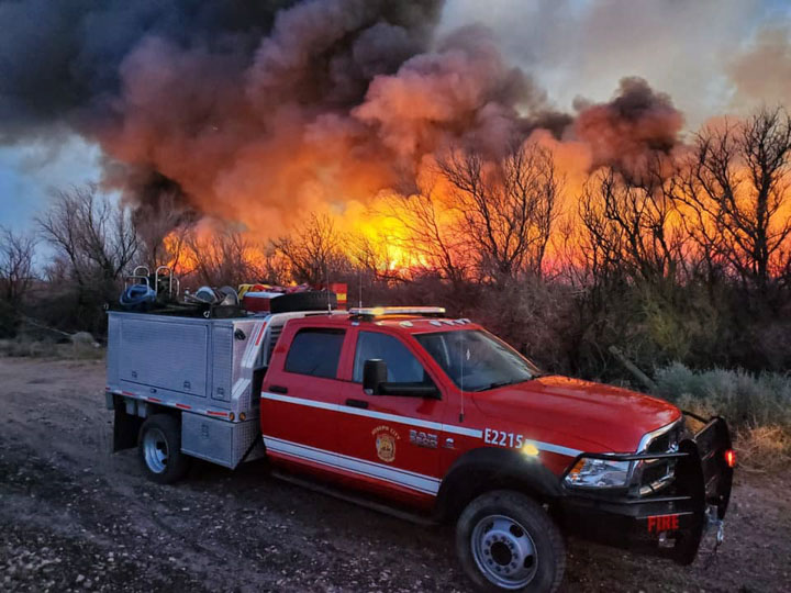
Little Fire SE of Winslow, AZ
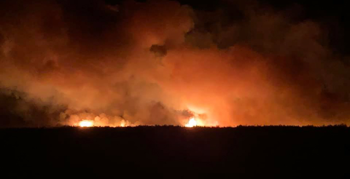
Little Fire SE of Winslow, AZ March 1, 2021. AZ State Forestry photo

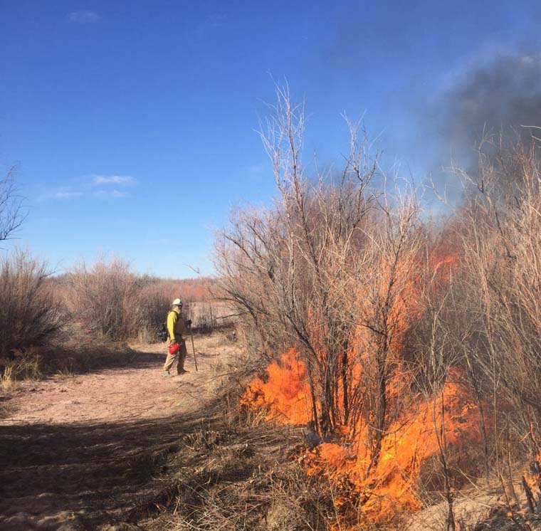
The “Little Fire” six miles southeast of Winslow, Arizona was mapped Monday at 461 acres. Much of the additional growth can be attributed to a burnout operation along two miles of the Little Colorado River, which incidentally, removed invasive salt cedar near the river.

Little Fire SE of Winslow, AZ
Little Fire SE of Winslow, AZ March 1, 2021. AZ State Forestry photo

The cause is still listed as human, but no ignition source has been released.


Originally published at 12:20 p.m. MST February 28, 2021

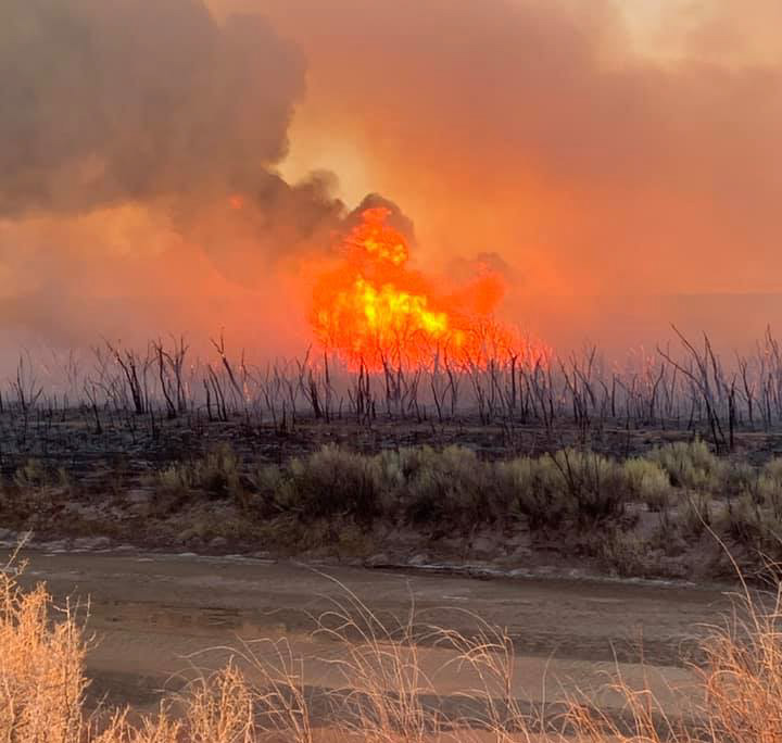
Little Fire, Feb. 27 2021 Winslow Arizona
Little Fire, Feb. 27, 2021. Photo by Joseph City FD.

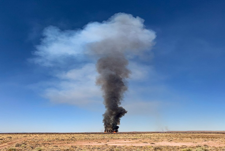
The “Little Fire” that started Saturday six miles southeast of Winslow has burned at least 100 acres, the Arizona Department of Forestry and Fire Management said in a Sunday morning update. Firefighters from Winslow, Joseph City, and the ADFFM stopped the spread Saturday night but winds are predicted to increase Sunday afternoon out of the north at 16 to 22 mph. The temperature will be in the low 40s.

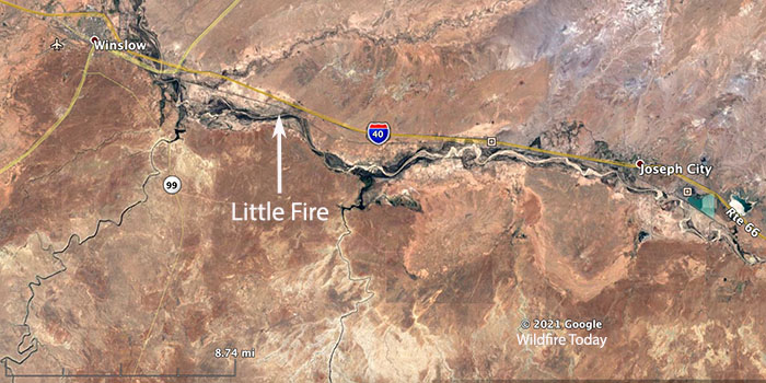
Map Little Fire
Map showing the location of the Little Fire in Arizona, Feb. 27, 2021.

The Little Fire started on tribal property and moved onto state protected land, burning through salt cedar near the Little Colorado River. Smoke has been visible from Interstate 40 near mile markers 261-263.

Investigators determined the blaze is human-caused, but the ignition source is unknown.

Little Fire, Feb. 27 2021 Winslow Arizona
Little Fire, Feb. 27, 2021. Photo by Joseph City FD.
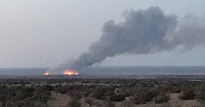
Little Fire, Feb. 27 2021 Winslow Arizona
Little Fire, Feb. 27, 2021. Photo by Jeff Zimmerman.
Little Fire, Feb. 27 2021 Winslow Arizona
Little Fire, Feb. 27, 2021. Photo by Joseph City FD.

Thanks and a tip of the hat go out to Jeff.

Hotshot Superintendent needs a kidney

Bill Kuche
Bill Kuche

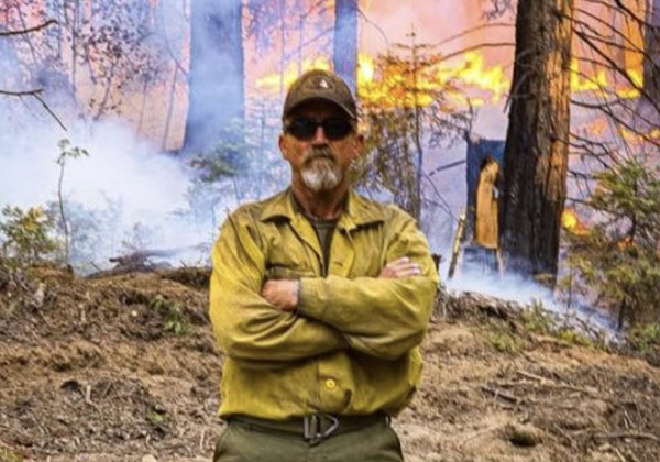
A hotshot Superintendent who needs a kidney transplant is hoping someone will step forward who can spare one in order to save his life.

Bill Kuche, Superintendent of the Flagstaff Interagency Hotshots is suffering from a kidney disease that started when as a child he contracted an illness that permanently damaged the organ.

His wife has started a GoFundMe page to raise funds for his treatment and to search for a live donor. Here is the text from the site:


BILL (WILLIAM) KUCHE NEEDS A KIDNEY

My name is Lyndsey Kuche, my husband Bill Kuche is the Superintendent of the T1 Flagstaff Interagency Hotshots in Arizona. We celebrated our 20th Wedding Anniversary today! We have 4 children together, Grace is 20, Carson is 19, Dharma is 11, and our adopted son Marcel who we welcomed to our family back in 2015 is also 20. Bill has dedicated his life the past 30 years to wildland firefighting, mentoring others, and has created unlimited opportunities for thousands of firefighters and citizens. Bill has always led a positive life of health, fitness, and unconditional devotion to his family, friends and colleagues.

Bill has Chronic Kidney Disease (CKD), he is in stage 5 of this disease and is desperately in need of a kidney transplant. I’ll offer you some background information of how CKD came into Bill’s life. When Bill was a child, he contracted “Strep Throat” (streptococcal virus). The virus attacked his kidneys and created a condition called “glomerulonephritis”, creating “holes” in both his kidneys. Bill has always demonstrated the ability to persevere throughout his life despite what happened to him when he was a kid.

Now, I am reaching out for help!

If anyone out there is willing to become a “Live Donor” for my husband Bill Kuche, please visit mayoclinic.org/livingdonor to get started.

The average wait time for a deceased organ donor’s kidney is approximately 5 years. Unfortunately, the wait time is not on our side. This fuels my need to reach out to you all asking your help for Bill. Please share this through your networks and help us spread the word in our wildland community to inspire others to become a potential living kidney donor for Bill.

My main priority is to find him a new kidney, as soon as possible. We have some friends who have learned of his need, reached out to me for information and have attempted to become a “Live Donor” for him. But, having gone through the process and screening myself, I know that sometimes the ability to be a live donor can very suddenly not be a possibility. Therefore, abruptly eliminating a person’s altruistic kidney donation to him. This is another reason why I am reaching out to you to help me spread the word.

Thank you for your attention and time to read my letter to you all,

Lyndsey Kuche, Wife of Bill (William) Kuche

USGS introduces new strategy for their 100 scientists engaged in studying wildland fire

It defines critical, core fire science capabilities for understanding fire-related and fire-responsive earth system processes, and informing management decision making

USGS wildland fire strategic plan

The U.S. Geological Survey (USGS) is rolling out a new Wildland Fire Science Strategic Plan that guides the activities of their 100 scientists whose research focuses on fire-related topics.

The plan has four integrated priorities, each with associated goals and specific strategies for accomplishing the goals:

  • Priority 1: Produce state-of-the-art, actionable fire science;
  • Priority 2: Engage stakeholders in science production and science delivery;
  • Priority 3: Effectively communicate USGS fire science capacity, products, and information to a broad audience; and
  • Priority 4: Enhance USGS organizational structure and advance support for fire science.

Here is how the USGS describes the plan:


To help address growing wildfire-related challenges in America, the U.S. Geological Survey is rolling out a new Wildland Fire Science Strategy that lays out the critical needs for wildfire research over the next five years. Released today, this strategy can be used to better understand the balance between fire’s benefits and its detrimental impacts.

Wildfires in the United States can be devastating, with 2017, 2018 and 2020 being particularly damaging and deadly years. The new fire strategy will guide future USGS research and help the agency provide timely and relevant information for land managers to tackle fire risks before they occur, during wildfire response and after the flames go out. It also addresses emerging priorities such as climate change and supporting underserved rural communities and tribes.

fire monitoring
Fire monitoring during wildfires helps researchers understand the complex relationships among fuels, fire behavior and fire effects. Fire behavior instruments are deployed during wildfires and prescribed fires to provide data on the types of fire environments that damage archaeological resources. In the photo, equipment is seen being tended to by U.S. Forest Service employees Dan Jimenez and Cyle Wold. The instruments, developed and owned by the USFS Missoula Fire Science Lab, quantify fire behavior on the landscape.(Credit: Rachel Loehman, USGS)

“Now is the time to act, and USGS science is leading the way,” said David Applegate, USGS Associate Director exercising the delegated authority of the USGS Director. “This new fire science strategy provides the roadmap for developing the research, data and technologies that are critically needed to help the country better face future wildfire challenges.”

The USGS employs more than 100 scientists whose research focuses on fire-related topics, including using high-resolution remote sensing to characterize vegetative fuel loads; applying the latest satellite technology to detect fires and map wildfire perimeters; evaluating best practices to reduce wildfire risks; and assessing post-wildfire flooding and debris-flow hazards. This work also includes creating and sharing best practices to support recovery across landscapes. Together, USGS expertise and monitoring capabilities are greatly improving the safety of first responders and the public-at-large.

The new strategy also emphasizes the importance of bridging fire and post-fire science to develop the most effective response, recovery and pre- and post-fire mitigation strategies to reduce risk. It highlights the use of computer simulations to help predict burn severity, which can then pinpoint areas that would likely be vulnerable to hazards during and after fires. Recognizing that post-fire hazards span many branches of science, the strategy integrates different research branches to improve planning for and response to fire-related disasters.

“Cutting-edge research and multidisciplinary teamwork are key to better understanding and addressing wildfire challenges in the 21st century,” said Anne Kinsinger, Associate Director for USGS Ecosystems. “Scientists from different fields – fire ecology, hydrology, geology, remote sensing and botany – are pooling their expertise to evaluate wildfires, linking initial fire behavior to post-fire hazards and applying that information to ecosystem recovery.”

Researchers across the USGS are working with the interagency fire community to expand the use of artificial intelligence, machine learning and other rapid-computing capabilities. For example, the USGS uses artificial intelligence with satellite imagery to detect fire boundaries and develop burn severity maps, and to identify distribution and abundance of fire-adapted invasive species like cheatgrass in the Great Basin.

“This strategy will help the local, state, tribal and federal collaboration to address the wildfire issue that our nation is experiencing,” said Jeff Rupert, Director of the Department of the Interior’s Office of Wildland Fire. “The science needs identified in the strategy will support firefighters that respond to wildfires and prevention efforts to protect communities, resources and people.”

fire effects monitoring
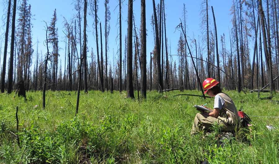
Pre- and post-fire measurements of fire effects help ecologists, fire scientists and managers determine how the severity of wildfires affects plants, animal habitat and ecosystem services. (Credit: Rachel Loehman, USGS)

For example, the USGS is partnering with the Los Alamos National Laboratory and Tall Timbers Research Station to model fire behavior, fire weather patterns, 3D fuel loads and smoke conditions to evaluate how fuel treatments can reduce fire risk across a changing landscape. The USGS is also strengthening its partnerships with the Fire Science Exchange Network to foster increased access and use of its fire information, data and tools while learning about needs of practitioners in the field.

The USGS Wildland Fire Science Strategy aligns with national initiatives as defined in the National Cohesive Wildland Fire Management Strategy. Developed by a broad swath of stakeholders at all levels, the Cohesive Strategy calls for science and management that promote resilient landscapes and fire-adapted communities for safe and effective wildfire responses.

For more details about the new USGS Wildland Fire Science 2021-2026 Strategic Plan, read the full report.

For more information about USGS fire science, visit www.usgs.gov/fire.


The caption in the second image was edited to correctly indicate that the personnel in the photo are USFS employees and the equipment seen was developed and owned by the USFS Missoula Fire Science Lab.

The wildland arsonist: one of the most dangerous criminals

Arsonist
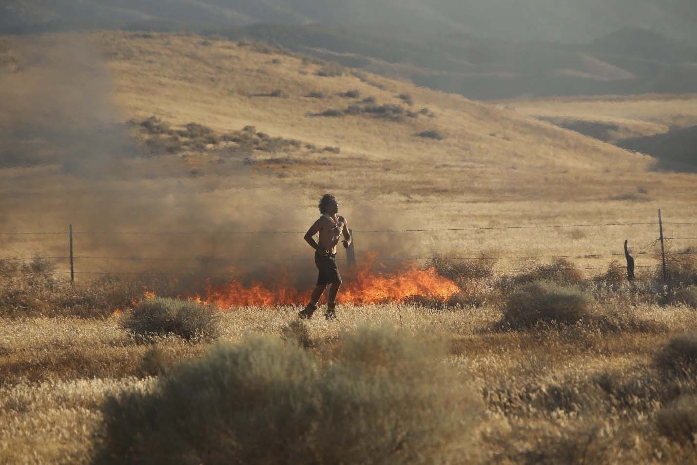
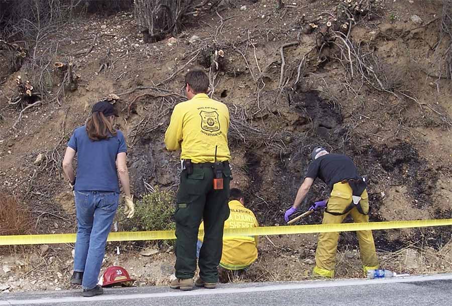
An arsonist in the midst of setting over a half-dozen fires in dry vegetation during a “red flag” condition in California. Photo courtesy of Jeff Zimmerman

By Joe Konefal and Ed Nordskog

The one criminal who possesses the power of a nuclear weapon at his fingertips is the wildland arsonist.  In certain areas of the world, if the weather and fuel conditions are favorable, a wildland arsonist has the instant ability to burn an entire community to the ground, and kill scores of people, their pets, livestock, and the wildlife in the area.  All of this carnage for the mere price of a match, a lighter or a road flare.

The good news is that there aren’t that many people intentionally setting arson fires in the wildlands, as yearly statistics prove that the overwhelming number of wildfires are not acts of arson.  The less good news is that historically, many of the actual wildland arson cases go “unsolved”.  The reasons for this are many, but one important reason is that compared to their urban counterparts, wildland arson investigators working for public agencies get very little money for resources and investigative training.  Wildland arson cases have two distinct phases; the scene work, and then the follow-up criminal investigation.  Many wildland investigators have a high degree of skill when conducting the “Origin and Cause” investigation at the scene, but they often lack the years of experience and ongoing certified training to pursue the criminal investigation portion of the case.  There are currently very few schools, books, or online sources out there dedicated specifically toward conducting an arson investigation in the wildlands.

That’s too bad.  Analysis of case histories shows that a significant portion of wildland arsons are committed by a small number of persons…the serial arsonists.  The majority of arson series are eventually solved, provided that the arsonist continues setting fires.  It is not unusual for investigators to learn that a single serial arsonist in the wildlands had set twenty to one hundred fires (or more) prior to the arrest.

Threat Assessment

Traditionally, the fire service (urban and wildland) rates arson fires by their damage (dollar loss) or their size in acreage.  This may greatly affect how much attention, manpower, and resources are devoted to an investigation.  But, to an investigator, the size of the fire has very little to do with assessing the threat level of an arsonist, as the size of the fire event is completely out of the hands of the arsonist.  The below factors are much more important to consider when conducting any threat assessment during a wildland arson investigation of an unknown subject.  These factors are important when considering the intent of the arsonist.

-Large number (more than three) of suspicious or arson fires in an area
-Rapid frequency of suspicious or arson fires in an area
-Arson fires purposely set in extreme fire conditions
-The use of an incendiary device by the arsonist

If any of these four factors are present, then even small fires or failed arson events (all serial arson cases have these) are to be considered high threat.  If an investigator determines that an offender is high threat, then the investigator must take immediate steps to approach this investigation as a major case investigation, and employ an arson task force approach to the case.

It is well known among modern criminal investigators that if you dedicate enough resources on any case, you can probably solve it fairly quickly.  The real issue is that public agencies seldom have the luxury to focus on any one case until it gets media attention.  This causes “small” fires set by arsonists to be classified as a “nuisance”, and put on the back burner for weeks or months until the arsonist sets a much larger or more destructive fire.  

Our position is that through training, and a proper threat assessment after every arson event, (small or large), investigators will more quickly focus resources on an emerging problem before the disastrous arson attack takes place.

Arson Task Force Approach and Investigative Mindset

Arson task force
Task Force: Federal and local investigators team up to work a serial arson case. The suspect was convicted for nine fires and had three prior serial arson convictions dating back thirty years. Courtesy Ed Nordskog’s case files.

This investigative mindset simply means treating the case as a major case from the beginning and using sufficient resources to solve the problem.  A task force can be as few as three to four investigators, or up to hundreds of investigators and support personnel.  The key to every task force is simple:  Bring the right people to the team, not the most.  

Continue reading “The wildland arsonist: one of the most dangerous criminals”

Bill reintroduced to create 21st Century Conservation Corps to improve resiliency to wildfire

Sponsored by two Senators and four Representatives

155th_Co_CCC_Feb,1940
154th Company, Civilian Conservation Corps, Eagle Lake Camp NP-1-Me. Bar harbor Maine, February, 1940.

Two Oregon Senators are going to reintroduce a bill that would put people to work in the woods, helping to restore public lands and provide jobs. The 21st Century Conservation Corps Act brought forward by Senators Ron Wyden and Jeff Merkley, would provide funds to support a natural resource management and conservation workforce and bolster wildfire prevention and preparedness.

Of course an earlier Conservation Corps with some similar goals was the Civilian Conservation Corps (CCC) 80 years ago. (More about the CCC later in this article.)

According to Senator Wyden:

Rural communities are facing two big challenges: struggling economies and continued wildfire threats. By investing in a 21st century workforce, this bill will put people to work to tackle the climate emergency, restore our public lands and reduce wildfire risks. The bottom line, creating new jobs and supporting our public lands go hand in hand.

 Provisions

Some of the provisions in the legislation would actually accomplish some meaningful things out on the ground that could make a difference:

  • Establishes a $9 billion fund for qualified land and conservation corps to increase job training and hiring specifically for jobs in the woods, helping to restore public lands and provide jobs in a time of need.
  • Provides an additional $3.5 billion for the U.S. Forest Service and $2 billion for the U.S. Bureau of Land Management to support science-based projects aimed at improving forest health and reducing the risk of catastrophic wildfire.
  • Establishes a $2 billion fund to provide economic relief for outfitters and guides holding U.S. Forest Service and U.S. Department of the Interior special use permits.
  • Provides $2 billion for the National Fire Capacity program, which helps the Forest Service implement FireWise, to prevent, mitigate, and respond to wildfire around homes and businesses on private land.
  • Provides $2 billion for the FEMA Building Resilient Infrastructure and Communities (BRIC) program to improve resiliency for communities impacted by wildfire.
  • Provides $6 billion for U.S. Forest Service, $6 billion for the National Park Service, and $2 billion for the Bureau of Land Management maintenance accounts to create jobs, reduce the maintenance backlog, and expand access to recreation.
  • Provides $3.5 billion for reforestation projects on a combination of federal, state, local, tribal and NGO lands, with over one hundred million trees to be planted in urban areas across America by 2030.
  • Increases access to public lands through expanding and investing in programs like Every Kid Outdoors and the Outdoor Recreation Legacy Partnership.

A nine-page document has more details about the bill.

Legislation with the same title was first introduced in the 2017-2018 Congress by Senator John McCain with strong bipartisan support, and a second time in the 2019-2020 Congress by Senator Ron Wyden. Neither was brought to a vote in the full Senate. It is possible that with the new administration and a new Congress the bill will have a slightly better chance of passage. So far, all six of the co-sponsors are of the same party, Democratic.

National Prescribed Fire Act of 2020

A few of the provisions in the bill are similar to our recommendations made in the analysis of the National Prescribed Fire Act of 2020, Senate Bill 4625, which was introduced September 17, 2020 by Senator Ron Wyden and died in the last Congress. It would have helped address the workforce capacity issue by appropriating $300 million for both the Forest Service and the Department of the Interior to plan, prepare, and conduct controlled burns on federal, state, and private lands.

At the time I made some suggestions that could be considered for funding along with an enhanced prescribed fire program:

  • Provide grants to homeowners that are in areas with high risk from wildland fires. Pay a portion of the costs of improvements or retrofits to structures and the nearby vegetation to make the property more fire resistant. This could include the cost of removing some of the trees in order to have the crowns at least 18 feet apart if they are within 30 feet of the structures — many homeowners can’t afford the cost of complete tree removal.
  • Cities and counties could establish systems and procedures for property owners to easily dispose of the vegetation and debris they remove.
  • Hire crews that can physically help property owners reduce the fuels near their homes when it would be difficult for them to do it themselves.
  • Provide grants to cities and counties to improve evacuation capability and planning, to create community safety zones for sheltering as a fire approaches, and to build or improve emergency water supplies to be used by firefighters.

Our article “Six things that need to be done to protect fire-prone communities” has even more ideas.

The CCC

The 21st Century Conservation Corps has some of the same goals as the Civilian Conservation Corps which between 1933 and 1942 employed young men across the United States who had trouble finding employment during the Great Depression. Through the course of its nine years in operation, three million participated in the CCC, which provided them with shelter, clothing, and food, together with a monthly wage that is equivalent to about $600 today. Enrollment peaked at the end of 1935, when there were 500,000 men in 2,600 camps with operations in every state.

The program closed in 1942 with World War II raging. The military reluctantly helped run the program but when the draft began in 1940, the policy was to make CCC alumni corporals and sergeants. Through the CCC, the regular army could assess the leadership performance of both regular and reserve officers.

Many of the projects the CCC accomplished still exist today. Their work included:

  1. Structural improvements: bridges, fire lookout towers, service buildings;
  2. Transportation: truck trails, minor roads, foot trails and airfields;
  3. Erosion control: check dams, terracing, and vegetable covering;
  4. Flood control: irrigation, drainage, dams, ditching, channel work, riprapping;
  5. Forest culture: tree planting, fire prevention, fire pre-suppression, firefighting, insect and disease control;
  6. Landscape and recreation: public camp and picnic ground development, lake and pond site clearing and development;
  7. Range: stock driveways, elimination of predatory animals;
  8. Wildlife: stream improvement, fish stocking, food and cover planting;
  9. Miscellaneous: emergency work, surveys, mosquito control.

Thanks and a tip of the hat go out to Kelly.