The US Forest Service has announced that one of the four people killed in the McKinney Fire in Northern California was Kathy Shoopman, a long-time FS employee. The agency said she died in her home in the community of Klamath River as a result of the fire on July 29, the day the fire erupted.
Ms. Shoopman started her career as a lookout at Baldy Mountain Lookout, west of Happy Camp, in 1974. Since then, she has staffed Lake Mountain Lookout, and most recently Buckhorn Lookout, a post she has held since 1993. She lived in the community of Klamath River for nearly five decades and was a talented artist, gardener, and a devout animal lover.
All four victims lived in Klamath River, which was ordered to evacuate on July 29 as the fire spread rapidly. It has now burned more than 60,000 acres. Ms. Shoopman was the first victim to have been positively identified.
Our sincere condolences go out to Ms. Shoopman’s family, friends, and co-workers.
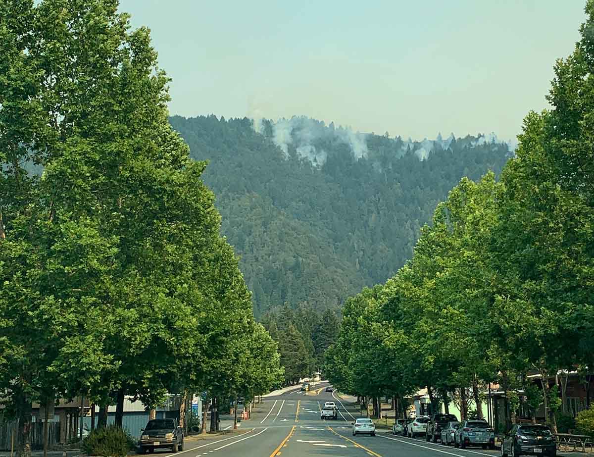
Willow Creek downtown during the Six Rivers Lightning Complex of fires, Aug. 7, 2022. InciWeb.
The wildfires in the Six Rivers Lightning Complex grew incrementally Monday, bringing the total acres burned up to about 8,900 acres when it was mapped at 9:00 Monday night. (See map below)
“Given the full-suppression tactics on this fire, crews will continue to fight fire aggressively in order to keep fire as small as possible,” the incident management team wrote in a Monday evening update. “Personnel are working to find areas to fight fire directly while continuing to provide community defense for Willow Creek, Seely Mcintosh, Salyer Heights, and other areas along the Trinity River.”
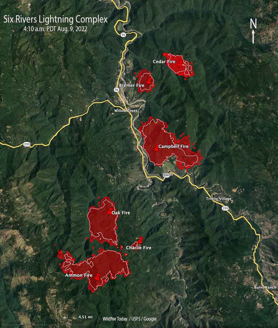
Map of the Six Rivers Lightning Complex. The red shaded areas were the perimeters at 9 p.m. August 8, 2022. The white lines were the perimeters about 24 hours previously. The red dots represent heat detected by a satellite at 4:10 a.m. Aug. 9, 2022.
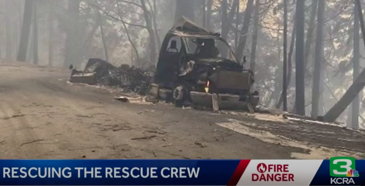
KCRA News reports that two firefighter crew carrier vehicles were destroyed by the fire. Dave Whitt, Chief of the Shingle Springs Band of Miwok Indians Tribal Fire, said “We had almost a million dollars worth of fire apparatus lost but nobody’s hurt, everybody’s safe.”
Two crew carriers burned in the Six Rivers Lightning Complex Fire, Aug. 8, 2022
With the destruction of the vehicles, 15 of the firefighters lost all of the personal gear they brought to the fire except what they were carrying at the time. Gone were sleeping bags, tents, extra tools, clothing, and personal items. Without their gear they were unable to set up tents and camp overnight like the other firefighters, so the Red Cross helped out by treating them like evacuees, providing a place to sleep when they were off duty.
Chief Whitt told Wildfire Today that he expects the US Forest Service compensation/claims process to replace the fire trucks and firefighting equipment. The tribe may assist the firefighters to replace their personal belongings, he said, but was not sure.
Resources assigned to the fire include 14 Type 1 Crews, 8 Type 2 Crews, 11 ST (strike teams) Type 3 Crews, 12 Dozers, 4 Chippers, 11 ST Type 6 Engines, 4 ST Dozers, 11 Type 3 Engines, 7 Water Tender Support, and 2 Feller Bunchers for a total of 525 personnel.
The weather forecast continues to predict moderate and normal conditions.
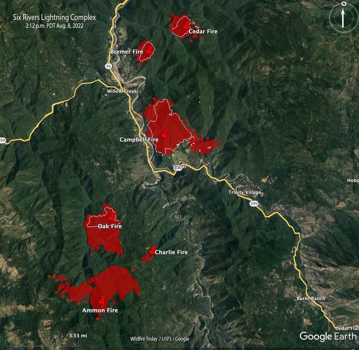
Map looking north from the south end of the Six Rivers Lightning Complex. The red shaded areas were the perimeters at 8:26 p.m. Aug. 7. The white lines were the perimeters about 24 hours before. The red dots represent heat detected by a satellite at 2:12 p.m. Aug. 8, 2022.
The incident management team that assumed command of the Six Rivers Lightning Complex at 6 a.m. Sunday August 7 said on Monday, “This is a full suppression fire. Firefighters will aggressively fight fire whenever it is safe to do so.”
Among their objectives, they intend to keep the fire west of Lone Pine, south of Horse Linto Creek, east of Brannan Ridge, and north of Ammon Ridge.
Humboldt County has issued additional evacuation orders. The current information is at the county’s website.
The fire is in a remote area of northwest California in the Six Rivers National Forest between Redding and Eureka.
The team reported that last year’s snow event left a lot of trees dead and down on the ground. If ignited, it can result in fire behavior that is more substantial than what would usually be anticipated this time of year.
Map of the Six Rivers Lightning Complex. The red shaded areas were the perimeters at 8:26 p.m. Aug. 7. The white lines were the perimeters about 24 hours before. The red dots represent heat detected by a satellite at 2:12 p.m. Aug. 8, 2022.
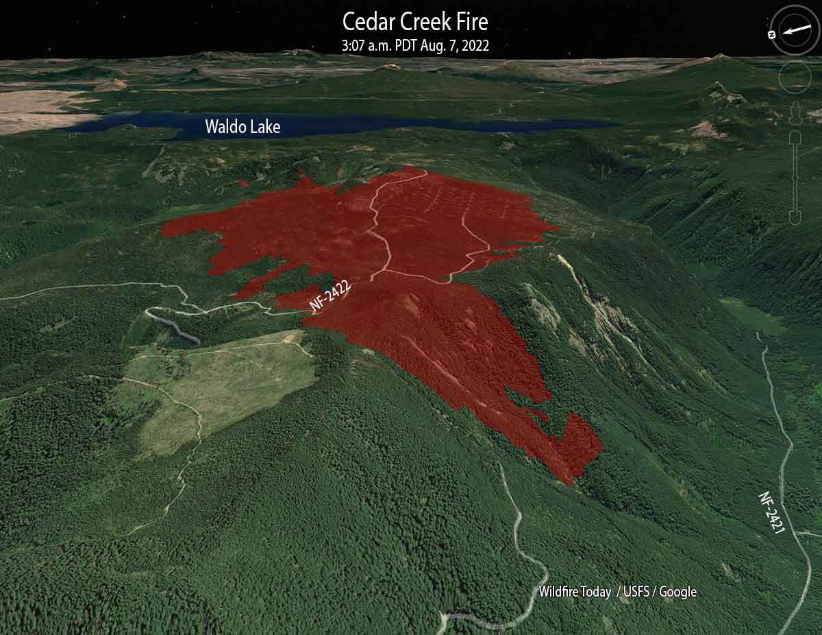
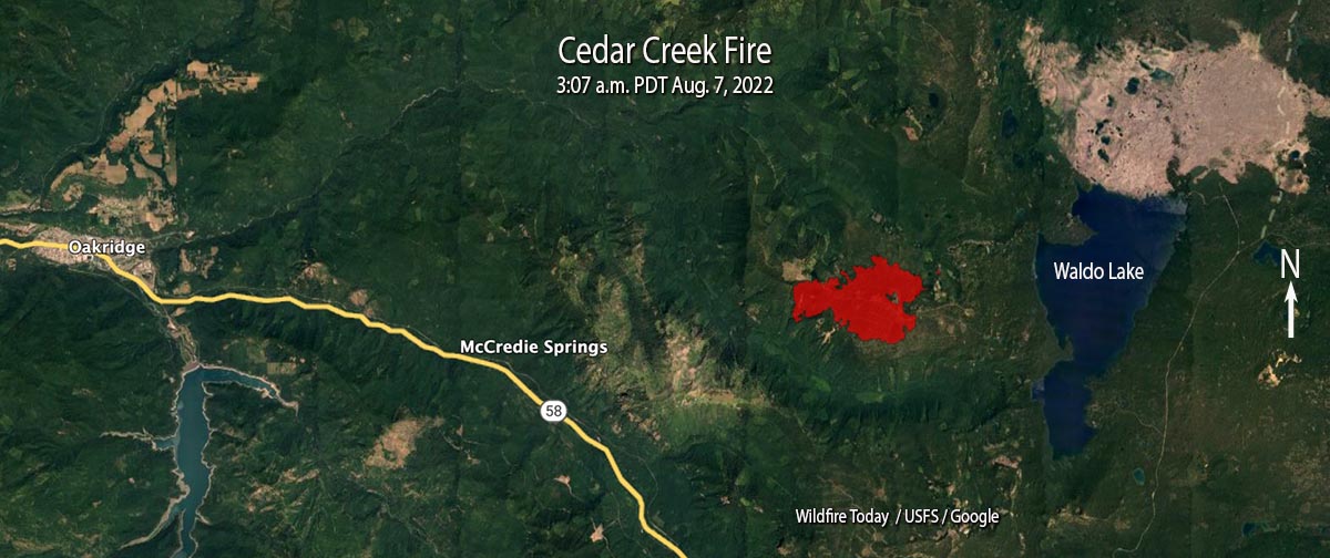
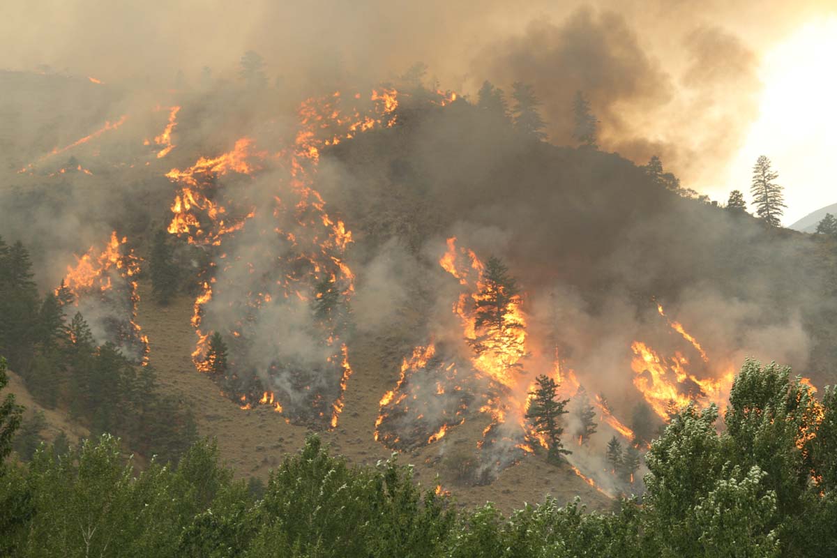
Cedar Creek Fire, looking east at 3:07 a.m. PDT Aug. 7, 2022
The Cedar Creek Fire on the Willamette National Forest in Western Oregon was very active when it was mapped by a fixed wing aircraft at about 10 p.m. Saturday, and also during a satellite overflight at 3 a.m. Sunday. Spot fires were observed 800 feet ahead of the main fire.
It has burned 1,822 acres since it started from a lightning strike August 1, one of 20 to 30 fires ignited by lightning that night. Most of it is burning on a plateau with a steep slope on the south side. The blaze is north of Highway 58, 14 air miles east of Oakridge, and 2 miles west of Waldo Lake.
Cedar Creek Fire, mapped at 3:07 a.m. PDT Aug. 7, 2022.
A Type 1 incident management team assumed command on August 5. Since then the team has been scouting for opportunities to safely engage the fire.
Currently there are no evacuations in effect.
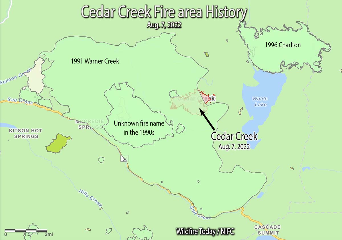
Update at 11:57 a.m. PDT August 9 2022. It turns out that there is a major error in the National Interagency Fire Center fire history database. In the map below we created using their data, the polygon shown as the 68,000-acre 1991 Warner Creek Fire is completely in error and does not exist at that scale or at that location. The polygon that was not identified in the NIFC database that we labeled as “Unknown fire name in the 1990s”, is actually the 8,900-acre Warner Creek Fire of 1991. We regret the error. This is not the first time we have seen gross errors in the NIFC fire history database, especially for Oregon, and causes us to question ever using it again.
The 1996 Charlton Fire which burned 9,000 acres is 3 miles to the northeast on the north side of Waldo Lake.
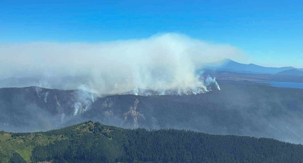
Cedar Creek Fire looking north at 11 a.m. August 6, 2022. InciWeb photo.
In the video below recorded Sunday morning, Operations Section Chief Kyle Cannon describes the current situation.
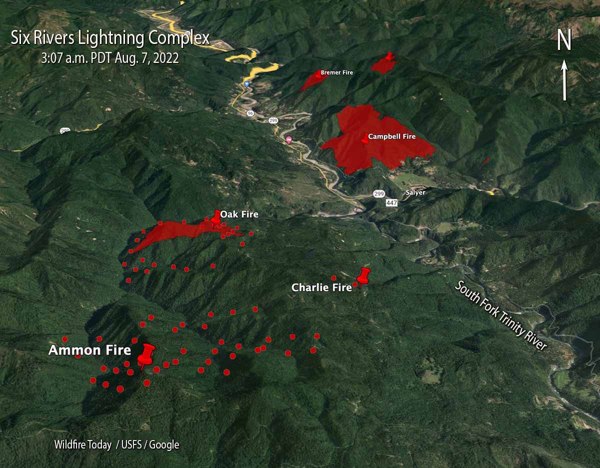
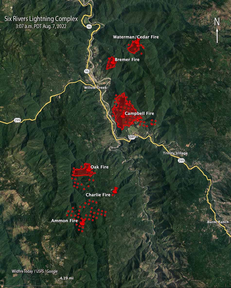
Six Rivers Lightning Complex, north end. The red shaded areas were the perimeters at 8:32 p.m. Aug. 6.
Saturday night at 8:32 a fixed wing aircraft mapped four of the eight fires on the Six Rivers National Forest that comprise the Six Rivers Lightning Complex of fires. The three closest to Willow Creek and east of Highway 299 at that time were the Bremer (213 acres), Campbell (1,526 acres), and Cedar (250 acres).
As can be expected when a dozen fires all start at about the same time in rugged country, there has been some confusion about the names of the fires. We did the best we could to sort that out, but the names on these maps could be subject to change.
Six Rivers Lightning Complex, south end. The red shaded areas were the perimeters at 8:32 p.m. Aug. 6. The red dots represent heat detected by a satellite at 3:07 a.m. August 7, 2022.
The Type 2 Incident Management Team 11, led by Incident Commander Christopher Fogle, will assume command August 7th at 6:00pm.
Six Rivers Lightning Complex. The red shaded areas were the perimeters at 8:32 p.m. Aug. 6. The red dots represent heat detected by a satellite at 3:07 a.m. August 7, 2022.
Updated at 8:13 p.m. PDT August 6, 2022
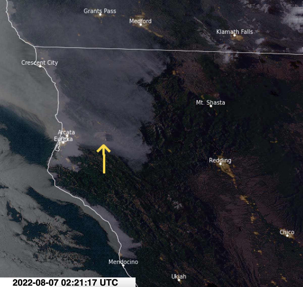
Satellite photo showing smoke from the Six Rivers Lightning Complex of fires at 7:21 PDT Aug. 6, 2022. NOAA.
Updated at 8:02 p.m. PDT August 6, 2022
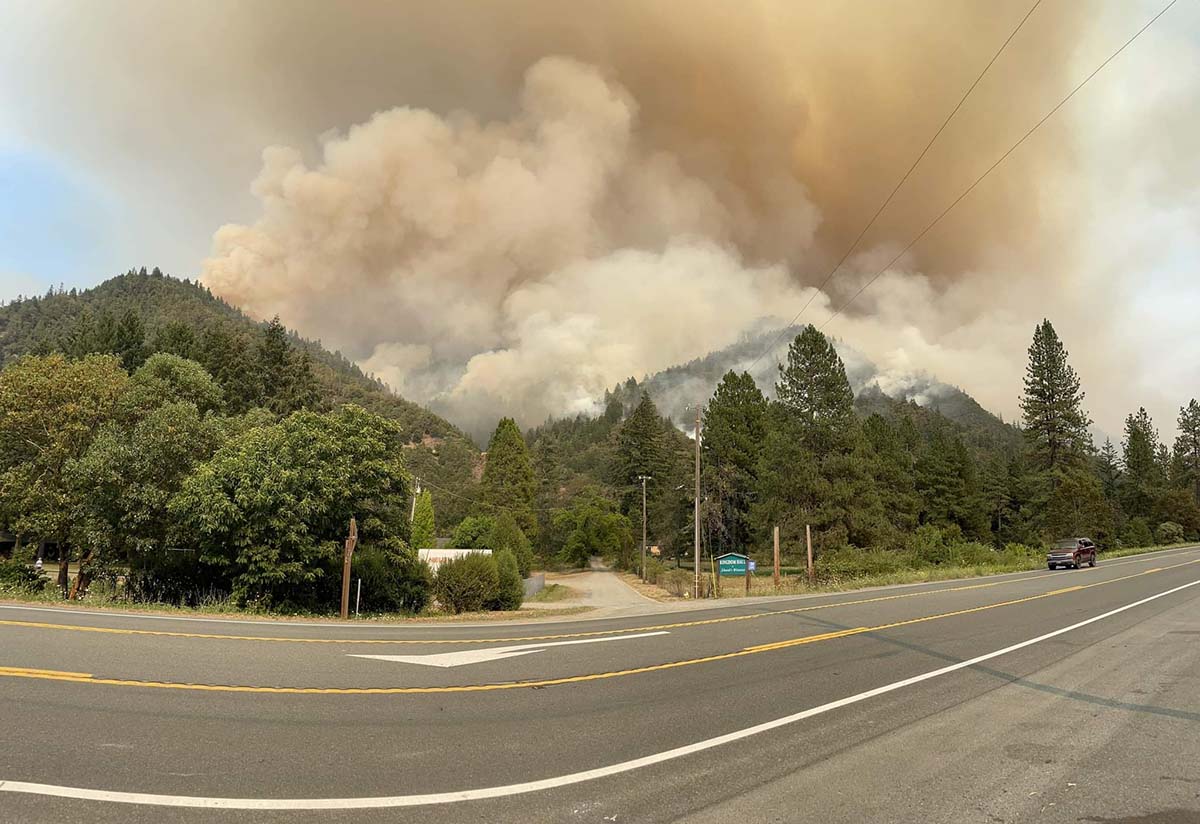
Campbell Fire, part of the Six Rivers Lightning Complex, taken from Lilys Thai Kitchen by Basho Warson Parks, Aug. 6, 2022.
The Six Rivers National Forest is calling the fires near Willow Creek, California, the Six Rivers Lightning Complex. They released the following information and map on Saturday.
We cannot stress this enough- This is a VERY ACTIVE INCIDENT and is emerging and changing rapidly. Please don’t take notifications lightly and stay informed.
WATERMAN: Approx. 75 acres. Fire is located northeast of Willow Creek on Waterman Ridge Road 7N02 Forest Route 4.
CEDAR: Approx. 80 acres. Fire is located near Waterman Fire.
BREMER: 15 acres. Fire is located northeast of Willow Creek on ridgetop above the Bigfoot Subdivision.
FRIDAY: Fire is located south of Willow Creek ½ mile up Friday Ridge Rd from Hwy 299.
OAK: 200 acres. Fire is located south of Willow Creek. Near FS Road 5N31 and 6N20.
CHARLIE: Contained. Located south of Willow Creek near the Oak Fire and along FS Road 6N20.
CORRAL: Fire is located northeast of Willow Creek on Tish Tang Ridge.
CAMPBELL: Due to fire activity, the Bravo and Campbell fire have merged and is now being called the Campbell fire. Approx. 150 acres. Located south of Willow Creek on the west side of Campbell Ridge above Campbell Ridge above Campbell Ridge Road.
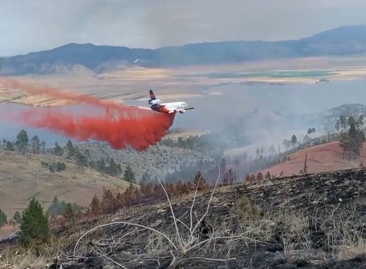
The Montana Department of Natural Resources and Conservation posted an excellent video of air tanker 914, a DC-10, dropping retardant on the Matt Staff Rd Fire.
DNRC’s County Assist Team has assumed command of the Matt Staff RD fire. Great progress was made thanks to the efforts of firefighters, aircraft, and calmer weather conditions. Here’s a video of an airtanker working with crews to slow fire progress. #mtfire#fireyear2022pic.twitter.com/YpiIrgZQY1
The fire has burned 1,538 acres 13 miles east of Helena, Montana between Canyon Ferry Lake and US Highway 287.
All evacuations on the fire were lifted at 8 p.m. Friday, August 5th. Matt Staff Road is still closed to the public. Montana’s County Assist Team assumed command of the fire at 12 p.m. on August 5th. The cooler temperatures and brief rain Saturday morning were beneficial to firefighting efforts.
The drop
The terrain seen in the video is not extreme, but appears to be outside the parameters NASA expected for a very large air tanker such as a DC-10.
Here is an excerpt from the NASA report issued March 2, 2009, titled “USFS Very Large Air Tanker Operational Test and Evaluation.”
The analysis suggests that for level or gently rolling terrain where level to slight descents (< 6-7%) are required, VLAT-class aircraft could probably be employed with few restrictions as long as they remained above 300’ AGL during the delivery.
Check out the video below posted by Kevin Osborne showing a DC-10 making a downhill drop in 2012 on the Goff Fire on the Klamath National Forest in Northern California.
Names of fires
On a related subject, here is my plea for initial attack and dispatcher personnel to keep the names of fires simple. Fires are usually named after a nearby landmark or geographical feature. One word is preferred, but certainly no more than two. Think about how many times the name will have to written, spoken, and typed into forms. Will spelling be easy, or will it be misleading, such as “Camp Fire”, or Road vs Rd?
Aerial ignition by unmanned aerial vehicle on the Moose Fire in Idaho, August 2, 2022. By Mike McMillan for the USFS.
Here is a quick two-minute review of wildfires over the last week, produced by the National Interagency Fire Center August 5 2022.
Currently there are 32 large uncontained fires in the United States that are being fully suppressed. Another 39 are not being fully suppressed: 17 in the Alaska Geographic Area, 3 in the Southwest, 5 in the Great Basin, and 4 in the Northern Rockies.