California power company’s line clearance program criticized by the state

Wall Street Journal reported PG&E’s power lines and equipment started more than 1,500 fires in a 4-year period

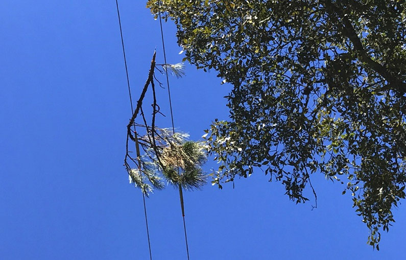
Vegetation power line cause faults fires electrically
File photo of vegetation near an electrical line. (Texas A&M Engineering photo)

The California Public Utilities Commission has ordered Pacific Gas and Electric to revise its plan to reduce wildfire ignitions caused by their power lines. The company provides electrical service to areas of Central and Northern California.

PG&E missed a deadline for submitting and gaining approval of their 2021 Wildfire Mitigation Plan. The PUC ordered the company to revise a version they prepared earlier and granted a one-month extension of the deadline.

The PUC’s Wildfire Safety Division says that PG&E is actually spending less money on clearing vegetation from power lines and other equipment, contradicting claims that they are hiring more people to do the work.

Other concerns in the report include quality control and verifying how money spent reduces wildfire risk.

The Wall Street Journal (subscription) reported that investigators attributed more than 1,500 fires to PG&E power lines and hardware between June 2014 and December 2017.

CAL FIRE attributed 12 fires that started in Northern California on October 8 and 9, 2017 to PG&E power equipment.

A search through the Wildfire Today archives found numerous fires attributed to PG&E between 1999 and 2020.  Some of the larger ones are below; it is not a complete or comprehensive list.

  • Zogg Fire, September, 2020, 56,338 acres, destroyed 204 structures, and caused the deaths of four people.
  • Kincade Fire, October, 2019, 77,000 acres, and destroyed 374 structures.
  • Camp Fire, November , 2018, 154,000 acres, destroyed 18,000 structures, and caused the deaths of 84 people. The company pleaded guilty to 84 counts of involuntary manslaughter.
  • Cascade Fire, October 2017, 9,989 acres, destroyed 250 structures, and caused the deaths of five people, including one firefighter.
  • Redwood Valley Fire, October, 2017, 36,523 acres, destroyed 543 structures, and caused the deaths of 9 people.
  • Sulphur Fire, October, 2017, 2,207 acres, destroyed 162 structures.
  • Cherokee Fire, October, 2017, 8,417 acres, destroyed 6 structures.
  • 37 Fire, October, 2017, 1,660 acres, destroyed 3 structures.
  • Blue Fire, October, 2017, 20 acres.
  • Norrbom, Adobe, Partrick, Pythian and Nuns Fires,  October, 2017, burned together, 56,556 acres, destroyed 1,255 structures, and caused the deaths of 3 people.
  • Pocket Fire, October, 2017, 17,357 acres, destroyed 783 structures.
  • Atlas Fire, October, 2017, 51,624 acres, destroyed 783 structures, and caused the deaths of 6 people.
  • Butte Fire, September 2015, 70,868 acres, destroyed a total of 921 structures, including 549 homes, 368 outbuildings, and 4 commercial properties, and caused the deaths of two people.
  • Pendola Fire, October, 1999, 11,725 acres.

More firefighting helicopters to be available in SoCal this summer

Two Chinooks and an S-61

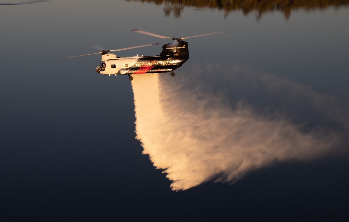
N42CU Coulson CH-47 Chinook helicopter
Coulson’s CH-47 Chinook N42CU. Coulson photo, 2020.

This article first appeared at Fire Aviation.

Three counties in Southern California will be boosting their aerial firefighting capability this year with each adding one large contractor-owned helicopter.

Ventura, Los Angeles, and Orange counties each have their own fleets of helicopters that can be used for firefighting and search and rescue. But in Los Angeles and Orange Counties, the 3,000-gallon Boeing CH-47D Chinooks they will add this year can carry three to eight times the loads of their FireHawks, UH-1H’s, and Bell 412EP’s.

Ventura, Los Angeles, and Orange Counties helicopters
Ventura, Los Angeles, and Orange Counties will be contracting for large helicopters this year.

Ventura County has arranged to add a Sikorsky S-61 with a 1,000-gallon tank. It will supplement their UH-1’s and the new-to-them Firehawk that just returned from Colorado after  being upgraded to Firehawk status with a new 1,000-gallon belly tank.

Orange County will also have a Sikorsky S-76 to provide intelligence, evaluate effectiveness of drops, and identify targets with a laser designator.

Coulson S-76 and S-61 helicopter
Coulson S-76 and S-61, L to R. Coulson photo.

The three counties will be calling this a “Quick Reaction Force Program.”

All four of these aircraft are being supplied by Coulson Aviation and will be staffed 24/7, capable of flying and dropping water on wildfires at night. They can also perform a maneuver that few helicopters have done in recent decades — refill their tanks while hovering over a water source at night. That is common, of course, during daylight, but rarely done in darkness using night-vision goggles.

The aircraft will be on contract starting June 15 ranging from 150 to 180 days.

Much of the funding for the helicopters is being supplied by Southern California Edison (SCE), expanding their program which supplied one or two helicopters based in Orange County in 2019 and 2020. In those years SCE paid the daily availability costs and when it was used on fires the hourly fees were covered by the jurisdiction in which the fire occurred.

In 2020 SCE and the Orange County Fire Authority (OCFA) leased a CH-47D Chinook from Coulson. The night-flying helicopter was stationed at the Los Alamitos Joint Forces Training Base in Orange County on a 24/7 schedule.

In 2019 the OCFA also had an arrangement with SCE for a 24/7 night flying helicopter. In that case Coulson supplied an S-61 capable of 1,000 gallons and a Sikorsky S-76. The S-76 was not leased in 2020 because it was going through an avionics upgrade getting ready for fighting fire in the upcoming Australian summer, but it will be part of the Quick Reaction Force Program in 2021.

It is likely that these and other helicopters will occasionally make use of the 69Bravo Helistop that is being upgraded with four metal 8,000-gallon automatically refilling water tanks. Designed to efficiently refill helicopters’ buckets or tanks, it is located on one of the highest peaks in the Topanga area of the Santa Monica Mountains in Los Angeles County.

The Chinook, Firehawk, and S-61 can get to and from water sources quickly cruising at 140 to 160 mph, while the S-76 with the pedal to the metal tops out at 178 mph.

Coulson Chinooks being unloaded at Houston
Coulson Chinooks being unloaded at Houston after completing their firefighting contracts in South America. Coulson photo, May, 2021.

Firefighting helicopter crash in China kills four

It was attempting to refill its water bucket at a lake

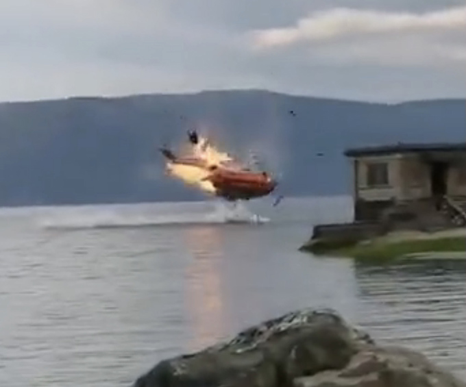
Helicopter crash in China May 10, 2021
Helicopter crash in China May 10, 2021. Still image from video.

This article first appeared on Fire Aviation.

Four were killed Monday May 10 after a helicopter crashed in Erhai Lake in Dali, Southwest China’s Yunnan Province. The Z-8X helicopter operated by the People’s Liberation Army Air Force had been assisting firefighters on the ground by dropping water with an external bucket. It crashed while attempting to refill at the lake.

Initially it was reported that the two pilots were killed and there were two missing crewmembers. After a search that involved 16 ships and more than 490 rescuers the crewmembers were found deceased about 16 hours later, very early Tuesday morning local time.

Videos show the aircraft start to slowly rotate or spin while it was a couple of hundred feet above the lake before the bucket was lowered into the water. The spin increased in speed and the helicopter descended, then there was an explosion that sent debris flying before the helicopter hit the water.

The video below has a different angle and includes footage after the crash.

The best video is at Yahoo News.

Our sincere condolences go out to the crew’s family, friends, and coworkers.

The Z-8 helicopter is a Chinese version of the French Aérospatiale SA 321 Super Frelon helicopter.

The China Daily, owned by the Propaganda Department of the Chinese Communist Party, reported that a huge number of people were assigned to the 118-acre wildfire the helicopter was working on:

“A total of 2,532 people were mobilized to extinguish the fire which scorched some 48 hectares of land, according to the forest and grassland fire prevention and control headquarters in Dali. No casualties as a result of the fire have been reported.”

A typical fire that size would have a perimeter of about 9,400 feet. If the 2,532 personnel on the fire were all standing on the perimeter they would be stationed every 3 feet, literally shoulder to shoulder.

Thanks and a tip of the hat go out to Bob.

Forecast for smoke from Arizona’s Tussock Fire

Tussock Fire smoke plume May 10
Tussock Fire predicted smoke plume. May 10. Arizona Department of Environmental Quality.

The Arizona Department of Environmental Quality expects that smoke from the Tussock Fire will generally disperse to the east Monday and Tuesday. The fire is 27 air miles northwest of the northern Phoenix suburbs.

Below is their prediction issued at 9:47 a.m. on Monday May 10, 2021:

“[Monday] is expected to be another windy day, with south-southwest winds in the 10-20 mph range. Smoke is forecast to rise and disperse toward the east-northeast. Smoke may move over Camp Verde, Payson, and Winslow; however, smoke is expected to be elevated off the ground. Some smoke may drop down the backside of the Bradshaws Mountains this afternoon and into Bumble Bee, Cordes Lakes, Cleator, and Mayer, but impacts are expected to be short-lived.

“[Tuesday], as high pressure builds into the region, smoke is forecast to rise and disperse toward the east-southeast, with some smoke moving over the far north portion of the Phoenix Valley. This smoke is expected to be elevated well off the ground, so not forecasting any smoke impacts to the Valley. With that said, Anthem, New River, and Cave Creek may briefly smell smoke, especially in the late evening on Tuesday.”

The forecast below for Arizona is for 6 p.m. MDT May 10, 2021, produced by NOAA.

Smoke Forecast, 6 p.m. MDT May 10, 2021 Arizona Tussock Fire
Smoke Forecast for Arizona, 6 p.m. MDT May 10, 2021. NOAA.

Australia will create new agency to oversee recovery from bushfires, floods, and cyclones

Bushfire in Victoria, Australia
Bushfire in Victoria, Australia. December, 2019.

In a response to the report from the Bushfire Royal Commission, Australia’s Federal government will create a new agency to provide relief, recovery, and mitigation from future weather events.

The National Recovery and Resilience Agency (NRRA) will be given $600 million to fund projects to bushfire and cyclone-proof houses, and build levees in disaster-prone areas. The money would also be put towards improving telecommunications infrastructure to better withstand disasters.

Two existing recovery agencies will fall under the umbrella of the new government body — the National Drought and North Queensland Flood Response and Recovery Agency (NDNQFRRA), and the National Bushfire Recovery Agency.

Control of the Bushfire Recovery Agency’s $2 billion fund will be handed to the new body.

The long-term recovery efforts in communities affected by recent floods across the east coast and cyclones in Western Australia will also become the responsibility of the NRRA.

NDNQFRRA coordinator-general Shane Stone, a former Northern Territory chief minister and Liberal Party president, will oversee the new agency.

From abc.net.au

Tussock Fire burns thousands of acres southwest of Crown King, Arizona

12 miles northwest of Lake Pleasant

Updated at 11:49 a.m. MDT May 10, 2021

The Type 1 Incident Management Team that assumed command of the Tussock Fire southwest of Crown King, Arizona at 6 a.m. Monday  provided additional information, confirming the fire was still mapped at 3,500 acres.

(Click here to see which areas will be affected by smoke from the fire on Monday and Tuesday.)

“The fire actively moved up hill yesterday with the dry windy conditions,” the update said. “Challenges the team will be assessing include the rugged topography and the alignment of drainages combined with anticipated weather. Additional resources and personnel are arriving to assist with the firefighting effort.”

Approximately 226 personnel are assigned to the fire.


Updated 9:17 a.m. MDT May 10, 2021

Tussock Fire map
Tussock Fire map. The red dots represent heat detected by a satellite at 4:18 a.m. MDT May 10, 2021. The red line was the perimeter at 9:22 a.m. MDT May 9, 2021.

The Incident Management Team (IMT) on the Tussock Fire five miles southwest of Crown King, Arizona is not releasing much information. At 11:35 p.m. on May 9 evacuations were in effect for Minnehaha, Fort Misery, and Horse Thief Basin. Crown King is now at SET and residents should begin preparing in the event an evacuation order is issued.

The map above shows the proximity to Crown King; scroll down to see maps showing broader areas.

Sunday night the IMT reported that no structures were immediately threatened at that time and the fire had burned 3,500 acres.

Tussock, fire history
Wildfire history in the vicinity of the 2021 Tussock Fire.
The Southwest Area Type 1 IMT #2 with Incident Commander Dave Bales was expected to assume command of the fire at 6 a.m. Monday, May 10.


1:15 p.m. MDT May 9, 2021

Map of the Tussock Fire
Map of the Tussock Fire at 9:22 a.m. MDT May 9, 2021.

Since the Tussock Fire started during the afternoon of May 8, it has burned 2,448 acres 6 miles southwest of Crown King, Arizona and has spread onto the Prescott National Forest. Due to very dry fuel and weather conditions a Type 1 Incident Management Team has been ordered to assist with management of the incident.

The fire is between Phoenix and Prescott, 27 air miles northwest of the suburbs of Phoenix. (See the map above)

Tussock Fire, satellite photo
Tussock Fire, satellite photo at 1241 p.m. MDT May 9, 2021. NASA.
Tussock Fire
Tussock Fire. Posted May 9, 2021 by BLM
Tussock Fire
Tussock Fire. Posted May 9, 2021 by BLM