Using maps of fires to communicate with the public

The good the bad and the ugly

Maps are a great way to communicate with a public that may be starving for information about an ongoing fire, or to inform them about conditions that could lead to more fires. They can provide information very quickly — if thoughtfully created.

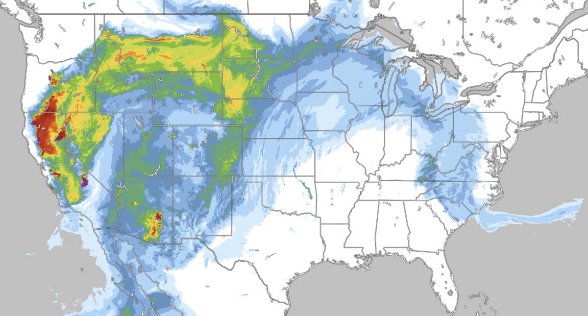
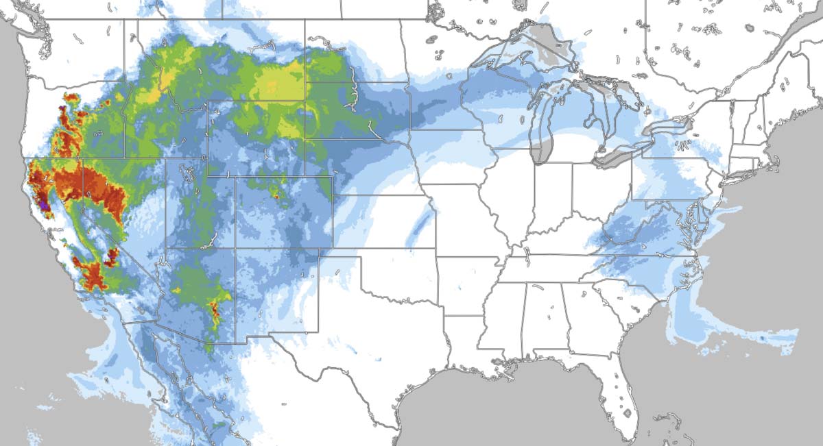
The two maps below distributed by Geographic Area Coordination Centers (GACC) on Twitter attempt to warn the public about the elevated danger of wildfires caused by actual or predicted lightning. I would venture a guess that the general public would have great difficulty figuring out what part of the country they represent based solely on the images. There are no state boundaries that can be easily identified and no cities or highways to make the guessing game easier. The polygons within the maps (which are not counties on the RMACC map) do not convey any worthwhile information to the casual Twitter user, only adding to the confusion.

I am a harsher critic of maps than most, having spent many fire assignments as Situation Unit Leader and Planning Section Chief, producing maps for firefighters and the public. Map making continues at Wildfire Today, producing graphics to illustrate the location of fires.

When the public sees smoke or they hear about new fires, many of them have one overriding question. Where is the fire? Unless they have property in the area, the typical person does not need to know that the fire is 300 feet west of Forest Service Road 24D3. They also don’t care about division breaks or helicopter dip sites. They need a map so they can figure out, in many cases, where the fire is in relation to them or their community. A map that is zoomed in so tight that the geographical context of the fire can’t be seen, is often not helpful to the public. A person can get oriented more easily if they can see highways and one or more cities/towns/communities. But if the incident is in a very remote area, that can be difficult.

I visited InciWeb today and found some good, bad, and ugly examples. All of the images below were large files that needed to be reduced in size to show here; the original images have more detail.

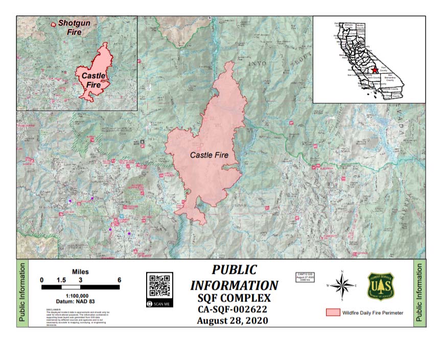
The map below of the Castle and Shotgun Fires on the Sequoia National Forest appears to be based on the standard Forest Service recreation map that forest visitors can purchase — on paper. It is shaded, which may represent vegetation and/or topography and also includes virtually every Forest Service site or feature that exists, including dirt roads. The result is clutter that unless a person has a high-resolution copy of the image and plenty of time, it is difficult or impossible to find paved roads, highways, or communities that could help a person to get oriented. At least it has a vicinity map at upper-right so we know it is in central California.

The base map used for fire public information maps should not be topographical lines or the standard F.S. recreation map.
Map SQF Complex of fires
Map of the SQF Complex of fires on the Sequoia National Forest, August 28, 2020.

The map of the Griffin Fire below is better. It is zoomed out providing geographical context, and is not cluttered. But much of the very small text is difficult or impossible to read.

Griffin Fire, Arizona
Griffin Fire, Arizona, August 30, 2020.

The map below shows five widely separated fires in Arizona so it has quite a bit of context. It shows many, many dirt roads, but that helps to show the location of the three fires on the east side. I don’t know that the shaded relief background adds value, but it has a vicinity map, which is a plus. Overall, a very good map.

Medicine Fire Arizona
Medicine and other Fires in Arizona Augut 30, 2020.

The map of the P515 and Lionshead Fires in Oregon deserves praise for its simplicity and lack of clutter. The colors showing ownership are all very different from each other, making it simple to compare them to the helpful legend. It is effective and easy to comprehend. The Lionshead Fire is so close to the edge it makes me wonder what is just off the map to the west. Probably more of the same, but still…

(One of my pet peeves is when six similar shades of brown, for example, represent different features. Not a problem on this map.)

P515 and Lionshead Fires in Oregon
P515 and Lionshead Fires in Oregon, August 29, 2020.

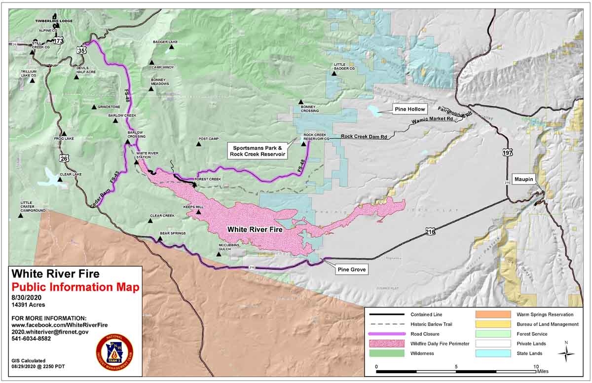
The best map that I ran across during my quick perusal of InciWeb today is the White River Fire on the Mt. Hood National Forest in Oregon. The map maker made sure to include at least one community and several highways. They even went the extra step of adding three labels to features with which the public may be familiar. It is pleasing to the eye, has a useful legend, and the highways near the fire are identified. Even though much of the fire is on Forest Service responsibility land, they resisted the urge to use the FS recreation map as a base map.  Great job, White River Fire. (Contact us and we’ll send you a prize, a Wildfire Today cap.)
White River Fire in Oregon
White River Fire in Oregon. August 30, 2020.

Two fires erupt in South Dakota and Nebraska

Posted on Categories WildfireTags ,

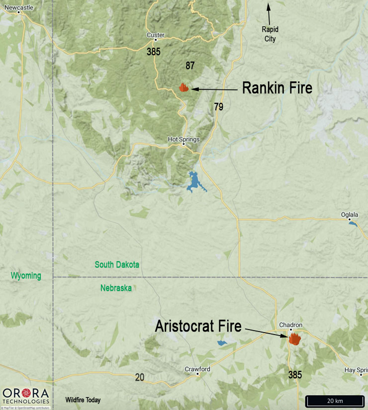
North of Hot Springs, SD and south of Chadron, NE

Black Hills Fires August 28, 2020
Map showing the locations of fires in Nebraska and South Dakota, August 28, 2020.

On Friday firefighters were attacking two new fires in South Dakota and Nebraska.

The Aristocrat Fire is in northwest Nebraska near Chadron three miles southeast of the intersection of highways 385 and 20. Spokesperson for the U.S. Forest Service Tom Buskirk said at 6:30 p.m. MDT Friday it had burned approximately 200 acres and the spread had been mostly stopped. A variety of federal, state, and local fire agencies are working on the blaze. Mr. Buskirk said a large air tanker and a single engine air tanker had assisted firefighters in the afternoon.

At Wildfire Today we noted that Friday at 2:18 a.m. MDT a satellite detected heat in the area of the Aristocrat Fire.

The Rankin Fire in southwest South Dakota is north of Hot Springs in Wind Cave National Park two miles north of the intersection of highways 87 and 385. The lightning-caused fire is east of highway 87 and 1.5 miles south of Rankin Ridge lookout tower. At 6:30 p.m. MDT Friday the 20-acre fire was burning in an area that has been treated with prescribed fires. It is being attacked by engine crews, a  Type 2 hand crew from Oregon, and a wildland fire module from New Jersey. Three single engine air tankers and a Type 3 helicopter are also assisting firefighters.

Engine crew on Cameron Peak Fire tests positive for COVID-19

Beginning next week at the fire west of Fort Collins, Colorado, personnel will be tested as they are demobilized if they request it

Cameron Peak Fire map
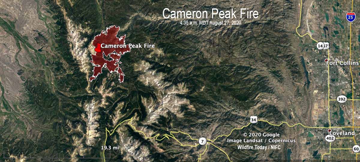
Map of the Cameron Peak Fire at 4:35 a.m. MDT August 27, 2020.

Three engine crew members working the night shift on the Cameron Peak Fire 32 miles west of Fort Collins, Colorado tested positive earlier this week for COVID-19. Five others at the 22,845-acre fire were considered exposed, so all eight were quarantined.

“It was three people off of one engine,” that tested positive, said Kevin Ratzmann the Medical Unit Leader for the fire. “One individual [initially] tested positive for COVID August 24. He started having a little shortness of breath so he was tested at the local hospital.”

The other two members of the engine crew also tested positive.

To see all articles on Wildfire Today about the Cameron Peak Fire, including the most recent, click here.

Before the first person who tested positive received his results, he came back to the fire camp and potentially exposed others, so five more people were put on precautionary quarantine. Local public health personnel determined that those five individuals were exposed within six feet for 15 minutes or longer, so they were quarantined out of an abundance of caution, explained Mr. Ratzmann. “Not one of [those five] have any symptoms,” he said. “They were all tested today [August 28]. We are waiting on the results and will test them again in three days and if they are all clear they will return to work.”

The person on the engine crew that reported symptoms claimed a medical exemption for wearing a mask, but the incident management team is now requiring everyone to wear a mask except when they are actually fighting fire on the fire line.

Many of the activities normally located at the incident command post have been converted to virtual systems or using QR codes, including check-in, demobilization, and meetings.

After contact tracing was completed, no personnel at the fire other than the eight that were isolated or quarantined were tested for COVID-19. However, the incident management team is offering voluntary COVID testing to others on the fire. Mr. Ratzmann said it was mostly because their home unit wanted the testing, not because they have symptoms. He said it took about two days to receive test results on the Pine Gulch Fire, another blaze in Colorado where he was assigned earlier, as the incident management team was tested when they demobilized.

Mr. Ratzmann said that starting early next week anyone at the Cameron Peak Fire who is being demobilized will be tested once if they request it. The national situation report shows 730 personnel assigned to the fire.

There are 38 people working in the Medical Unit at the incident command post, including personnel on the 5 ambulances. That is a larger staff for a Medical Unit on a 730-person fire than in the pre-COVID era.

The Cameron Peak fire has been less active in the last couple of days. Satellites orbiting more than 200 miles overhead have not been able to pick up very many large heat sources. However, there are undoubtably numerous areas on the fire that are still burning and where much still needs to be accomplished by firefighters. Most of the areas detected by satellites were on the northeast side, four to five miles northeast of Chambers Lake.

200 U.S. Army soldiers to be mobilized to fight wildfires

After training, they are expected to be fire-ready by September 3

Soldier training
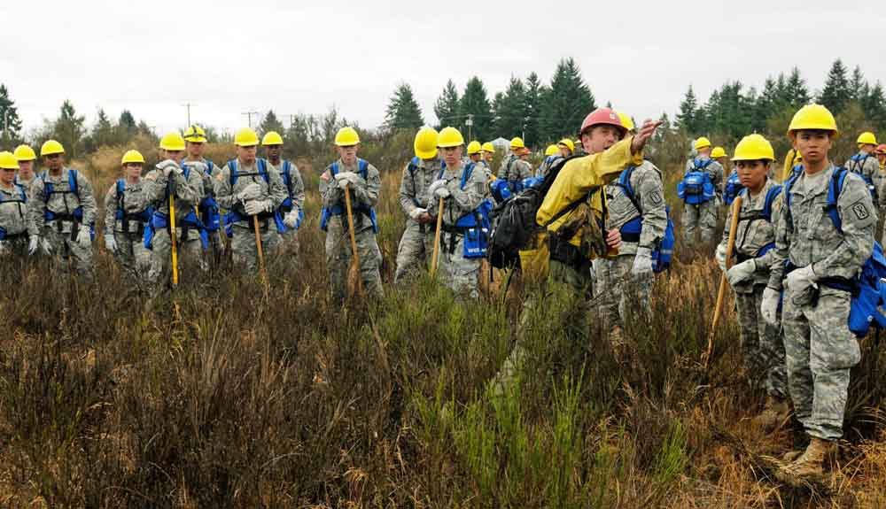
File photo. Jay Karle, center right, a crew boss assigned to assist Soldiers of 5th Battalion, 3rd Field Artillery Regiment, 17th Field Artillery Brigade, points out boundaries to be used during wildland firefighting training near Joint Base Lewis-McChord, Aug. 20, 2015. The “First Round” Soldiers were activated to help suppress fires in the Pacific Northwest due to civilian resources running low. (U.S. Army photo by Sgt. 1st Class Andrew Porch, 28th Public Affairs Detachment.)

Approximately 200 active duty U.S. Army soldiers are being mobilized to assist with wildfire suppression efforts.

The Department of Defense approved the request for the personnel that was submitted by the National Multi-Agency Coordinating Group through the National Interagency Fire Center in Boise.

After receiving training, the soldiers will serve as firefighters.  Above normal fire activity is occurring in northern California, Arizona, and Colorado.

The last use of active duty soldiers for firefighting duty in the United States was in 2018. Wildfire Today has articles about mobilizations in 2008, 2015, 2017, and 2018.

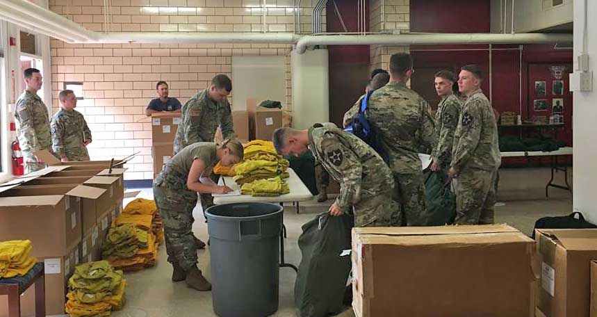
The personnel will be trained in the basics of wildland fire suppression and firefighter safety by wildland fire agency personnel beginning Sunday, August 30 at Joint Base Lewis-McChord near Tacoma, Washington. The soldiers will be outfitted with wildland fire personal protective equipment and other gear. Training is expected to conclude by Wednesday, September 2, with the soldiers beginning work on a wildfire thereafter. While deployed they will be accompanied by experienced wildland fire strike team leaders and crew bosses from wildland fire management agencies.

In addition to the U.S. Army activation, four military C-130s equipped with Modular Airborne Fire Fighting Systems (MAFFS) are currently serving as air tankers, providing wildfire support in California.

Military Mobilized wildfires
File photo. Personal Protective Equipment is distributed to soldiers at Joint Base Lewis-McChord in preparation for deployment to the Umpqua North Fire in Oregon. September 7, 2017. USFS photo.

Pine Gulch Fire could become largest in Colorado history

Pine Gulch Fire Colorado
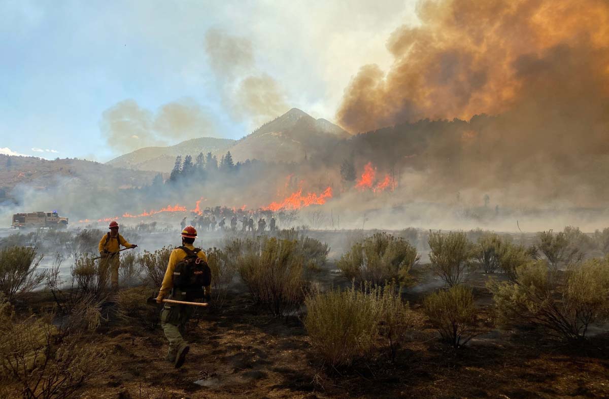
Pine Gulch Fire August 21, 2020. InciWeb.

If the Pine Gulch Fire 12 miles north of Grand Junction, Colorado continues growing at the pace it has shown for the last couple of days, it will soon become the largest fire in the state’s recorded history, surpassing the Hayman Fire that burned 137,760 acres in 2002. On Wednesday the Pine Gulch Fire was 135,920 acres, an increase of 1,795 in the previous 24 hours.

The area was under a flash flood watch Wednesday afternoon for heavy rain from thunderstorms that could lead to flooding and debris flows.

In the last week the only large heat sources that satellites could detect were on the northwest edge where it has been spreading recently and in the interior. There are undoubtably many smaller hot areas still burning or smoldering that the satellites orbiting over 200 miles overhead could not detect.

map Pine Gulch Fire Colorado August 26, 2020
The red line was the perimeter of the Pine Gulch Fire at 12:09 p.m. MDT August 26, 2020. The white line was the perimeter two days before.
Pine Gulch Fire Colorado
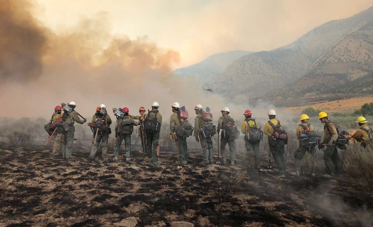
Pine Gulch Fire August 21, 2020. InciWeb.
Pine Gulch Fire Colorado
Pine Gulch Fire August 21, 2020. InciWeb.
Pine Gulch Fire Colorado
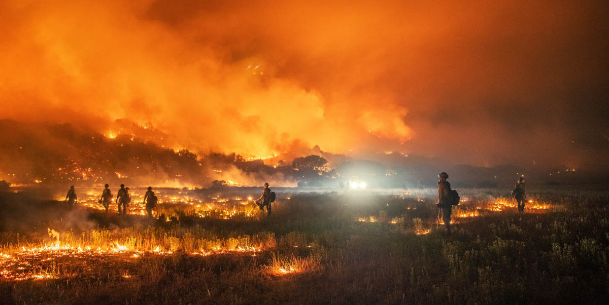
Firefighters on Pine Gulch Fire during night shift, August 17, 2020. InciWeb.
Pine Gulch Fire Colorado single engine air tanker
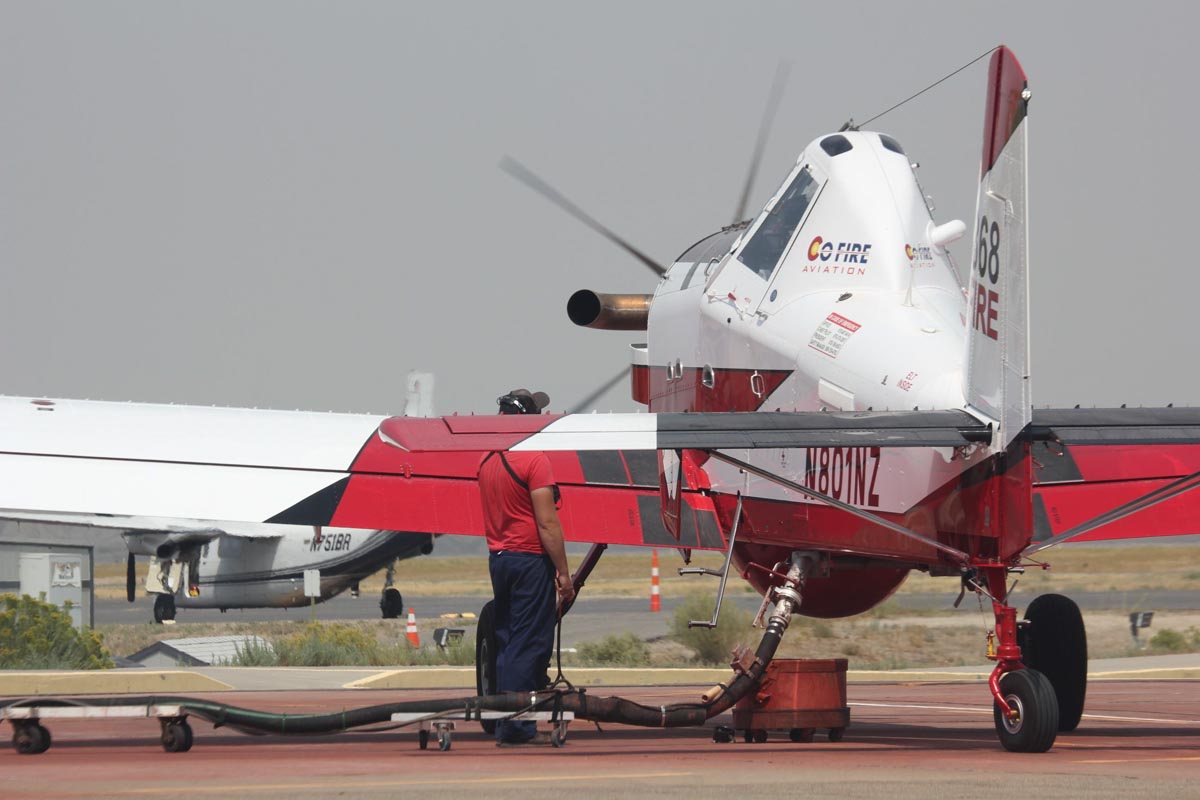
Single engine air tanker reloading while working the Pine Gulch Fire August 24, 2020, InciWeb.

Forecast for wildfire smoke, August 27, 2020

Smoke forecast 6 p.m. MDT Aug 26 2020.
Smoke forecast 6 p.m. MDT Aug 26 2020. RealEarth.

These maps show the forecasts for the distribution of near surface smoke from wildfires. The map above is for Wednesday evening August 26, and the other is for Thursday morning August 27.

Smoke forecast 5 a.m. MDT Aug 27, 2020
Smoke forecast 5 a.m. MDT Aug 27, 2020. RealEarth.