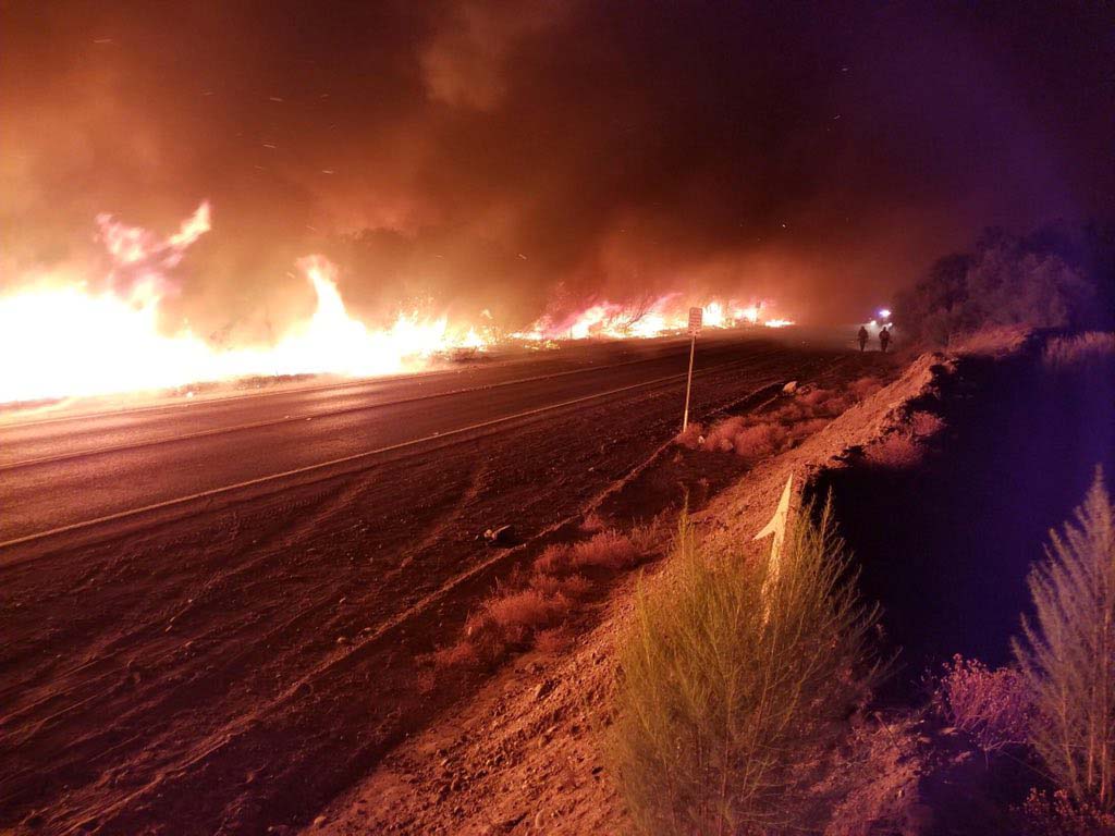
Above normal wildfire activity predicted to expand from the Great Basin into the Northwest and Northern Rockies

wildfire potential July 2020

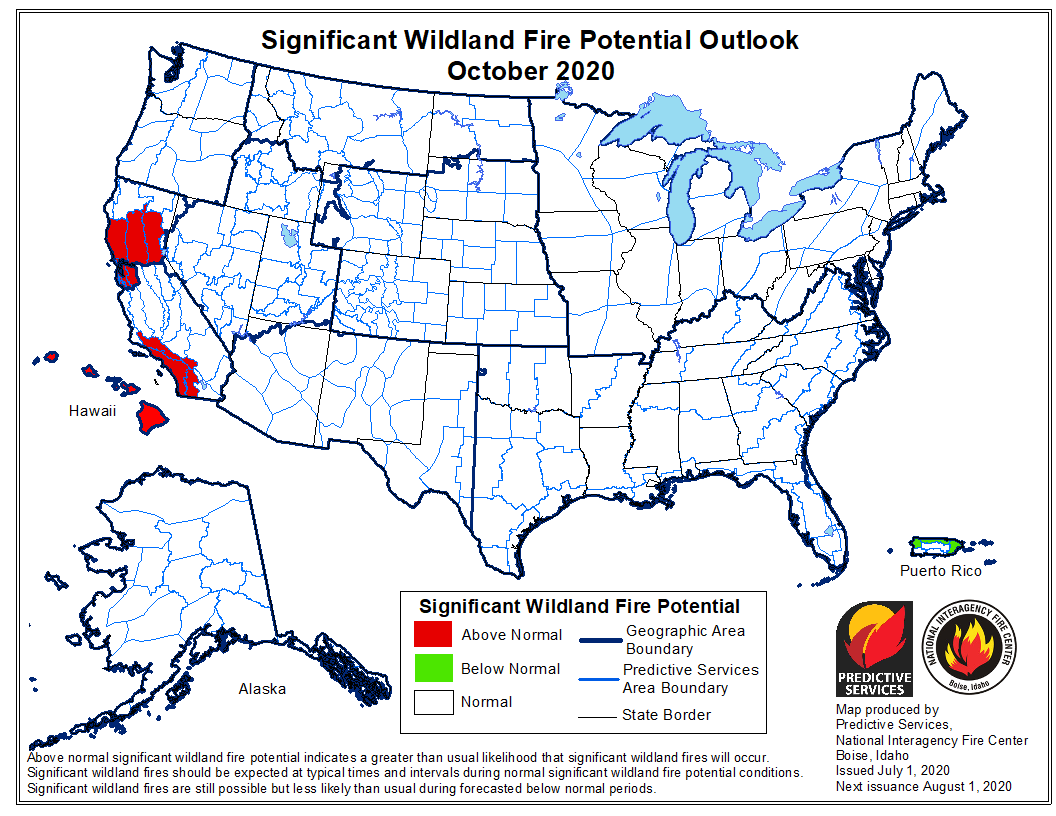
Today the Predictive Services section at the National Interagency Fire Center issued their National Significant Wildland Fire Potential Outlook for July through October.

In July and August above normal wildfire potential is predicted to grow west and north across northern California, the Great Basin and the Central Rockies then expand into the Pacific Northwest and the Northern Rockies.

The data from NIFC shown here represents the cumulative forecasts of the ten Geographic Area Predictive Services Units and the National Predictive Services Unit.

Below:

  • An excerpt from the NIFC narrative report for the next several months;
  • More of NIFC’s monthly graphical outlooks;
  • NOAA’s three-month temperature and precipitation forecasts;
  • Drought Monitor;
  • Keetch-Byram Drought Index.

“Precipitation was below average in June across most of the country except across the Pacific Northwest where amounts were generally 150% of average or greater. Areas of concern emerged across California, the Great Basin, and Arizona where less than 5% of monthly precipitation was received. Temperatures were generally a few degrees above normal along the Pacific Coast and a few degrees below normal across the Interior West. In the East, temperatures were generally near normal in June.

“July is the entry point into the core of the Western Fire Season. As the season sequentially expands west and north across California, the Great Basin and the Central Rockies into the Northern Rockies and the Pacific Northwest, it will encounter areas of intensifying and expanding drought. This will lead to Above Normal significant large fire potential across large portions of the Great Basin and Northern California that will expand further north into the Pacific Northwest and Northern Rockies in August and September.

“The elevated potential in southwestern areas will begin to diminish with the arrival of the monsoon in early July. Activity will linger into mid-September in northern areas until the seasonal transition begins and begins to bring the season to a close. In Alaska, significant large fire activity will become less frequent in late July as returning moisture events gradually reduce the fire potential.”
wildfire potential August 2020 wildfire potential September 2020 wildfire potential October 2020

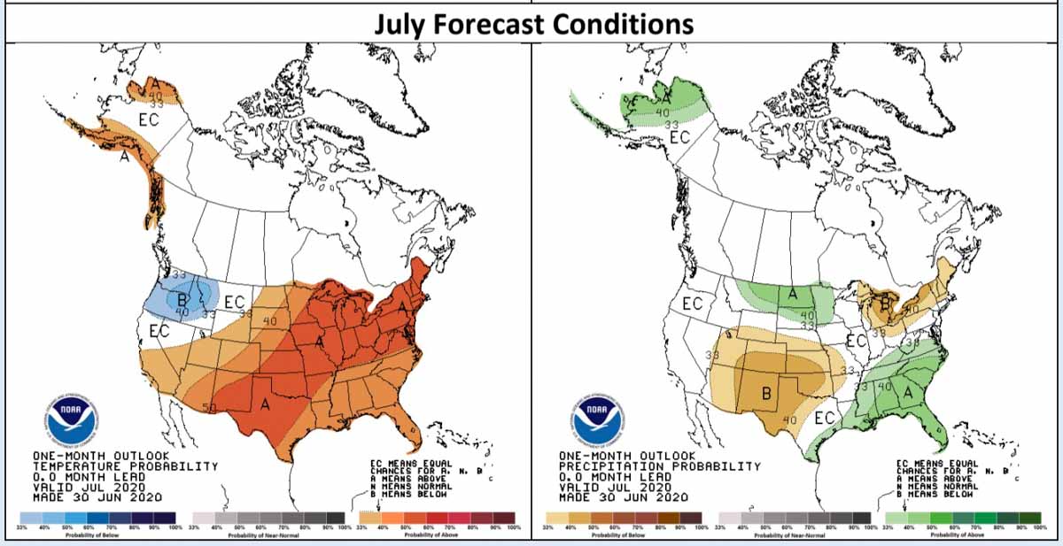
Temperature and precipitation forecast for July
Temperature and precipitation forecast for July.
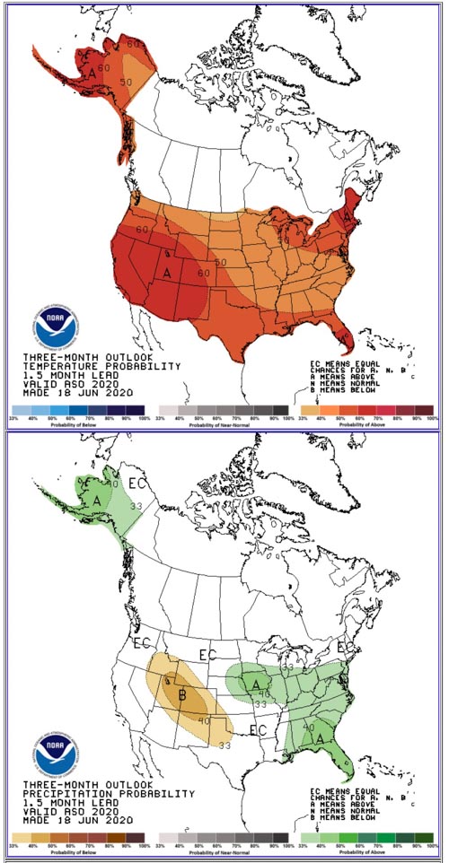
Three Month weather Outlook
Temperature and precipitation forecast for August, September, and October.
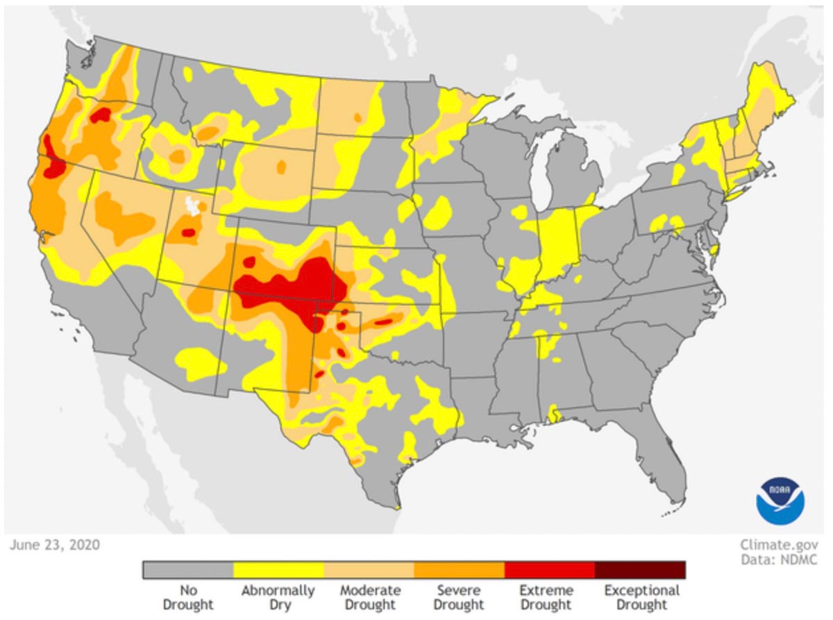
Drought Monitor issued June 25, 2020
Drought Monitor — June 23, 2020.
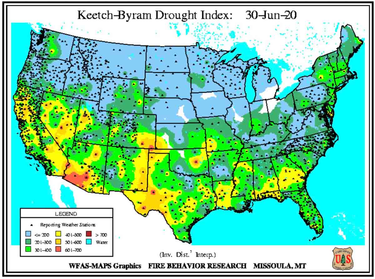
Keetch-Byram Drought Index, June 30, 2020
Keetch-Byram Drought Index, June 30, 2020.

Chatridge 2 Fire burns over 400 acres south of Denver

In Douglas County

(UPDATED at 3:41 p.m. MDT June 30, 2020)

Investigators from the South Metro Fire Rescue Fire Marshal’s Office determined that an electrical malfunction on a power pole started the Chatridge 2 Fire that burned 461 acres south of Denver yesterday.

The South Metro public information officer said the first Chatridge Fire occurred in 2016, “same area and same cause”.

The fire is still 100 percent contained and firefighters are mopping up today. 

Tankers 22 (a P-3, N922AU) and 02 (a BAe-146, NJ474NA)
Tankers 02 (left, a BAe-146, N474NA) and T-22 (a P-3, N922AU) were working the Chatridge 2 Fire and reloading at Rocky Mountain Metropolitan Airport (Jeffco) 6-29-2020. Shane Hervey photo.

More photos of air tankers at Rocky Mountain Metropolitan Airport (Jeffco) taken June 29 are at Fire Aviation.


(Originally published at 3:31 p.m. MDT June 29, 2020)

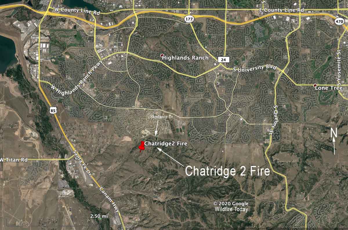
Chatridge 2 Fire Denver map
Map showing the location of the Chatridge 2 Fire south of Denver, June 29, 2020.

In about four and a half hours today the Chatridge 2 Fire burned 456 acres south of Denver in Douglas County, finally bumping up against structures south of Highway 470 and east of Highway 85.

Firefighters stopped the spread of the fire as it reached Skydance Drive, thanks to the help of at least three large air tankers and multiple helicopters.

The fire moved quickly through brush and grass pushed by 17 mph winds gusting to 34 mph while the relative humidity was in the low teens.

It was reported at 9:49 a.m. and the spread was stopped at 2:42 p.m. MDT, June 29.

One of the large air tankers was Tanker 02 (N474NA), a BAe-146 dispatched out of Pueblo. There was also a P-3, Tanker 22 (N922AU), that just came on duty yesterday on the first exclusive use contract ever issued by the state of Colorado. An MD87 was also seen over the fire.  The large air tankers were slated to work the fire until about 3:30 p.m.

Chatridge 2 fire
Chatridge 2 Fire. Photo by Jason Mowry @jmowry11 at 2:05 p.m. MDT June 29, 2020.

(UPDATED at 4:27 p.m. MDT June 29, 2020)

Map Chatridge 2 Fire
Map of the Chatridge 2 Fire produced by Colorado’s Multi-Mission Aircraft.

Thanks and a tip of the hat go out to Bean. Typos or errors, report them HERE.

Fireworks spark wildfire and force evacuations at Lehi, Utah

Near Traverse Mountain south of Salt Lake City

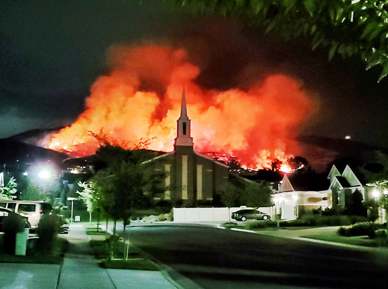
Traverse Fire
Traverse Fire at Lehi, Utah caused by fireworks. Photo by Justin Reeves June 28, 2020.

A person using fireworks ignited a wildfire south of Salt Lake City, Utah that led to evacuations north of Lehi.

The Traverse Fire was reported around 12 p.m. Saturday and quickly grew onto Traverse Mountain. Notices from Lehi Community Emergency Response around 3 a.m. Sunday said several areas near the mountain were ordered to evacuate: “Any homes one quarter mile radius from Vialetto Way to Annuvolato Way evacuate, also Autumn Hills Blvd and Spring View Lane.” In Draper city the Maple Hollow neighborhood was ordered to evacuate at about 5 a.m. Sunday.

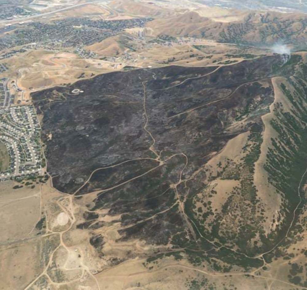
Traverse Fire
Aerial photo of the Traverse Fire Sunday morning, June 28 via @UtahWildfire. It burned up to the back yards of 23 homes in a new subdivision on West Autumn Hills Blvd.

The fire burned up to the back yards of 23 homes in a new subdivision on West Autumn Hills Blvd.

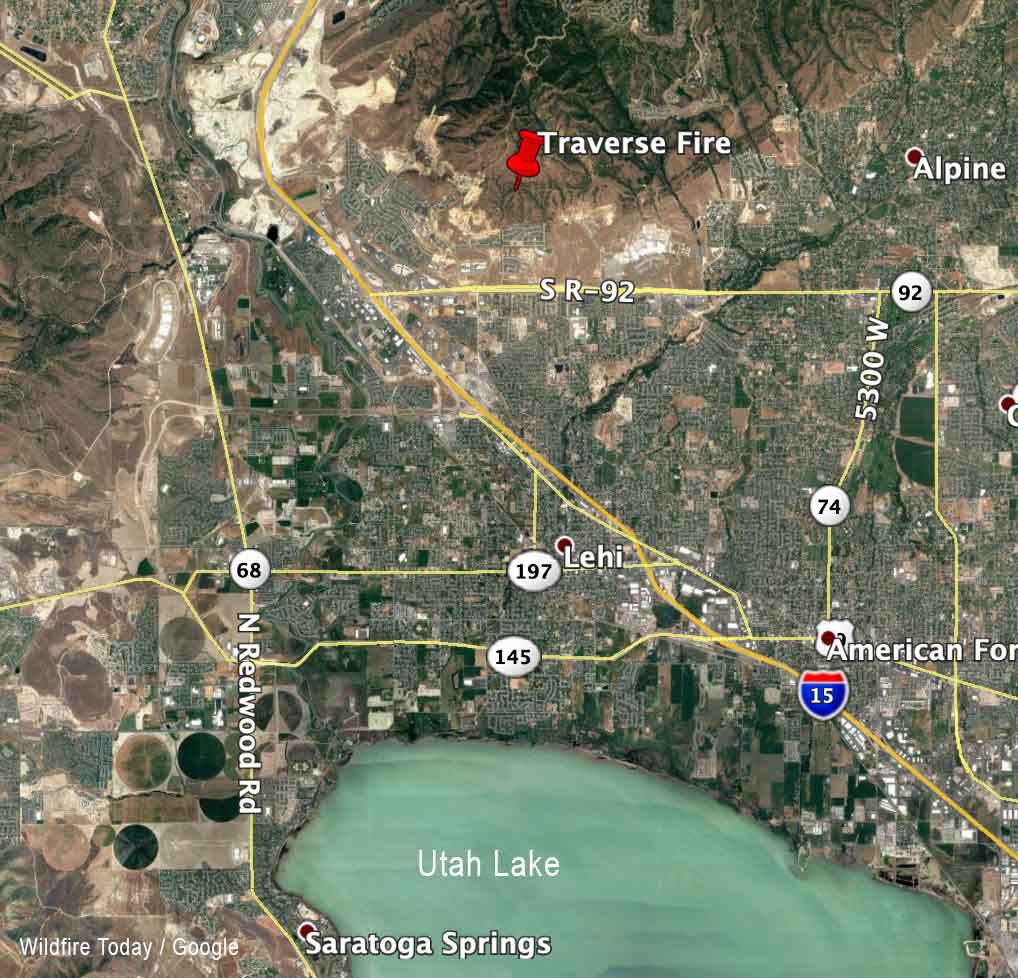
Traverse Fire map
Map showing the approximate location of the Traverse Fire on the north side of Lehi, Utah.

At 11:55 a.m. Sunday Utah Fire Info reported that the Traverse Fire had been mapped at 450 acres. Evacuations were still in effect but “will be reassessed after the anticipated, strong wind event in the forecast has passed.” A current Red Flag Warning for the area is due to low humidity and 20 mph winds gusting over 40 mph through the afternoon. There is a good chance of rain after 3 p.m. Sunday.

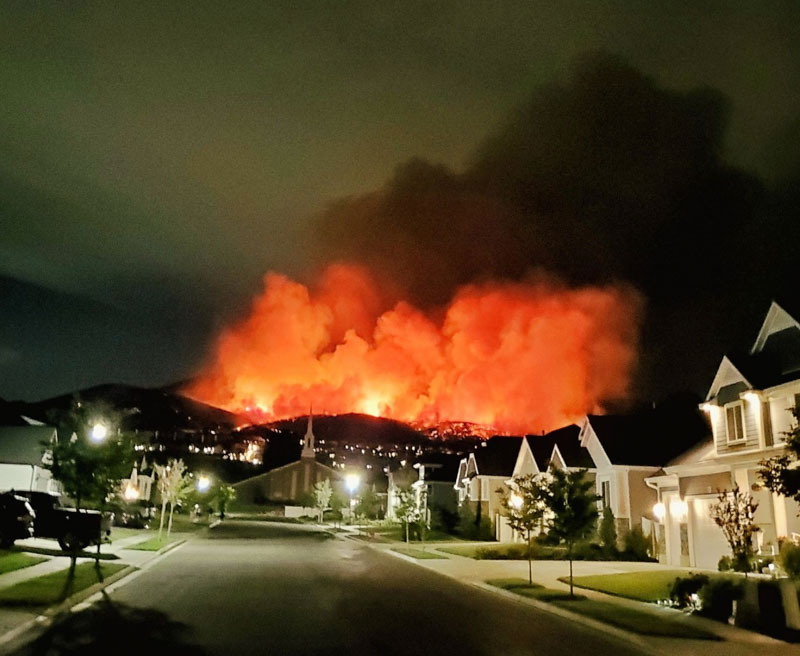
Traverse Fire fireworks

Traverse Fire
Traverse Fire at Lehi, Utah caused by fireworks. Photo by Justin Reeves June 28, 2020.

The National Park Service and South Dakota Governor Kristi Noem are planning a fireworks extravaganza over the pine forest at Mount Rushmore National Memorial July 3, 2020.

Thanks and a tip of the hat go out to Rick. Typos or errors, report them HERE.

Firefighters on the Bighorn Fire near Tucson prepare for Red Flag conditions Sunday and Monday

The fire has grown to over 95,000 acres, approaching “megafire” status of 100,000 acres

(Originally published at 2:29 p.m. MDT June 27, 2020)

Summerhaven Bighorn Fire Tucson Mt Lemmon
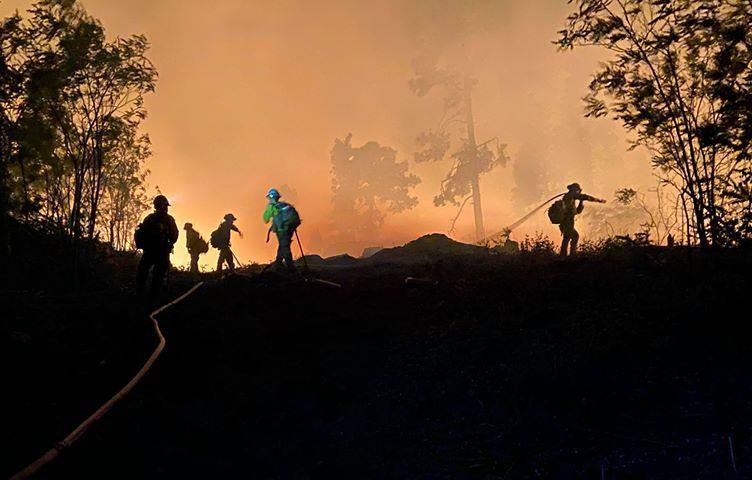
Night operations at Summerhaven on the Bighorn Fire. Photo by David Melendez June 26, 2020.

The National Weather Service in Tucson has issued a Red Flag Warning for Tucson and the Bighorn Fire area from noon to 8 p.m. MST Sunday and from noon to 8 p.m. MST Monday. The prediction is for strong winds, low humidity, and very high fire danger. The wind is expected to be out of the southwest at 15 to 25 mph with gusts to 35 mph Sunday, and on Monday, southwest at 15 to 20 mph with gusts between 35 and 40 mph. The relative humidity will be 10 to 17 percent in the valleys and 13 to 21 percent in the mountains.

From the Incident Management Team on Saturday:

“Friday night, burnout operations south of Davis Spring Road and 4 miles west of Redington were conducted to reduce the risk of eastward fire spread. Aerial ignition operations were conducted near Palisade Canyon and Green Mountain to improve firelines and reduce the risk of uncontrolled fire reaching the Catalina Highway. East of Saddlebrook a firing operation improved firelines. Holding, mop up and structure protection was the focus in Summerhaven, Willow Canyon, and Saddlebrook. Biosphere, Oracle, and Sabino Canyon were in patrol status.

“Saturday’s Activities: Crews will hold and improve line near Willow Canyon, Palisade Canyon, Green Mountain, and south of the Davis Spring Road. Hotshot crews will build fireline on the south side of Green Mountain. A hand crew will work to extinguish a hotspot approximately three miles northeast of Catalina State Park.  East of the fire, construction will continue on contingency lines by connecting to existing road systems. Structure protection will be in place for Saddlebrook and along the Catalina Highway.Initial attack resources are pre-positioned around the fire.”

A mapping flight Friday night determined that the Bighorn Fire had burned 95,225 acres, a 24-hour increase of over 7,000 acres.

(To see all articles about the Bighorn fire, including the most recent, click here.)

map Bighorn Fire Tucson Mt Lemmon
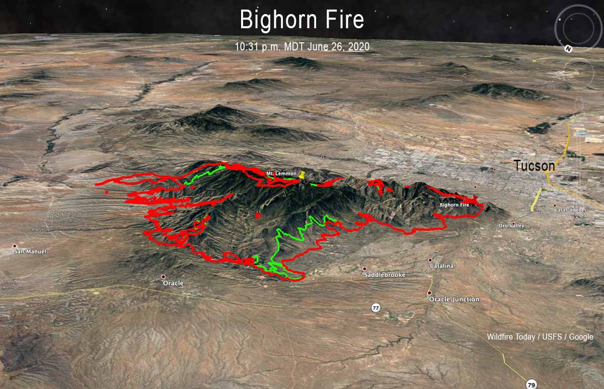
3-D map of the Bighorn Fire looking southeast. The red line was the perimeter at 10:31 p.m. MDT June 26, 2020. The green line was the perimeter about 48 hours before.
map Bighorn Fire Tucson Mt Lemmon
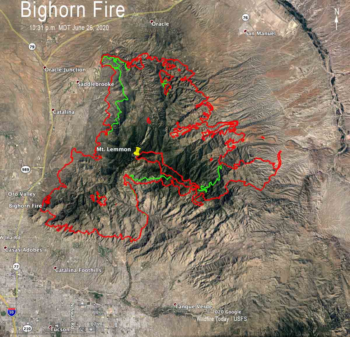
Map of the Bighorn Fire. The red line was the perimeter at 10:31 p.m. MDT June 26, 2020. The green line was the perimeter about 48 hours before.
Bighorn Fire Tucson Mt Lemmon
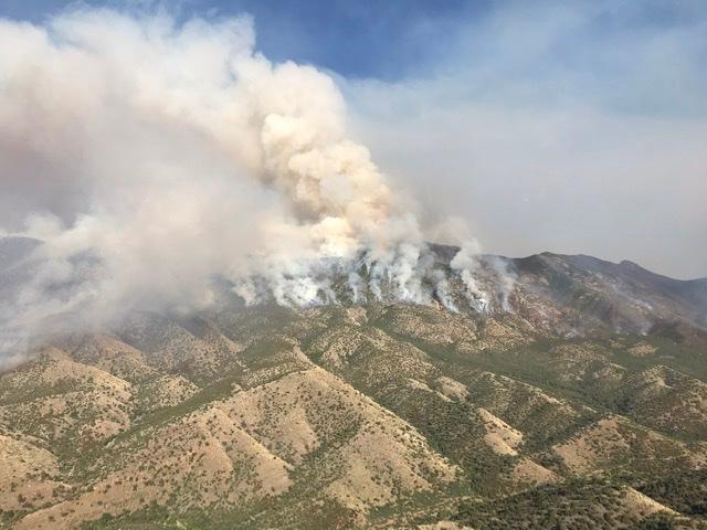
Firing operation on Oracle Ridge at the Bighorn Fire. Inciweb photo June 23, 2020.

Avondale Fire burns almost 1,000 acres near Phoenix Raceway

West of Phoenix

Avondale Fire Arizona Phoenix
Avondale Fire. Photo by Arizona State Forestry 6-26-2020.

Since the Avondale Fire started Friday afternoon west of Phoenix it has burned approximately 980 acres, the Arizona State Forestry announced at 10:49 a.m. MDT Saturday. It has been burning through a river bottom in salt cedar, creating thick, dark smoke.

First reported near 113th Avenue and Indian Springs Road in Avondale, it began on state land and has burned onto a parcel managed by the Buenos Aires National Wildlife Refuge. It is about half a mile northwest of Phoenix Raceway.

The Maricopa County Sheriff’s Office has information about evacuations.

Avondale Fire Arizona Phoenix map
Map showing heat (the red dots) detected by a satellite on the Avondale Fire at 4:12 a.m. MDT June 27, 2020.
Avondale Fire Arizona Phoenix
Avondale Fire. Photo by Arizona State Forestry 6-27-2020.

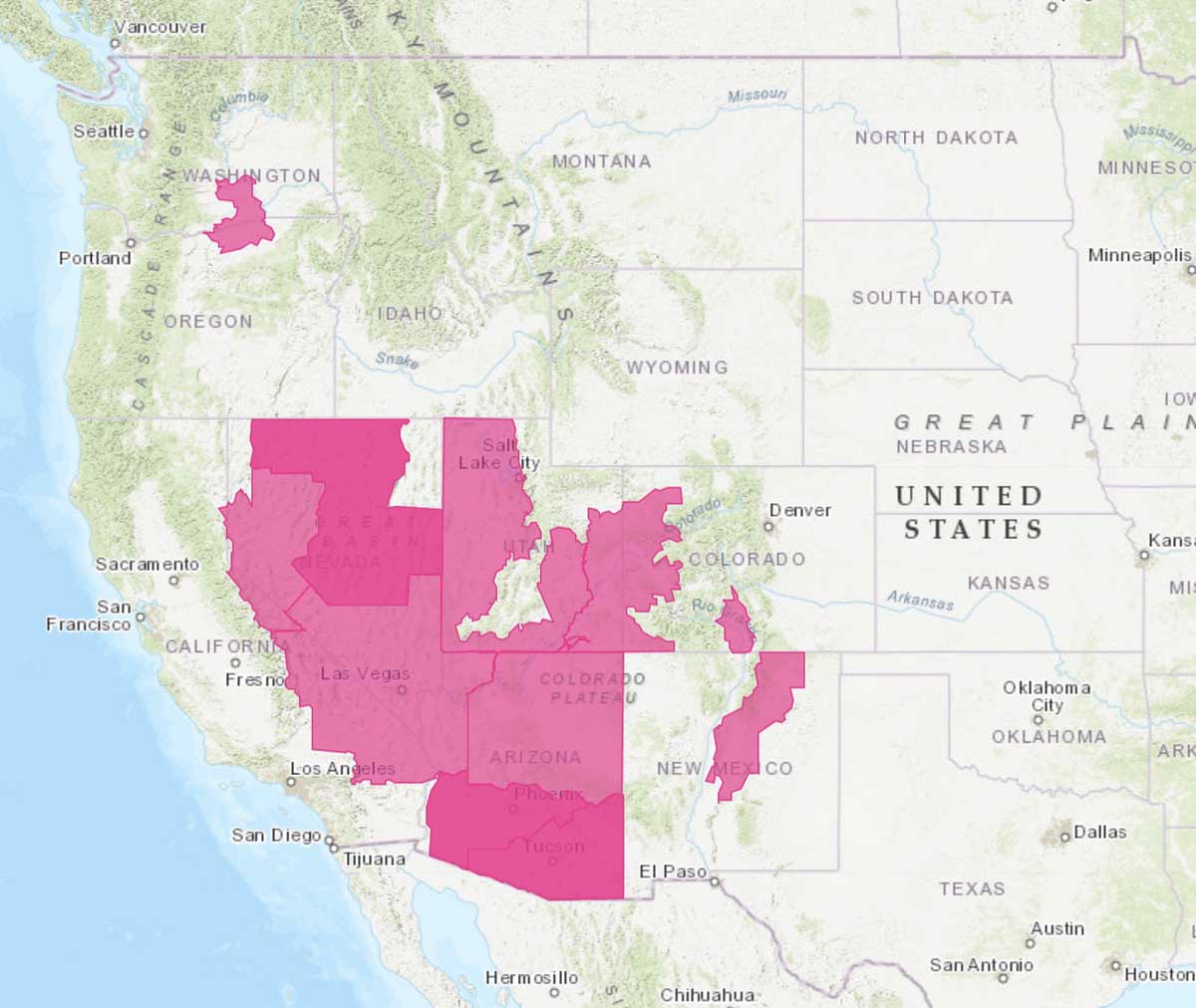
Red Flag Warnings in 8 states, June 27

Red Flag Warnings June 27, 2020
Red Flag Warnings June 27, 2020. NWS.

(UPDATE at 2:30 p.m. MDT June 27, 2020: the National Weather Service may or may not have correctly identified the red areas on the map as Red Flag Warning areas for today, Saturday June 27. We are checking to confirm. The image is a screenshot from the NWS web site.)


(Originally published at 9:40 a.m. MDT June 27, 2020)

The National Weather Service has issued Red Flag Warnings for June 27 in areas of Washington, Oregon, California, Nevada, Utah, Arizona, New Mexico, and Colorado. Most of the areas will experience strong winds and low humidities, resulting in enhanced wildfire danger.

(Red Flag Warnings can be modified throughout the day as NWS offices around the country update and revise their weather forecasts.)