A story about how a Tribal Fire Crew Rescued the Real Smokey Bear

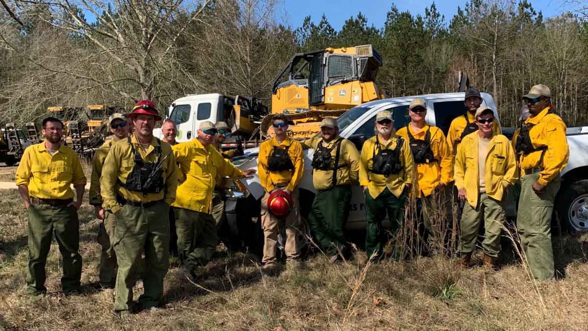
Taos Pueblo Snowball fire Crew
The Taos Pueblo Snowball Fire Crew. Photo/Bureau of Indian Affairs

This version of how Smokey Bear was originally discovered was posted on the U.S. Forest Service website by Sandy Marin, USFS Tribal Relations.


This year, we celebrated Smokey Bear’s 75th birthday as a national fire prevention icon. Many know Smokey’s message: “Only YOU can prevent wildfires,” but fewer people may know that Smokey was a real American black bear rescued, in the spring of 1950, from a raging wildfire in New Mexico.

The Los Tablos and Capitan Gap fires, which burned over 17,000 acres, were stoked by 70-mile per hour winds that made the fires hard to fight. The Taos Pueblo Snowball crew formed when the war chief of the tribe called all available firefighters to quench the blaze in the Lincoln National Forest. Twenty-five volunteers boarded a school bus and began the long journey to fight the growing fires, fueled by gusting winds and high temperatures. It was only the second fire-fighting experience for the rookie crew. The men spent 28 long days fighting the fires.

The crew rescued the five-pound American black bear cub who later became known as “Smokey” out of the embers. Adolph Samora, a member of the Snowball crew, remembers putting out fire hotspots when some other firefighters called him over to what looked like a crumpled jacket lying on the ground.

“The little cub was covered,” he said. “[A crewmember] picked it up and placed it in my arms. The cub had blisters all over his hands and feet.” Crew members wrapped the three-month-old cub in their own jackets to protect his badly burned paws while they transported the little bear to safety.

A local family nursed Smokey back to health, and the bear was later moved to the National Zoo in Washington, D.C., where he lived for the next 26 years. The story of Smokey’s rescue can be viewed at Smokey Bear LIVE from the Lincoln National Forest.

The Forest Service and the U.S. Advertising Council created Smokey Bear in 1944. Since then, Smokey Bear has become the longest running public service campaign in our nation’s history. His 75th anniversary celebration began with an appearance in the Tournament of Roses Parade on New Year’s Day and finished with his appearance on Smokey Bear-themed ornaments for the U.S. Capitol Christmas tree. Other highlights included a new Smokey Bear exhibit at the National Zoo in D.C. and a birthday party at the Smithsonian Portrait Gallery. But the crown jewel of a wonderful birthday year was the giant Smokey balloon floating down 5th Avenue in New York City during the Macy’s Thanksgiving Day Parade.

So how can you honor Smokey at the conclusion of his 75th birthday year celebration? Help in his lifelong mission of fire prevention, because only YOU can help prevent wildfires.

Adolph Samora Taos Pueblo
Adolph Samora, one of the original members of the Taos Pueblo Snowball crew responsible for the rescue of Smokey Bear. Photo/Smokey Bear LIVE

Here is a link to more information about finding Smokey.

Thanks and a tip of the hat go out to Ted. Typos or errors, report them HERE.

Prescribed fire planned in footprint of the 2000 Jasper Fire

The wildfire burned 83,000 acres 15 miles west of Custer, South Dakota

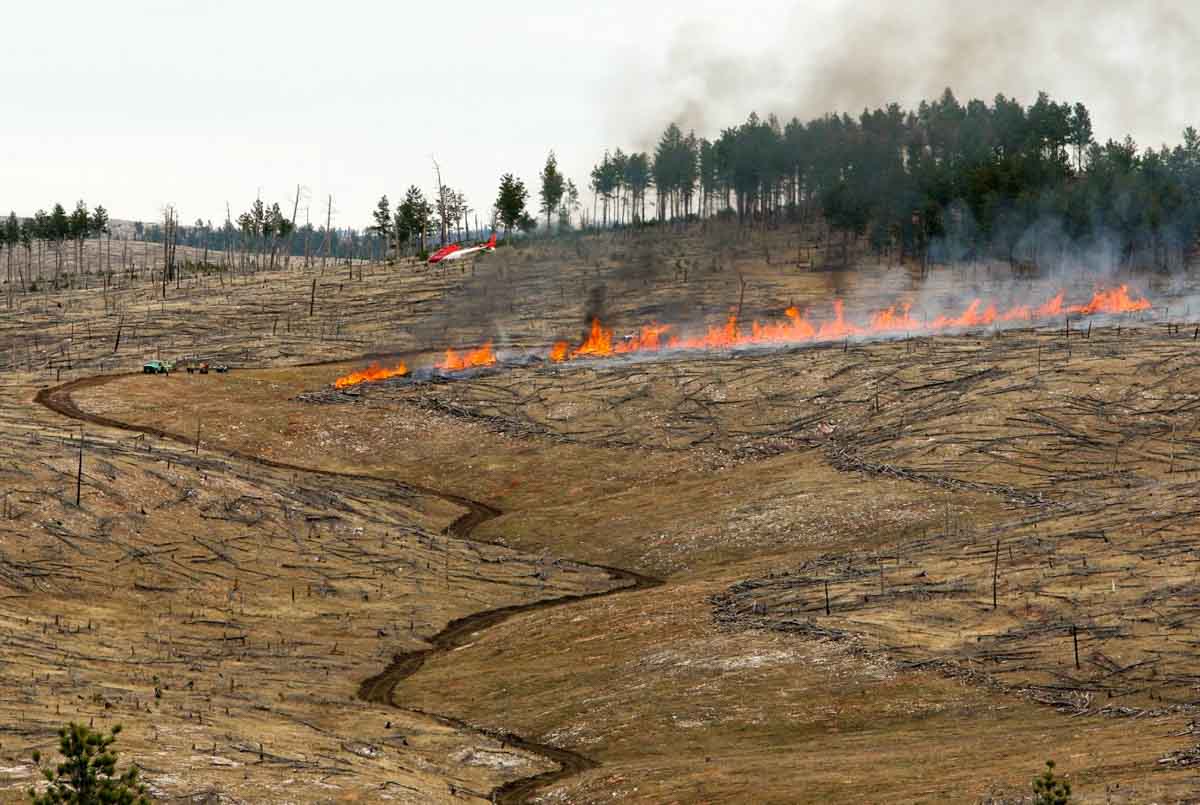
Anti-Horse Project prescribed fire Black Hills National Forest
Photo taken Oct. 2016 on the Anti-Horse Project; Black Hills National Forest photo.

The Black Hills National Forest plans to ignite the 2,700-acre Anti-Horse prescribed fire Wednesday March 11, if the weather is suitable.

“This is scheduled to be a two day burn, however we may burn into Friday March 13th if conditions warrant,” said Josh Morgan, Fuels Assistant Fire Manager Officer, Hell Canyon Ranger District.

The Anti-Horse Project area is located approximately 15 air miles west of Custer, South Dakota and 17 miles east of Newcastle, WY in the Surveyor Hill Road/Jasper Fire area, across from the U.S. Forest Service Tepee Work Center.

The objective of the burn is to reduce long term fire hazards and improve health and vigor of forested stands in portions of the Jasper fire area. In 2000 the 83,000-acre Jasper Fire created extensive areas of dead and dying stands. The dead trees have fallen to the ground, creating high concentrations of fuel on the ground that create a hazard to firefighters, the public, and forest resources.

2000 Jasper fire
The Jasper fire, about 2 hours after it started on August 25, 2000. Photo by Bill Gabbert.

In 2013 a decision was signed which allows 16,500 acres of fire hazard reduction in the Jasper Fire and the nearby Roger’s Shack Fire. Over the course of about 10 years, prescribed burning is being used to reduce the fire hazard in these areas. In addition, the decision includes about 650 acres of thinning to improve the health and vigor of islands of forest stands within these areas. “Over the next several years we will work on this project to make the area more resilient for the future,” said District Ranger Lynn Kolund when he signed the decision in April, 2013.

Escaped prescribed fire burns 20 acres near Elsinore, CA

The spread of the South Main Fire was stopped by 286 firefighters and 4 aircraft

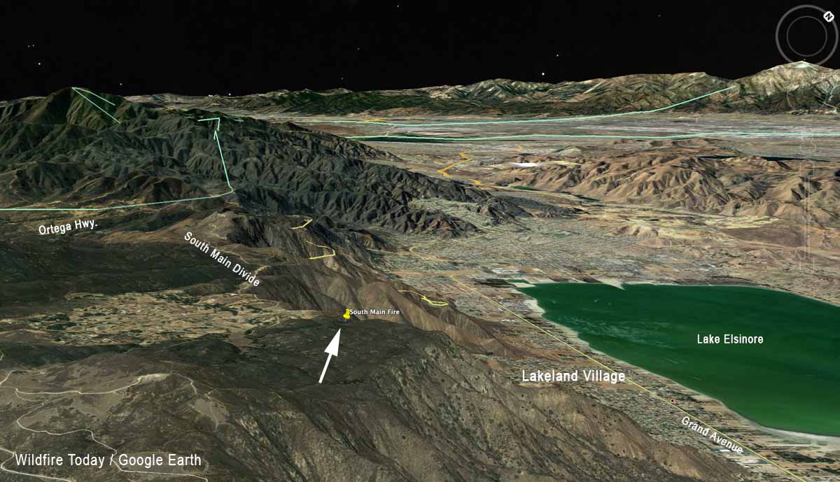
South Main Fire Cleveland National Forest map
The arrow on the 3-D map shows the approximate location of the South Main Fire on the Cleveland National Forest March 6, 2020.

A prescribed fire on the Cleveland National Forest in southern California escaped the intended project area on March 6 and burned an additional 20 acres. It occurred near the South Main Divide between Lakeland Village and a residential community west of the road.

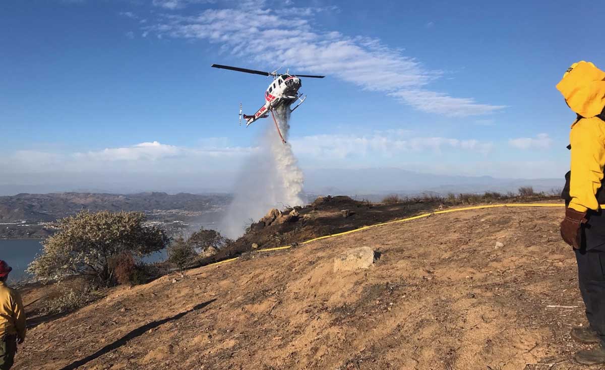
The spread of the South Main Fire was stopped by 286 firefighters, 3 helicopters, and at least one S-2T air tanker.

South Main Fire Cleveland National Forest helicopter
A CAL FIRE UH1 helicopter drops water on the South Main Fire on the Cleveland National Forest March 6, 2020. USFS photo.
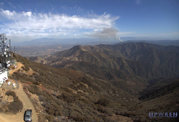
South Main Fire Cleveland National Forest
Smoke from the South Main Fire as seen March 6 from an HPWREN camera on Santiago Peak.

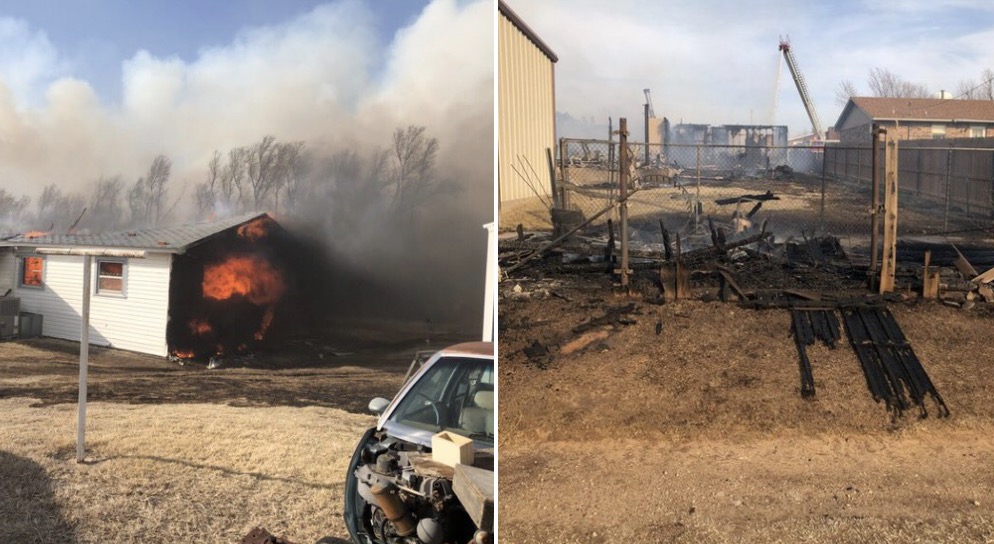
Structures burn in Oklahoma wildfire

A fire in the panhandle has burned over 29,000 ares

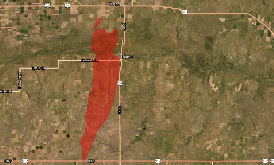
Map 412 Fire in Beaver County, Oklahoma
Map of the 412 Fire in Beaver County, Oklahoma. Data from 1:30 p.m. CDT March 8, 2020, by Oklahoma Forestry Services. The map shows a small fire northwest of the larger 412 Fire which is the Beaver Road Fire that occurred Sunday, March 1, 2020.

(UPDATED at 8:01 p.m. CDT March 8, 2020)

After more accurate mapping the Oklahoma Forestry Services reported Sunday afternoon that the Beaver Fire in Beaver County has burned 29,120 acres and is 50 percent contained. Crews continue to improve fireline and mopup hot spots.

On Saturday Cody Rehder of the Oklahoma Highway Patrol wrote on Twitter, “The town of Beaver is being evacuated at this time. The fire has reached the SW edge of town. Structures are on fire and the HS football field as burned.”

412 Fire in Beaver County, OK
Photos from the 412 Fire in Beaver County, OK. Photos by Cody Rehder of the OK Highway Patrol, March 7, 2020.

(UPDATED at 12:55 p.m.CST March 8, 2020)

The Beaver fire in the panhandle of Oklahoma is still estimated to be 13,000 acres, but that could change after more accurate mapping is complete. Saturday the Oklahoma Forestry Services responded to 30 new wildfires.

In a Sunday morning update the OFS said, “OFS are over the fire in an [Oklahoma Highway Patrol] aircraft mapping the fire and coordinating with ground resources. Rain chances do enter the southwestern part of the state this afternoon and gradually move east through the state, but going fires from yesterday will remain active.”

Crow Fire in Latimer County
A new fire Sunday morning, the Crow Fire, in Latimer Co. near Panola Mtn. OFS photo.

(Originally published at 9:37 p.m. CST March 7, 2020)

The 412 Fire in the Oklahoma panhandle has destroyed structures and burned approximately 13,000 acres, the Oklahoma Forestry Services (OFS) announced in an update at about 8 p.m. CST Saturday. At about 7:30 p.m. Saturday the OFS said fire had been at least temporarily stopped at the EW 100 road three miles north of Beaver.

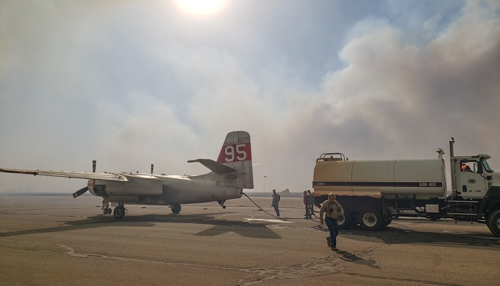
The communities of Beaver and Forgan are under evacuation orders.  Firefighters from Oklahoma, Texas, and Kansas are battling the fire along with Air Tanker 95, a privately owned S-2 aircraft formerly operated by the California Department of Forestry and Fire Protection. The air tanker is under a call when needed arrangement in Kansas, operated by Ag Air Service out of Nikerson, Kansas. The aircraft can carry up to 800 gallons and still has the radial engines, unlike the S-2s operated by CAL FIRE today that have been converted to turbine engines.

Air Tanker 95
Air Tanker 95. Photo by Kansas Forest Service.

There are no details available as to the number of structures that have been destroyed or the locations. Damage assessments are underway.

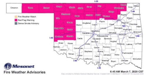
Red Flag Warnings Oklahoma
Red Flag Warnings in northwest Oklahoma, March 7, 2020.

The area was under a Red Flag Warning on Saturday. Strong winds pushed the fire approximately 14 miles across plains.

The 412 Fire occurs one day after the three-year anniversary of the huge Starbuck Fire that burned half a million acres across Oklahoma and Kansas. State and county officials estimated the fire caused at least $50 million in damages.

The 412 Fire near Beaver was one of 19 wildfires the OFS responded to across the state Saturday.


Oklahoma 412 fire wildfire Beaver
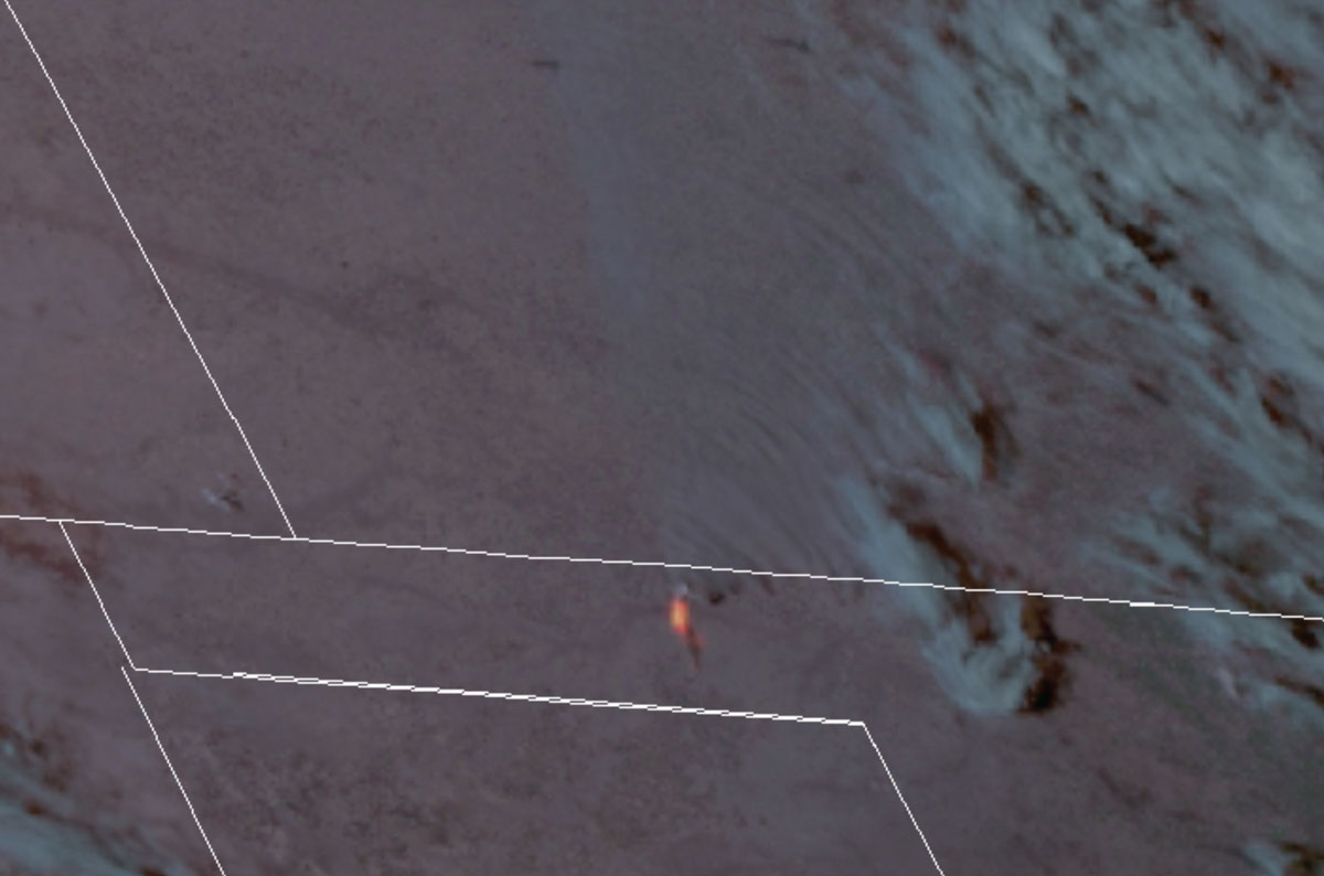
Satellite image showing heat detected on the 412 Fire in the Oklahoma panhandle at 5 p.m. DST March 7, 2020. GOES-17 NASA image.
Oklahoma 412 fire wildfire Beaver smoke
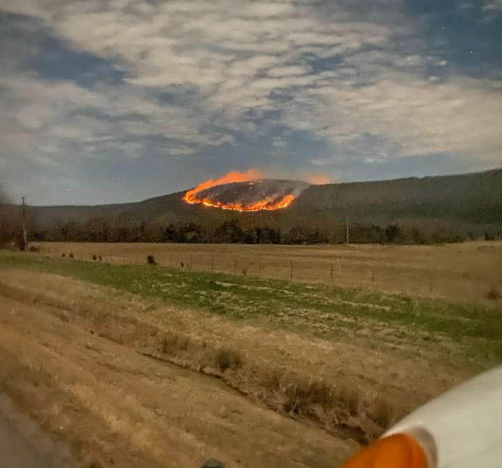
412 Fire, March 7, 2020. Photo by Oklahoma Forestry Services.

Thanks and a tip of the hat go out to Matt. Typos or errors, report them HERE.
Researchers study factors that affect long-distance spotting of wildfires

The results could lead to more accurate models for spotting and fire behavior

map spot fires wildfire Australia
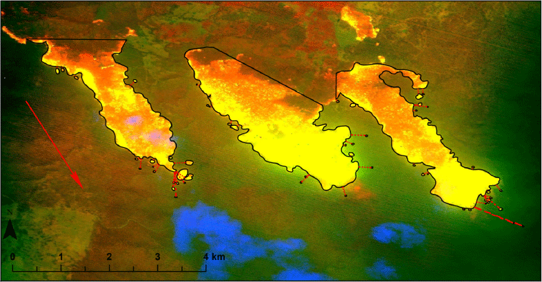
New South Wales Rural Fire Service line scan showing three separate source fires (three largest polygons). Most actively burning fire is yellow, orange is still hot after main fire front has passed, brown is extinguished, green is unburnt vegetation, blue is part of the smoke plume. Red dotted lines indicate spot fire (small polygons) distances measured for analysis. Red arrow indicates spread direction. (from the research)

Data collected in an Australian study could lead to the development of more accurate predictive models for wildfire behavior and spotting, especially for extreme wildfires.

Burning embers driven ahead of a wildfire can dramatically increase the rate of spread and the danger faced by firefighters and the public. Under moderate burning conditions a small number of spot fires might be suppressed if enough firefighting resources are available, but on large plume-dominated fires pushed by strong winds spot fires far from the  main fire can burn together making suppression at the head of the fire impossible. In many cases ember showers have been the primary ignition source for the destruction of structures in the wildland urban interface.

During the 2009 Black Saturday bushfires in eucalpyt-dominated forests in Australia the maximum spot fire distances were 30 to 35 km (18 to 22 miles) and during the 1965 wildfires in eastern Victoria were 29 km (18 miles). Spot fires in North America have been documented at distances of up to 19 km (12 miles).

A research paper on spotting distance in Victoria and New South Wales was published earlier this week by the International Journal of Wildland Fire, written by Michael A. Storey, Owen F. Price, Jason J. Sharples, and Ross A. Bradstock, titled “Drivers of long-distance spotting during wildfires in south-eastern Australia.”

The researchers took advantage of the increasing use of airborne mapping technologies on wildfires in Australia, including infrared and multispectral line scanning, to analyze data from 338 observations. (See map above.) They used ArcGIS to manually draw polygons and determine the size of the actively burning areas of the fire, which they called “source fire area”, and measured the distance to spot fires and the size of each. They also collected fuels, weather, and topography information.

Below is an excerpt from the research:

Maximum spot fire distances ranged from 5.0 m to 13.9 km (mean, 0.9 km; 95th percentile, 3.9 km). The mean number of spot fires per source fire (irrespective of distance) was 13. The distribution of maximum distance values appeared exponential, with a high proportion of shorter distances (Fig. 4a). Very long-distance spotting was rare; only 11 source fires had a maximum spotting distance >5 km.

maximum spot fire distances
Frequency distribution histograms of (a) maximum spot fire distance values from each source fire and (b) number of long-distance spot fire (>500 m) values from each source fire. (from the research)

Eleven of the fires had spotting distances more than 5 km (3.1 miles). The longest distance measured to a spot fire was 13.9 km (8.6 miles).

The analysis of 338 wildfire line scan observations found the size of the active area of the source fire to be the strongest predictor of long-distance spotting. Important secondary effects were fuel, weather, and topography.

Excerpts:

Wind speed was important to both Maximum-distance and long-distance Spot-number. Upper-level wind speed had weaker but still significant effects in the models. Wind at different levels can influence many aspects of wildfire behaviour, including plume development, plume turbulence and tilt, fire intensity, vorticity development, firebrand transport and ignition likelihood in receiver fuels.

A steep slope somewhere within the source fire (i.e. source fire max. slope) increased the maximum spot fire distance and the probability of spot fire occurrence >500 m. TRI [Terrain Ruggedness Index] performed similarly but was highly correlated with slope (>0.9), so was not included in the same models. An area of relatively high wind exposure (e.g. exposed ridge) also increased maximum spotting distance. Slope and wind exposure may be important through interactions with wind, changing wind speed, increasing turbulence and potentially enhancing pyroconvection, leading to enhanced firebrand generation and transport.

[W]e did not find a commonly used measure of bark spotting potential to be a significant predictor. Our results suggest that to accurately predict long-distance spotting, models must incorporate a measure of source fire area. Gathering data on spotting and plume development at wildfires over a range of intensities (including measuring intensity and frequent line scans) and improving fuel maps should be prioritised to allow for the development of reliable predictive spotting models.

The fibrous or stringy bark on some eucalyptus species is particularly suited aerodynamically for being lofted in a convection column and traveling for long distances while still burning, and is one of the primary ignition sources for long range spotting in Australia. The bark on North American trees is different, but the methods used by the Australian researchers could be used to collect similar spot fire occurrence data in the United States and Canada which could lead to improved spotting and fire behavior models.

Two Hollows Fire burns over 2,000 acres in south Mississippi

Mississippi Fire Feb 28 2020 MFC photo
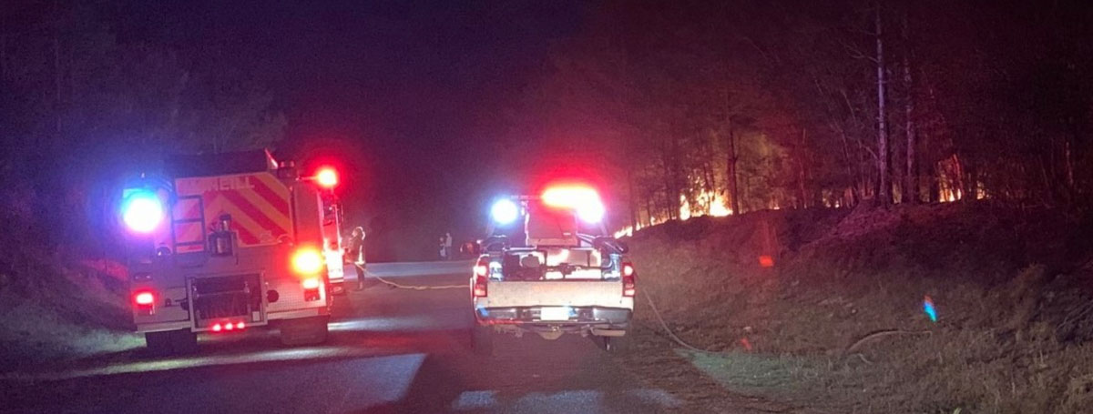
Two Hollows Fire Feb. 29, 2020. MFC photo.

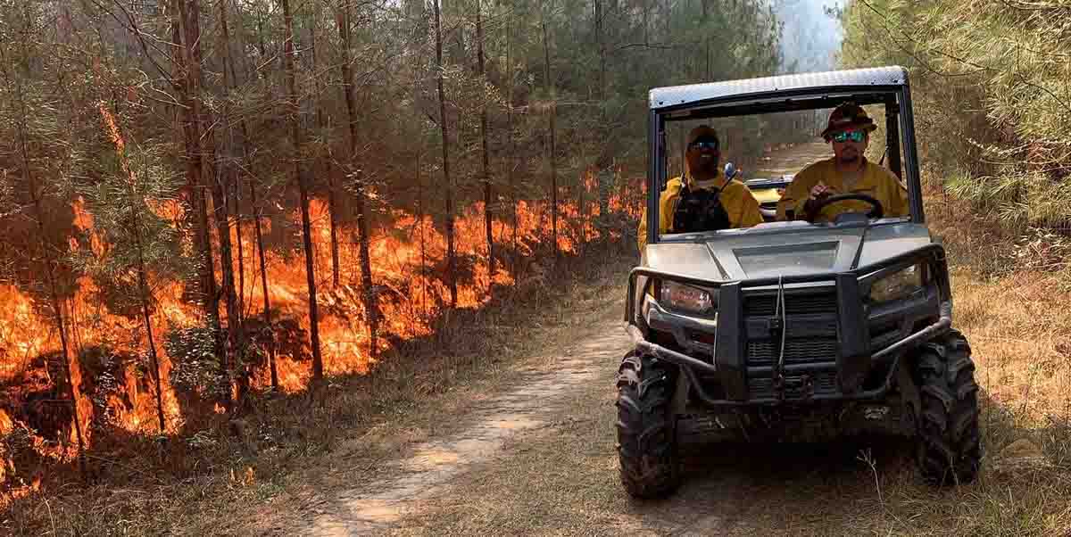
The Two Hollows Fire burned about 2,200 acres of industrial timber land in Pearl River County, Mississippi, approximately nine miles southeast of Poplarville. Jason Scott of the Mississippi Forestry Commission said 22 homes and 18 outbuildings were threatened but all were saved. The MFC responded with  19 employees, one fixed wing aircraft, seven bulldozers, and one drone. Multiple VFDs also responded with six engines and one water tender.

The fire was reported Saturday night, February 28. It took 12 hours to contain, and the Mississippi Forestry Commission monitored the fire for an additional 48 hours.

Two Hollows Fire
Two Hollows Fire Feb. 29, 2020. MFC photo.

The cause of the fire is still under investigation.

Mississippi Fire Feb 29 2020 MFC photo
Two Hollows Fire Feb. 29, 2020. MFC photo.

If you are having trouble playing the video below, you can view it at YouTube.