Satellite imagery of Camp Fire seven hours after it started

Deer Creek Resources of Chico, California has produced five images that show the Camp Fire about four and a half hours after it started near Pulga, California on November 8, 2018.  Zeke Lunder used data from LANDSAT 8 with the infrared heat layer to map the location of the fire at 10:45 p.m. PST. By that time it was burning thousands of homes in Paradise.

(The images below show the corrected time stamp of 10:45 a.m. on November 8, 2018.)

Camp Fire satellite photo 10:45 am Nov. 8, 2018. Zeke Lunder

Camp Fire satellite photo 10:45 am Nov. 8, 2018. Zeke Lunder

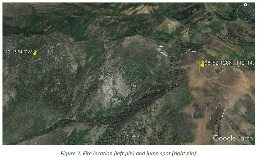
To help get oriented take note of the north indicator that is at the top-right on four of the four photos. Presumably north is at the top in the other photo (above).

Camp Fire satellite photo 10:45 am Nov. 8, 2018. Zeke Lunder

Camp Fire satellite photo 10:45 am Nov. 8, 2018. Zeke Lunder

Camp Fire satellite photo 10:45 am Nov. 8, 2018. Zeke Lunder

To see all articles on Wildfire Today about the Camp Fire, including the most recent, click HERE.

Smoke obscures some areas, as Mr. Lunder wrote, but it appears that significant spotting was occurring. During that seven-hour period the wind was out of the northeast at 8 to 15 mph gusting at 21 to 35 mph. At noon the relative humidity was 13 percent. A few hours before the fire started the wind was from the northeast at 32 gusting up to 52.

Here is more information about the fuels that the fire was burning through in the first few hours.

CAL  FIRE has not released the cause of the fire but Pacific Gas & Electric disclosed to the Public Utilities Commission that one of their high voltage power lines had a disruption in service on Pulga Road near the Camp Fire at 6:15 a.m. the day it started, November 8. The burn pattern along with the wind direction would lead one to believe that it is likely that the point of origin of the fire was in the general vicinity of Pulga Road and the small community of Pulga, but this is not confirmed. The fire was reported at 6:29 a.m.

Report released for injuries to several smokejumpers on wildfire in Utah

Three of the seven jumpers were injured and evacuated by two helicopters

Injuries smokejumpers Miner Camp Peak Fire
Map from the FLA.

(Originally published at Fire Aviation)

The Wildland Fire Lessons Learned Center has released a Facilitated Learning Analysis for an incident within an incident. Three of the seven smokejumpers that parachuted into the Miner Camp Peak Fire on July 29 east of Meadow, Utah were injured when landing. (Map) Two injuries were to the hand or wrist and the other was diagnosed at the scene as a broken collar bone or at least the potential for one.

The jumpers were evacuated by two helicopters, an air ambulance and a helicopter with hoist capabilities.

The jumpers received the resource order for the fire at 8:30 a.m. on July 29 while they were engaged in physical training at Winnemucca, Nevada. Since some of them “like to run trails in the surrounding area”, they did not get off the ground until 10:30. Due to the delayed departure, the distance they had to fly, and multiple issues related to fuel, the seven jumpers did not arrive on the ground at the fire until 5 p.m.

You can read the FLA here. (2.1MB .pdf file)

The Camp and Woolsey Fires have burned more than 10,000 structures

The death toll increased Thursday evening to a total of 66 for the two fires in California.

map destroyed homes structures camp fire paradise california
Red icons represent structures that are more than 50 percent burned in the Paradise and Magalia areas of the Camp Fire. The full zoomable map is HERE, where a person can search for individual addresses.

(UPDATED at 8:07 p.m. PST November 15, 2018)

Thursday evening fire authorities updated some of the information about the Camp Fire which has devastated areas around the town of Paradise, California. According to the Butte County Sheriff’s Office the number of fatalities has risen to 63, an increase of 7 over the last 24 hours. And surprisingly, the number that are unaccounted for changed from 130 to 631. Some of those could be in shelters, relocated to another part of the state, or without means of communication.

As of Thursday evening the fire has destroyed 9,700 single residences, 118 multi-residences, and 290 commercial structures, for a total of 10,108 buildings.

According to CAL FIRE, the Camp fire has burned 141,000 acres, an increase of exactly 1,000 acres in 24 hours.


(Originally published at 8:25 a.m. PST November 15, 2018)

A total of more than a quarter of a million acres have burned in the Woolsey and Camp Fires in California.

About 460 workers and 22 cadaver dogs are assessing the path that the Camp Fire took as it devastated the town of Paradise in Northern California on November 8. The estimated number of homes destroyed in the blaze is fluid and keeps rising, reaching 8,756 Thursday morning with another 260 commercial structures destroyed. The fatalities the crews have discovered has risen to 56, with 130 people still unaccounted for.

To see all articles on Wildfire Today about the Woolsey Fire, including the most recent, click HERE. For the Camp Fire, click HERE.

For the last several days the Camp Fire has continued to spread on the north and east sides, at a slower rate than earlier, but still adding thousands of acres each day. CAL FIRE is saying the fire has burned 140,000 acres.

ESRI and CAL FIRE, working with local emergency service providers, have established a mapping system that displays the status of structures affected by the Camp Fire. It is still a work in progress and is far from complete, as the workers survey the more than 10,000 homes in the Paradise and Magalia areas. Residents can view the map and search for addresses at the internet site.

Some of the refugees from the Camp Fire who have not been allowed into the burned area are living in temporary shelters and camping in parking lots of Walmart and other businesses.

In southern California, the Woolsey Fire has grown very little in the last couple of days, but unburned islands of vegetation occasionally ignite and put up substantial smoke columns. Officials estimate that 504 structures have been destroyed, but a survey that was 25 percent complete Wednesday evening found 370 that were confirmed to have burned. The numbers have not been broken out by residences, outbuildings, and commercial structures.

At about 12:20 Thursday morning a firefighter on the Woolsey Fire was struck by a passing civilian vehicle on the Pacific Coast Highway and was flown to Los Robles Regional Medical Center in Thousand Oaks. The injuries for the firefighter, who was from South Kitsap Fire and Rescue in Washington, were non-life threatening. Officials said it was not a hit and run incident.

On Wednesday fire officials raised the death total to three on the Woolsey Fire. CAL FIRE is saying the blaze has burned 98,362 acres.

Lakeview Crew 7 earns Hotshot status

Lakeview hotshots
The Lakeview 7 Hotshot Crew on the Cougar Creek Fire in central Washington, Aug. 17, 2018. Photo by Kari Greer, NIFC.

Congratulations to Lakeview Crew 7, an interagency hotshot firefighter crew comprised almost entirely of U.S. military veterans.

The crew was formed in 2000 and reorganized in 2011 to help military veterans transition to productive civilian careers. Crew 7 has been funded under the BLM Veterans Crew Program since 2012.

In March of 2016, Crew 7 began the process to be certified as a hotshot crew. They went through the review process in 2017 and received the recommendation for certification this year.

During the 2018 wildfire season, Lakeview Crew 7 battled fires across the West, including the large Cougar Creek Fire in central Washington.

“Our time spent in the military is a key ingredient to our achievements,” said Levi VanderMolen, a member of Crew 7.

“It’s what separates us from other crews and inspires us to work harder and become the best.”

Learn more about BLM career opportunities for veterans:
https://www.blm.gov/careers/veterans

Lakeview Crew 7
Photo by Kari Greer, NIFC

Firefighters battled the Sierra Fire under harrowing conditions

dozer winds fire wildfire
A dozer operator battles extreme winds and a fire, Tuesday on the Sierra Fire near Fontana, Calif. Screenshot from SBCountyFire video.

With large, devastating wildfires burning at both ends of California it is refreshing to hear about a fire that appears to be a success story.

Tuesday night at about 10 p.m. the Sierra Fire started in Fontana, California near Interstate 15 at Sierra and Riverside Avenues. At that time the weather station in Devore recorded sustained north-northwest winds at 25 mph gusting to 45 along with 10 percent relative humidity.

map Sierra Fire
The Sierra Fire is at Riverside and Sierra Avenues in Fontana, CA.

In spite of these horrendous conditions, by 4:30 a.m. on Wednesday the 26 engines, 7 hand crews, and 3 dozers  were able to stop the spread at 147 acres. Kudos to these badass firefighters.

You can get a taste of the conditions they were dealing with in this very impressive video.

@FirePhotoGirl also shot video at the fire.

Wildfire smoke and air quality maps, November 13, 2018

wildfire smoke forecast November 13 2018

Above is NOAA’s forecast for the distribution of wildfire smoke at 6 p.m. PST November 13, 2018. Much of Central and Northern California has severely compromised air quality and is in the “unhealthy” category.

Below is air quality data from AirNow.gov for Tuesday November 13, 2018:

Air quality for November 13, 2018
Air quality for November 13, 2018.