Wildfire potential, May through August

(Originally published at 12:03 p.m. MDT May 1, 2018)

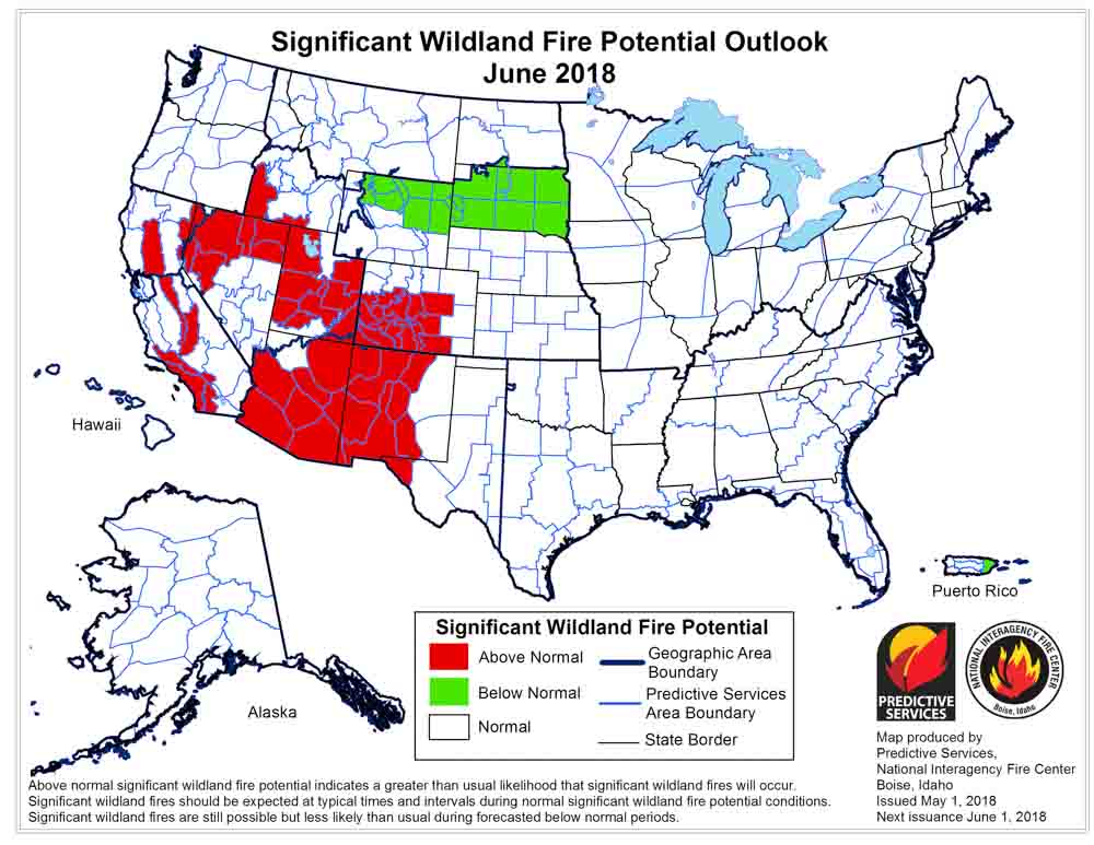
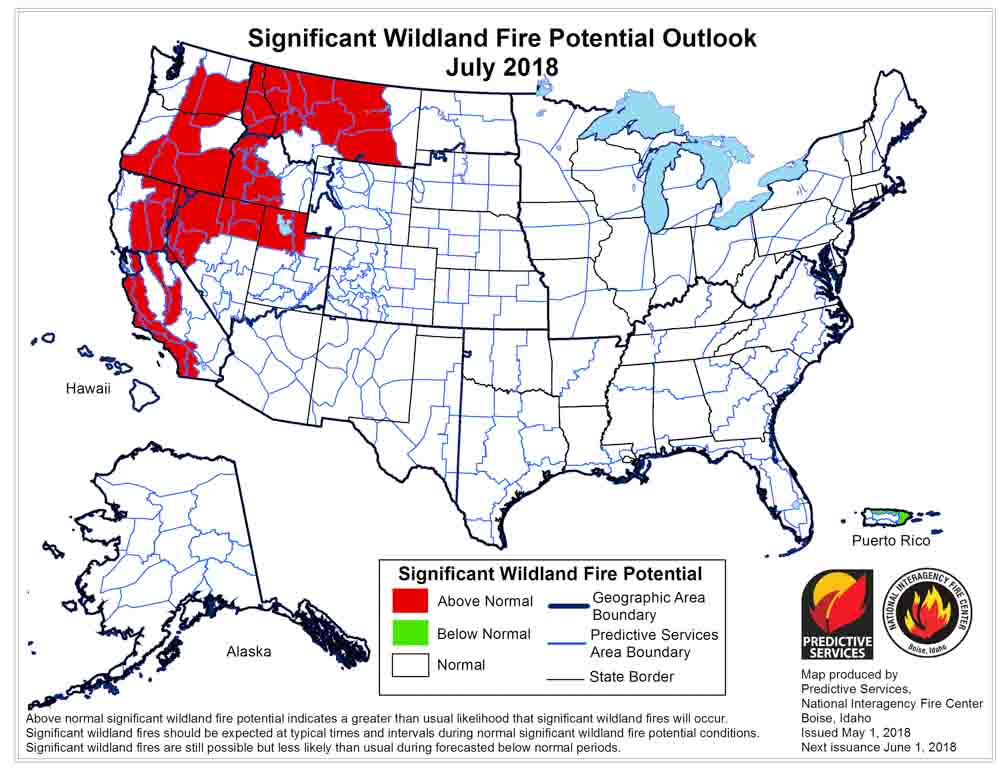
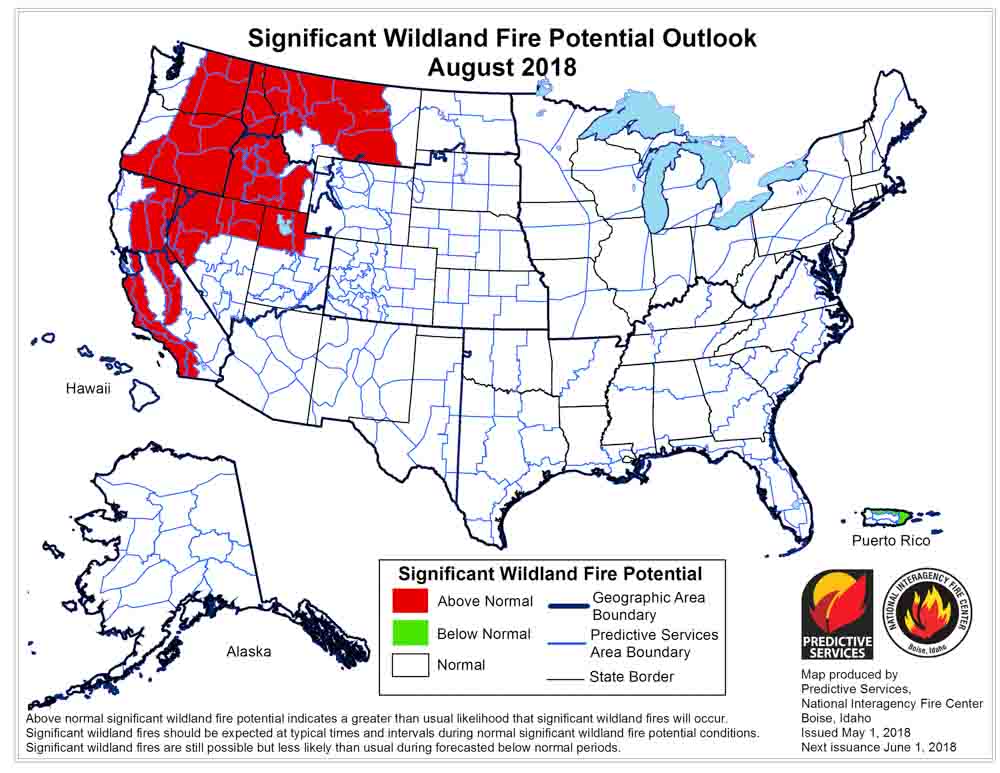
On May 1 the Predictive Services section at the National Interagency Fire Center issued their Wildland Fire Potential Outlook for May through August. The data represents the cumulative forecasts of the ten Geographic Area Predictive Services Units and the National Predictive Services Unit.

If their analysis is correct, in July and August California, the northwest, and the northern Rockies will experience above normal wildfire activity.

Below are:

  • The highlights of the NIFC narrative report for the next several months;
  • NIFC’s monthly graphical outlooks;
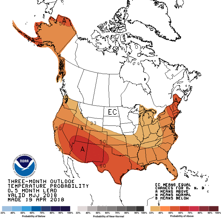
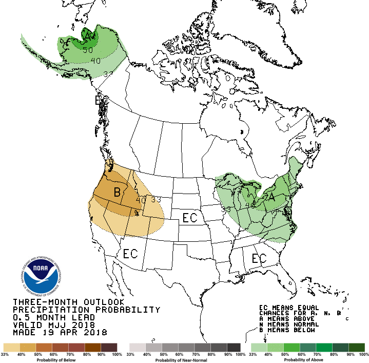
  • NOAA’s three-month temperature and precipitation forecasts; and,
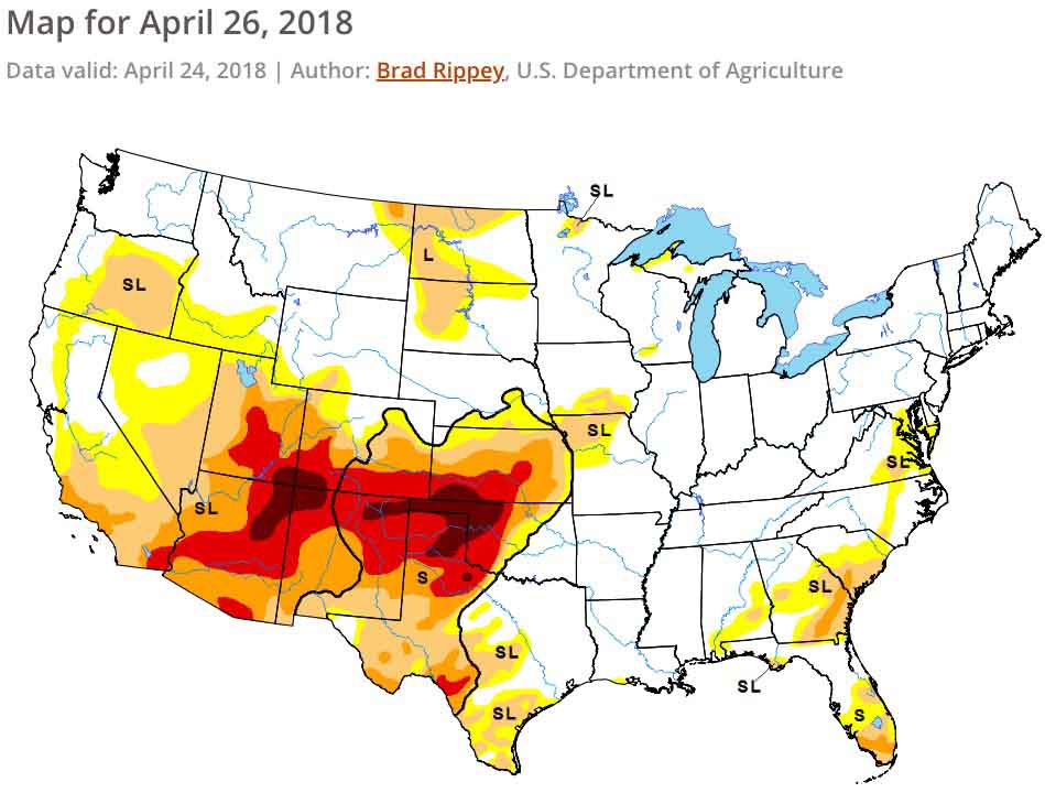
  • Drought Monitor.

“The significant wildland fire potential forecasts included in this outlook represent the cumulative forecasts of the ten Geographic Area Predictive Services units and the National Predictive Services unit.

“Preexisting drought conditions along with several wind events allowed for fire activity across the southern Great Plains and New Mexico to increase in April. By month’s end, activity was beginning to spread westward into Arizona and southern California. Entering May, a normal progression of fire activity is being observed as the Great Plains begins to receive its spring rainfall while the Southwest continues to be dry. What is atypical is the drought severity that is in place across the Four Corners Region and now southern California. The drought coupled with the carryover of an above average fine fuel growth from last year is expected to lead to Above Normal Significant Wildland Fire Potential in May and June across portions of the Southwest, Great Basin, and southern California. In the East, the elevated potential across Florida and portions of Georgia will return to Normal potential as summertime convective patterns ensue.

“The peak of the fire season in the Southwest is expected to occur by late June, just before the onset of the annual monsoon season which should gradually bring their season to a close. Data suggests that the monsoon’s arrival should occur by early July. The projected focus of the monsoon’s early surges will be across New Mexico and Colorado but will refocus westward as July progresses. A normal transition of fire season activity west and north is expected through July as warmer and drier than average conditions develop across the western states. Of concern is the preexisting grass crop from 2017 and the new growth which will cure by July across California, the Great Basin, and Oregon. Higher, timbered elevations in these areas will become a concern by July as the past winter’s below average snowpack melts allowing for the high elevation fuels to become dry enough to support fire activity.

“In August, seasonal transitions focus the fire activity over the northwestern quarter of the country, though central and southern California also continue to experience significant activity. With significant carryover of fine fuels from last year and average grass crop growth this year, elevated fire potential will continue into August across many of the lower and middle elevations from the central Great Basin and California northward to Canada. Higher elevations in the Cascades, Northern Sierras, and possibly the Northern Rockies may also see elevated fire potential as well should warmer and drier than average conditions develop as expected.

“In Alaska, Normal Significant Wildland Fire Potential is expected as the state experiences a typical transition into fire season. Conditions across the state have been generally wetter than average while temperatures have been warmer than average. Since this pattern is expected to continue through the core of the Alaskan fire season, the potential for Above Normal Significant Wildland Fire Activity is low.”
wildfire potential June

wildfire potential July

wildfire potential August

temperature 0utlook

Precipitation outlook

Drought Monitor
Drought Monitor

Tinder Fire continues to grow northeast of Payson, AZ

Above: Tinder Fire, April 30, 2018. InciWeb photo.

(Originally published at 8:32 a.m. MDT May 1, 2018)

The Tinder Fire 22 air miles northeast of Payson, Arizona continued to expand on the north and east sides Monday, adding another 2,797 acres to bring the total burned area up to 11,420 acres.

(To see all articles on Wildfire Today about the Tinder Fire, click here.)

The Incident Management Team has acknowledged that structures have burned but said Coconino County officials will be assessing the damage and releasing information when it becomes available. CBS This Morning is reporting that 20 to 30 structures have been destroyed.

map Tinder Fire Arizona
Vicinity map of the Tinder Fire.
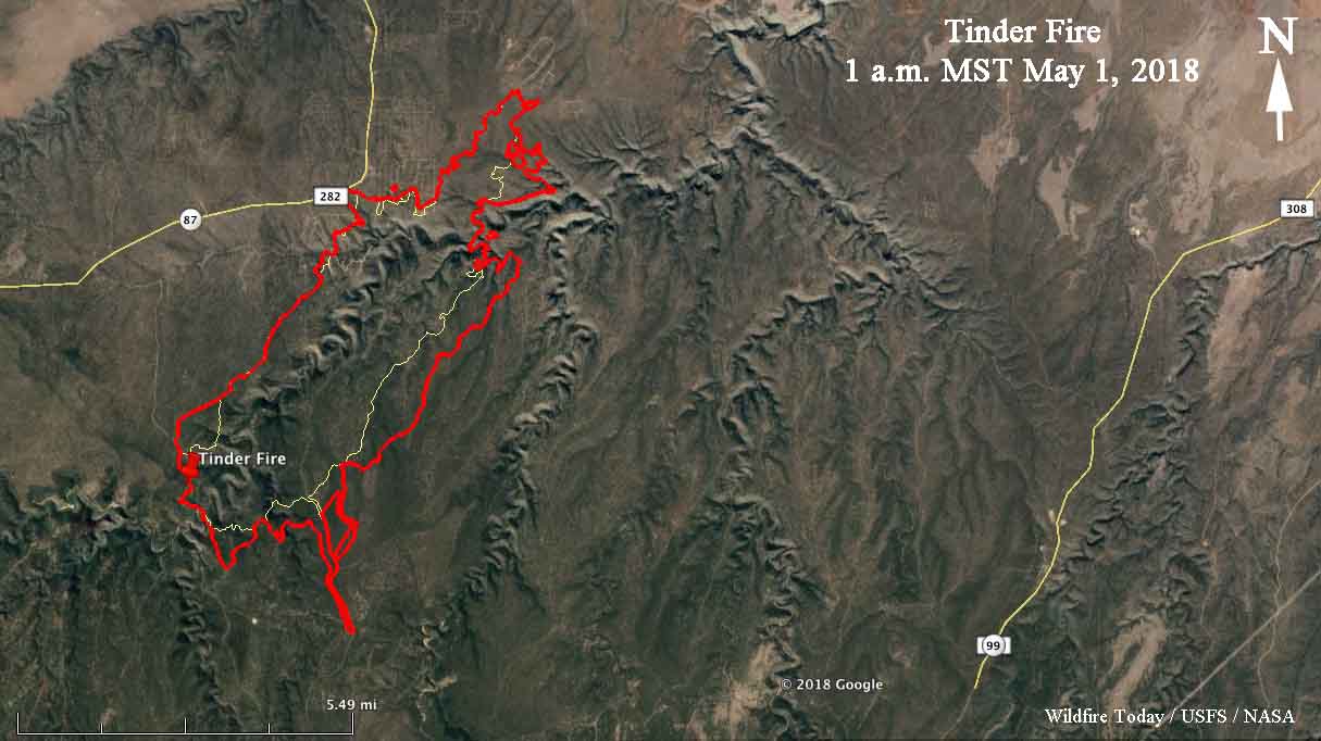
map Tinder Fire Arizona
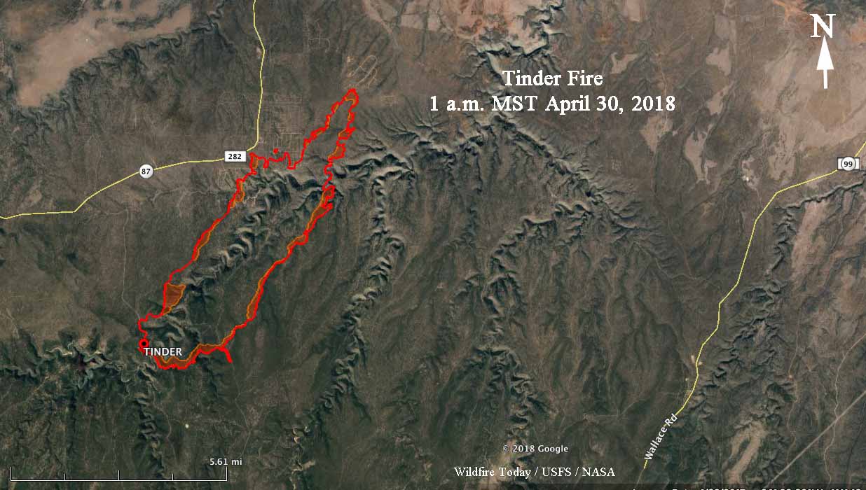
Map of the Tinder Fire showing the perimeter at 1 a.m. MST May 1, 2018. Perimeter by USFS.

The area is not under a Red Flag Warning Tuesday for extreme fire weather, but the forecast calls for 20 mph southwest winds gusting above 30 mph with a high temperature of 56 and a relative humidity of 28 percent. Beginning at 5 p.m. Tuesday there is a 50 percent chance of rain, and by sunrise on Wednesday the humidity will reach 80 percent. The elevation at the fire is about 6,700 feet.

KMAX Tinder Fire Arizona
A KMAX helicopter works the Tinder Fire April 30, 2018. InciWeb photo.

Moderating weather conditions after today could give the 510 personnel assigned to the fire a chance to make significant progress.

The video below was recorded at a public meeting Monday evening April 30.

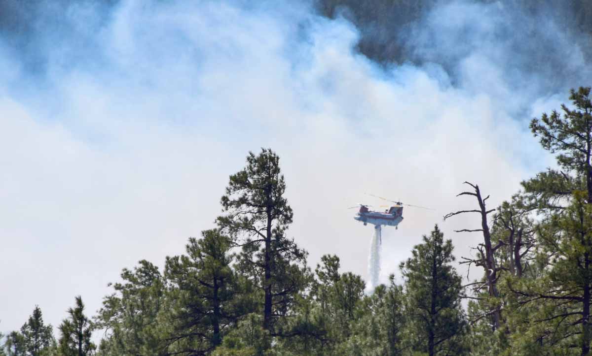
Chinook Tinder Fire Arizona
A Chinook helicopter with an internal tank works the Tinder Fire April 30, 2018. InciWeb photo.

Tinder Fire forces evacuations, burns structures in central Arizona

Above: 3D map of the Tinder Fire showing the perimeter at 1 a.m. MST April 30, 2018. Looking South. Perimeter by USFS.

(Originally published at 10:29 a.m. MDT April 30, 2018)

Structures have burned and evacuations are taking place at the Tinder Fire in Arizona. A mapping flight at 1 a.m. MT on Monday showed that it had burned 8,623 acres east of Highway 87 between Payson and Winslow, Arizona.

(To see all articles on Wildfire Today about the Tinder Fire, click here.)

Firefighters were actively engaged in structural protection Sunday night. The Incident Management Team (IMT) led by Bea Day reports that structures have burned but no details are available. The fire remains active in the communities affected by the fire and the priority is providing for emergency responder and public safety. Coconino County will be assessing damages and providing updates as they are able.

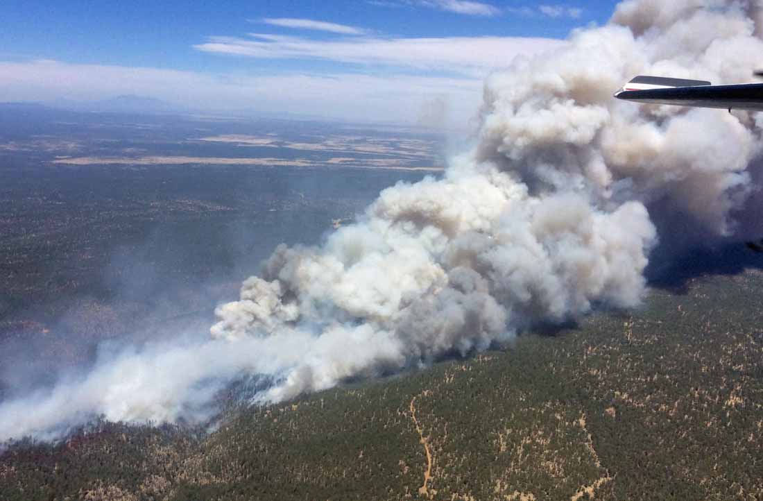
Tinder Fire
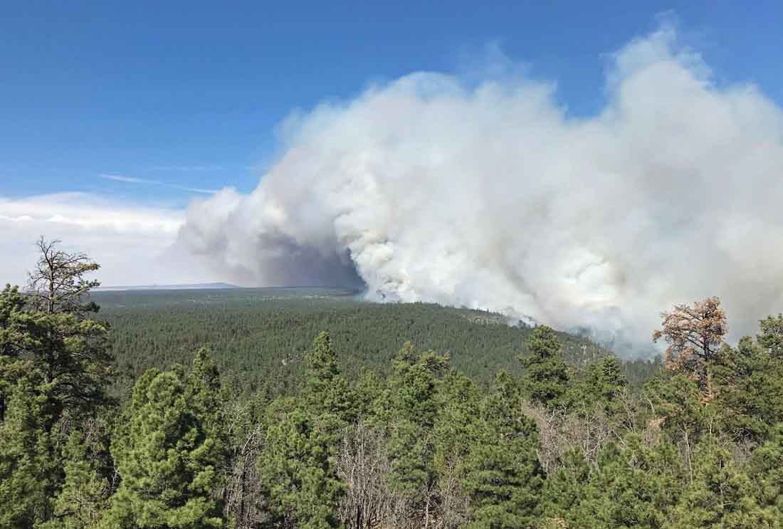
Tinder Fire, April 29, 2018. InciWeb photo, uncredited and undated.

The fire started April 27 during Red Flag Warning conditions. A map released Sunday morning showed that it had burned about 500 acres. A strong southwest wind pushed it to the northeast away from its origin near Highway 95 east of Blue Ridge Reservoir. A new map from 1 a.m. Monday  showed that it spread near a community on the east side of Highway 87/282.

Map of the Tinder Fire
Map of the Tinder Fire showing the perimeter at 1 a.m. MST April 30, 2018. Perimeter by USFS.

The resources assigned to the fire include 13 crews, 5 helicopters, 23 engines, 3 dozers, 2 water tenders, and overhead, for a total of 510 personnel.

On Monday the fire is just outside a Red Flag Warning area, but strong southwest winds will continue to be a challenge for firefighters through Tuesday.  The IMT reports that there is a potential for very active to extreme fire behavior with rapid rates of spread and moderate to long range spotting. The weather forecast indicates that the fire will continue to move to the northeast.

The Coconino County Sheriff’s Office has ordered evacuations for communities affected by the fire that are north, east, and west of Hwy 87. Visit https://www.facebook.com/CoconinoCounty for details. Blue Ridge area residents can call the County’s Call Center, 928-679-8393, with questions about evacuations and structures.

Satellite photo Tinder Fire
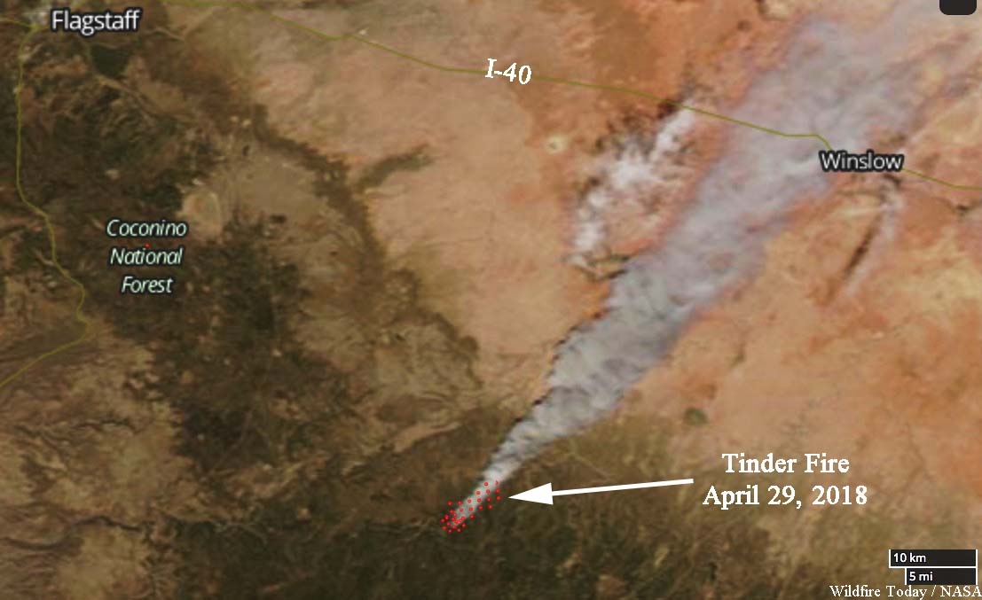
Satellite photo of the Tinder Fire, April 29, 2018. NASA.
Tinder Fire
Tinder Fire, April 29, 2018. InciWeb photo, uncredited and undated.

Below is video of the fire recorded over the fire Monday morning.

Red Flag Warnings in 11 states, April 30, 2018

The National Weather Service has issued Red Flag Warnings or Fire Weather Watches for areas in Arizona, New Mexico, Kansas, Colorado, Nebraska, Oklahoma, Texas, Illinois, Virginia, Maryland, and Delaware.

The Red Flag Warning map was current at 8:50 a.m. MDT on Monday. Red Flag Warnings can change throughout the day as the National Weather Service offices around the country update and revise their forecasts.

OK Bar Fire grows by almost 8,000 acres

Above: Map of OK Bar Fire. The red line was the perimeter at 2229 MDT April 28, 2018. The yellow line was the perimeter about 20 hours before.

The OK Bar Fire in Southern New Mexico consumed another 7,817 acres Saturday to bring the total up to 37,067. Most of the growth was on the south side where it is now 8 miles north of the international border.

The area is under a Red Flag Warning that expires Monday night. Forecasters expect 25 to 35 mph southwest winds with gusts to 45 mph or higher and relative humidities reaching into the single digits. Strong southwest winds will continue through mid week.

The OK Bar Fire is not being fully suppressed and information about the incident is not easy to find. It is still not listed at InciWeb or on the official fire information site for New Mexico. Even though it has been growing by thousands of acres each day since it started April 22 the national situation report keeps saying, “Last narrative report unless significant activity occurs.”

Red Flag Warnings in 10 states, April 29,2018

The National Weather Service has issued Red Flag Warnings or Fire Weather Watches for areas in Arizona, New Mexico, Kansas, Colorado, Nebraska, Wyoming, Minnesota, Iowa, Texas, and Wisconsin. Utah again miraculously avoids extreme fire weather.

The Red Flag Warning map was current at 11 a.m. MDT on Sunday. Red Flag Warnings can change throughout the day as the National Weather Service offices around the country update and revise their forecasts.