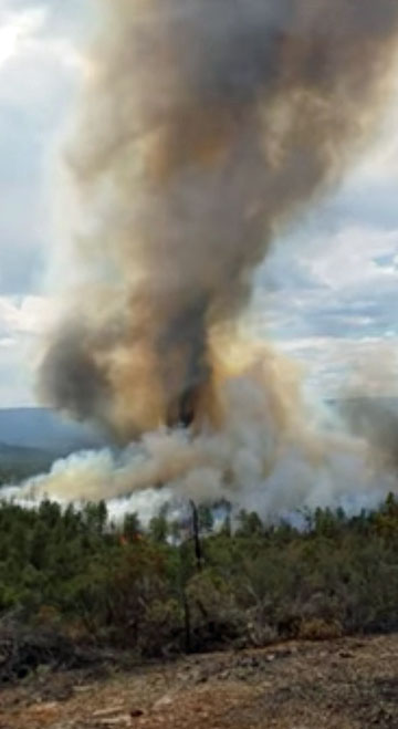
Sawmill Fire causes evacuations east of Green Valley, AZ

Above: A satellite photographed the darkened outline of the Sawmill Fire east of Green Valley, Arizona on April 26, 2017. The red dots represent heat.

(UPDATED at 9:10 a.m. MDT April 27, 2017)

The growth of the Sawmill Fire east of Green Valley, Arizona slowed Wednesday as decreasing winds allowed air tankers and helicopters to drop water and retardant to assist the firefighters on the ground. The only significant spread that we found on satellite images was an additional 400 acres on the northeast corner of the fire.

As of Wednesday night fire managers were still calling it 40,356 acres.

An evacuation order remains in place for Rain Valley. Since evacuation orders were lifted for Greaterville and Singing Valley, residents of those areas are being allowed through the Arizona Highway 83 closure to access their homes. Arizona Highway 83 remains closed to public traffic.

The area is under a Red Flag Warning on Thursday and Friday for relative humidities in the teens and strong winds. One of the priorities on Thursday is to use aircraft to help secure the firelines before the winds increase.

Today, April 27, a Type 1 Incident Management Team will assume command of the 606 personnel on the Sawmill Fire.

****

(UPDATED at 7:47 p.m. MDT April 26, 2017)

At about 2 p.m. MDT the Incident Management Team said the Sawmill Fire had grown to 40,350 acres. At that time there were seven helicopters and three fixed wing aircraft assisting the firefighters on the ground.

On Wednesday morning the incident management team called it 20,000 acres.

At 2:03 p.m. MDT on Wednesday a heat detecting satellite mapped growth of the fire on the south and northeast sides.

map Sawmill Fire Arizona
The red area shows the approximate location of the Sawmill Fire at 2:03 p.m. MDT on April 26, 2017. The white line was the approximate perimeter about 12 hours earlier.

The weather station near the fire at Empire recorded on Wednesday a high temperature of 75, a minimum relative humidity of 12 percent, and wind in the afternoon out of the northwest at 8-12 mph gusting at 20-24.
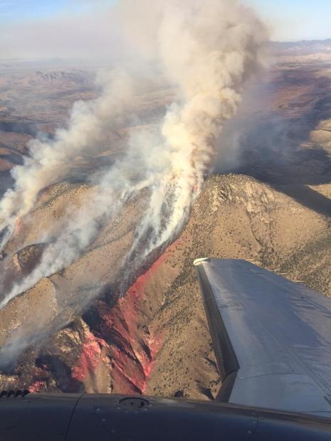
Sawmill Fire
Undated and uncredited photo of the Sawmill fire. Inciweb photo.

****

(UPDATED at 11:16 a.m. MDT April 26, 2017)

A fire that started Sunday morning, April 23 eight miles east of Green Valley, Arizona, has burned (we estimate) about 28,000 acres as of 2:38 a.m. MDT on Wednesday, April 26, 2017, and required evacuations for the communities of Greaterville, Singing Valley, and Rain Valley. It has spread to the east 21 miles, has a perimeter of approximately 63 miles, and crossed Arizona Highway 83 in multiple places.

Sawmill fire map
Sawmill fire map, approximate perimeter 2:38 a.m. MDT April 26, 2017.

The fire is burning on lands protected by the Coronado National Forest, Bureau of Land Management and the Arizona Department of Forestry and Fire Management.
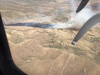
Sawmill Fire, April 23
Sawmill Fire, April 23, 2017. Inciweb photo.

On Tuesday the temperature in the fire area was in the low 70’s, the relative humidity was in the 30’s, and the wind was 12-18 gusting at 25-33 mph out of the west. The forecast for the fire area on Wednesday calls for conditions that could lead to significant additional fire spread toward the east and southeast, with temperatures in the mid-70’s, humidity dipping into the single digits, and winds out of the northwest at 10-20 mph gusting to 29.

Tuesday evening Jeff Andrews’ Type 2 Incident Management Team assumed command. Due to the increasing complexity, management will transition to a Type 1 Team on Thursday, April 27.
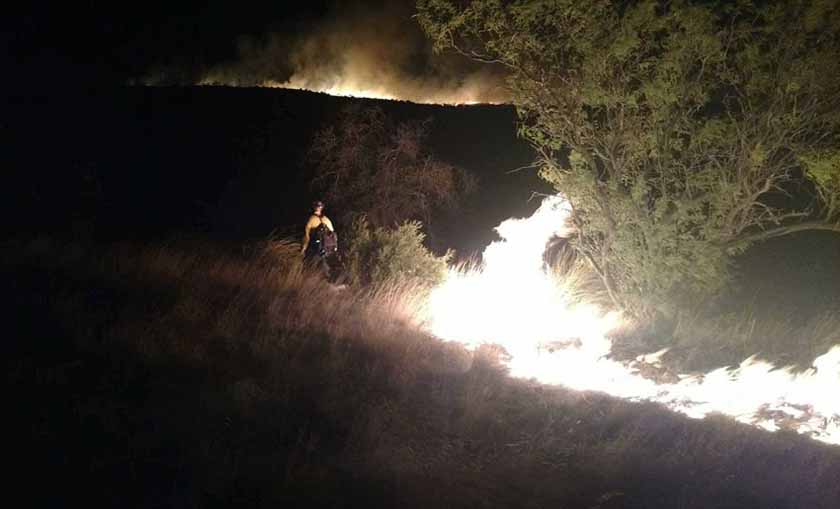
Sawmill Fire
Sawmill Fire. Photo by Arizona Dept. of Corrections’ Florence Inmate Crew.

A full suppression strategy is being employed to protect nearby values at risk including homes, ranches and outbuildings, communications facilities, power lines, and the Arizona National Scenic Trail.
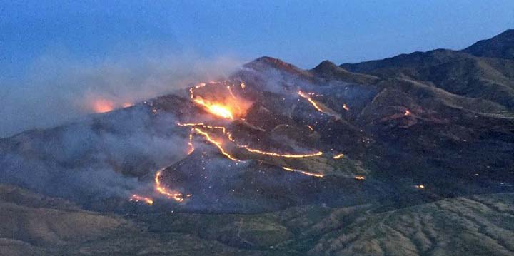
Sawmill Fire
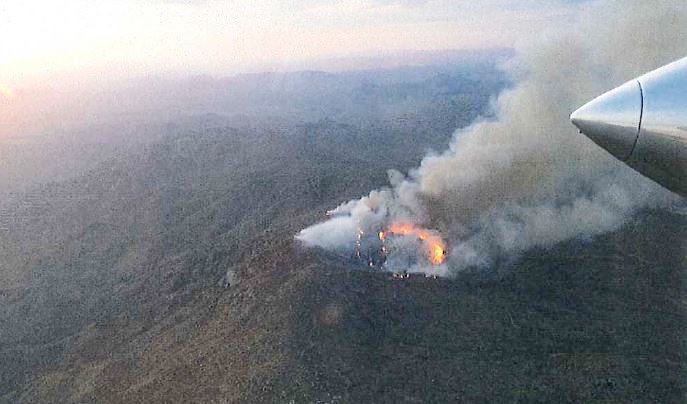
Sawmill Fire, early in the morning on April 24, 2017. Photo by Arizona Department of Forestry and Fire Management.

Creating Defensible Space Around Utility Poles

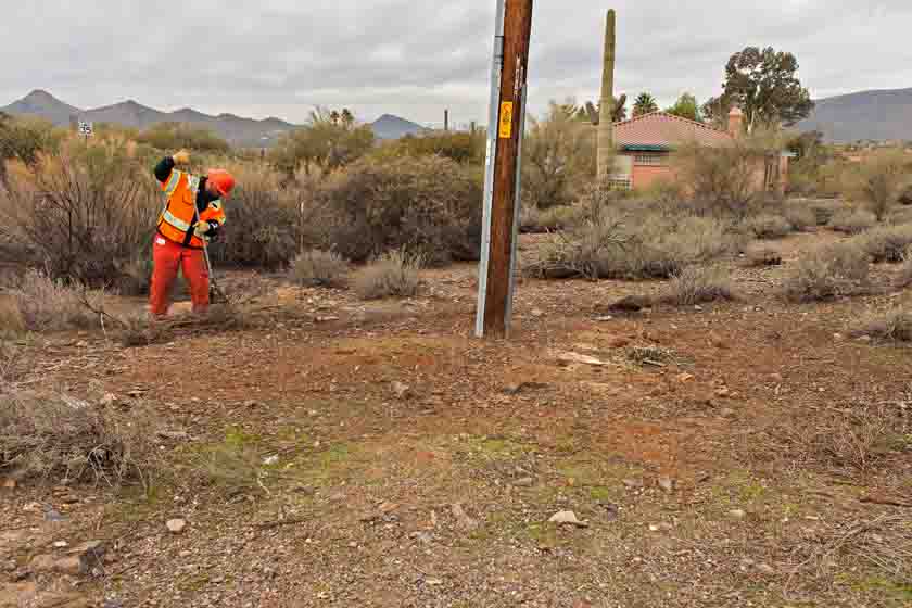
Above: The power pole hazard mitigation crew’s sawyer flush cuts a palo verde stump.

By Tom Story

“As Arizona’s largest utility, there are fire risks we have to manage,” said Wade Ward, Fire Mitigation Specialist for Arizona Public Service (APS). “The primary goal of fire mitigation is to prevent fire from ever happening. The second is to provide safe and reliable electricity to the communities APS serves.  Just as important is the ability to provide for firefighter safety around our system in the event of a fire”, Mr. Ward continued.  “With five thousand miles of transmission and twenty-eight thousand miles of distribution it is hard not to have our system affected by wildland fire.  When this happens, APS’s priority is providing a safe environment for crews to work in”.

defensible space power poles
In Cave Creek, AZ; Wade Ward, Fire Mitigation Specialist for Arizona Public Service, sizes up a palo verde tree slated for removal as part of the APS Defensible Space Around Poles program.

Mr. Ward knows fire (he joined APS after his fire career at the Prescott Fire Department) and he has seen factors like drought, climate change and forest management set the stage for larger and more powerful wildland fires.  “It is becoming more evident that due to extended drought over the past decade forest and vegetation ecosystems have been stressed from the lack of regular moisture compounded by shorter drier winters and longer warmer summers,” Mr. Ward said.

APS sends out inspectors to identify hazardous vegetation in violation of its safety and reliability clearance standards as well as violations of the National Fire Code and the Urban Wildland Interface Code (which state that a utility with equipment attached to the pole must clear all vegetation 10 feet in all directions including 10 feet from the ground). The area around the pole is cleared by work crews to create defensible space.  “There are approximately 70 thousand poles within our system that we will have on a three year return cycle to maintain Defensible Space Around Poles (DSAP)” said Mr. Ward.

defensible space power poles
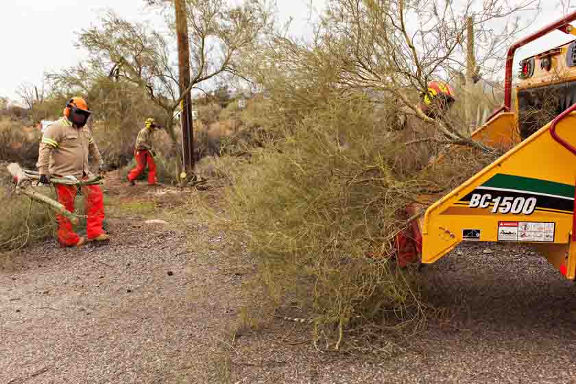
Other crew members cut up and feed the branches into a chipper.

The clearing is being done using manual methods (including chain saws, string trimmers and other hand tools) and where approved is followed by the application of herbicide in compliance with Environmental Protection Agency’s Integrated Vegetation Management practices. APS has prioritized the treatment of subject poles by utilizing data derived from a risk assessment done across the state. Mr. Ward continued; “It is a part of our core values at APS Forestry to manage vegetation and the environment by balancing benefits to create healthy forests and safe reliable energy”.

Mr. Ward finished his remarks noting, “In 2016 we created 110 acres of defensible space around the state of Arizona. One pole at a time”.

defensible space power poles
Putting the finishing touches on the cleanup around one of the Arizona Public Service power poles in Cave Creek, AZ.

Former hotshot sues to obtain information about Yarnell Hill Fire

Yarnell Hill Fire
Yarnell Hill Fire at 7:30 p.m. MST, June 29, 2013, approximately 21 hours before the 19 fatalities. Photo by ATGS Rory Collins, Oregon Department of Forestry.

A former hotshot superintendent is suing the Department of Agriculture to get information the U.S. Forest Service so far has not released about the Yarnell Hill Fire. On June 30, 2013, 19 members of the Granite Mountain Hotshot Crew were entrapped and killed on the fire near Yarnell, Arizona.

Fred Schoeffler is seeking recordings or transcripts of radio transmissions with aircraft that were working on the fire.

Below is an excerpt from an article in the Republic:

Schoeffler, a former hotshot supervisor in Payson for 26 years, alleges that the Forest Service answered his Freedom of Information Act request by claiming they “did not find any responsive records.” Wildfire officials previously have acknowledged the study was underway, and Schoeffler’s complaint notes that air-to-ground voices of those taking part are audible in Forest Service videos released after the fire.

Thanks and a tip of the hat go out to Jeff and Dick.

Typos or errors, report them HERE.

Report released on entrapment of six firefighters on the Cedar Fire in Arizona

Above: Fire whirl on the Cedar Fire, June 28, 2016, around the time of the entrapment. Screen grab from the video.

A report has been released on the entrapment of six firefighters that occurred on the Cedar Fire south of Show Low, Arizona June 28, 2016.

The firefighters were part of the Navajo Interagency Hotshot Crew (NIHC) that remained along with two Type 6 engines and possibly one other crew after the Type 1 Incident Management Team was released the previous day. The assignment of half the crew, nine firefighters, was to “monitor” a part of the southwest side of the fire that had six miles of uncontained fire edge. The other half was working on the southeast side.

Three of the nine personnel on the southwest side served as lookouts while the remaining six were monitoring and checking the fire edge. When a very large fire whirl developed near the six, they realized their escape route was cut off, and took refuge in a previously burned area. The ground fuels had burned, but the canopy was still intact. As the fire approached they deployed their fire shelters, remaining in them for about 30 minutes.

cedar fire entrapment site
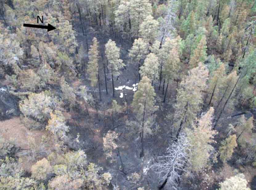
The entrapment site at the Cedar Fire.

After the fire whirl subsided, the squad members were able to hike out to staged vehicles. They were transported in three ambulances, medically evaluated, and transported to Summit Hospital in Show Low, Arizona where they were evaluated. Two firefighters were treated for smoke inhalation and all were released by 10 p.m. that evening.

The report says the personnel deployed and entered the shelters just as they had practiced several times in training, and the devices worked as designed. There were no difficulties, as reported at other entrapments, with the PVC bags becoming soft and difficult to open.

Thankfully there were no serious injuries and the training the firefighters had received paid off.

But there are a number of interesting facts about what occurred before the entrapment

Resources on the fire

On June 27, the day before the entrapment, the Type 1 Incident Management Team issued their final update on the 45,977-acre fire just before they were released later that day. Below is a portion of the document.

cedar fire update

The report claims the Type 1 Team recommended that the number of personnel assigned be reduced on Tuesday June 28 to about 400. But on Monday, June 27 all firefighters except for two Type 6 engines were released. With a 70 percent chance of rain in the weather forecast, on Tuesday the local agency decided to replace the Type 1 Team with a Type 4 Incident Commander, two Type 6 engines, and one or two hand crews. The crew(s) had to be re-mobilized on Tuesday after being released. Some aircraft were also assigned on Tuesday.

Video of the large fire whirl

Weather on Tuesday, the day of entrapment

About 20 minutes before the 2:45 p.m. entrapment the weather at the fire was 95 degrees, 21 percent relative humidity, with a 7 to 10 mph wind out of the south. Although “numerous” people observed dust devils and fire whirls before the large fire whirl formed, there was no discussion about modifying fire suppression tactics. Dust devils can be an indicator of the potential for extreme fire behavior.

cedar fire entrapment
Fire whirl on the Cedar Fire, June 28, 2016. Screen grab from the video.

Yarnell Hill Fire homeowners ask appellate court to allow them to sue the state

Above: Hearing in the Court of Appeals, September 21, 2016. Screen grab from video.

From the Insurance Journal:

Attorneys for Yarnell residents who lost their homes in the deadly 2013 Arizona wildfire are asking the Court of Appeals to allow their clients to sue the state.

KJZZ-FM reported that previously homeowners sued the state Forestry Division, but a trial judge dismissed the case concluding the state had no duty to protect the residents’ property.

At a hearing [September 21, 2016] an attorney for the state said Arizona is not responsible for protecting everyone who chooses to live adjacent to wilderness.

Plaintiffs’ attorney David Abney says that since the state fought the fire, it voluntarily agreed to try to protect Yarnell. Abney wants the appellate court to give his clients a chance to make their case to a jury.

The 2013 Yarnell wildfire killed 19 firefighters and burned more than 120 homes.

To our knowledge, the Court of Appeals has not yet handed down their decision.

Video from the hearing is available on YouTube.

Weather forecast for the prescribed fire in Arizona that led to accidents on Interstate 40

prescribed fire smoke accidents arizona
Map, produced at 11:41 a.m. MDT Oct. 20, 2016, showing heat detected on the Green Base prescribed fire. The dots nearest the Interstate represent heat that was detected during the afternoon of October 18, 2016. The northernmost dots are from October 17, 2016. Click to enlarge.

We looked further into what led to the smoky conditions that resulted in numerous vehicle crashes on Interstate 40 west of Flagstaff, Arizona early Wednesday morning, October 19. The smoke on the highway from a prescribed fire was referred to as “pea soup”, and was clearly the cause of some of the accidents, but investigators are not yet ready to say the smoke caused the one fatality when a vehicle was sandwiched between two semi trucks.

During the very early morning hours of Wednesday, October 19, smoke settled into the areas around Interstate 40 between Parks and Williams. An electronic sign warned motorists about smoke, but the severely reduced visibility was not anticipated by the U.S. Forest Service. After the accidents started occurring the Interstate was closed for five hours.

ADEQ smoke permit green base prescribed fire
Data from the smoke permit issued by the Arizona Department of Environmental Quality for the Green Base prescribed fire. Click to enlarge.

The Kaibab National Forest ignited the Green Base Prescribed Fire on Tuesday, October 18, 2016 immediately north of Interstate 40. The smoke permit issued by the Arizona Department of Environmental Quality anticipated moderate “impacts on sensitive areas”:

Smoke impacts to the following communities of Flagstaff, Parks, Spring Valley, Pittman Valley, Sherwood Forest Estates and some smoke may impact Williams. I-40 may experience moderate smoke impacts in low-lying areas.

The Flagstaff office of the National Weather Service issued a Spot Weather Forecast for the Green Base Prescribed Fire at 5:28 a.m. MST on Tuesday October 18, 2016. It anticipated a “good” maximum ventilation rate for Tuesday, did not specify one for Tuesday night, and for Wednesday it was described as “fair”.

spot weather green base prescribed fire
Spot Weather forecast for the Green Base Prescribed Fire, October 18, 2016. Click to enlarge.

The ventilation rate provides an estimate of how high and how far smoke will disperse. A high ventilation rate suggests that smoke will spread out quickly and through a deep layer of the atmosphere, so that surface concentrations downwind will be lower than they would be with a lower ventilation rate.

The transport winds (from the ground to the mixing height) for Tuesday night were predicted to be “west 5 to 10 knots shifting to the north after midnight, then shifting to the northeast early in the morning.” The wind speed after the shift was not specified. Perhaps this was interpreted by fire managers to mean it would continue at 5 to 10 knots.

The prescribed fire was just north of the east-west Interstate, so a wind out of the northeast would likely push the smoke toward the highway. And if an area is prone to nighttime inversions, visibility can be compromised.

Fox News reported that Cory Mottice, a National Weather Service meteorologist in Flagstaff, said, “[Smoke] always gets trapped after dark,” he said. “It’s just a question of where the wind blows it.”

However that analysis was not described in detail in the spot weather forecast issued by Mr. Mottice’s office. As in many spot weather forecasts, much of the information appears to be generated by a computer, with little interpretation or discussion about how the information will affect the fire. Meteorologists are not expected to be Fire Behavior Analysts, but sometimes a little human-created discussion and interpretation can add value to a computer product.

Below are excerpts from an article at the Arizona Daily Sun:

… A Highway Patrol captain at the scene said smoke in the area reduced visibility down to about 20 feet, Department of Public Safety spokesman Bart Graves said. Sherwood Forest Estates Fire Chief Wayne Marx said even his crews had to stick their heads out the window to watch the yellow stripe on the road as they escorted commuters away from the interstate.

“You couldn’t see past the end of the hood,” Marx said.

[…]

One retired meteorologist who lives in the area believes more precautions should have been taken. Parks resident Byron Peterson, who retired from National Weather Service station in Bellemont, said the smoke was already bad on Old Route 66 Tuesday afternoon. Firefighters waved him on, he said, even though there were times when he could not see 10 feet in front of him.

“It was very frightening to say the least,” Peterson said.

He said strong southwest winds coming up over Bill Williams Mountain near Williams formed an eddy of swirling air that then dove down over the prescribed burn, keeping the smoke from dissipating.

“I tried to explain that to people at the Forest Service and it was just like talking to a wall,” he said.