Tag: Arizona
A confluence of wildfire and art
The Fires of Change exhibition is a collaborative science and art partnership among the Southwest Fire Science Consortium, Flagstaff Arts Council, and the Landscape Conservation Initiative. The exhibition will open at the Coconino Center for the Arts in September 2015 during the Flagstaff Festival of Science. This film documents the workshop the artists attended at the North Rim of the Grand Canyon to learn about fire management. For more information about the project, the partnership, and the artists involved, visit the Flagstaff Arts Council web site.
I am really curious about what will be created out of this very intriguing project. If it works out the way it possibly could, it should be a travelling exhibition, or, other areas could conduct similar initiatives.
Wildfire briefing, December 4, 2014
Fires in U.S. and Australia determined to be caused by power lines

Two fires, in Western Australia and California, have recently been determined to be caused by electrical power lines.
The Pfeiffer Fire at Big Sur, California started on December 16, 2013 and burned 34 homes and 917 acres in the coastal community 23 miles south of Monterey. The U.S. Forest Service reported on Wednesday:
The cause of the fire was determined to be high resistance heating of the Pfeiffer Ridge Mutual Water Company electrical control wires immediately adjacent to a steel water pipe line. The high resistance heating of the electrical control wires created a competent ignition source for this fire. The first fuel ignited was accumulated dried leaves and redwood needles.
The other fire was in Western Australia. Below is an excerpt from an article in Western Australia Today:
A rotted power pole infested with termites has been blamed for the Parkerville bushfire which destroyed more than 40 homes this year. But EnergySafety director Ken Bowron said the organisation would not take action against Western Power or the landowner.
The EnergySafety report into the cause of the fire on January 12 was released on Thursday and found the bushfire originated from a private pole at 180 Granite Road, Parkerville.
“There was no evidence to suggest the work performed by Western Power to replace the surface aerial seven months before the incident, or the work to replace the adjacent pole two day before the bushfires, causes the PA pole to fail,” Mr Bowron said.
“Based on the available evidence and legal advice, EnergySafety will not be taking any legal action against any party. The clear finding of the report is that the pole failed because it was rotten and had been infested by termites.
Hearing in Prescott on Granite Mountain Hotshots’ retroactive retirement benefits
From the Daily Courier in Prescott, Arizona:
Now nearly a year and a half after 19 Granite Mountain Hotshots died fighting the Yarnell Hill wildfire, the matter of retroactive retirement benefits continues to play out at Prescott City Hall.
With its earlier decision granting retirement benefits to the family of fallen Hotshot Andrew Ashcraft still under appeal, the local fire retirement board will take on two new retirement cases today.
During a 9 a.m. Thursday hearing at Prescott City Hall, the Prescott Board of the Public Safety Personnel Retirement System Board will turn to the retirement claims by the families of Sean Misner and William Warneke, and whether the scope of the actual hearings on the claims should be limited…
Tree ring researcher at the University of Arizona honored
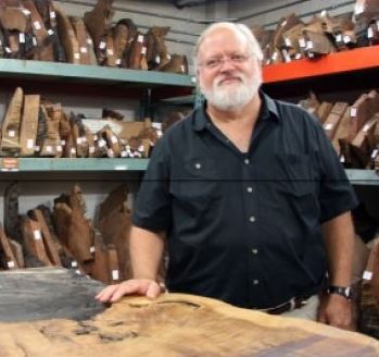
Thomas W. Swetnam, Regents’ Professor of dendrochronology and director of the University of Arizona Laboratory of Tree-Ring Research, has been named a Fellow of the American Association for the Advancement of Science (AAAS), the world’s largest general scientific society.
As part of the Section on Geology and Geography, Swetnam was elected as an AAAS Fellow for his investigations of tree rings as a record of past changes in climate, allowing scientists to predict future forest-fire frequencies in the Southwest.
Mr. Swetnam specializes in analyzing climate changes through history and prehistory, dangerous insect outbreaks and forest fires. In recent years, enormous blazes, some 10 times greater than those that firefighters have been accustomed to seeing in California and Arizona, have forced scholars to attempt to understand this phenomenon. The conclusions from Swetnam’s studies of these so-called megafires and their alarming size, duration and frequency have made the scientific community, governments throughout the world and media to pay close attention. Swetnam has appeared on programs such as PBS’ “NewsHour” and CBS’ “60 Minutes.”
Firefighters suppress two fires north of Flagstaff
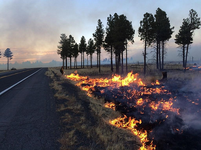
Firefighters on the Coconino National Forest have contained two fires north of Flagstaff, Arizona. The 509-acre Kendrick 2 Fire, about 20 miles northwest of Flagstaff on Highway 180 Near Kendrick Mountain, has a fireline around it, meeting the definition of containment, but the incident commander is calling it only 50 percent contained Monday morning.
Highway 180 remains closed in both directions Monday morning. Fire managers expect to recommend reopening the highway later today.
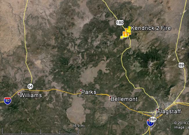
The other fire was 12 miles north of the Flagstaff Mall on the west side of Hwy 89 near Forest Service Road 418. It was named for its location at milepost 431 on Hwy 89. The fire was contained after burning 204 acres.
Geronimo Hotshots fireline video

The video below features the Geronimo Hotshots, firefighters from the San Carlos Apache Reservation in southeastern Arizona. It was shot by crew member Samson Belvado in 2013, much of it with a helmet camera, and put together by the The Atlantic filmmaker Sam Price-Waldman.
Additional photos emerge of Yarnell Hill Fire

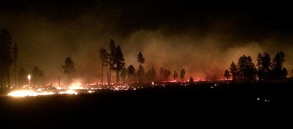
We received some photos today of the Yarnell Hill Fire that we had not previously seen. Most of them are snapshots of smoke coming up from behind a ridge or distant air tankers in the sky, but one of them captured our interest, the image above. It does not generate much new information, but it appears to show that when it was taken, at 8:16 p.m. on June 29, 2013 (according to the time stamp on the file), 27 hours after the fire started, it was still not a large fire. This photo is consistent with the photo below taken at 7:30 p.m. on June 29, 2013 which has been public since last year.
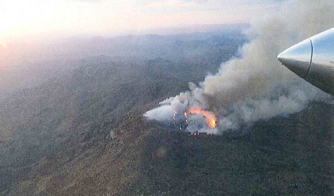
According to information released by the Arizona State Forestry Division on July 16, 2013, on the second day of the fire at 5:30 p.m. on June 29 there were 13 firefighters working on the fire and it had burned six acres. By the afternoon of day three of the fire, June 30, it had grown to be much, much larger than it had been the evening before. At 4:47 p.m. that day the incident commander and the Arizona Dispatch Center received notice from Air Attack that firefighters had deployed fire shelters. The Granite Mountain Hotshots, 19 of them, died in the fire when a predicted wind shift changed the direction of the spread of the fire and entrapped the firefighters. The intensity of the fire exceeded the protection capabilities of the shelters.
On September 28, 2013 when the ASFD released their Serious Accident Investigation report on the fatalities, we wrote this about the lack of aggressive suppression action on the fire:
The ordering and use of ground and aerial firefighting resources was less than aggressive on June 29, the day before the tragedy when the fire was still small. The only air tankers used that day were two single engine air tankers, and for only part of the day, dropping a total of 7,626 gallons. After being released, they were requested again by Air Attack, but dispatch only allowed one to respond to the fire, wanting to keep one in reserve in case there were other fires.
General Norman Schwarzkopf’s philosophy when confronting the enemy was to use “overwhelming force”. This strategy also is effective when confronting a wildfire. Overwhelming force for a short amount of time can prevent megafires burning for weeks, consuming many acres, dollars, and sometimes homes and lives.
The bottom line: Being timid or TOO cost-conscious during initial attack or the first burning period of a fire can be far more expensive in dollars and in the worst case, lives.
