At 1 p.m. Wednesday cameras pointed at the Rices Fire show that it is not putting up much smoke.
Rices Fire as seen from the Barr Ranch camera, looking north at 1:02 p.m June 29, 2022.
Mapping at mid-morning on Wednesday found it had burned 820 acres.
Updated at 9:07 a.m. PDT June 29, 2022
Rices Fire map, estimated perimeter, June 28, 2022.
Updated at 8:03 a.m. PDT June 29, 2022
Rices Fire, as seen from the Barr Ranch camera looking north at 7:29 a.m. June 29, 2022.
The spread of the Rices Fire in Northern California north of Bridgeport west of French Corral slowed overnight. The latest size estimate from CAL FIRE is 769 acres.
Tuesday night the relative humidity went up to 36 percent after reaching 6 percent Tuesday afternoon. Very early Wednesday morning the wind was from the northeast at 4 mph gusting to 10.
The spot weather forecast for Wednesday issued Tuesday afternoon, predicted 91 degrees, east winds 3 to 7 mph shifting to the southwest at 5 to 8 mph after 9 to 10 a.m., with 10 percent relative humidity. Without strong winds this is not considered extreme conditions, but with ultra low humidity and fuel moistures there will still be considerable resistance to control.
8:15 p.m. PDT June 28, 2022
A wildfire in Nevada County in Northern California is prompting evacuations near Birchville. Since it started at about 2 p.m. Tuesday it had burned approximately 520 acres by 6:30 p.m. It was reported near Rices Crossing and Cranston Roads and is believed to have originated from a structure fire that spread into vegetation.
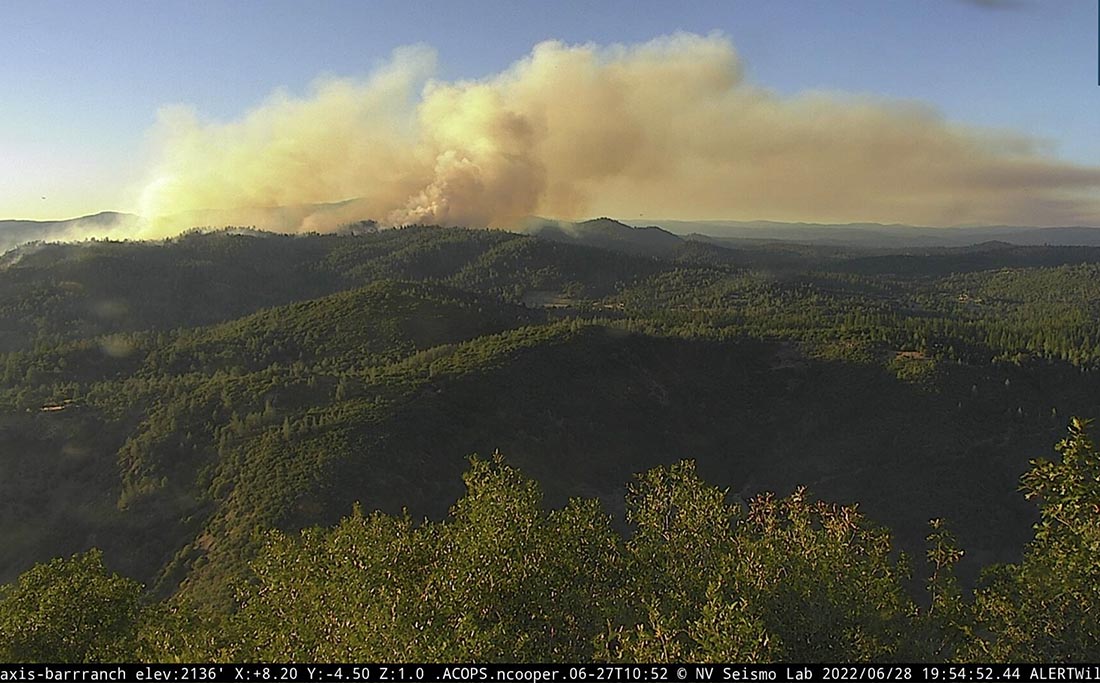
Rices Fire, as seen from the Barr Ranch camera, looking north at 7:54 p.m. June 28 2022.
A nearby weather station Tuesday afternoon recorded a high of 100 degrees recorded, relative humidity as low as 6 percent with 6 mph southwest winds gusting to 15 mph. The forecast for Wednesday calls for 91 degrees, east winds 3 to 7 mph shifting to the southwest at 5 to 8 mph after 9 to 10 am., with 10 percent relative humidity.
We will post more information as it becomes available.
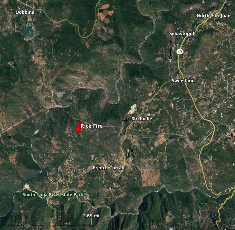
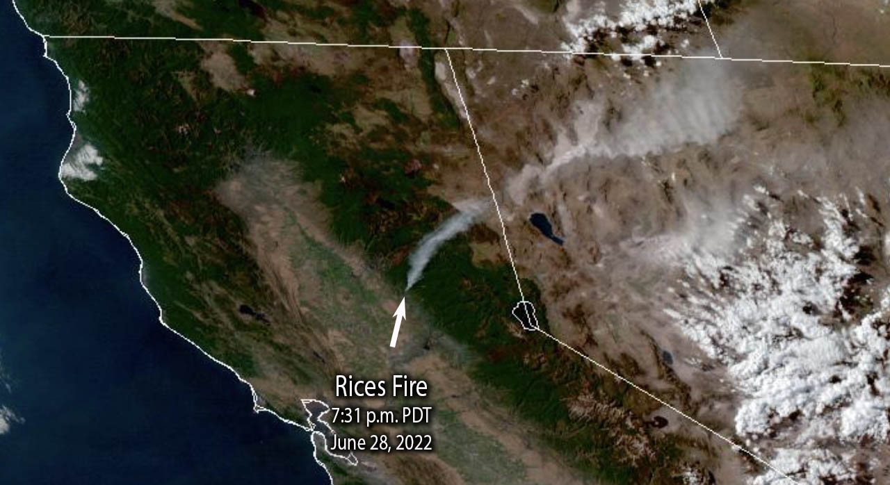
Approximate location of the Rices Fire, June 28, 2022.Rices Fire, satellite photo, 7:31 p.m. PDT June 28, 2022
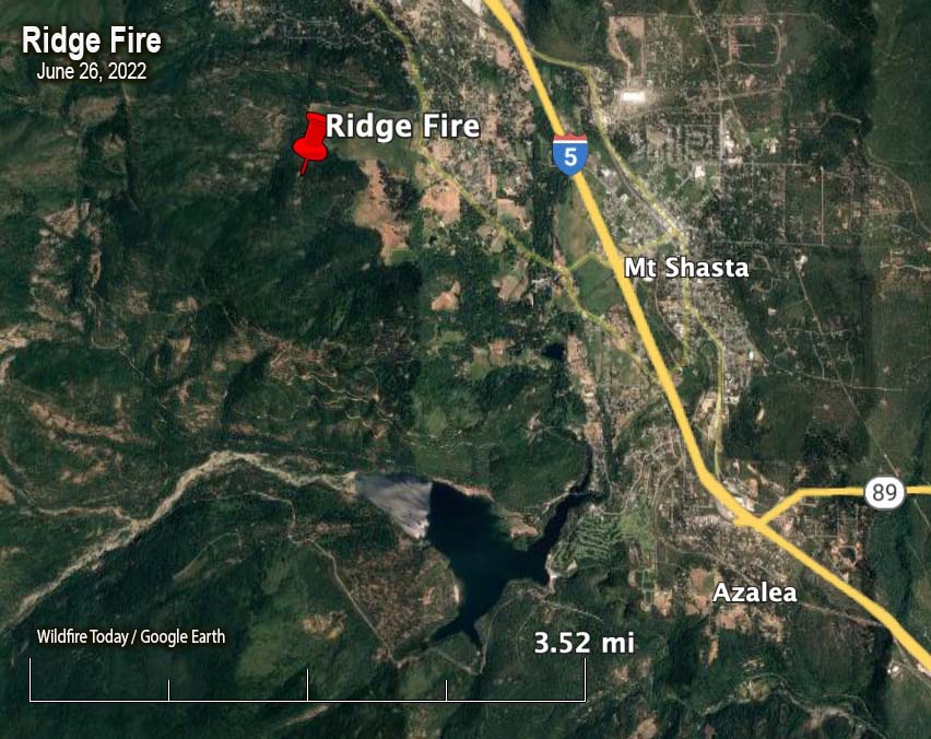
Map showing the location of the Ridge Fire at 1 a.m. June 26, 2022.
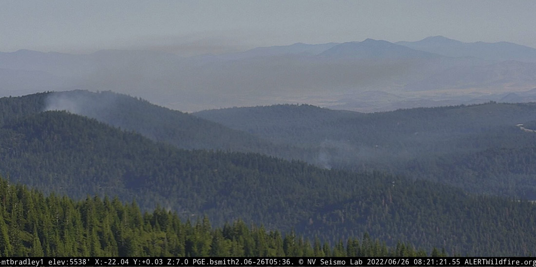
At about 9 p.m. Saturday firefighters responded to the Ridge Fire two miles northwest of the city of Mt. Shasta, west of Interstate 5 in Northern California. Infrared cameras showed multiple heat sources. It is not known if there was more than one ignition or if spot fires occurred from a single fire. The size estimate from CAL FIRE is 10 acres.
It is in an area with difficult access, on private land about a quarter mile outside the Shasta-Trinity National Forest.
The weather after sunset at the Mt. Shasta weather station two miles away in the community, recorded 2 mph winds out of the southeast switching to the northeast after 9 p.m. The relative humidity in the town, which may not be representative of conditions near the fire on ridge, increased overnight from 10 to 63 percent.
The forecast for Sunday at the fire area calls for 93 degrees, 12-15 percent relative humidity, and 2 to 6 mph winds out of the southeast becoming south in the afternoon.
Ridge Fire as seen from Mt. Bradley, 8:21 a.m., June 26, 2022.
Sequoia grove in Sequoia and Kings Canyon NP, November, 2021. NPS photo by Daniel Jeffcoach.
At Wildfire Today we don’t get too excited about proposed legislation because most of it is introduced, sent to a committee, and is never seen again. But pending, there are two that will interest land managers and wildland firefighters and may have a better than 50/50 chance of passing.
Save Our Sequoias
Today House Minority Leader Kevin McCarthy (R-Bakersfield-23) and co-author House Committee on Natural Resources Ranking Member Bruce Westerman (R-Ark.) introduced the Save Our Sequoias (SOS) act.
These trees that can live for up to 3,000 years need protection. This should include actively managing and reducing the surrounding hazardous fuels. In addition, when firefighting resources are scarce, which seems to be the new normal, Multi-Agency Coordinating Groups need to consider the irreplaceable value of these iconic groves when allocating personnel and equipment for going fires. Some may say these behemoths are at least, if not more, valuable than man-made structures that also may need protection from nearby fires.
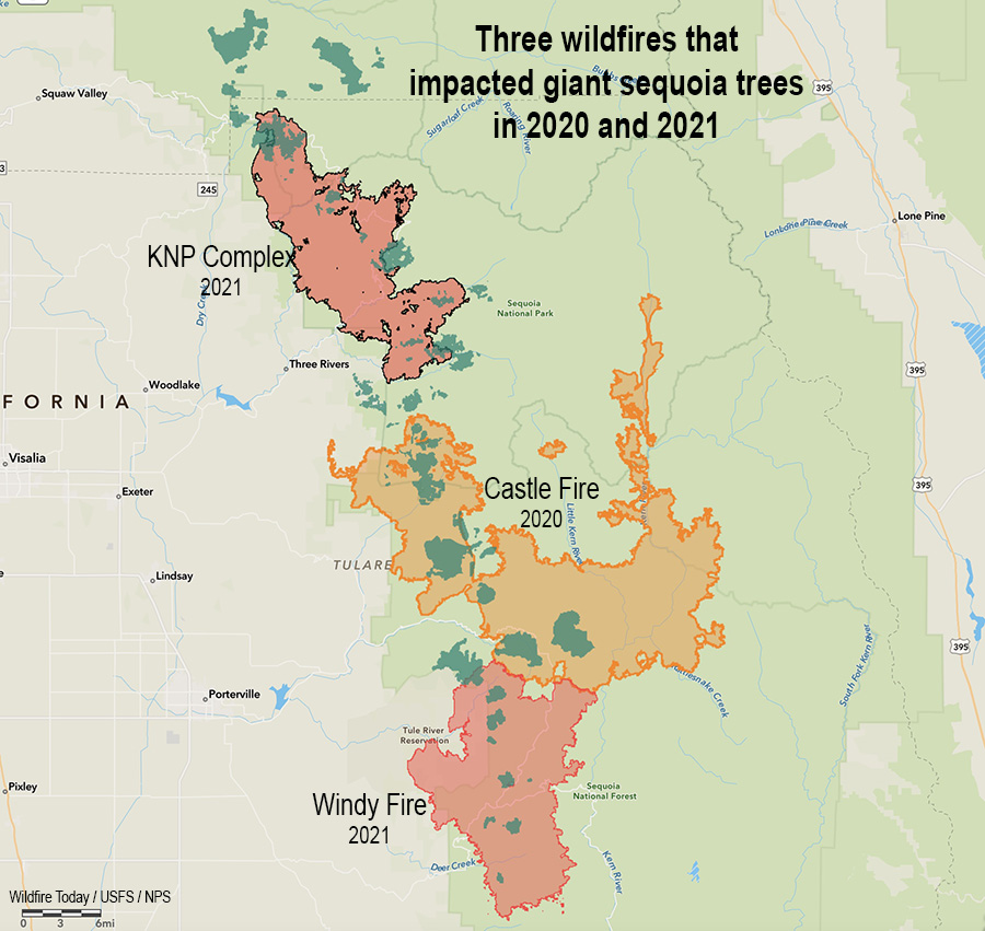
Preliminary surveys found that in a two year period, 2020 and 2021, almost 20 percent of all giant sequoias in their natural range over four feet in diameter were killed by fire (and neglect) or will die in the next few years. In 2020, 10 to 14 percent of the entire Sierra Nevada population of giant sequoia trees over 4 feet in diameter were killed in the Castle Fire. Early estimates after two fires the following year, the KNP Complex and the Windy Fire, 2,261 to 3,637 sequoias over four feet in diameter were killed or will die within the next three to five years.
At this rate, with this climate, we could lose the rest of these massive trees in just a few years.
Three fires in two years that killed giant sequoia trees. The darker green areas represent groves of giant sequoias.
Please watch this video to see how urgent the issue is.
The film was produced by Kyle Dickman and the Mariposa County Resource Conservation District thanks to a grant from the California Wildlife Conservation Board’s Forest conservation Program.
Despite the looming threat to the remaining Giant Sequoias, federal land managers have not been able to increase the pace and scale of treatments necessary to restore Giant Sequoia resiliency to wildfires, insects, and drought. At its current pace, it would take the U.S. Forest Service approximately 52 years to treat just their 19 highest priority Giant Sequoia groves at high-risk of experiencing devastating wildfires. Without urgent action, we are at risk of losing our iconic trees in the next several years. Accelerating scientific forest management practices will not only improve the health and resiliency of these thousand-year-old trees but also enhance air and water quality and protect critical habitat for important species like the Pacific Fisher.
The SOS Act will provide land managers with the emergency tools and resources needed to save these remaining ancient wonders from the unprecedented peril threatening their long-term survival. The bill would:
Enhance coordination between federal, state, tribal and local land managers through shared stewardship agreements and the codification of the Giant Sequoia Lands Coalition, a partnership between the current Giant Sequoia managers.
Create a Giant Sequoia Health and Resiliency Assessment to prioritize wildfire risk reduction treatments in the highest-risk groves and track the progress of scientific forest management activities.
Declare an emergency to streamline and expedite environmental reviews and consultations while maintaining robust scientific analysis.
Provide new authority to the National Park Foundation and National Forest Foundation to accept private donations to facilitate Giant Sequoia restoration and resiliency.
Establish a comprehensive reforestation strategy to regenerate Giant Sequoias in areas destroyed by recent catastrophic wildfires.
Neither the text or a summary of the bill, H.R.8168, is available, but on the day it was introduced Congress.gov listed 26 cosponsors — 13 Republicans and 13 Democrats.
$1,000 Recruitment or Retention bonus for wildland firefighters
An amendment has been added to the National Defense Authorization Act (NDAA) of 2023, H.R.7900, which would pay a recruitment or retention bonus of not less than $1,000 to Federal wildland firefighters. The minimum amount would be increased each year according to the Consumer Price Index. It would be available once a year to any primary or secondary firefighter after successfully completing the Work Capacity Test.
‘‘Federal wildland firefighter’’ is defined as “any temporary, seasonal, or permanent position at the Department of Agriculture or the Department of the Interior that maintains group, emergency incident management, or fire qualifications, as established annually by the Standards for Wildland Fire Position Qualifications published by the National Wildfire Coordinating Group, and primarily engages in or supports wildland fire management activities, including forestry and rangeland technicians and positions concerning aviation, engineering heavy equipment operations, or fire and fuels management.”
It does not appropriate any additional funding to pay the bonuses, but the dollars could most likely come from the salaries from unfilled positions.
The NDAA is far from being passed, but this is a high priority piece of legislation which is sometimes used as a vehicle for slipping in unrelated bills. The 2014 NDAA, for example, included authorization and $130 million to transfer seven HC-130H aircraft from the Coast Guard to the US Forest Service to be used as air tankers. But that’s a long, sad, story with a couple of unexpected twists. (Unless there are still more delays, one or more may be actually flying over fires for the California Department of Forestry and Fire Protection, not the Forest Service, in 2023.)
A correction was made to the dates in which nearly 20 percent of all giant sequoias in their natural range over four feet in diameter were killed by fire (and neglect) or will die in the next few years.
A woman and her two dogs were killed by lightning in Pico Rivera
8:15 a.m. PDT June 24, 2022
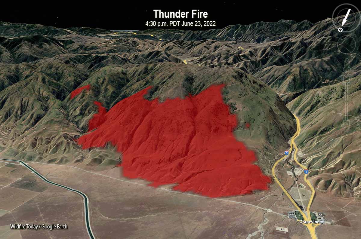
Map of the Thunder Fire, 4:30 p.m. PDT June 23, 2022, near the Grapevine on Interstate 5 in Southern California. Looking south-southeast
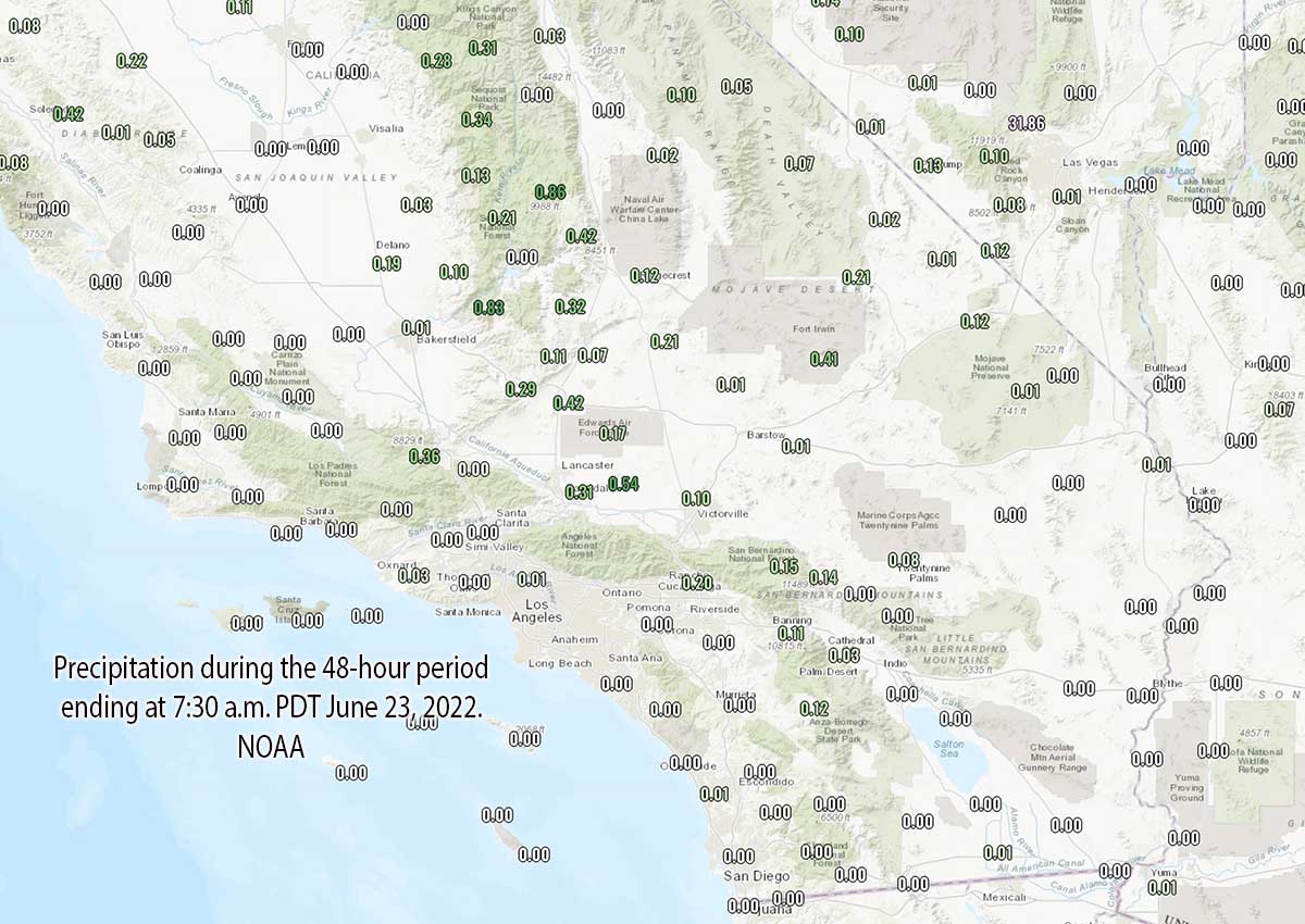
It is still possible that some of the 50,000+ lightning strikes in California on Wednesday and Thursday could have started fires that are undetected, very small, and smouldering, but so far most of the blazes that have been reported have been contained, or very close to it. The lack of numerous huge fires in the wake of the lightning is likely due to the rain that accompanied the strikes in some areas, high relative humidity, and it being fairly early in the fire season before fuel moistures drop to critical levels.
The largest has been the Thunder Fire (see map above) just west of the Grapevine on Interstate 5 north of Frazier Park. The official cause has not yet been released, but lightning is suspected said Captain Andrew Freeborn of the Kern County Fire Department. Friday morning it was 2,466 acres and had 311 personnel assigned.
The Romero Fire was reported Thursday afternoon in Merced County near Santa Nella, five miles south of Highway 152. As of early Friday morning it had burned 422 acres of grass and is 100 percent contained. The cause has not been released.
Five other fires in the greater Bay Area have burned 26 to 522 acres; firefighters so far have not had much difficulty in stopping the spread of those incidents.
On Thursday the reported wildfire activity in Southern California was, CAL FIRE, 33 fires; County and local, 14 fires; and US Forest Service, 6 fires. It is not known how many of these can be attributed to lightning.
7:42 a.m. PDT June 23, 2022
Lightning, during the 24 hours ending at 6:15 a.m. PDT June 23, 2022. LightningMaps.org
As monsoonal moisture moved through Southern California Wednesday more than 50,000 lightning strikes were detected, starting wildfires and killing a woman and her two dogs who were walking in Pico Rivera.
Chris Vagasky, @COweatherman, tweeted that a total of 54,329 strikes were recorded across California on Wednesday UTC time.
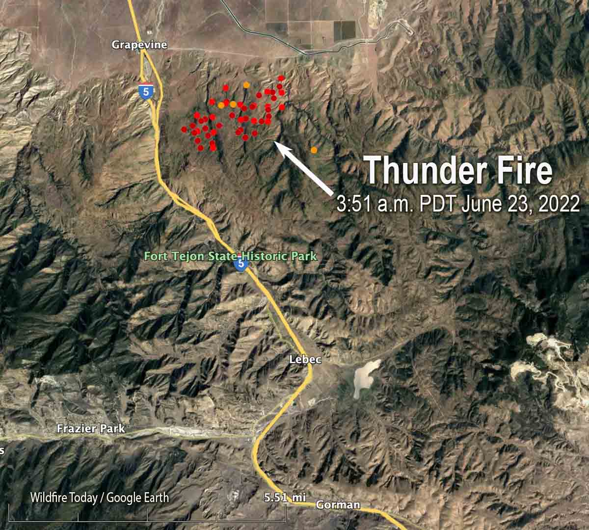
Map showing heat detected on the Thunder Fire by satellites as late as 3:51 a.m. MDT June 23, 2022.
Multiple fires suspected of being started by lightning occurred in Southern California, with most of them being suppressed while very small. The cause of the Thunder Fire east of Interstate 5 near the Grapevine north of Frazier Park is under investigation, but the suspected cause is lightning, said Captain Andrew Freeborn of the Kern County Fire Department. At 6:45 a.m. Thursday the Department reported it had burned approximately 2,300 acres and was being staffed by 250 personnel.
Small fires on the Angeles National Forest were being worked overnight by firefighters assisted by night-flying helicopters.
The Rancho Fire in Rancho Tehama in Northern California has destroyed 10 structures and damaged 4 others, the California Department of Forestry and Fire Suppression said Monday night.
It was mapped Monday afternoon at 255 acres with a 17-acre spot fire out ahead. Tuesday morning at 8 a.m. it had grown to about 700 acres, CAL FIRE reported.
Evacuations are in effect and 158 structures are threatened.
Rancho Fire, 8:04 p.m. PDT, June 13, 2022.
The fire is 14 miles southwest of Red Bluff and 14 miles northwest of Corning.
Rancho Fire map, 12:07 a.m.. June 14, 2022
The aerial video below was shot at 6:20 p.m. PDT June 13, 2022. After that, the size more than doubled.
OCFA’s FIRIS Intel 12 on the Rancho Incident, Tehama County. The main fire is mapped at 255 acres with a 17.5 acre spot fire at the head of the fire. pic.twitter.com/lJOwdKA3ej
The Sheep Fire just northeast of Wrightwood, California has prompted evacuations of some areas northwest of the community. The San Bernardino County Sheriff’s Office and NIXLE have the details. An evacuation center is at Serrano High School, 9292 Sheep Creek Road, Phelan, CA 92371.
The fire is burning on both sides of Highway 2 and Sunday evening was spreading toward Desert Front Road. Most of the heat detected by a satellite overnight was on the northwest side of the fire.
Smoke over the Sheep Fire at 8:24 a.m. June 13, 2022.
Monday morning the Southern California Geographic Coordination Center said it had been mapped at 939 acres, an increase of 139 acres overnight. It was reported Saturday June 11 at 6:30 p.m.
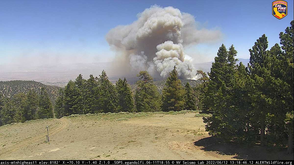
Sheep Fire, 1:18 p.m. June 12, 2022.
The incident is being managed by the Angeles National Forest, San Bernardino County Fire, and CAL FIRE in unified command.
Sunday afternoon a cell phone outage was reported in the Wrightwood area, and law enforcement was prepared to go door to door if additional evacuations were required.
California Incident Management Team 14 with Incident Commander Watkins will in-brief Monday at 5 p.m.