Proposal: plant oak trees to limit spread of a brush fire

Tony Shafer and Shea Broussard have developed a fire simulator or model they say can predict the spread of a brush fire. With their “FlameMapper” program they have focused primarily on the Santa Monica Mountains of southern California.

Below is an excerpt from an article in the Malibu Times:

…Shafer, who retired after 43 years with the Los Angeles County Fire Department, has two master’s degrees and is a longtime Malibu resident. He has extensively studied the wildfires of the Santa Monica Mountains from 1900 to today.

“Virtually every stick between the 101 and the Pacific Ocean has burned at least once or twice in the last 50 years,” Shafer said. “Some areas have burned six or seven times.”

Local wildfires tend to start at or near the 101 Freeway and strong Santa Ana wind conditions drive the flames toward the coast. FlameMapper software incorporates data from the burn paths of every major wildfire in the last 115 years, including many variables, and is now able to simulate the probable paths and speed a fire could take, based on location, wind, humidity, etc.

In detailed studies of the most common paths that fires have taken through the mountains over the years, Shafer noticed something interesting. “I noticed that oak trees next to a structure protected that structure,” he said.

He began building computer simulations of oak tree plantings at various areas on fire paths. The results showed that “the spread of the fire is vastly reduced by oak trees that have the understory (flammable plants growing underneath the tree) removed.”

Shafer noticed while running simulations of past fires that came down Malibu Canyon that there is a narrow “choke point” or “corridor” near Piuma and Malibu Canyon roads that a fire beginning at the 101 has to get through in order to make it all the way into Malibu. He feels that if oak trees were planted at that particular site, it would stop fires on that route from getting into Malibu…

Thanks and a tip of the hat go out to Barbara.

CAL FIRE says vegetation conditions are the worst on record

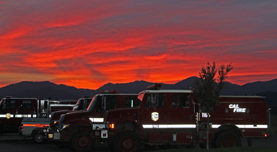
Redding, CA sunset CAL FIRE engines.
Sunset in Redding, California enhanced by smoke from the Eiler Fire, August 10, 2014. (Click to see a larger version.) Photo by Bill Gabbert.

Below is an excerpt from an article at Capital Public Radio:

…CAL FIRE says the timing of this year’s rains and four years of drought will combine to make fire conditions in 2015 the worst on record.

“We measure the fuel moisture content of all of the vegetation -the brush and the trees and we track that over the course of time and compare it month to month each year,” says Ken Pimlott, Director of CAL FIRE. “And we put it through formulas and determine how much energy and how much heat it will put out when it’s burning. And we have seen -we saw it last year and we will see it again this year- we’ll be reaching records for potential heat output for times of the year that would normally not be burning in those conditions.

CAL FIRE Director Ken Pimlott urged homeowners to clear space and conserve water.

“We don’t have water to water lawns and unnecessary landscaping. So, what that means is, is you need to  remove that vegetation as it dries. We don’t want your dry lawn and your dry brush to contribute to more of the fire hazard. So, stop watering your lawn and remove it.”

Thanks and a tip of the hat got out to Barbara.

Engine from San Diego FD rolls during training

CBS News 8 – San Diego, CA News Station – KFMB Channel 8

An engine from the San Diego Fire Department slipped off a narrow dirt road while training and rolled over twice, injuring two firefighters. They were transported to a hospital with injuries were described as moderate to minor. The engine involved, Engine 29, was out by themselves training for a wildland fire scenario when it slipped off the road.

Thanks and a tip of the hat go out to Chris.

Lake Fire, east of San Bernardino, California

(UPDATE at 10:53 a.m. PT, June 26, 2015)

map of Lake Fire
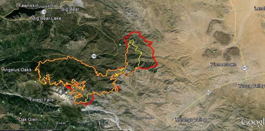
Map of the Lake Fire. Both lines show the perimeter at about 11 p.m. The yellow line is from June 24, while the red line is from June 25. (click to enlarge)

The Lake Fire east of San Bernardino, California grew by about 7,000 acres over the last couple of days. The incident management team now puts the size at 29,813 acres.

The fire remains active on the northeast side. On Thursday the fire made a push north to the Heartbreak Ridge area and east to Three Sisters Peaks.

Firefighting resources on scene include, 153 engines, 4 air tankers (including one DC-10), 18 helicopters, 4 support fixed wing planes, 54 hand crews, 18 water tenders, 8 dozers, and 2,116 personnel.

Mandatory evacuations include: areas along Hwy 38 east of Angelus Oaks, Barton Flats, Seven Oaks, South Fork, Heart Bar, Rainbow Lane, Burns Canyon, and Rimrock. A voluntary evacuation is in place for Pioneertown.

****

(UPDATE at 8:58 a.m. PT, June 25, 2015)

Late Wednesday night, June 24, the San Bernardino County Sheriff Department initiated a mandatory evacuation for the Burns Canyon and Rimrock areas.

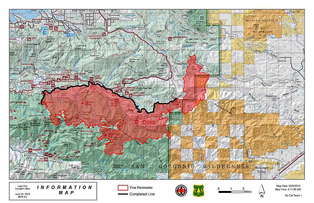
Lake Fire map June 25, 2015
Lake Fire map, released at 4:15 a.m. PT, June 25, 2015. It is not clear what time before that the perimeter data was current. Note that the heavy black line indicates the only completed fireline. (click to enlarge)
Lake Fire Map 1210 am PT June 25 2015
Lake Fire Map. The red dots represent heat detected by a satellite at 12:10 am PT, June 25 2015. The solid red line was the fire perimeter at 11 p.m. on June 23. (click to enlarge)

The map above shows the fire perimeter at 11 p.m on June 23 (the red line), and the red dots represent heat detected by a satellite at 12:10 a.m. PT, June 25. This shows a large growth of the fire in the last 24 hours. The satellite data indicates more fire spread to the east than the official map. Friday morning the incident management team reported that the fire has burned 23,199 acres.

****

(UPDATE at 8:14 p.m. PT, June 24, 2015)

Map of the Lake Fire
Map of the Lake Fire, 5:09 p.m. PT, June 24, 2015.

Wednesday afternoon approximately 360 campers were safely evacuated from Camp Oakes in the Lake Williams Area. This was a precautionary evacuation due to the large number of campers.

The fire remains active on the northeast end. On Wednesday the fire made a push north toward the Rainbow Lane Area but so far no structures have been lost. The southern portion of the fire burned into the headwaters of the North Fork of Whitewater, and may continue to burn to the south. Fire spread is primarily through burning material rolling downhill and reigniting ground fuels, which burn back uphill. Hotshot crews will remain camped out along this area over the coming days.

Wednesday evening, June 24, a hobby drone flown over the Lake Fire caused a safety problem, requiring all firefighting aircraft to be grounded, according to CAL FIRE Public Information Officer Daniel Berlant.

A collision between a drone and a helicopter or fixed wing aircraft could be fatal if it damages the windshield, the engine, props, or rotors.

The Incident Management Team reports that the Lake Fire has burned 20,874 acres. The number of personnel on the fire has increased to 1,922.

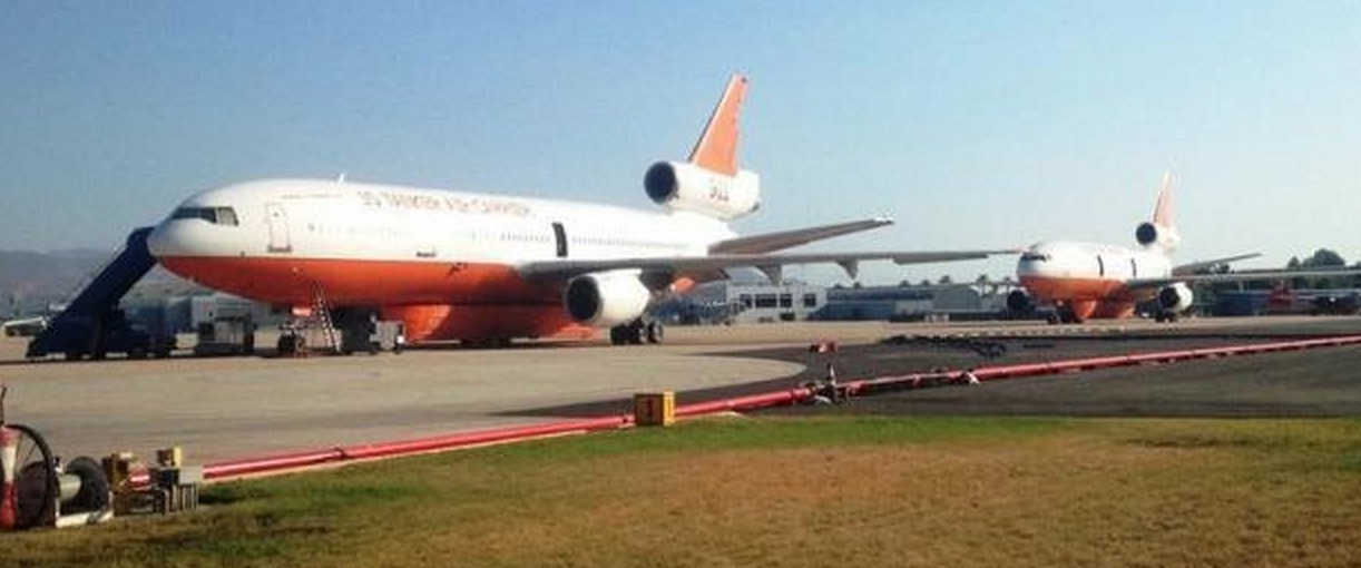
Tankers 911 and 912
Tankers 911 and 912, both DC-10s, at an air tanker base near the Lake Fire. Undated InciWeb photo.

Continue reading “Lake Fire, east of San Bernardino, California”

Northern California: Saddle Fire

Saddle Fire
Saddle Fire. USFS photo.

The Saddle Fire in northern California has burned about 1,000 acres in the Shasta-Trinity National Forest. It started from lightning on June 9 and beginning today will be managed by Molhoek’s Type 2 Incident Management Team.

The  fire is 5 miles northwest of Hyampom, 33 miles east of Eureka, and 60 miles west of Redding.

Map Saddle Fire
Map showing the location of the Saddle Fire in northwest California at 1:40 a.m. MT June 12, 2015. (Click to see a larger version.)

The Trinity County Sheriff’s Office implemented mandatory evacuations along County Road 311, also known as the Lower South Fork Road, north of Big Slide Campground to Manzanita Ranch. Residents of Hyampom are under an advisory evacuation. The Red Cross has an evacuation center at the Hayfork High School.

Map of Saddle Fire
Map of the Saddle Fire. The red, brown, and yellow squares represent heat detected by a satellite at 1:40 a.m. MT, June 12, 2015. The red squares are the most recent.

A lightning-struck tree on the Klamath

Lightning fire Photo

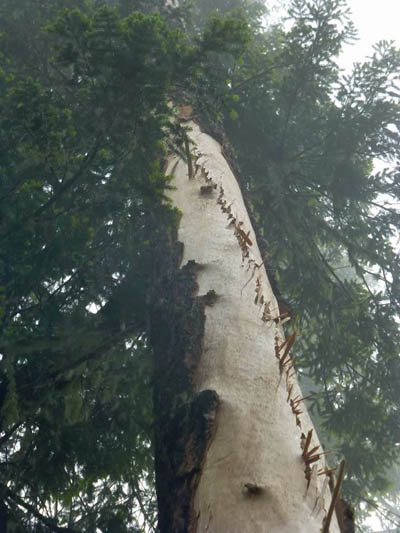
These photos of a tree that was struck by lightning were taken by USFS Forester Todd Drake on June 1 when he and his crew responded to a fire caused by lightning on the Klamath National Forest in northern California.

The amount of bark blown off by the strike is impressive. Sometimes the scar is only a few inches wide. This must have been a very powerful positive strike.

Lightning fire Photo

Lightning fire Photo