The map shows the lightning strikes that were recorded in the western United States during the 24-hour period that ended at 6 a.m. MDT, August 12, 2014.
Tag: California
Updated; Fire shelters deployed on the Beaver Fire

(Updated at 7:15 p.m. August 12, 2014)
The three firefighters who were entrapped and deployed fire shelters were removed from the fireline and transported to a hospital in Yreka, California Monday evening, according to Corey Wilford, a spokesperson for the Incident Management Team (IMT). He said all three were treated for symptoms of smoke inhalation and one of them had second degree burns on his lower leg. After treatment, they were all released from the hospital.
The area that the IMT had previously described as a “safety zone”, did not meet the definition, in that fire shelters were required. On the other hand, the three firefighters had previously observed the area and remembered that it could serve as a “deployment site”, meaning that firefighters could likely survive being burned over at that location, but they would need to deploy fire shelters.
****
(Originally published at 8:44 a.m. PDT, August 12, 2014)
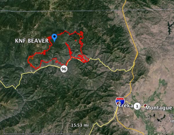
Three firefighters were entrapped by advancing flames Monday afternoon on the Beaver Fire in northern California, approximately 15 miles northwest of Yreka.
The incident occurred at 5:30 p.m. as a rapid wind shift affected the fire. All three firefighters deployed their fire shelters in a predetermined safety zone. They were evaluated on scene and no serious injuries were reported.
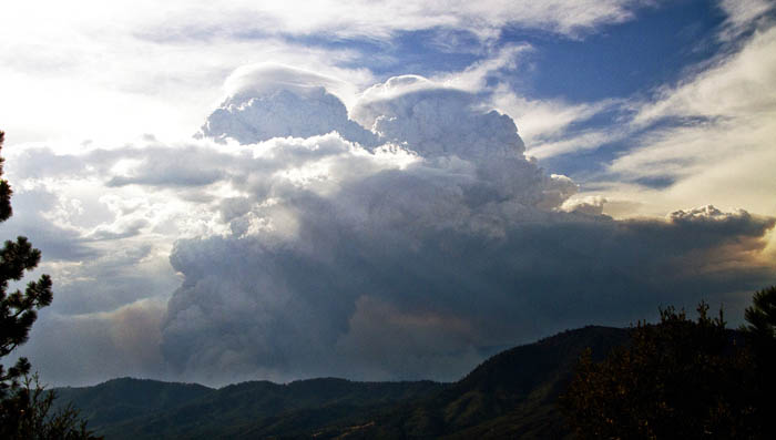
All firefighters on the fire were actively withdrawing as a thunderstorm approached. The weather system east of the Beaver Fire produced 30 to 35 mph outflow winds that changed direction rapidly and caused extreme fire behavior. With the increase in wind speed, flame lengths extended into the canopy of the trees, causing a sustained crown run which aligned with the exposed west slope on Buckhorn Ridge.

The lightning-caused Beaver Fire was discovered on June 30 and has blackened 28,000 acres. It is burning in a very remote area and could be a long-duration event. The Incident Management Team is calling it 30 percent contained.
The fire area is under a Red Flag Warning on Tuesday.
CAL FIRE situation report, August 11, 2014
The California Department of Forestry and Fire Protection has released their weekly statewide Fire Situation Report.
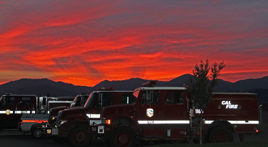
Sunset, enhanced with fire engines

Some of the readers of this site may agree with the supposition that a beautiful sunset can be enhanced if there are fire engines in the foreground. OK… probably not MANY will agree — but maybe there’s one or two that will. Or, at least ONE. Right? Help me out here!
This was a strike team of CAL FIRE engines that is assigned to the Eiler Fire 40 air miles east of Redding, California. They are working 24-hour shifts and every other day come in to Redding to stay in a motel, where this photo was taken tonight, August 10.
California: Coffee Fire

Today our California road trip took us to the 6,100-acre Coffee Fire in northern California’s Trinity Alps — very steep, remote country near tiny little towns that no one has ever heard of. Towns so small that you don’t even notice them when driving through, like Trinity Center, Coffee Creek, Covington Mill, and Wyntoon. Later you look at a map, and think, “I drove through Wyntoon? Who KNEW?”

That is not to diminish the work being done by the 558 firefighters and support personnel, out on the fireline and toiling at the Incident Command Post in hastily erected yurts, each with a struggling little 110-volt air conditioner sitting on a table outside, blowing slightly cooler air in through a window. But the fire personnel appreciated the output of the A/C. Not every incident command post has the electricity capacity to run a couple of dozen air conditioners. Why, back in the old days… (don’t get me started!).

The firefighters out on Coffee Creek Road did not have air conditioners in the 90+ degree conditions. The ones we saw were working to keep burning logs that rolled down the hill from crossing the road and starting spot fires. During the previous three days, August 6 through 8, a planned 1,400-acre burnout set the very steep hill above them on fire. Firefighters used a helicopter to light it, dropping little ping pong ball-like plastic spheres that ignited about half a minute after being ejected from the helicopter. Over the three days the helicopter lit horizontal lines, like terraces, working from the top slowly down to the road above the creek. We could see the smokey convection column from 40 air miles away in Redding on Friday as they lit off the last section in a blaze of glory.


The firefighters on the road were not only battling the fire and the rolling, burning logs, but there was also a near constant barrage of rocks coming down the hill and landing on the road, freed from their perches on the steep slope as the vegetation supporting them burned away. Most of them were fist to cantaloupe-sized, but the front end loader operator whose job was to go back and forth pushing debris and logs off the road said one of the rocks was four feet in diameter. Definitely a hard hat area. 😉

The Branch Director responsible for that area on the fire, Marc Walburn, said the plan was to leave an unburned “filter strip” at the bottom of the blackened hill, as is sometimes done on logging or other projects that disturb the vegetation. The filter strip can slow down any water runoff from the newly barren slope above, and filter out silt, debris, and ash that could have an adverse impact on water quality in the creek below. We were not clear on how they intended to get the fire to stop at the top of the filter strip. They did not construct a fireline as a barrier. They may have counted on the rain that occurred a few days before to help with the effort. When we were there in mid-afternoon today, the fire had burned all the way down to the road in some places and was being mopped up by engine crews.
Despite the fact that some areas in northern California have had some rain over the last week, even up to an inch in the northeastern part of the state, some locations are still extremely dry, especially the larger 1,000 and 10,000-hour time lag fuels, better known as “logs” to normal people. On the Coffee Fire, the Incident Meteorologist exploring a burned area discovered a large log that apparently had been rained on a few days before. The top of the log, wet from the rain, did not burn, but everything below the top, being extremely dry, did, leaving an odd looking unburned shelf, with white ash below.

Another story we heard yesterday added to the evidence of drought. Dan Johnson, the Regional Aviation Group Supervisor for the U.S. Forest Service’s North Zone in California, said firefighters are telling him that they are finding and occasionally stepping into more stump holes than usual while they are walking through a burned area. The stumps and large underground roots, especially of dead trees, are burning more completely and deeper underground, since they are much dryer than normal. These sometimes can’t be seen until you step onto an area that collapses under your weight, and your foot goes several inches, or in a worst case, several feet down into the earth, surrounded by burning coals. Serious injuries can be the result.

Be careful out there.
Update #2: Eight firefighters burned in northern California
(Originally published at 10 a.m. PDT August 9; updated at 8 a.m. PDT August 10, 2014
(CAL FIRE released a preliminary report on the incident: Blue Sheet)
The California Department of Forestry and Fire Protection (CAL FIRE) has announced that eight firefighters suffered burn injuries while working on the Lodge Lightning Complex in northwest California near Laytonville. They released the following statement Friday night:
This evening, eight (8) firefighting personnel, three (3) local government firefighters and five (5) CAL FIRE/CDCR inmate firefighters, received burn injuries while fighting the Lodge fire in Mendocino County. All are in the process of being medivaced and transported to a regional burn center. Initial reports indicate their injuries are serious under the guidelines of Department Policy but are not life threatening.
I have ensured that the Chief of the local government department involved in this incident has been notified and that family notifications are taking place. Updates will be provided as additional details are confirmed. Please keep the firefighters in your thoughts and prayers as they recover from their injuries.
Ken Pimlott
Director
10 News has a video report.
Later, CAL FIRE spokeswoman Lynne Tolmachoff said all eight firefighters were released from the hospital a matter of hours after their arrival.
The fire is known as the Lodge Fire, Lodge Lightning Complex, and the Lodge LCA Fire. It has burned 7,100 acres of heavy timber in steep terrain and the incident management team is calling it 35 percent contained.
Resources assigned to the fire include 1,950 personnel, 157 engines, 44 hand crews, 15 helicopters and 29 dozers.

