Tenaja Fire causes evacuations near Murrieta, California

By Thursday afternoon it had burned almost 2,000 acres

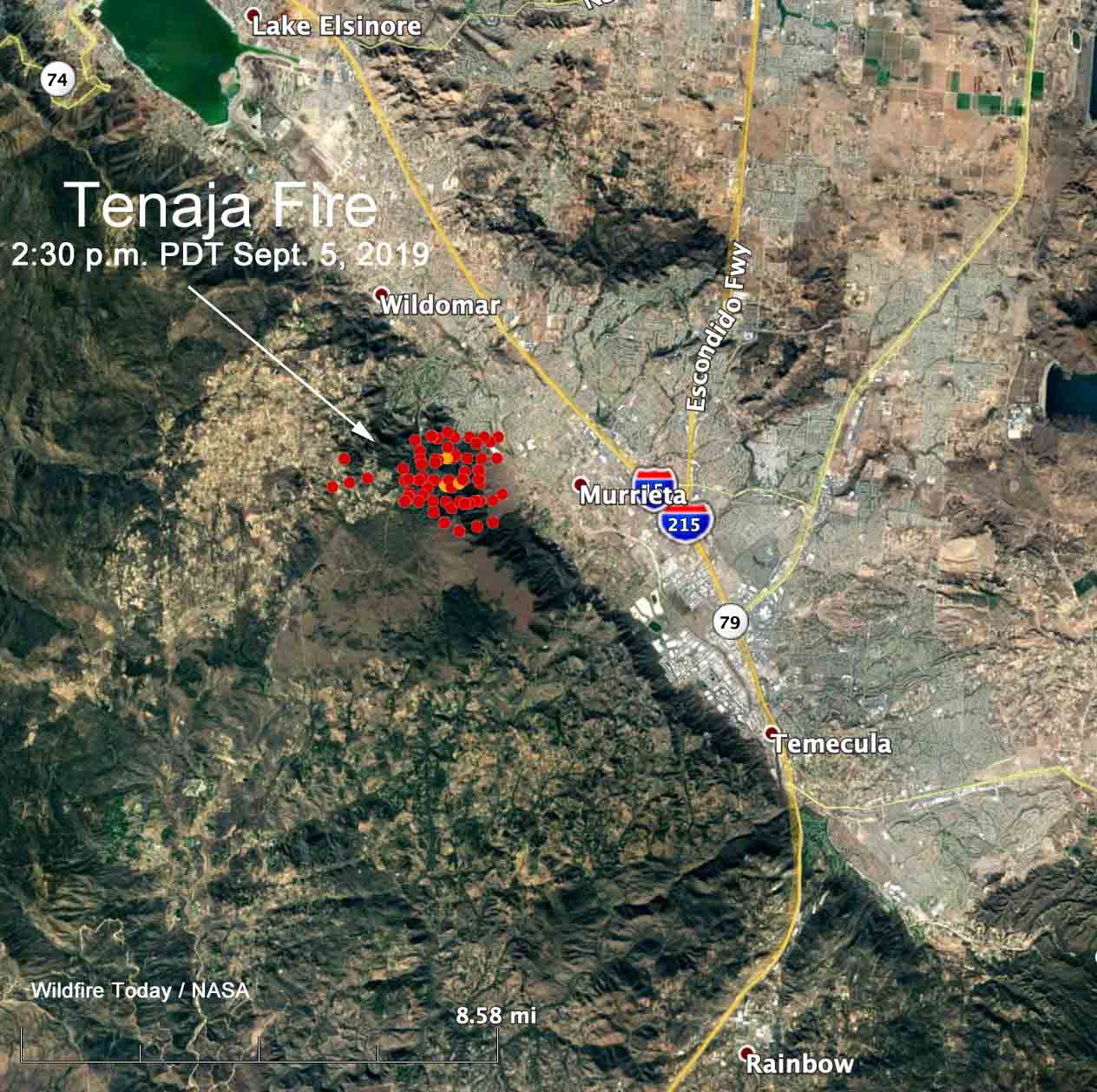
map Tenaja Fire
The red dots represent heat on the Tenaja Fire detected by a satellite at 2:30 p.m. PDT September 5, 2019 .

About 24 hours after it was reported at 4 p.m. PDT Wednesday the Tenaja Fire west of Murrieta in Southern California flared up again requiring additional evacuations and commitments of firefighting resources.

The blaze started near the intersection of Tenaja Road and Clinton Keith Road in the La Cresta community. (see map above) Spreading quickly in the high temperatures, thunderstorms played havoc, causing the wind direction to shift causing erratic fire behavior. Air tankers, helicopters, and firefighters on the ground kept it to about 1,400 acres Wednesday night as the rate of spread slowed.

Thursday morning there was still very little containment of the fire perimeter. It was fairly quiet until early afternoon when the activity picked up considerably. Rapid spread toward dense complexes of homes in the Murrieta and Wildomar communities triggered more evacuations and large orders for additional firefighting resources.
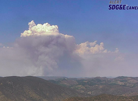
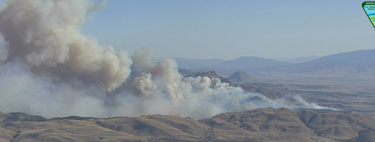
Tenaja Fire smoke
Smoke over the Tenaja Fire at 1:39 p.m. PDT September 5, 2019. HPWREN.

The fire came very close to a number of homes, some of which were painted red by fire retardant drops. Good work by firefighters on the ground and in the air prevented it from moving into residential areas.
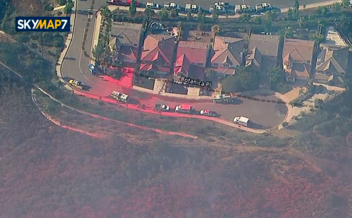
Tenaja Fire homes
Tenaja Fire. Screenshot from ABC7 video.

At 5:30 p.m. the spread had been at least temporarily stopped, and in places where there was no fireline the vegetation was red from multiple air tanker drops. Fire officials estimated it had burned 1,974 acres. There were no reports of homes burning.
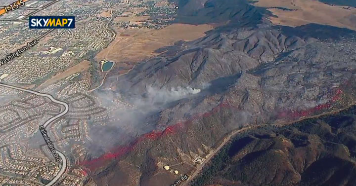
Tenaja Fire
Tenaja Fire. Screenshot from ABC7 video.

Lawsuit filed against Southern California Edison for allegedly causing the Rey Fire

The fire burned over 32,000 acres north of Santa Barbara in 2016

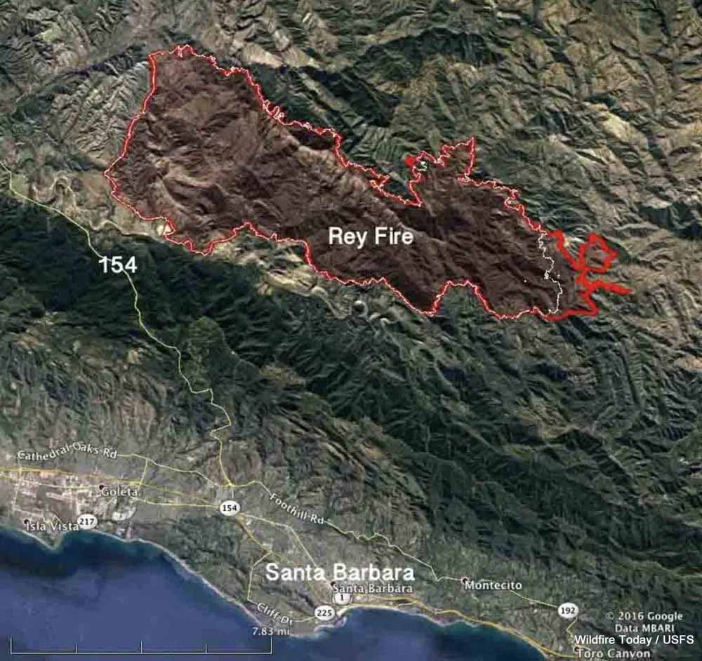
Map Rey Fire August 25 2016
Map of the Rey Fire. The red line was the perimeter at 10 p.m. PDT Aug. 25, 2016. The white line was the perimeter at 10 p.m. PDT Aug. 23.

The federal government has filed a lawsuit against Southern California Edison and two other companies for allegedly allowing the Rey Fire to ignite north of Santa Barbara, California on August 18, 2016. The complaint that was filed in U.S. District Court August 17, 2019 contends that of the 32,606 acres that burned in the fire, 19,752 acres were within the Los Padres National Forest. Also named in the lawsuit were Frontier Communications (a telecommunications company) and Utility Tree Service (a tree trimming company).

The fire started when a tree fell on power and communications lines. The court document states, “SCE and UTS were informed of the potential danger the tree that fell on the subject lines posed, were aware of the danger that said tree might fall on the subject lines before it fell, and failed to take any action to prevent it from falling on the subject lines.”

The filing says Frontier failed to, “…maintain proper vegetation clearance around and below its communication lines, and using a device, including its communication lines and equipment, which may cause a fire and failure to take reasonable precautions to avoid starting and spreading a fire.”

The Government alleges SCE violated the terms of its Special Use Permit for the powerlines by “…failure to prevent damage to the land and property of the United States; to take reasonable precautions to prevent and suppress fires; to construct, maintain and operate its equipment and power lines in a safe and effective working order; and to properly and safely maintain, operate, use and occupy the premises of National Forest System lands.”

On the date the suit was filed, SCE had not paid any of the suppression or rehabilitation costs which amounted to more than $26 million.

In addition to those costs, the Government hopes to recover costs of “wrongful injury to [National Forest] trees, loss of timber and vegetation, loss of habitat and environmental damages, damage to the soil, loss of use, scenic views, and aesthetic values”, in an amount to be determined at a trial by jury.

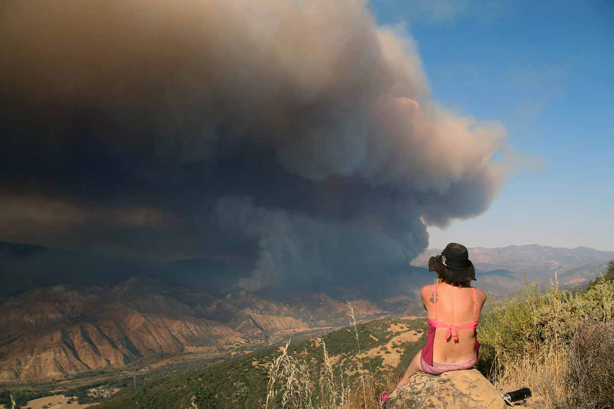
Rey Fire.
Rey Fire, August 21, 2016. Photo by Jeff Zimmerman.


Long Valley Fire burns hundreds of acres on Calif/NV line north of Reno

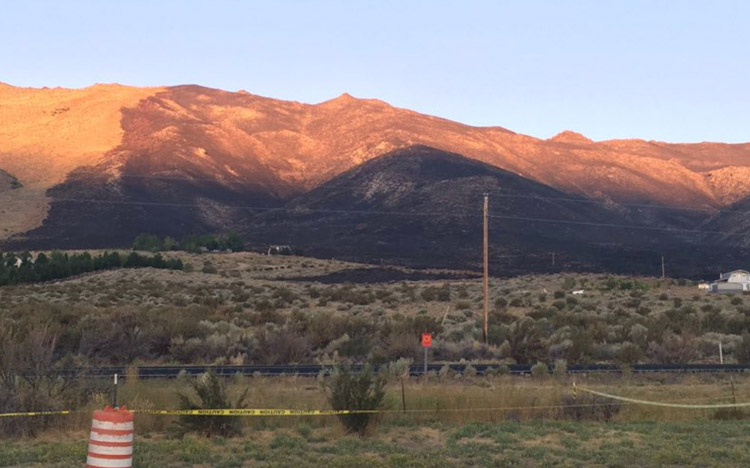
Long Valley Fire, August 25, 2019
The sun rises on the Long Valley Fire, August 25, 2019. Photo by Truckee Meadows Fire Protection District .

(UPDATED at 9:42 a.m. PDT August 25, 2019)

At 8:37 a.m. PDT August 25 the Truckee Meadows Fire Protection District reported that the Long Valley Fire had been mapped at 2,438 acres and all evacuations had been lifted.

HERE is a link to a map of the fire produced Sunday morning.


(UPDATED at 7:03 a.m. PDT August 25, 2019)

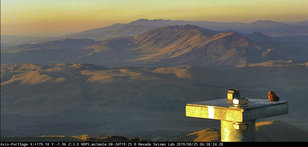
As the sun was rising Sunday morning the camera at Fort Sage looking south to the Long Valley Fire did not show any significant columns of smoke. The fire is north of Reno, Nevada between Highway 395 and Red Rock Road. (see map below)

Long Valley Fire
The Long Valley Fire, looking south from the camera at Fort Sage at 6:38 a.m. PDT August 25, 2019.

The Truckee Meadows Fire Protection District reported at 7:10 p.m. PDT Saturday that one primary structure and multiple outbuildings burned. At 8:38 p.m. PDT the District said the fire had burned about 1,500 acres and “at least 50 to 75 homes have been impacted” by the fire.

The closure of Red Rock Road was lifted by 12:30 a.m. Sunday. Electrical power may still be shut off in some areas.

At 12:31 a.m. Sunday the evacuation order was still in effect.

The video below shows a Very Large Air Tanker, a DC-10, making  a downhill retardant drop Saturday evening on the fire.


(Originally published at 6:49 p.m. PDT August 24, 2019)

Long Valley Fire
Long Valley Fire as seen from the camera at Fort Sage at 5:23 p.m PDT August 24, 2019.

The Long Valley Fire started Saturday afternoon north of Reno along Highway 395 about two miles south of the north end of Red Rock Road. Pushed by a strong wind it spread to the northeast toward Red Rock Road. The Truckee Meadows Fire Protection District is working to keep the fire west of the road.

Continue reading “Long Valley Fire burns hundreds of acres on Calif/NV line north of Reno”

Mountain Fire causes evacuations northeast of Redding, California

The fire is 4 miles east of the community of Shasta Lake

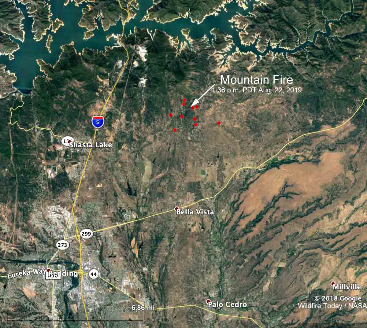
map Mountain Fire Redding California
The red dots represent heat detected on the Mountain Fire by a satellite at 1:38 p.m. PDT August 22, 2019. Click to enlarge.

The Mountain Fire is causing evacuations in Northern California, northeast of Redding. The fire is 4 miles east of the community of Shasta Lake and is north of Highway 299.  At 1:38 p.m. PDT most of the fire was between Bear Mountain Road and Dry Creek Road, an area with many structures.

It was reported at noon on Thursday and by 2:40 p.m. had burned approximately 600 acres. Later in the afternoon Air Attack estimated the size at 820 acres.

Pacific Gas and Electric shut off the power to about 1,200 customers.

By 5:50 p.m. PDT the radio traffic on the incident had slowed considerably, which often indicates the spread of the fire has slowed as well. It was first burning in timber and other heavy fuels but some portions moved into lighter vegetation that provided less resistance to control, and where aircraft could be more effective.

The Shasta County Sheriff’s Office has a lengthy list of areas under evacuation orders. The evacuation center is at Crosspointe Community Church, 2960 Hartnell Road, Redding CA. According to the Sheriff’s  Office, 1,110 structures are threatened and 3,885 residents have been evacuated.

California sends firefighters into Mexico to battle wildfire near border

CAL FIRE engines cross border into Mexico
CAL FIRE engines cross the border into Mexico to assist firefighters in the suppression of a wildfire west of Tecate, Mexico. CAL FIRE photo.

The California Department of Forestry and Fire Protection (CAL FIRE) has mobilized a strike team of fire engines to cross the international border in order to help firefighters in Mexico. They will be assisting in the suppression of the Border 8 Fire that has burned 1,500 acres very close to the border just west of Tecate, Mexico 23 miles southeast of San Diego.

The fire is a threat to cross the border in an area of the United States with steep topography and limited access. Keeping it from crossing the border would be the preferred option, rather than having to suppress a much larger fire in difficult terrain on the U.S. side.

The fire has been spreading to the east, generally toward the city of Tecate which has a population of 102,000 in its metropolitan area.

Air tankers have been dropping retardant in a few selected locations north of the border off and on since the fire started August 14, including S2T and C-130 aircraft from bases at Ramona and Hemet, California.

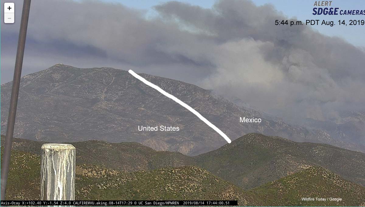
Border Fire Mexico United States California
Photo from Otay Mountain showing the Border Fire at 5:44 p.m. PDT August 14, 2019, and the approximate location of the international border (white line).

CAL FIRE may decide to activate the unstaffed air tanker base at Brown Field Municipal Airport which is 1.6 miles north of the border and about 16 miles west of this fire. It is 31 miles south of the Ramona air tanker base and has a 7,972-foot runway which according to information from the USFS “provides ample length to meet safe takeoff requirements for the size and weight of a Next Generation Air Tanker with a full payload”. The runway at Ramona is too short to handle many of the large air tankers. The tanker base at Hemet, which also has a relatively short runway, is 80 miles north of the fire.

The fire can be seen via cameras here and here.

Border Fire threatens to burn from Mexico into U.S.

Border Fire Mexico United States California
Photo from Otay Mountain showing the Border Fire at 5:44 p.m. PDT August 14, 2019, and the approximate location of the international border (white line).

A large wildfire in Mexico west of Tecate is very close to the U.S. border and threatens to burn into California about 23 miles southeast of San Diego. It is spreading to the east, generally toward the city of Tecate which has a population of 102,000 in its metropolitan area.

The California Department of Forestry and Fire Protection, CAL FIRE, is monitoring the situation and has already started moving firefighting resources into the area, including aircraft.

Video from Channel 8 in San Diego showed air tankers, an S2 and a C-130 (T-134), making drops north of the border.

CAL FIRE may decide to activate the unstaffed air tanker base at Brown Field Municipal Airport which is 1.6 miles north of the border and about 16 miles west of this new fire. It is 31 miles south of the Ramona air tanker base and has a 7,972-foot runway which according to information from the USFS “provides ample length to meet safe takeoff requirements for the size and weight of a Next Generation Air Tanker with a full payload”. The runway at Ramona is too short to handle many of the large air tankers.

The fire can be seen via cameras here and here.

Border Fire Mexico United States California
A 3-D map view of the area, looking east from Otay Mountain. The yellow line is the international Border. The area is similar to that seen in the photo from Otay Mountain, at the top of the article.
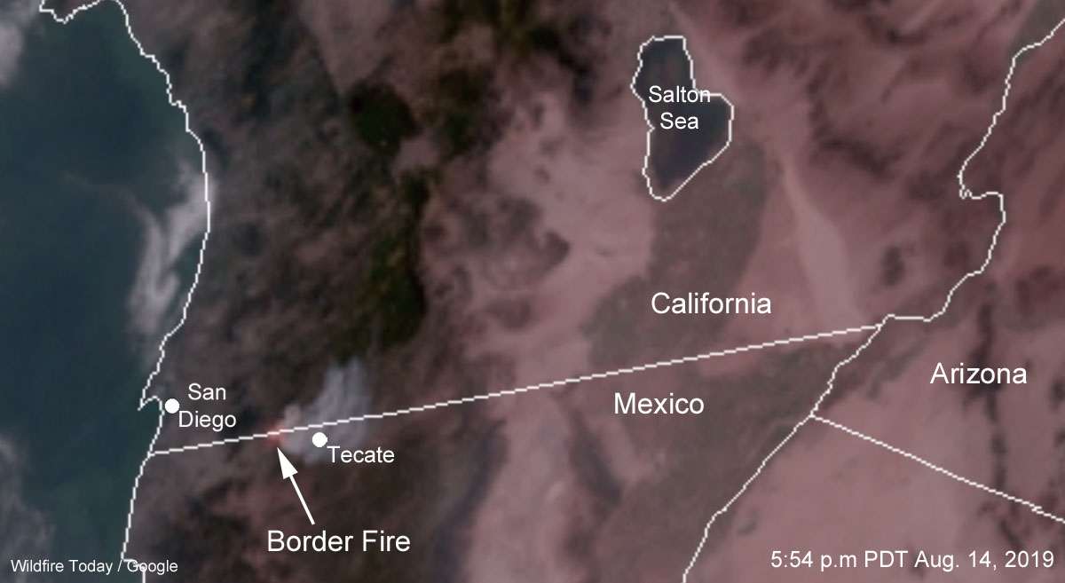
Border Fire Mexico United States California
Satellite photo showing smoke from the Border Fire at 5:44 p.m. PDT August 14, 2019.