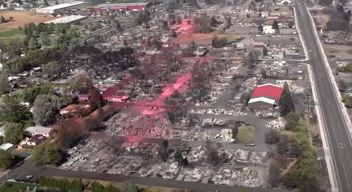
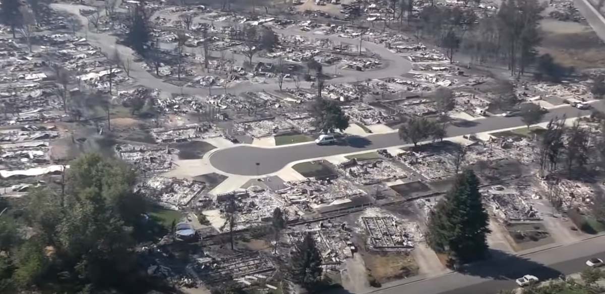
The latest official estimate of the number of structures destroyed in the Almeda Drive Fire in southern Oregon on September 8 is 600 homes and 100 commercial buildings. A video appears to indicate that number is conservative.
(Update November 19, 2020: Jackson County estimates 2,357 residences were destroyed in the 3,200-acre fire.)
Authorities have confirmed two deaths. Since lightning and power lines can be ruled out, they have concluded it was human-caused. It is possible the number of fatalities could rise as searches are conducted. It was weeks before searches were concluded after the Camp Fire at Paradise, California. There will be lists of people that are unaccounted for, but many of them will be safe and having difficulty communicating with family and friends.
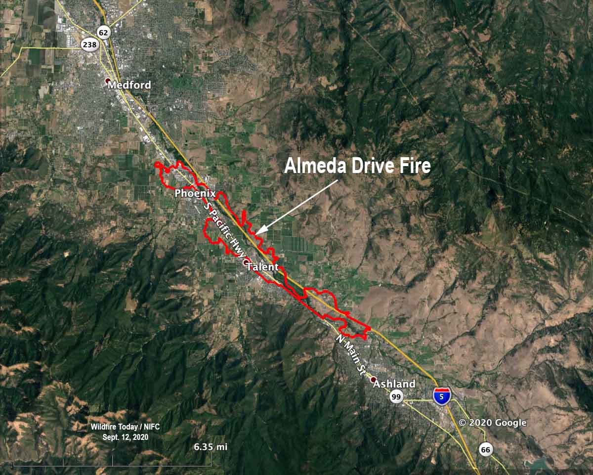
The Oregonian reports officials are considering arson as a possible cause:
Authorities are investigating the Almeda fire as an arson after discovering human remains in Ashland, the city police chief said. The Jackson County’s Major Assault/Death Investigation Unit is investigating the nature of the death of the person found, according to Ashland Police Chief Tighe O’Meara.
“One thing I can say is that the rumor it was set by Antifa is 100% false information,” the police chief said by email. “We have some leads, and none of it points in that direction.”
The FBI is asking the public to not waste the time of law enforcement with conspiracy theories and misinformation.
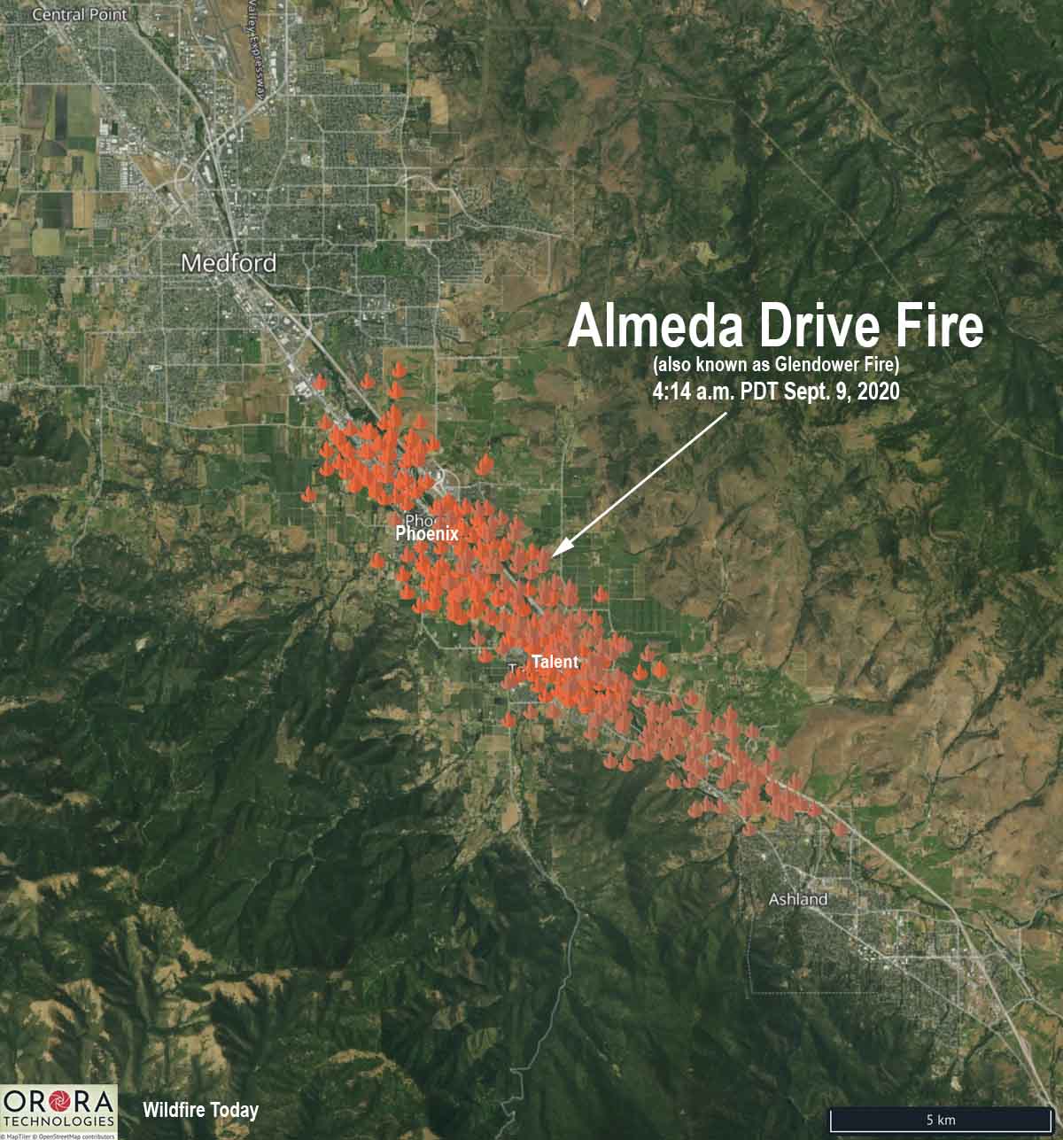
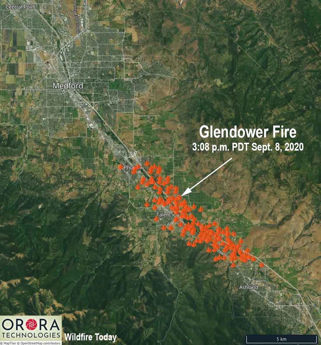
To have been so destructive, it is a little surprising that the fire only burned 3,200 acres. The 40 to 45 mph wind on September 8 was from the southeast, which aligned with the Interstate 5 corridor as it burned like a blowtorch for 8 miles, starting north of Ashland and tearing through the cities of Talent and Phoenix. Photos of what remains of the area show retardant drops made by air tankers, a DC-10 and two MD-87s, but they were largely ineffective. This is no surprise, since a wind stronger than 15 or 20 mph can scatter the retardant off target, or if the wind is stronger and turbulent it can be unsafe to operate an aircraft flying low and slow.
The video shot by Jackson County authorities on September 8 is below. It begins near Ashland, then continues up the Interstate 5 corridor through Talent and Phoenix.
Below are more screenshots from the video.

