Six things that need to be done to protect fire-prone communities

We have to learn to live with fire

Puntzi Fire, structures burned
Structures that burned in the Puntzi Fire in British Columbia.

A reporter asked me what needs to be done to keep from repeating disasters like we have seen recently in California at Paradise, Redding, and the Napa Valley. I told him that there is no one thing that needs to be done, such as raking or “forest management”, it requires a comprehensive holistic approach.

The principle of the weakest link in the chain applies here. If one of the categories of improvements to protect a development is sub-par, the individual structures and the entire community in a fire-prone environment is at risk. And if a homeowner does not do their part, it can endanger their neighbors.

Reducing the chances that a fire in a populated area will turn into a disaster that burns thousands of homes involves at least six categories of factors: home spacing, envelope of the structure itself, home ignition zone, community infrastructure, wildland urban interface, and fire codes.

  1. Home spacing/lot size

Cities, counties, and planning boards are often under pressure to approve new housing developments. They want to expand their tax base. Developers try to fit as many homes into a new subdivision as possible to maximize their investment. This too often results in homes that are 20-feet apart. If one is ignited by a burning ember that may have traveled a quarter of a mile from a fire (or a burning home) the radiant heat alone can ignite the homes on both sides. Then you can have a self-powered conflagration spreading house to house through a city. When the structures are that close together, the homeowners have not reduced the fuel in the Home Ignition Zone, and the home itself is not built to FireWise standards, a massive disaster can be the result.

If a homeowner wants, or is required, to reduce the flammable material within 100 feet of their residence, what are they expected to do if there is another home 20 feet away that is really a large assembly of flammable material?

Paradise Camp fire homes burned
A neighborhood on Debbie Lane in Paradise, California, before and after the Camp Fire that started November 8, 2018. The homes were 14 to 18 feet apart.

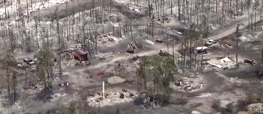
Some of the homes in Paradise, California that burned were less than 20 feet apart. According to measurements using Google Earth, we determined that the structures in the photo above were 14 to 18 feet from each other.

The National Institute of Standards and Technology released a report on the 2012 Waldo Canyon Fire that burned 344 homes and killed two people in Colorado Springs, Colorado. They concluded that current concepts of defensible space did not account for hazards of burning primary structures, hazards presented by embers, and the hazards outside of the home ignition zone. In addition, NIST recommended:

High-density structure-to-structure spacing in a community should be identified and considered in [Wildland Urban Interface] fire response plans. In the Waldo Canyon fire, the majority of homes destroyed were ignited by fire and embers coming from other nearby residences already on fire. Based on this observation, the researchers concluded that structure spatial arrangements in a community must be a major consideration when planning for WUI fires.

After studying the Carr Fire that destroyed 1,079 residences at Redding, California earlier this year, retired CAL FIRE Battalion Chief Royal Burnett reached similar conclusions.

It was easy to figure out why the houses on the rim burned — they were looking right down the barrel of a blowtorch. Even though they had fire resistant construction, many had loaded their patios with flammable lawn furniture, tiki bars and flammable ornamental plants. Palm trees became flaming pillars, shredded bark became the fuse, junipers became napalm bombs. Under current standards houses are build 6 to an acre; 10 feet to the property line and only 20 feet between houses. Once one house ignited, radiant heat could easily torch the next one.

2. Envelope of the structure itself

Included in this category are characteristics of the roof, vents, siding, doors, windows, foundation, fences, eaves, and decks. A FEMA publication (13 MB) has excellent detailed recommendations. Headwaters Economics found that the cost of building a fire-resistant home is about the same as a standard home. When implemented, Chapter 7A of the California Building Code, regulates these features.

3. Home Ignition Zone

The NFPA and FireWise programs recommend reducing flammable material within 100 feet of structures and spacing the crowns of trees at least 18 feet apart that are within 30 feet of the home, 12 feet apart at 30 to 60 feet, and 6 feet apart at 60 to 100 feet. Another house that is 15 to 50 feet away is also fuel, and if it ignites will be a serious threat.

firewise wildfire risk home tree spacing
Firewise vegetation clearance recommendations. NFPA.

4. Community infrastructure and planning

  • Distance to nearby structures
  • Evacuation capability and planning
  • Safety zones where residents can shelter in place
  • Road and driveway width, wide enough for large fire trucks
  • Turnarounds at the end of roads
  • Signage, and
  • Emergency water supply.

Again, the FEMA document has great recommendations.

5. Wildland-Urban Interface

There is of course much that can be done surrounding the places where people live that would reduce the vegetation or fuel and decrease the intensity and ember generation potential of a fire as it approaches an urban area. Large scale fuel management projects including fuel breaks and prescribed fire programs are usually conducted by state and federal agencies.

Silverthorne, Colorado 2018 Buffalo Mountain Fire
Fuel breaks at Silverthorne, Colorado during the 2018 Buffalo Mountain Fire. USFS.

A fuel break does not have to be devoid of vegetation, but it should have minimal tons per acre that would therefore burn with less intensity and with fewer fire brands being lofted downwind. This could enable firefighters to make a stand and create a place from which to ignite a backfire, perhaps aided by aircraft dropping water or retardant.

6. Fire codes are essential

The only effective way to ensure that residents understand and implement these five tasks is to make them mandatory by establishing Fire Codes at the local and state levels.

Analysts studying the aftermath of the Camp Fire which destroyed much of Paradise, California found that homes built to fire-safe standards had a much higher survival rate than those that were not. Beginning in 2008 new construction in the city was required to follow a standard, Chapter 7A of the California Building Code, designed for the state’s areas at high risk from wildfire. Fifty-one percent of the homes built under the 7A code survived, while only eighteen percent built before 2008 did.

Chapter 7A lays out standards for roofs, exterior walls, vents in exterior walls and attics, windows, exterior doors, decking, and outbuildings. Remember, the cost of building a fire-resistant home is about the same as a standard home.

The warming climate is demonstrating that wildfires are becoming increasingly perilous. It is the responsibility of state and local governments  protect their citizens by enacting sensible standards.

Bill to provide real-time location of fires and firefighters sent to the President

The legislation passed both the House and the Senate with overwhelming bipartisan support

firefighter radio White Draw Fire
A firefighter on the White Draw Fire uses a radio to coordinate with other firefighters. July 29, 2012. Photo by Bill Gabbert.

A bill that directs the federal land management agencies to begin implementing a system that would enhance the situational awareness of wildland firefighters has passed both the House and the Senate and is awaiting the signature of the President.

On February 12 the Senate passed the John D. Dingell, Jr. Natural Resources Management Act with a vote of 92 to 8, and yesterday the House passed it 363 to 62. (Update: it became law March 12, 2019 when it was signed by the President.)

The bill also includes numerous other actions related to public lands including creating more than 1.3 million acres of wilderness out West, adding three national park units, and expanding eight others.

If the bill passes and is actually implemented by the federal land management agencies it would generate progress toward what we have called the Holy Grail of Wildland Firefighter Safety, knowing the real time location of a fire and the resources assigned. Too many firefighters have been killed when the exact location of one or both of these critical aspects of situational awareness were unknown. Recent examples with a total of 24 line of duty deaths were on the Yarnell Hill and Esperanza Fires.

The technology to monitor in real time a fire and firefighting resources has existed for years. Various systems are being used already by a few state and local agencies. The military does it for their war fighters, monitoring the enemy and their own forces. If implemented on fires, it will save lives.

Firefighters lives are as important as soldiers.

“I am proud that our Public Lands package passed the House yesterday and that we were able to include in it Senator Cantwell and Senator Gardner’s seminal bill to better equip our firefighters”, said Senator Joe Manchin, Ranking Member of the Senate Energy and Natural Resources Committee. “It is plain to see that wildfires are getting worse not better, and I want to ensure these brave men and women have access to the tools available that will keep them safe, as they work to keep us safe.”

The key points, below, in the legislation have requirements for the Secretaries of Interior and Agriculture. The completion dates will be established from the time the legislation is signed. (UPDATE: the bill was signed by the President March 12, 2019)

    • Establish a research, development, and testing program, or expand an applicable existing program, to assess unmanned aircraft system technologies, including optionally piloted aircraft, across the full range of wildland fire management operations. (within 180 days)
    • Develop consistent protocols and plans for the use on wildland fires of unmanned aircraft system technologies, including for the development of real-time maps of the location of wildland fires. (within 180 days)
    • Develop and operate a tracking system to remotely locate the positions of fire resources, including, at a minimum, any fire resources assigned to Federal Type 1 wildland fire incident management teams. (within 2 years)  According to a press release by Senator Maria Cantwell, by the 2021 fire season, all firefighting crews – regardless of whether they are federal, state, or local – working on large wildfires will be equipped with GPS locators.
    • Establish a system to track and monitor decisions made by state and federal wildland firefighting agencies to flag unusual costs, and those that endanger firefighters or deviate from an applicable fire management plan. (no time requirement)
    • Assign air quality resource advisors to Type 1 incidents managing a fire on federal land. (no time requirement)
    • Establish a system to collect data on firefighter injuries that were treated by a doctor, and all deaths during the Work Capacity Test, vehicle crashes, and aircraft accidents. (no time requirement)
    • The two Secretaries will work with NASA to establish a “Rapid Response Erosion Database” and maps that would make it possible to evaluate changes in land cover and soil properties caused by wildland fires. (no time requirement)
    • The two Secretaries, NASA, the Secretary of Energy, and the National Laboratories shall establish and maintain a system to predict the locations of future wildfires for fire-prone areas of the United States. (no time requirement)

The bill does not appropriate any additional funding to implement the real-time tracking provision. A study by the Congressional Budget Office concluded that the estimated $8 million cost is “insignificant” in the overall billions of dollars spent on wildland fire. Discussions behind the scenes in Washington are centered around small tracking devices being included in kits available from the wildland fire warehouse system which can be ordered by incident management teams the same way they order radio kits. The devices could then be distributed to personnel and other resources on fires. The newer Bendix-King radios used by firefighters already have GPS receivers which could be used to provide location data in a tracking system.

Now the question becomes, will the federal land management agencies actually implement the program to track the real-time location of fires and firefighters, or will they slow-walk it into oblivion like the Congressional orders to purchase a new air tanker, convert seven HC-130H Coast Guard aircraft into air tankers, and the repeated requests from the GAO and Inspector General to provide data about the effectiveness of firefighting aircraft?


(UPDATE February 28, 2019)

Senate passes bill that would enhance the situational awareness of wildland firefighters

Passed on a 92 to 8 vote

On February 12 the Senate passed the Natural Resources Management Act on a vote of 92 to 8. It directs the Secretaries of Interior and Agriculture to implement systems that would enhance the situational awareness capability of wildland firefighters — knowing the real time location of a fire and the resources assigned. This will affect firefighters in five federal agencies: National Park Service, Bureau of Land Management, Bureau of Indian Affairs, Fish and Wildlife Service, and Forest Service.

Sen. Rand Paul
Sen. Rand Paul

A last minute attempt by Kentucky Senator Rand Paul to add an amendment authorizing the sale of some U.S. Forest Service land in his state was shot down.

The bill also includes numerous other actions related to public lands including creating more than 1.3 million acres of wilderness out West, adding three national park units, and expanding eight others.

Now the bill goes to the House of Representatives where it will likely be considered after the mid-February recess.

More details about the legislation.

Legislation advances that could enhance the safety of wildland firefighters

Their lives are as important as soldiers

Granite Mountain Hotshots Memorial State Park
The site in Granite Mountain Hotshots Memorial State Park where 19 firefighters died in the Yarnell Hill Fire June 30, 2013 in Arizona. The crew did not know the exact real-time location of the fire, and others assumed the firefighters were in a different, and safe, location. Photo by Arizona State Parks.

(UPDATED at 5 p.m. MST February 12, 2019)

On February 12 the Senate passed the Natural Resources Management Act described below with a vote of 92 to 8. It directs the Secretary of the Interior and the Secretary of Agriculture to implement systems to enhance the situational awareness capability of wildland firefighters. A last minute attempt by Senator Rand Paul to authorize the sale of some U.S. Forest Service land in Kentucky was shot down.

The bill also includes numerous other actions related to public lands including creating more than 1.3 million acres of wilderness out West, adding three national park units, and expanding eight others.

Now the bill goes to the House of Representatives where it will likely be considered after the mid-February recess.


(Originally published at 2:49 p.m. MST February 7, 2019)

A bill that was introduced a year ago in the 2017-2018 Congress that could enhance the safety of wildland firefighters has been resurrected in the new Congress. Last year S.2290, the Wildfire Management Technology Advancement Act of 2018 looked like it had a chance of being passed after being approved unanimously by the Senate Energy and Natural Resources Committee in December.

Most of the provisions in the bill have now been incorporated into an omnibus bill, a conglomeration of over 100 pieces of legislation combined into one huge lands bill that is hundreds of pages long. It is designated as Senate Bill 47, the Natural Resources Management Act and has 15 bipartisan sponsors — 7 Democrats, 7 Republicans, and one independent.

In a February 5 procedural vote 99 out of 100 senators voted yes. Rand Paul of Kentucky was the lone dissenter. But it still needs full passage from the Senate and the House and of course a signature by the President.

If the bill passes and is actually implemented by the federal land management agencies it would generate progress toward what we have called the Holy Grail of Wildland Firefighter Safety, knowing the real time location of a fire and the resources assigned. Too many firefighters have been killed when one or both of these critical pieces of situational awareness were unknown. Recent examples with a total of 24 line of duty deaths were on the Yarnell Hill and Esperanza Fires.

The technology to monitor in real time a fire and firefighting resources has existed for years. Various systems are being used already by a few state and local agencies. The military does it for their war fighters, monitoring the enemy and their own forces. If implemented on fires, it will save lives.

Firefighters lives are as important as soldiers.

We were told by a staffer in Washington that articles on Wildfire Today in which we wrote about the Holy Grail of Wildland Firefighter Safety were distributed on Capital Hill to inform legislators about the issue.

The key points, below, in the legislation as currently written, have requirements for the Secretaries of Interior and Agriculture. The completion dates will be established from the time the legislation is signed.

    • Establish a research, development, and testing program, or expand an applicable existing program, to assess unmanned aircraft system technologies, including optionally piloted aircraft, across the full range of wildland fire management operations. (within 180 days)
    • Develop consistent protocols and plans for the use on wildland fires of unmanned aircraft system technologies, including for the development of real-time maps of the location of wildland fires. (within 180 days)
    • Develop and operate a tracking system to remotely locate the positions of fire resources, including, at a minimum, any fire resources assigned to Federal Type 1 wildland fire incident management teams. (within 2 years)
    • Establish a system to track and monitor decisions made by state and federal wildland firefighting agencies to flag unusual costs, and those that endanger firefighters or deviate from an applicable fire management plan. (no time requirement)
    • Assign air quality resource advisors to Type 1 incidents managing a fire on federal land. (no time requirement)
    • Establish a system to collect data on firefighter injuries that were treated by a doctor, and all deaths during the Work Capacity Test, vehicle crashes, and aircraft accidents. (no time requirement)
    • The two Secretaries will work with NASA to establish a “Rapid Response Erosion Database” and maps that would make it possible to evaluate changes in land cover and soil properties caused by wildland fires. (no time requirement)
    • The two Secretaries, NASA, the Secretary of Energy, and the National Laboratories shall establish and maintain a system to predict the locations of future wildfires for fire-prone areas of the United States. (no time requirement)

This version of the bill removes the previous requirement to conduct a study to determine the feasibility of operating aircraft at night when managing wildland fires.

The bill does not appropriate any additional funding to implement the real-time tracking provision. A study by the Congressional Budget Office concluded that the estimated $8 million cost is “insignificant” in the overall billions of dollars spent on wildland fire. Discussions behind the scenes in Washington are centered around small tracking devices being included in kits available from the wildland fire warehouse system which can be ordered by incident management teams the same way they order radio kits. The devices could then be distributed to personnel and other resources on fires. The newer Bendix-King radios used by firefighters already have GPS receivers which could be used to provide location data in a tracking system.

There is no routine annual funding for the land management agencies in this bill. That is addressed in H.R.266 which has not been passed. If the agencies are not funded they will be subject another government shutdown on February 15.

In the video below published on February 4, Senate Majority Leader Mitch McConnell appears to favor passage of the bill — beginning at 1:30.

Legislation advances toward the Holy Grail of Wildland Firefighter Safety

esperanza fire fatalities
Five firefighters that worked on this engine were killed on the Esperanza Fire October 26, 2006 while protecting an unoccupied house. The firefighters did not know the location of the fire, and their Division Supervisor thought the crew was at a different, and safe, location.  A similar situation occurred on the Yarnell Hill Fire in 2013 where 19 firefighters were killed. The crew did not know the location of the fire and others assumed they were in a different, and safe, location. Photo from the official Esperanza Fire fatality report.

A Senate Bill introduced in January of this year took an important step through the legislative process Tuesday. The Wildfire Management Technology Advancement Act, Senate Bill 2290, was approved unanimously by the Senate Energy and Natural Resources Committee. It still has to be acted upon in the House of Representatives and the full Senate but this unanimous vote in committee is a good sign. It was introduced by Senator Maria Cantwell (D-WA) and co-sponsored by Cory Gardner (R-CO).

If the bill passes and is actually implemented by the federal land management agencies it would generate progress toward what we have called the Holy Grail of Wildland Firefighter Safety, knowing the real time location of a fire and the resources assigned. Too many firefighters have been killed when one or both of these critical pieces of situational awareness were unknown. Recent examples with a total of 24 line of duty deaths were on the Yarnell Hill and Experanza Fires.

The technology to monitor in real time a fire and firefighting resources has existed for years. Various systems are being used already by a few state and local agencies. The military does it for their war fighters, monitoring the enemy and their own forces. If implemented on fires, it will save lives. Firefighters lives are as important as soldiers.

The key points, below, in the legislation as currently written, have requirements for the Secretaries of Interior and Agriculture. The completion dates will be established from the time the legislation is signed.

  • Establish a research, development, and testing program, or expand an applicable existing program, to assess unmanned aircraft system technologies, including optionally piloted aircraft, across the full range of wildland fire management operations. (within 180 days)
  • Develop consistent protocols and plans for the use on wildland fires of unmanned aircraft system technologies, including for the development of real-time maps of the location of wildland fires. (within 1 year)
  • Develop and operate a tracking system to remotely locate the positions of fire resources, including, at a minimum, any fire resources assigned to Federal Type 1 wildland fire incident management teams. (within 1 year)
  • Establish a system to track and monitor decisions made by state and federal wildland firefighting agencies to flag unusual costs, and those that endanger firefighters or deviate from an applicable fire management plan. (no time requirement)
  • Assign air resource advisors to Type 1 incidents. (no time requirement)
  • Establish a system to collect data on firefighter injuries that were treated by a doctor, and all deaths during the Work Capacity Test, vehicle crashes, and aircraft accidents. (no time requirement)
  • The two Secretaries will work with NASA to establish a “Rapid Response Erosion Database” and maps that would make it possible to evaluate changes in land cover and soil properties caused by wildland fires. (no time requirement)
  • The two Secretaries, NASA, the Secretary of Energy, and the National Laboratories shall establish and maintain a system to predict the locations of future wildfires for fire-prone areas of the United States. (no time requirement)
  • Conduct a study to determine the feasibility of operating aircraft at night when managing wildland fires. (within 1 year)

A press release issued by Senator Cantwell’s office (below) gave a shout-out to Wildfire Today for our relentless pursuit of the Holy Grail. Here is the complete text:


Cantwell Bill to Modernize Firefighting Technology Passes Committee

Legislation would bring state-of-the-art technology, including real-time mapping and GPS locators, to firelines across the country

Washington, D.C. — Today, at a business meeting of the Senate Energy and Natural Resources Committee, U.S. Senator Maria Cantwell (D-WA) – the committee’s top Democrat –  secured passage of her bipartisan Wildfire Management Technology Advancement Act. The bill passed through committee unanimously.

The bill, co-sponsored by Senator Cory Gardner (R-CO), increases the use of technology to keep firefighters and communities safe, better reduce the risks from wildfires, and increase the effectiveness of wildfire response.

“We owe it to the brave men and women who risk their lives to fight wildfires to equip them with the best available technology, to keep them safe, and to ensure their efforts are effective,” said Senator Cantwell in her opening statement before the Senate Energy and Natural Resources Committee.

Included in the bill are measures to increase firefighter safety by providing crews on wildfires with GPS locators and using Unmanned Aircraft Systems to scout out and map wildfires in real-time. Wildfire Today refers to the simultaneous use of mapping aircraft and GPS locators as the ‘Holy Grail’ of firefighter safety. The bill also helps protect families and communities by assisting with smoke forecasting and planning for the impacts of smoke from wildfires.

Continue reading “Legislation advances toward the Holy Grail of Wildland Firefighter Safety”

217 scientists sign letter opposing logging as a response to wildfires

The House version of the 2018 Farm Bill would expand logging on public lands

One of the favorite responses of some politicians to devastating wildfires is to call for increased logging on public lands. Their reasoning is that having fewer trees will prevent large fires. The fact is that logging does not eliminate forest fires. For example, in a clear cut there is still fuel remaining, especially if the slash is left untreated, which can spread a fire faster than a forested area and can act as spot fire traps with dry, easily ignitable vegetation that is even more susceptible to propagating a fire from airborne burning embers up to a mile away from the main fire.

The House version of the 2018 Farm Bill being considered now would expand logging on public lands in response to recent increases in wildfires. A group of 217 scientists, educators, and land managers have signed an open letter calling on decision makers to facilitate a civil dialogue and careful consideration of the science to ensure that any policy changes will result in communities being protected while safeguarding essential ecosystem processes.

Below is an excerpt from the scientists’ letter:


What Is Active Management and Does It Work to Reduce Fire Activity?

Active management has many forms and needs to be clearly defined in order to understand whether it is effective at influencing fire behavior. Management can either increase or decrease flammable vegetation, is effective or ineffective in dampening fire effects depending on many factors, especially fire weather, and has significant limitations and substantial ecological tradeoffs.

Thinning Is Ineffective in Extreme Fire Weather – Thinning is most often proposed to reduce fire risk and lower fire intensity. When fire weather is not extreme, thinning-from-below of small diameter trees followed by prescribed fire, and in some cases prescribed fire alone, can reduce fire severity in certain forest types for a limited period of time. However, as the climate changes, most of our fires will occur during extreme fire-weather (high winds and temperatures, low humidity, low vegetation moisture). These fires, like the ones burning in the West this summer, will affect large landscapes, regardless of thinning, and, in some cases, burn hundreds or thousands of acres in just a few days. Thinning large trees, including overstory trees in a stand, can increase the rate of fire spread by opening up the forest to increased wind velocity, damage soils, introduce invasive species that increase flammable understory vegetation, and impact wildlife habitat.  Thinning also requires an extensive and expensive roads network that degrades water quality by altering hydrological functions, including chronic sediment loads.

Post-disturbance Salvage Logging Reduces Forest Resilience and Can Raise Fire Hazards – Commonly practiced after natural disturbances (such as fire or beetle activity), post-disturbance clearcut logging hinders forest resilience by compacting soils, killing natural regeneration of conifer seedlings and shrubs associated with forest renewal, increases fine fuels from slash left on the ground that aids the spread of fire, removes the most fire-resistant large live and dead trees, and degrades fish and wildlife habitat. Roads, even “temporary ones,” trigger widespread water quality problems from sediment loading. Forests that have received this type of active management typically burn more severely in forest fires.

Wilderness and Other Protected Areas Are Not Especially Fire Prone – Proposals to remove environmental protections to increase logging for wildfire concerns are misinformed. For instance, scientists recently examined the severity of 1,500 forest fires affecting over 23 million acres during the past four decades in 11 western states. They found fires burned more severely in previously logged areas, while fires burned in natural fire mosaic patterns of low, moderate and high severity, in wilderness, parks, and roadless areas, thereby, maintaining resilient forests.

Consequently, there is no legitimate reason for weakening environmental safeguards to curtail fires nor will such measures protect communities.

Closing Remarks and Need for Science-based Solutions

The recent increase in wildfire acres burning is due to a complex interplay involving human-caused climate change coupled with expansion of homes and roads into fire-adapted ecosystems and decades of industrial-scale logging practices. Policies should be examined that discourage continued residential growth in ecosystems that evolved with fire. The most effective way to protect existing homes is to ensure that they are as insusceptible to burning as possible (e.g., fire resistant building materials, spark arresting vents and rain-gutter guards) and to create defensible space within a 100-foot radius of a structure. Wildland fire policy should fund defensible space, home retrofitting measures and ensure ample personnel are available to discourage and prevent human-caused wildfire ignitions. Ultimately, in order to stabilize and ideally slow global temperature rise, which will increasingly affect how wildfires burn in the future, we also need a comprehensive response to climate change that is based on clean renewable energy and storing more carbon in ecosystems.

Public lands were established for the public good and include most of the nation’s remaining examples of intact ecosystems that provide clean water for millions of Americans, essential wildlife habitat, recreation and economic benefits to rural communities, as well as sequestering vast quantities of carbon. When a fire burns down a home it is tragic; when fire burns in a forest it is natural and essential to the integrity of the ecosystem, while also providing the most cost effective means of reducing fuels over large areas. Though it may seem to laypersons that a post-fire landscape is a catastrophe, numerous studies tell us that even in the patches where fires burn most intensely, the resulting wildlife habitats are among the most biologically diverse in the West.

For these reasons, we urge you to reject misplaced logging proposals that will damage our environment, hinder climate mitigation goals, and will fail to protect communities from wildfire.