Firefighters are making progress in some areas on the Lolo Peak Fire

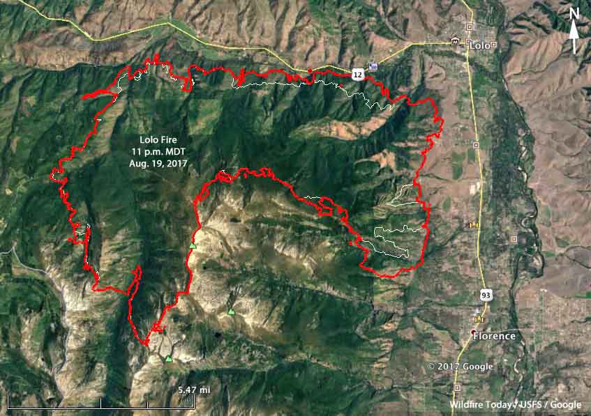
Above: 3-D map of the Lolo Peak Fire, looking west. The red line was the perimeter at 11 p.m. MDT August 19, 2017. The white line was the perimeter 23 hours earlier.

(Originally published at 8:40 a.m. MDT August 20, 2017.)

The Lolo Peak Fire grew by another 2,800 acres Saturday bringing the total up to 30,765 acres, but some of that increase was the result of burnout or firing operations conducted to tie in the fire edge with barriers or firelines.

In spite of a Red Flag Warning in effect Saturday afternoon firefighters had a pretty good day, conducting firing operations on the northwest, north, and east sides of the fire. Operations Section Chief Mark Goeller said the Highway 12 corridor is looking fairly secure and mopup has started in that area as well as some locations on the east side south of Lolo and west of Florence and Carlson. There is still a great deal of uncontrolled fire edge on the south side of the fire in the higher elevations.

The west wind predicted for Sunday should make a planned firing operation on the west side easier than it would be with winds from other directions.
map Lolo Fire Montana
The red line was the perimeter of the Lolo Peak Fire at 11 p.m. MDT August 19, 2017. The white line was the perimeter 23 hours earlier.

In the video below Mr. Goeller gives an excellent briefing on Saturday’s activities and the plans for Sunday.

Update on Lolo Peak Fire south of Missoula, Saturday evening

(Originally published at 8:22 p.m. MDT August 19, 2017)

(All of the articles about the Lolo Peak Fire have the “Lolo Peak Fire” tag, and can be found here, with the most recent news at the top.)

The Lolo National Forest says this video is a synopsis of the operations that occurred on the Lolo Peak Fire today (Saturday August 19).

Lolo Peak Fire causes more evacuations, Highway 12 closed

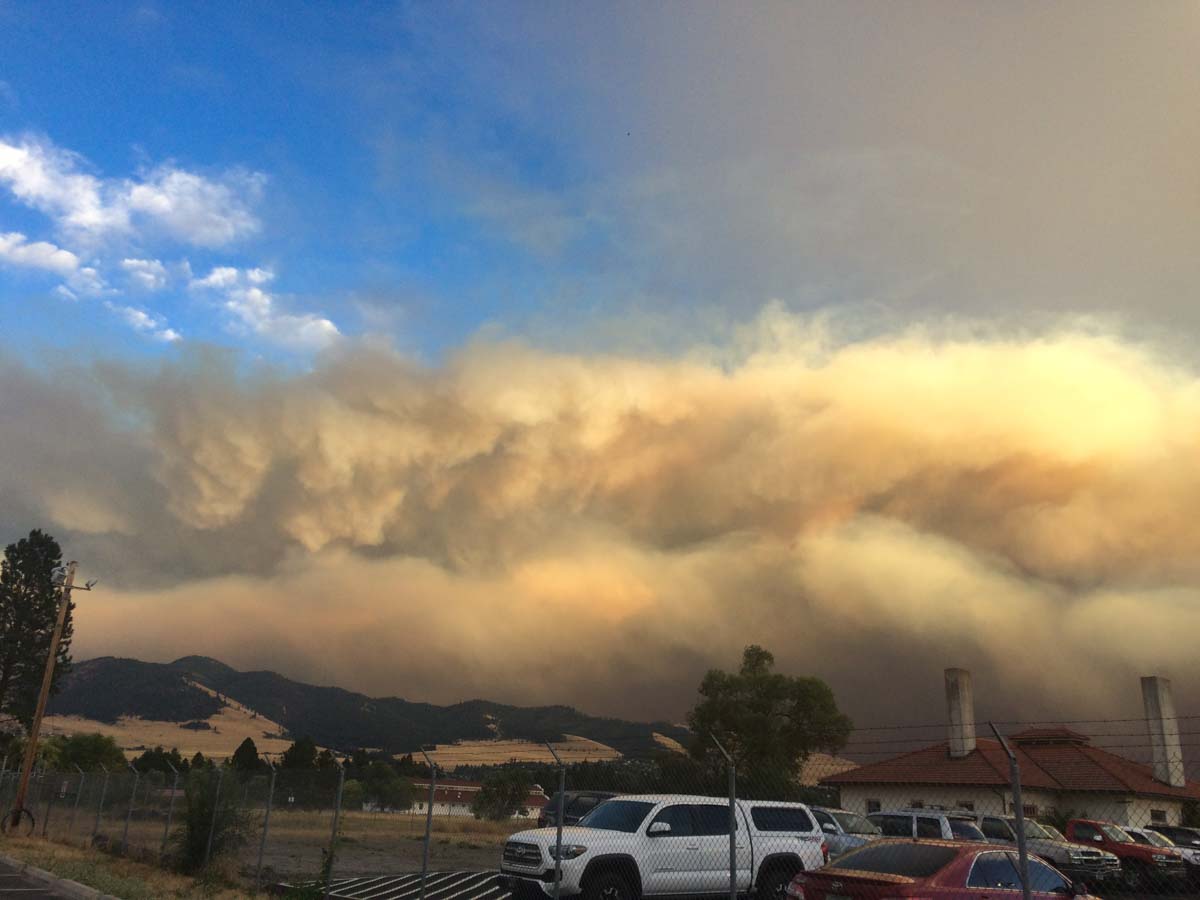
Above: Lolo Fire at 6:25 p.m. MDT August 18, 2017 as seen from the Missoula area. Photo by Dick Mangan.

(Originally published at 7:28 a.m. MDT August 19, 2018)

(All of the articles about the Lolo Peak Fire have the “Lolo Peak Fire” tag, and can be found here, with the most recent news at the top.)

The Lolo Peak Fire eight miles southwest of Missoula, Montana roared across an additional 9,000 acres Friday to bring the total burned area to 27,900 acres. Officials closed Highway 12 and evacuated additional locations on the north side of the highway on Sleeman Creek Road and west of Stella Blue. Old Hwy 93 is closed from the intersection of Long Lane in Florence north through Missoula County.

There has been no report of the fire crossing Highway 12.

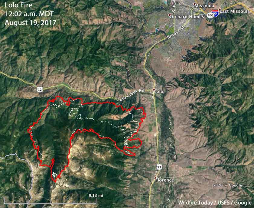
Strong winds pushed the fire farther to the north and the east from the Mill Creek area towards Travelers Rest. (See the map below.)

Lolo Fire map
Map of the Lolo Fire. The red line was the perimeter at 12:02 a.m. MDT August 19, 2017. The white line was the perimeter 24 hours earlier.

The Lolo Peak fire is being managed as a full suppression fire, but Greg Poncin’s Northern Rockies National Incident Management Team has been describing it as a “long duration wildfire with the potential to reach the corridors of Highway 12 and Highway 93”. Ten structures have burned in the fire.

Lolo Fire
Lolo Fire at 8:14 p.m. MDT August 18, 2017 as seen from the Missoula area. Photo by Jim Loach.

Continue reading “Lolo Peak Fire causes more evacuations, Highway 12 closed”

Heavy wildfire smoke in some areas of California, Oregon, and Montana

Air Quality Index
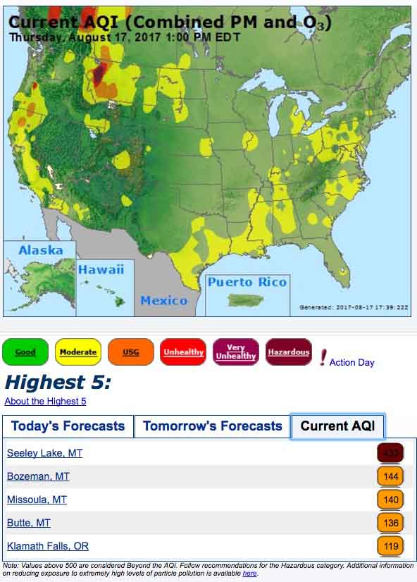
Air Quality Index at 12:30 p.m. MDT August 17, 2017.
Air Quality Index
Air Quality Index

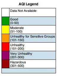
Some areas in northwest Montana are seeing heavy concentrations of smoke generated by the local fires that have been burning for several weeks. When the AirNow map above was generated the Air Quality Index (AQI) at Seeley Lake was 433, well into the “Hazardous” category which ranges from 301 to 500. If it exceeds 500 that will be off the scale.

Almost all of the western two-thirds of Montana are at least in the Moderate AQI level and many areas range from Unsafe for Sensitive Groups, to Unhealthy, to Very Unhealthy.

Some locations in Oregon and Northern California are also experiencing air quality and smoke issues.

Air Quality Index for Montana
Air Quality Index for Montana, Idaho, and Wyoming at 12:30 p.m. MDT August 17, 2017.
Wildfire smoke map
Wildfire smoke at mid-day August 17, 2017. NOAA.


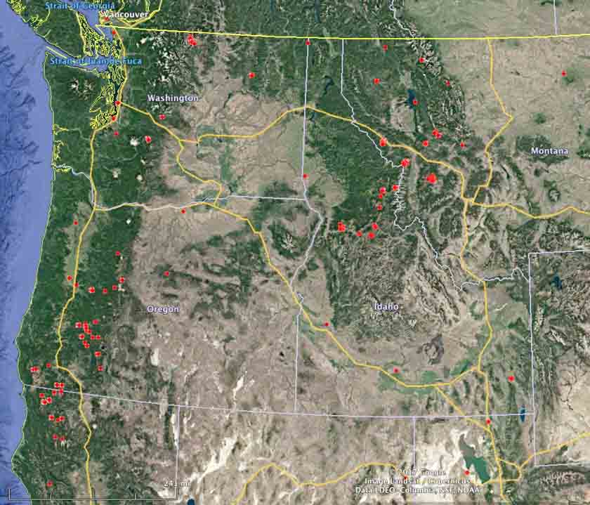
Dozens of active wildfires in the Northwest U.S.

Above: Active wildfires in Washington, Oregon, Idaho, Western Montana, and Northern California at 4:18 a.m. MDT August 16, 2017.

(Originally published at 10:21 a.m. MDT August 16, 2017)

Dozens of wildfires are active in the Northwest one-quarter of the United States. Many of them have been burning for several weeks under a limited suppression strategy. The states of Washington and Oregon have a total of 32 large uncontained fires that have spread over 810,171 acres.

Air Quality Index LegendAt times the area around Missoula has been heavily affected by smoke. Here are some PM 2.5 readings from Wednesday morning:

  • Seeley Lake: 180
  • Missoula: 33
  • Lolo: 54
  • Superior: 180
  • French Town: 19
  • Clinton: 26
wildfires near Missoula, Montana
Satellite photo showing smoke from wildfires near Missoula, Montana, August 15, 2017.
wildfires northwest california
Satellite photo showing smoke from wildfires in northwest California, August 15, 2017.
wildfires northwest united states
Active wildfires (without added name tags) in Washington, Oregon, Idaho, Western Montana, and Northern California at 4:18 a.m. MDT August 16, 2017.

More evacuations ordered for the Sunrise Fire in western Montana

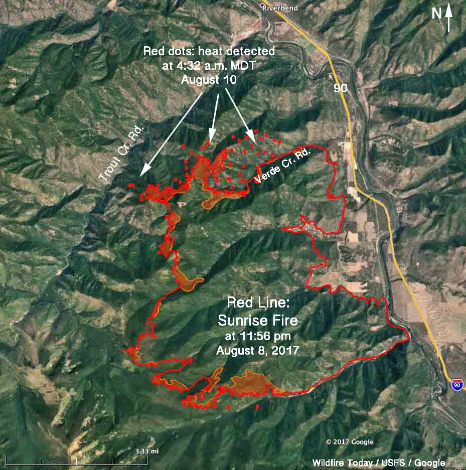
Above: 3-D map of the Sunrise Fire 6 miles south of Superior, Montana. The red line was the perimeter at 11:56 pm. MDT August 8. The red dots represent heat detected by a satellite at 4:32 a.m. MDT August 10.

(Originally published at 12:02 p.m. MDT August 10, 2017.)

Cougar Gulch has been added to the list of areas under evacuation orders on the Sunrise Fire which has been burning since July 16 six miles south of Superior Montana. Quartz Creek and Verde Creek were previously evacuated.

Tuesday night the fire was mapped at 15,203 acres, but has added approximately 1,000 acres since then primarily on the north and northwest sides, and a small amount on the south side. It has grown to within less than a mile of Trout Creek Road on the west side.

map sunrise fire montana
The red line on this map of the Sunrise Fire was the perimeter at 11:56 MDT August 8. The red dots represent heat detected by a satellite at 4:32 a.m. MDT August 10, 2017.

The Lolo National Forest is not completely suppressing the fire. Instead, they are stopping portions of it when they think it becomes necessary to protect private property. Thursday morning they released a statement that read in part:

Over the next few days the team will work to slow the growth of the fire to allow for more effective and safe engagement by strategically introducing fire to unburned areas; lessening the likelihood for high-intensity and fast moving fire.

On Wednesday burnout operations continued in the Quartz Creek and Verde Creek areas with hand and aerial ignition. The northern edge of the fire now extends into the head of Cougar Gulch.

Thursday’s plans are to continue burnout operations on the north side of Quartz Creek drainage to reduce fuel loading around structures. Firing will continue in Verde Creek.

Sunrise Fire
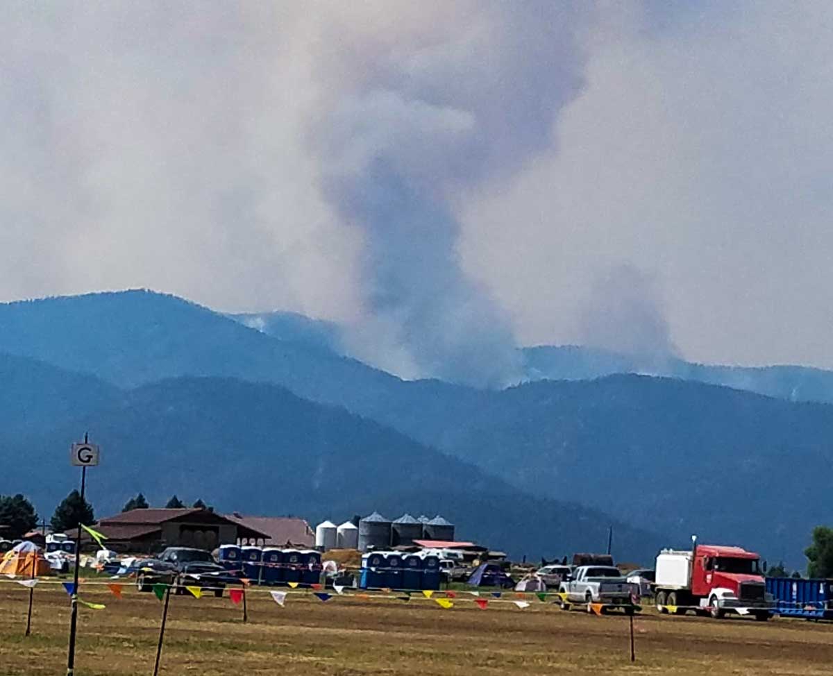
Smoke rising from the Verde Creek area on the Sunrise Fire. Inciweb. Undated and uncredited.