400 firefighter hand crews are deployed on fires in the United States

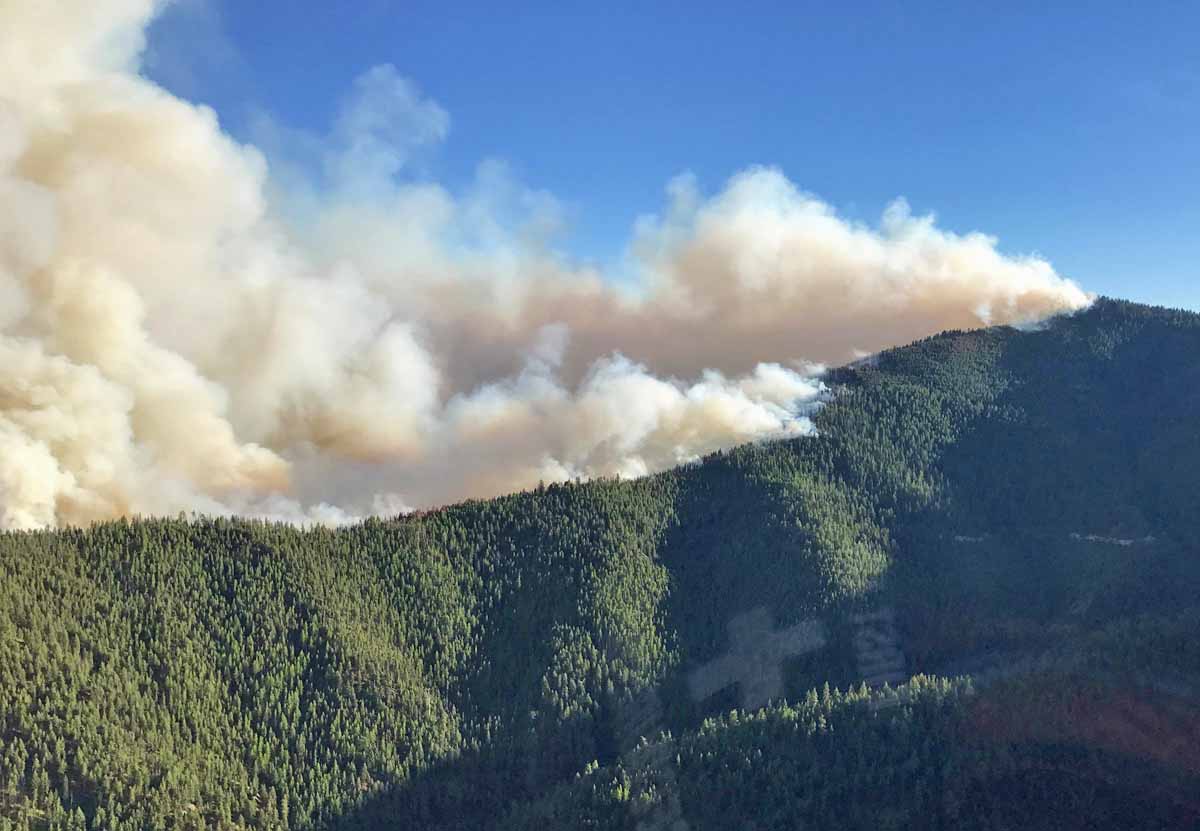
Above: A firefighter ignites a burnout on the Powerline Fire southwest of Pocatello, Idaho. Uncredited Inciweb photo, posted August 6, 2017.

(Originally published at 12:48 p.m. MDT August 6, 2017)

Wildland firefighters are much busier this year than in a typical year. To date, fires have burned 46 percent more acres than the 10-year average — 5,820,802 acres vs. the 3,962,906 average. In some years fire activity in Alaska, where many very large fires are not suppressed, can inflate these numbers, but so far that state can only account for 626,786 acres, not a huge number for Alaska.

400 hand crews, usually comprised of 20 people each, are deployed nationwide, along with 949 fire engines, and 120 helicopters for a total of 16,673 personnel.
map powerline fire
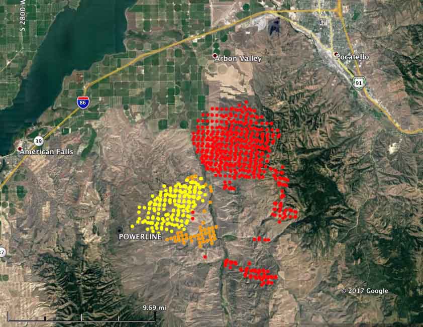
Map showing heat detected on the Powerline Fire southwest of Pocatello, Idaho by a satellite August 5 and 6, 2016. The red dots are the most current, at 4:04 a.m. MDT August 6. Some areas with light vegetation, such as grass, may have burned and cooled before the satellite overflight and were not detected.

Here are brief descriptions of some of the larger or more prominent fires:

  • Powerline (see the map and photo above): Since it was reported Friday night this fire has spread very rapidly. Saturday it was very active on the northeast and southeast sides. Using satellite data the Incident Management Team estimated early Sunday morning that it had burned over 40,000 acres, but that is a very rough guess. More accurate mapping by fixed wing aircraft will provide better numbers. The satellite information indicated that by 4:04 a.m. Sunday it had spread to within 6 miles of Pocatello, Idaho. It is moving into steeper terrain with heavier fuels, offering more resistance to control and is the #2 priority in the Great Basin Geographic Area according to the national situation report.
  • Mammoth Cave, southwest of Carey, Idaho. Since it started August 4 it has burned three structures and 30,000 acres. It is the number 1 priority in the Great Basin Geographic Area.
  • The Shoestring Fire between Shoshone and Gooding, Idaho has blackened about 12,000 acres since it started August 5. It is the #3 priority in the Great Basin Geographic Area.
  • The Rice Ridge Fire northeast of Seeley Lake, MT is the #1 priority in the Northern Rockies Geographic Area and is threatening over 1,000 structures. It added almost 700 acres on Saturday to bring the total to 7,740.
  • The Sunrise Fire, 12,900 acres, the #2 priority in the Northern Rockies Geographic Area, grew by 600 acres Saturday. It has been burning since July 16, growing every day, adding several hundred acres daily on the east or northeast sides. It is now mapped at 12,900 acres.
  • The Hanover Fire, in a very remote area 15 miles northwest of Riggins, Idaho, was extremely active on Saturday. The Incident Management Team reports that it has burned 4,479 acres.
  • Parker 2, 10 miles east of Alturas, California. It was very active Saturday, adding 5,300 acres, growing to 7,100 acres.
  • Minerva 5, just south of Quincy, California. It has burned 4,088 acres and the voluntary evacuation of the town has been lifted. Firefighters completed a firing operation Saturday night.
 sawyer Minerva 5 Fire
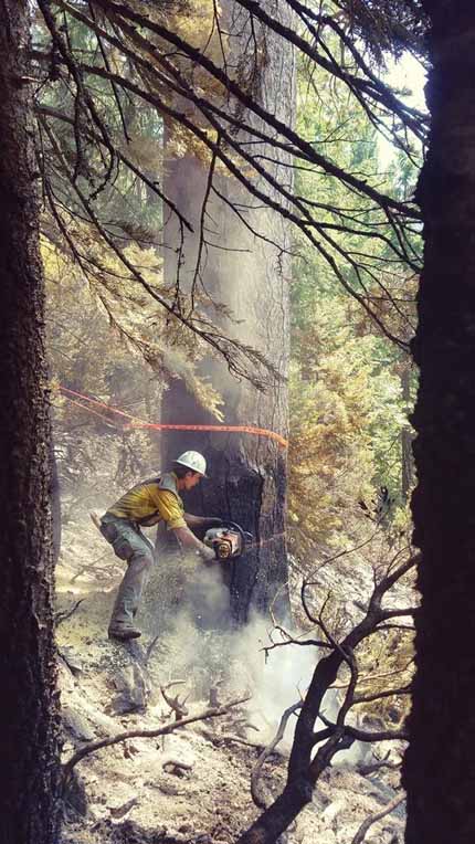
A sawyer on the Minerva 5 Fire, August 2, 2017. Inciweb photo, uncredited.

Wildfire smoke produces “unhealthy” conditions in some areas of the US Northwest and British Columbia

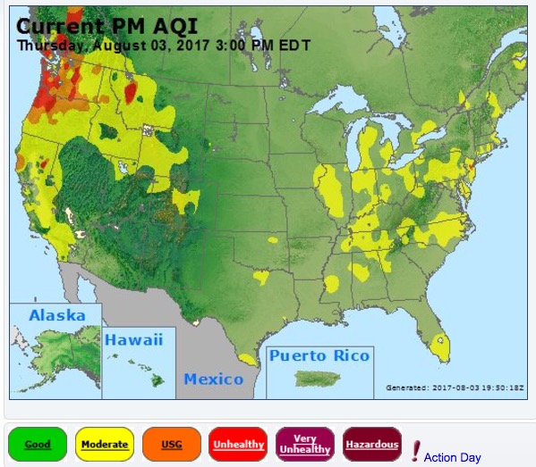
Above: The distribution of wildfire smoke, current as of 2:09 p.m. MDT August 3, 2017.

(Originally published at 2:50 p.m. MDT August 3, 2017)

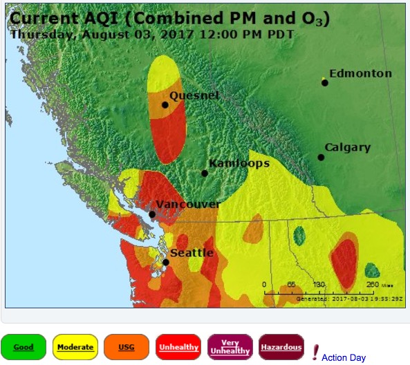
Smoke from wildfires in the United States Northwest and southern British Columbia is accumulating in those areas causing, in some areas, significant degradations in air quality. In British Columbia many massive fires combined with light winds has resulted in the smoke not being transported out of the area.

air quality smoke united states
Air quality August 3, 2017 for western Canada and parts of Washington, Idaho, and Montana.

Some areas in BC, western Montana, and the western portions of Washington and Oregon have “unhealthy” air quality today, according to Air Now.

air quality smoke west canada

Continue reading “Wildfire smoke produces “unhealthy” conditions in some areas of the US Northwest and British Columbia”

Updated: Firefighter dies in tree felling accident in Lolo National Forest in Montana

(Updated at 9:47 a.m. MDT August 4, 2017)

Missoula County Sheriff T.J. McDermott announced that a wildland firefighter was killed Wednesday August 2 on the Lolo Peak Fire in the Lolo National Forest in Western Montana. The Sheriff said Brent M. Witham, 29, of Mentone, California, died in a “tree felling” accident. Dispatchers said the man was given CPR after being struck by a falling tree, but rescuers were unable to save his life.

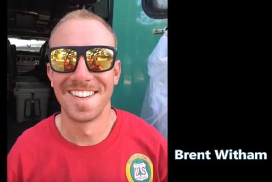
Brent Witham
Brent Witham, screenshot from the 2016 Vista Grande IHC Crew Video.

He was a member of the Vista Grande Hotshots, based in Idyllwild, California according to Lolo Peak fire information officer Mark Struble.

Our sincere condolences go out to Mr. Witham’s friends, family, and coworkers.

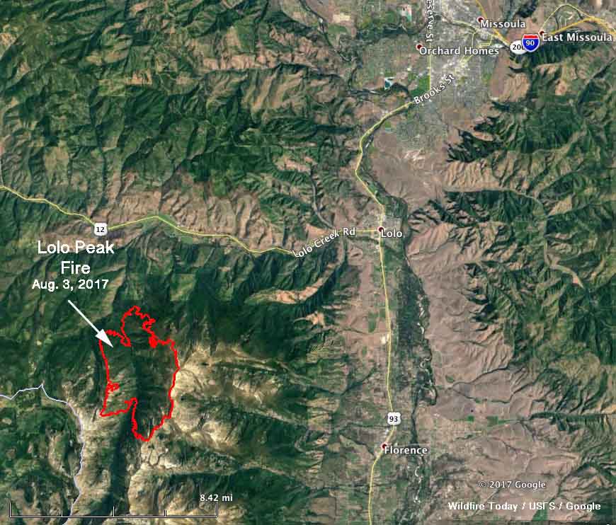
Map of the perimeter Lolo Peak Fire
Map of the perimeter of the Lolo Peak Fire, at 2 a.m. MDT August 3, 2017.

Two weeks ago another firefighter was killed by a falling tree on the Lolo National Forest. Trenton Johnson 19, died June 19 while helping to suppress the Florence Fire, a small fire near Florence Lake northeast of Seeley Lake.

Between 1990 and 2014 18 firefighters were killed on wildland fires by hazardous trees, which was 4 percent of the 440 firefighter deaths in the stats for that period kept by the National Interagency Fire Center.

Started July 15 by lightning, the Lolo Peak Fire has burned 6,542 acres 8 miles southwest of Lolo, Montana south of US Highway 12.

This article was updated August 4 to include the name and photo of the firefighter after it was released by the Sheriff.

Fires in Western Montana still very active

The fires are consuming thousands of acres each day and producing large quantities of smoke.

Above: Satellite photo taken August 1, 2017 showing smoke produced by wildfires in western Montana and Northeastern Idaho. The red dots represent heat detected by a sensor on the satellite.

(Originally published at 10:48 a.m. MDT August 2, 2017)

The residents of Western Montana have been dealing with wildfire smoke for several weeks and there is no relief in sight.

Our map above identifies eight of the largest blazes in the area. Here are a few facts about some of them, with them ranked in priority order according to fire management officials.

  • Rice Ridge: Six miles north of Seeley Lake, MT; 3,994 acres, 150 personnel assigned.
  • Sunrise: Six miles south of Riverbend, 9,900 acres, 548 personnel assigned.
  • Sapphire Complex: Three fires, 15 miles southeast of Clinton, MT, 12,756 acres, 864 personnel assigned.
  • Lolo Peak: 8 miles southwest of Lolo, MT, 5,724 acres, 822 personnel assigned.
  • Arrastra Creek: 6 miles northwest of Lincoln, MT, 3,675 acres, 127 personnel assigned.
  • Whetston Ridge: 25 miles southwest of Philipsburg, MT, 3,621 acres, 30 personnel assigned.

Another community evacuated near Sunrise Fire in western Montana

Above: 3-D map of the Sunrise Fire looking west. The red line was the perimeter at 9 p.m. MDT July 30, 2017. The white line was the perimeter two days earlier.

(Originally published at 5:55 p.m. July 31, 2017.)

During the last two days the Sunrise Fire west of Missoula, Montana 6 miles south of Riverbend has continued to work its way down the slopes near the small communities west of the Clark Fork River, moving to within 1.5 to 0.3 miles of the river. As of Sunday night it had burned about 8,200 acres, an increase of 2,700 acres in the last two days.

Another community, Verde Creek, has been added to the evacuation orders that already included Sunrise, Quartz Flats, and Quartz Creek.

The areas of major growth on Saturday and Sunday were on the north and southeast sides.

Sunrise Fire
The Sunrise Fire, July 30, 2017. Photo by Kevin Chaffe.

On the south side, the fire continued to burn into the Quartz Creek drainage; retardant was used to slow its spread downslope. On the north side in Sunrise Creek, the fire made an aggressive uphill run towards Eagle Rock and Verde Saddles.

Hotshot crews conducted controlled burning operations to reduce fuels in the Sunrise and Quartz Flats Communities while helicopters and air tankers were busy on all areas of the fire.

Resources assigned include 14 hand crews, 6 helicopters, 31 engines, 5 dozers, 14 water tenders, 4 skidgens, and 1 masticator for a total of 494 personnel.

All articles about the Sunrise Fire can be found HERE, with the most recent at the top of the page.