The US Forest Service announced today that the Calf Canyon Fire northwest of Las Vegas, New Mexico was caused by piles that were still burning more than two months after they were ignited near the end of January, 2022. The heat remained after having been at times under snow when it was detected on April 9. The piles were comprised of vegetation and debris remaining after a fuel treatment project.
A statement released by the Santa Fe National Forest indicated that crews constructed a fireline around the 1.5-acre blaze on April 9 and “…continued to monitor the fire over the next couple of days to ensure there were no signs of heat or flames near the edge. Ten days later,” the statement continued, “on April 19 the Calf Canyon Fire reignited and escaped containment lines. A wind event on April 22 caused significant fire spread, and the Calf Canyon Fire merged with the Hermits Peak Fire, which was caused by an escaped prescribed burn.”
(Wildfire Today first covered the escape of the broadcast prescribed fire that created the Hermits Peak Fire on April 9. On May 13 we described the burning of the piles now confirmed to be the origin on the Calf Canyon Fire.)
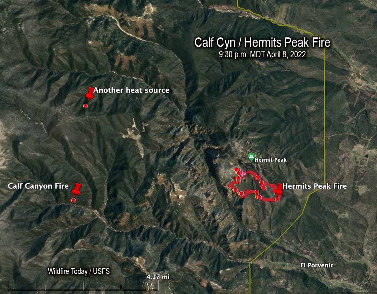
The term “reignited” is misleading. The burning piles were never completely put out. Wildfire Today found records showing that on April 8 fixed wing aircraft with thermal heat sensors began mapping the Hermits Peak Fire nearly every night the rest of the month. From imagery on April 8 at 9:30 p.m. MDT the Infrared Analyst noted two small heat sources both about 4 miles from the fire, one to the northwest and another almost due west which later became the Calf Canyon Fire. The heat to the northwest, 2.7 miles north of the Calf Canyon Fire, was not detected in subsequent mapping flights, indicating that it went out on its own or was successfully suppressed by firefighters.
Here are the results, related to what became the Calf Canyon Fire, of the Hermits Peak Fire aerial fire mapping from April 8 through April 21, 2022 (times are CDT):
- 8 @ 9:30 p.m.: heat noted at the pile burning site
- 9: (firefighters constructed line around a 1.5-acre fire spreading at the pile burning site)
- 10 @ 3 a.m.: heat noted
- 10 @ 10 p.m.: mapping mission unable to be filled (UTF)
- 11 @ 8:45: heat noted
- 13 @ 2 a.m.: not noted
- 13 @ 7:30 p.m.: not noted
- 14 @ 8:15 p.m.: not noted
- 15 @ 7:30 p.m.: not noted
- 16 @ 10 p.m.: UTF
- 18 @ 1:45 a.m.: not noted
- 18 @ 10 p.m.: UTF
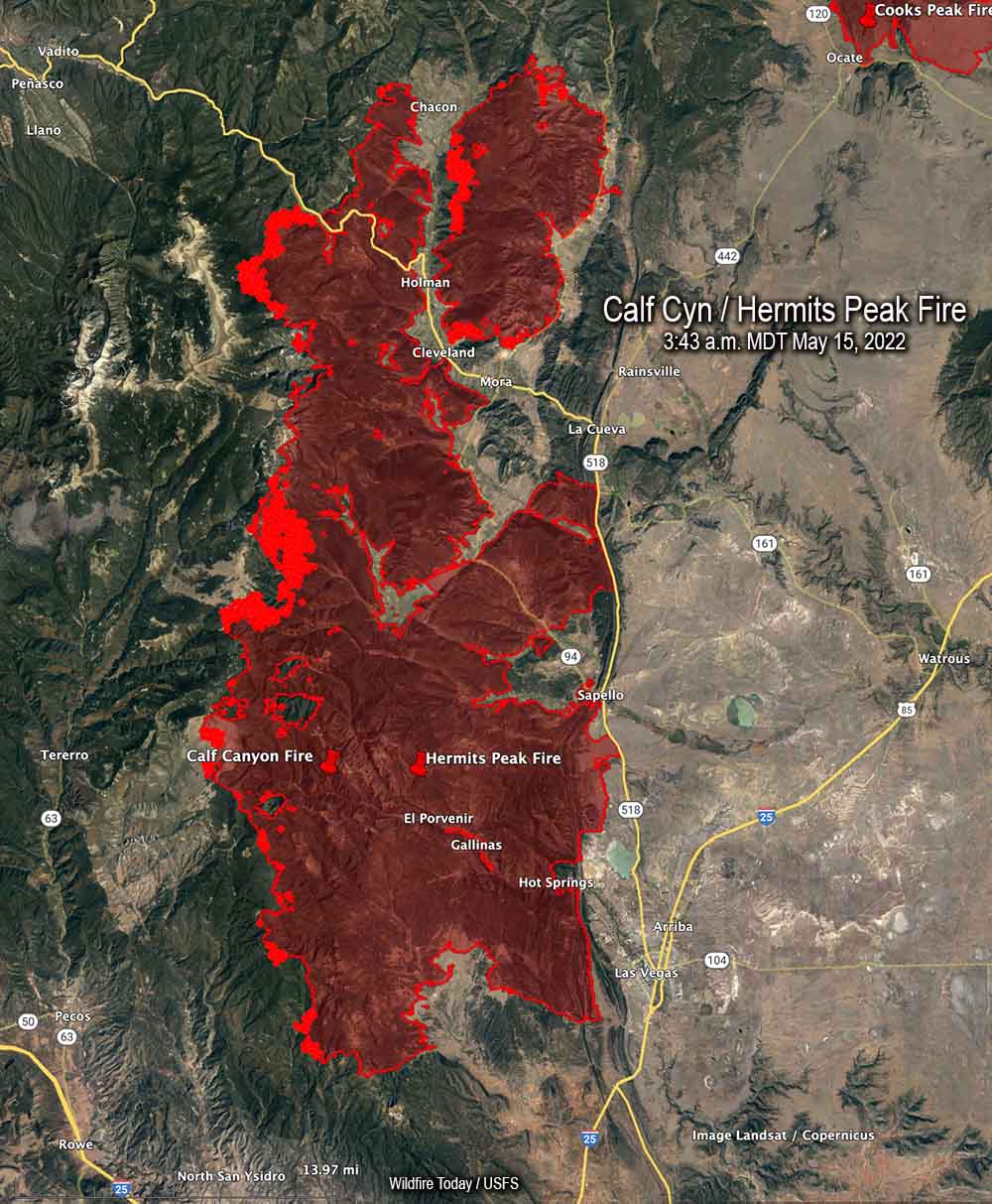
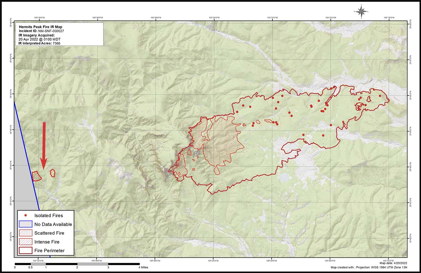
- 20 @ 1 a.m.: intense heat noted at two locations at the pile burning site which were separately mapped by the Infrared Analyst. (See the map above. Either the fire spotted about 0.4 miles out ahead, or a second area in the pile burning project began spreading)
- 21 @ 1:30 a.m.: had grown to about 220 acres; was approximately half a mile wide and one mile long)
It is unknown if the mapping mission each night included the pile burning site four miles west of the Hermits Peak Fire, or if the Infrared Analyst was careful to examine the imagery for small detections of heat at the pile burning site.
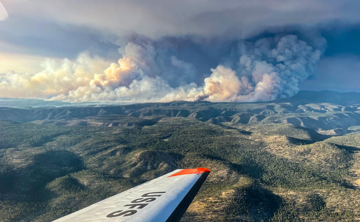
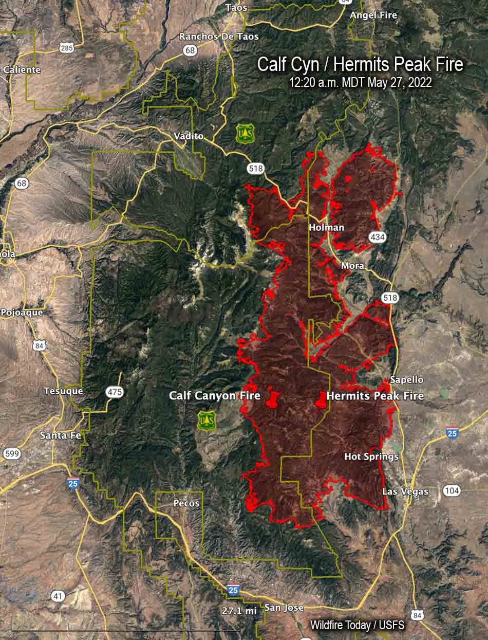
After April 20 the Calf Canyon Fire was large and merged with the Hermits Peak Fire on the 22nd when both fires blew up. At that time the Hermits Peak fire was nearly contained and had been relatively quiet for several days, but pushed by very strong winds both fires ran 11 miles to the northwest in narrow parallel footprints until the wind speed decreased, allowing the flanks of both fires to spread laterally until they merged. The winds monitored at a weather station that day near Las Vegas, NM recorded sustained speeds of 40 to 50 mph with gusts up to 67 while the relative humidity dropped as low as 6 percent.
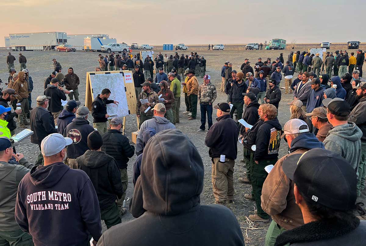
“We don’t have enough resources to do everything we want to do at one time so we have to prioritize the resources we have at the right location,” said Incident Commander Carl Schwope in a briefing on April 23.
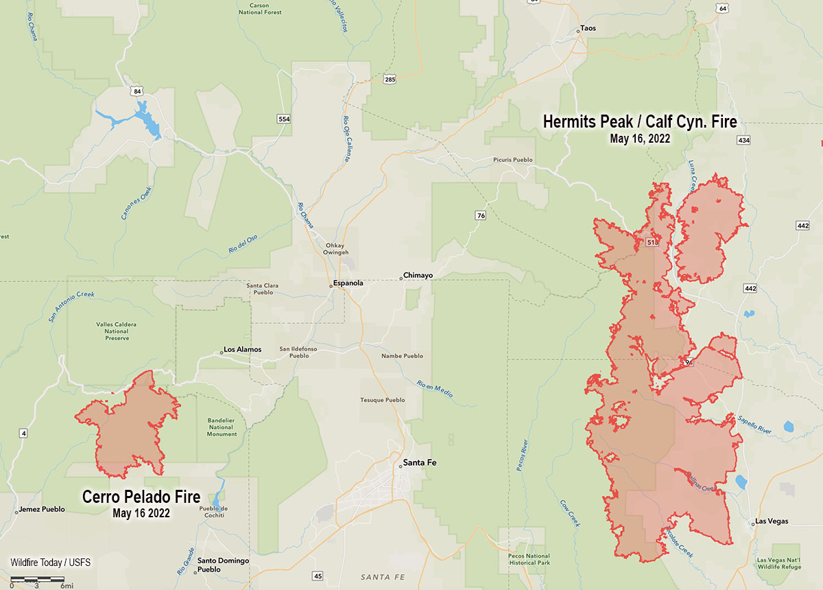
The two merged fires, both the result of escaped prescribed fires and now called Calf Canyon / Hermits Peak Fire, are now 17 miles wide, 45 miles long, and have burned more than 312,000 acres, about 1/3 the size of Rhode Island. If you were driving from the south end of the fire at Las Vegas, NM on Highway 518 going north, it would take about an hour to reach the north edge of the fire near Angostura.
The article was edited May 31, 2022 to add the time that the fire was mapped each night.
Thanks and a tip of the hat go out to Jay and Karen.