9:09 p.m. MDT May 13, 2022
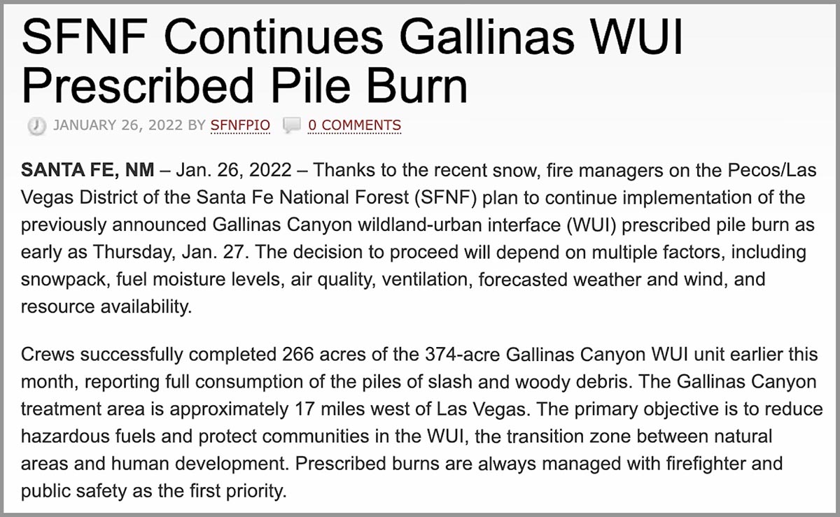
About three months before the Calf Canyon Fire was reported April 19, 2022, employees of the Santa Fe National Forest ignited hundreds of acres of debris piles which were created during fuels treatment projects. The piles were “approximately 17 miles west of Las Vegas,” according to a notice posted at the New Mexico Fire Information website on January 26, 2022. (See below) The name of the project was Gallinas Canyon wildland-urban interface (WUI) prescribed pile burn. In January prior to the notice crews had already completed 266 acres of the 374-acre unit and planned to continue burning more piles “as early as January 27.”
Fires are usually named after a geographical feature near the point of origin. Calf Canyon Road intersects with Forest Road 263 which is in Gallinas Canyon.
On September 27, 2012 a 300-acre hazardous fuels reduction mechanical thinning project was finished just north of Calf Canyon Road, which likely left hundreds of piles to burn later.
This project and Calf Canyon Road are broadly within the general area where the Calf Canyon Fire started. There have also been other fuels treatment projects in that area over the last 10 years.
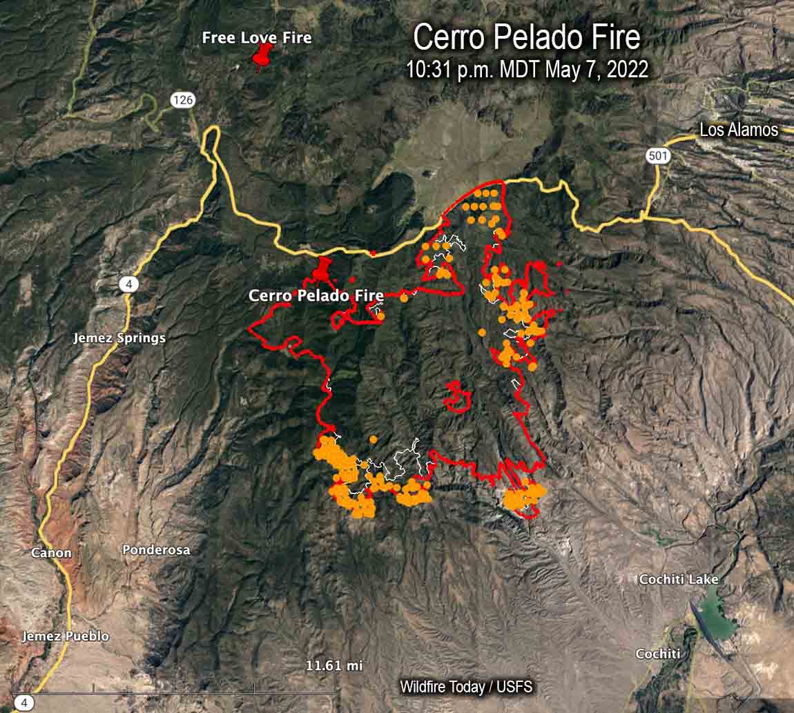
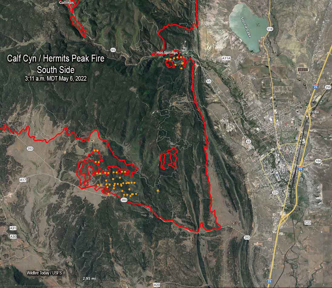
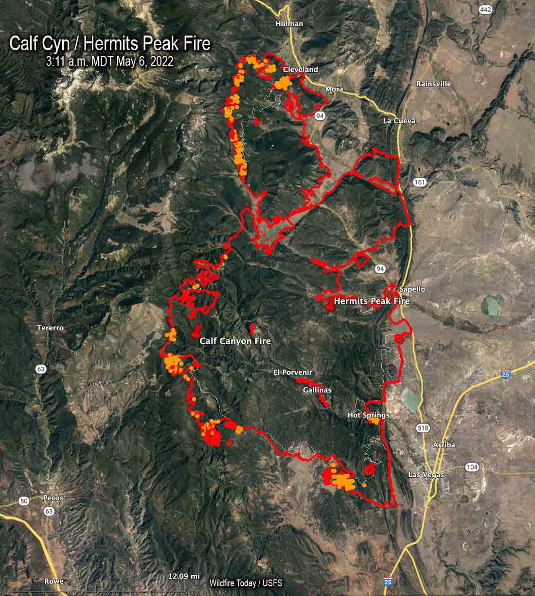
To see all articles on Wildfire Today about the Calf Canyon and Hermits Peak Fires, including the most recent, click here.
The US Forest Service has already identified an escaped prescribed fire as the cause of the Hermits Peak Fire, but lists the cause of the Calf Canyon Fire as under investigation.
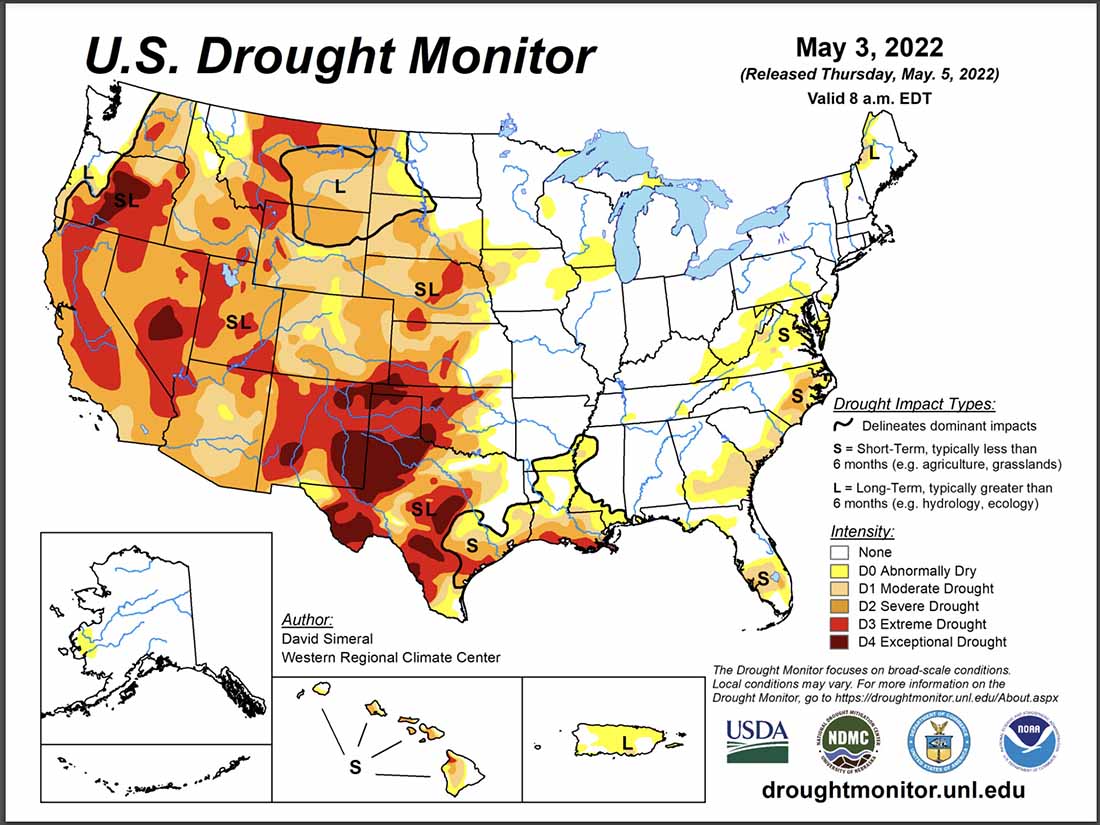
Wildfires, prescribed fires, and pile burns are known to have smoldered for months, sometimes under snow and through an entire winter, before being discovered months later when smoke becomes visible. The burn piles were at approximately 8,000 feet, so the snow reported in the notice may have kept the vegetation cold and wet for a couple of months if the pile burning was completed in February. We are not saying that is what caused the Calf Canyon Fire, but investigators have no doubt evaluated that possibility and ruled it in or out.
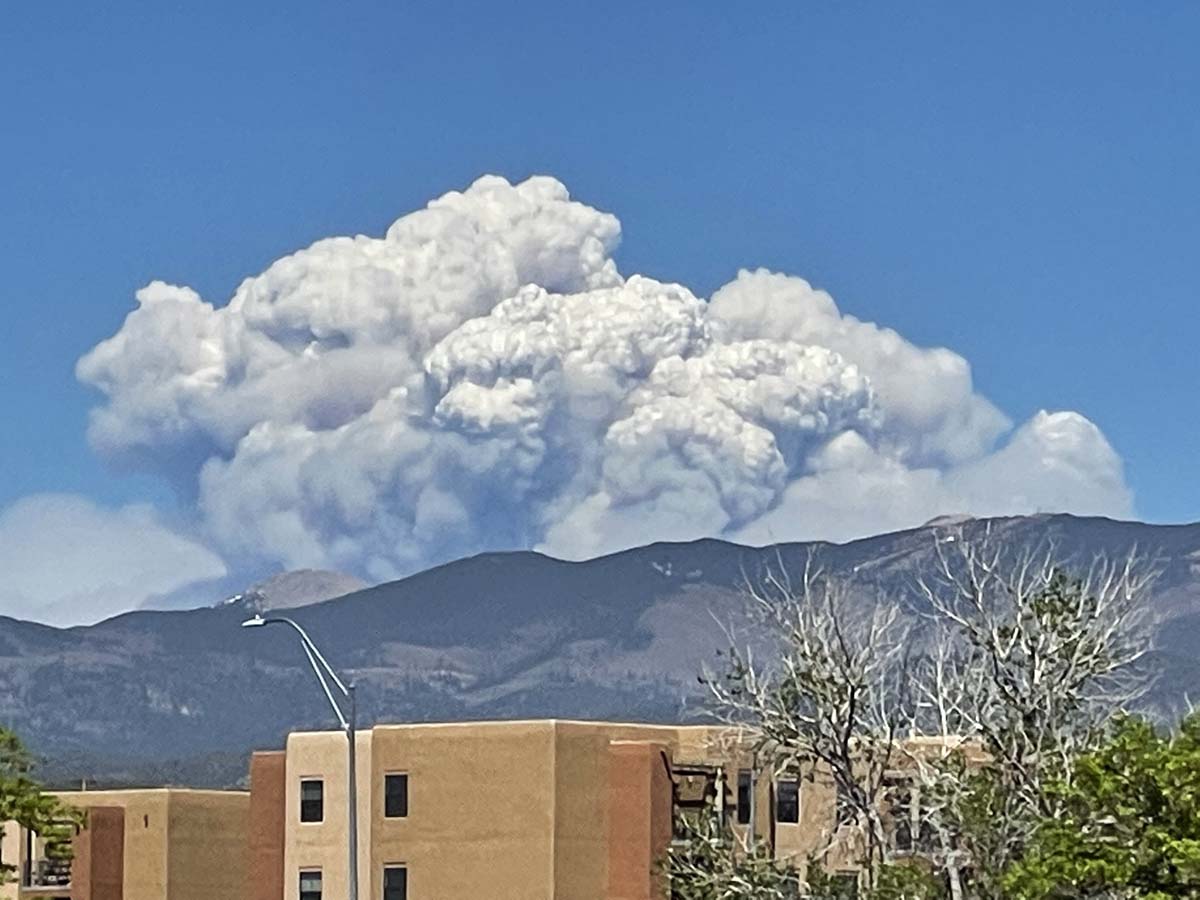
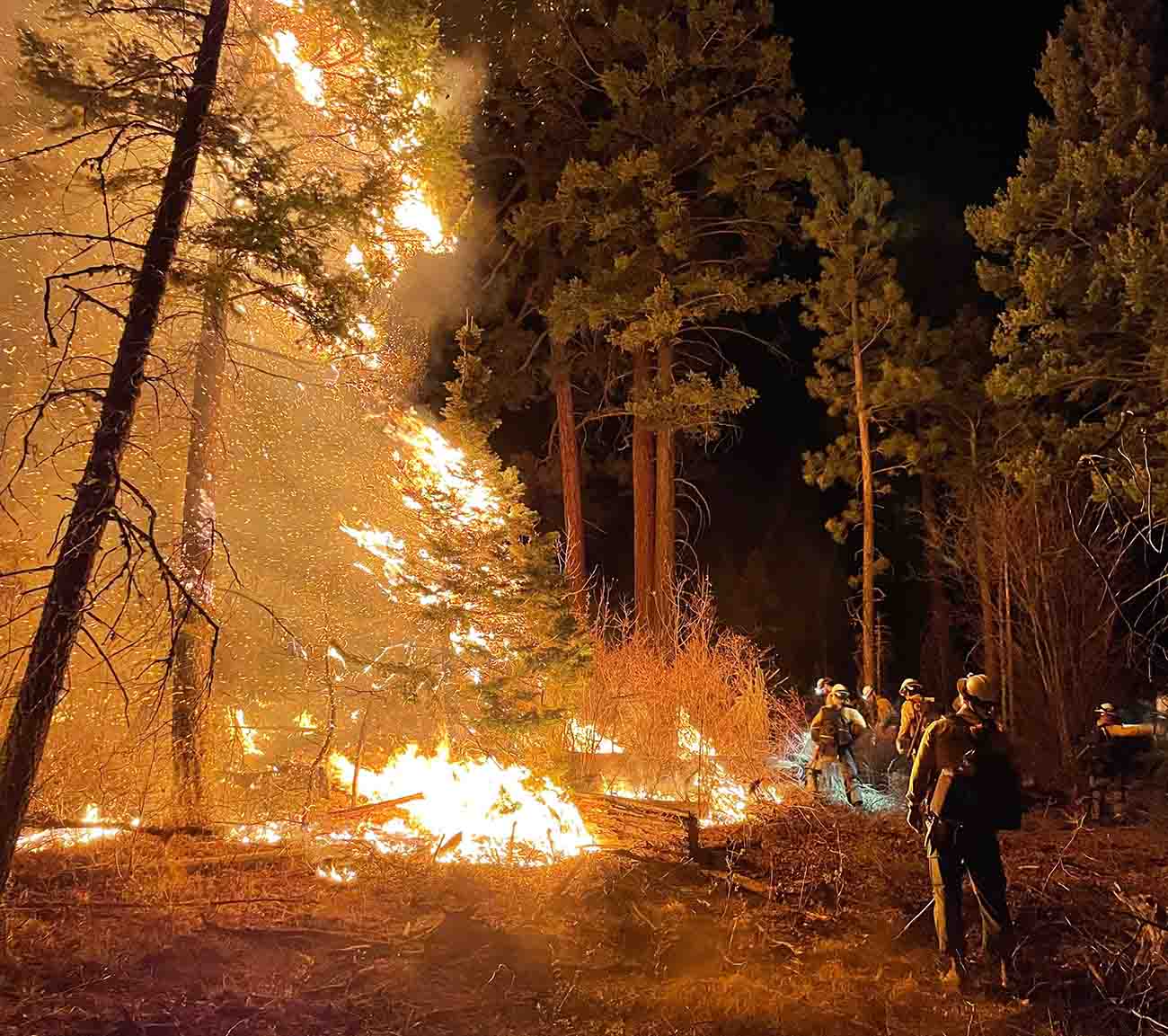
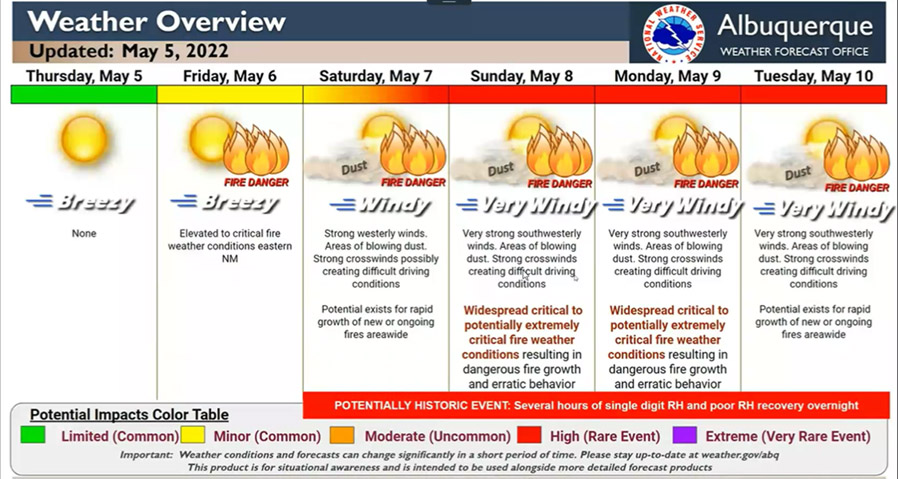
Three days after the Calf Canyon Fire was reported strong winds and low humidities combined to caused it to merge with the Hermits Peak Fire and spread 10 miles to the northeast through dry vegetation in a 24-hour period.
What is next for the Calf Canyon / Hermits Peak Fire?

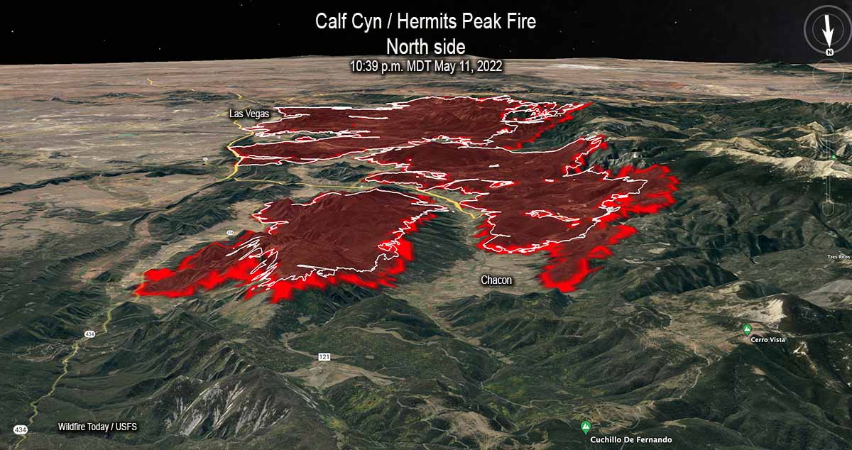
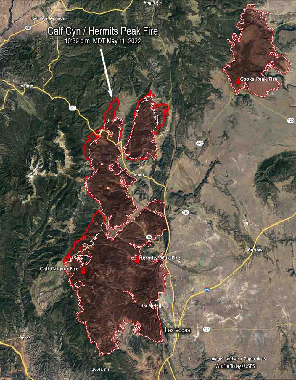
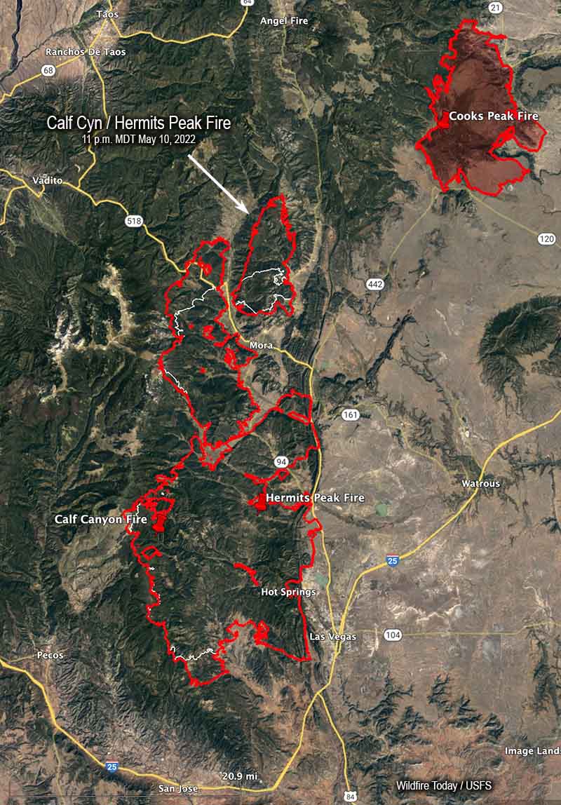
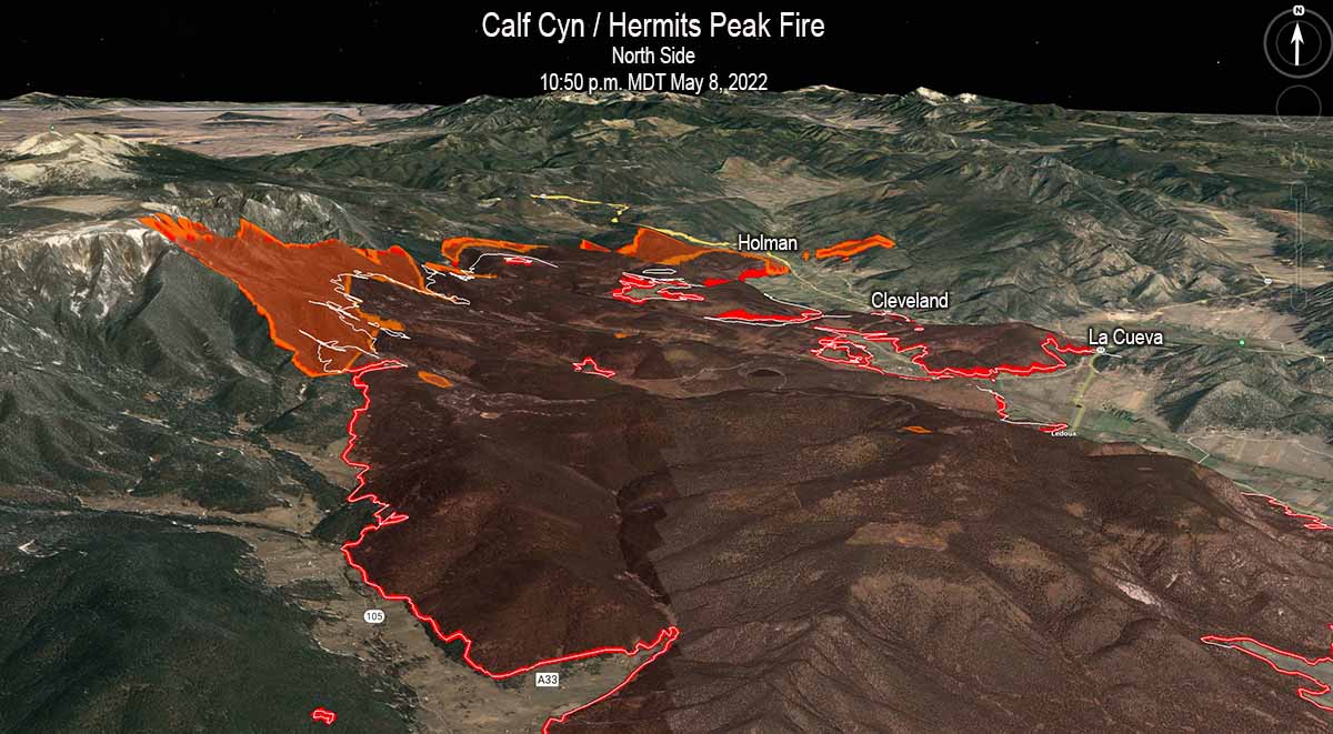
While the Calf Canyon / Hermits Peak Fire has been churning through more than 270,000 acres on its march to the north, at least 90 percent of those acres have burned in areas with no recorded history of previous fires in the national database, going back decades. If that spread to the north and north-northeast continues there is limited significant fire scars in the records out ahead that will slow the fire. (Update May 14, 2022: The NIFC database does not include two fires north of the Calf Canyon / Hermits Peak Fire; the 2020 Luna Fire (10,100 acres) and the 2018 Sardinas Canyon Fire (2,300 acres), according to the link provided in a comment by SE.)
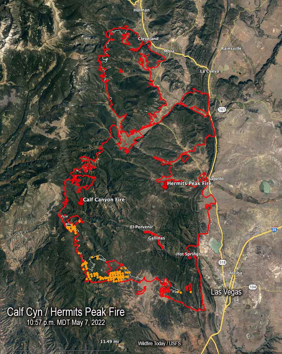
The overall length of the fire is 45 miles as of Thursday night May 12. From the origins they ran north for 32 miles, and south for 13.
There are also no large completed fuel treatment projects in the national database north of the fire that could serve as barriers, except for several near US Highway 64 west of Angel Fire near Valle Escondido 14 miles away. But there are other fuels treatment projects at what is now the southeast corner of the fire in the Barillas Peak area. It has just started to burn into the 2,534-acre “Wildfire Commissary 2015” fire use fire, but it is possible that without too much trouble it could work its way around it, another smaller fire use incident, and a 600-acre prescribed fire conducted in 2004.
At the end of the day on May 12 the north end of the fire was 14 miles from US 64, 19 miles from Taos, 11 miles from the Cooks Peak Fire, and 25 miles from the Philmont Scout Ranch.