Southwest Oregon and Northwest California — a hotbed of fire activity for at least 20 years

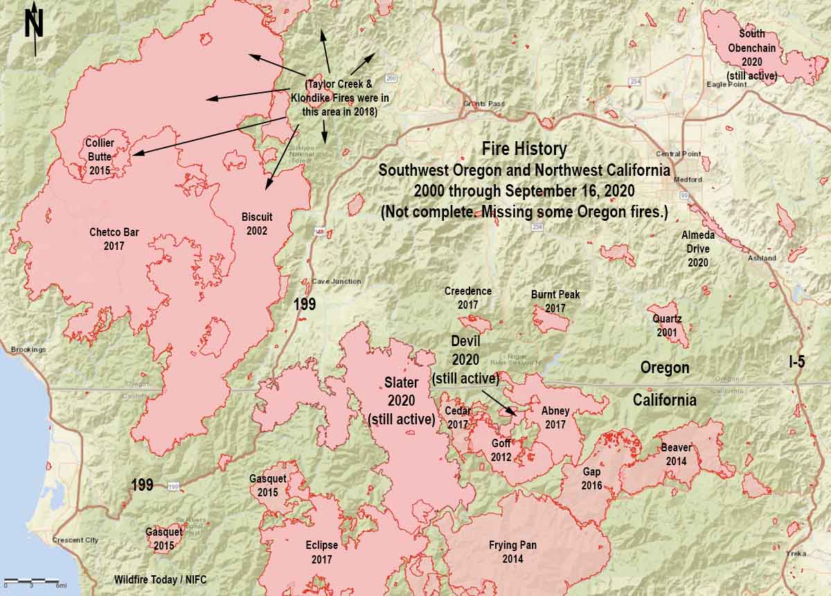
map history of fires in Northwest California and Southwest Oregon
A partial history of fires in Northwest California and Southwest Oregon, 2000 through Sept 17, 2020.

The Northwest California/Southwest Oregon area has kept firefighters very busy at times during the last 20 years, as you can see on the map above.

A new fire is rapidly putting itself into that history. The Slater Fire reported September 8 grew to 89,000 acres by September 9 and has now spread to 150,000 acres. That growth, however, has slowed in the last several days.

It started northeast of Happy Camp, California and ran north into Oregon then took a left and crossed Highway 199. It has come to within about four miles of the 2002 Biscuit Fire.

If recent fire history is any indication, the Slater Fire may not even slow down when and if it reaches the Biscuit burn, and of course it depends on the weather, which has moderated this week. The 2017 Chetco Bar Fire and the 2018 Klondike Fire burned for miles into the then 17 or 18-year old fire scar. The entire eastern two-thirds of the Chetco Bar Fire was in the footprint.

Strong winds that drove the dozens of fires September 8 in Oregon are not super rare. The Klondike Fire west of Grants Pass started July 15, 2018. In early October it had become virtually dormant, but a few hot spots were revitalized by an east wind event on the 14th. According to an article in the Mail Tribune the suddenly vigorous fire was transporting burning embers that started spot fires six miles out ahead of the flaming front:

“Extreme spotting” propelled fine embers up to six miles ahead of the main fire, dropping the live ash right between firefighters’ tents and close to people’s homes.

“We even had to move our own fire camp,”  [information officer Kale] Casey said.

So if the weather this year is anything like it was two years ago, firefighters could be busy in the area for at least another month.
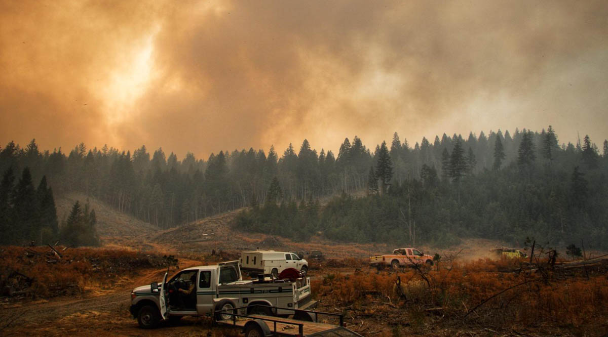
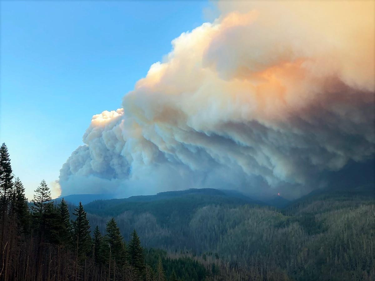
Slater Fire
Slater Fire, Sept. 15, 2020. InciWeb.

California and Oregon fires — lives lost and structures burned

Elkhorn Fire
Elkhorn Fire. Shasta-Trinity National Forest in northern California. September 3, 2020. Sanford Ridge Off of Winter Trail in Wilderness Area. Photo by Mike McMillan.

Lives lost

The tally of the number of lives lost in the California and Oregon blazes will undoubtedly climb as teams search through the footprints of residences. It took weeks in 2018 to document every fatality at the Camp Fire at Paradise, California. Here are the numbers collected so far by the San Francisco Chronicle:

  • 19, at least — California
  • 10, at least — Oregon

Structures destroyed

It is difficult to get good consistent numbers about structures that have burned. CAL FIRE usually includes damaged buildings as well as those that have been destroyed. The Incident Status Summary, ICS-209, that incident management teams on a fire submit every day asks for the number that were destroyed. And it is likely that many teams on fires have not had the time to count all of the affected structures.

Here are the numbers of destroyed structures from the September 14, 2020 National Incident Management Situation Report compiled at the National Interagency Coordination Center, broken down by Geographic Areas. It uses data from the ICS-209:

  •  4,258 — California
  • 2,077 –Northwest (Washington & Oregon)
  • 168 — Northern Rockies
  • 46  — Great Basin
  • 64 — Rocky Mountain

Acres burned

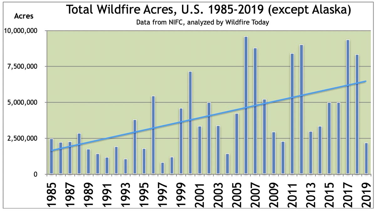
The fire season is not over in all areas, but the number of acres burned to date has exceeded the 10-year average number burned in a year. But the figure varies greatly from year to year. 2019 had the least number since 2004, when considering only the states outside of Alaska.

5,887,136 — The total number of acres burned to date in the U.S., not counting Alaska

5,608,376 — 10-year annual average number of acres burned in the U.S., not counting Alaska

Acres burned annually in the U.S.
Acres burned annually in the U.S., 1985-2019, except Alaska.

There have been many large fires in the last one to two months in Arizona, California, Oregon, Colorado, and Washington, but it has been quieter than usual in Idaho, Montana, Wyoming, and New Mexico.

Now that the extreme weather has moderated, firefighters beginning to make progress on fires in northwest Oregon

Map of fires in northwest Oregon, September 13, 2020 Riverside Beachie Creek Lionshead
Map of fires in northwest Oregon, September 13, 2020.

Lionshead Fire

Of the three very large fires south of Portland, Oregon the 138,718-acre Lionshead has been the most active in the last 24 hours, with most of the growth occurring on the northeast and southeast sides. Crews continue to secure and protect property and conduct damage assessments as fire activity, smoke, and other hazards allow. Wildfires have not burned in the area for many decades, which has resulted in heavy layers of fuel on the ground that firefighters must work through to construct fireline and mop up, a very laborious and time-consuming process.

Resources assigned to the fire include 51 hand crews, 62 engines, and 10 helicopters for a total of 1,482 personnel.

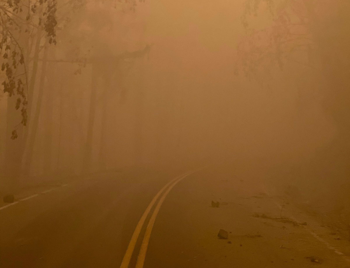
Air quality on the Lionshead Fire
Air quality on the Lionshead Fire, Sept 11, 2020. InciWeb photo.

Riverside Fire

On the Riverside Fire dozers completed a line around spot fires on the west side to help secure the areas closest to the communities of Estacada and Molalla. On Sunday crews were working on the north side above the North Fork Reservoir, looking at opportunities to move towards the east. Firefighters are using two unmanned aerial systems (UAS, or drones) to assess fire conditions from the air. Helicopters are flying when visibility allows.  The blaze has burned 53 structures at last count, and 133,799 acres, and is still a mile away from the Beachie Creek Fire. Resources assigned to the fire include 8 hand crews, 11 engines, and 3 helicopters for a total of 315 personnel.

“You’ll start in the coming days to see some lines showing containment” on the Riverside fire said Alan Sinclair, incident commander for the Type 1 incident management team. “We’re having a little bit more favorable weather and things are coming together.”

Riverside Fire
Riverside Fire, from La Dee Flats September 9, 2020. InciWeb photo.

Beachie Creek Fire

Fog slowed activity of the fire and firefighters on the 188,374-acre Beachie Creek Fire Sunday. After it dissipated firefighters resumed work on the perimeter and accessing damage to structures. Crews and heavy equipment are tying in the control lines on the west and northwest sides. The Beachie Creek and the Riverside Fires remain about one mile apart. Resources assigned to the fire include 11 hand crews, 45 engines, and 7 helicopters for a total of 563 personnel.

Three Area Command Teams (ACT) were mobilized Thursday to assist local units in suppressing the fires in the western states. One of them, led by Area Commander Joe Stutler, will be coordinating the efforts in northwest Oregon. The other two will be California.

Air quality and smoke forecasts for September, 13, 2020

Smoke Forecast fire September 13, 2020
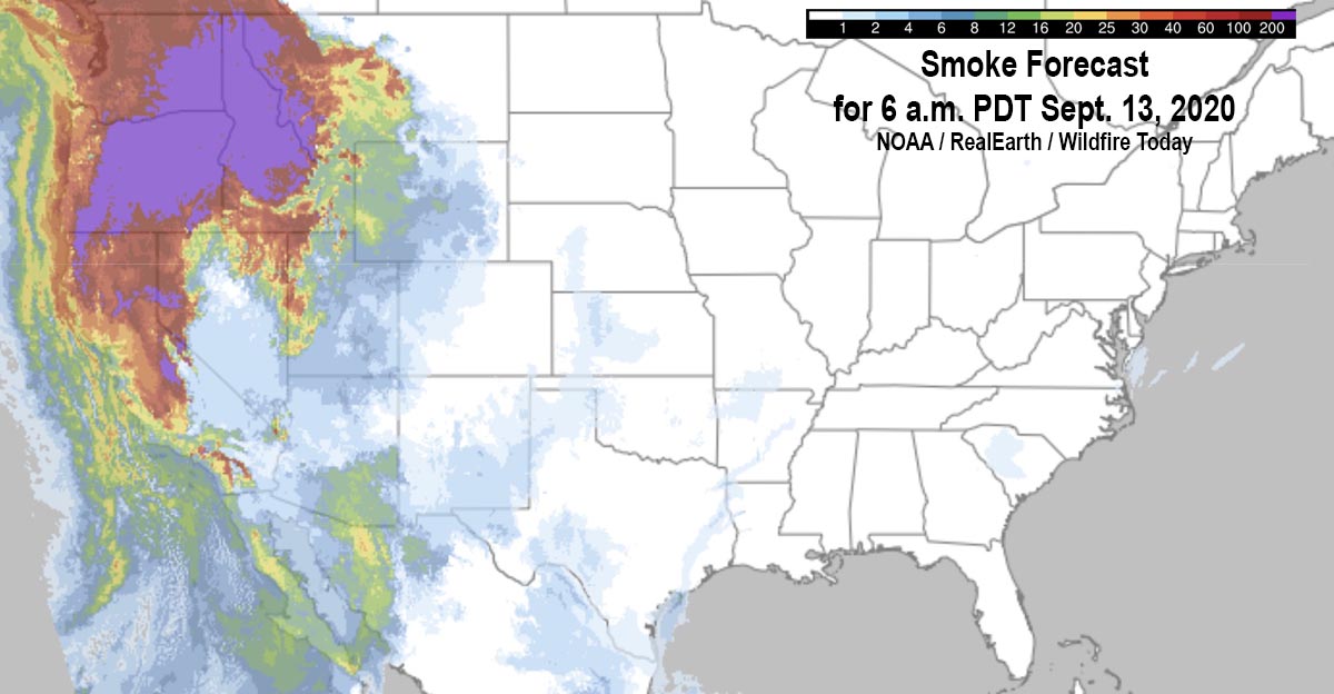
Smoke forecast for 6 a.m. PDT Sept 13, 2020.

The map above shows the forecast for the distribution of near-surface smoke at 6 a.m. PDT September, 13, 2020.

It appears that severe impacts will occur in areas of Washington, Oregon, Idaho, and Montana.

(UPDATED smoke and air quality maps for September 13 can be found HERE)

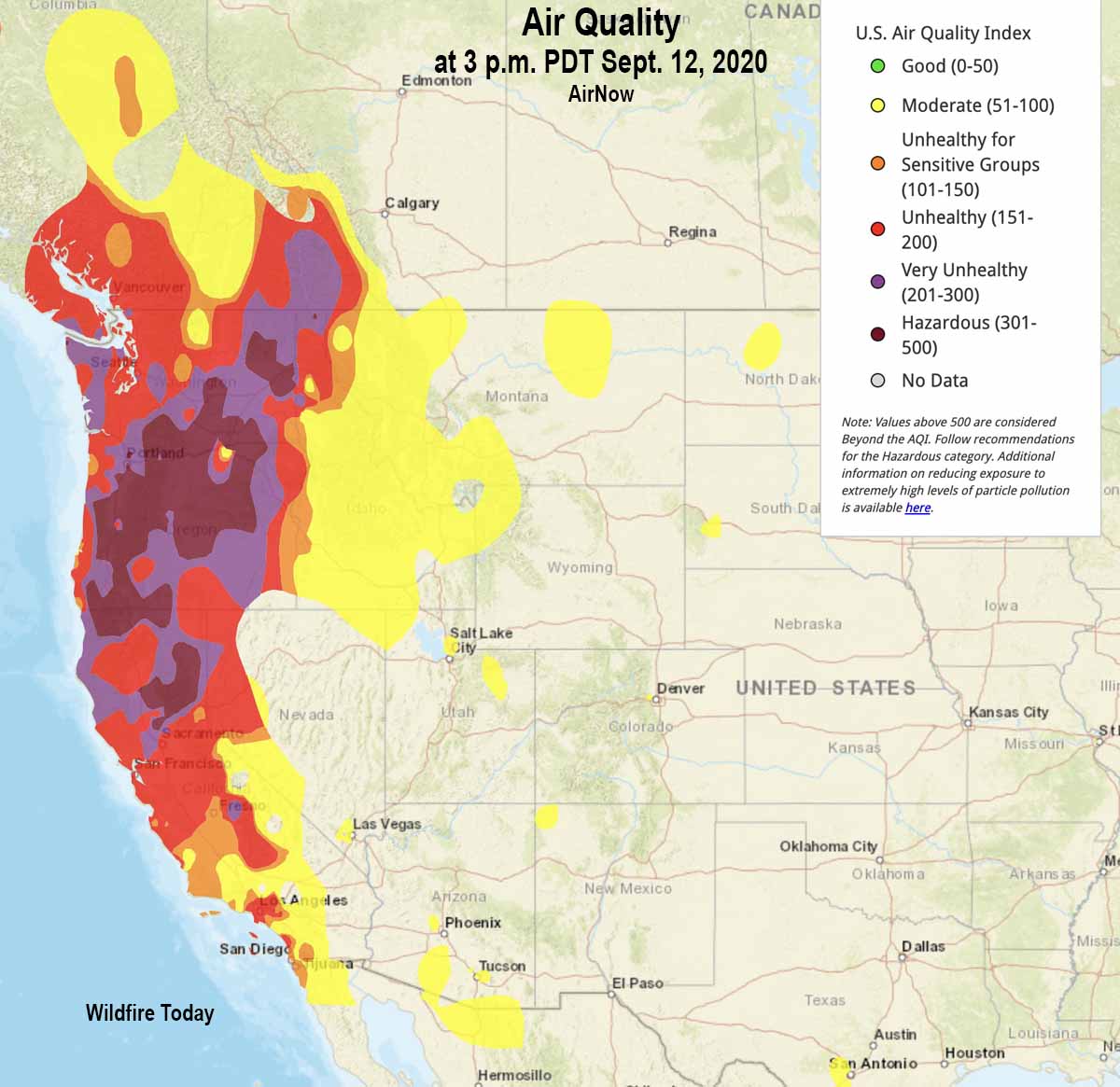
Air quality from AirNow at 3 p.m. PDT September 12, 2020 is below. Most of Oregon, Washington, and northern California are in the categories of Unhealthy, Very Unhealthy, or Hazardous. If you’re in those areas and are lucky enough to have an N95 mask, this is a good time to use it. Being indoors does not help much unless you are aggressively filtering the air with a HEPA category filter. (Information about how to reduce your exposure to smoke.)

Air quality at 3 p.m. PDT Sept. 12, 2020
Air quality at 3 p.m. PDT Sept. 12, 2020. AirNow.

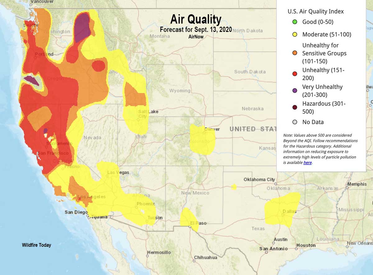
Below is the air quality forecast for Sunday September 13, 2020.

Air Quality forecast for September 13, 2020
Air Quality forecast for September 13, 2020. AirNow.

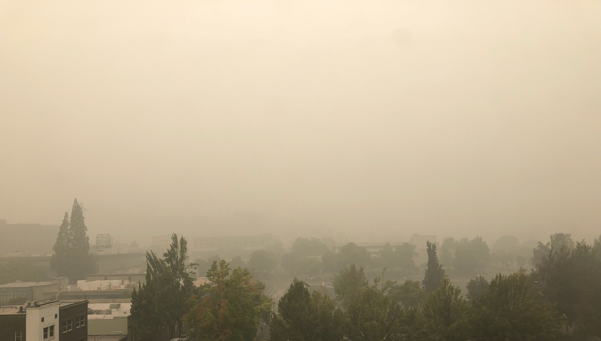
The photos below compare visibility in Eugene, Oregon on a clear day and today, September 12, 2020.

Visibility Eugene, Oregon clear day
Visibility in Eugene, Oregon on a clear day.
Visibility Eugene, Oregon today September 12, 2020 smoke fires
Visibility in Eugene, Oregon today, September 12, 2020.

Video shows large number of structures burned during the Almeda Drive Fire in southern Oregon

It impacted the cities of Talent and Phoenix, September 8, 2020

structures burned Almeda Fire Phoenix Talent Oregon
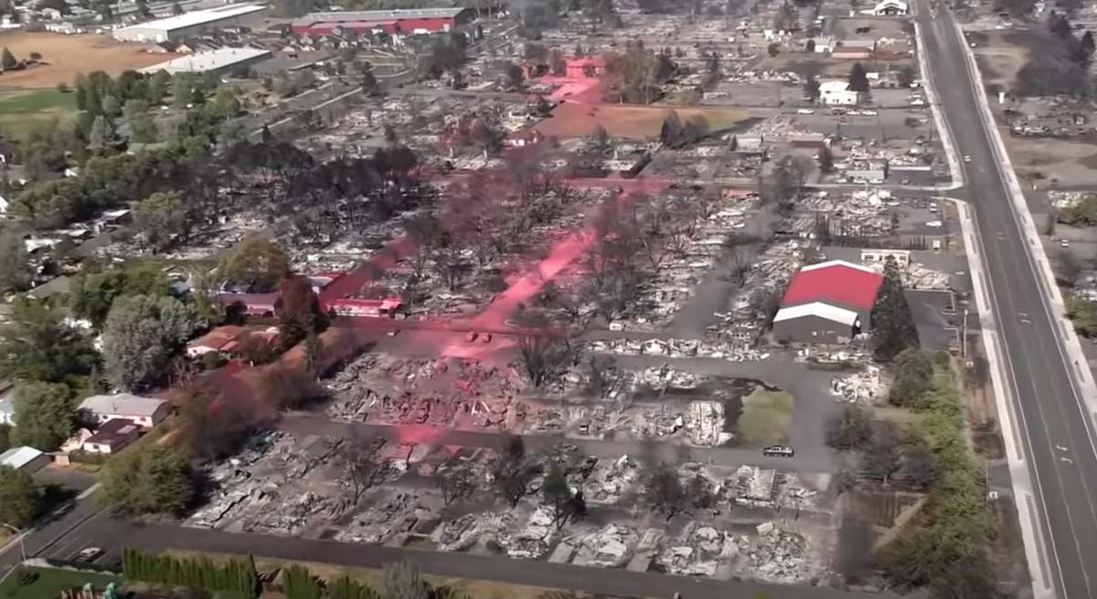
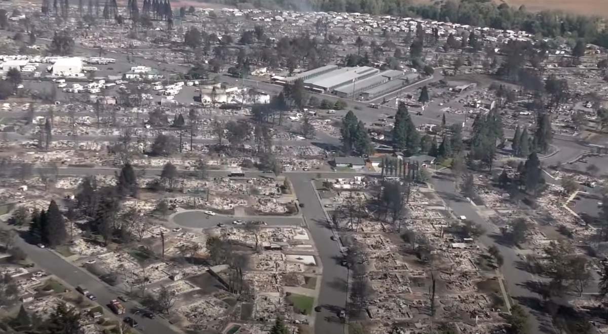
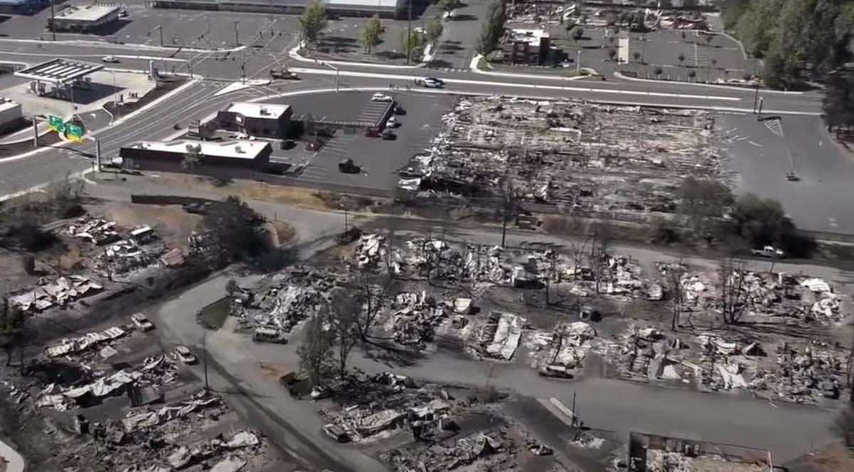
Devastation from the Almeda Drive Fire in the area of Phoenix and Talent in southern Oregon. Screenshot from video shot by Jackson County on September 8, 2020.

The latest official estimate of the number of structures destroyed in the Almeda Drive Fire in southern Oregon on September 8 is 600 homes and 100 commercial buildings. A video appears to indicate that number is conservative.

(Update November 19, 2020: Jackson County estimates 2,357 residences were destroyed in the 3,200-acre fire.)

Authorities have confirmed two deaths. Since lightning and power lines can be ruled out, they have concluded it was human-caused. It is possible the number of fatalities could rise as searches are conducted. It was weeks before searches were concluded after the Camp Fire at Paradise, California. There will be lists of people that are unaccounted for, but many of them will be safe and having difficulty communicating with family and friends.

map Almeda Drive Fire
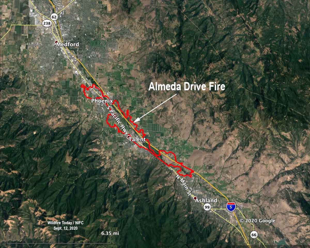
Map of the Almeda Drive Fire

The Oregonian reports officials are considering arson as a possible cause:

Authorities are investigating the Almeda fire as an arson after discovering human remains in Ashland, the city police chief said. The Jackson County’s Major Assault/Death Investigation Unit is investigating the nature of the death of the person found, according to Ashland Police Chief Tighe O’Meara.

“One thing I can say is that the rumor it was set by Antifa is 100% false information,” the police chief said by email. “We have some leads, and none of it points in that direction.”

structures burned Almeda Drive Fire Phoenix Talent Oregon
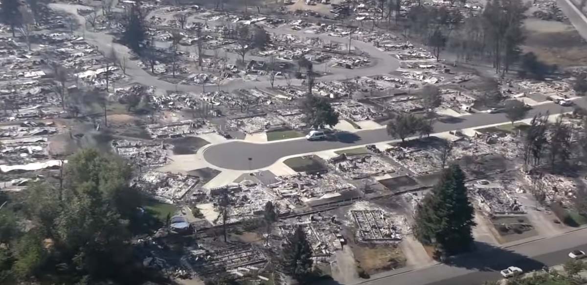
Devastation from the Almeda Drive Fire in the area of Phoenix and Talent in southern Oregon. Screenshot from video shot by Jackson County on September 8, 2020.

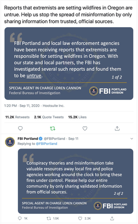
The FBI is asking the public to not waste the time of law enforcement with conspiracy theories and misinformation.

FBI information fires Oregon

To have been so destructive, it is a little surprising that the fire only burned 3,200 acres. The 40 to 45 mph wind on September 8 was from the southeast, which aligned with the Interstate 5 corridor as it burned like a blowtorch for 8 miles, starting north of Ashland and tearing through the cities of Talent and Phoenix. Photos of what remains of the area show retardant drops made by air tankers, a DC-10 and two MD-87s, but they were largely ineffective. This is no surprise, since a wind stronger than 15 or 20 mph can scatter the retardant off target, or if the wind is stronger and turbulent it can be unsafe to operate an aircraft flying low and slow.

The video shot by Jackson County authorities on September 8 is below. It begins near Ashland, then continues up the Interstate 5 corridor through Talent and Phoenix.

Below are more screenshots from the video.

Continue reading “Video shows large number of structures burned during the Almeda Drive Fire in southern Oregon”

Oregon fires have burned about a million acres

An Area Command Team has been mobilized to assist local units in the state

structures burned Almeda Fire Phoenix Talent Oregon
Devastation from the Almeda Drive Fire in the area of Phoenix and Talent in southern Oregon. Screenshot from video shot by Jackson County on September 8, 2020.

It could take some time to count all of the structures that have burned in western Oregon. What is known so far about the huge fires that have burned approximately a million acres in the state is the deaths of seven people have been documented according to state officials. Dozens more, they said, are unaccounted for, but many of those could be safe and are having difficulty communicating with friends and relatives.

The number of people that have evacuated has been fluctuating wildly. The Oregonian reported that the state in a news release Thursday night said an “estimated 500,000 Oregonians have been evacuated and that number continues to grow.” The half-million figure received widespread attention, but after an analysis by the newspaper determined that number could not be accurate, Gov. Kate Brown acknowledged Friday the true number to be far lower, about 40,000. She explained that the higher figure included everyone in some category of evacuation, including “Be Set,” and “Be Ready.”

Map heat wildfires western U.S.
Map of heat detected on wildfires in the western U.S. by satellites September 12, 2020.

The weather next week is expected to be cooler, with decreasing winds and a slight chance of rain on Tuesday and Thursday. This should slow the spread of the blazes and enable firefighters to shift from evacuations to constructing fireline on the perimeters. Up until now, a very, very small percentage of the edges of the fires have containment line.

Doug Grafe, chief of fire protection at the Oregon Department of Forestry, said eight of the large fires “will be on our landscape until the winter rains fall. Those fires represent close to 1 million acres … We will see smoke and we will have firefighters on those fires up until the heavy rains.”

Three Area Command Teams (ACT) were mobilized Thursday to assist local units in suppressing the fires in the western states. One of them, led by Area Commander Joe Stutler, will be coordinating the efforts in northwest Oregon. The other two will be California.

Typically an ACT is used to oversee the management of large incidents or those to which multiple Incident Management Teams have been assigned. They can take some of the workload off the local administrative unit when they have multiple incidents going at the same time. Your typical Forest or Park is not usually staffed to supervise two or more Incident Management Teams fighting fire in their area. An ACT can provide decision support to Multi-Agency Coordination Groups for allocating scarce resources and help mitigate the span of control for the local Agency Administrator. They also ensure that incidents are properly managed, coordinate team transitions, and evaluate Incident Management Teams.

structures burned Almeda Fire Phoenix Talent Oregon
Devastation from the Almeda Drive Fire in the area of Phoenix and Talent in southern Oregon. Screenshot from video shot by Jackson County on September 8, 2020.
Satellite photo smoke wildfires
Satellite photo showing smoke from wildfires at 5:17 p.m. PDT September 11, 2020.