

News and opinion about wildland fire
Labor Day Weekend

Hot, dry and in some cases windy weather will bring elevated wildfire danger to many of the western states through the Labor Day weekend.
Southern California
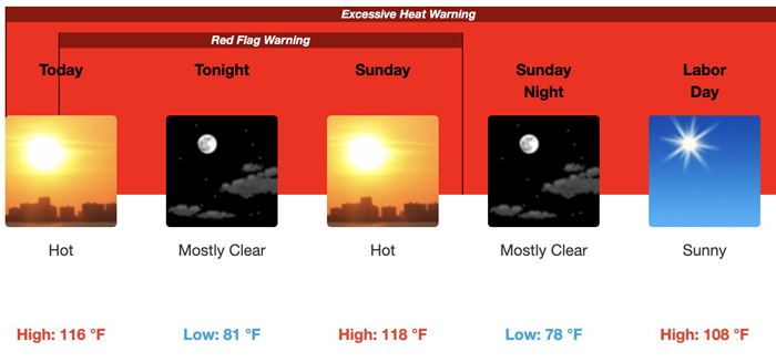
Extreme heat in southern California could set all-time high temperature records with the possibility of rolling power blackouts and more wildfires. Some of the inland cities could have temperatures 10 to 20 degrees above normal through Monday. The hottest days will be Saturday and Sunday, with slightly lower temperatures Monday. Riverside could see highs of 116 on Saturday and 118 on Sunday.
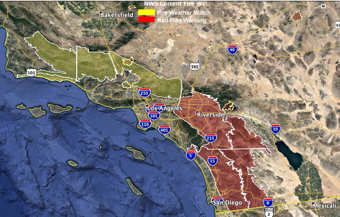
Red Flag Warnings are in effect Saturday for portions of Riverside and San Diego Counties through Sunday at 6 p.m. Forecasters expect east winds of 15 to 20 mph with gusts of 25 to 35 mph, with single-digit humidities in the afternoons.
A Fire Weather Watch for the Los Angeles, Ventura County, and Santa Barbara mountains for Monday evening through Tuesday evening will probably be turned into a Red Flag Warning for gusty sundowner winds from the north or northeast at 15 to 25 mph with local gusts up to 40 mph Saturday, increasing to 15 to 30 mph with local gusts up to 45 mph Sunday evening and Monday evening. The strongest winds will be in the western portions of the Santa Ynez mountains and Santa Barbara south coast.
The National Weather Service did not mince any words in describing the forecast:
The very hot and unstable conditions will bring a significant threat of large plume dominated fires across the region through Labor Day.
Northwestern United States
A strong high pressure ridge centered across the western Great Basin Saturday will bring continued hot and dry conditions through the afternoon and early evening, with temperatures in the 90s and humidities below 15 percent, contributing to potentially extreme fire behavior given the very dry fuel conditions. In central Idaho and western Montana winds are expected to exceed 20-25 mph for several hours Saturday afternoon.
Smoke
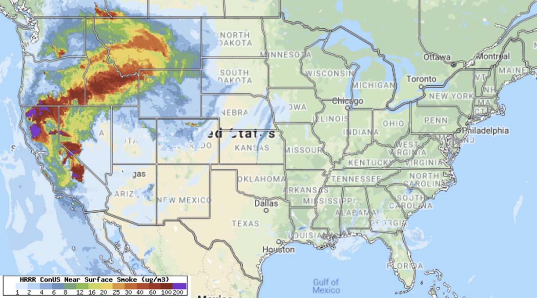
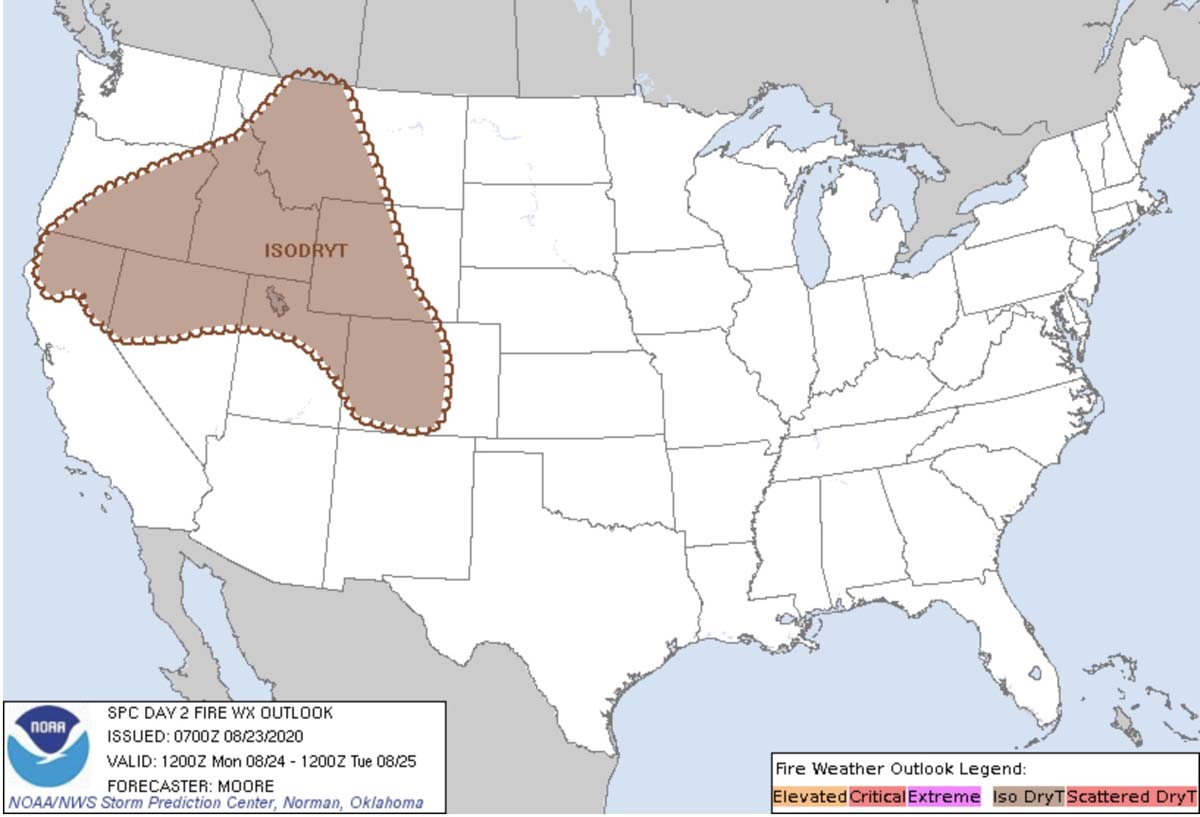
August 23 through 24, partly due to the possibility of dry lightning
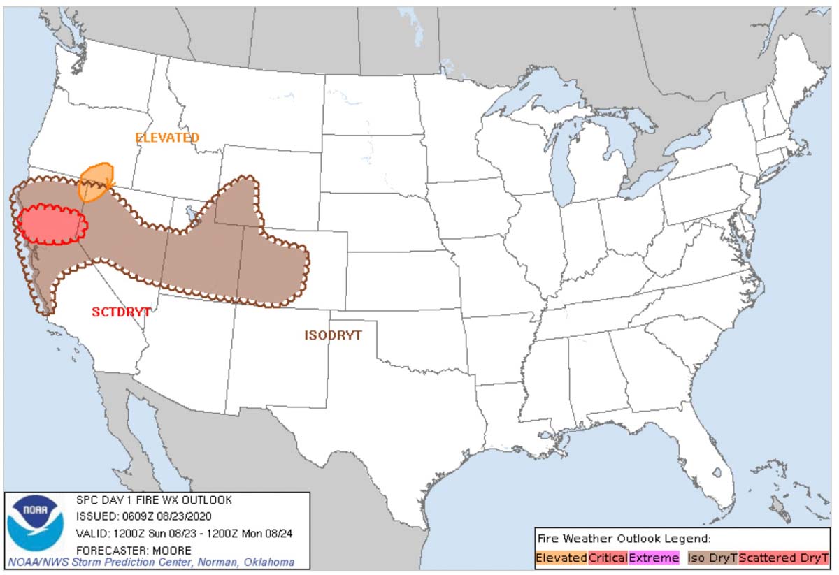
The chance of lightning with little or no rain Sunday and Monday combined with high temperatures and low humidities has led to predictions of elevated fire danger.
Red Flag Warnings are in effect for the northern half of California Sunday and Monday. The highest threat of dry lightning is Sunday afternoon through Monday morning.
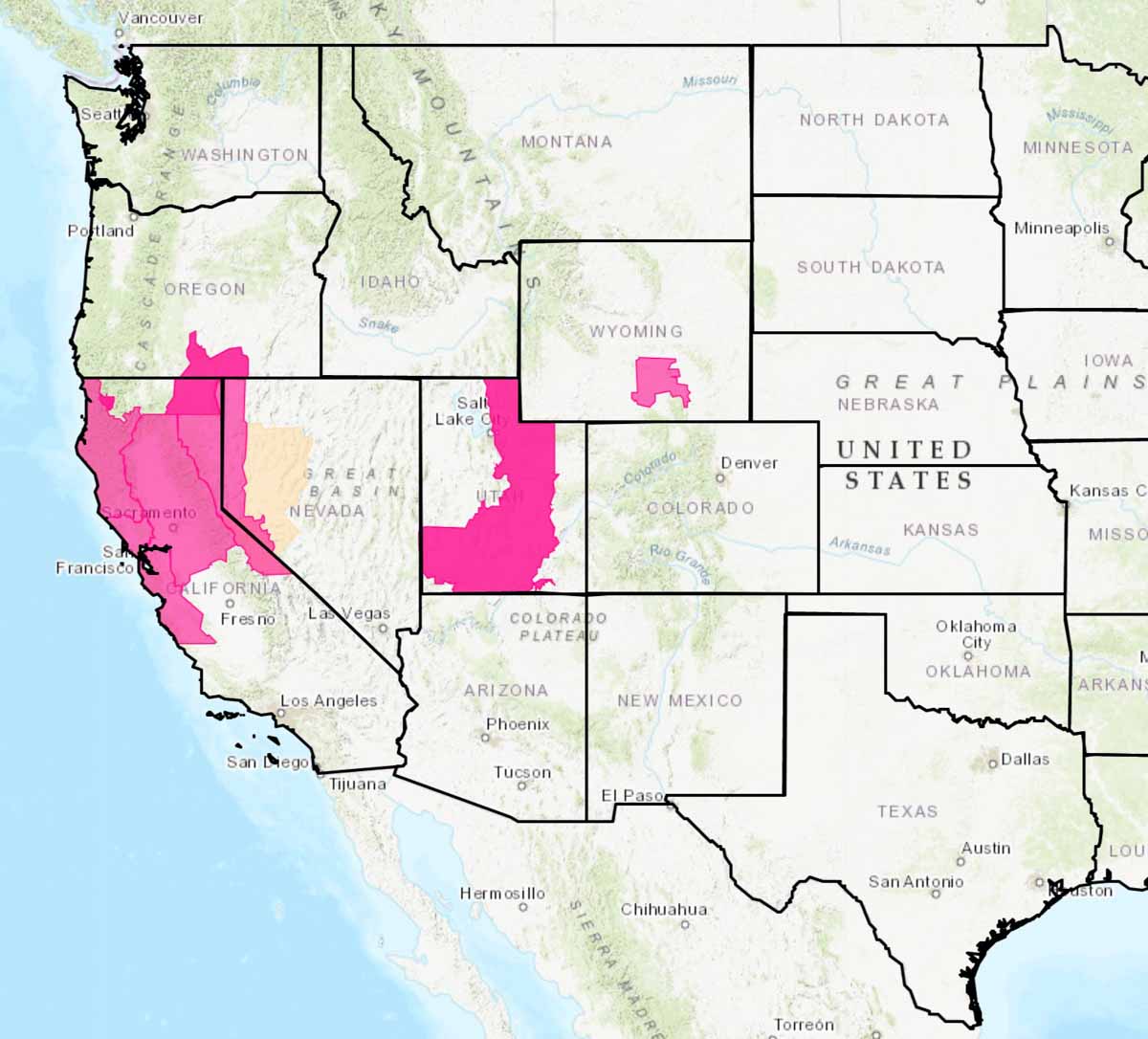
Thunderstorms with little or no rain is what started over 500 fires earlier last week. On Monday scattered or isolated dry thunderstorms could hit northern California and portions of Nevada, Utah, Wyoming, and Colorado. The storms are expected to move farther north Monday.
Nick Nauslar, a Fire Meteorologist at the National Interagency Fire Center in Boise wrote about the forecast in a tweet at 11:30 p.m. Saturday, saying, “Hundreds of new fires are likely if this event pans out.”
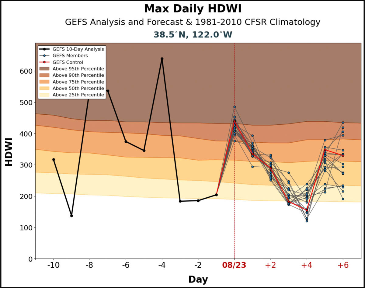
The Hot Dry Windy Index (HDW) predicts higher than normal fire danger for the area of the Hennessey Fire in the Bay Area Sunday through Tuesday. On Sunday it is above the 90th percentile compared to the average for the date. The HDW is a fairly new tool developed for firefighters to predict weather conditions which can affect the spread of wildfires. It is relatively simple and only considers the atmospheric factors of heat, moisture, and wind. To be more precise, it is a multiplication of the maximum wind speed and maximum vapor pressure deficit (VPD) in the lowest 50 or so millibars in the atmosphere. The HDW only only uses weather information – fuels and topography are not considered by HDW at all. If the fuels are wet or have a high live or dead moisture content it will not be reflected in the data.
High temperatures, low RH, and strong winds
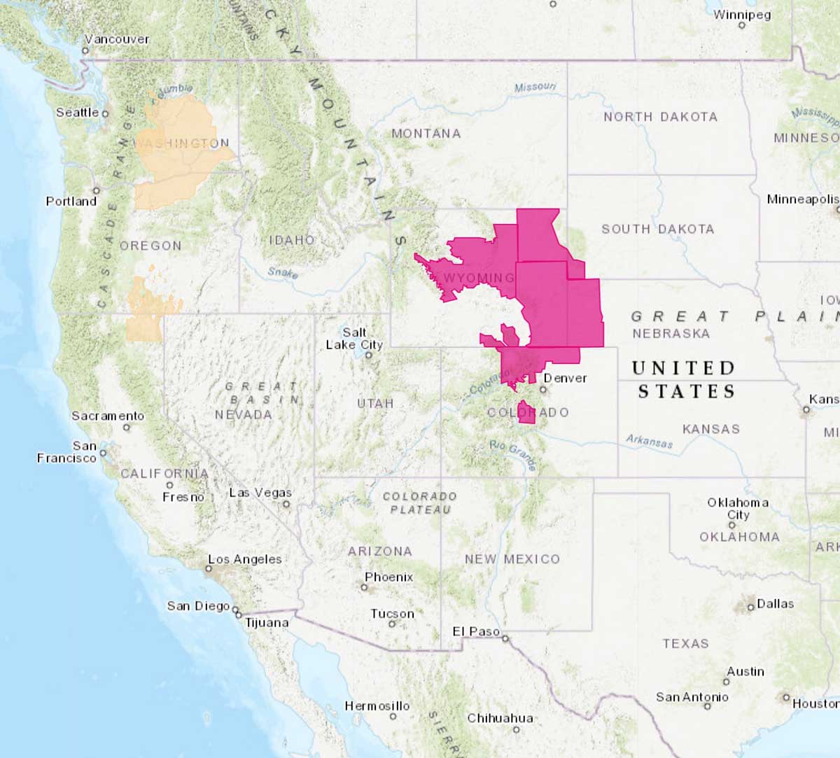
The National Weather Service has issued Red Flag Warnings for July 10 in areas of Wyoming, South Dakota, Nebraska, and Colorado.
Darren Clabo, the South Dakota State Fire Meteorologist, tells us what to expect in his state:
“A Red Flag Warning is in effect for southwestern SD today from 1200 to 2100 hrs. See https://www.weather.gov/unr/ for details.
“A dryline will move pass through southwestern SD at noon today. Following it, temperatures will rise to near 100, RH will drop below 10%, and westerly winds will gust up to 40 mph creating very critical fire weather conditions. Later this evening, a cold front will then move through which will switch the winds to the north but the winds will remain strong through 2200 hrs. No precipitation is expected over southwestern SD with the cold front passage. There will be a ~10 hour window of extremely critical fire weather conditions. Stay aware of your surroundings when on initial attack. This primarily affects Fall River, Custer, and Oglala Lakota Counties.
“Elsewhere across the state, severe weather is likely with large to very large hail, strong winds, and a few tornadoes possible.”
(Red Flag Warnings can be modified throughout the day as NWS offices around the country update and revise their weather forecasts.)
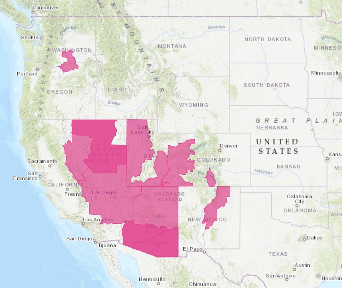
(UPDATE at 2:30 p.m. MDT June 27, 2020: the National Weather Service may or may not have correctly identified the red areas on the map as Red Flag Warning areas for today, Saturday June 27. We are checking to confirm. The image is a screenshot from the NWS web site.)
(Originally published at 9:40 a.m. MDT June 27, 2020)
The National Weather Service has issued Red Flag Warnings for June 27 in areas of Washington, Oregon, California, Nevada, Utah, Arizona, New Mexico, and Colorado. Most of the areas will experience strong winds and low humidities, resulting in enhanced wildfire danger.
(Red Flag Warnings can be modified throughout the day as NWS offices around the country update and revise their weather forecasts.)
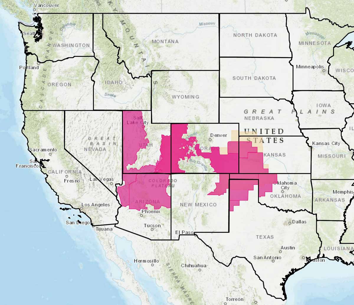
The National Weather Service has issued Red Flag Warnings for June 13 in areas of Utah, Colorado, Arizona, New Mexico, Kansas, Oklahoma, and Texas. Most of the areas will experience strong winds and low humidities, resulting in enhanced wildfire danger.
(Red Flag Warnings can be modified throughout the day as NWS offices around the country update and revise their weather forecasts.)