Dispatch center in Bozeman, MT to close

Reasons cited include difficulty in filling positions

Map -- Custer Gallatin NF western region

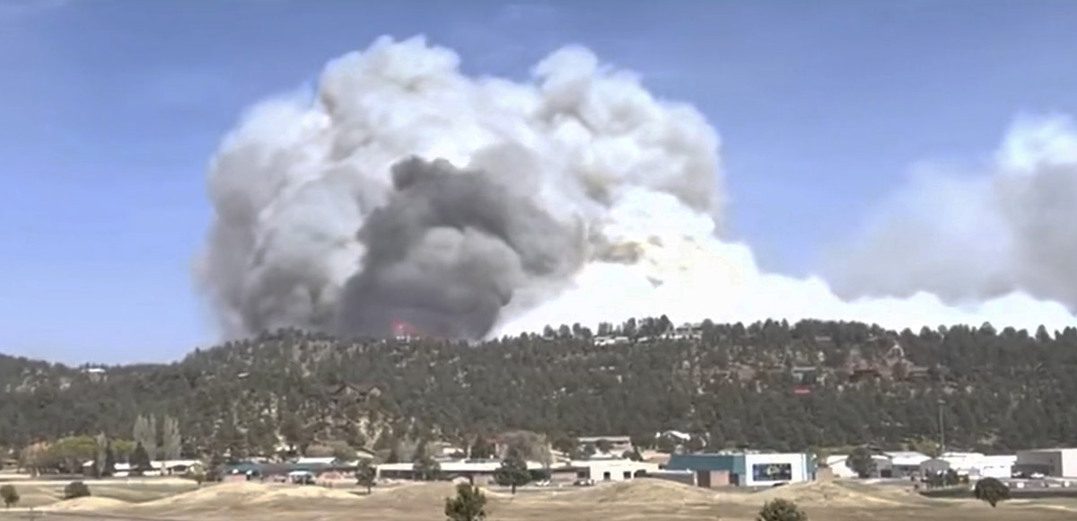
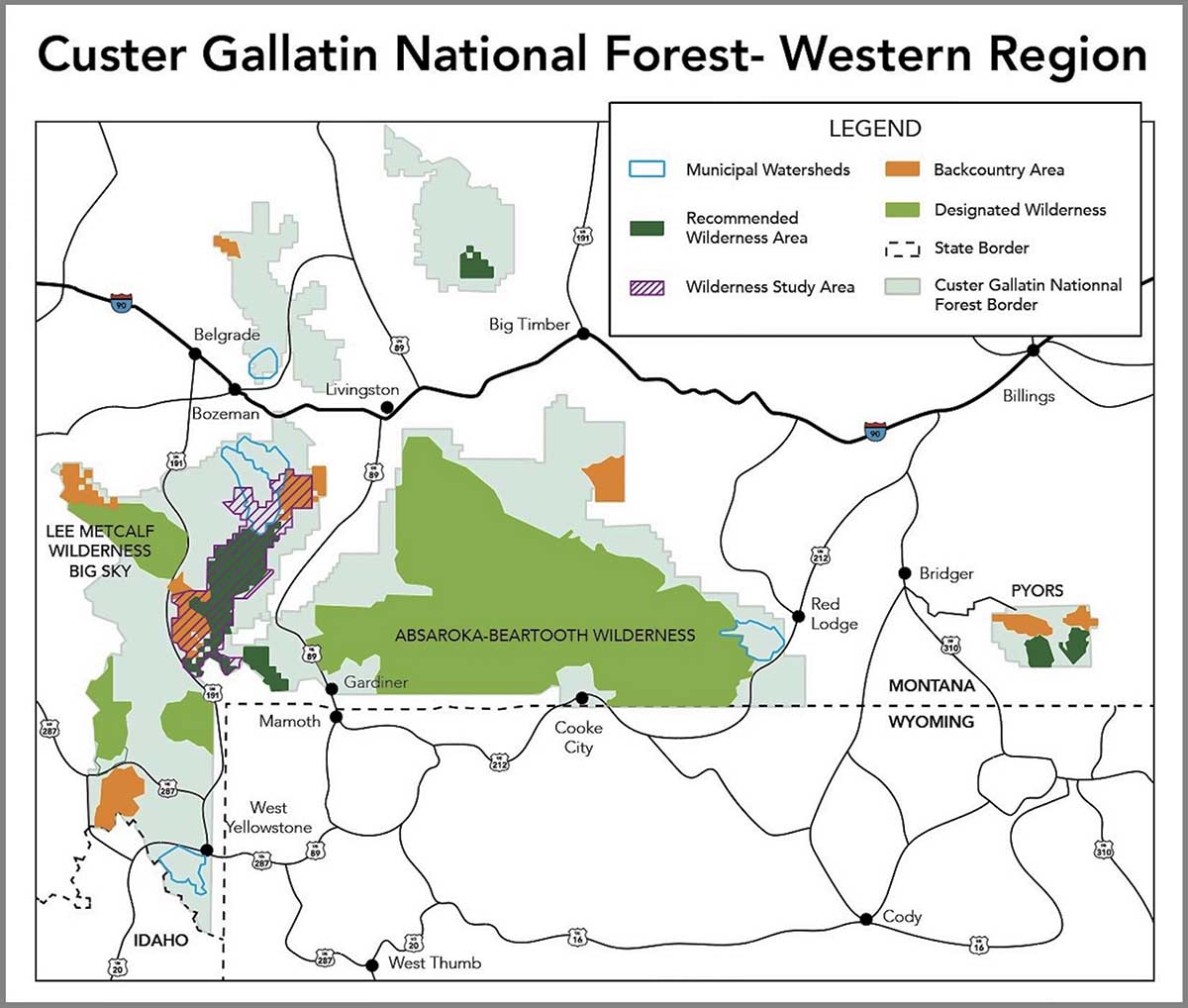
One of the three dispatch centers that serve the Custer Gallatin National Forest in Montana is closing. Bozeman Interagency Dispatch Center has been the smallest of the three and multiple factors over the last decade have created a situation where the center is not sustainable, according to information released by the Forest:

Fire seasons are generally longer and often intense, increasing the expectations from dispatch centers that directly support firefighters. Additional policy changes affecting aircraft dispatching and the cost of living to attract dispatchers to Bozeman, MT are also factors.

Over the last three years, Bozeman dispatch has tried unsuccessfully to recruit and fill the Initial Attack dispatcher position in several separate hiring events. The cost of living in Bozeman was cited as the biggest deterrent to accepting a position.

The Forest Service (FS) and the other agencies staffing the Bozeman Interagency Dispatch Center have decided that the Bozeman-based dispatch center “will transition to Billings,” meaning, Bozeman Dispatch will close.

Marna Daley, the Public Affairs Officer for the Custer Gallatin NF told Wildfire Today that the organizational chart for the Bozeman Dispatch Center had five positions supplied by the Forest Service — two permanent full-time, one permanent part-time, and two seasonals. Because of the difficulty in filling the jobs there, in recent years typically there were only two FS personnel in the office. Ms. Daley said with so many vacant positions at Bozeman, they often brought in detailers or used other methods to take up the slack.

As this transition is occurring, and with it being early in the fire season, only one position is filled, and that person has accepted a different job on the Forest.

dispatch center -- Great Plains in Rapid City, SD
Example of a dispatch center — Great Plains in Rapid City, SD. January 25, 2012.

The Billings Interagency Dispatch Center is staffed by workers not only from the FS, but also the Bureau of Land Management, Bureau of Indian Affairs, and the Montana Department of Natural Resources. The FS’s contribution will be three permanent full-time positions and one seasonal.

But in recent years both Bozeman and Billings have operated at low staffing levels with critical unfilled vacancies. 

“Often throughout a wildland fire season dispatch centers need to operate seven-days/week, round-the-clock schedule to support wildland fire operations, which has proven difficult at current staffing levels,” the FS wrote in a briefing document about combining the two dispatch centers.

The FS described Billings as “A city with a broad base of socially and economically diverse systems including housing, schools, airport, healthcare, childcare, and family necessities associated with the cost of living…A fully staffed Billings Interagency Dispatch Center should also provide a better work-life balance for employees across the spectrum.”

The FS tentatively expects Billings Dispatch to be fully operational with the appropriate radio communications and additional duties on April 18, 2022. Field testing has been going on since March. The phone number to report a fire will be the main dispatch number, 406-896-2900.

Experienced wildland firefighter explains why he resigned

“The agency is failing its firefighters on so many levels,” he said

Truckee Hotshots, hiking firefighters fire
Truckee Hotshots, hiking in. September, 2019. Truckee Hotshots photo.

A wildland firefighter who had worked his way into middle management of the Truckee Interagency Hotshot Crew has publicly resigned. A two-page letter laying out his reasons has been widely circulated, along with a copy of an email written by the Superintendent of the crew, Scott Burghard, discussing the loss of this experienced firefighter. Wildfire Today received both letters from third parties, not the two individuals named in the letters.

Chris Mariano was a GS-6 Squad Boss on Truckee until April 7, 2022. He said drafting the letter was difficult — the best part of his life was working as a hotshot on the Tahoe National Forest, writing:

I prospered — I was all in. I wanted nothing more than to be a hotshot, to be a leader, to care for the land and to be of service. While the sense of purpose and camaraderie remain, I now feel hypocritical to recruit or encourage crew members to work for an agency that is failing to support its fire management programs and thus the public.

The agency is failing its firefighters on so many levels. Classification, pay, work life balance, mental health, presumptive disease coverage, and injury/fatality support. There are efforts to correct some of these issues but for many it is too little too late…We are losing people at a terrifying rate at a time when wildfires burn longer, hotter, more frequently, and with devastating severity.

Mr. Mariano became an expert at operating drones, unmanned aerial systems (UAS), for the US Forest Service and was qualified as an FAA Commercial UAS Operator. He was the first UAS pilot in Region 5 (California) and was certified for UAS aerial ignition, test and evaluation pilot, inspector pilot, and was on a national instructor cadre for UAS aerial ignition. He had hoped to move into a full time UAS position with the Forest Service but as a GS-6 he was not officially qualified to apply.

“I plan to move into the private sector to continue training men and women to operate UAS,” Mr. Marino said, “and assist in the development of unmanned technologies to assist in wildfire suppression and prevention.”

Below is the letter from his supervisor, Scott Burghard, and following that, is a .pdf of the letter from Mr. Marino.


“Tuesday, April 12, 2022
Subject: Another IHC Resignation

“I am distributing the resignation letter of my Squad Boss Chris Mariano.  Chris is the employee every supervisor dreams of hiring.  His work ethic is unrivaled.  His selfless commitment is unbelievable.  He has battle tested, boots on the ground operational experience.  He was instrumental in bringing UAS to the fireline and introducing technologies to a technologically stagnant environment.  He is a creative problem solver.  He is a strong communicator.  He is intelligent, inclusive, dedicated, committed, passionate, professional… you name it.  Chris is the epitome of what the agency should be cultivating as a leader… not losing.  The fireline will miss him.  The agency will miss him.  I will miss him.  And my job will be tremendously more challenging without him, and my crew will be less effective and capable because of it.

“Chris’s resignation hits close to home, and very hard.  Watching the mass exodus of our operational knowledge is one of the saddest evolutions I have witnessed.  Many of my fire assignments have transformed from operationally focused suppression tactics to exercises in preserving human life.  We do not have the tacit knowledge, operational competence, or resource capacity to be effective with the scale of wildfire complexity we are facing.  Because, we have not supported our Firefighters.  We cannot fill our vacancies.  In the rare circumstance we are successful at hiring we are replacing training and operational experience with a lower degree of aptitude.  Fire behavior, fire size, and fire severity have increased exponentially over the last decade.  In contrast, the agency response has been on the opposite trajectory.  Every aspect of our wildfire suppression workforce is struggling to retain, recruit, and simply staff.  On the ground and in the air.  How are we allowing this to happen?  Was the devastation of the last few fire seasons not a compelling illustration?  How is the threat of entire ecosystems, communities and human life being incinerated not prioritized appropriately?  When is the agency going to adequately address staffing, retention and the needs of its wildfire suppression programs?  Wildfires certainly aren’t waiting…

“Chris is more than an empty seat in a crew haul.  He is more than a vacant name on an org chart.  He is more than a statistical loss.  His absence will be felt.  And the absence of the many somehow incalculable resignations will be felt.  His resignation embodies every deficiency that will contribute to the biblical destruction ahead of us.

“Respectfully,

“Scott Burghardt
Superintendent Truckee Hotshots
Forest Service”


[pdf-embedder url=”https://wildfiretoday.com/wp-content/uploads/2022/04/Letter-of-Resignation.pdf” title=”Letter of Resignation Chris Mariano”]

Officials say 207 homes destroyed in McBride Fire in New Mexico

Two people were found deceased at a home inside the fire perimeter

Updated at 10:20 a.m. MDT April 16, 2022

McBride Fire, New Mexico April 16, 2022
McBride Fire, Ruidoso, New Mexico. Posted by the Incident Management Team April 16, 2022.

The perimeter of the McBride Fire at Ruidoso, New Mexico did not change in any significant way Friday, even as a few pockets of vegetation in the interior burned, putting up occasional bursts of smoke. Firefighters have been mopping up to further secure the fire’s edge. Dozers and ground crews are working on the north side in the rugged, tough country in the Eagle Creek area. On the east edge where the fire is burning in old fire scars, crews are scouting for potential control lines, such as old two track roads.

Some evacuations have been lifted, but others remain in place. The list, updated once or twice a day, is posted online.

The Incident Status Summary filed Friday evening shows resources working on the fire include 5 hand crews, 23 fire engines, and 3 helicopters. In a Saturday morning briefing the Information Officer said a total of 299 personnel were assigned. The number of homes destroyed remains at 207.


Updated 8:28 a.m. MDT April 15, 2022

Map McBride Fire 8:15 p.m. April 14, 2022
Map showing the perimeter of the McBride Fire (in red) at 8:15 p.m. April 14, 2022. The black line was the perimeter about 24 hours before.

The McBride Fire at Ruidoso, New Mexico grew by about 300 acres Thursday and was mapped that night at 6,162 acres. The changes in the perimeter, some of which could be attributed to more accurate mapping or tactical burning operations, were on the southeast side north of the intersection of Gavilan Canyon Road and US 70 and on the northeast side near Eagle Creek Canyon Road.

Again on Thursday, more moderate winds allowed helicopters to assist firefighters on the ground by dropping water. Crews worked on constructing or securing fire lines on the east and south sides. On the northeast side dozers worked with firefighters to construct fire line. Crews put out any remaining hotspots on the southwest side, focusing on the areas where structures were damaged or destroyed.

Resources assigned to the McBride Fire Thursday evening according to the National Situation Report and the Incident Status Summary report, included 1 hand crew and 15 fire engines, for a total of 138 personnel. The report showed no helicopters even though Incident Commander Dave Bales said in a Thursday afternoon briefing that helicopters had been dropping water.

The Nogal Canyon Fire which is being suppressed by the same Incident Management Team is burning on the Lincoln National Forest 12 miles northwest of Ruidoso, southwest of Nogal. Thursday afternoon officials said it had burned 394 acres, an increase of 49 acres in 24 hours. About 65 personnel are assigned that blaze.


Updated 9:45 a.m. MDT April 14, 2022

McBride Fire perimeter at 7:30 p.m. April 13, 2022 fire history
McBride Fire perimeter (in red) at 7:30 p.m. April 13, 2022. Seen also are fires from 2011 and 2000.

The McBride Fire at Ruidoso, New Mexico spread further to the northeast Wednesday, burning an additional 300 acres on the north side of  Eagle Creek Canyon Road.

Thursday morning fire officials said the 5,736-acre fire has destroyed 207 homes. That number does not include outbuildings. Tuesday night, just hours after the fire started, officials said structures were lost in the areas of McBride, Gavilan Canyon, Fawn Ridge, Homestead Acres, and Lower Eagle Creek.

An elderly couple was found deceased at a home on Gavilan Canyon Road in Ruidoso on Tuesday. Law enforcement personnel found the couple after a report from a family member that they were unaccounted for.

Continue reading “Officials say 207 homes destroyed in McBride Fire in New Mexico”

Hermits Peak Fire spreads further east prompting more evacuations

Updated at 8:25 a.m. MDT April 14, 2022

Map Hermits Peak Fire
3-D Map of the Hermits Peak Fire, looking west-southwest. The red line represents the perimeter at 7:30 p.m. April 13, 2022. The white line was the perimeter at 3 a.m. MDT April 13, 2022.

Operations Section Chief Shilow Norton said that decreasing winds on Wednesday allowed firefighters to make significant progress on the Hermits Peak Fire 12 miles northwest of Las Vegas, New Mexico. They used helicopters to drop water on the southeast side of the fire to support dozers as they constructed fire line. Crews nearly completed that line and hand crews worked through the night on steep portions of the east end that were inaccessible to dozers.

On the northeast side, south of the 266 Road and the Sapello River, firefighters were able to put in fire line in areas where the fire had moved out of the timber and into grass. Dozers also put in direct fireline south and southwest of San Ignacio.

Click to see all articles on Wildfire Today, including the most recent, about the Calf Canyon, Hermits Peak, and Cooks Peak fires.

Mapping Wednesday evening determined that the fire had burned about 7,000 acres.

Sheriff Chris Lopez said initial assessments have found five outbuildings that were destroyed but have not seen any homes that burned.

A Red Flag Warning is in effect Thursday for southwest winds 20 to 30 mph gusting to 40 with relative humidity of 4 to 10 percent.


12:03 p.m. MDT April 13, 2022

3-D Map Hermits Peak Fire 3 a.m. April 13, 2022
3-D Map Hermits Peak Fire. Looking west-southwest at 3 a.m. April 13, 2022.

The Hermits Peak Fire spread nearly four miles to the east on Tuesday, growing to 6,276 acres by Tuesday night according to the Santa Fe National Forest. (Reports from other government sources put it at 7,900 acres.) The fire is 12 miles northeast of Las Vegas, New Mexico. The east side of the fire has moved into flatter terrain, providing better access for firefighters. But until the wind speeds decrease, they will primarily be following the fire, picking up a few sections of the flanks as the head continues to move.

In a Wednesday morning briefing  Operations Section Chief Shilow Norton said winds with sustained speeds of 48 mph gusting to 60 caused spot fires east of the fire Monday night. The fire continued to spread to the east-northeast on Tuesday and moved through the community of Las Dispensas. The 20 homes there had been prepped by firefighters in the last few days to reduce the chance of them burning. Mr. Norton said firefighters had to leave when the fire came through on Tuesday and later came back, but to his knowledge all of the homes were saved. The fire also impacted San Ignacio and Las Tusas. Firefighters are having some success, he said, in holding the northeast side of the fire in several places in the drainage along the Sapello River.

To see all articles about the Hermits Peak Fire on Wildfire Today, including the most recent, click HERE.

When the wind dies down, said Mr. Norton, previously completed fuel treatments east of the fire southwest of Sapello could be helpful in slowing the spread, allowing firefighters to take direct action. But with 48 mph winds, virtually nothing will stop the head of the fire. The wind has made it impossible for air tankers and helicopters to be effective.

Map Hermits Peak Fire 3 a.m. MDT April 13, 2022
Map, Hermits Peak Fire. The red line was the perimeter at 3 a.m. MDT April 13, 2022. The white line was the perimeter at about 9 a.m. April 12, 2022.

The extreme fire activity prompted additional evacuations affecting the Canoncito area in the Manuelitas Creek drainage, locations near Manuelitas, and north of Gallinas.

Evacuations

The San Miguel County Sheriff’s Office has issued evacuation orders using the Ready, Set, Go! system. The following areas are in Go status (i.e., residents should be evacuating): Las Dispensas, Pendaries Village, San Ignacio, Las Tusas, Lone Pine Mesa, Canoncito, La Canada, Manuelitas, Lower Canyon Road in Gallinas Canyon and La Tewa, Chavez, County A3, Southwest Sapello, and Southern Tierra Monte-Canyon. The following areas are in Set status (i.e., residents should be preparing for a potential evacuation): Upper Rociada, Rociada, Pendaries Valley East, Penasco Blanco, South Carmen, Northern Tierra Monte-Canyon, Big Pine, Canovas Canyon, El Porvenir, Gallinas, and Trout Springs. An evacuation shelter is available at the Old Memorial Middle School gym located at the corner of Legion and Old National in Las Vegas, NM.

Weather

Red Flag Warnings are again in place for strong winds and low humidity. After a hard freeze Wednesday morning, it will be sunny and cool, with high temperatures far below normal.

McBride Fire starts near Ruidoso, NM as winds were gusting over 70 mph

Burned thousands of acres in the first few hours

Updated at 9:02 a.m. MDT April 13, 2022

Map, McBride Fire April 12, 2022
Map, McBride Fire April 12, 2022. (the time is uncertain)

The Incident Management team’s latest update on the McBride Fire was Tuesday night at 9 p.m. At that time the size was listed at 4,138 acres. Approximately 150 structures have burned.

The blaze spread very rapidly after it started Wednesday afternoon. The fire behavior was described by firefighters as extreme, with crowning and spotting as it burned to the northwest through timber and grass.

To see all articles on Wildfire Today about the McBride Fire, including the most recent, click HERE.

Mandatory evacuations are in place for the area around Moon Mountain, McBride/Snowcap/Timberline, Eagle Creek, Homestead Acres, Rancho Ruidoso Valley Estates, Deer Valley, Deer Park, and Alto east of Flute Player. The Ruidoso Convention Center is accepting evacuees. More evacuations are possible. The Lincoln County Fairgrounds, Roswell Animal Shelter, and Otero Fairgrounds are open for those who need to evacuate with livestock.

3-D Map, McBride Fire, April 12, 2022
3-D Map, McBride Fire, April 12, 2022. Looking north.

The area is under a Red Flag Warning again on Wednesday. The spot weather forecast for the McBride Fire issued at 1:40 a.m. on Wednesday, said, “The ongoing light precipitation will end in the next 3 hours with no accumulation expected.” On Wednesday it will be sunny. The winds will be out of the west at 16 mph with gusts to around 31 mph, with a minimum humidity of 6 percent. Wednesday night will see no humidity recovery with a maximum of 16 percent and 10 to 14 mph winds gusting to 26 out of the southwest and west. Thursday should bring west winds of 7 to 14 mph with 7 percent relative humidity.

A Type 1 Incident Management Team, Southwest Team #2, is mobilizing.


Updated at 8:15 p.m. MDT April 12, 2022

The Village of Ruidoso released an update on the McBride Fire at 7 p.m. Tuesday:

An air attack update has decreased the estimated acreage to 3,000. At this time 150 homes and structures have been lost. This is an active fire and is at 0% contained.

A mandatory evacuation notice is in order for Moon Mountain, Gavilan Canyon, Hull Road and Paradise Canyon. If you live in those areas please evacuate to the Ruidoso Convention Center. Mandatory evacuations are already in place for Eagle Creek, Homestead Acres, Rancho Ruidoso Valley Estates, Old Fort Stanton Road, and Airport Road. More evacuations are possible.

The Ruidoso Convention Center is open and the Red Cross is on site to assist those who have evacuated. The Lincoln County Fairgrounds are currently full but the Roswell Animal Shelter and Otero Fairgrounds are open for those who need to evacuate with livestock.

Crews were able to knock back the fire near the Ruidoso Middle School and evacuate 1,700+ students in 1.5 hours from Ruidoso High School, Ruidoso Middle School and Elementary Schools to the Ruidoso Convention Center. Ruidoso Municipal Schools have cancelled school for Wednesday, April 13, 2022.


6:53 p.m. MDT April 12, 2022

map Satellite image smoke McBride Fire at 5:11 p.m. MDT April 12, 2022 New Mexico
Satellite map showing smoke from the McBride Fire at 5:11 p.m. MDT April 12, 2022. NOAA.

After the McBride Fire started near McBride Drive in Ruidoso, New Mexico at approximately 2:30 p.m. April 12 it spread very rapidly pushed by winds recorded at the nearby Smokey Bear weather station at 40 mph sustained, gusting at one point to 80 mph. The winds all day in Ruidoso have been out of the southwest and the relative humidity in the afternoon dropped to 19 percent.

There are reports of multiple structures having been destroyed.

At 5 p.m. the Lincoln National Forest said on their Twitter account that it had spread to 15,000 acres and “Ruidoso residents N of Ruidoso High School need to evacuate immediately.” Specifically, areas being evacuated include Gavilan Canyon Road, Homestead Loop, Eagle Creek, Blue Lake Drive, Mira Monte Road, and east of Fort Stanton Rd. The Ruidoso Convention Center is accepting evacuees. (Later that 15,000-acre figure was reduced to 3,000 acres.)

map firefighting aircraft orbits over the McBride Fire in New Mexico
A firefighting aircraft orbits over the McBride Fire in New Mexico at 6:22 p.m. MDT April 12, 2022. ADSB Exchange map.

The fire has been spreading to the northeast toward the Sierra Blanca Regional Airport.

The local power company, PNM, shut off the electricity to 18,400 customers because the fire was moving toward a transmission line.

Within a few hours after the fire started a Type 1 Incident Management Team used for the most complex emergency incidents was ordered. It is very rare for this type of team to be requested a few hours after a fire is first reported.

With 40 mph winds gusting to more than 70, helicopters and fixed wing firefighting aircraft can’t be used safely or effectively. A small twin engine aircraft has been orbiting the fire at 17,000 feet providing intelligence and looking for opportunities to engage the fire.

McBride Fire
McBride Fire. From Melissa Gibbs KRQE video April 12, 2022.

Another fire that started on Tuesday, the Nogal Canyon Fire, is also burning on the Lincoln National Forest 12 miles northwest of Ruidoso, southwest of Nogal. Judging from heat detected by satellites it is spreading rapidly. The Forest Service said at about 4 p.m. Tuesday that all of Nogal Canyon was under an evacuation order.

Thanks and a tip of the hat go out to Tom.

PG&E reaches settlements with 6 counties for Kincade and Dixie Fires

Will pay $55 million and avoids criminal charges

Kincade Fire map, final, November 9, 2019
Kincade Fire map, final, November 9, 2019.

Pacific Gas and Electric reached an agreement Monday with six Northern California Counties to avoid criminal charges for the company’s role in igniting two very large destructive wildfires, the 2021 Dixie Fire and the 2019 Kincade Fire. The settlement means the district attorneys in the six counties will not pursue criminal charges against the company, or if they have already been filed, will be dismissed.

The Dixie Fire burned on the Plumas National Forest, Lassen National Forest, Lassen Volcanic National Park, and across five counties: Butte, Lassen, Plumas, Shasta and Tehama. The Kincade Fire was in Sonoma County.

The agreements with the counties does not prevent the US Attorney from filing criminal charges for the Dixie Fire. Nor does it prevent civil litigation from property owners. The Sacramento Bee reported that PG&E said it expects liabilities from the Kincade Fire to reach $800 million and the Dixie Fire to be $1.15 billion.

The Dixie and Kincade Fires, caused by PG&E power lines, burned 963,000 and 77,758 acres respectively.

In the settlement PG&E agreed to pay $55 million over a five year period. About $35 million will go to local organizations, volunteer fire departments, local schools, Rotary Clubs, Chambers of Commerce, fire safe councils, and other non-profits. The company will pay a $7.5 million civil penalty to Sonoma County related to the Kincade Fire and a $1 million civil penalty to each of the five North Valley counties related to the Dixie Fire. PG&E said they will not seek recovery of these costs from customers.

Details of some of the payments, according to PG&E, include:

Wildfire Safety

  • Local Safety Workforce: Adding 80-100 new PG&E jobs based in Sonoma County, as well as 80-100 more positions collectively across Butte, Lassen, Plumas, Shasta and Tehama counties. These new positions will increase PG&E’s local expertise and presence focused on completing critical safety work in these communities.
  • Local Inspection and Work Commitments: Executing specific safety work and inspections in the six counties including commitments to carry out vegetation management and equipment inspections, which will be reviewed and verified by the independent monitor.

Local Community College Partnerships

  • Fire Technology Training Program: Committing to work collaboratively with Santa Rosa Junior College (SRJC) on efforts to expand and enhance the College’s Fire Technology Program of the Public Safety Training Center, including providing funding and sharing PG&E wildfire safety know-how and learnings. The company also will provide funding to campuses in the six counties which, at the discretion of the colleges, can be used for site acquisition and development, equipment purchases, and developing and implementing fire technology program curriculum.
  • Vegetation Management Training Program: Providing funding and assisting in the creation of new utility vegetation management training programs at SRJC and several campuses across the North Valley. These programs will be modeled after coursework that debuted at Butte College in 2020.

Direct Payment Program to Accelerate Community Recovery

  • PG&E will launch a new Direct Payments for Community Recovery program with an online tool where individuals whose homes were destroyed by the Dixie Fire can submit claims for expedited review, approval and payment. PG&E will verify the claims and make offers based on an objective, predetermined calculation. Claimants who accept the offers will receive payment, typically within 30 days of accepting an offer and within 75 days of first submitting a complete claim. PG&E has also agreed to provide in-person and telephone customer support centers to navigate this new program.
Firefighters on the Dixie Fire
Firefighters on the Dixie Fire, Strike Team 9163G. CAL FIRE photo.