Researchers find that nearly half of lightning down strikes in California occur with little or no rain

Researchers studied the climatology of dry lightning in California

Dry Lightning, California
(B) Total number of dry lightning flashes across three elevation zones (<1000 m, 1000–2000 m, >2000 m) within the domain for each month between 1987–2020. Text indicates the area of each elevation zone, and inset map shows the geographic distribution of the elevation zones and major mountain ranges. (D) The three elevation zones for each month (bars). Dashed lines in (D) indicate the dry lightning fraction averaged across all months for each zone. Blue dashes in (D) represent the dry lightning fraction computed from all months and elevation zones. (From the paper)

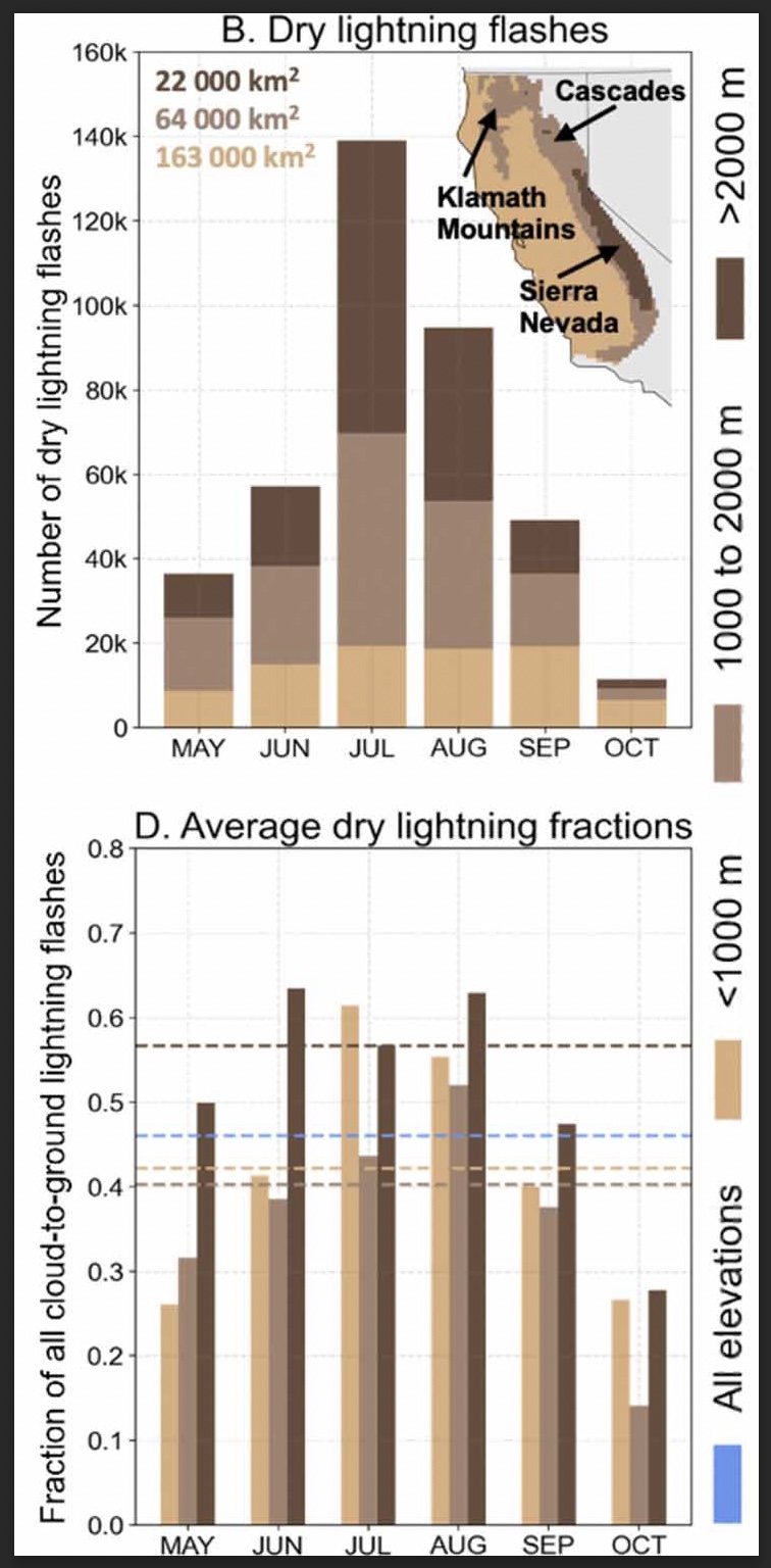
A group of six researchers who studied the occurrence and characteristics of cloud to ground lightning in Central and Northern California found that nearly half, 46 percent, was dry, accompanied by less than 0.1 inch of precipitation.

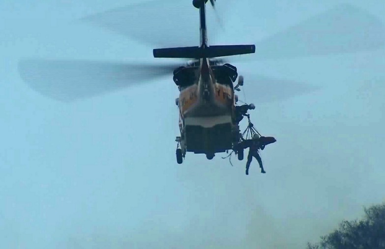
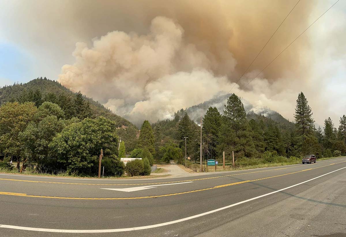
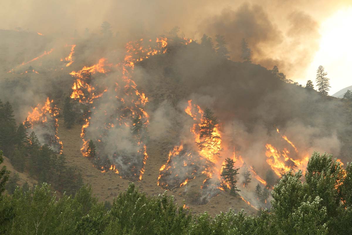
Of course dry lightning is the bane of land managers and is much more likely to ignite a wildfire than a wet thunderstorm. And on the occasions when there are thousands of down strikes, it can overwhelm the capacity to suppress what can be hundreds of fires.

The six scientists used daily gridded lightning and precipitation observations (1987–2020) in combination with atmospheric reanalyses, to characterize the climatology of dry lightning and the associated meteorological conditions during the warm season (May–October) when wildfire risk is highest.

The paper the group produced is available as open source: “Meteorological and geographical factors associated with dry lightning in central and northern California.”

Daniel Swain, a prolific user of Twitter, used the platform today to highlight some of the group’s findings. In the tweet below, click on “read reply” to see more discussion and illustrations.

The six researchers who participated in the project were Dmitri A. Kalashnikov, John T. Abatzoglou, Nicholas J. Nauslar, Daniel L. Swain, Danielle Touma, and Deepti Singh.

Firefighters are scouting for potential control lines on the Cedar Creek Fire in Western Oregon

11:20 a.m. PDT August 7, 2022

Cedar Creek Fire, mapped at 3:07 a.m. PDT Aug. 7, 2022
Cedar Creek Fire, looking east at 3:07 a.m. PDT Aug. 7, 2022

The Cedar Creek Fire on the Willamette National Forest in Western Oregon was very active when it was mapped by a fixed wing aircraft at about 10 p.m. Saturday, and also during a satellite overflight at 3 a.m. Sunday. Spot fires were observed 800 feet ahead of the main fire.

It has burned 1,822 acres since it started from a lightning strike August 1, one of 20 to 30 fires ignited by lightning that night. Most of it is burning on a plateau with a steep slope on the south side. The blaze is north of Highway 58, 14 air miles east of Oakridge, and 2 miles west of Waldo Lake.

Cedar Creek Fire, mapped at 3:07 a.m. PDT Aug. 7, 2022
Cedar Creek Fire, mapped at 3:07 a.m. PDT Aug. 7, 2022.

A Type 1 incident management team assumed command on August 5. Since then the team has been scouting for opportunities to safely engage the fire.

Currently there are no evacuations in effect.

Update at 11:57 a.m. PDT August 9 2022.
It turns out that there is a major error in the National Interagency Fire Center fire history database. In the map below we created using their data, the polygon shown as the 68,000-acre 1991 Warner Creek Fire is completely in error and does not exist at that scale or at that location. The polygon that was not identified in the NIFC database that we labeled as “Unknown fire name in the 1990s”, is actually the 8,900-acre Warner Creek Fire of 1991. We regret the error. This is not the first time we have seen gross errors in the NIFC fire history database, especially for Oregon, and causes us to question ever using it again.

Fire history near the Cedar Creek Fire

The 1996 Charlton Fire which burned 9,000 acres is 3 miles to the northeast on the north side of Waldo Lake.

Cedar Creek Fire Oregon 11 a.m. August 6, 2022
Cedar Creek Fire looking north at 11 a.m. August 6, 2022. InciWeb photo.

In the video below recorded Sunday morning, Operations Section Chief Kyle Cannon describes the current situation.

Book about California’s female inmate firefighters

“Breathing Fire” by Jaime Lowe

Injured inmate hoist helicopter
Firefighter Shawna Lynn Jones was airlifted after being injured in Malibu on Feb. 25, 2016. (Credit: KTLA)

The third California state inmate to die since 1943 while incarcerated and fighting a wildland fire was a woman. In the early hours of the morning on February 25, 2016 while fighting the Mulhollan Fire near Malibu as part of a hand crew, Shawna Lynn Jones, 22, was struck by a boulder that rolled down a hill. She was airlifted to UCLA Medical Center where she was treated for major head injuries. Ms. Jones was removed from life support after her organs were donated, in keeping with her family’s wishes.

This tragedy is one of the stories covered in a book by Jaime Lowe about California’s female inmate firefighters, “Breathing Fire: Female Inmate Firefighters on the Front Lines of California’s Wildfires.”

Here is an excerpt from a review by Erin Berger in Outside Magazine.

But Lowe makes a clear distinction between professional firefighting in the free world and the carceral system’s employment of inmates as firefighters. “All the women I spoke with could see the benefits of the firefighting program, but most bristled at the idea that they had volunteered,” Lowe writes, citing the litany of reasons an inmate would consider such a dangerous job more desirable than the conditions in prison, which include sexual assault, neglect for the sick or mentally ill, and poor nutrition. “‘Volunteer’ is a relative term for the incarcerated.”

Breathing Fire
Macmillan

Six Rivers Lightning Complex of fires emerges in Northern California

Near Willow Creek east of Eureka

Updated 7:19 a.m. PDT August 7, 2022

SRF Lightning Complex 3:07 a.m. Aug. 7, 2022
Six Rivers Lightning Complex, north end. The red shaded areas were the perimeters at 8:32 p.m. Aug. 6.

Saturday night at 8:32 a fixed wing aircraft mapped four of the eight fires on the Six Rivers National Forest that comprise the Six Rivers Lightning Complex of fires. The three closest to Willow Creek and east of Highway 299 at that time were the Bremer (213 acres), Campbell (1,526 acres), and Cedar (250 acres).

As can be expected when a dozen fires all start at about the same time in rugged country, there has been some confusion about the names of the fires. We did the best we could to sort that out, but the names on these maps could be subject to change.

Evacuations are in effect. Evacuation zones can be found at community.zonehaven.com. An evacuation center has been established at Trinity Valley Elementary School, at 730 Highway 96, Willow Creek. For more information and up-to-date evacuation information go to humboldtsheriff.org/emergency, or Humboldt County Office of Emergency Services or Trinity County Office of Emergency Services.

Six Rivers Lightning Complex
Six Rivers Lightning Complex, south end. The red shaded areas were the perimeters at 8:32 p.m. Aug. 6. The red dots represent heat detected by a satellite at 3:07 a.m. August 7, 2022.

The Type 2 Incident Management Team 11, led by Incident Commander Christopher Fogle, will assume command August 7th at 6:00pm.

Six Rivers Lightning Complex
Six Rivers Lightning Complex. The red shaded areas were the perimeters at 8:32 p.m. Aug. 6. The red dots represent heat detected by a satellite at 3:07 a.m. August 7, 2022.

Updated at 8:13 p.m. PDT August 6, 2022

Satellite photo smoke from the Six Rivers Lightning Complex of fires
Satellite photo showing smoke from the Six Rivers Lightning Complex of fires at 7:21 PDT Aug. 6, 2022. NOAA.

Updated at 8:02 p.m. PDT August 6, 2022

Campbell Fire, part of the Six Rivers Lightning Complex
Campbell Fire, part of the Six Rivers Lightning Complex, taken from Lilys Thai Kitchen by Basho Warson Parks, Aug. 6, 2022.

The Six Rivers National Forest is calling the fires near Willow Creek, California, the Six Rivers Lightning Complex. They released the following information and map on Saturday.

We cannot stress this enough- This is a VERY ACTIVE INCIDENT and is emerging and changing rapidly. Please don’t take notifications lightly and stay informed.

Evacuations are in effect. More information:

Humboldt County: facebook.com/HumCoOES
Trinity County: facebook.com/TrinityCoOES

  • WATERMAN: Approx. 75 acres. Fire is located northeast of Willow Creek on Waterman Ridge Road 7N02 Forest Route 4.
  • CEDAR: Approx. 80 acres. Fire is located near Waterman Fire.
  • BREMER: 15 acres. Fire is located northeast of Willow Creek on ridgetop above the Bigfoot Subdivision.
  • FRIDAY: Fire is located south of Willow Creek ½ mile up Friday Ridge Rd from Hwy 299.
  • OAK: 200 acres. Fire is located south of Willow Creek. Near FS Road 5N31 and 6N20.
  • CHARLIE: Contained. Located south of Willow Creek near the Oak Fire and along FS Road 6N20.
  • CORRAL: Fire is located northeast of Willow Creek on Tish Tang Ridge.
  • CAMPBELL: Due to fire activity, the Bravo and Campbell fire have merged and is now being called the Campbell fire. Approx. 150 acres. Located south of Willow Creek on the west side of Campbell Ridge above Campbell Ridge above Campbell Ridge Road.

Continue reading “Six Rivers Lightning Complex of fires emerges in Northern California”

Video of DC-10 dropping on a fire east of Helena, Montana

Tanker 914, a DC-10, dropping on the Matt Staff RD Fire
Still image from video of Tanker 914, a DC-10, dropping on the Matt Staff RD Fire. MT DNRC.

This article was first published at Fire Aviation.

The Montana Department of Natural Resources and Conservation posted an excellent video of air tanker 914, a DC-10, dropping retardant on the Matt Staff Rd Fire.

The fire has burned 1,538 acres 13 miles east of Helena, Montana between Canyon Ferry Lake and US Highway 287.

All evacuations on the fire were lifted at 8 p.m. Friday, August 5th.  Matt Staff Road is still closed to the public. Montana’s County Assist Team assumed command of the fire at 12 p.m. on August 5th. The cooler temperatures and brief rain Saturday morning were beneficial to firefighting efforts.

The drop

The terrain seen in the video is not extreme, but appears to be outside the parameters NASA expected for a very large air tanker such as a DC-10.

Here is an excerpt from the NASA report issued March 2, 2009, titled “USFS Very Large Air Tanker Operational Test and Evaluation.”

The analysis suggests that for level or gently rolling terrain where level to slight descents (< 6-7%) are required, VLAT-class aircraft could probably be employed with few restrictions as long as they remained above 300’ AGL during the delivery.

Check out the video below posted by Kevin Osborne showing a DC-10 making a downhill drop in 2012 on the Goff Fire on the Klamath National Forest in Northern California.

Names of fires

On a related subject, here is my plea for initial attack and dispatcher personnel to keep the names of fires simple. Fires are usually named after a nearby landmark or geographical feature. One word is preferred, but certainly no more than two. Think about how many times the name will have to written, spoken, and typed into forms. Will spelling be easy, or will it be misleading, such as “Camp Fire”, or Road vs Rd?

A brief look at large wildfires in the United States this week

As of August 5, 2022

Moose Fire August 2, 2022 in Montana
Aerial ignition by unmanned aerial vehicle on the Moose Fire in Idaho, August 2, 2022. By Mike McMillan for the USFS.

Here is a quick two-minute review of wildfires over the last week, produced by the National Interagency Fire Center August 5 2022.

Currently there are 32 large uncontained fires in the United States that are being fully suppressed. Another 39 are not being fully suppressed: 17 in the Alaska Geographic Area, 3 in the Southwest, 5 in the Great Basin, and 4 in the Northern Rockies.