An MD-87 air tanker drops on the Blodgett Peak Fire Dec 22, 2021. Image from video shot by Colorado Springs Fire Department.
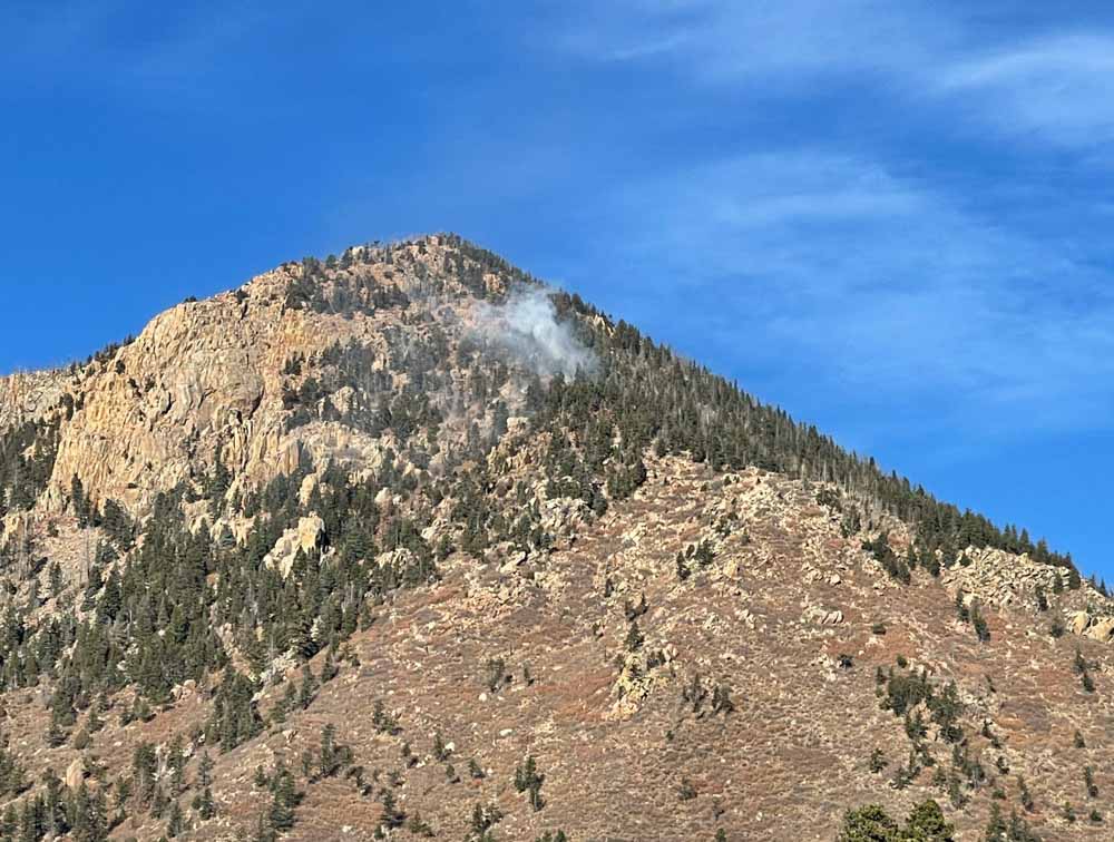
The last entry on the Pike & San Isabel National Forests blog was on October 13, about a 13-acre fire northeast of Gardner, Colorado — until yesterday, Dec. 22, when a fire was reported at 5:22 a.m. about two miles southwest of the Air Force Academy northwest of Colorado Springs. It was near the top of Blodgett Peak, 9,400 feet above sea level.
A person would think that three days before Christmas there would be snow in Colorado at that elevation, but none was visible in photos posted by the Colorado Springs Fire Department. And not only was there no snow, but two large air tankers were on duty and assisted firefighters.
The fire is 0.9 mile inside the National Forest boundary. It was mapped by the state’s multi-mission aircraft Wednesday at 0.3 acre.
Blodgett Peak Fire Dec 22, 2021. Photo by Colorado Springs Fire Department
The area was under a Red Flag Warning Wednesday for predicted winds gusting over 40 mph and very low humidity. Firefighters did not reach the fire Wednesday due to concerns about the wind. The area was patrolled by personnel from the Colorado Springs Fire Department that night, and the incident was turned over at 9 a.m. Thursday to the US Forest Service with a Type 2 hand crew and a Type 3 helicopter.
Ten years ago a slow moving fire on Colorado’s front range, especially in December, would not always have been aggressively attacked. But gradually since the 2012 Waldo Canyon Fire destroyed 344 homes, killed two people, and burned 18,000 acres on the west side of Colorado Springs, federal and local fire agencies have been improving their initial attack strategies.
#BlodgettPeakFire Air tanker drops on the fire successful this afternoon. CSFD brush patrols will be in the area overnight. Active flames may be visible throughout the night, please don’t call 911, we have crews on scene monitoring. Please avoid the area. pic.twitter.com/6swXr0CqxG
Excerpt #1 from the Wildland Fire section of the NFPA Needs Assessment.
A survey conducted by the NFPA asked fire departments of all sizes about their readiness and capability for suppressing wildland fires. This general topic was one of seven in the survey that was sent to more than 26,000 fire departments in the last year.
Excerpt #2 from the Wildland Fire section of the NFPA Needs Assessment.
From the NFPA:
“This Fifth Fire Service Needs Assessment Survey was conducted beginning in 2020 and concluding in 2021. It follows earlier surveys completed in 2001, 2005, 2010, and 2015. A total of 2,969 fire departments responded to the survey, with approximately 75 percent responding online and 25 percent filling out the paper version. Overall, the response rate was 11 percent, ranging from a 7 percent response from fire departments protecting populations of less than 2,500 to a 39 percent response from fire departments protecting populations of 500,000 or more. The previous Needs Assessment report included additional state-level reporting. NFPA will be working in the coming months to produce these types of reports for selected states.
“This report shows that while some fire service needs have been declining, many have remained constant or increased. Fire service needs exist for departments of all sizes and in every area, including staffing, training and certification, facilities, apparatus, personal protective equipment (PPE); and health and wellness. In general, the smaller the community protected, the greater the need.”
A contract firefighter was killed by a falling tree in Oregon, August 23, 2021
3-D Map, fatality, Gales Fire Aug. 23, 2021.
A report completed by the Lane County Sheriff’s office concluded that Frumencio Ruiz Carapia was killed by a falling tree while working on the Gale Fire on the Willamette National Forest in Oregon, August 23, 2021. The incident occurred about 34 air miles east-southeast of Eugene.
Mr. Carapia, 56 years old, was employed by GE Forestry, a company based in Central Point, which is near Medford, Oregon. Originally from Mexico, he had worked for more than 25 years with GE. Mr. Carapia is survived by his four adult children, a grandson, and was looking forward to the birth of a granddaughter.
Vicinity map, Gales Fire Fatality, Aug. 23, 2021.
The crew was putting in a cold line on the edge of the fire. The Sheriff determined that a green tree snapped and slid down the slope striking Mr. Carapia. He suffered numerous very serious injuries and was deceased before he could be extricated from under the four-foot diameter tree.
Map, Gales Fire Fatality, Aug. 23, 2021.The burned area is shown in brown. The white line is the fire edge.
Below are excepts from the Sheriff’s report, written in the first person by the responding officer:
“I made contact with the on scene command and was provided a name for the involved individual who was identified as Frumencio Ruiz Carapia. I was further advised the death was witnessed by the crew boss who was identified as Armando Tovar. I made contact with Tovar who stated his crew was putting in a “cold line” which was explained to be a fire line along the edge of the fire. Tovar stated the crew was in a steep creek drainage when he heard and observed a large tree snap above the crew. Tovar started calling on the radio for the crew to get out of the area. Tovar stated he observed the tree which he called a “green tree” snap and fall down the creek drainage and slide towards Ruiz Carapia, striking him. When asked if there was any chainsaw use going on in the area he stated there was none and they were only digging a fire line. The deceased was located under the tree and a call for help was placed on the radio.”
The tree that fell during the Gales Fire, killing Frumencio Ruiz Carapia, Aug. 23, 2021. Lane County Sheriff’s office photo.
“I went with a crew down to where the deceased was located. The area is a steep creek drainage with old growth trees. I observed approximately 3 snags above the location where the deceased was located. The snags were burning near the base and as well as several feet up the trees. I was advised by fire personnel the trees were immediate hazards to the safety of the crew however because of the terrain and where we needed to go they were unable to cut them down. I was advised we needed to hastily work the scene and remove the deceased to get out of danger. I took a few photos of the scene and the deceased.”
“I maintained an observation of the deceased as he was removed from under the tree. I observed the tree to be approximately 75 feet long and about 4 feet in diameter. The tree appeared to have broken off from its base and fell down the creek drainage along the north side of the creek drainage before coming to rest in the creek bottom.”
Frumencio Ruiz Carapia
The report did not include photos of the base of the tree.
The Gales Fire, managed as part of the Middle Fork Complex, ultimately burned more than 29,000 acres.
Gales Fire, Middle Fork Complex of fires, OR, Aug. 16, 2021, InciWeb.
Among other goals, it will develop a strategy to meet aerial firefighting needs through 2030
December 17, 2021
Route Fire, Southern California, Sept. 11, 2021.
The Departments of the Interior, Agriculture and Homeland Security Federal Emergency Management Agency (FEMA) today announced the establishment of a new Wildland Fire Mitigation and Management Commission, which is required by the Bipartisan Infrastructure Law, H.R.3684, signed by the President on November 15, 2021, which became Public Law Number 117-58.
The Commission is tasked with recommending federal policies and strategies to more effectively prevent, mitigate, suppress and manage wildland fires, including the rehabilitation of land affected by wildland fires. It will include representation from federal, state, Tribal, county and municipal governments as well as non-governmental stakeholders from private industry.
The legislation authorized $600 million for management of fire personnel and approximately $600 million for fuel management, pre-fire planning, satellite fire detection, research, radio interoperability, and other uses.
The new law is very specific and detailed in laying out the deliverables of the new Commission, perhaps worrying that if it was too vague not much would get done. The 27 members of the commission will have their work cut out for them — 9 from federal departments and 18 non-federal stakeholders, plus an Executive Director they can hire. They may also bring on staff if needed. The members will serve “without compensation” but can be reimbursed for travel expenses and per diem.
The appointments of the members of the Commission are to be made no more than 60 days after the date the legislation became law, which works out to January 14, 2022. Their initial meeting is to be held within 30 days after all members have been appointed — no later than February 13, 2022. They are to meet at least once every 30 days, in person or remotely.
Their assignments fall into two broad categories; here are some of the highlights:
1. Develop recommendations to mitigate and manage wildland fires
By February 13, 2023 develop a report describing recommendations to prevent, mitigate, suppress, and manage wildland fires; consider protection of human life, short- and long-term forest management; wildland-urban interface; utility corridors; rehab after fires; streamlining environmental reviews; and, recommendations for modernizing and expanding the use of technology, including satellite technology, remote sensing, unmanned aircraft systems, and any other type of emerging technology to prevent, mitigate, suppress, and manage wildland fires.
2. Report on aerial wildland firefighting equipment, strategy, and inventory
By March 30, 2022 prepare an inventory of surplus cargo and passenger aircraft that may be used for wildland firefighting purposes.
By June 28, 2022 develop an assessment of the number of aircraft needed to fight wildland fires through 2030. The report will include an assessment of the federal government’s authorities to provide or sell surplus aircraft to Federal, State, or local organizations to be used for wildland firefighting, and, identify any additional authorities that are needed. The Commission is directed to consider all private and public sector options for accessing necessary aircraft and aircraft parts, including procurement, contracting, retrofitting, and public-private partnerships.
Update December 18, 2021:
One of the comments on this article left today by Professional WFF mentioned that the Quadrennial Fire Reviews in 2005, 2009, and 2014 would be a good place to start. Links to them are HERE. Excerpts from the fire aviation section of the 2014 QRF are HERE.
Kansas Forest Service reports that the largest blaze burned about 365,000 acres
12:52 p.m. Dec. 17, 2021 CST
Fire near Natoma, Kansas, Dec. 16, 2021. Kansas Forest Service photo.
The Kansas Army National Guard mobilized Blackhawk helicopters to assist firefighters battling a rash of wildfires that began Wednesday. The very strong winds gusting to 80 mph made it impossible for any aircraft to work the fires until Thursday when the wind speeds decreased. A weather station at the Russell Airport recorded wind gusts of 100 mph, which is 26 mph higher than the minimum speed for a Category 1 hurricane.
The Kansas Forest Service said Thursday that 11 large fires burned nearly 400,000 acres this week in the state which is entering its dry season while the extreme western part is impacted by drought. The agency reported that the largest fire, dubbed for now the “Four Counties Fire” which is in portions of four counties between Codell and Russell, burned approximately 365,000 acres. The map below shows the fire at about 270,000 acres.
Map of wildfires in Kansas, Dec. 16, 2021. Kansas Forest Service.
Some of the fires are still burning, but not with the speed and intensity seen on Wednesday. The weather forecast for Russell, KS Friday calls for north-northwest winds 8 to 14 mph with gusts to 23 mph, with relative humidity in the mid 30s. Friday night and until Saturday afternoon the winds will be 14 to 18 mph out of the north-northwest with gusts up to 26 mph. Saturday afternoon the humidity will drop into the mid 20s. These conditions will make it difficult for firefighters to put the fires to bed.
Kansas Gov. Laura Kelly issued a declaration of a State of Disaster Emergency on Thursday, Dec. 9 due to elevated dangers of wildland fires.
“Much of Kansas is recovering from yesterday’s storms and wildland fires,” said Mark Neely, State Fire Management Officer, Kansas Forest Service on Dec. 16. “The Kansas Forest Service is working with state and local partners to get fires under control and mopped up so that we can return to normal conditions.”
In a fire outbreak of this size, it can be difficult to keep track of numerous simultaneous incidents, and that is the case this week.
“In Kansas, local officials retain full control of all emergencies, so State agencies receive information as local authorities choose to provide it,” the Kansas Forest Service reported Friday. “It is believed that several of the fires are fully or mostly contained, several will require several more days of work, but details from local officials are still very slow to come in. Additionally, tornadoes, severe winds, dust storms, etc., created havoc nearly statewide.”
Kansas Army National Guard Black Hawk helicopter from the 1st Battalion, 108th Aviation Regiment is used to mop up a fire in western Kansas. Image provided by the Kansas Army National Guard Dec. 17, 2021.
400,000 acres burned in Kansas wildfires Wednesday
Updated 4:35 p.m. Dec. 16, 2021 CST
The red dots represent heat detected by satellites on wildfires near Russell, Kansas, as late as 3:06 a.m. CST Dec. 16, 2021. Clouds and dust at times blocked the view from the satellites and/or the light vegetation burned and cooled between satellite overflights. Therefore, the burned area is likely much larger than shown by the red dots.
A large wildfire in Russell and Ellis Counties in Kansas has burned approximately 96,000 acres and destroyed at least 10 homes, according to the Russell County Sheriff. Satellites were still detecting heat on the fire at 3:06 a.m. CST Thursday. The fire is north of Interstate 70, and is northwest, north, and northeast of Russell, about 7 miles from the city. (UPDATE at 1 a.m. CST Dec. 17: The Kansas Forest Service said the “Four County Fire” has burned 365,850 acres.)
The fire was pushed by very strong winds on Wednesday. A weather station at the Russell Airport recorded wind gusts of 100 mph, which is 26 mph higher than the minimum speed for a Category 1 hurricane.
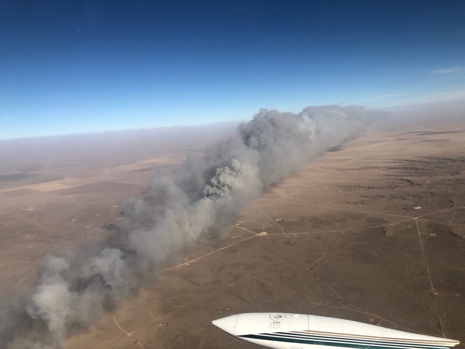
Many other fires were occurring at the same time in Western Kansas and the panhandles of Oklahoma and Texas (see below).
The Kansas Forest Service assessed the situation Thursday morning:
Wednesday pretty much stripped western Kansas of fire resources, between multiple major fires in critical fire weather, and many traffic crashes. Initial assessment indicates that 11 fires burned a cumulative acreage of nearly 400,000 acres. Further damage details are being assessed by local agencies at this time. Multiple resources will committed, likely for several days.
Dust picked up by the winds created visibility problems, requiring some highways to be closed Wednesday.
Satellite photo, fires in Oklahoma, and Texas, Dec. 15, 2021. The red areas indicate fires.
Eric Metzger, a meteorologist at the National Weather Service in Wichita, told the New York Times that before Wednesday, Kansas had not had any rain for over a month. The state has seen fires in December, when the weather gets dry, he added, but this one felt different.
“I’ve lived out here for more than 20 years,” he added. “This is historic for us.”
Satellite photo, fires in Kansas, Oklahoma, and Texas, 3:51 p.m. CST Dec. 15, 2021. The red dots represent heat detected on fires by satellites.
Update on two fires in the Texas panhandle mentioned earlier, with information from the Texas Forest Service Thursday afternoon: The North 207 Fire between Pampa and Borger is listed at 23,810 acres. The Parker Creek Fire southwest of Dumas is estimated at 11,066 acres.
Thursday morning the Oklahoma Forest Service said the Cobb Fire in the panhandle had burned about 10,000 acres.
Originally published at 8:57 p.m. Dec. 15, 2021 CST
Map of fires in the panhandles of TX and OK. December 15, 2021.
Very strong winds in Kansas and the panhandles of Texas and Oklahoma caused wildfires to spread very rapidly Wednesday. Blowing dust also caused severe visibility problems, and prompted the street lights to come on at noon in at least one area.
Oklahoma
Due to the Cobb Fire in the Oklahoma panhandle the Guymon Police Department in a 2 p.m. Facebook post on Wednesday encouraged the residents on the northwest side of town to evacuate. Heat data from satellites at 1:55 p.m. CST indicated it had burned approximately 5,000 acres northwest of Guymon. The Oklahoma Forest Service said at 7 p.m. it had grown to about 10,000 acres. The eastward progression toward Guymon had been stopped, they said, and one structure was destroyed. Wind gusts up to 79 mph were recorded in the area.
Cobb Fire. Oklahoma Forest Service photo. December 15, 2021.
Texas
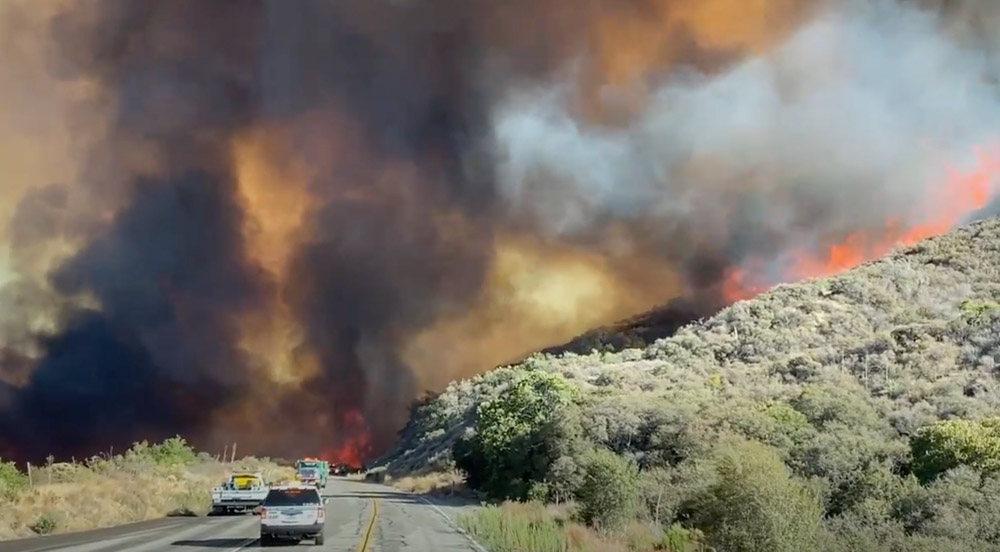
Fires in the Texas panhandle were spreading to the east-northeast on Wednesday, also pushed by very strong winds gusting over 80 mph.
The North 207 Fire in Carson County has burned an estimated 15,000 acres about 5 miles southeast of Borger. The Texas Forest Service said it has crossed Highway 152.
North 207 Fire. Texas Forest Service photo. December 15, 2021.
The Parker Creek Fire started in Oldam County and spread into Hartley County southeast of Channing, about 14 miles south of Dumas. The TFS said at 6:08 p.m. it had burned 3,500 acres but satellite heat data indicates it could be larger.
Parker Creek Fire, December 15, 2021. Texas Forest Service photo.
Kansas
There are also numerous fires in western Kansas, also pushed by strong winds out of the west measured in at least one location at 100 mph. The New York Times reported that two fires merged in Russell and Ellsworth Counties in the central part of the state to form a massive blaze about 40 miles long, according to Eric Metzger, a meteorologist with the National Weather Service.