Pacific Power lawsuit may come down to fire behavior experts

Over the Labor Day holiday in 2020, with east winds picking up toward the end of a long, hot and dry summer, Leland Ohrt was dispatched to a home not far from his own, where a tree branch had fallen on a powerline and started a small brush fire. Ohrt was Mill City Fire Chief, a VFD chief in a small town in western Oregon’s Cascades; he hosed down the fire, then drove over to Schroeder Road, where another tree branch had fallen over another powerline and was still arcing sparks into the dry fuels below. Ohrt couldn’t stop the sparking, so he hosed the utility lines with water until they exploded and de-energized themselves.

Those two incidents initiated a frenzied 48 hours for Ohrt, acccording to an OPB report today, and he was later recognized for his efforts to save Mill City as the fires destroyed thousands of homes down the Santiam Canyon and across other parts of western Oregon.

Chief Ohrt saw Pacific Power’s utility lines start those fires, but he took the stand last week to defend the utility company in a class action trial against Pacific Power. He told a jury in Multnomah County Circuit Court that he immediately blew off attorneys who’d sent him paperwork in the weeks following the fires — lawyers who were trying to contact fire victims.

“I threw all that paperwork away,” Ohrt said. “You could tell right off the bat they were going to go after Pacific Power for this.”

Ohrt’s testimony highlighted a key aspect of the defense Pacific Power’s corporate owners, PacifiCorp, expect to lay out in the coming weeks of the trial: Most of the wildfires in the Santiam Canyon started not from their powerlines, but from embers of the Beachie Creek Fire. Even in places where powerlines did start fires, PacifiCorp’s attorneys contend that people fighting those fires quickly got them under control.
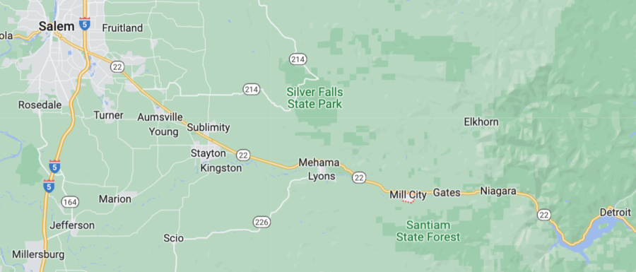
Mill City, Oregon map

The defense follows what has been several weeks of plaintiffs’ attorneys alleging that PacifiCorp acted negligently by keeping its lines energized during the Labor Day fires, even though they had plenty of warning from weather officials and state government about fire danger. The decision to keep the power on contributed to fires spreading out of control, according to the plaintiffs and their attorneys.

Ohrt though, under questioning from PaficiCorp’s lawyers, pointed to another culprit: the U.S. Forest Service. Ohrt has more than 45 years’ experience with Mill City’s volunteer fire department, but he does not have any experience fighting wildfires.
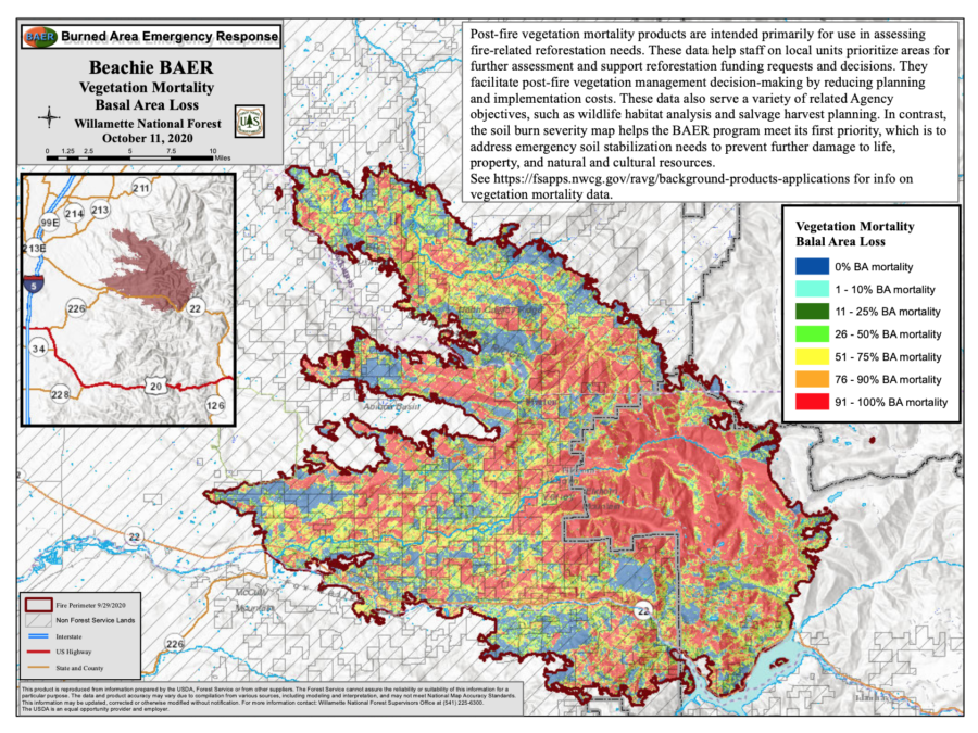
Beachie Creek BAER team map
The inciweb images and maps and pages have been retired from the internet, but a few files remain on the Willamette NF site.

Weeks before the Santiam Canyon fires, a lightning strike started the Beachie Creek Fire — northeast of Gates in the Opal Creek Wilderness. Forest Service officials said then that steep terrain made it difficult to get crews to the site to contain the slowly growing fire. According to Ohrt, though, letting the Beachie Creek Fire smolder allowed it to throw embers into the Santiam Canyon when winds picked up on Labor Day.
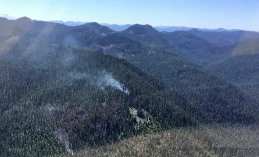
2020 Beachie Creek Fire
Beachie Creek Fire August 27, 2020, just 11 days after it started, before it grew very large on September 8. USFS photo.

An excellent “storymap” about the Beachie Creek Fire is [HERE].

“The U.S. Forest Service was supposed to be fighting that fire,” Ohrt said in his testimony.

Late in 2020 Linn County had to sue the Forest Service to get fire documents.

The Type 3 IC at the time knew that air support was critical, according to a USFS review of the fire, but he also recognized that the fire was burning in an old growth stand, meaning there was a multistory canopy with abundant down logs, duff, moss, and fuels. He knew that getting firefighters on the ground to dig deep for hotspots was the only way to successfully contain the fire.

“Everyone assumes that if you hammer a fire with aerial resources, it will go out, but that’s not the case. There needs to be boots on the ground working in tandem with aircraft. There are hidden hotspots, sheltered from aerial attack, under big logs and deep roots that have to be dug out.”
~ unnamed Type 3 Incident Commander

Whether jurors in the case find PacifiCorp responsible for the wildfires in the Santiam Canyon will likely be influenced by which attorneys’ experts they find more believable. Oregon State University professor John Bailey, for example, testified that there was no way the Beachie Creek Fire could have thrown embers far enough before midnight on Labor Day 2020 to start fires near the town of Gates. Bailey, who teaches fire management and has been studying forestry since the 1980s, said he used topography data, recorded weather conditions, and fuels analysis to estimate where the Beachie Creek Fire could have thrown embers ahead of its front to start new fires. He said strong east winds that night would have — at most — lit spot fires north of Gates and other residential areas in the canyon.

PacifiCorp’s attorneys, on the other hand, had atmospheric sciences professor Neil Lareau of the University of Nevada testify, and he said the extreme weather conditions that night did indeed throw firebrands miles ahead of the Beachie Creek Fire. Lareau explained to jurors how he used satellite data from the fire to determine when plumes of debris burst from the fire and cast embers thousands of feet aloft. He said those plumes matched up with on-the-ground reports of spot fires in the Santiam Canyon. Bailey, by contrast, said embers thrown by fires can rarely travel more than a mile — a far shorter distance than needed to start the fires Lareau claimed originated from the Beachie Creek Fire.

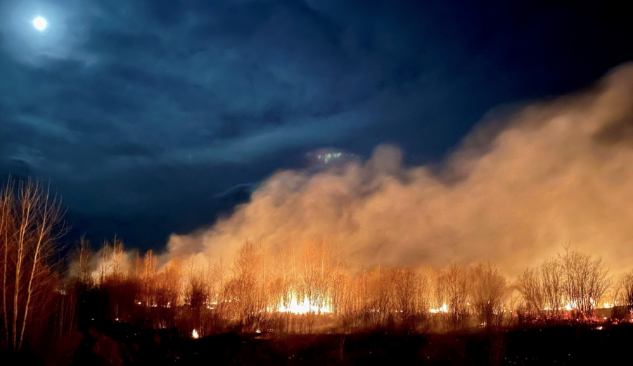
Alberta firefighters hoping for weather change

Several regions in the U.S. are suffering from poor air quality as smoke from wildfires in Canada drifts south. Much of the of the U.S. has experienced smoky skies for days, creating unhealthy conditions for residents with heart or lung conditions. ABC News reports that the National Weather Service issued an air quality alert for all of Montana, along with parts of Idaho, Colorado, and Arizona. In Utah, the Department of Environmental Quality urged residents on Friday to avoid outdoor activities in places with visible smoke and haze. Heavy smoke began to pour into northeastern Colorado on Friday.

Alberta Wildfire
Alberta Wildfire

Reuters reported that Alberta authorities hope cooler temperatures and showers forecast for the coming week will help firefighters in the oil-rich Canadian province, although storms could complicate efforts. Forecasters are tracking a front likely to move into Alberta on Sunday that could bring cooler weather. Christie Tucker, information unit manager at Alberta Wildfire, said Saturday the front could mean increased humidity or even rain.

“What we’d like to see is a long steady rain that will soak into the forest and into the ground,” Tucker said. “That will help us more than a short burst that would bring lightning and could spark a new wildfire.”

airnow.gov fire and smoke map

Alberta has endured energy production cuts, residential evacuations, and poor air quality after an intense start to the wildfire season. This year, Alberta Wildfire has responded to 496 wildfires burning more than 842,000 hectares, compared with just 459 hectares in 2022.

“This year’s total is nearly 2,000 times last year,” Tucker said. Over 2,800 firefighters from Canada and the United States were fighting 91 active fires on Saturday.

Canada’s wildfires have sent smoke to U.S. states including Minnesota, Nebraska, Illinois, Wisconsin, Wyoming, Utah, Washington, and Colorado, triggering air quality alerts in several places.

The air quality index on the Front Range in Colorado reached 168 on Friday, according to the state’s Department of Public Health and Environment. A reading between 151 and 200 indicates unhealthy conditions that affect sensitive groups as well as the general public, health officials say. Idaho also saw widespread haze earlier in the week, according to the state’s Department of Environmental Quality.

Oregon gears up for 2023

Posted on Categories PreventionTags ,

Fire season is already under way in Oregon, with some small fires burning in the southwest part of the state, and state and federal officials are talking about options for funding firefighting efforts.

On May 17, Governor Tina Kotek announced she was adding over $200 million in funding for the state’s wildfire protection system to her budget request to the state legislature. “We need to continue to support things that have worked,” Kotek said in a press conference covered by KEZI-TV. “We need another $207 million to continue our advancements in wildfire protection, in both resilience and protection and response, and I would hope legislators would support that.”

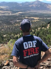
ODF Fire
Oregon Dept. Forestry

In Washington, D.C., Oregon Senators Jeff Merkley and Ron Wyden are working on legislation to create national recreation areas across the state. That distinction would require wildfire prevention strategies in the region. “The bill requires the Bureau of Land Management to take preemptive steps to reduce wildfire risks in the new recreation areas,” Wyden said at a Senate committee hearing, “including the construction of new roads to implement fire risk reduction plans and for public safety.”

Fire departments and districts have also received additional funding for firefighters, engines, and risk reduction programs. Much of that funding comes from 2021’s Senate Bill 762.

“Senate Bill 762 was a major investment in in fighting wildfire in Oregon, and it was a huge help for not only the Oregon Department of Forestry but other wildfire agencies in the state,” said Jessica Prakke, PAO with the Oregon Department of Forestry. The legislation provided $220 million to agencies to modernize and improve wildfire preparedness, response, and resiliency. “It was a huge investment in protecting Oregon from wildfire and it has done an immense amount of good across the state,” she said.

She said the funding also expanded the state’s network of wildfire detection cameras. One such camera caught a fire caused by a lightning strike in Lane County. On the night of May 15 a camera alerted ODF staff to smoke in between Sharps Creek and Mosby. A staffer monitoring the cameras dispatched fire crews to the site, and they had the fire under control within three hours. Prakke said there are now nearly 100 cameras at 60 sites across the state. The system also uses a mapping system to help pinpoint smokes for dispatchers and first responders.

Prevention is the key for a successful season, said Prakke. “The best way to stop wildfire is for people to keep wildfire prevention at the top of their mind,” she said. “About 70 percent of all wildfire in Oregon is human-caused, and so the less that we can contribute to wildfire on our parts, the less our resources are strained to fight other causes of wildfire.”

California’s ALERT camera network now publicly accessible

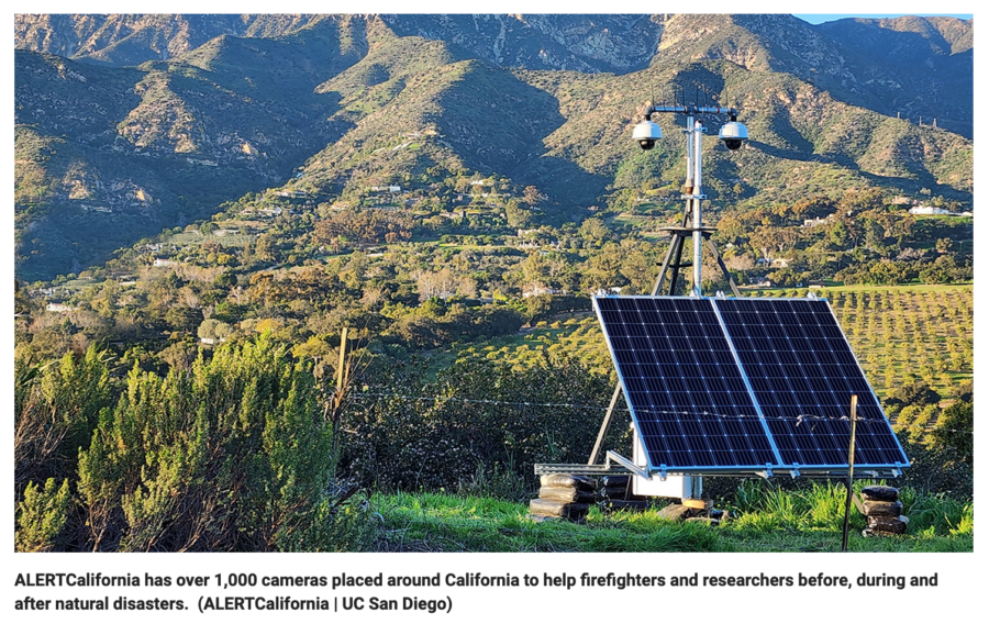
Cal Fire and other agencies are using a network of over 1,000 cameras across California to track wildfires — and now the public can access the network, too. FOX News reports that the University of California San Diego and state fire agencies have partnered to launch a public website for people to view live camera feeds from across the state.

ALERTCalifornia camera network

ALERTCalifornia uses a network of more than 1,000 live cameras to track fires. “We’re trying to understand the impacts, the cascading disasters after these events,” said Dr. Neal Driscoll, a professor of geology and geophysics at the UC San Diego Scripps Institution of Oceanography in La Jolla, California. “I’m a professor. I study earthquakes, I make sensors, and here these sensors lend themselves to other events, such as atmospheric rivers and wildfires.”

View live feeds here: cameras.alertcalifornia.org

As the ALERTCalifornia camera network grows in size and sophistication, UC San Diego researchers are using new technology to study natural disaster patterns in the West. ALERTCalifornia provides state-of-the-art technology supporting data-driven decisions to prepare for, respond to, and recover from natural disasters. Based at the University of California San Diego, ALERTCalifornia is a public safety program focused on fires and other natural disasters featuring a world-class camera network.

“These cameras are on mountaintops that we can access, and so if we get a 911 call from someone reporting smoke, we can — one click away — just get on the computer and see if there is actually any smoke in the area,” said Capt. Brent Pascua, PIO with Cal Fire. “We can use multiple cameras to pinpoint the location and get a better location as well.”

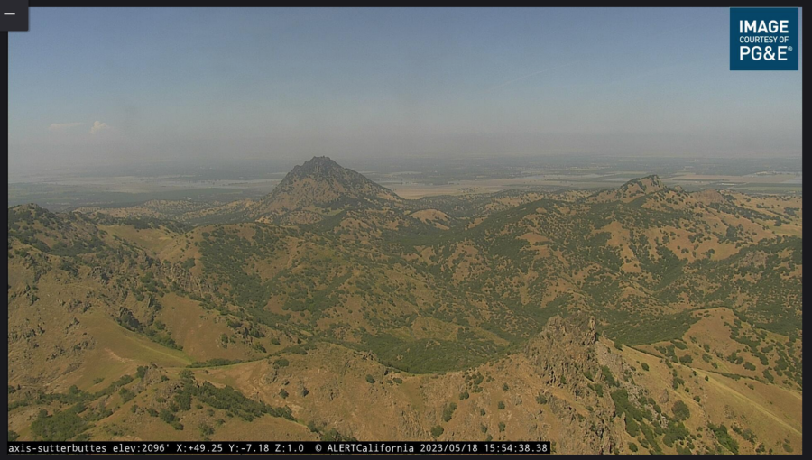
“Five or six years ago they had to send a battalion out or an aircraft to confirm ignition,” says Driscoll. “Now they can turn to our cameras. They can immediately move the camera, and image that area, and confirm ignition.” The high-definition cameras can pan, tilt and zoom, with a view as far as 60 miles on a clear day and 120 miles on a clear night, according to Scripps Institution of Oceanography. New cameras were recently installed in Los Angeles, Santa Barbara, and Madera counties since the new year.

Sutter Buttes camera today

Only fire agencies can control the movement of the cameras, which are placed on tripod platforms that can be removed seasonally with little to no impact on sensitive habitats or tribal lands. The camera network started 20+ years ago in 2000, with numerous improvements to the technology over time. The network was originally created to study earthquakes. Since then, it’s expanded to monitor fires and other natural disasters. Public access to the camera feed was launched last week.

Oregon trains National Guard crew

Airmen from the 173rd Fighter Wing recently spent five days of wildland fire training with the Oregon Department of Forestry in preparation for their role in assisting with the 2023 fire season.

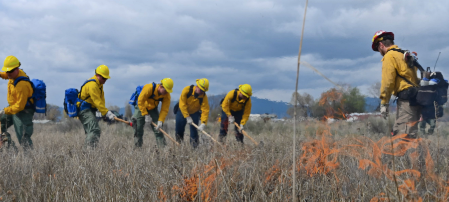
Air National Guard Magazine featured a story about ODF firefighters lighting a controlled blaze during training for the 173rd Fighter Wing Airmen at Kingsley Field in Klamath Falls, Oregon.

(U.S. Air National Guard photo by Airman 1st Class Adriana Scott)

“We are tasked with training Guardsmen on Operations Plan Smokey,” said Jake Barnett, protection supervisor for ODF. He said this initial training consists of 32 hours of in-class and hands-on instruction. Airmen are ready to assist the state of Oregon if called up during emergencies and natural disasters. Operation Plan Smokey provides extra resources to the state from the National Guard via an interagency agreement between the Oregon Military Department and the ODF. Training covered fire behavior, tool use, and communications. The last day included a burn in sagebrush and tall grass. Oregon red-carded 20 new firefighters for the state, and Col. Lee Bouma, 173rd FW commander, said they trained an extra three crews this year.

Wildfire near Wickenburg burns hundreds of acres

Firefighters had an 870-acre wildfire burning south of Wickenburg, Arizona about 60 percent contained today; the Cloud Fire near Vulture Mine and Whispering Ranch roads started Thursday, according to the BLM.

State Forestry was responding with aircraft, engines, and hand crews. KJZZ reported that 75 firefighters from the BLM, Wickenburg, and Buckeye Valley were also working the fire.

12NEWS had video. Forestry officials said airtankers slowed the progress of the fire, which was burning in short, dense grass.

The fire started Thursday about 16 miles from Wickenburg.