California: Wheatland Fire near Lake View Terrace

Above: the approximate location of the Wheatland Fire near Lake View Terrace in southern California.

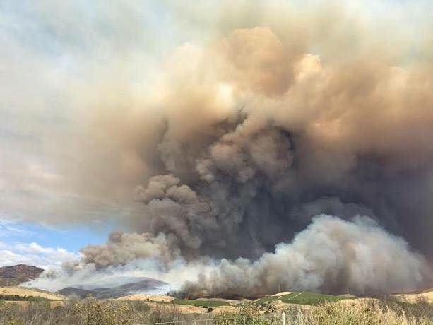
A brush fire that has blackened about 183 acres put up an impressive amount of smoke today. The fire broke out in mid-afternoon on Monday and by evening had slowed considerably. Fire officials called it 35 percent contained at 6 p.m.

The Wheatland Fire is north of the 210 freeway in the Lake View Terrace area above Wheatland Avenue in southern California. It burned north away from homes until its progress was impeded by a deepening marine layer and by ridgelines, making it feasible for aircraft to drop water and retardant in those areas, assisting firefighters on the ground and slowing the fire.

Canada requests 10 crews from the U.S. for Fort McMurray Fire

Canada asked the United States for 200 firefighters.

Canada has requested 10 hand crews from the United States to assist with the huge wildfire at Fort McMurray, the Horse River Fire, in Alberta. A spokesperson for the U.S. Forest Service, Kaari Carpenter, said the personnel have been asked to arrive on Wednesday, May 25. The National Interagency Coordination Center (NICC) is coordinating with several Geographic Areas hoping to find ten 20-person crews, on which all firefighters have passports.

Other resources that have been requested are two Interagency Resource Representatives (IARR) to support efforts in the Fort McMurray area, and one Technical Specialist (THSP) to serve as International Liaison for NICC at the Canadian Interagency Forest Fire Centre in Winnipeg, Manitoba.

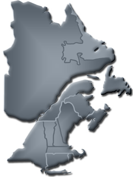
map Northeastern Forest Fire Protection Commission (NFFPC)
Map of state & provinces within the Northeastern Forest Fire Protection Commission

We are working on confirming that an incident management team (IMT) comprised of both Canadians and Americans was mobilized to the Fort McMurray Fire about a week ago. The Northeastern Forest Fire Protection compact has built an IMT consisting of both Canadian Province members and American members and successfully mobilized them across Compact lines to Alberta. As far as we know this is the first time in the history of the compacts that an IMT team has crossed INTER-compact lines to manage international fires.

The map of the Fort McMurray Fire (Horse River Fire) below shows that it has been active over the last 24 hours on the north and east sides. It has burned 523,000 hectares (1.3 million acres or 2019 square miles).

Map Ft McMurray Fire
Map of the Fort McMurray Fire (Horse River Fire). The purple line was the approximate perimeter the morning of May 18, 2016. The dots represent heat detected by a satellite within the last 24 hours, with the most recent, as late as 3:15 p.m. MDT May 23, 2016. Click on the map to see a larger version.

Our main article about the Fort McMurray Fire.

Thanks and a tip of the hat go out to Chris and others.

California: Metz Fire burns thousands of acres near Soledad

Metz Fire
Metz Fire. Photo via NPS.
The Metz Fire was reported mid-afternoon on Sunday southeast of Soledad, California and within about six hours was mapped by CAL FIRE at 3,878 acres. At that point the spread slowed and it was still reported at the same size the next morning at 8:15 a.m. PDT. One of our readers told us there were seven air tankers assigned.

The fire is about three miles southwest of Pinnacles National Park.

Map Metz Fire
Map of the Metz Fire, May 23, 2016. CAL FIRE.

Washington DNR says powerline caused the fatal Twisp River Fire

An investigator’s report on the cause of the fatal Twisp River Fire revealed that a tree branch contacting a power line ignited, dropped to the ground, and started the fire west of Twisp, Washington.

Three firefighters for the U.S. Forest Service were killed inside their vehicle August 19, 2015 when they were attempting to escape from the rapidly spreading fire. A fourth firefighter exited the vehicle and ran to safety. He was severely burned, but survived, hospitalized for three months. The deceased were Tom Zbyszewki, 20, Andrew Zajac, 26, and Richard Wheeler, 31. The injured firefighter was Daniel Lyon, 25, of Puyallup, Washington.

The Seattle Times obtained a copy of the investigation report through a public records request. The entire 38-page document can be seen here.

Thanks and a tip of the hat go out to Kelly.

Red Flag Warnings, May 22, 2016

wildfire Red Flag Warnings, May 22, 2016

The National Weather service has posted Red Flag Warnings or Fire Weather Watches for areas in New Mexico, Texas, Minnesota, and Michigan.

The maps were current as of 10:27 a.m. MDT on Sunday. Red Flag Warnings can change throughout the day as the National Weather Service offices around the country update and revise their forecasts and maps. For the most current data visit this NWS site.

Wildfires in Russia may be sending smoke to northern Canada

Wildfire smoke map
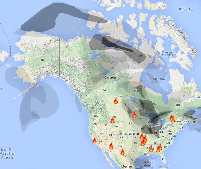
Wildfire smoke map, May 22, 2016. Weatherunderground

Wildfires in Siberia may be to blame for some of the smoke that has passed over Alaska and northern Canada in recent days. Meanwhile, fires in Saskatchewan and Manitoba are contributing to the smoky skies in Ontario, Canada and the Midwest in the United States.

Below is a video showing a vehicle in the Chernyshevsky District of Russia, 300 km from Chita, driving through smoke near a wildfire. It was uploaded May 17, 2016.

Articles on Wildfire Today tagged “smoke”.