Lessons Learned Review released for engine rollover near Meeker, Colorado

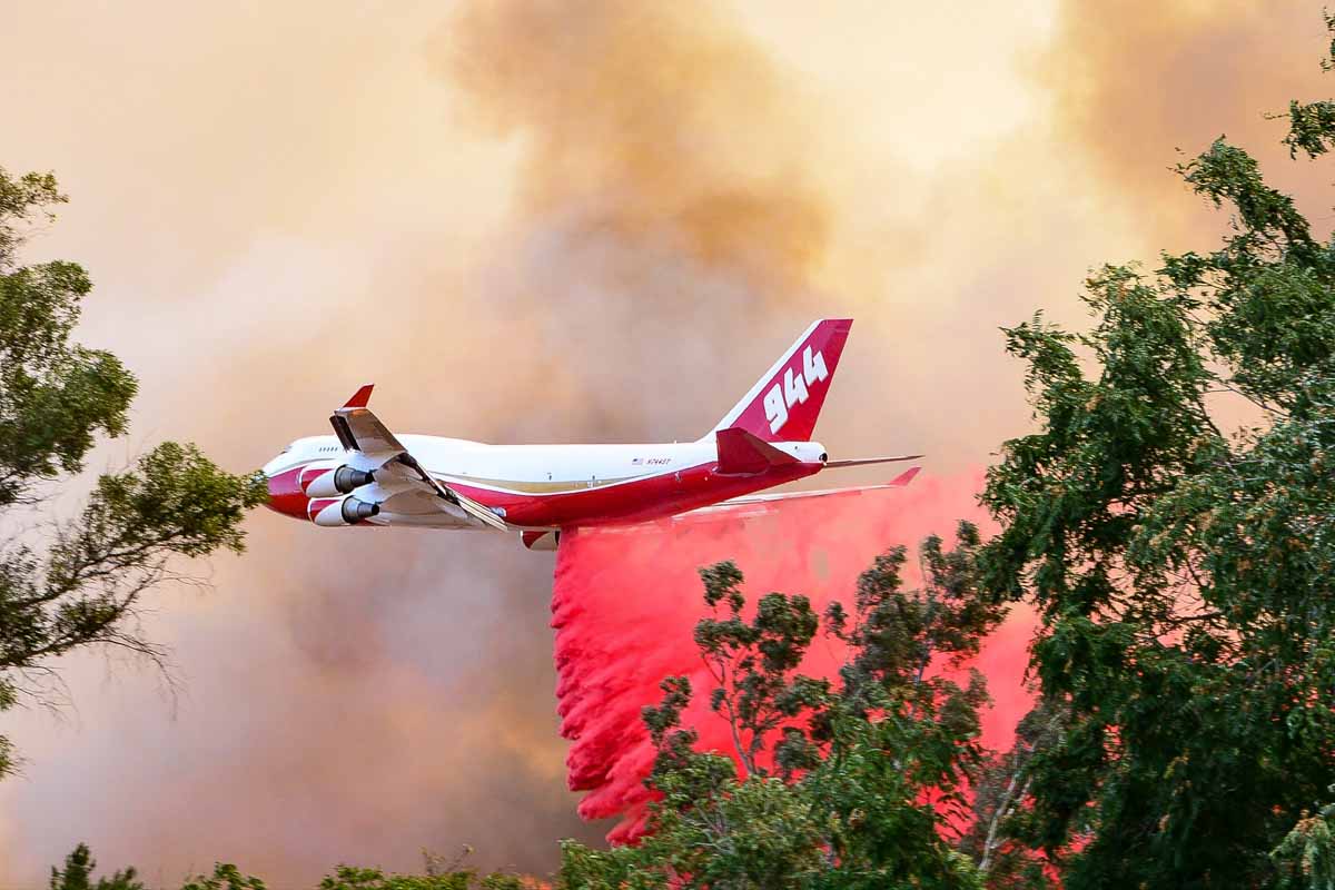
Above: the photo above is from the LLR.

A Lessons Learned Review has been released for an engine that rolled over while working on the Fawn Fire near Meeker, Colorado July 8 ,2018.

The entire document is HERE.  Below is the Executive Summary:

On July 8th at approximately 2325, on the Fawn Fire near Meeker Colorado, a cooperating fire department engine (Engine 1) rolled off the roadway as they were travelling from the fire back to Incident Command Post (ICP). Due to a high volume of fire traffic and very dry conditions, the road surface was extremely dusty and visibility was often severely reduced.

As Engine 1 was departing the fire area, they were the second to last vehicle in a convoy of 5 vehicles. Approximately a half mile after leaving the fire and headed back down County Road 29, Engine 1 encountered near zero-visibility due to dust and started to slow down. This reduction in visibility occurred in a short section of the road where the road bed narrowed due to erosional sloughing. Unable to see the upcoming road bed hazard, the engine operator continued driving straight as he was slowing the engine down. The front passenger [-side] tire travelled off the roadway, and the engine rolled off the embankment and down about 75 feet before coming to rest in the creek bottom back on its tires.

Although there was substantial damage to the cab of the engine, all the vehicle occupants were wearing their seat belts and only sustained minor injuries (bruising, chest and back pain). Due to the heavy dust, none of the other convoy vehicles knew immediately that the rollover had happened. A rapid response from other vehicles in the convoy occurred after it was discovered that Engine 1 had rolled off the road.

The three crewmembers of Engine 1 were assessed for injuries and then driven back to the ICP. At the ICP, an ambulance that had been called to respond met the Engine 1 crew and transported them to a local medical facility in Meeker. After a thorough medical assessment, it was determined that no serious injuries had occurred, and all 3 were released from the hospital at approximately 0630 on the morning of July 9th.

Thankfully there were no serious injuries.

fire engine rollover colorado
Photo from the LLR.

The report stated, “The Headache Rack saved the cab from crushing worse than it did.” A body-mounted “headache rack” is only designed to prevent cargo from entering the passenger compartment during a sudden stop and is far to weak to provide serious rollover protection.

This is the 59th article on Wildfire Today that is tagged “rollover”. These accidents are common, and wildland fire engines should be designed with real frame-mounted roll bars, not cheap-ass expanded metal grates protecting the glass in the rear window.

We wrote more about roll bars and headache racks HERE.

And, the photo below is from an article about real rollover protection on a fire engine.

Mercedes Benz G-wagon fire engine
Mercedes Benz G-wagon engine. Photo by Victoria Department of Environment, Land, Water and Planning.

The next two photos are from the LLR.

fire engine rollover colorado
Photo from the LLR.
fire engine rollover colorado
Photo from the LLR.

Lawsuit filed alleging steam engine train started 416 Fire

The fire burned over 54,000 acres north of Durango, Colorado in June, 2018

At least six local residents and business owners in the Durango, Colorado area have filed a lawsuit against the company that operates the steam engine-powered train that hauls tourists on a 50-mile route between that city and Silverton. The Durango & Silverton Narrow Gauge Railroad locomotive burns coal which heats water, converting it to steam. Similar powered trains are known to start fires when burning embers are produced along with the smoke. The suit alleges that the train started a fire on June 1  north of Durango that eventually burned over 54,000 acres in very steep terrain west of Highway 550.

map 416 fire
The 416 Fire, July 4, 2018.

When the fire first started it was named the “Train xx Fire”. But instead of the “xx” there was a number, which gave the impression that a train had also started other fires in the area. After the fire quickly grew very large, the name was changed to “416 Fire”. The U.S. Forest Service investigated to determine the cause, but according to an article in the Durango Herald they have not released the results, which will likely be reviewed by Colorado State Attorney General’s office before they are revealed in late fall or early winter.

The people that filed the lawsuit claim the fire adversely affected tourism, causing a 5.6 percent drop in sales tax and a 13.2 percent drop in lodgers tax  over the same period in 2017.

MD87 air tanker drops 416 Fire
An MD87 air tanker drops on the 416 Fire June 7, 2018. Photo by Dan Bender, La Plata County Sheriff’s Office.

Below are excerpts from the Herald’s article:

Plaintiffs say the company and its owner knew, or should have known, of the drought conditions that existed at the time the fire started.

The company did work to prevent this possibility. The train has its own firefighting tactics, such as having pop cars with water tankers follow a train to extinguish small fires and a helicopter to tackle fires from the air.

But plaintiffs say the railway operator was not equipped to extinguish this blaze. It had just laid off its veteran crew of firefighters at the beginning of the year, the lawsuit states, and replaced them “with employees much less experienced in fire mitigation and firefighting techniques.”

Fire crews “were unable to put down the fire because they were insufficiently trained by the defendant and/or because the firefighting equipment provided on the pop car was wholly insufficient to appropriately respond to the fire,” attorneys wrote in the lawsuit.

The video below is an interview with Cres Fleming who was the second person on scene at the 416 Fire June 1, 2018.

Thanks and a tip of the hat go out to Gary.
Typos or errors, report them HERE.

Firefighters in British Columbia battle with fire tornado

It took possession of their fire hose

fire tornado british columbia
Screenshot from the video below by mar.lowsky

When I went through basic firefighter training the instructors did not cover what to do if a fire tornado takes possession of our fire hose.

What would YOU do if your fire hose got swept up?

FYI: In the video caption below, “line” is fire hose, and “guard” is fire control line.

FSU researchers: Most fires in Florida go undetected

By: Zachary Boehm

A new study by Florida State University researchers indicates that common satellite imaging technologies have vastly underestimated the number of fires in Florida.

Holmes Nowell
Christopher Holmes, assistant professor in the department of Earth, Ocean and Atmospheric Science, and Holly Nowell, postdoctoral researcher in EOAS.

Their report, published in collaboration with researchers from the Tall Timbers Research Station and Land Conservancy, challenges well-established beliefs about the nature and frequency of fire in the Sunshine State. While there were more fires than expected, researchers said, strategically prescribed burns throughout the state are proving an effective force against the ravages of wildfire.

The paper appears in the journal Geophysical Research Letters.

For scientists studying fire, sophisticated satellites whizzing far above the Earth’s surface have long represented the best tool for monitoring wildfires and prescribed burns — carefully controlled and generally small fires intended to reduce the risk of unmanageable wildfires.

But FSU researchers suggest that fire experts themselves have been getting burned by faulty data, and that broadly accepted estimates of fire area and fire-based air pollutants might be flawed.

“There are well-known challenges in detecting fires from satellites,” said lead investigator Holly Nowell, a postdoctoral researcher in the Department of Earth, Ocean and Atmospheric Science. “Here we show that only 25 percent of burned area in Florida is detected.”

Using comprehensive ground-based fire records from the Florida Forest Service — which regulates and authorizes every request for a prescribed burn in the state — researchers found dramatic discrepancies between fires detected by satellites and fires documented by state managers.

prescribed fire Florida
Austin Dixon of the Tall Timbers Research Station and Land Conservancy monitors a prescribed burn. Credit: Kevin Robertson

The majority of fires in Florida come in the form of prescribed burns, but because these fires are designed to be brief and contained, they often fall under the radar of satellites soaring overhead.

This is especially true in a state like Florida, where dense cloud cover is common and the warm, wet climate allows vegetation to regrow quickly after a blaze, disguising the scars that fires leave in their wake.

“Like a detective, satellites can catch a fire ‘in the act’ or from the ‘fingerprints’ they leave behind,” said study co-author Christopher Holmes, an assistant professor in EOAS. “In our area, catching an active fire in a thermal image can be hard because the prescribed fires are short, and we have frequent clouds that obscure the view from space.”

The state fire records also revealed a counterintuitive truth: Unlike in western states such as California, where dry conditions frequently produce massive increases in destructive and often uncontrollable fires, Florida actually experiences a decrease in land consumed by fire during drought.

When drought conditions emerge, researchers said, officials are less likely to authorize prescribed burns. And because prescribed burns account for the overwhelming majority of fires in the state, overall fire activity decreases.

This also suggests that prescribed burning programs — which aim to reduce the risk of wildfire in dry conditions — are having a materially positive effect.

“Although we still have occasional destructive wildfires, including the recent tragic Eastpoint fire, our results indicate that prescribed fire policy is helping to reduce wildfire risk,” Holmes said, referencing the June 2018 wildfire that destroyed dozens of homes in Florida’s Big Bend region.

Tall Timbers specialist Tracy Hmielowski uses a drip torch to ignite vegetation as part of a prescribed burn. Credit: Kevin Robertson
While the team’s study reconfirms the utility of prescribed burning, it calls into question prevailing estimates for airborne pollution from fire. If, as the study suggests, only 25 percent of fires in Florida are detected by satellites, then there could be “a rather large bias and a significant potential underestimation of emissions,” Nowell said.

The study’s findings are specific to Florida, but researchers suspect that similar satellite limitations may be skewing fire detection — and, consequently, emission estimates — in neighboring regions and geographically analogous areas like the savannas of Africa or the agricultural belts of Europe and Asia.

“We believe this result easily extends to the rest of the Southeast United States — which burns more area than the rest of the United States combined in a typical year — and other similar regions throughout the world that use small prescribed burns as a land management technique,” Nowell said.

Kevin Robertson, Casey Teske and Kevin Hiers from Tall Timbers contributed to this study. The research was funded by the National Aeronautics and Space Administration.

Thanks and a tip of the hat go out to Tom.
Typos or errors, report them HERE.

Wildfires close in on Utah communities south of Provo

The fires are threatening communities, including Woodland Hills and Elk Ridge

(UPDATED at 11:51 a.m. MDT September 16, 2018)

Map Pole Creek and Bald Mountain Fires
Map of the Pole Creek and Bald Mountain Fires with data from 12:16 a.m. MDT September 16, 2018. By the Incident Management Team.

The Incident Management Team reports that as of 12:16 a.m. Sunday the Pole Creek Fire had burned 61,248 acres and the Bald Mountain Fire, 13,509 acres.

Map Pole Creek Bald Canyon Fires
3-D map of the Pole Creek and Bald Canyon Fires, looking south. Data from 12:13 a.m. MDT Sept. 16, 2018. Wildfire Today, Google, USFS. Click to enlarge.

(Originally published at 9:12 a.m. MDT September 15, 2018)

Smoke Pole Creek Bald Mountain Fires
Smoke from the Pole Creek and Bald Mountain Fires illuminated by flames. Posted on Twitter by Jennifer Stone (@stonejutah) with the hash tag #paysontemple

Fifteen miles south of Provo, Utah the Bald Mountain and Pole Creek fires had come within half a mile of merging when the fires were mapped at 2:36 a.m. Saturday. That city is not threatened but residents of Elk Ridge and Woodland Hills who have not evacuated yet are looking at flames on the steep slopes uncomfortably close to their homes.

Bald Mountain and Pole Creek Fires map
3-D map, looking south showing the Bald Mountain and Pole Creek Fires. The red lines were the perimeters at 10:45 p.m. MDT Sept. 14. The red dots represent heat detected by a satellite at 2:36 a.m. Sept. 15. The red shaded areas had intense heat Friday night. Click to enlarge.

The fires were started by lightning on the Unita National Forest — Pole Creek on September 6 and Bald Mountain on August 24. Initially Forest Service personnel allowed them to burn with the intention of suppressing only the portions that may threaten property, private land, important natural resources, or lives. They wanted to herd them around, while re-introducing a natural process, fire, into the environment.

To see all articles on Wildfire Today about the Pole Creek and Bald Mountain Fires, including the most current, click HERE.

Now they have both spread outside the land managed by the Forest Service and are burning private private property. No structures have been reported burned, but the estimated costs of suppressing the fires to date is almost $2 million. That number will keep rising as more firefighting resources flood in to augment the 433 personnel already on scene.

The reported sizes of the fires have been rather confusing at times, but according to a mapping flight at 10:45 Friday night the Pole Creek Fire was 48,497 acres and the Bald Mountain Fire had burned 11,090, for a combined total of 59,587 acres. A satellite overflight at 2:36 a.m. Saturday showed additional growth on the west and north sides that occurred in the four hours between the flights.

map Bald Mountain, Pole Creek, and Coal Hollow Fires
Map showing the Bald Mountain, Pole Creek, and Coal Hollow Fires. The red lines were the perimeters at 10:45 p.m. MDT Sept. 14. The red dots represent heat detected by a satellite at 2:36 a.m. Sept. 15. The red shaded areas had intense heat Friday night. The Coal Hollow Fire has been quiet for several days. Click to enlarge.

With a Red Flag Warning in effect through Sunday, rapid fire growth to the north and east is expected to continue, with strong winds, and on Saturday, single-digit relative humidity.

Red Flag Warnings
Red Flag Warnings in effect September 15, 2018.

Report released about firefighter fatality — trees were broken off during retardant drop

 Draper City, Utah Battalion Chief Matthew Burchett was killed when a low drop uprooted an 87-foot tall tree that fell on him

Diagram fatality air tanker drop Green Sheet
Diagram from the Green Sheet.

(Originally published on FireAviation, September 14, 2018. Updated at 7:43 MDT September 14, 2018)

The California Department of Forestry and Fire Protection (CAL FIRE) has released what they call a “Green Sheet” report about the fatality and injuries that were caused by falling tree debris resulting from an air tanker’s retardant drop. The accident occurred on the Ranch Fire which was part of the Mendocino Complex of Fires east of Ukiah, California. The report was uploaded to the Wildland Fire Lessons Learned Center on September 13, 2018 exactly one month after the August 13 accident.

A firefighter from Utah, Draper City Battalion Chief Matthew Burchett, was killed when a low drop uprooted an 87-foot tall tree that fell on him. Three other firefighters had different assortments of injuries from sheered-off trees and limbs, including broken ribs, deep muscle contusions, ligament damage to extremities, scratches, and abrasions.

747 supertanker palmer fire
File photo: The 747 SuperTanker drops on the Palmer Fire south of Calimesa and Yucaipa in southern California, September 2, 2017. Photo by Cy Phenice, used with permission.

Standard procedure is for firefighters to leave an area before an air tanker drops. The report said the personnel on that Division were told twice that day to not be under drops — once in a morning Division break-out briefing, and again on the radio before the fatal drop and three others from large air tankers were made in the area. It was not confirmed that all supervisors heard the order on the radio to evacuate the drop area.

One of the “Incidental Issues / Lessons Learned” in the report mentioned that some firefighters like to record video of air tanker drops:

Fireline personnel have used their cell phones to video the aerial retardant drops. The focus on recording the retardant drops on video may distract firefighters. This activity may impair their ability to recognize the hazards and take appropriate evasive action possibly reducing or eliminating injuries.

The air tanker that made the drop was T-944, a 747-400 that can carry up to 19,200 gallons. Instead of a more conventional gravity-powered retardant delivery system, the aircraft has pressurized equipment that forces the retardant out of the tanks using compressed air. This is similar to the MAFFS air tankers. When a drop is made from the recommended height the retardant hits the ground as a mist, falling vertically, rather than the larger droplets you see with a gravity tank.

In this case, according to the report, the drop was made from approximately 100 feet above the tree tops. The report stated:

The Aerial Supervision Module (ASM) identified the drop path to the VLAT by use of a smoke trail. The VLAT initiated the retardant drop as identified by the smoke trail. Obscured by heavy vegetation and unknown to the VLAT pilot, a rise in elevation occurred along the flight path. This rise in elevation resulted in the retardant drop only being approximately 100 feet above the treetops at the accident site.

When a drop is made from a very low altitude with any air tanker, the retardant is still moving forward almost as fast as the aircraft, as seen in this drop. If it is still moving forward there will be “shadows” that are free of retardant on the back side of vegetation, reducing the effectiveness of the drop. From a proper height retardant will gradually slow from air resistance, move in an arc and ideally will be falling gently straight down before it hits the ground. Another example of a low drop was on the Liberty Fire in Southern California in 2017 that dislodged dozens of ceramic roofing tiles on a residence and blew out several windows allowing a great deal of retardant to enter the home.

We reached out with some questions to Global Supertanker, the company that operates the 747 Supertanker, and they gave us this statement:

We’re heartbroken for the families, friends and colleagues of Chief Burchett and the other brave firefighters who were injured during their recent work on the Mendocino Complex Fire. As proud members of the wildland firefighting community, we, too, have lost a brother.

On August 13, 2018, Global SuperTanker Services, LLC acted within procedural and operational parameters. The subject drop was initiated at the location requested by the Aerial Supervision Module (ASM) after Global SuperTanker Services, LLC was advised that the line was clear.

The former President and CEO of the company, Jim Wheeler, no longer works there as of September 1, 2018. The company is owned by Alterna Capital Partners LLC, of Wilton, Conn.

(Updated at 7:43 MDT September 14, 2018 to include the statement from Global Supertanker that we received at 7:35 p.m. MDT September 14, 2018)